Nice and wild Skogsøyna (09.08.2018)

| Startpunkt | Parking at Skogsøyna (15m) |
|---|---|
| Endpunkt | Parking at Skogsøyna (15m) |
| Tourcharakter | Wanderung |
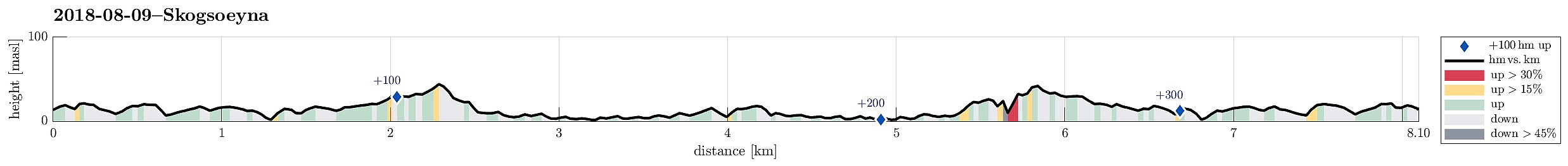
| Tourlänge | 3h 30min |
| Entfernung | 8,1km |
| Höhenmeter | 363m |
| GPS |
|
| Besteigungen | Skogsøytua (49m) | 09.08.2018 |
|---|
Trip Summary
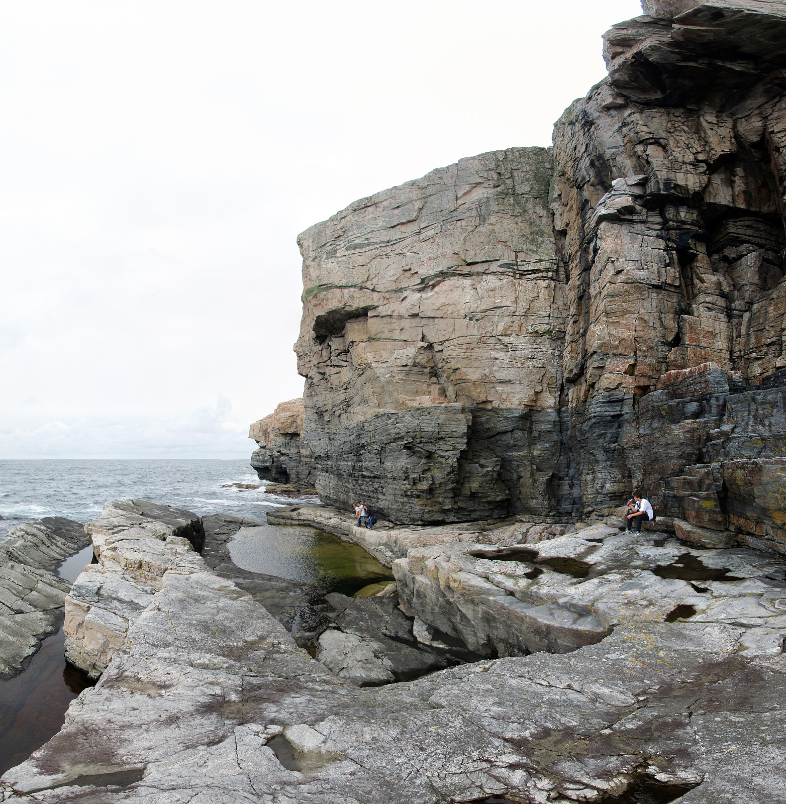
We parked our cars near the bridge between Skogsøyna and Herdlevær, where a board also tells the hikers about the island and the paths that one can take. From there, we followed the main path along the northwestern shore of Skogsøyna, heading towards the spectacular southwestern end of the island. After a bit of hiking, we approached Skogsøytua, i.e., the highest point on this trip (about 45mosl). From there, instead of heading back "as usually", we first explored the lower parts of the cliffs at Skogshola. Note that it is critical that you indeed judge the situation correctly in order to avoid any dangerous and unwanted problems with the sea. Should it happen that a wave takes you off the stones, it is likely possible that you will end up in severe troubles (others have died there before). Afterwards, exploiting the low waters at the time we were there, we decided to explore the islands in the south of Skogsøytua. We headed towards Illnova, crossing the beaten rocks. Also here, one needs to be well aware of the situation in order to avoid unpleasant or even dangerous developments (rising waters can likely make a dry return to Skogsøytua difficult, for example). After this excursion to Illnova, we went back to Skogsøytua, enjoying once more the impressive cliffs there. Eventually, we just hiked back the path that we had taken from the cars in the first place. All in all, this (again!) was a very nice visit to Skogsøyna, which clearly is worth a trip, especially if you wish to get into close contact with the rather wild North Atlantic!
Photos
Selected photos are available as Google photo album.
Useful Resources
See also the related FB-page Hiking around Bergen, Norway.

Benutzerkommentare