Exploring Turøyna (11.05.2018)

| Startpunkt | Turøyna (45m) |
|---|---|
| Endpunkt | Turøyna (45m) |
| Tourcharakter | Bergtour |
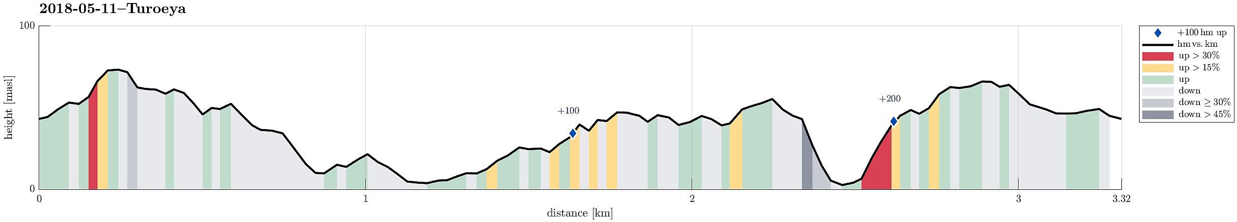
| Tourlänge | 3h 00min |
| Entfernung | 3,3km |
| Höhenmeter | 237m |
| GPS |
|
| Besteigungen | Turøyvarden (75m) | 11.05.2018 |
|---|---|---|
| Turøybjørnen (61m) | 11.05.2018 |
Note that most parts of this hike are without any trail.
Trip Summary
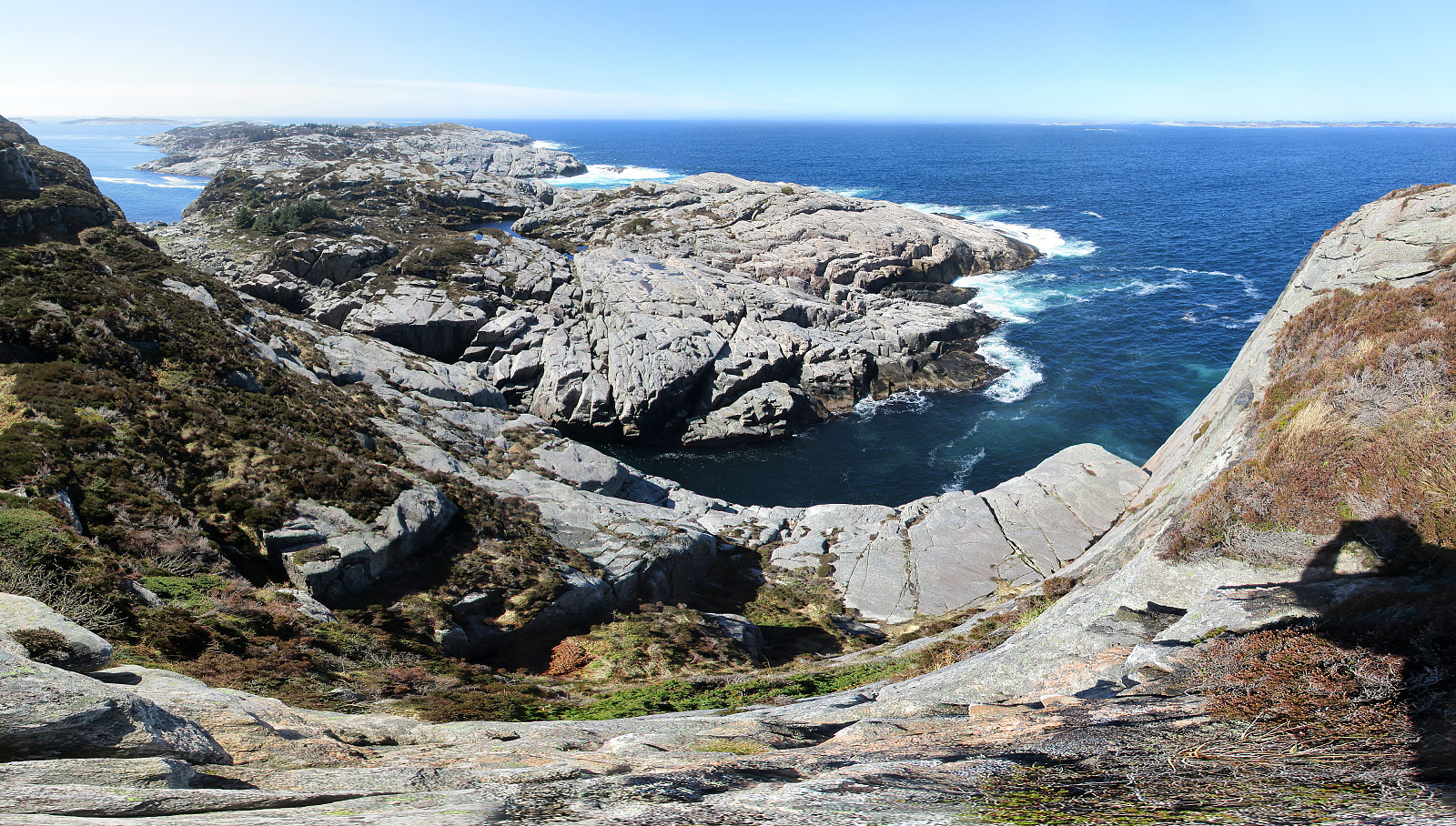
It was time to get out to Turøyna and explore the rather wild nature there! We started from the street to the small settlement on Turøyna and headed towards the large cairn, Turøyvarden, on the largest top of the island. From there, we continued northwards (and without any path) to reach Svartanova via Tuskeluren. From there, to get further northwest to Laksneset, we had to find a way to cross over a rather deep trough. Starting relatively low on Svartanova and searching for a proper place "on half height", walking in southwestern direction, proved to be the right approach and after only a few steps, we were able to cross over. Then it was straight forward to get to Laksneset and enjoy some nice views from there. Continuing our hike around the island, we then followed the rugged heights at the northwestern side of the island. Clearly, this part is very exciting, since the cliffs towards the North Atlantic are so impressive (they seem impossible to traverse, actually). After finding our way all the way to Turøybjørnen at the southwest of this part of the island, we started to turn back, descending first to meet the sea at the bottom of the trough that is "cutting" through the island SW-NE. Ascending, again, no the other, southeastern side, we went in an arch towards the big cairn, again, closing this round across an impressive, wild island.
Photos
Selected photos are available as Google photo album.
Useful Resources
See also the related FB-page Hiking around Bergen, Norway.

Benutzerkommentare