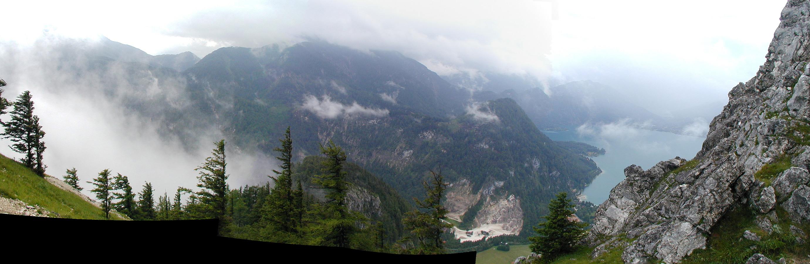
Kleiner Schoberstein from Weissenbach (02.07.2005)

| Startpunkt | Weissenbach (475m) |
|---|---|
| Endpunkt | Weissenbach (475m) |
| Tourcharakter | Bergtour |
| Tourlänge | 3h 00min |
| Entfernung | 4,4km |
| Höhenmeter | 527m |
| GPS |
|
| Besuche anderer PBE | Resting area / Kleiner Schoberstein (900m) | 02.07.2005 |
|---|
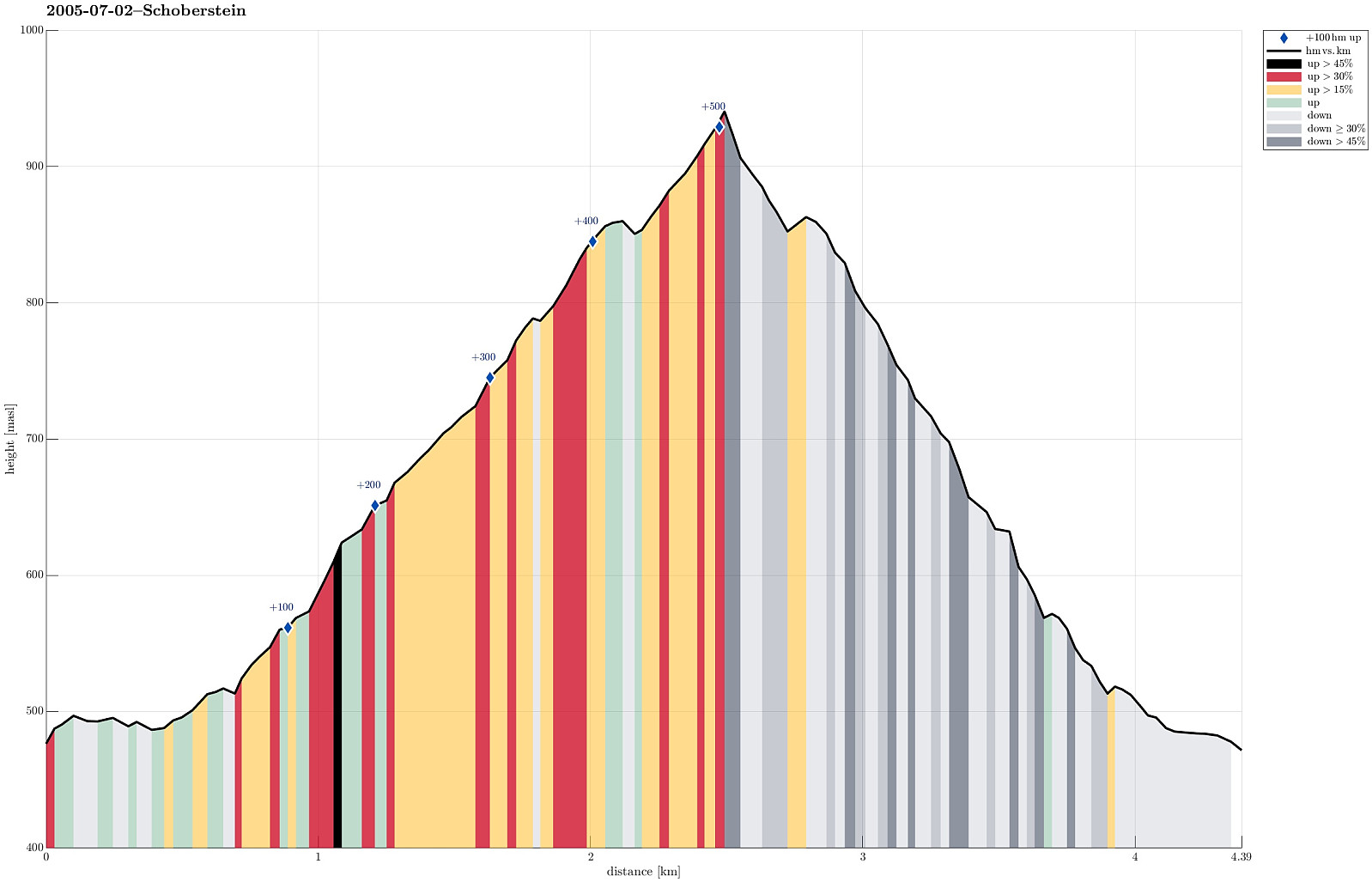
Note that this track has been created from memory, i.e., it was not recorded automatically.
Trip Summary
We started from Weissenbach am Attersee and ascended via the western ridge of the Höllengebirge up to Schober (Kleiner Schoberstein). Clearly, this is a nice (and not so long) hill-walk for those, who are enjoying some good time at lake Attersee!
Useful Resources
See also the related FB-page Hiking around Bergen, Norway.

Benutzerkommentare