Höllengebirge with Alberfeldkogel (27.06.2005)

| Startpunkt | Feuerkogel cable car (1.575m) |
|---|---|
| Endpunkt | Feuerkogel cable car (1.575m) |
| Tourcharakter | Wanderung |
| Tourlänge | 5h 00min |
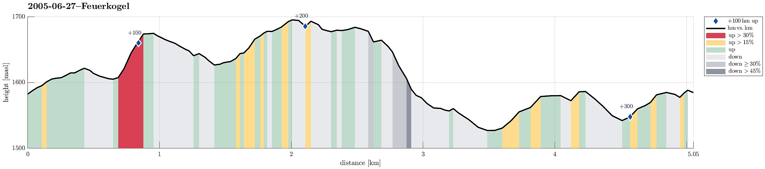
| Entfernung | 5,1km |
| Höhenmeter | 344m |
| GPS |
|
| Besteigungen | Alberfeldkogel (1.706m) | 27.06.2005 |
|---|---|---|
| Heumahdgupf (1.680m) | 27.06.2005 | |
| Besuche anderer PBE | Feuerkogel (1.592m) | 27.06.2005 |
| Gasselhöhe (1.589m) | 27.06.2005 |
Trip Summary
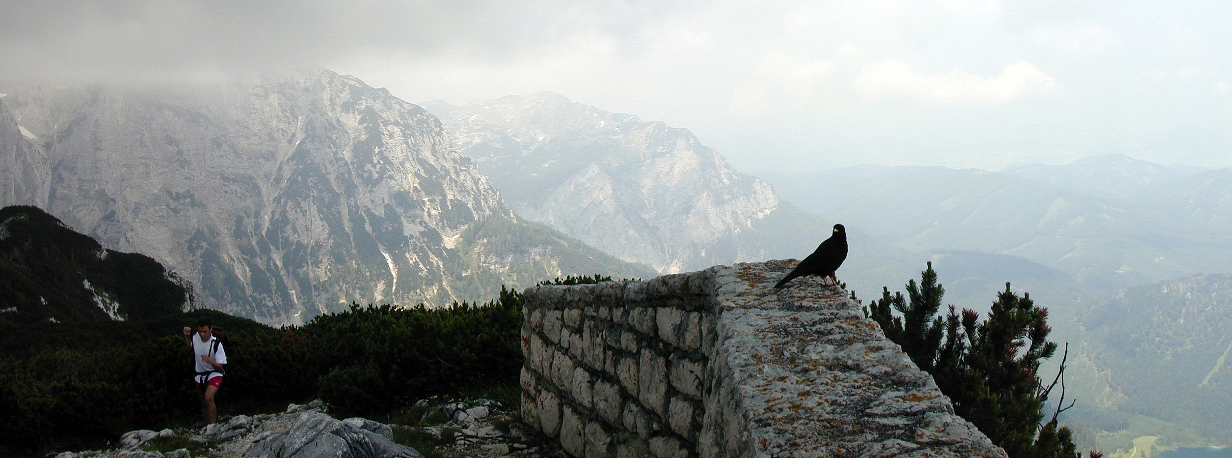
We took the car to Ebensee at the lake Traunsee and then the cable car, which swiftly lifted us up to Feuerkogel 1575mosl! From there, we first walked "along the edge" (Höllengebirge falls off quite steeply in northern direction there, offering amazing views of the beautiful Salzkammergut, in particular with Traunsee etc.). This way, we made it to Alberfeldkogel, from which we enjoyed a wonderful view (mostly in northern direction). The weather was just so and so and due to the height it clearly was not very warm. We then made a round back to the cable car, hiking a little more "inlands". It was fun to also explore the still remaining patches of old snow (in end of June!).
Useful Resources
More about related information on the web page of the cable car to Feuerkogel.
See also the related FB-page Hiking around Bergen, Norway.

Benutzerkommentare