Meeting the North Atlantic at Skogsøya (24.06.2017)

| Startpunkt | Bridge to Herdleværet (15m) |
|---|---|
| Endpunkt | Bridge to Herdleværet (15m) |
| Tourcharakter | Bergtour |
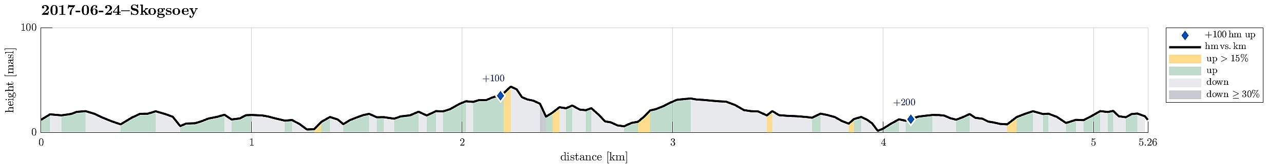
| Tourlänge | 2h 00min |
| Entfernung | 5,3km |
| Höhenmeter | 247m |
| GPS |
|
| Besteigungen | Skogsøytua (49m) | 24.06.2017 |
|---|
Trip Summary
We took the car from Bergen to the west and then further north to Øygarden. On Ona, right next to Kollsnes, we left road 561 and continued on road 228 towards Herdleværet. On Skogsøyna, just before crossing the bridge to Herdleværet, we parked the car and started to hike towards the west, following the northern rim of Skogsøyna. First, we were positively impressed about work that seemingly was done quite recently to further improve this trail, making it easier to avoid wet and/or muddy shoes (at least to a certain degree). Nice! :-)
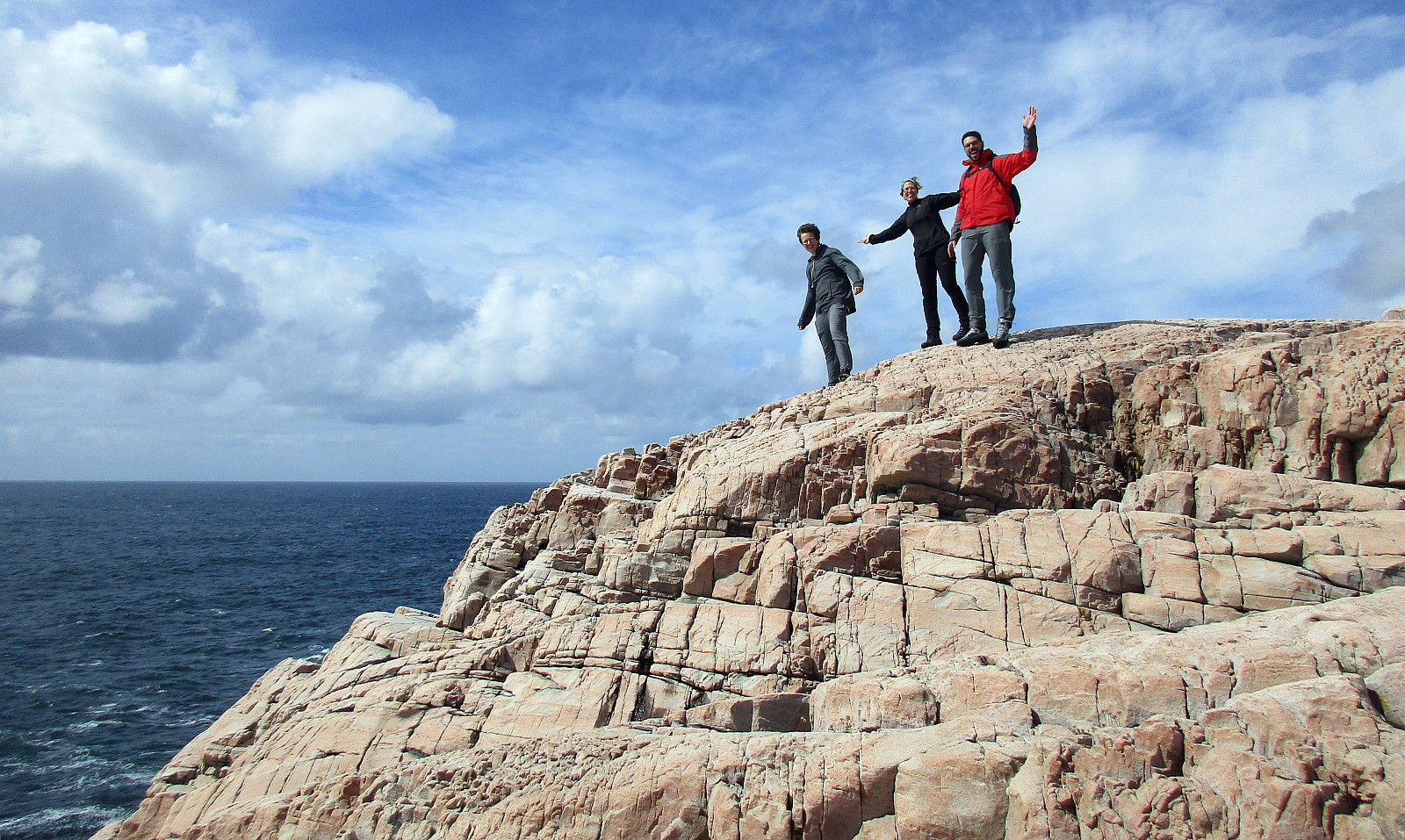
Skogsøytua
At the outer tip of Skogsøyna, we reached our goal for this day, Skoysøytua (some 50m above sea level and with nice views over the open Atlantic!). We explored the cliffs and watched the energetic ocean rumble against the rocks of Skogsøytua. We also rounded the cliffs in order to get further down (at Skogshola). Having enjoyed this nice place for a while, we turned back and returned to the car (more or less) along the same path that we had taken out, first.
Conclusion
It's always nice to visit Skogsøyna and pay some respect to the wild Northern Atlantic there. It's also easy and quite short to walk.
Photos
Selected photos are available as Google photo album.
Useful Resources
See also the related FB-page Hiking around Bergen, Norway.

Benutzerkommentare