Løvstakken (23.12.2016)

| Startpunkt | Litlavatnet parking (160m) |
|---|---|
| Endpunkt | Litlavatnet parking (160m) |
| Tourcharakter | Bergtour |
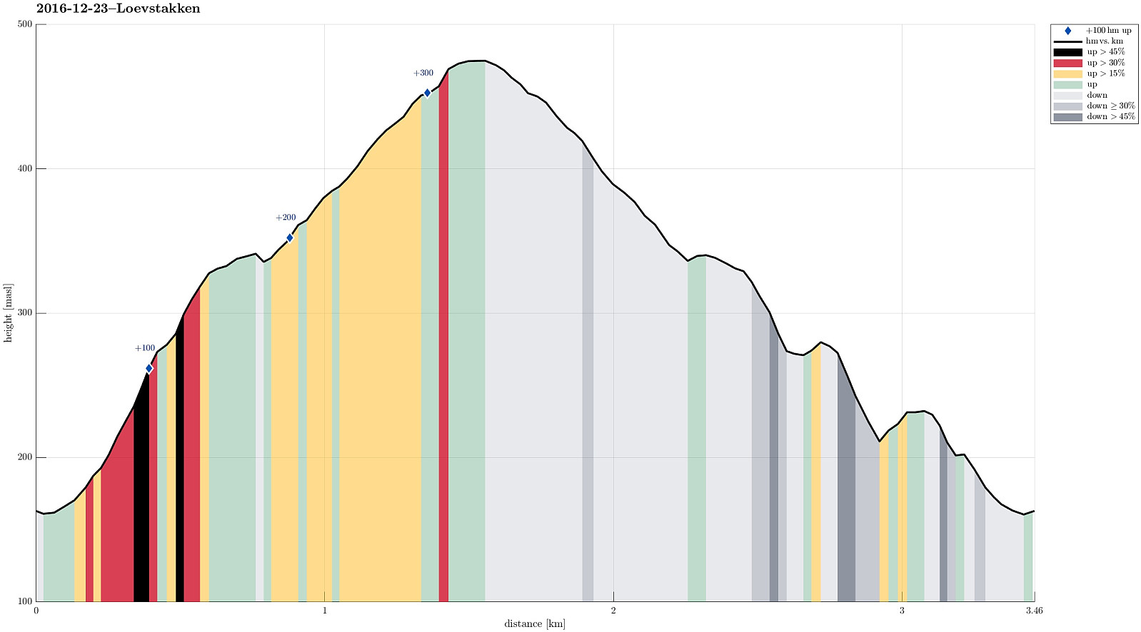
| Tourlänge | 1h 15min |
| Entfernung | 3,5km |
| Höhenmeter | 372m |
| GPS |
|
| Besteigungen | Løvstakken (478m) | 23.12.2016 |
|---|---|---|
| Besuche anderer PBE | Fossen (200m) | 23.12.2016 |
| Krohnegården p-plass (160m) | 23.12.2016 |
Trip Summary
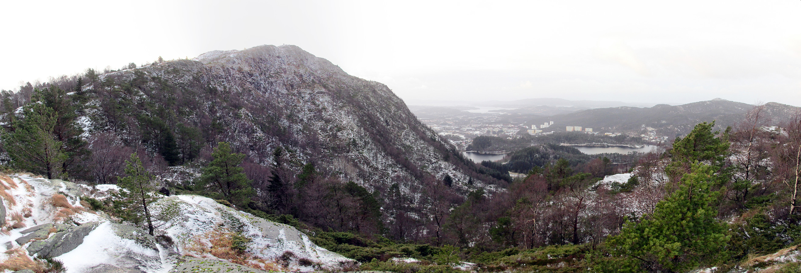
We parked at the small parking place right above Litlavanet (along road Krohnegården). We then stepped upwards in northeastern direction (towards Ravnefjellet) and came to the small saddle between Ravnefjellet and Løvstakken soon. From there, we turned "back" towards Løvstakken (mostly in southern direction, then). Soon later, we came to the top of Løvstakken. We returned basically along the same route. Almost all the way back, a little excursion (to the upper parts of the little waterfall down there "in the western corner of Løvstakken") was added---mostly to get an idea, whether one could ascend to Løvstakken also from there "diritissima" (it seems so---to be explored!).
Useful Resources
See also the related FB-page Hiking around Bergen, Norway.
Web page WestCoastPeaks.com provides useful information about Løvstakken.

Benutzerkommentare