Løvstakken (steep way up) (19.11.2016)

| Startpunkt | Kirsten Flagstads vei (135m) |
|---|---|
| Endpunkt | Kirsten Flagstads vei (135m) |
| Tourcharakter | Bergtour |
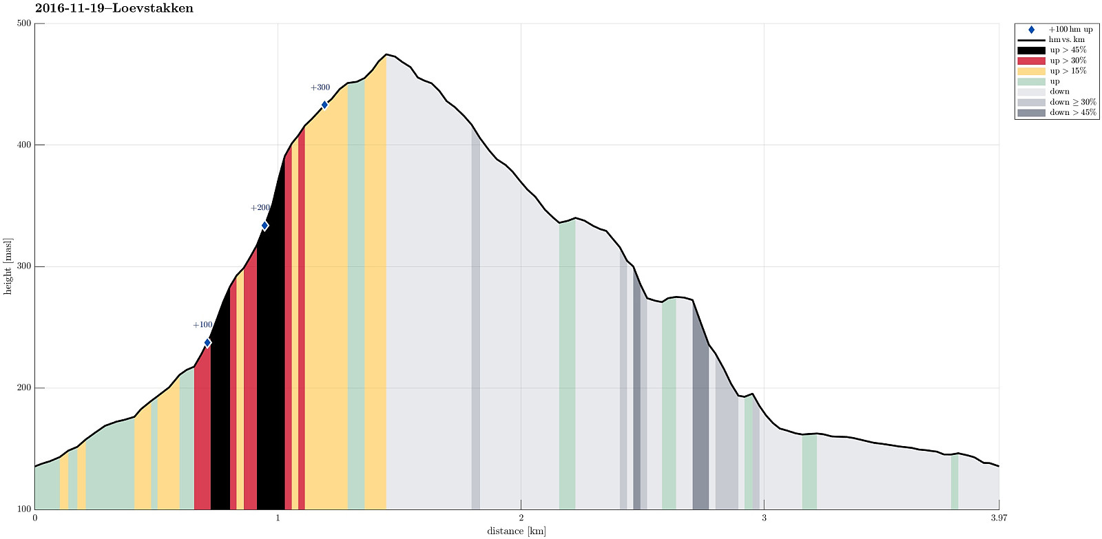
| Tourlänge | 1h 10min |
| Entfernung | 4,0km |
| Höhenmeter | 361m |
| GPS |
|
| Besteigungen | Løvstakken (478m) | 19.11.2016 |
|---|---|---|
| Besuche anderer PBE | Fossen (200m) | 19.11.2016 |
Trip Summary
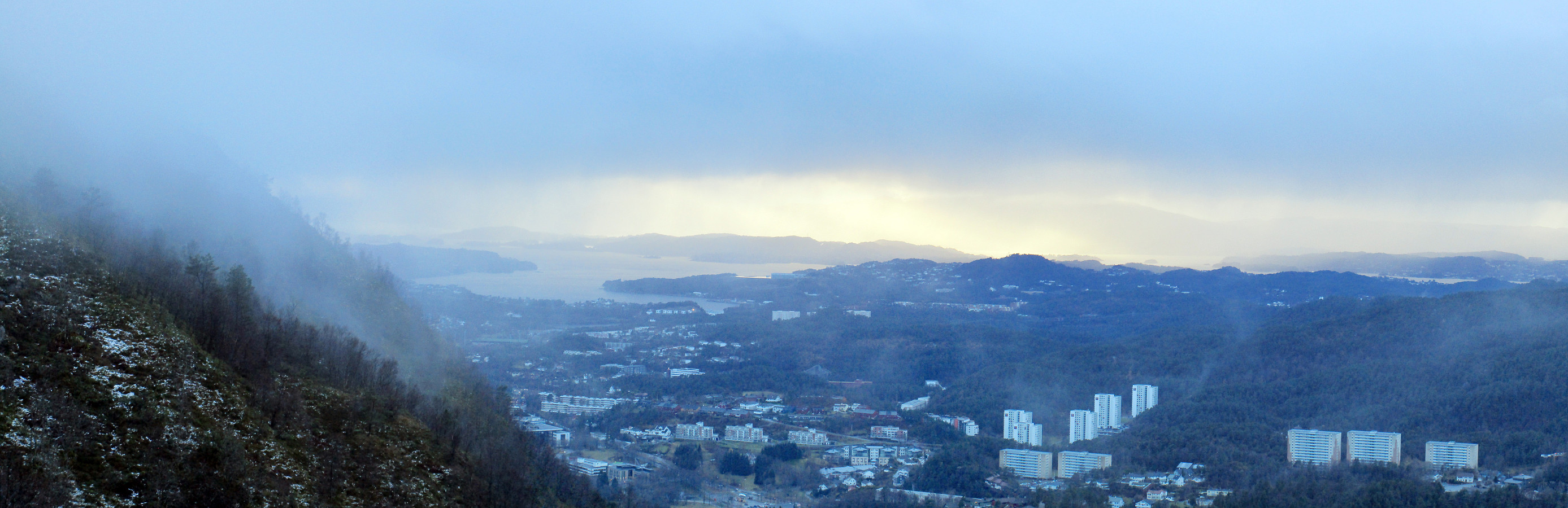
We parked at the upper end of Kirsten Flagstads vei and walked from there (in light rain that soon would change into web snow). We walked up Rosenlundveien until we reached a major turn near house #43. Right after the turn, a small path leaves to the left and upwards. First, one steps a few meters up through the forrest, before then continuing underneath a power or telephone line that leads straight up, almost directly towards the summit of Løvstakken. Somehwere near the tree line, the path then turns a bit left (then in northern direction), where it continues steeply upwards over some rumble. Some meters higher up, one gets (if the weather is nice!) a great view over Fyllingsdalen. From there, it is then less steeply up towards the not far high-point of Løvstakken. From Løstakken, we walked downwards along the northern ridge, before we turned left in order to get back into Fyllingsdalen (slightly above Litlavatnet). Once back down we followed Krohnegården to get back to our car. Even though the weather was wet and not really warm, it was fun to ascend Fyllingsdalen along this very steep route up! :-)
Photos
Selected photos are available as Google photo album.
Useful Resources
See also the related FB-page Hiking around Bergen, Norway.
Web page WestCoastPeaks.com provides useful information about Løvstakken.

Benutzerkommentare