Langrinden (Ulriken) (17.03.2016)

| Startpunkt | Montana (195m) |
|---|---|
| Endpunkt | Montana (195m) |
| Tourcharakter | Bergtour |
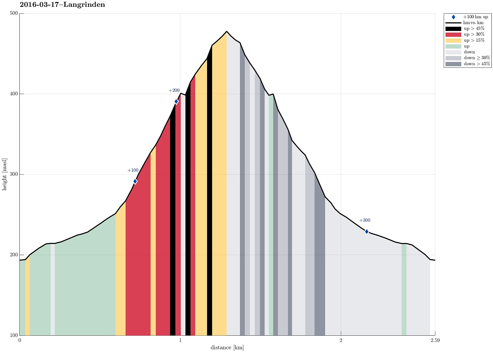
| Tourlänge | 1h 00min |
| Entfernung | 2,6km |
| Höhenmeter | 298m |
| GPS |
|
| Besuche anderer PBE | 8. mai-steinen (466m) | 17.03.2016 |
|---|---|---|
| Ravnegrind (228m) | 17.03.2016 |
Trip Summary
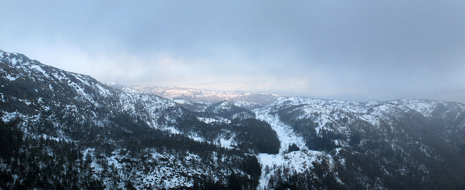
We started from Haggardshaugen (right above Montana Vandrehjem), followed Skiveien / Johan Blytts vei up to the point, where a little bridge crosses over a small stream. Instead of crossing the bridge, we turned left and followed the ridge up (first towards the power line mast, then along the ridge further up). This is a very nice way up to Ulriken. Since time was late, already, and it started to get dark (also, we reached the clouds at a point which is marked with Langrinden), we decided to not ascend all the way up to Ulriken, but turn around and go back, instead. All in all, a short and nice evening hike, right after work! :-)
Photos
Selected photos are available as Google photo album.
Useful Resources
See also the related FB-page Hiking around Bergen, Norway.
Web page WestCoastPeaks.com provides useful information about Haugavarden, Ulriken, Storfjellet, and Landåsfjellet
and also Petter Bjørstad has a useful page about Ulriken.
Web page UT.no from the Norwegian Trekking Association recommends the same hike up Ulriken.
On Bergentopp 200 there is a page (in Norwegian) about Ulriken.

Benutzerkommentare