Torneberget (13.09.2014)

| Startpunkt | Slåtthaug (57m) |
|---|---|
| Endpunkt | Slåtthaug (57m) |
| Tourcharakter | Bergtour |
| Tourlänge | 1h 30min |
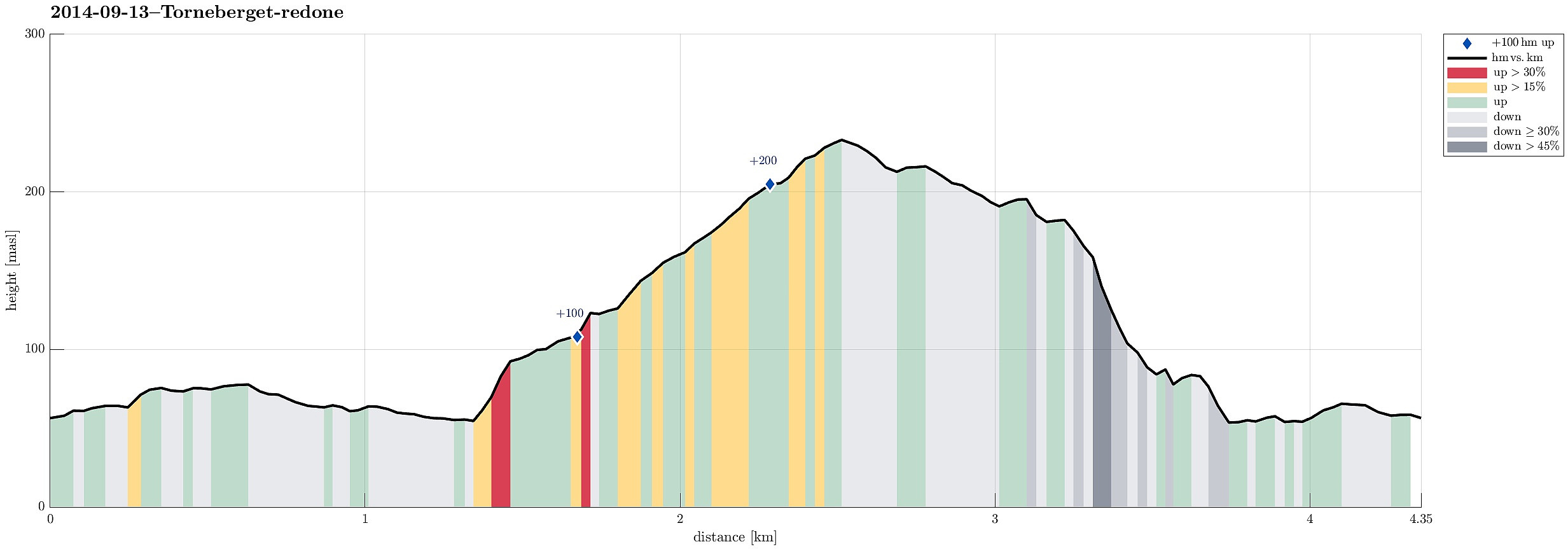
| Entfernung | 4,4km |
| Höhenmeter | 273m |
| GPS |
|
| Besteigungen | Torneberget (235m) | 13.09.2014 |
|---|
Note that this track has been created a posteriori, i.e., from memory, not automatically recorded.
Trip Summary
While my son played some soccer at Slåtthaug, I made a quick ascent to nearby Torneberget -- it's a not-at-all-prominent peak in front of Smøråsfjellet, towards Bergen, with selected views northwards over Bergen. Descending towards Slåtthaug, without any path through the woods, was a little bit challenging, because descending finally towards the houses of Smøråsflaten proved to be very steep (just a few meters, bust still).

Benutzerkommentare