Archiv - Nach Datum
Archiv - Nach Aktivität
-
Andere Tour (1)
- Expedition (1)
-
Andere Wintertour (10)
- Schneeschuhtour (10)
- Fahrradtour (2)
- Fußtour (228)
-
Klettern (8)
- Alpinklettern (7)
- Mixed-Klettern (1)
-
Skitour (49)
- Randonnée/Telemark (49)


Gesammelte Listen
-
Romsdal ≥ 100m pf.
(134/301)
 44%
44% -
Sunnmøre ≥ 100m pf.
(78/531)
14%
-
Norges 1000 største fjell målt i primærfaktor
(52/1000)
5%

To Mount Gryta in Stryn Municipality
- Datum:
- 05.12.2020
- Tourcharakter:
- Wanderung
- Tourlänge:
- 2:30h
- Entfernung:
- 7,4km
 On this day, there was some snow in the mountains, though not enough for skiing; at least most places. So my son and I opted for a mountain that we could ascend on foot on this day, and we were of course prepared to do the walk in snow about halfway up to our knees. A mountain well suited for such a trek, was Mount Gryta in Stryn Municipality in the County of Vestland. So we went to Stryn by car, and used Google map to find our way to Stryn Vinterskisenter [i.e. "Stryn Winter Skiing Center"]. This skiing center has been so named, because there is another one, much higher up in the mountains, that carries the name Stryn Sommerskisenter [i.e "Stryn Summer Skiing Center"]. From the parking lot at the ski centre, we followed a road through a cabin village called Bøasetra; a >>>
Til Niusen på Skøye med Dag
- Datum:
- 21.11.2020
- Tourcharakter:
- Wanderung
- Tourlänge:
- 2:17h
- Entfernung:
- 7,8km
 Det hadde nylig falt en del snø, slik at det i de høye fjellene var for mye snø til å gå vanlige fjellturer, men samtidig var det fortsatt for lite med tanke på å skulle gå på ski. Så da foreslo eldstegutten min at vi kunne gå på Nihusen på skøye. Dette fjellet er ikke særlig høyt, bare 438 høydemeter, så man kommer seg alltids både opp og ned igjen, selv om det er litt glatt, og man bruker litt tid på turen.
Vi kjørte til Skodje [lokal utt.: Skøye], og parkerte på parkeringsplassen bak rådhuset og legekontoret (se kart), og derfra fulgte vi Nihusvegen opp til skogen. Min sønn hadde vært på Nihusen før, og visste vegen, men med en god turbeskrivelse skulle det uansett ikke ha vært vanskelig å finne stien vi skulle følge gjennom skogen og opp på fjellet. Stien >>>
Det hadde nylig falt en del snø, slik at det i de høye fjellene var for mye snø til å gå vanlige fjellturer, men samtidig var det fortsatt for lite med tanke på å skulle gå på ski. Så da foreslo eldstegutten min at vi kunne gå på Nihusen på skøye. Dette fjellet er ikke særlig høyt, bare 438 høydemeter, så man kommer seg alltids både opp og ned igjen, selv om det er litt glatt, og man bruker litt tid på turen.
Vi kjørte til Skodje [lokal utt.: Skøye], og parkerte på parkeringsplassen bak rådhuset og legekontoret (se kart), og derfra fulgte vi Nihusvegen opp til skogen. Min sønn hadde vært på Nihusen før, og visste vegen, men med en god turbeskrivelse skulle det uansett ikke ha vært vanskelig å finne stien vi skulle følge gjennom skogen og opp på fjellet. Stien >>>
To Mount Klovetinden and Mount Middagshornet
- Datum:
- 26.09.2020
- Tourcharakter:
- Wanderung
- Tourlänge:
- 5:17h
- Entfernung:
- 13,1km
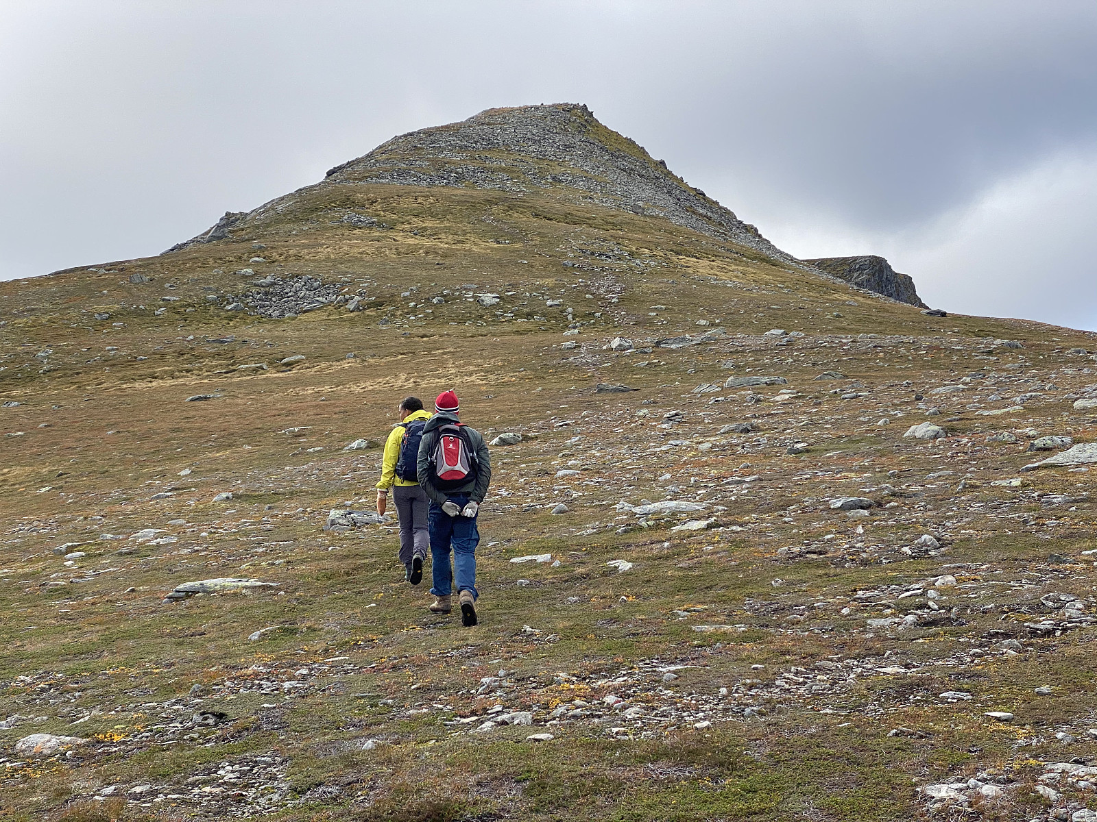 On this particular day, I went mountain hiking with my oldest son and my youngest daughter. We discussed in advance where to go, and then my daughter came up with the suggestion of Mount Klovetinden [945 m.a.m.s.l.] in Ørsta Municipality, and the rest of us had no objection to it. We went with my daughter’s car to the ferry quay at Solevågseidet, crossed the fjord by the ferry; and then continued by car to the bay called Barstadvika, and then up to a cabin area called Barstadsætra, located about 190 m.a.m.s.l. (see map). We parked the car at the parking lot by the river, and then started hiking up the mountain along a nice, well marked, and readily visible trail. My daughter had been hiking in this area before, and new very well which trail we ought to choose.
The first part of the trail >>>
On this particular day, I went mountain hiking with my oldest son and my youngest daughter. We discussed in advance where to go, and then my daughter came up with the suggestion of Mount Klovetinden [945 m.a.m.s.l.] in Ørsta Municipality, and the rest of us had no objection to it. We went with my daughter’s car to the ferry quay at Solevågseidet, crossed the fjord by the ferry; and then continued by car to the bay called Barstadvika, and then up to a cabin area called Barstadsætra, located about 190 m.a.m.s.l. (see map). We parked the car at the parking lot by the river, and then started hiking up the mountain along a nice, well marked, and readily visible trail. My daughter had been hiking in this area before, and new very well which trail we ought to choose.
The first part of the trail >>>
To Mount Sandfjellet in Vestnes Municipality
- Datum:
- 05.09.2020
- Tourcharakter:
- Wanderung
- Tourlänge:
- 3:51h
- Entfernung:
- 10,7km
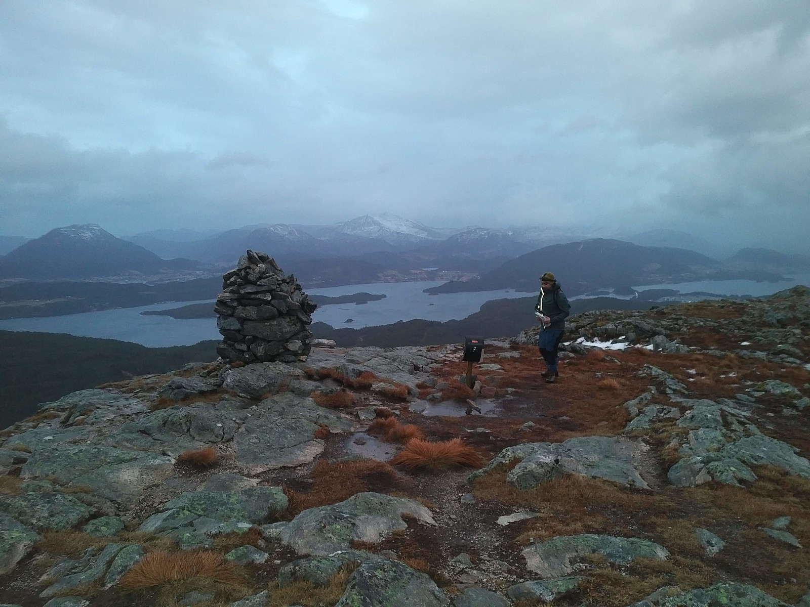
 This particular hike was one that my oldest son, Dag, recommended me to do. He had himself ascended this mountain, and said it was a nice day-trip that is feasible to realize. He explained to me how to get there, and where to park the car; and before leaving home, I even consulted some tour descriptions here on Peakbook. I drove to a fjord called Tresfjorden, in Vestnes Municipality, and then continued up a valley called Rypdalen. In the upper part of Rypdalen Valley, you have to pay a fee in order to continue. Now, the easiest way to pay that fee is to use the Swish app, though there was also a mailbox in which you could drop an envelope with money inside. Once you've payed the fee, you can continue upwards along a steep and narrow graveled road that takes you all the way up to a parking lot >>>
Hiking to Mount Honndalsrokken with My Oldest Son
- Datum:
- 29.08.2020
- Tourcharakter:
- Wanderung
- Tourlänge:
- 8:24h
- Entfernung:
- 18,6km
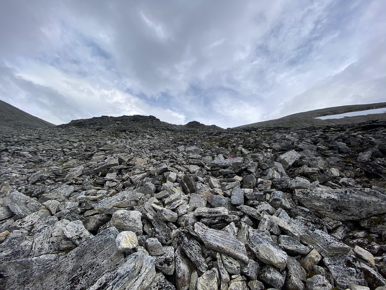
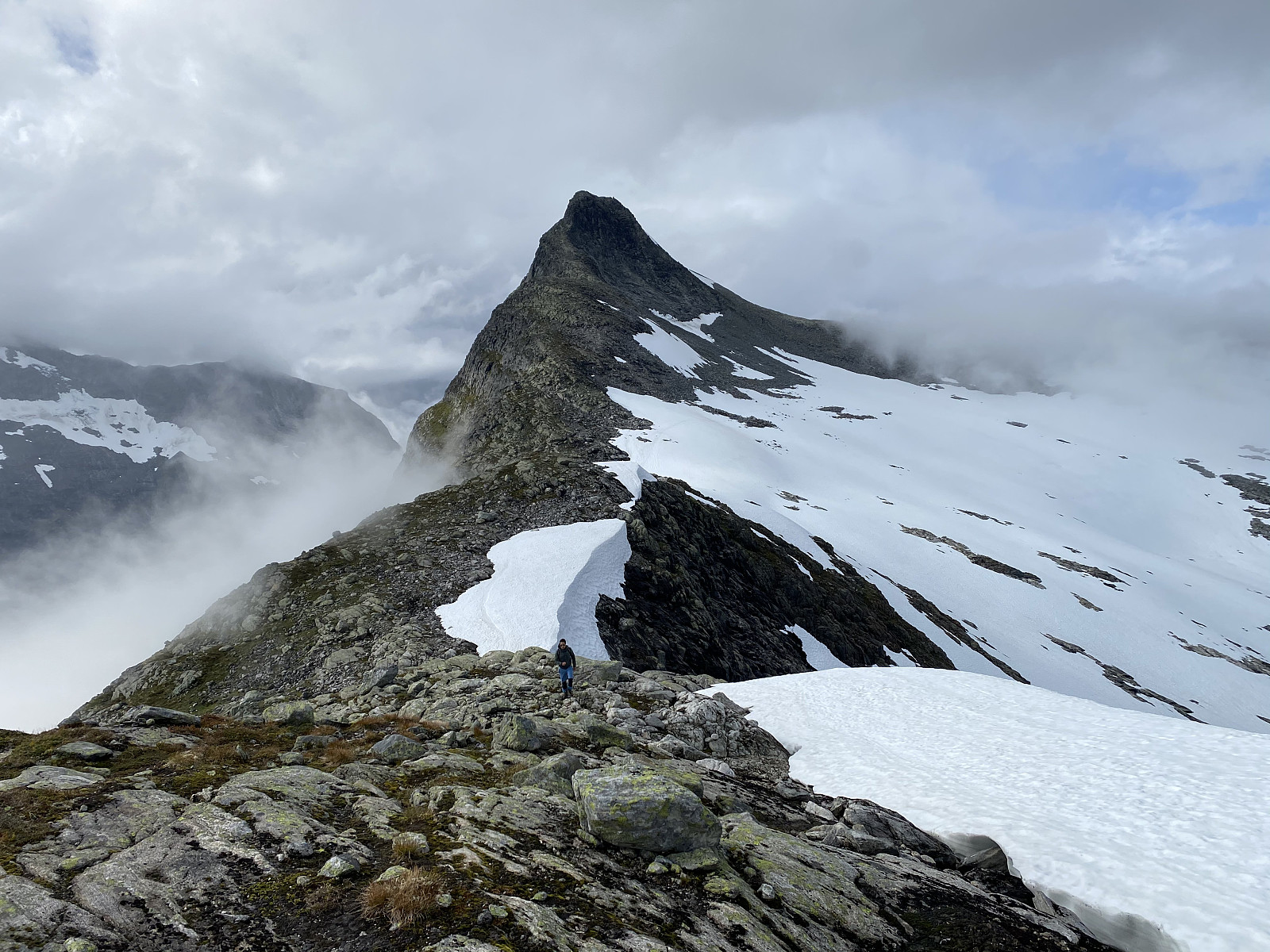 On this day my son Dag asked me to join him for a hike to Mount Honndalsrokken . This mountain is widely known in our part of Norway, as its characteristic spikelike shape may be spotted from afar. The name of the mountain is actually also derived from its shape: The spikelike summit of the mountain looks a bit like the spindle of a traditional spinning wheel, and rokk is the Norwegian word for such a spinning wheel. [Officially, the mountain is actually called Hornindalsrokken, but most locals refer to it as Honndalsrokken]. I have for several years been thinking of hiking this mountain, and so I immediately agreed to his suggestion, and went with him.
We parked our car in the parking lot just by Honndøla Bru, i.e. the bridge across Honndøla River (see image ##1 and 26), and from there we >>>
On this day my son Dag asked me to join him for a hike to Mount Honndalsrokken . This mountain is widely known in our part of Norway, as its characteristic spikelike shape may be spotted from afar. The name of the mountain is actually also derived from its shape: The spikelike summit of the mountain looks a bit like the spindle of a traditional spinning wheel, and rokk is the Norwegian word for such a spinning wheel. [Officially, the mountain is actually called Hornindalsrokken, but most locals refer to it as Honndalsrokken]. I have for several years been thinking of hiking this mountain, and so I immediately agreed to his suggestion, and went with him.
We parked our car in the parking lot just by Honndøla Bru, i.e. the bridge across Honndøla River (see image ##1 and 26), and from there we >>>
Hiking to Mount Geitnausa with my daughter
- Datum:
- 01.02.2020
- Tourcharakter:
- Wanderung
- Tourlänge:
- 2:21h
- Entfernung:
- 8,1km
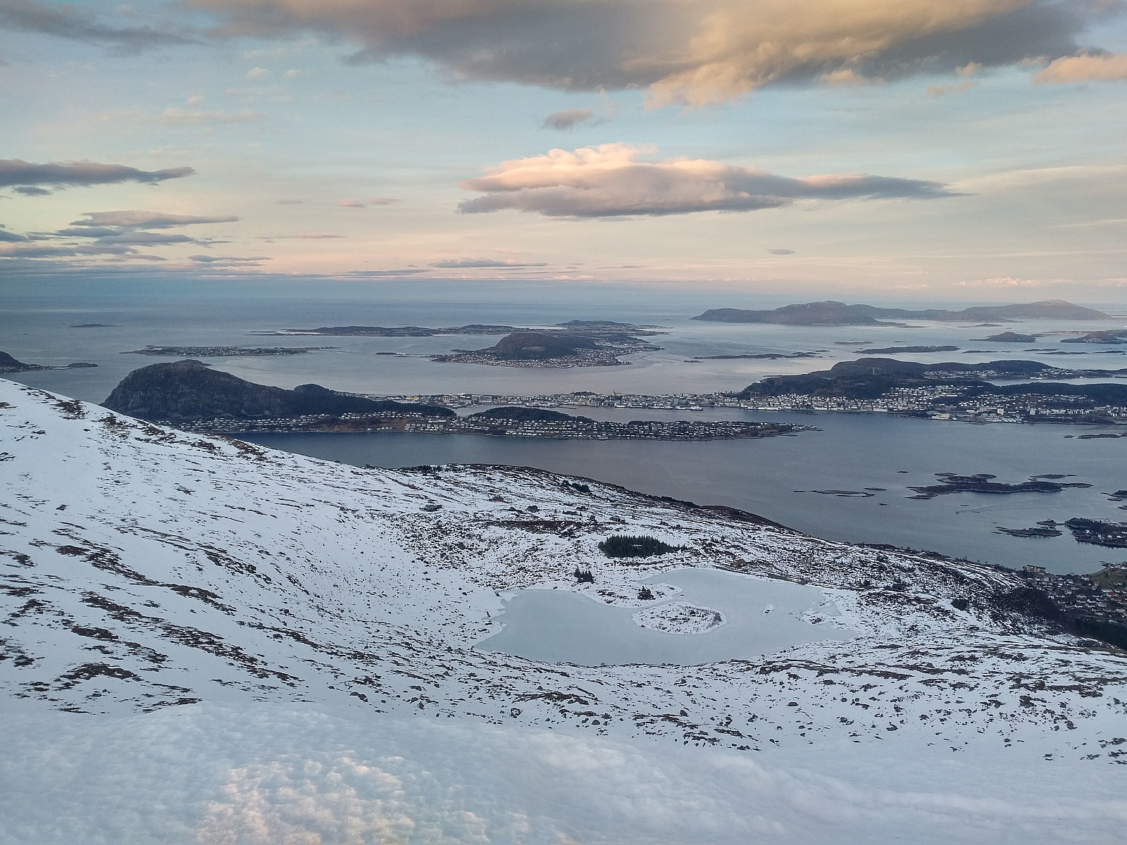
 The town of Ålesund is located on four islands in the county of Møre & Romsdal, beautifully, in between fjords and mountains. One of the four islands, the one called Uksenøya, has a mountain ridge generally referred to as Emblemsfjellet [i.e. the Emblem mountain, after a village called Emblem on the south side of the mountain. This mountain actually have a number of peaks, i.e. Høgkubben, Geitnausa, Vasstrandegga and Merafta .
Now, I've actually been to all of these summits, but the advantage of this mountain is that it is close to the town, and it's easy to get there whenever you want to. So, we drove to a place called Myrdalen, in the part of the town that is called Spjelkavika; and then we set out from there, aiming for the peak called Geitnausa. There actually is a nice forest road >>>
The town of Ålesund is located on four islands in the county of Møre & Romsdal, beautifully, in between fjords and mountains. One of the four islands, the one called Uksenøya, has a mountain ridge generally referred to as Emblemsfjellet [i.e. the Emblem mountain, after a village called Emblem on the south side of the mountain. This mountain actually have a number of peaks, i.e. Høgkubben, Geitnausa, Vasstrandegga and Merafta .
Now, I've actually been to all of these summits, but the advantage of this mountain is that it is close to the town, and it's easy to get there whenever you want to. So, we drove to a place called Myrdalen, in the part of the town that is called Spjelkavika; and then we set out from there, aiming for the peak called Geitnausa. There actually is a nice forest road >>>
To Mount Vasstrandegga in Rainy Weather
- Datum:
- 11.01.2020
- Tourcharakter:
- Wanderung
- Tourlänge:
- 3:45h
- Entfernung:
- 13,7km
 We had a hike to the mountain called Vasstrandegga on this day, my son and I. We started out from a parking lot in a hollow called Sirigrova . This parking lot is mainly used by trekkers intending to ascend one of the nearby mountains, hence it wasn't the first time we parked there. There's a little mountain road winding its way through the valley Østremsdalen up to a cluster of cottages called Østremssætra , once used for caretakers of domestic animals (mainly sheep) when they were grazing in the mountains during summer. We followed the road up to Østremssætra, then took left along a tiny forest path, which we followed upwards into the mountains. We lost the trail at some point during our climb, due to some slight amount of snow here and there, but it didn't really matter much, as we had >>>
Another Hike to Mount Gamlemsveten
- Datum:
- 04.01.2020
- Tourcharakter:
- Wanderung
- Tourlänge:
- 2:42h
- Entfernung:
- 9,4km
 In winter time, whenever snow is to scarce for mountain skiing, and yet too abundant for an ordinary mountain hike on foot; then Mount Gamlemsveten is a very good option. There has been built a huge TV broadcasting antenna at the very summit, and there are even some other telecommunication installations up there as well. A construction road was once built up to the summit for the purpose of bringing material like plank, concrete and iron up there when the TV antenna was built; hence even when there's quite some snow, the ground beneath is pretty even, and not as stony as it usually is in mountains like this. On the other hand, the road up there is usually not plowed, and cars are not allowed apart from those that take part in maintenance work on the installations up there; hence you are very >>>
Icy Hike to the Peaks Litlehornet and Uggedalshornet
- Datum:
- 28.12.2019
- Tourcharakter:
- Wanderung
- Tourlänge:
- 1:49h
- Entfernung:
- 5,5km
 We have ascended Mount Gamlemsveten multiple times, my son and I but there have been a number of smaller mountains around Gamlemsveten that we haven't climbed yet; or at least I haven't, as my son have climbed a lot of mountains that I have yet to climb. So, we decided on this day to climb some of the nearby less-than-500-meters mountains, and took my son's car to the usual parking lot in Søvikdalen valley. The initial part of the route was the same as when we climbed Mount Storehornet and Mount Skålbotsheia 3 weeks earlier; i.e. you pass by a shooting range located about 800 meters from the parking lot, and then climb up from the innermost "bottom" of the valley, into a hanging valley called Engsetskaret and located at an elevation about 200 meters above the main valley [i.e. about >>>
Winter Hike to Mount Tverrfjellet on Sula Island
- Datum:
- 21.12.2019
- Tourcharakter:
- Wanderung
- Tourlänge:
- 3:18h
- Entfernung:
- 11,7km
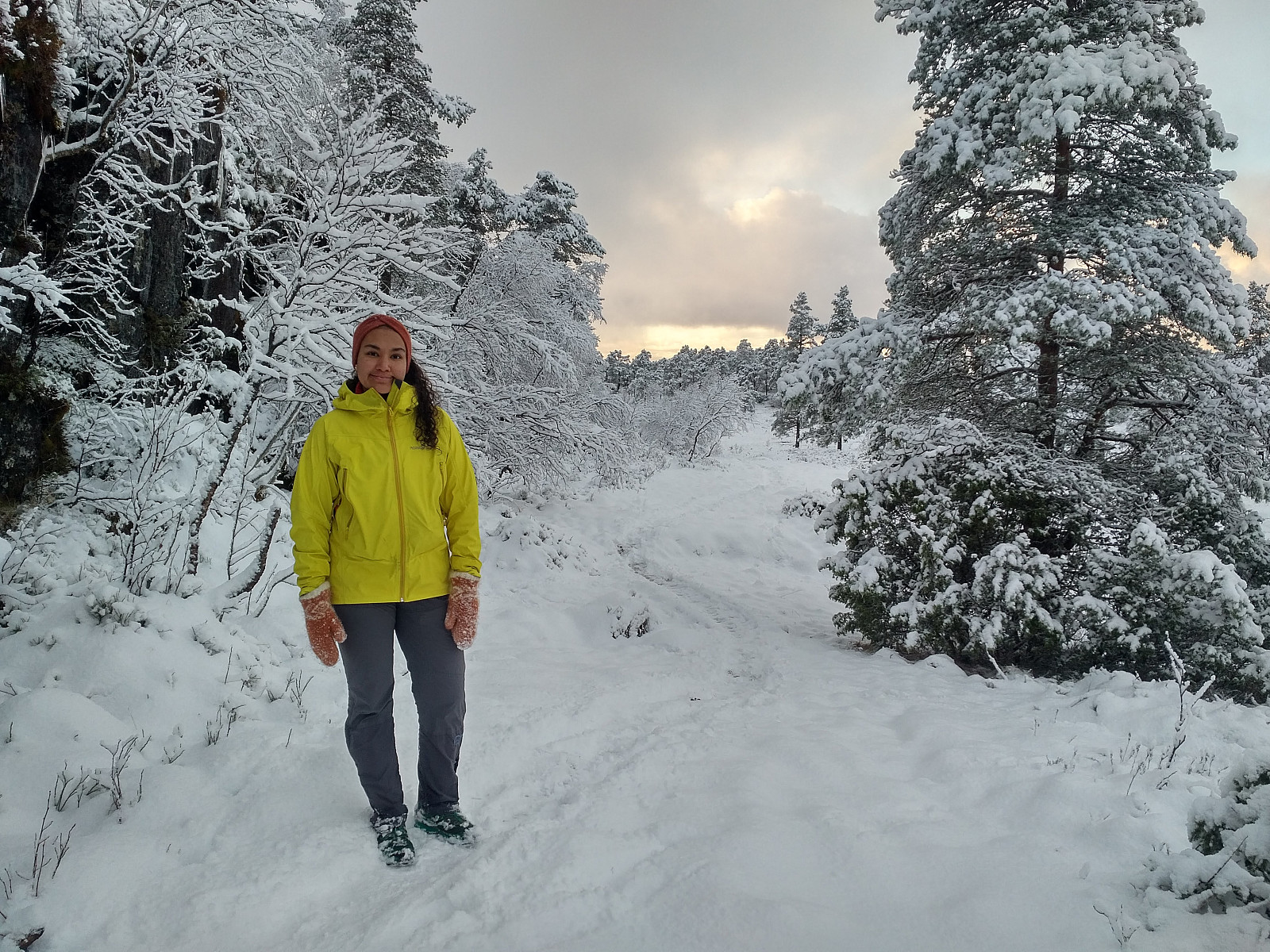
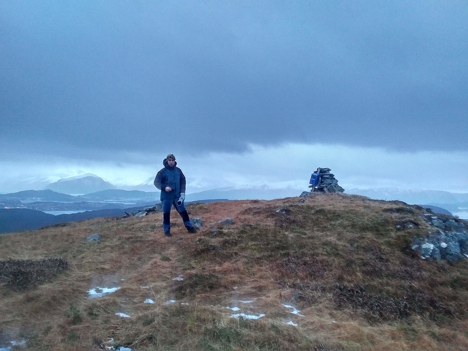
 It was only 3 weeks since last time I ascended Mount Sulafjellet with my son, and yet we decided to go there again, as we regard this trip as a good workout. My youngest daughter vaarsolholm (Vår Solholm) also came along with us on this occasion. As previously, we walked the forest road up to Rollonhytta Cabin, and from there we just followed the mountain path that continues up to the summit of the mountain. Snow was less abundant now, compared to what it was three weeks ago; hence the cairns that mark the trail were easy to spot, and it was, therefore, much easier to follow the trail up to the summit of the mountain. We just shot a few pictures while at the top of the mountain, and then went back down to our car at Mauseid parking lot.
