Archiv - Nach Datum
Archiv - Nach Aktivität
-
Andere Wintertour (3)
- Schneeschuhtour (3)
-
Fahrzeugtour (1)
- Autotour (1)
- Fußtour (137)
-
Klettern (23)
- Alpinklettern (9)
- Klettersteig (2)
- Sportklettern (11)
-
Skitour (62)
- Langlauf (1)
- Randonnée/Telemark (58)
- Tourenskilauf (3)


Gesammelte Listen
-
Norges 1000 største fjell målt i primærfaktor
(45/1000)
 4%
4%

Lieblingstouren
Lieblingsgipfel


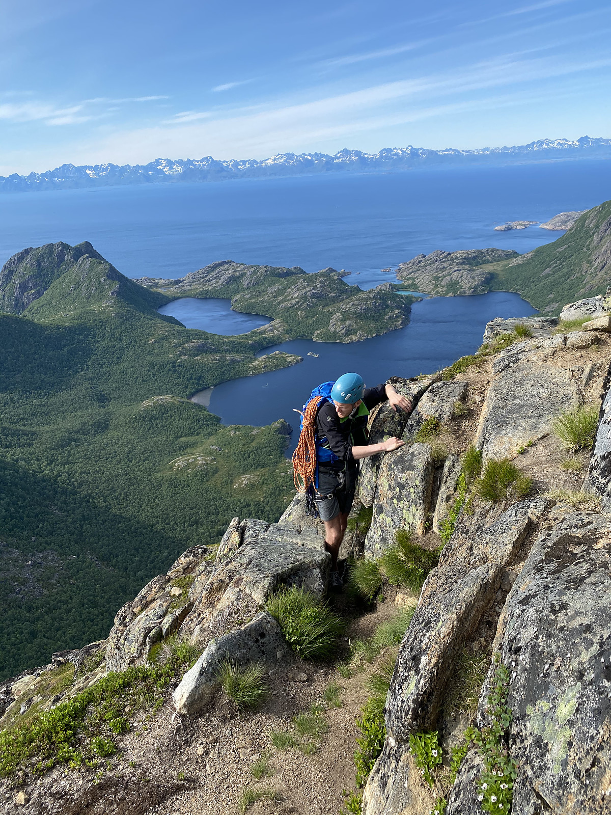
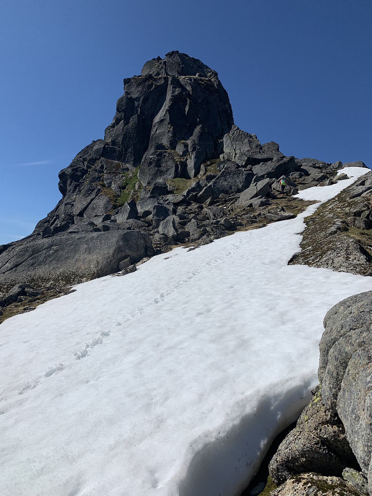
Djeveltanna - Skittentinden traverse
- Datum:
- 15.08.2021
- Tourcharakter:
- Alpinklettern
- Tourlänge:
- 7:08h
- Entfernung:
- 14,3km
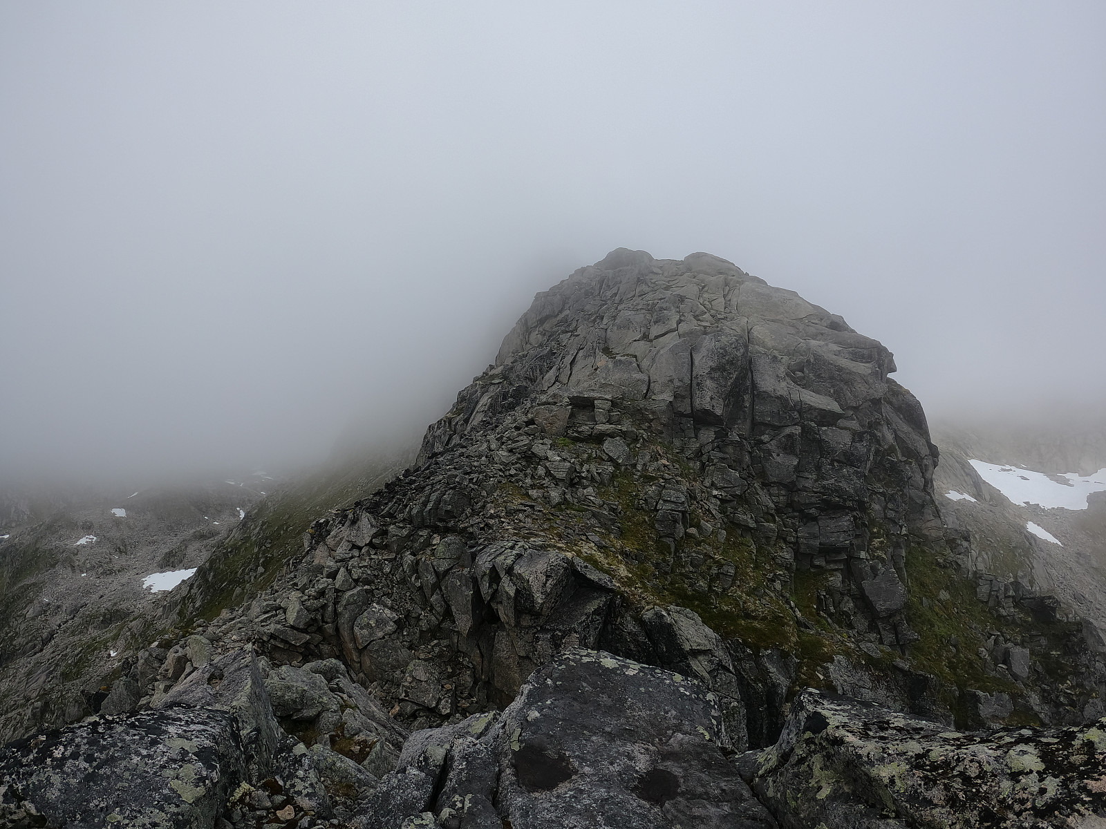 Våknet til en del mer tåker enn det fleste værinstitutter hadde sett for seg. Vi bestemt oss for å prøve denne traversen i likevel, og fikk oss en fin tur med masse artig klyving på stein av fantastisk kvalitet :)
Vi parkerte ved den vanlig Skittentind parkeringen og fulgte en tydelig sti over myren. Vi tok til høyre i det stien gikk to forskjellige veier og satt kurs mot Djeveltanna. Vi trasket over litt myr og vi begynte å ta høyde opp den bratte renna på østsiden av fjellet. Her var det en del stein og gress, men alt satt fast og det gikk helt greit å gå opp hit. Terrenget ble en del slakere i det vi ankom skaret og herifra fulgte vi ryggen av fjellet mot vest. Mye bra og artig klyving herifra og opp mot toppen. Etter å ha gått opp et snøparti som var bittelitt for bratt >>>
Våknet til en del mer tåker enn det fleste værinstitutter hadde sett for seg. Vi bestemt oss for å prøve denne traversen i likevel, og fikk oss en fin tur med masse artig klyving på stein av fantastisk kvalitet :)
Vi parkerte ved den vanlig Skittentind parkeringen og fulgte en tydelig sti over myren. Vi tok til høyre i det stien gikk to forskjellige veier og satt kurs mot Djeveltanna. Vi trasket over litt myr og vi begynte å ta høyde opp den bratte renna på østsiden av fjellet. Her var det en del stein og gress, men alt satt fast og det gikk helt greit å gå opp hit. Terrenget ble en del slakere i det vi ankom skaret og herifra fulgte vi ryggen av fjellet mot vest. Mye bra og artig klyving herifra og opp mot toppen. Etter å ha gått opp et snøparti som var bittelitt for bratt >>>
Antline & Pizzatyven
- Datum:
- 14.05.2021
- Tourcharakter:
- Alpinklettern
- Tourlänge:
- 5:28h
- Entfernung:
- 4,4km
Hamarøyskaftet
- Datum:
- 27.06.2020
- Tourcharakter:
- Alpinklettern
- Tourlänge:
- 8:39h
- Entfernung:
- 9,4km
 I first saw Hamarøyskaftet from a plane on the way to Tromsø, and ever since then have hoped to climb it. I did a fair amount of research before setting off, and found the report written by Olepetter (Ole-Petter Andersen) very helpful :)
After parking along Halsnesveien we followed a nice path until the route began at a shallow diedral. The path up was pretty logical, and soon we came to the first section of climbing, a layback along a thin crack. From here it was a short walk until the next steep section, a steep gully. The gully had good hand holds and wouldn´t be a problem for anyone comfortable with klyving. The path became more difficult to follow after this, and we came to what we thought was the third pitch, a relatively okay layback.
After heading past this pitch, we came to the real third pitch, the real layback >>>
I first saw Hamarøyskaftet from a plane on the way to Tromsø, and ever since then have hoped to climb it. I did a fair amount of research before setting off, and found the report written by Olepetter (Ole-Petter Andersen) very helpful :)
After parking along Halsnesveien we followed a nice path until the route began at a shallow diedral. The path up was pretty logical, and soon we came to the first section of climbing, a layback along a thin crack. From here it was a short walk until the next steep section, a steep gully. The gully had good hand holds and wouldn´t be a problem for anyone comfortable with klyving. The path became more difficult to follow after this, and we came to what we thought was the third pitch, a relatively okay layback.
After heading past this pitch, we came to the real third pitch, the real layback >>>
Himmel og Hav - Mellomtinden
- Datum:
- 20.06.2020
- Tourcharakter:
- Alpinklettern
- Tourlänge:
- 10:00h
 Shorts & sports bra weather all day was a great start to the climbing season!
After a swampy approach we used about 45? minutes trying to find the notoriously mysterious Himmel og Hav. We walked up and down, then backwards, then called some friends, and after getting an extra pitch in, we came to the real start, where we saw the two old pegs everyone had mentioned. Here Brede led what we would find afterwards to be a more difficult variation of the first pitch, but what turned out to be really nice climbing after an awkward off-width start. Nicely placed ledges made for great belay stations. Brede also led the next pitch, again really nice climbing, before I led the final pitch to the top.
Time went super fast in the wall, and soon we had been out for 10 hours and I was pretty sunburnt.
Shorts & sports bra weather all day was a great start to the climbing season!
After a swampy approach we used about 45? minutes trying to find the notoriously mysterious Himmel og Hav. We walked up and down, then backwards, then called some friends, and after getting an extra pitch in, we came to the real start, where we saw the two old pegs everyone had mentioned. Here Brede led what we would find afterwards to be a more difficult variation of the first pitch, but what turned out to be really nice climbing after an awkward off-width start. Nicely placed ledges made for great belay stations. Brede also led the next pitch, again really nice climbing, before I led the final pitch to the top.
Time went super fast in the wall, and soon we had been out for 10 hours and I was pretty sunburnt.
Blåskredtinden
- Datum:
- 06.08.2019
- Tourcharakter:
- Alpinklettern
- Tourlänge:
- 6:23h
- Entfernung:
- 11,4km
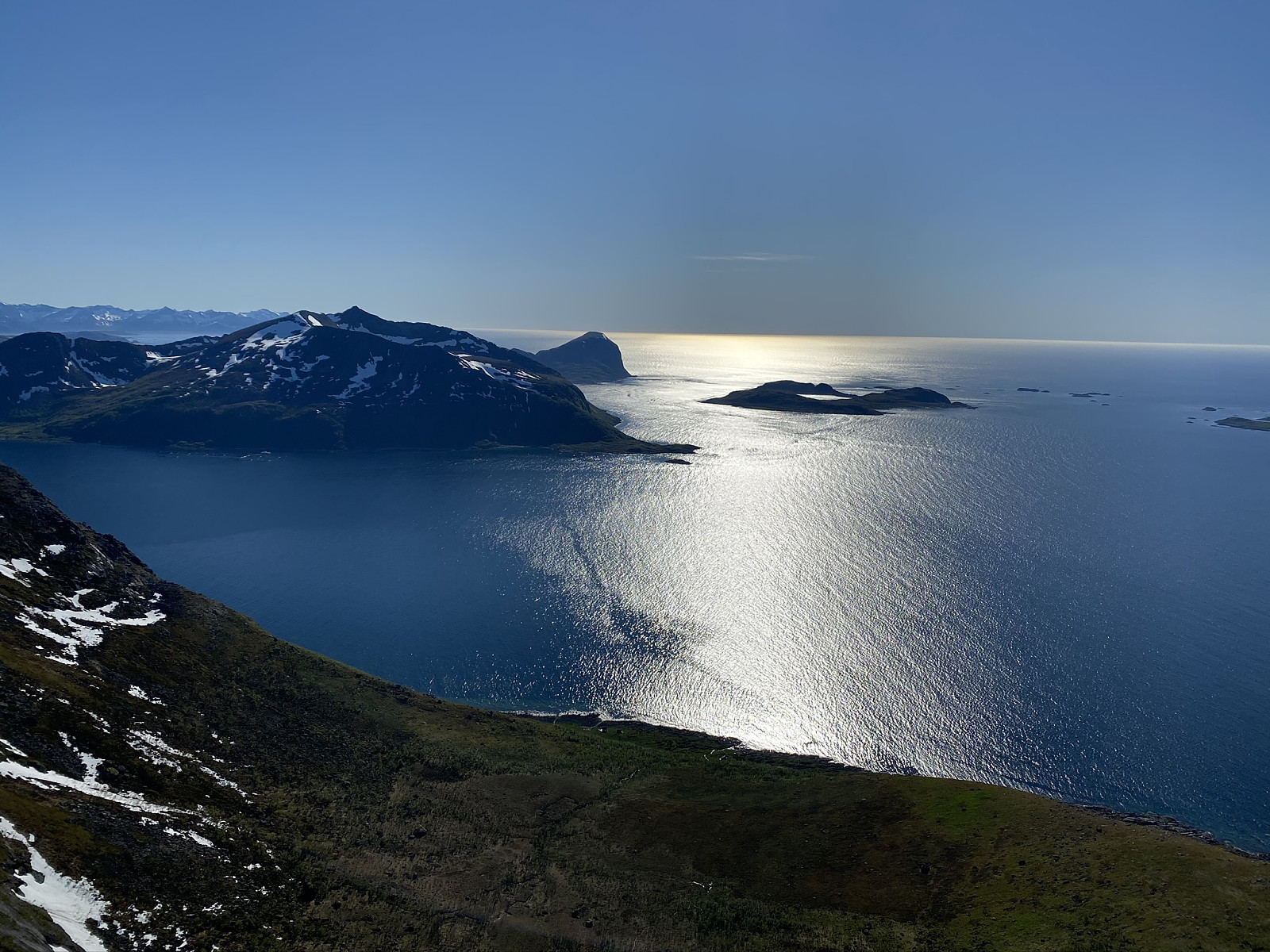
 Another day of blue skies! Met Trond Olav in Tromsø and drove out to Løvdal together. From here we parked the car and followed a small trail into the right hand side of Løvdalelva. The small trodden path follows the valley in along the lake on quite a long approach and eventually comes up to a pass around 300moh where you get great views of Blåskredtinden. From here the trail disappears and we lost around 100moh as we headed down towards the small lake. After a small, loose boulder field we started gaining elevation steeply through heavy, vegetated terrain and ended up pushing our way steeply through bushes until the terrain got more rocky. We followed a stone gully to the right before heading over to where we would start our one ropelength of climbing. Great quality rock and a nice pitch. >>>
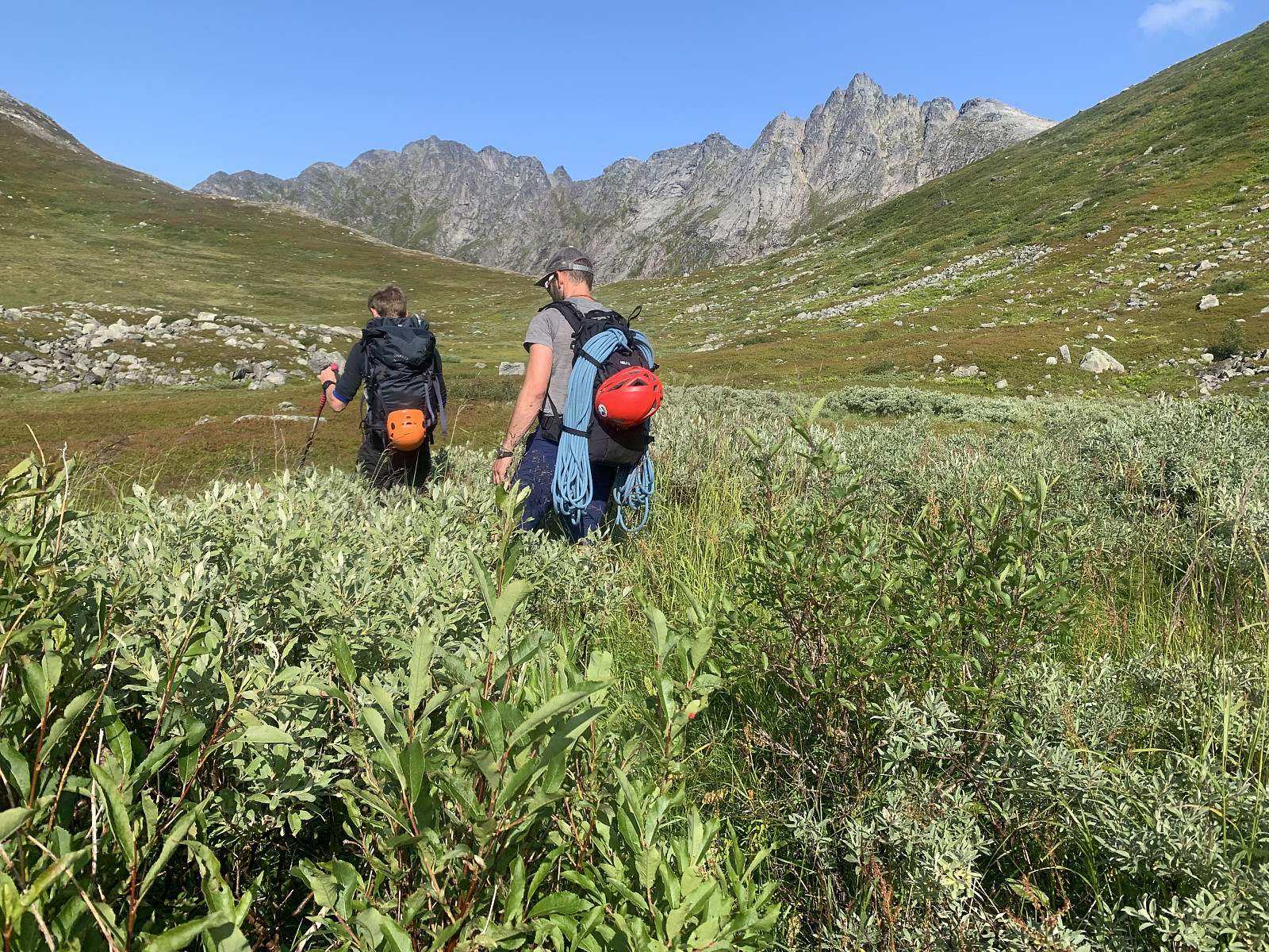
Stjerntinden in the box!
- Datum:
- 15.06.2019
- Tourcharakter:
- Alpinklettern
- Tourlänge:
- 10:30h
- Entfernung:
- 17,8km
 The last mountain to finish our clean sweep of all the highest points in each kommune in Lofoten, happened also to be Norways most difficult kommunetopp. We met Geir Rune at Ytre Skjelfjord and divided up the gear. Around 9.30am we started our trip hiking through knee high grass and bushes, before we started gaining elevation in challenging terrain. The trail was weak and came and went. We walked up through some steep gullies covered in really thick vegetation, and once we came up on the pass around 600moh, we began a sideways traverse over a steep snow & grass felt, which was wet and slippery.
Around 750moh we took our hardnesses on and started the first pitch, slippery mossy climbing up 'Holms renna'. From here, the second pitch led up through a big crack in the mountain. The next pitch >>>
The last mountain to finish our clean sweep of all the highest points in each kommune in Lofoten, happened also to be Norways most difficult kommunetopp. We met Geir Rune at Ytre Skjelfjord and divided up the gear. Around 9.30am we started our trip hiking through knee high grass and bushes, before we started gaining elevation in challenging terrain. The trail was weak and came and went. We walked up through some steep gullies covered in really thick vegetation, and once we came up on the pass around 600moh, we began a sideways traverse over a steep snow & grass felt, which was wet and slippery.
Around 750moh we took our hardnesses on and started the first pitch, slippery mossy climbing up 'Holms renna'. From here, the second pitch led up through a big crack in the mountain. The next pitch >>>

