Archiv - Nach Datum
Archiv - Nach Aktivität
-
Andere Wintertour (3)
- Schneeschuhtour (3)
-
Fahrzeugtour (1)
- Autotour (1)
- Fußtour (137)
-
Klettern (23)
- Alpinklettern (9)
- Klettersteig (2)
- Sportklettern (11)
-
Skitour (62)
- Langlauf (1)
- Randonnée/Telemark (58)
- Tourenskilauf (3)


Gesammelte Listen
-
Norges 1000 største fjell målt i primærfaktor
(45/1000)
 4%
4%

Lieblingstouren
Lieblingsgipfel


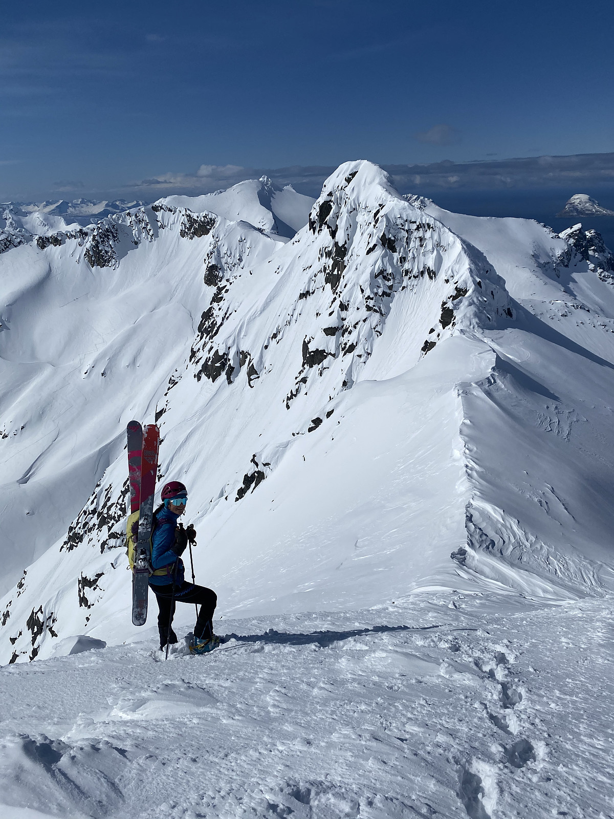
Blåtinden
- Datum:
- 31.05.2020
- Tourcharakter:
- Randonnée/Telemark
- Tourlänge:
- 5:00h
- Entfernung:
- 11,0km
 Spring is finally starting to arrive! Still plenty of snow and we could walk with skiis from the roadside :) No tracks made for an interesting trip through the forrest with pretty wet snow below the tree line. Nice slush afterwards, but stepper sections on the ridge ( 600-900moh) were a lot wetter, though the snow appeared stable and was sitting pretty well. Really nice skiing down through the bowl with a bit of luggeføre. Nice to be alone on a mountain that’s so popular. Takk for turen pauke!
Kvasstinden rundt
- Datum:
- 23.05.2020
- Tourcharakter:
- Randonnée/Telemark
- Tourlänge:
- 6:57h
- Entfernung:
- 20,5km
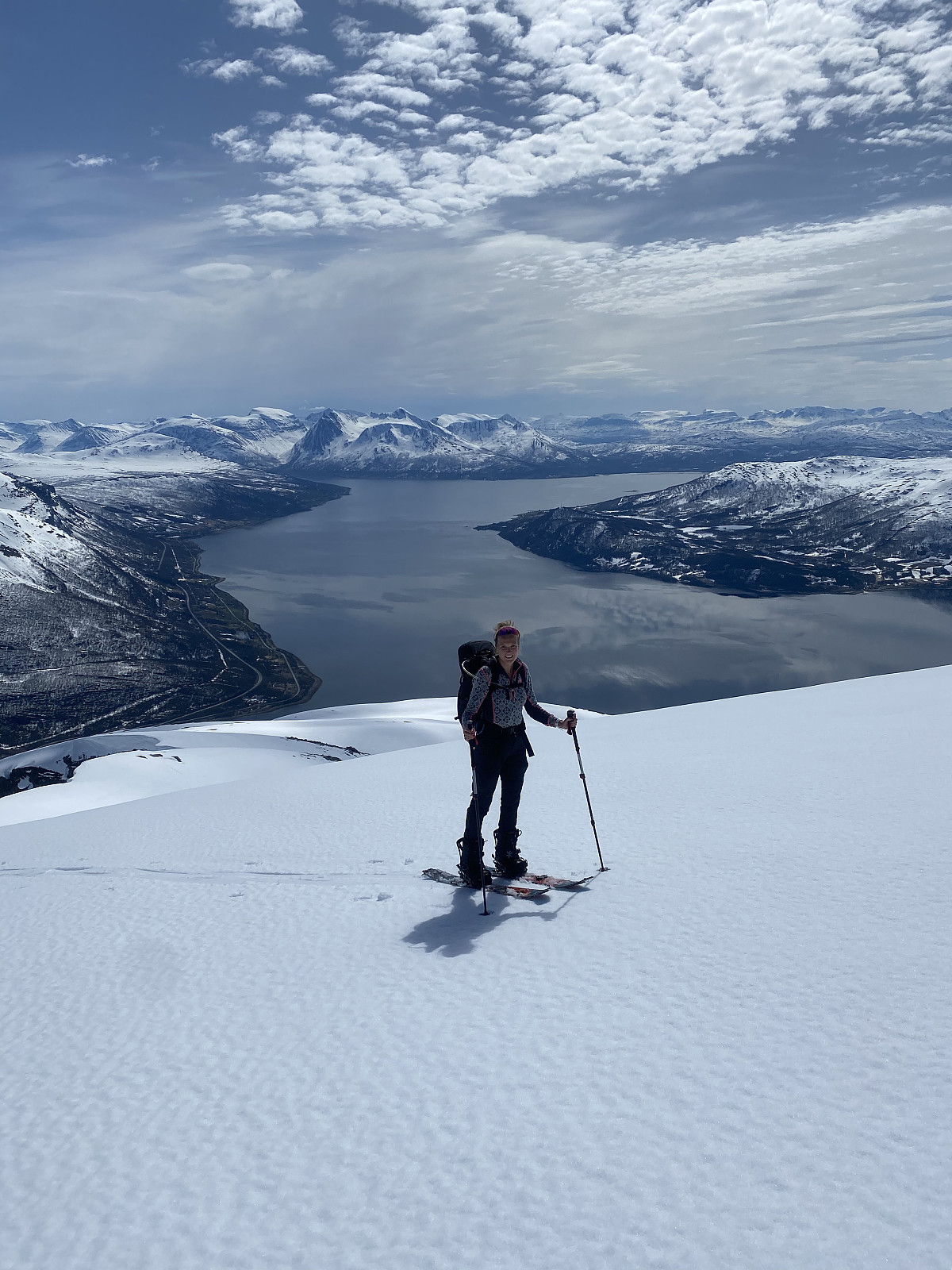
 Kvasstinden is a less-visited peak in Nord-lenangen. The most straight forward route would be to start in Storvoll and walk along the fjord, but higher temperatures meant Sten & Martine thought it would be better to walk via Bjørndalen and avoid the rotten snow. We parked at Bjørndal and followed tracks up through Bjørndalen just after 7am, before heading left in the valley once the terrain flattened out. The plan was to glide north east and down to around 60moh before we started gaining elevation again. We found a short cut down one of the east facing flanks of Bjørnskarstinden and got some fun skiing in, before heading up Kvasstinden.
Stunning views in all directions from the top, and nice varied terrain. Great slush conditions skiing down from the top, and we glided into the valley >>>
Kvasstinden is a less-visited peak in Nord-lenangen. The most straight forward route would be to start in Storvoll and walk along the fjord, but higher temperatures meant Sten & Martine thought it would be better to walk via Bjørndalen and avoid the rotten snow. We parked at Bjørndal and followed tracks up through Bjørndalen just after 7am, before heading left in the valley once the terrain flattened out. The plan was to glide north east and down to around 60moh before we started gaining elevation again. We found a short cut down one of the east facing flanks of Bjørnskarstinden and got some fun skiing in, before heading up Kvasstinden.
Stunning views in all directions from the top, and nice varied terrain. Great slush conditions skiing down from the top, and we glided into the valley >>>
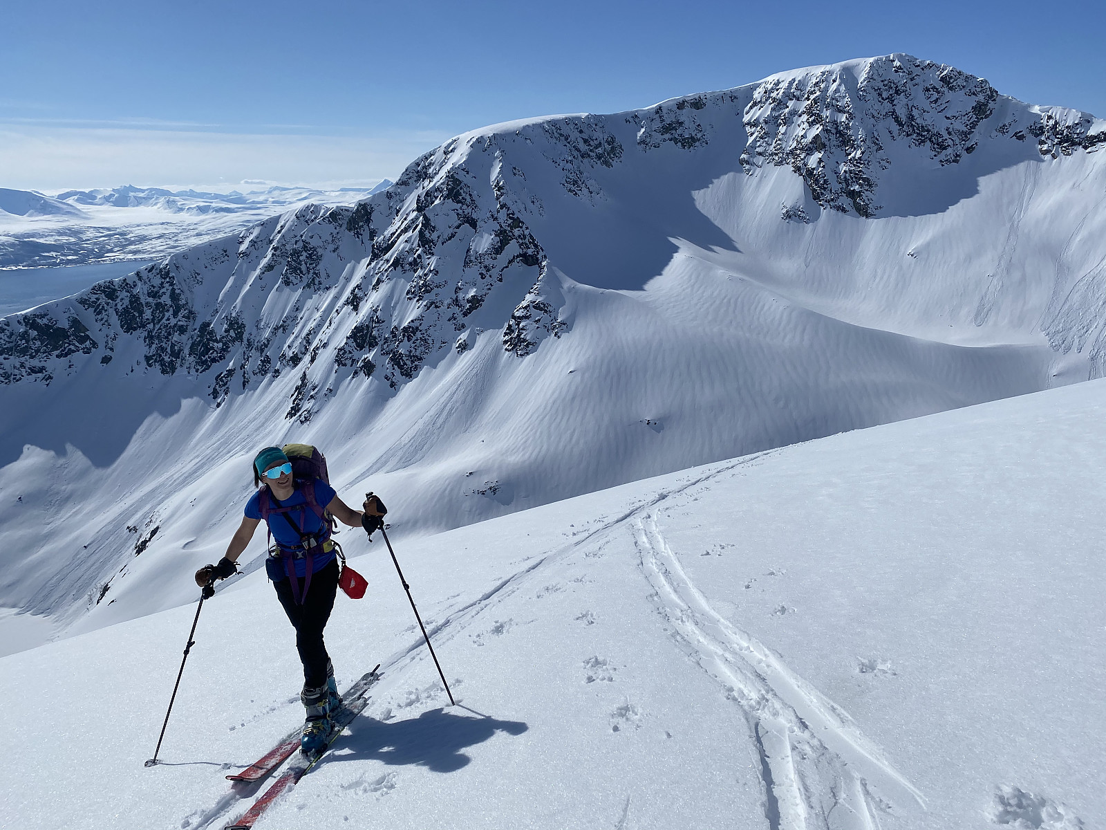
Nordre Solltinden
- Datum:
- 22.05.2020
- Tourcharakter:
- Randonnée/Telemark
- Tourlänge:
- 3:48h
- Entfernung:
- 6,3km
 Øytopper over 1000m.
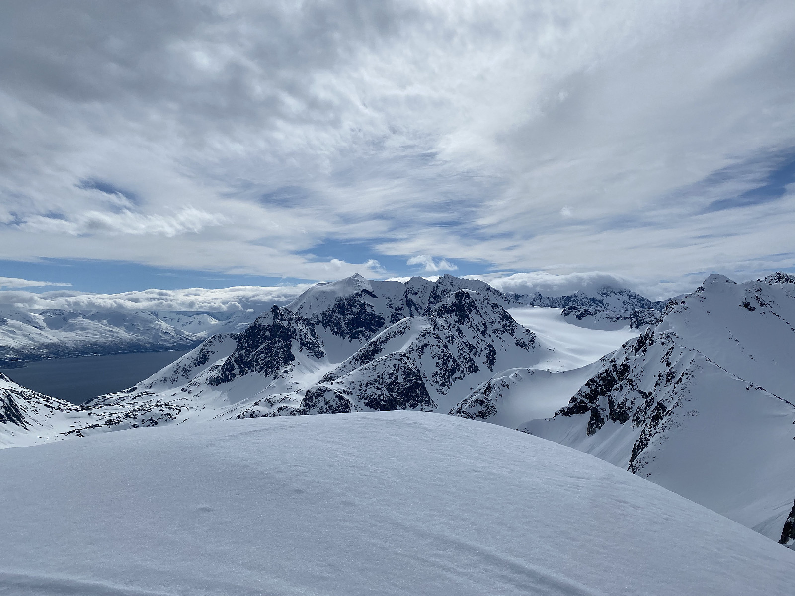
High temperatures and avalanche danger made me think a ridge formation would be the best option for today, and Rema1000 was still on the list. We parked just after the small bridge at Nordre Åborsneset and followed the right side of the river up towards the ridge. The first day of shorts weather for this year :) From here it was easy terrain along the ridge until around 850moh where the top flank started getting steeper. After digging a snow profile, we decided the snow was stable enough to boot up but not stable enough to ski. We parked the skiis and headed to the top on foot. Amazing views of Ringvassøya and over to Lyngen. After downclimbing to our skiis we had fantastic slush the whole way down, with the last hundred elevation or so really wet, heavy snow. Takk for >>>
Øytopper over 1000m.
High temperatures and avalanche danger made me think a ridge formation would be the best option for today, and Rema1000 was still on the list. We parked just after the small bridge at Nordre Åborsneset and followed the right side of the river up towards the ridge. The first day of shorts weather for this year :) From here it was easy terrain along the ridge until around 850moh where the top flank started getting steeper. After digging a snow profile, we decided the snow was stable enough to boot up but not stable enough to ski. We parked the skiis and headed to the top on foot. Amazing views of Ringvassøya and over to Lyngen. After downclimbing to our skiis we had fantastic slush the whole way down, with the last hundred elevation or so really wet, heavy snow. Takk for >>>
Skitntinden (skitoppen)
- Datum:
- 21.05.2020
- Tourcharakter:
- Randonnée/Telemark
- Tourlänge:
- 3:08h
- Entfernung:
- 9,5km
 Endelig, varmt vær og sol i Tromsø! Begynte som tre, men etter innsjøen ble det snu-tur på de andre to i følget grunnet gnagsår. Høy temperaturer og mye sol hadde ført til høy skredfare og jeg ville ikke gå alene; men fikk hive meg på turen til et hyggelig par som var bak oss, Morten & Adele. Finfin utsikt fra toppen og fin slush-kjøring på vei ned, men på de vest-vendte sider var det veldig lett å utløse våte skred.
Storstolpan
- Datum:
- 16.05.2020
- Tourcharakter:
- Randonnée/Telemark
- Tourlänge:
- 4:00h
- Entfernung:
- 9,4km
Gorželvtinden
- Datum:
- 14.05.2020
- Tourcharakter:
- Randonnée/Telemark
- Tourlänge:
- 3:23h
- Entfernung:
- 10,0km
Styrmannstinden
- Datum:
- 13.05.2020
- Tourcharakter:
- Randonnée/Telemark
- Tourlänge:
- 4:00h
- Entfernung:
- 7,7km
Lots of new snow on Monday & Tuesday meant I was looking forward to heading out when the clouds cleared on Wednesday afternoon. We parked just before the bend in the road at Vågbotn and headed up towards Styrmmanstinden. Fresh snow and no other tracks made for hard trail breaking work, and there was a lot more wind than forecasted. We gained elevation effectively, but it was tough on the legs making kick turn tracks through the steeper section. From the skare we got great views towards Hollendaren/Zapfetoppen and headed up the final section before the top. Parked the skiis around 50m from the top and walked the rest. Great views as always, but still freezing cold. Is summer coming soon?! Excellent skiing all the way down to the car, loose powder in the top few hundred meters and deep, >>>
Storsteinnestinden S-N Traverse
- Datum:
- 10.05.2020
- Tourcharakter:
- Randonnée/Telemark
- Tourlänge:
- 4:42h
- Entfernung:
- 11,8km
 We parked one car at Ersfjordbotn and then drove to Kattfjordeidet, where we parked at the regular parking and headed up the normal route. Quite a few people already out, despite it being 9.30 on a Sunday. The trip up went quickly with good snow conditions, but the east facing slope up from the lake had quite a bit of wind transported snow on it. The last 50m or so elevation were quite icy, so here we put on the ski crampons to get to the top. Once we were at the top, Hannah headed down the north side to check out the conditions. It was looking a bit wind blown but we decided to give it a go. It was too icy and wind-packed that we could ski straight down from the top, so the skis went on the backpack while we headed down onto the flank. My crampon skills definitely need some work! From here >>>
Åborsdalstinden
- Datum:
- 02.05.2020
- Tourcharakter:
- Randonnée/Telemark
- Tourlänge:
- 4:17h
- Entfernung:
- 9,8km
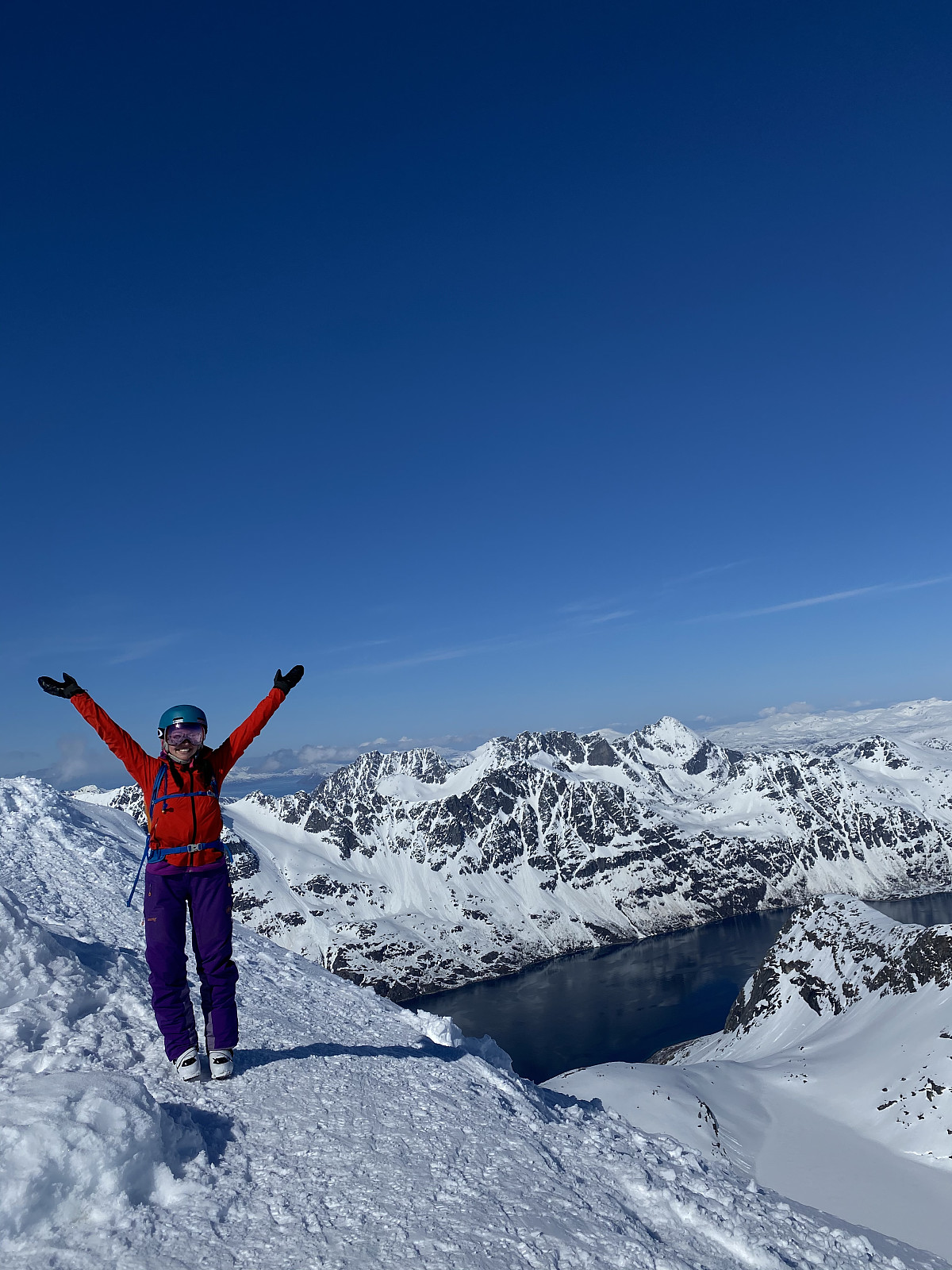
 We had originally planned to ascend Bjørnskarstinden via the north facing gully, but due to large cornices hanging over the route, we headed up Åborsdalstinden instead.
We parked at Nordre Åbordsneset and made tracks up on the right hand side of the river. After coming up on the ridge, we headed west in the valley and towards Soltindan. Once we got to the skare between Bjørnskarstinden and Åborsdalstinden, we could see huge cornices hanging over the east side of Soltindan and over the gully we were planning to ascend. With the first warm day in...forever? and sun, we decided today was not the day to be under so many cornices. We had around 400m of elevation to reach the summit of Åborsdalstinden, directly on our right, so we headed up there. Terrain between 30-40 degrees made for some >>>
We had originally planned to ascend Bjørnskarstinden via the north facing gully, but due to large cornices hanging over the route, we headed up Åborsdalstinden instead.
We parked at Nordre Åbordsneset and made tracks up on the right hand side of the river. After coming up on the ridge, we headed west in the valley and towards Soltindan. Once we got to the skare between Bjørnskarstinden and Åborsdalstinden, we could see huge cornices hanging over the east side of Soltindan and over the gully we were planning to ascend. With the first warm day in...forever? and sun, we decided today was not the day to be under so many cornices. We had around 400m of elevation to reach the summit of Åborsdalstinden, directly on our right, so we headed up there. Terrain between 30-40 degrees made for some >>>

