Archiv - Nach Datum
Archiv - Nach Aktivität
-
Andere Wintertour (3)
- Schneeschuhtour (3)
-
Fahrzeugtour (1)
- Autotour (1)
- Fußtour (137)
-
Klettern (23)
- Alpinklettern (9)
- Klettersteig (2)
- Sportklettern (11)
-
Skitour (62)
- Langlauf (1)
- Randonnée/Telemark (58)
- Tourenskilauf (3)


Gesammelte Listen
-
Norges 1000 største fjell målt i primærfaktor
(45/1000)
 4%
4%

Lieblingstouren
Lieblingsgipfel


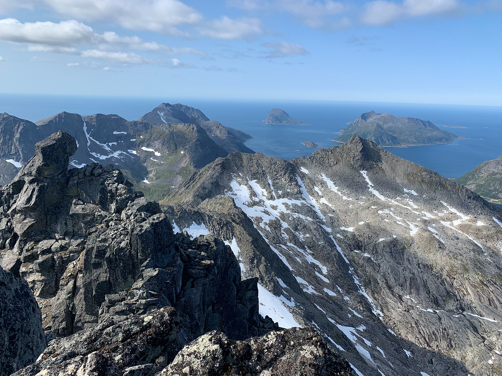
Soria Moria Traversen
- Datum:
- 11.08.2019
- Tourcharakter:
- Bergtour
- Tourlänge:
- 4:30h
- Entfernung:
- 9,5km
 Øytopper ≥ 1000 meter (fastland)
Another Sunday of scrambling with hmsv1 (Hannah Vickers) :) We hiked from left to right, starting from following the path from the parking lot and then taking to the left over a boulder field and continuing on up to top 884. Once we reached top 884 we were rewarded with stunning views over the entire ridge. From here we had some sections of good scrambling and came to Hannahs nervous point - two parallell rocks with a 2 meter drop down. Fun! After this, it was easy going up to Storsteinnestinden, where the views were magnificent. We continued onto Leirholstinden, encountering one awkward bit of scrambling that was exposed below. There is some rocks assembled as someone has tried to make stairs, but we found it easier to pull ourselves up just to the left of these. From here we >>>
Øytopper ≥ 1000 meter (fastland)
Another Sunday of scrambling with hmsv1 (Hannah Vickers) :) We hiked from left to right, starting from following the path from the parking lot and then taking to the left over a boulder field and continuing on up to top 884. Once we reached top 884 we were rewarded with stunning views over the entire ridge. From here we had some sections of good scrambling and came to Hannahs nervous point - two parallell rocks with a 2 meter drop down. Fun! After this, it was easy going up to Storsteinnestinden, where the views were magnificent. We continued onto Leirholstinden, encountering one awkward bit of scrambling that was exposed below. There is some rocks assembled as someone has tried to make stairs, but we found it easier to pull ourselves up just to the left of these. From here we >>>
Store Kvænangstind - skrekk og gru!
- Datum:
- 09.08.2019
- Tourcharakter:
- Bergtour
- Tourlänge:
- 9:08h
- Entfernung:
- 21,7km
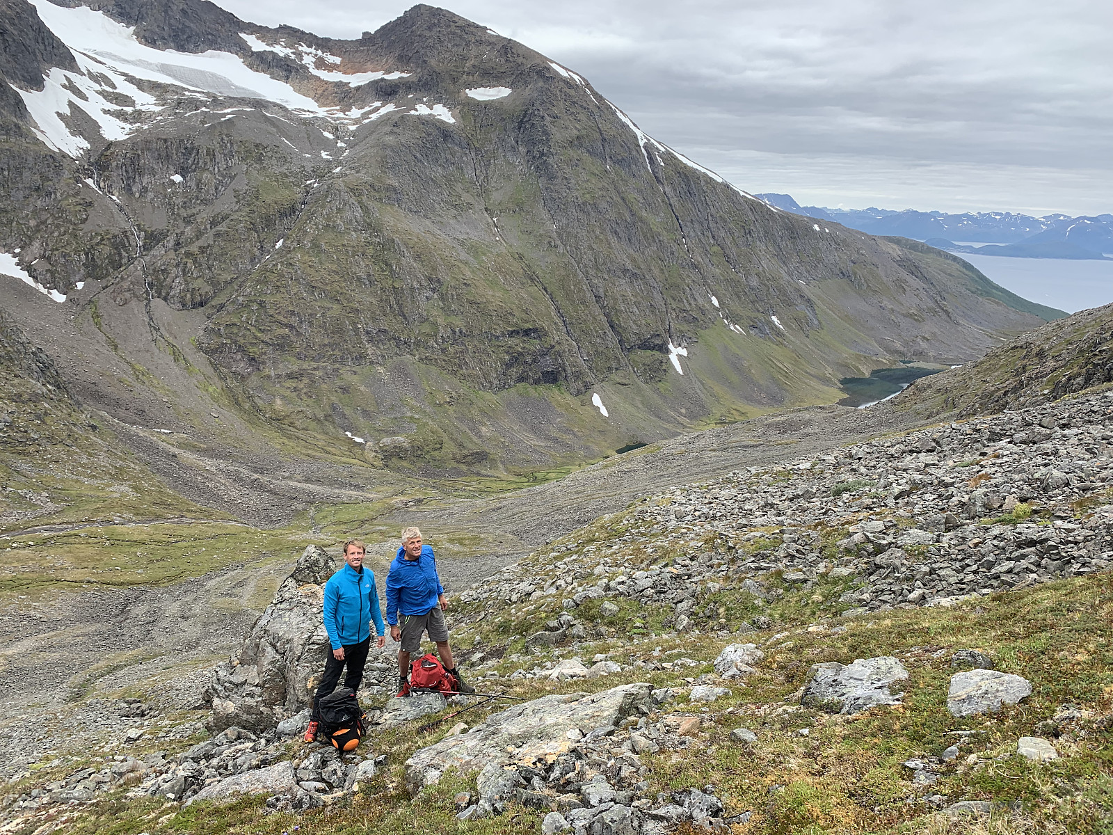 We had arranged the day before to get a boat ride in to Meiland with a local, so we met him at Klubbeneshamn at 9am. The first challenge of the day was getting around the locked gate on the jetty, and with the sun shining we began walking around 9.30am, following a tractor path up from the few cabins. Soon the path turned into a great, well trodden trail through the forrest for around 45minutes until we came to Storvatnet. Along the way we met a local who was picking cloudberries and asked where we were going. He laughed and said nothing but 'Ha - Skrekk og gru!'. Once we reached the lake we stopped and discussed the weather, as it looked like the full sun and 15 degrees that Yr had forecast wasn’t going to be right. It was heavily overcast and around 8 degrees. Otto messaged Martin, who >>>
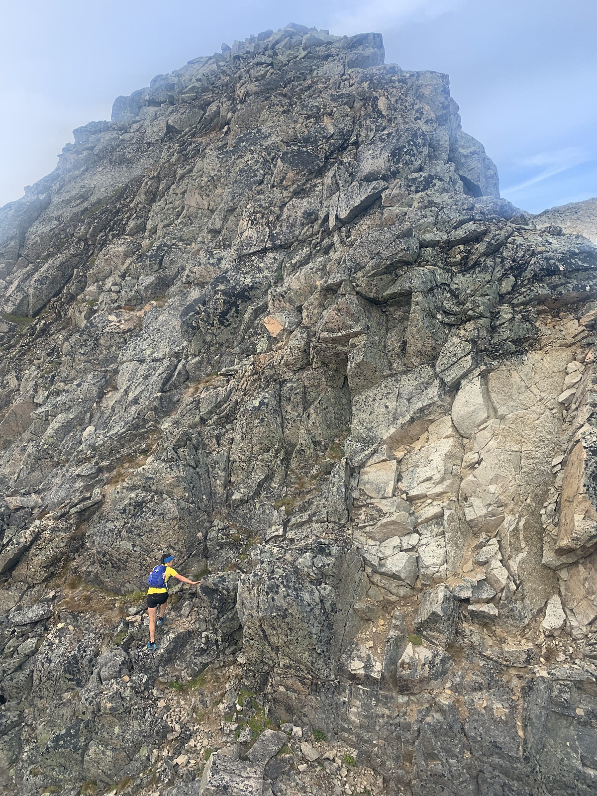
Middagstinden
- Datum:
- 07.08.2019
- Tourcharakter:
- Bergtour
- Tourlänge:
- 5:07h
- Entfernung:
- 11,3km
 Øytopper ≥ 1000 meter (fastland)
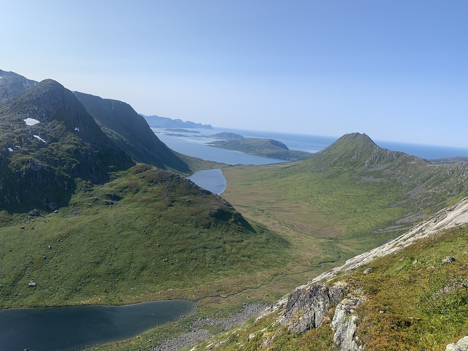
Undoubtably one of the best views on Kvaløya and the best, most challenging scrambling I've done to date. We parked in the big parking place opposite Tverrfjellet and followed the path up to the left hand side of the river. Around 500moh the trail flattened out, the trail disappeared and we followed the right hand side of Tverrfjellvatnet in easy terrain and over sturdy rocks. After around 45 minutes we started gaining elevation again, this time up looser rocks. The views were already stunning back over Katfjordeidet, over to Blåskredtinden and sommarøya.
We picked a path over the rocks until we came to a point where we could see two steep stone pillars. From here we scrambled around to the left which was very exposed. After completing this section we thought >>>
Øytopper ≥ 1000 meter (fastland)
Undoubtably one of the best views on Kvaløya and the best, most challenging scrambling I've done to date. We parked in the big parking place opposite Tverrfjellet and followed the path up to the left hand side of the river. Around 500moh the trail flattened out, the trail disappeared and we followed the right hand side of Tverrfjellvatnet in easy terrain and over sturdy rocks. After around 45 minutes we started gaining elevation again, this time up looser rocks. The views were already stunning back over Katfjordeidet, over to Blåskredtinden and sommarøya.
We picked a path over the rocks until we came to a point where we could see two steep stone pillars. From here we scrambled around to the left which was very exposed. After completing this section we thought >>>
Blåskredtinden
- Datum:
- 06.08.2019
- Tourcharakter:
- Alpinklettern
- Tourlänge:
- 6:23h
- Entfernung:
- 11,4km
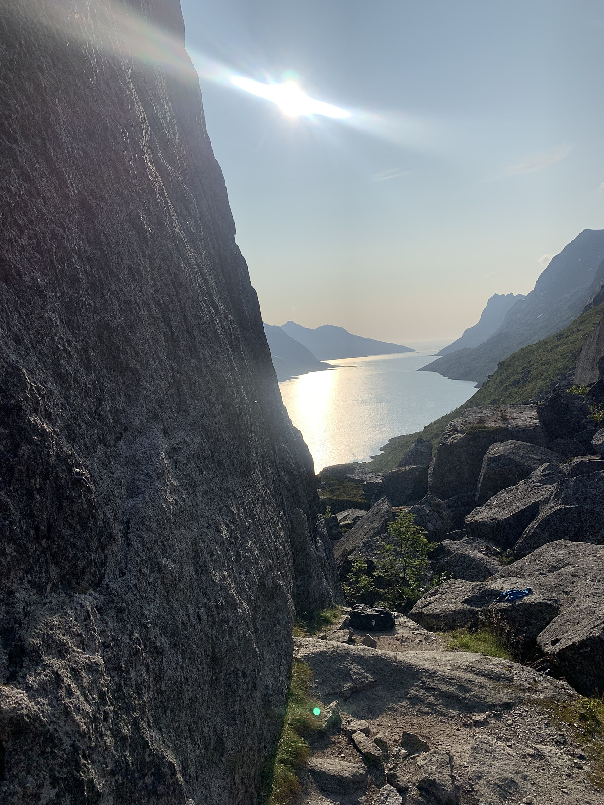
 Another day of blue skies! Met Trond Olav in Tromsø and drove out to Løvdal together. From here we parked the car and followed a small trail into the right hand side of Løvdalelva. The small trodden path follows the valley in along the lake on quite a long approach and eventually comes up to a pass around 300moh where you get great views of Blåskredtinden. From here the trail disappears and we lost around 100moh as we headed down towards the small lake. After a small, loose boulder field we started gaining elevation steeply through heavy, vegetated terrain and ended up pushing our way steeply through bushes until the terrain got more rocky. We followed a stone gully to the right before heading over to where we would start our one ropelength of climbing. Great quality rock and a nice pitch. >>>
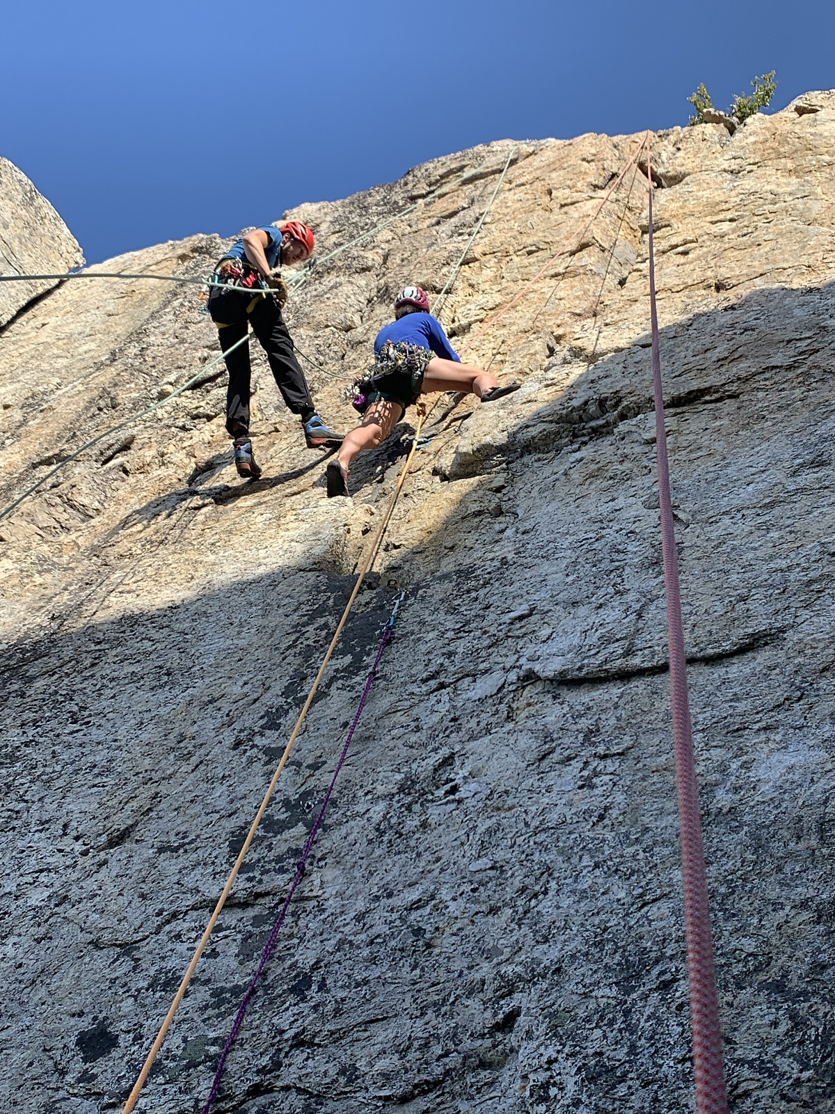
Ersfjorden klatrefelt
- Datum:
- 05.08.2019
- Tourcharakter:
- Sportklettern
- Tourlänge:
- 5:00h
- Entfernung:
- 4,5km
 Nok en utfordring å finne frem her! Parkerte litt før Ersfjordotn brygge og fulgte grusveien til høyre langs ersfjorden. Etter ca 1km går stien godt synlig opp til høyre. Her er det godt markert ved stein varde men det ble mye fram og tilbake gjennom buldrefeltet å komme frem. Innmarsjen var litt lenger og mer tungvint enn hva vi hadde trodd. Ble en fin kveld i veggen til slutt, med alle 5'er ruter på Sjarmorveggen klatret på led. Veldig god stein kvalitet, men graderingene virket vanskelig! GPS spor er fra turen tilbake fra veggen til bilen.

