Arkiv - dato
Arkiv - aktivitet
-
Annen vintertur (3)
- Trugetur (3)
- Fottur (137)
-
Kjøretur (1)
- Biltur (1)
-
Klatring (23)
- Alpin klatring (9)
- Sportsklatring (11)
- Via ferrata (2)
-
Skitur (62)
- Fjellskitur (3)
- Langrennstur (1)
- Randonnée/Telemark (58)


Lister jeg samler etter
-
Norges 1000 største fjell målt i primærfaktor
(45/1000)
 4%
4%

Favoritturer
Favorittopper


Skjeggen
- Dato:
- 30.07.2019
- Turtype:
- Fjelltur
- Turlengde:
- 2:46t
- Distanse:
- 5,8km
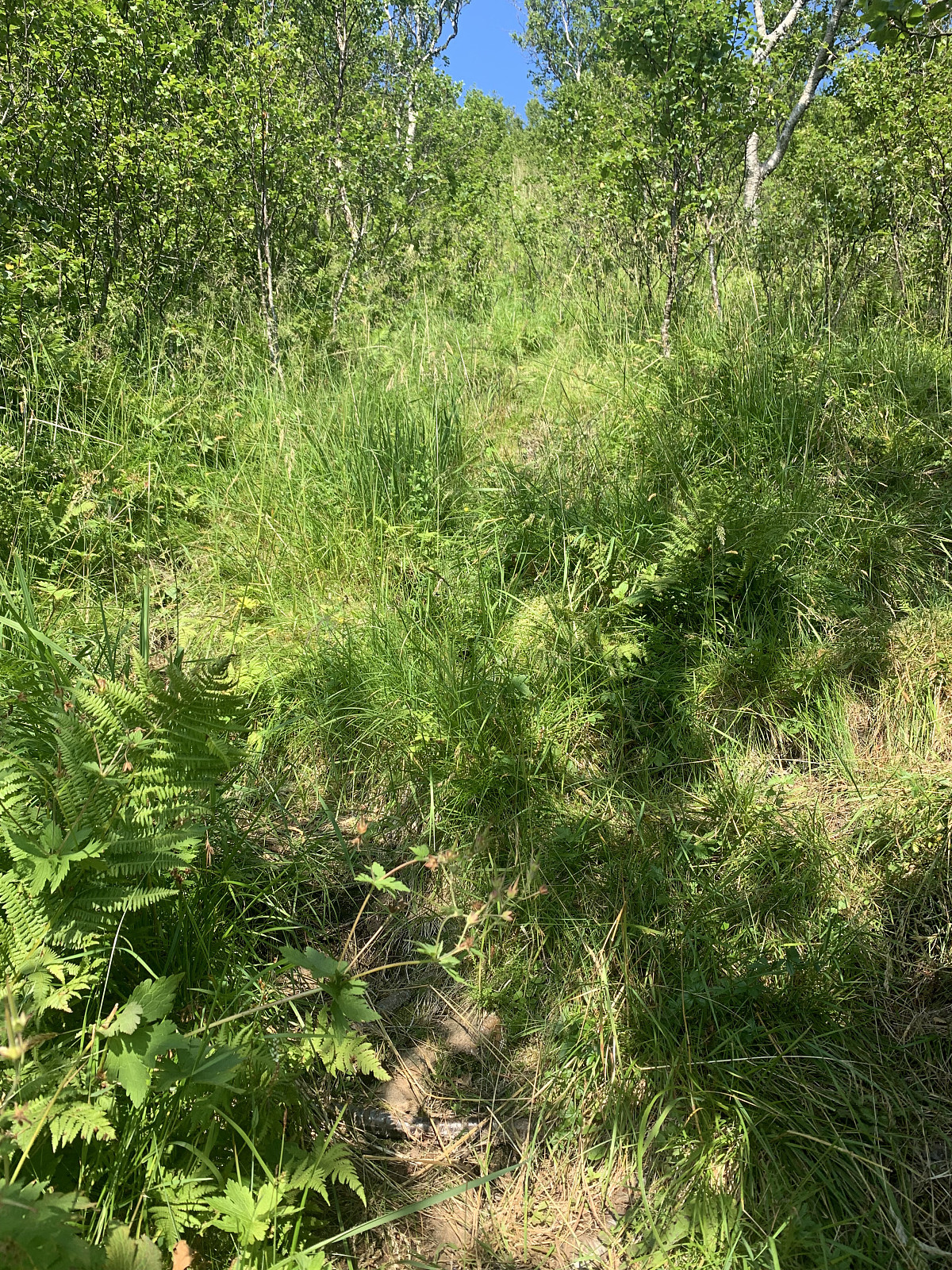 Temperatures returned to normal today and with the sun shining, a trip up Skjeggen was in order on the drive northwards to Tromsø. Parked on a farmers property beside some curious cows and followed a gravel road upwards. The road ended at a small dam and the path followed the left hand side of the river up. Gained elevation very steeply on a heavily vegetated trail through the forrest for the first 600m, before the trail flattened out, became more sandy and headed to the right over the ridge and towards the top. Easily trodden terrain and a pleasant hike with effective elevation gain. Phenomenal views of Helgelandskysten, Svartisen and all the way out to Værøy and Lofoten. Legs felt surprisingly fine on the way up today, but once I came to the top yesterdays' hikes took their toll and I >>>
Kremtur til Helgelandsbukken
- Dato:
- 29.07.2019
- Turtype:
- Fjelltur
- Turlengde:
- 6:04t
- Distanse:
- 20,1km
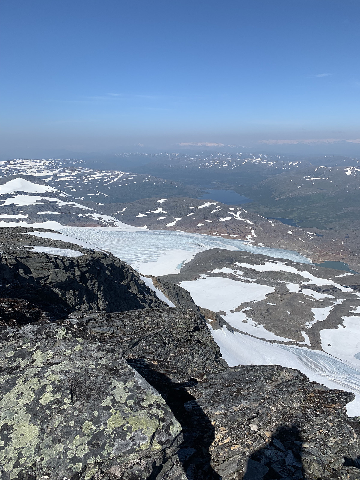
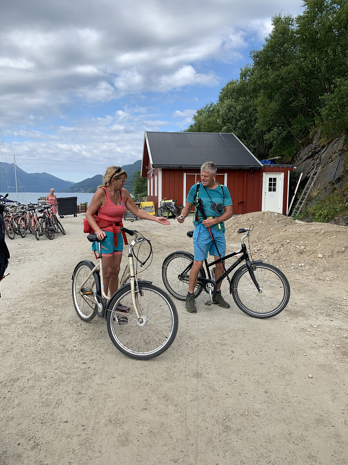 We started our day with a boat ride in Holandsfjorden to Engen. From here we rented bikes and cycled 3km along Engabrevatnet until we came to the trail start up to Svartisen. From here we followed the signs to Tåkeheimen. We walked up over smooth svaberg, before the trail got steeper in rockier & sandier terrain. Stunning views over Svartisen! From here it was good, steady elevation gain up a clear trail until we came to the Tåkeheimen cabin after 1t45min. Here we had a food break, checked out the amazing cabin, and then headed up along the ridge towards the top. A steep and sandy trail to start with, before heading through a nice, fast boulder field and then following easy terrain of small rocks and some snow fields towards the top. Phenomenal views over Svartisen as far as the eye could >>>
Fykantrappa
- Dato:
- 29.07.2019
- Turtype:
- Fottur
- Turlengde:
- 1:15t
- Distanse:
- 2,9km
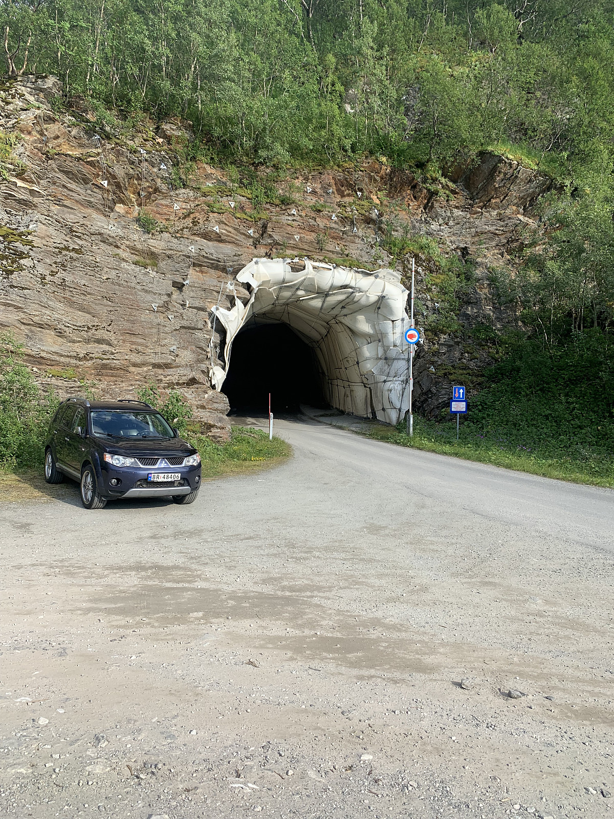 The 1129 wooden stairs were built over 100 years ago and I thought they would be worth a visit while in Glomfjord. I took the first right after Svartistunnelen and followed a small road along the lake. With absolutely zero signage it was a hassel to locate the trail start. Parked to the left before the road after Fykanvatnet tunnels through the mountain and followed a well trodden trail for ca 10 min before coming to the start of the stairs. Legs were already warm from Helgelandsbukken earlier in the day, so from here it was plankekjøring up the steep stairs and I was at the top 10 min later. Decided to walk down and up again once more before calling it a day. Lovely views and a nice end to a wonderful day with over 2000m elevation :)
Kunna i tropevarme
- Dato:
- 28.07.2019
- Turtype:
- Fjelltur
- Turlengde:
- 2:45t
- Distanse:
- 4,5km
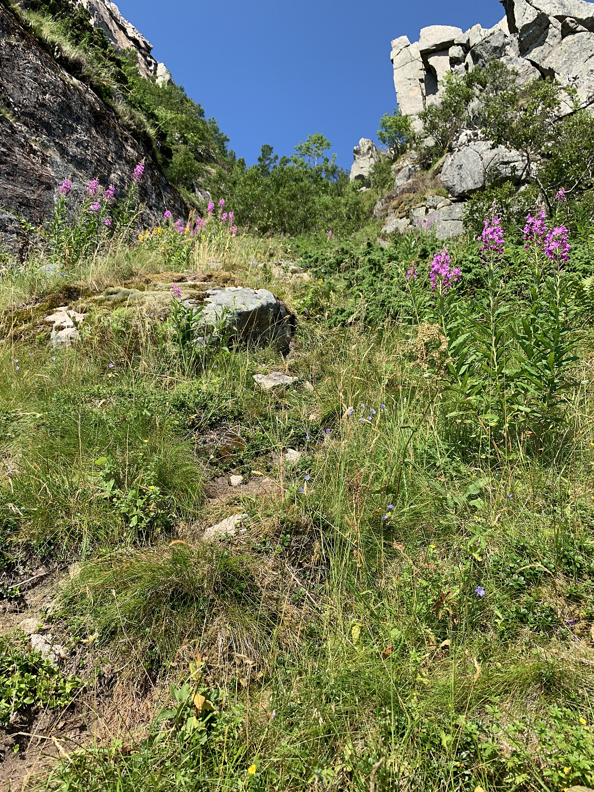 Officially too hot to go hiking! innerdal (Inger Lise Innerdal) & I had originally planned to take Skjeggen together, but with the 30+ degrees we decided the less elevation the better. We walked along the beach and looked for a trail leading up the mountain, but after 500m with no luck we headed back to the parking and tried our luck towards the stone scree below a steep gully. Here we saw some old white (once red, now very old) brøytestikker marking the trail and headed up over the stone scree and into a steep, vegetated gully. Very, very effective elevation gain and walking up here was like walking in an oven and we had to stop every 50meters to avoid passing out. Soon we came out of the gully, the trail flattened out and the terrain became much more pleasant. From here it was just to enjoy the great views and try >>>
Northern Norway's highest - Oksskolten
- Dato:
- 27.07.2019
- Turtype:
- Fjelltur
- Turlengde:
- 7:03t
- Distanse:
- 15,8km
 We camped overnight near the trailstart and woke up to what would be the hottest day of the year so far. We started walking around 8.15am and followed the markers up towards the small lake at 855moh. Here we took a wrong turn and followed the trail to the left, which is the circuit trail around Ridaren. We realised we were walking further away from the glacier and made our way back over a bouldery section of rock to the edge of the glacier, by here it was 9am. On with the crampons and ice axes and we started heading over a flat section of the glacier. There ended up being more and more crevasses as we progressed to the middle of the glacier and we had to tread carefully. After reading reports and speaking to otto (Otto Lund) who was last here in summer 10 years ago, the general practise has been to cross this >>>
Synnøvjordtinden
- Dato:
- 23.07.2019
- Turtype:
- Fjelltur
- Turlengde:
- 2:27t
- Distanse:
- 7,8km
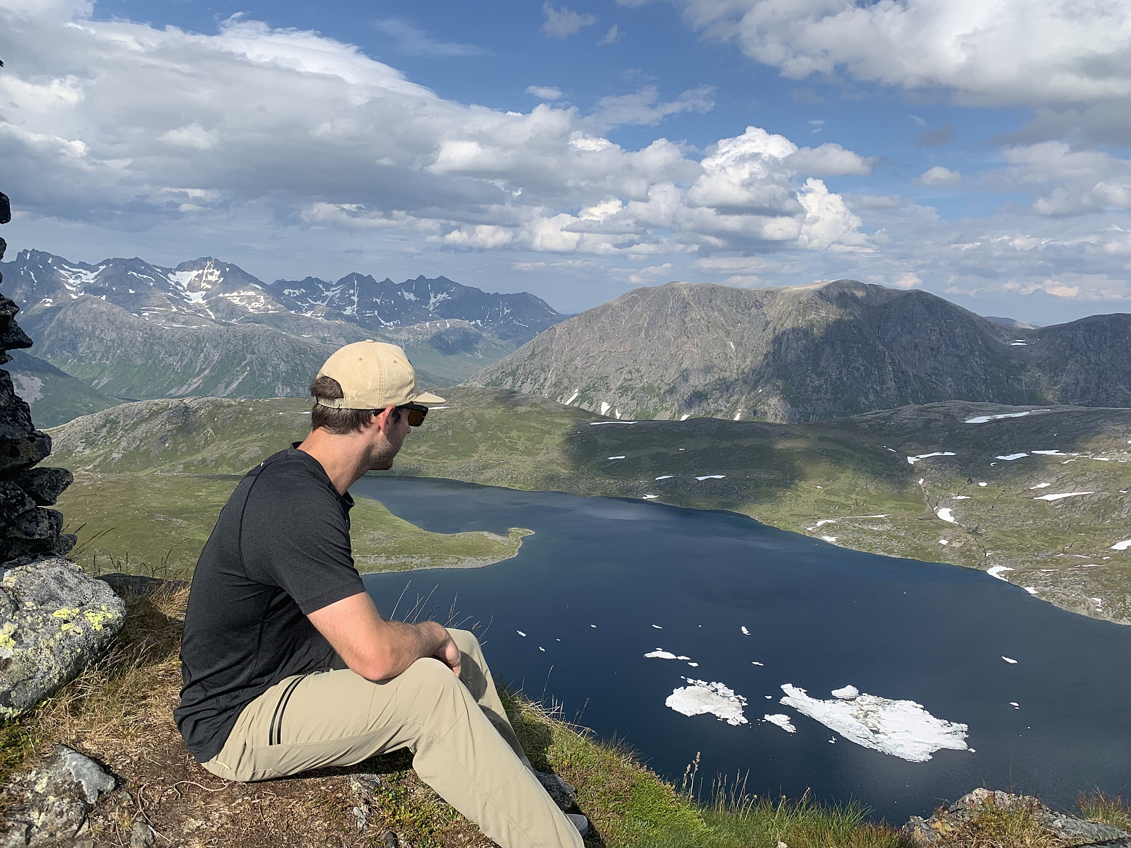 A lovely afternoon hike with Morgan. Parked by the side of where the trail starts on Norgeskart and followed the left hand side of the river up. Great, easily trodden terrain though once we came to the lake it was difficult to follow the unmarked trail up the ridge. We followed the general direction on Norgeskart and encountered the trail on/off again. Walked too fast to talk much on the way up, but the descent was a social one with variable luck following the trail. GPS track looks like I had wine in my camelback and not water ;) Great views over to Vasstinden and Kattfjordeidet. Thanks for great company Morgan!
Styrmannstinden & Melketinden
- Dato:
- 21.07.2019
- Turtype:
- Fjelltur
- Turlengde:
- 5:28t
- Distanse:
- 9,3km
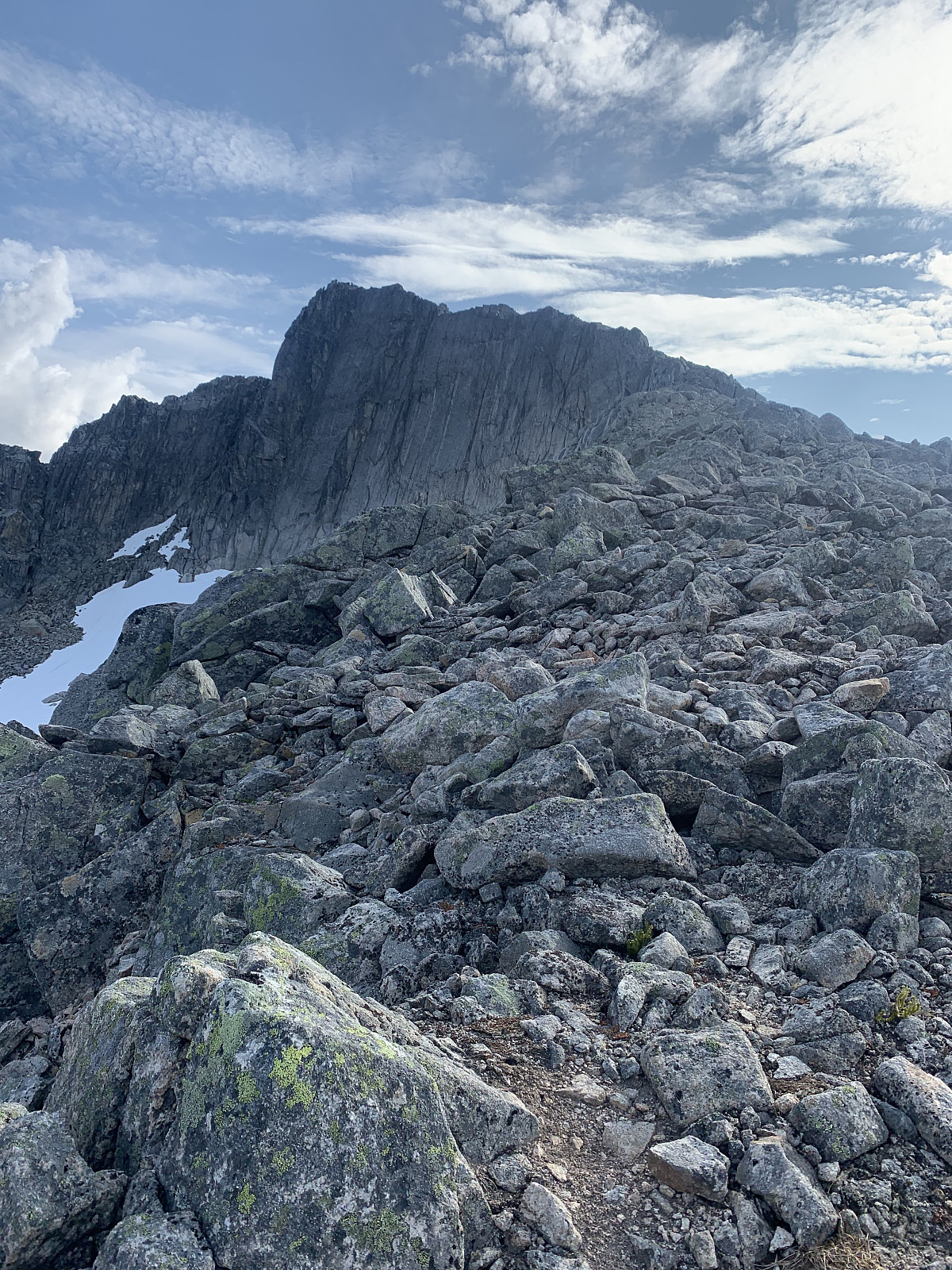 I had long been keen to try reach Melketinden with a traverse from Styrmannstinden, saving the long approach on skiis in Blåmannsvikdalen. We parked in Vågbotn and followed a great trail up to Styrmannstinden. Steady elevation gain the whole way to the top with some sections of snow once we hit around 800moh. 1.5hours later we had come up to Styrmannstinden and got our sights on Melketinden. Majority of the traverse looked fine, though the steep section straight down from Styrmannstinden looked quite gnarly from the top.
We picked a natural trail down and encountered combination of very exposed scrambling and really loose rock. This section was quite time consuming and we used around half an hour to descend the steepest 150m of elevation. From here the ridge levelled out and we started gaining >>>
I had long been keen to try reach Melketinden with a traverse from Styrmannstinden, saving the long approach on skiis in Blåmannsvikdalen. We parked in Vågbotn and followed a great trail up to Styrmannstinden. Steady elevation gain the whole way to the top with some sections of snow once we hit around 800moh. 1.5hours later we had come up to Styrmannstinden and got our sights on Melketinden. Majority of the traverse looked fine, though the steep section straight down from Styrmannstinden looked quite gnarly from the top.
We picked a natural trail down and encountered combination of very exposed scrambling and really loose rock. This section was quite time consuming and we used around half an hour to descend the steepest 150m of elevation. From here the ridge levelled out and we started gaining >>>

