Arkiv - dato
Arkiv - aktivitet
-
Annen vintertur (3)
- Trugetur (3)
- Fottur (137)
-
Kjøretur (1)
- Biltur (1)
-
Klatring (23)
- Alpin klatring (9)
- Sportsklatring (11)
- Via ferrata (2)
-
Skitur (62)
- Fjellskitur (3)
- Langrennstur (1)
- Randonnée/Telemark (58)


Lister jeg samler etter
-
Norges 1000 største fjell målt i primærfaktor
(45/1000)
 4%
4%

Favoritturer
Favorittopper


Blåskredtinden
- Dato:
- 06.08.2019
- Turtype:
- Alpin klatring
- Turlengde:
- 6:23t
- Distanse:
- 11,4km
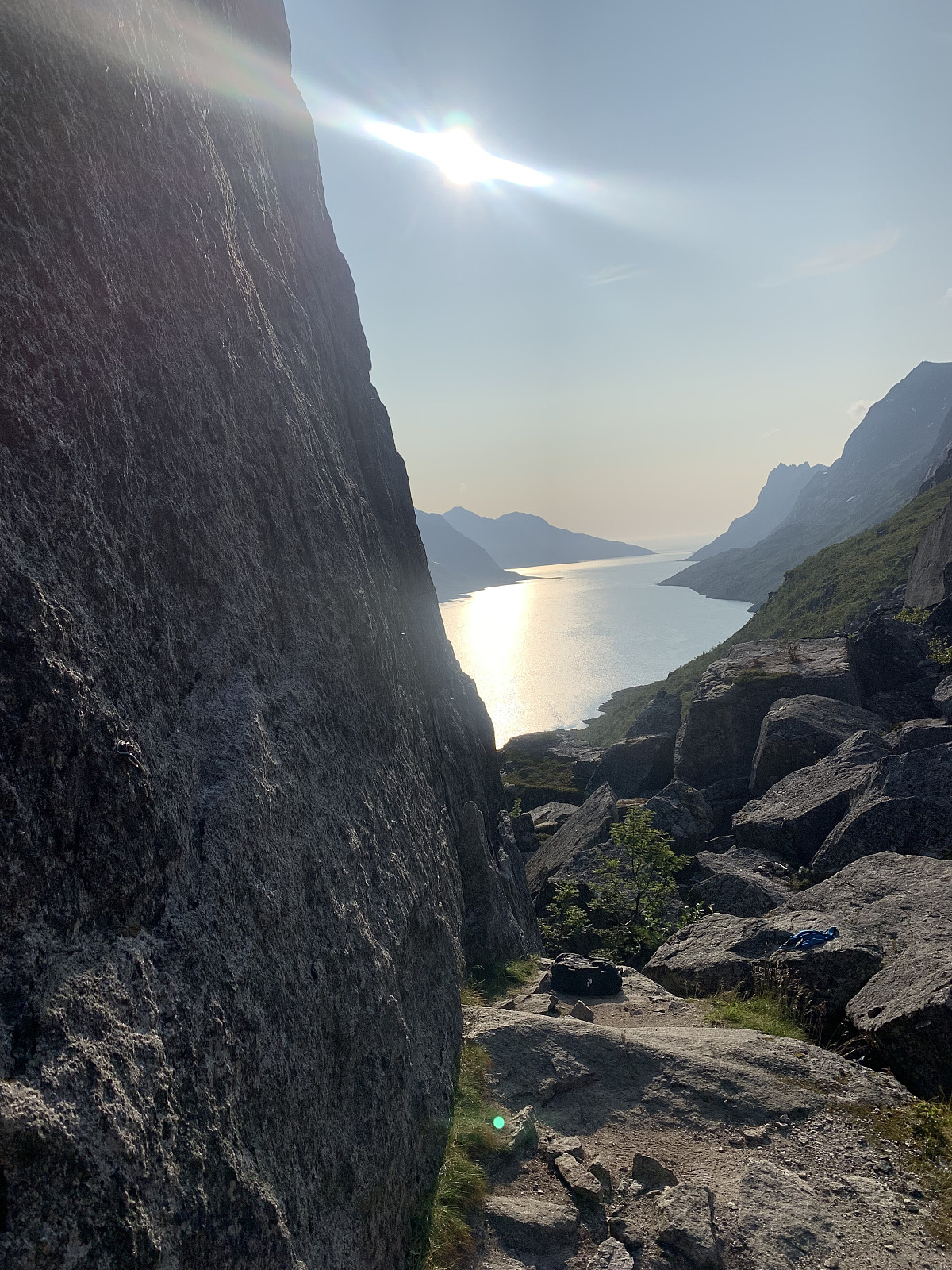
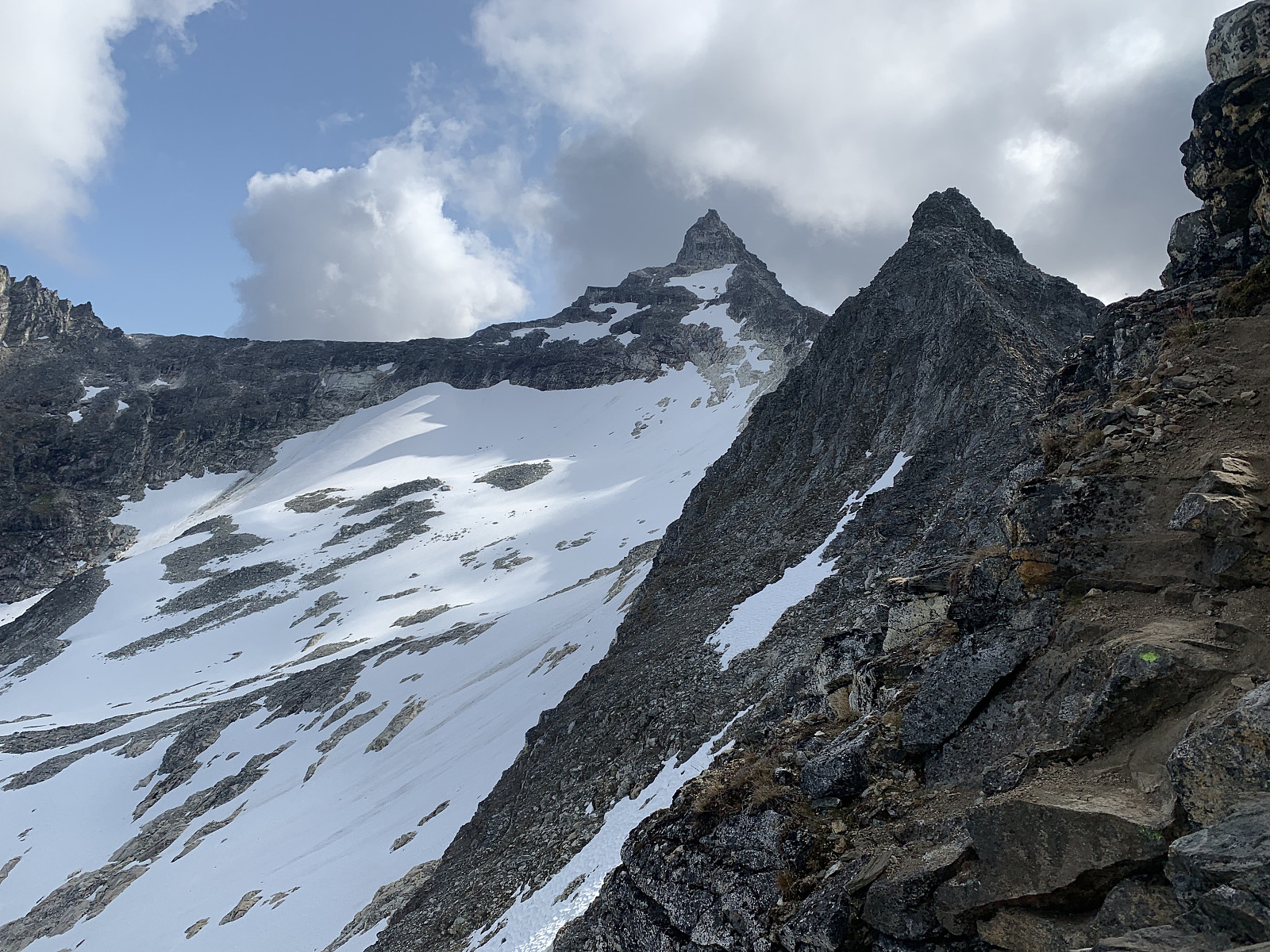
 Another day of blue skies! Met Trond Olav in Tromsø and drove out to Løvdal together. From here we parked the car and followed a small trail into the right hand side of Løvdalelva. The small trodden path follows the valley in along the lake on quite a long approach and eventually comes up to a pass around 300moh where you get great views of Blåskredtinden. From here the trail disappears and we lost around 100moh as we headed down towards the small lake. After a small, loose boulder field we started gaining elevation steeply through heavy, vegetated terrain and ended up pushing our way steeply through bushes until the terrain got more rocky. We followed a stone gully to the right before heading over to where we would start our one ropelength of climbing. Great quality rock and a nice pitch. >>>
Ersfjorden klatrefelt
- Dato:
- 05.08.2019
- Turtype:
- Sportsklatring
- Turlengde:
- 5:00t
- Distanse:
- 4,5km
 Nok en utfordring å finne frem her! Parkerte litt før Ersfjordotn brygge og fulgte grusveien til høyre langs ersfjorden. Etter ca 1km går stien godt synlig opp til høyre. Her er det godt markert ved stein varde men det ble mye fram og tilbake gjennom buldrefeltet å komme frem. Innmarsjen var litt lenger og mer tungvint enn hva vi hadde trodd. Ble en fin kveld i veggen til slutt, med alle 5'er ruter på Sjarmorveggen klatret på led. Veldig god stein kvalitet, men graderingene virket vanskelig! GPS spor er fra turen tilbake fra veggen til bilen.
Hamperokken
- Dato:
- 04.08.2019
- Turtype:
- Fjelltur
- Turlengde:
- 5:07t
- Distanse:
- 12,0km
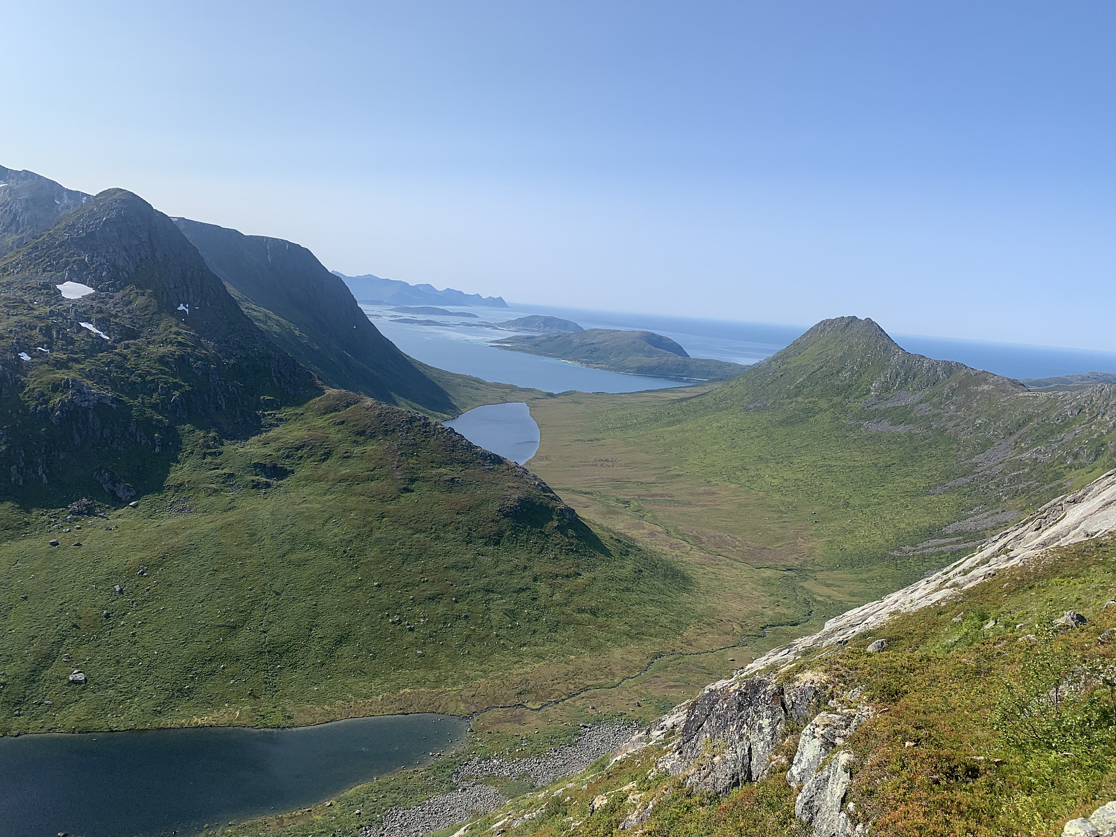
 My new favourite mountain in Tromsø :) We met up in the parking lot around 8.30 and started our hike shortly after. The trail up to Middagsaksla is really, really great and the elevation gain was steady and effective. Well marked (not surprising with Tromsø Skyrace the day before) and soon we were at 1100moh and were greeted with stunning views of Hamperokken. From here we just followed the ridge all the way towards Hamperokken and had a wonderful time scrambling over excellent rocks. We walked over the crest of the ridge for majority of the trip, though there is a small trodden path that goes a little lower down to the right. In the last section before the summit, the trail goes up through a gully, though we scrambled up the bigger rocks to the right. After a small lunch break and realizing >>>
Tromtinden
- Dato:
- 03.08.2019
- Turtype:
- Fjelltur
- Turlengde:
- 2:15t
- Distanse:
- 7,4km
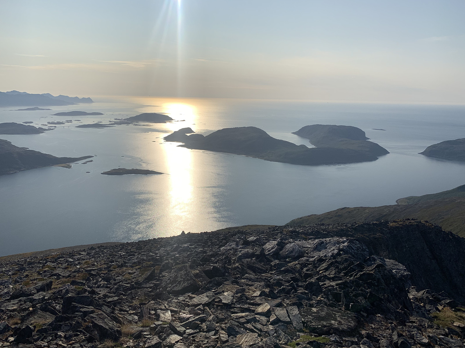
 My plan was originally to hike Tromtinden together with Mellomtinden but I miscalculated how long the approach in the valley was and realised I had time for only one of them. After parking by the side of Rekvikvatnet, I followed the trail to the right of the lake and then across to valley to the left towards Tromtinden. The approach was pretty flat and boring, and the elevation gain was slow. The trail splits into two around the small lake at 300moh and I followed the trail to the right. From here you gain elevation steadier heading up the outer side of the mountain and the views were great out over the ocean, especially from the small varden at 566moh. I didn't meet a single person out hiking today and it was a wonderfully peaceful and calm night. Followed the trail back down the way I came >>>
Vasstinden
- Dato:
- 02.08.2019
- Turtype:
- Fjelltur
- Turlengde:
- 2:30t
- Distanse:
- 7,4km
 Nok en nydelig ettermiddag i Tromsø som måtte brukes med en tur til Vasstinden etter jobb. Jeg fikk hele fjellet for meg selv (nesten) og møtet bare to andre folk ute på tur. Helt vindstille på toppen og utsikten like deilig som alltid :)
Skjeggen
- Dato:
- 30.07.2019
- Turtype:
- Fjelltur
- Turlengde:
- 2:46t
- Distanse:
- 5,8km
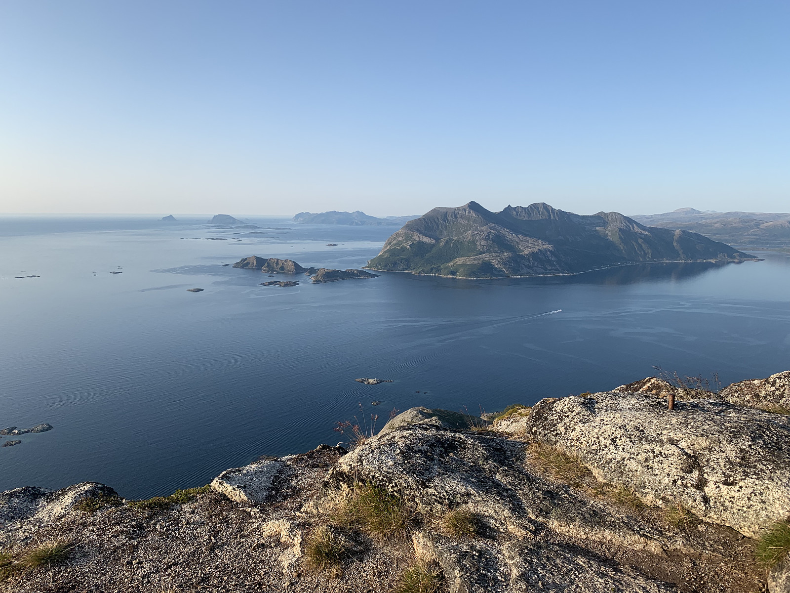
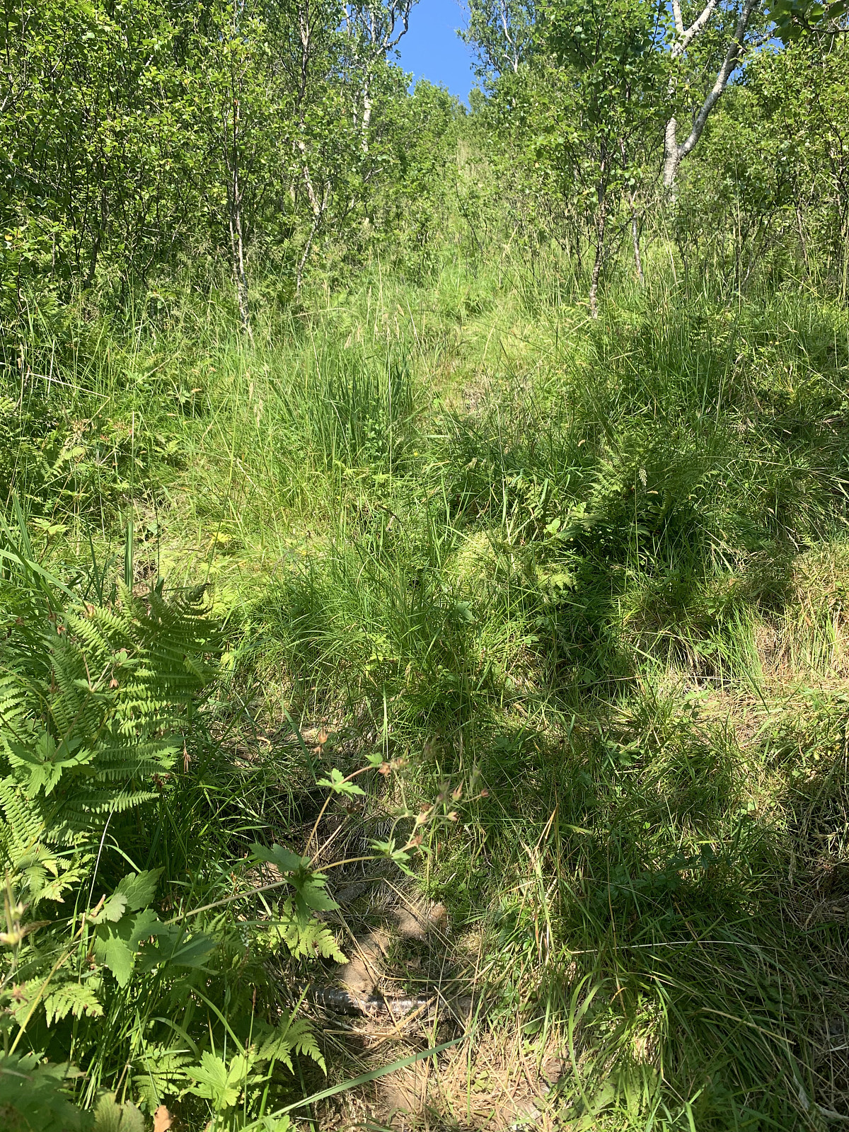 Temperatures returned to normal today and with the sun shining, a trip up Skjeggen was in order on the drive northwards to Tromsø. Parked on a farmers property beside some curious cows and followed a gravel road upwards. The road ended at a small dam and the path followed the left hand side of the river up. Gained elevation very steeply on a heavily vegetated trail through the forrest for the first 600m, before the trail flattened out, became more sandy and headed to the right over the ridge and towards the top. Easily trodden terrain and a pleasant hike with effective elevation gain. Phenomenal views of Helgelandskysten, Svartisen and all the way out to Værøy and Lofoten. Legs felt surprisingly fine on the way up today, but once I came to the top yesterdays' hikes took their toll and I >>>
Fykantrappa
- Dato:
- 29.07.2019
- Turtype:
- Fottur
- Turlengde:
- 1:15t
- Distanse:
- 2,9km
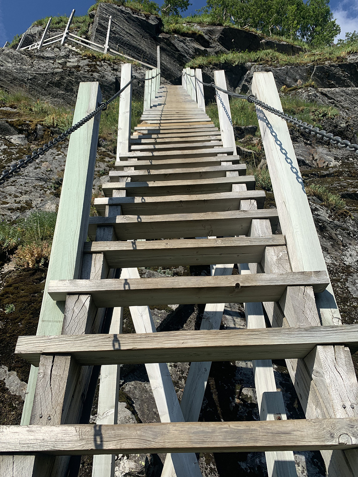 The 1129 wooden stairs were built over 100 years ago and I thought they would be worth a visit while in Glomfjord. I took the first right after Svartistunnelen and followed a small road along the lake. With absolutely zero signage it was a hassel to locate the trail start. Parked to the left before the road after Fykanvatnet tunnels through the mountain and followed a well trodden trail for ca 10 min before coming to the start of the stairs. Legs were already warm from Helgelandsbukken earlier in the day, so from here it was plankekjøring up the steep stairs and I was at the top 10 min later. Decided to walk down and up again once more before calling it a day. Lovely views and a nice end to a wonderful day with over 2000m elevation :)
Kremtur til Helgelandsbukken
- Dato:
- 29.07.2019
- Turtype:
- Fjelltur
- Turlengde:
- 6:04t
- Distanse:
- 20,1km
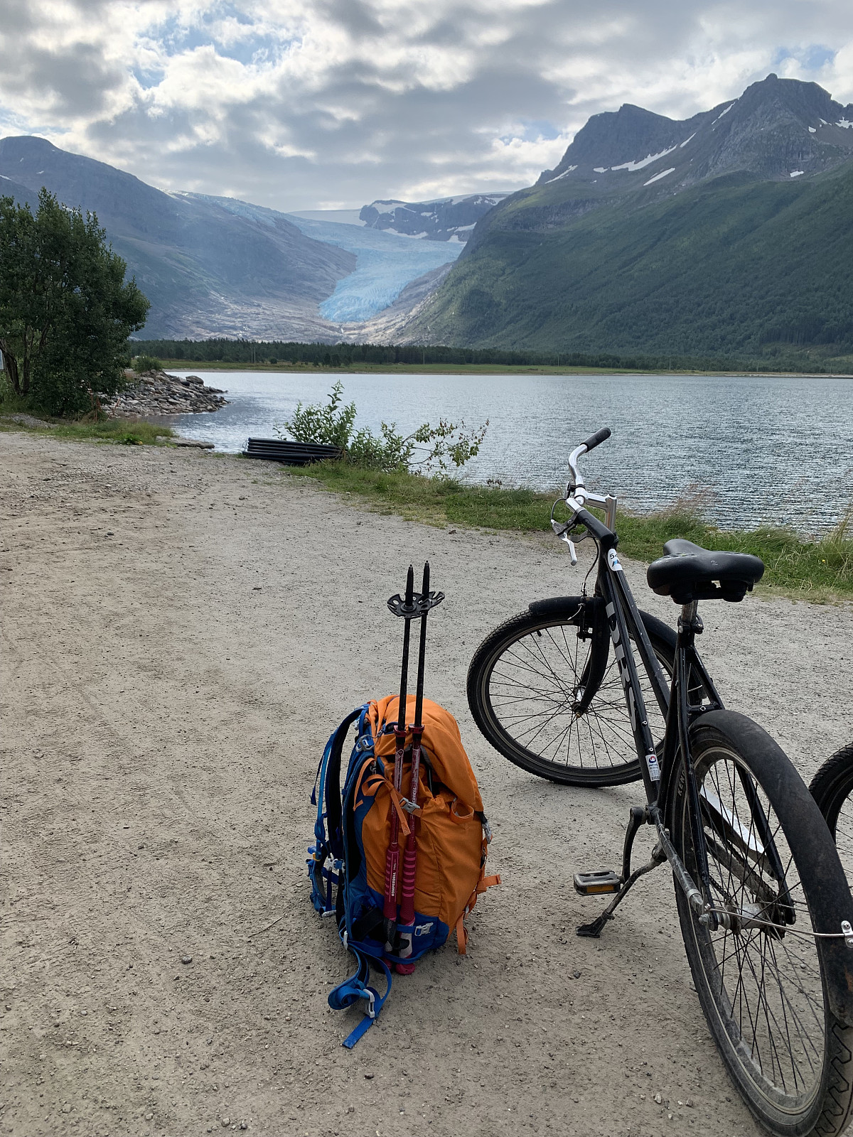 We started our day with a boat ride in Holandsfjorden to Engen. From here we rented bikes and cycled 3km along Engabrevatnet until we came to the trail start up to Svartisen. From here we followed the signs to Tåkeheimen. We walked up over smooth svaberg, before the trail got steeper in rockier & sandier terrain. Stunning views over Svartisen! From here it was good, steady elevation gain up a clear trail until we came to the Tåkeheimen cabin after 1t45min. Here we had a food break, checked out the amazing cabin, and then headed up along the ridge towards the top. A steep and sandy trail to start with, before heading through a nice, fast boulder field and then following easy terrain of small rocks and some snow fields towards the top. Phenomenal views over Svartisen as far as the eye could >>>
Kunna i tropevarme
- Dato:
- 28.07.2019
- Turtype:
- Fjelltur
- Turlengde:
- 2:45t
- Distanse:
- 4,5km
 Officially too hot to go hiking! innerdal (Inger Lise Innerdal) & I had originally planned to take Skjeggen together, but with the 30+ degrees we decided the less elevation the better. We walked along the beach and looked for a trail leading up the mountain, but after 500m with no luck we headed back to the parking and tried our luck towards the stone scree below a steep gully. Here we saw some old white (once red, now very old) brøytestikker marking the trail and headed up over the stone scree and into a steep, vegetated gully. Very, very effective elevation gain and walking up here was like walking in an oven and we had to stop every 50meters to avoid passing out. Soon we came out of the gully, the trail flattened out and the terrain became much more pleasant. From here it was just to enjoy the great views and try >>>

