Archive - Date
Archive - Activity
-
Climbing (23)
- Alpine climbing (9)
- Sport climbing (11)
- Via ferrata (2)
-
Drive (1)
- Car drive (1)
-
Other winter trip (3)
- Snowshoe trip (3)
-
Ski trip (62)
- Backcountry skiing (3)
- Cross-country skiing (1)
- Randonnée/Telemark (58)
- Trip by foot (137)


Favourite trips
Favourite peaks


Skamtinden
- Date:
- 29.08.2018
- Characteristic:
- Trip by foot
- Duration:
- 3:11h
- Distance:
- 5.1km
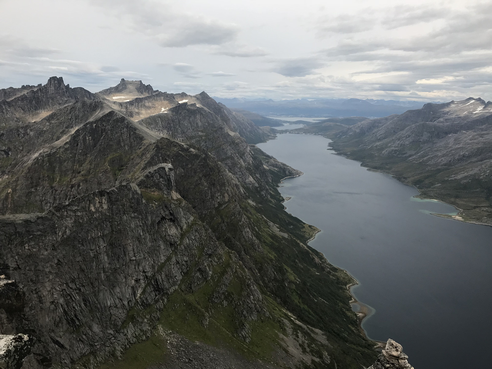 We went on an evening trip with the hope of a nice sunset, which unfortunately never came because the clouds got too thick. I found the rocks towards the top a bit unstable to walk on, not something I’ve got the hang of yet, I always seem to find only the wobbly ones. We had some dinner and enjoyed the aaaaamazing view at the top before walking down again. I thought it was a really beautiful hike, Takk for turen uglefisk (Paal Andre Lund) og Alex :)
Astritind
- Date:
- 26.08.2018
- Characteristic:
- Hillwalk
- Duration:
- 3:27h
- Distance:
- 12.7km
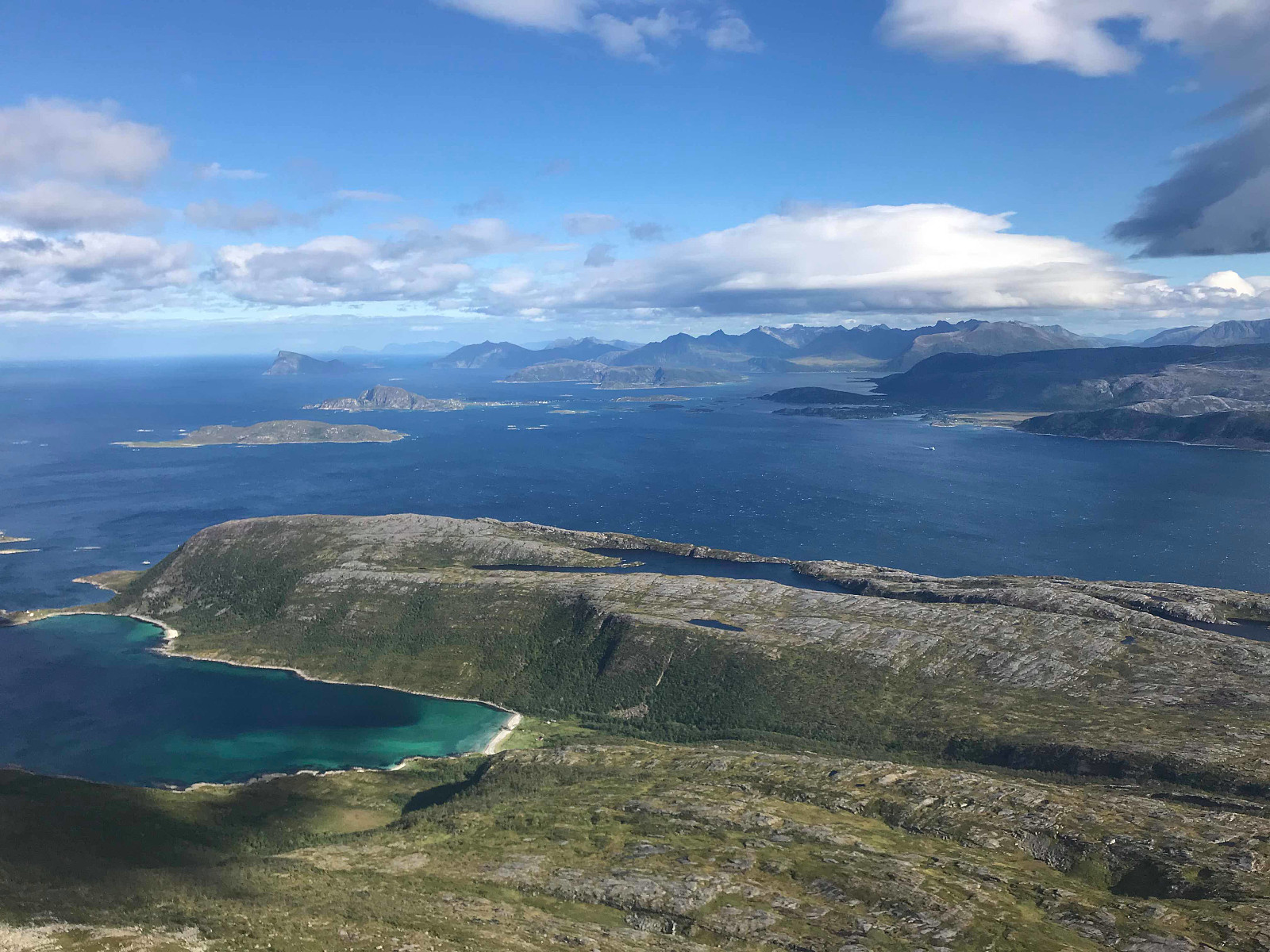 Definitely the windiest hike I've done to date! A cosy mountain with a really slow elevation gain, which worked pretty well as I spent the whole trip battling the wind to try and walk in a straight line! We walked about 5km in until we came to the ridge, which looked and was good fun to scramble over. The path was great and easy to walk on with almost no loose stones :) Takk for turen otto (Otto Lund) og uglefisk (Paal Andre Lund)
Narvtinden - English
- Date:
- 24.08.2018
- Characteristic:
- Hillwalk
- Duration:
- 3:30h
- Distance:
- 8.0km
 Another day of rainy weather in Lofoten, which meant a shorter and smaller trip. Narvtinden looks pretty cool from the road, so Paal decided he wanted to go.
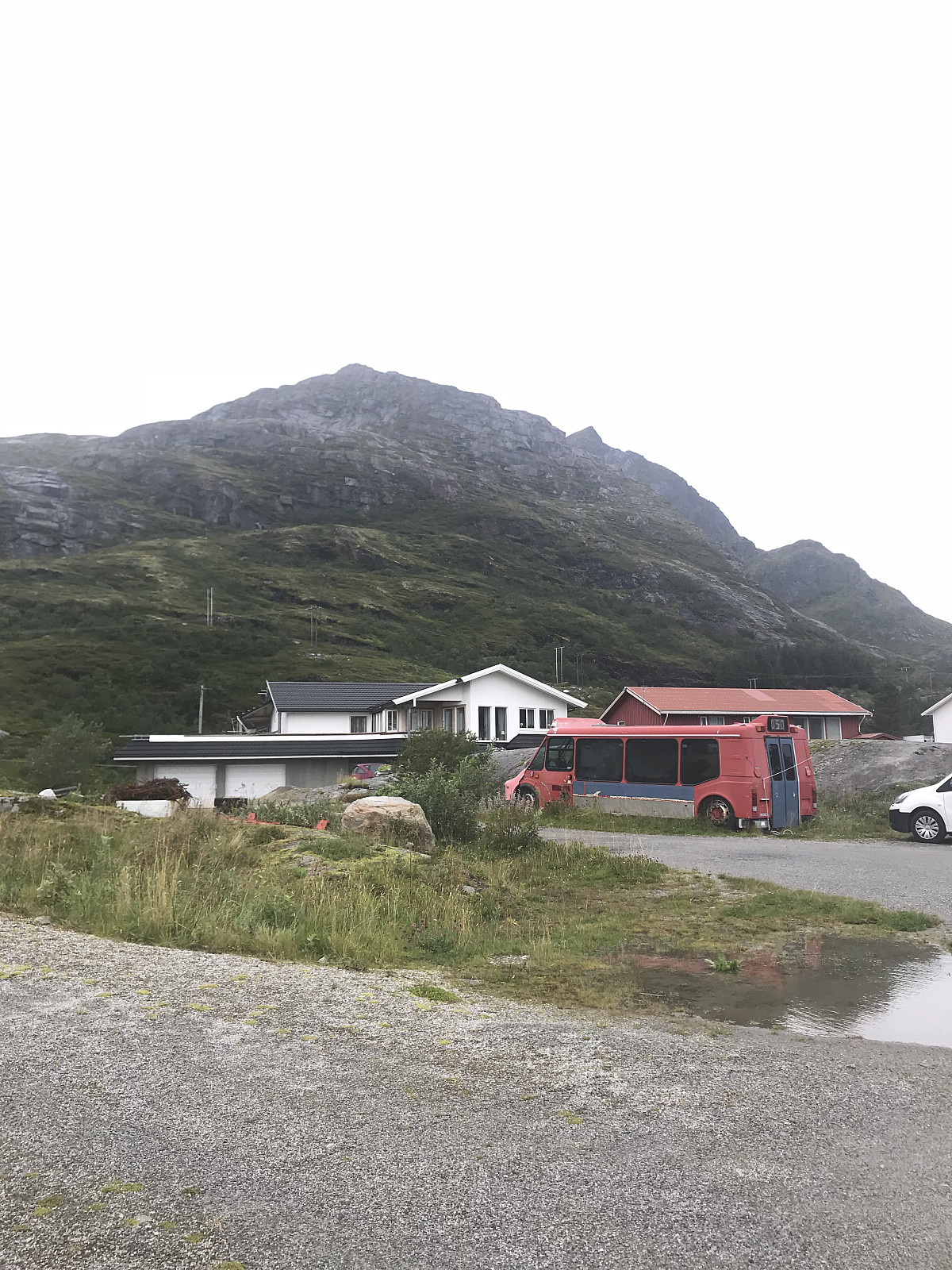
We parked behind a red Sammfunshus in Møllarodden and started heading up a gravel road. After 200m we took a right over a stone bridge and followed a nice, clear and easy to walk trail up the mountain. Lots of big Svaberg rocks which I like walking on. The path soon went to the left hand side of Tekoppstetten, where we got a clear view over to our goal. The path went down around 70m elevation before it started heading up the ridge. Still a really nice path to walk on, a few places with some small scrambling and soon we reached the østtoppen which was at 677m. We continued following the path along the ridge, losing about 30m elevation >>>
Another day of rainy weather in Lofoten, which meant a shorter and smaller trip. Narvtinden looks pretty cool from the road, so Paal decided he wanted to go.
We parked behind a red Sammfunshus in Møllarodden and started heading up a gravel road. After 200m we took a right over a stone bridge and followed a nice, clear and easy to walk trail up the mountain. Lots of big Svaberg rocks which I like walking on. The path soon went to the left hand side of Tekoppstetten, where we got a clear view over to our goal. The path went down around 70m elevation before it started heading up the ridge. Still a really nice path to walk on, a few places with some small scrambling and soon we reached the østtoppen which was at 677m. We continued following the path along the ridge, losing about 30m elevation >>>
Reinebringen - English
- Date:
- 23.08.2018
- Characteristic:
- Hillwalk
- Duration:
- 2:12h
- Distance:
- 4.0km
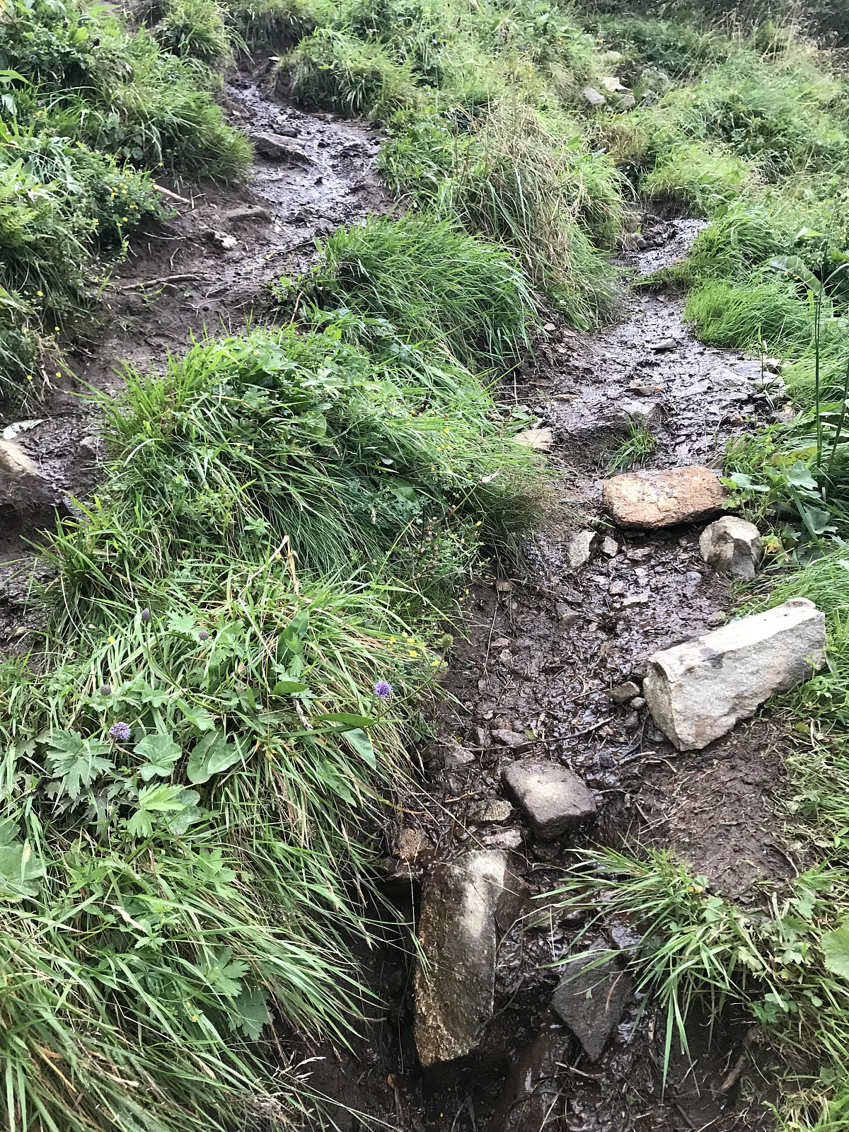 Even though the trail is officially closed for repair work done by the Sherpas, we work an evening trip after they were finished working for the day. Short and steep, we used around 50mins until we came up to the famous, magnificent, wonderful view from the top. This trip would have gotten a 6, but we didn’t walk up the stairs as we didn’t want to disturb any work that was happening. The trail is completely destroyed which was really sad to see. Majority of the path was just a lot of slippery mud or loose stones. Would recommend avoiding this trail until the stairs are finished....dessverre utsikten fristet oss alt for mye!
<gallery>
Even though the trail is officially closed for repair work done by the Sherpas, we work an evening trip after they were finished working for the day. Short and steep, we used around 50mins until we came up to the famous, magnificent, wonderful view from the top. This trip would have gotten a 6, but we didn’t walk up the stairs as we didn’t want to disturb any work that was happening. The trail is completely destroyed which was really sad to see. Majority of the path was just a lot of slippery mud or loose stones. Would recommend avoiding this trail until the stairs are finished....dessverre utsikten fristet oss alt for mye!
<gallery>
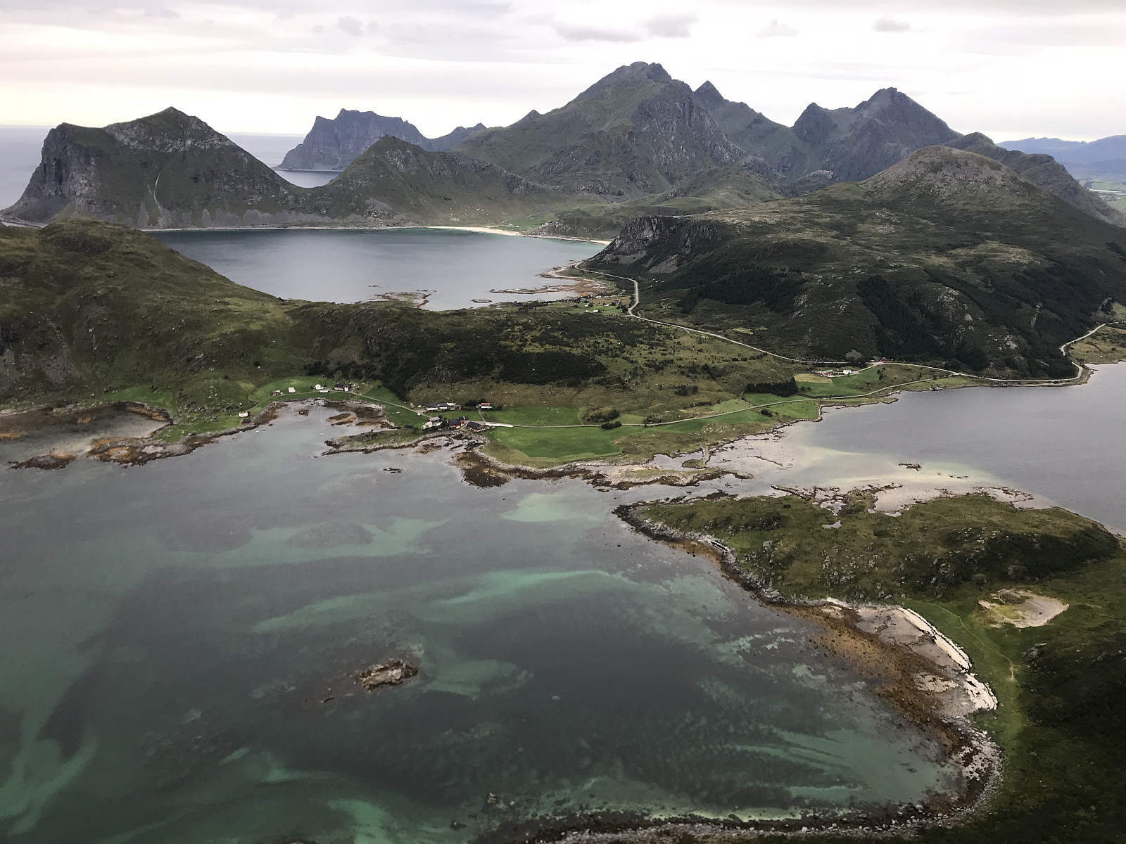
Festvågtinden - English
- Date:
- 22.08.2018
- Characteristic:
- Hillwalk
- Distance:
- 3.5km
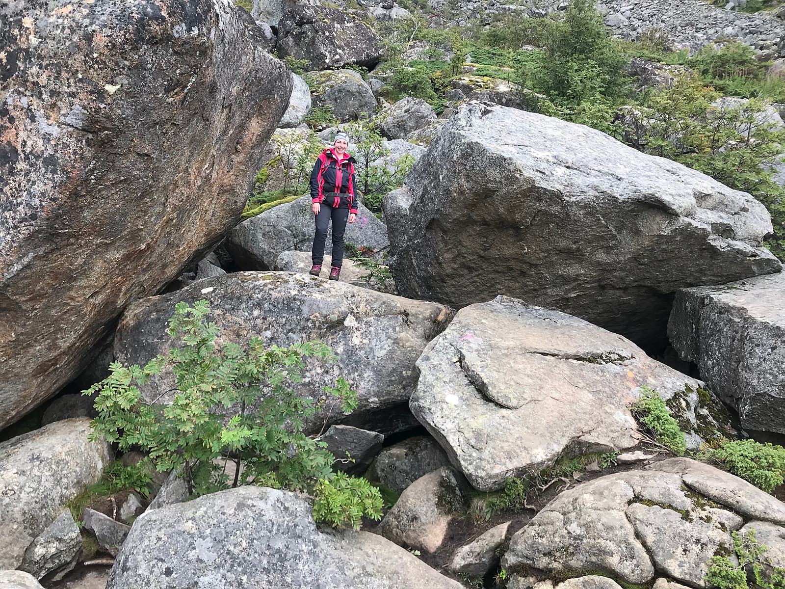 After camping just outside Henningsvær for the night, we saw a break in the clouds and decided to take a quick trip up Festvågtinden. The path started with some big boulders, pretty muddy and slippery but easy to follow. We started by taking a path which led more to the right, which we realised was heading to the lake. We crossed back over the stones and walked on the left hand side. We reached the top after 50minutes, and after some photos and droning, we saw a path leading further along the ridge which looked like it could lead to some cool photos (so of course Paal had to go!). We followed a small trail on the traverse that leads to Presten. We found a rock which I had seen on Instagram and had wanted to visit, but thought it was only available from climbing the Presten wall, which was >>>
Offersøykammen - English
- Date:
- 22.08.2018
- Characteristic:
- Hillwalk
- Duration:
- 1:10h
- Distance:
- 2.9km
 A small late afternoon trip that we decided to take on the way as we were driving out to Reine. We parked on the side of the E10 in a car park to the left of the main road, and to the side of Lofotcabins there was a path leading up the mountain. A good, clear path that was easy to follow. Really nice view from the top. I was a bit tired as it was our second trip for the day, we used 45mins up but could be done in 30mins. Takk for turen uglefisk (Paal Andre Lund)
Svolværgeita - English
- Date:
- 21.08.2018
- Characteristic:
- Climbing
- Duration:
- 4:00h
- Distance:
- 5.4km
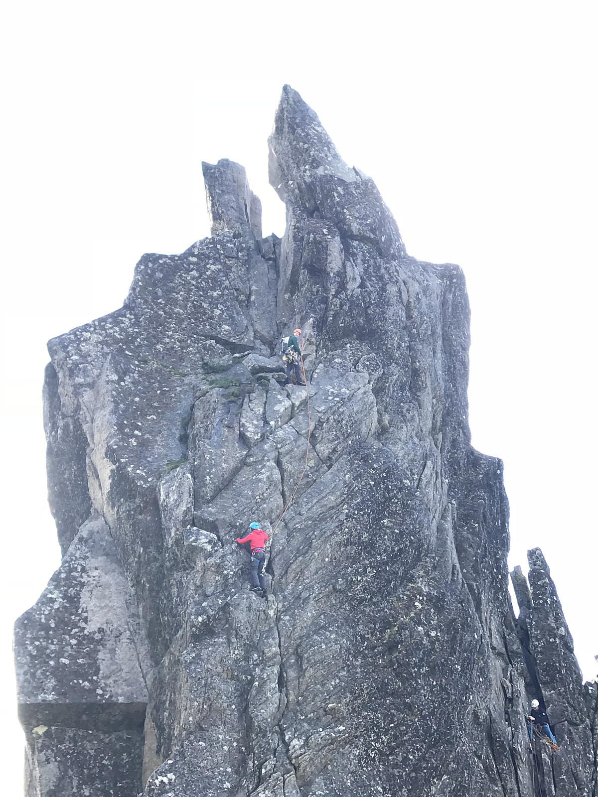 My first outdoor rock climb - helt rå!
We followed the path from the cemetery, straight up and a little to the left of the goat. A few big and wet rocks, quite a messy path as it’s had been raining quite heavily the previous few days. A little bit of scrambling in a few places but soon enough we were at the top. There was 6 other Norwegians, all planning to climb the 1910 route. We took the direct route - nice climbing and I found enough good hand and feet grips, but we had to use a rope ladder to get up the first 2/3 meters. A beautiful view from the top, though it started sleeting as soon as I got to the top so we came down quite quickly. Definitely won’t be my last climbing trip, Takk for turen uglefisk (Paal Andre Lund) !
My first outdoor rock climb - helt rå!
We followed the path from the cemetery, straight up and a little to the left of the goat. A few big and wet rocks, quite a messy path as it’s had been raining quite heavily the previous few days. A little bit of scrambling in a few places but soon enough we were at the top. There was 6 other Norwegians, all planning to climb the 1910 route. We took the direct route - nice climbing and I found enough good hand and feet grips, but we had to use a rope ladder to get up the first 2/3 meters. A beautiful view from the top, though it started sleeting as soon as I got to the top so we came down quite quickly. Definitely won’t be my last climbing trip, Takk for turen uglefisk (Paal Andre Lund) !

