
Corrán Tuathail (14.08.2018)

| Startpunkt | Kate Kearney's Cottage (55m) |
|---|---|
| Endpunkt | Cronin's Yard (150m) |
| Tourcharakter | Bergtour |
| Tourlänge | 10h 50min |
| Entfernung | 21,3km |
| Höhenmeter | 1.652m |
| GPS |
|
| Besteigungen | Carrauntoohil (1.039m) | 14.08.2018 |
|---|---|---|
| Cnoc an Bhraca (731m) | 14.08.2018 | |
| Cnoc an Chuillinn (958m) | 14.08.2018 | |
| Cnoc na Peiste (988m) | 14.08.2018 | |
| Cnoc na Toinne (845m) | 14.08.2018 | |
| Cruach Mhor (932m) | 14.08.2018 | |
| Maolan Bui (973m) | 14.08.2018 | |
| Strickeen Hill (440m) | 14.08.2018 | |
| The Big Gun (939m) | 14.08.2018 | |
| Besuche anderer PBE | Cronins Yard (150m) | 14.08.2018 |
| Kate Kearney's Cottage (55m) | 14.08.2018 |
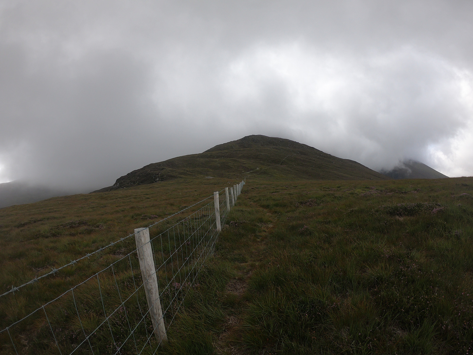
I had originally planned to go the Com Callí [Hag's glen] circle from Cronin's Yard, but as the bus service only go as far as Kate Kearney's Cottage, I decided to start the tour there and go to Cruach Mhór via Cnoc an Bhraca rather than through the glen. Starting out from Kate Kearney's Cottage I headed south towards the Gap of Dunloe and turned right/west onto the gravel road up towards Strickeen Hill. Reaching the plateau there were a few fences blocking the way so I went up the wee Strickeen Hill to get a better view of the path towards Cnoc an Bhraca. It turned out that there is a path along a straight fence almost all the way up to the top, altough some parts of the path were very wet. Ascending up to Cnoc an Bhraca the fog grew thicker and it was time to get out the shell jacket and prep the compass.
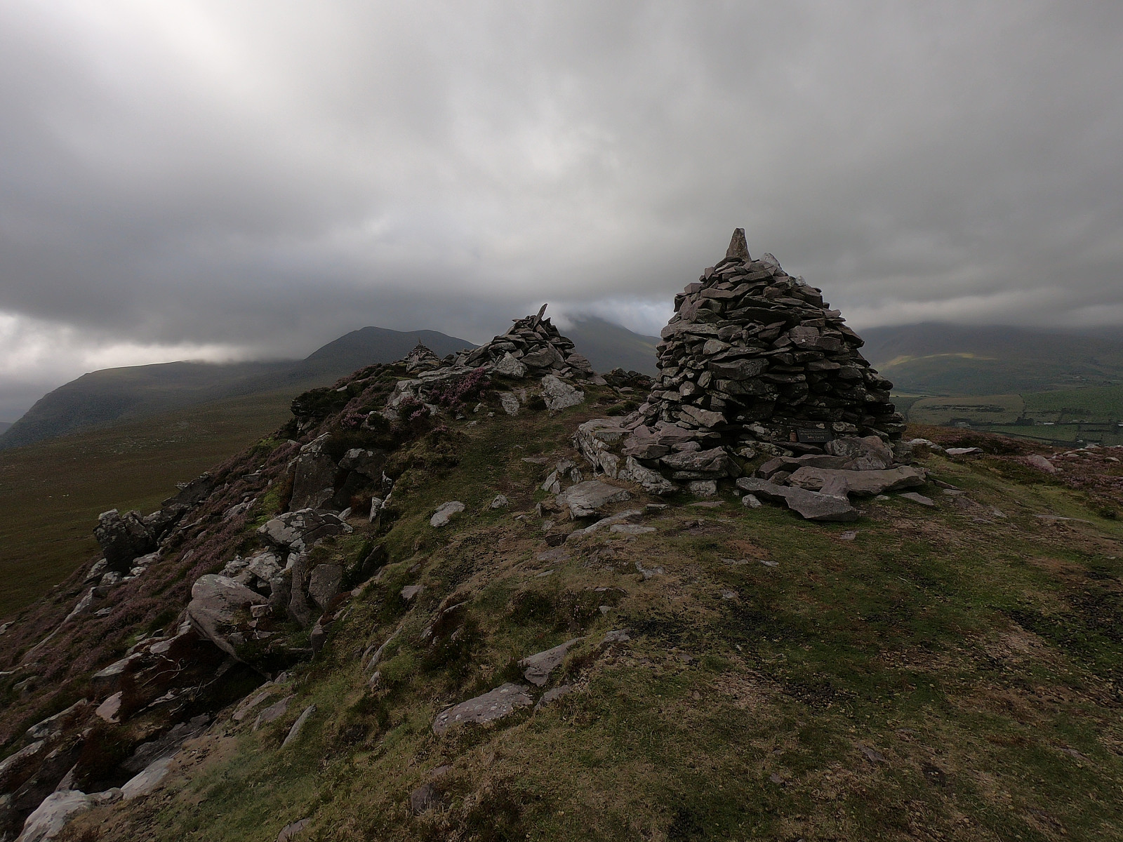
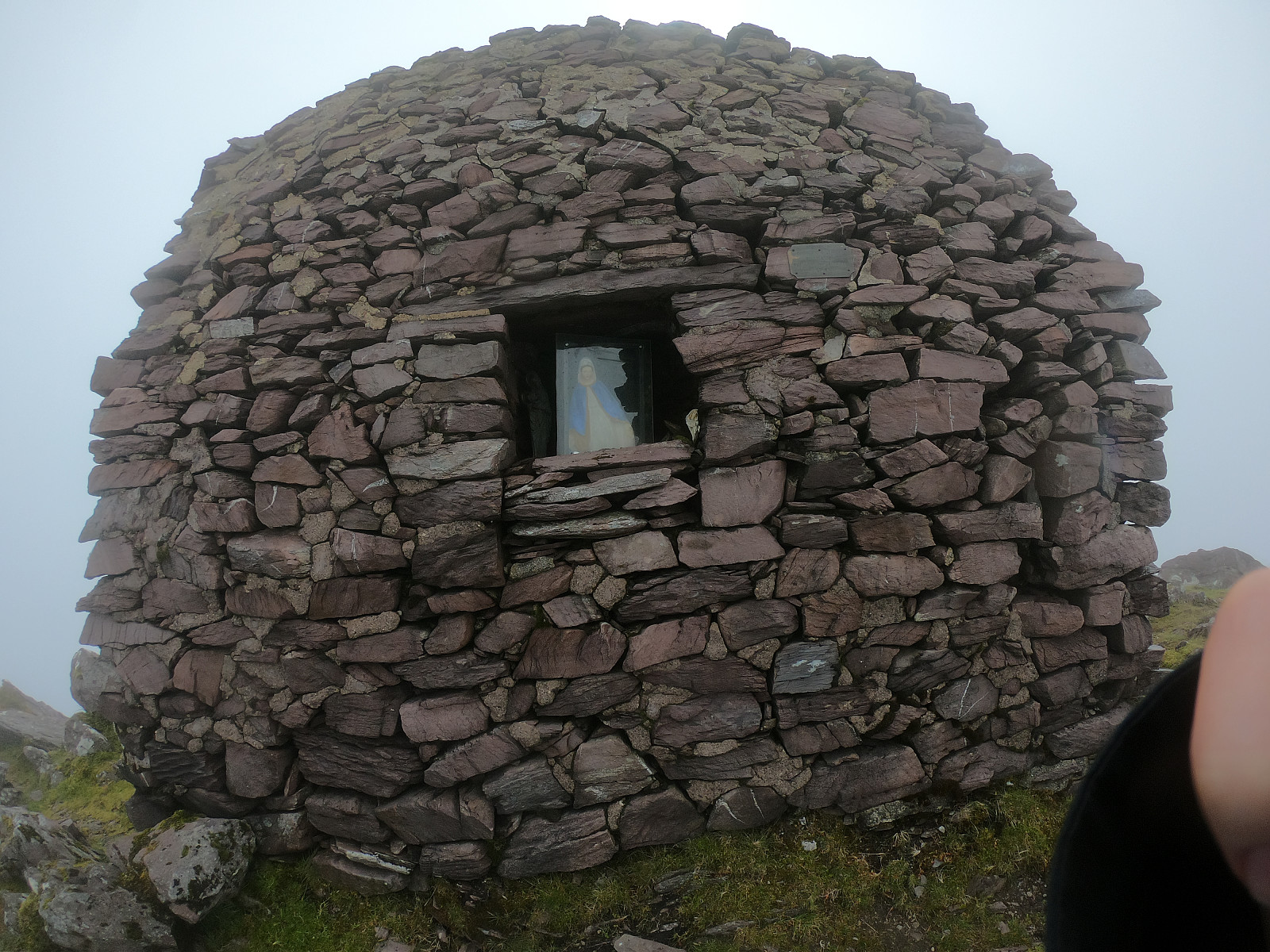
From here the path along the ridge was reasonably straigt forward, even with limited visibility, and I slowly reached the top of Cruach Mhór, where there is a christian shrine. According to my guidebook (from 2006) it was built fairly recently by a local man over a period of two years as an act of religious devotion. From here the easiest option actually seemed to be to follow the path just west of the Big Gun Ridge up to The Big Gun, and then cross the ridge and follow the path on the south side of the ridge to Cnoc na Péiste and onwards on the rigde to Maolan Buí and Cnoc an Chuillinn. There are no cairns that mark the tops, so I just verified my position with GPS. During the eidge walk the wind was picking up quite strongly and the moist of the fog was accompanied by light horizontal rain, that turned into heavier rain. Raching the top of the Devil's Ladder I saw other people for the first time since Strickeen Hill, which was quite nice from a safety perspective considering the bad weather. But so close to Ireland's highest peak I was not going to give up, so I walked the last ascent up to Corrán Tuathail and was greeted by the large metal cross placed on the highest point.
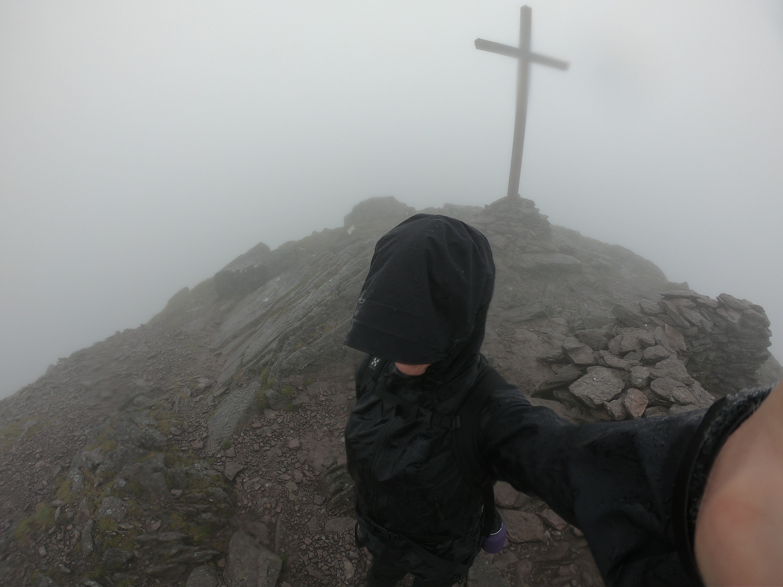
The plan had originally been to walk a wee detour to Caher na Féinne (1001 m) and back, and then descend to Cronin's Yard via Binn Chaorach (1010 m) so that I had visited all three peaks above 1000 m i Ireland, but the extremely limited line of sight, bad paths, strong wind and increasingly wet weather made me rethink that plan and I decided to head back to Cronin's Yard in a more direct descent. Getting down, though, would prove to be the hardest part of today's walk. As I descended along the path from Corrán Tuathail I got an increasng feeling that I was heading in the wrong direction, and the compass confirmed I was walking south-west rather than south-east. After a few attempts to check the GPS on my mobile, I realised I was halfway down the ridge to Caher na Féinne. And that was the last piece of service that mobile would give me before getting water damaged beyond repair. I turned around and ascended back to Corrán Tuathail. The big black cross, just visible through the fog, confirming my position.
I always bring a map with me on tour, and I had thankfully invested in a waterproof map of the MacGuillycuddy's Reeks. I think this is the first time hillwalking that I had to rely 100% on a map and compass to get down, not being able to peak once in a while at the GPS as I usually do when walking with limited range of sight. As I could not find the path down to Devil's Ladder, I walked in a general south-eastern direction, making sure to avoid the ridge to the south-west towards Caher na Féinne. After what felt like an eternity descending blindly, I fiannly reached Devil's Ladder and could begin the very steep descent down to Com Callí.
The further down I got into the glen, the more the line of sight increased, and eventually I found some paths going between the two small lochs and on to Cronin's Yard. After about 5 km on the paths I finally reached Cronin's Yard where I could borrow a mobile from some campers to call for a taxi back to Cill Airne. Soaked through as I was, I was very thankful to get a cup of warm tea from an English couple while waiting the 30 minutes for the taxi to arrive. Back at the hotell in Cill Airne I was very happy to have a room with a bath tub!


Benutzerkommentare