Arkiv - dato
Arkiv - aktivitet
-
Annen tur (1)
- Kajakkpadling (1)
-
Annen vintertur (3)
- Trugetur (3)
- Fottur (615)
-
Skitur (3)
- Fjellskitur (3)
-
Sykkeltur (94)
- Blandet sykling (22)
- Gatesykling (2)
Arkiv - Etter geografi
"Peakbookvenner"


Lister jeg samler etter
-
Bergen ≥ 50m pf. og ≥ 100 m.o.h.
(81/89)
 91%
91% -
Opptur Bergen
(98/113)
86%
-
De syv fjell rundt Bergen
(6/7)
85%
-
Most dominating tops of the Bergen peninsula
(63/75)
84%
-
Utvalgte topper og turmål i Bergen
(244/306)
79%
-
Sund ≥ 50m pf.
(14/18)
77%
-
Alle topper i Bergen
(272/350)
77%
-
Os ≥ 50m pf.
(23/34)
67%
-
Hytter og objekter i Byfjellene
(66/101)
65%
-
Midthordland PF>= 100m
(73/115)
63%

Vasstinden from Lauklineset
- Dato:
- 02.07.2023
- Turtype:
- Fottur
- Turlengde:
- 4:00t
- Distanse:
- 8,1km
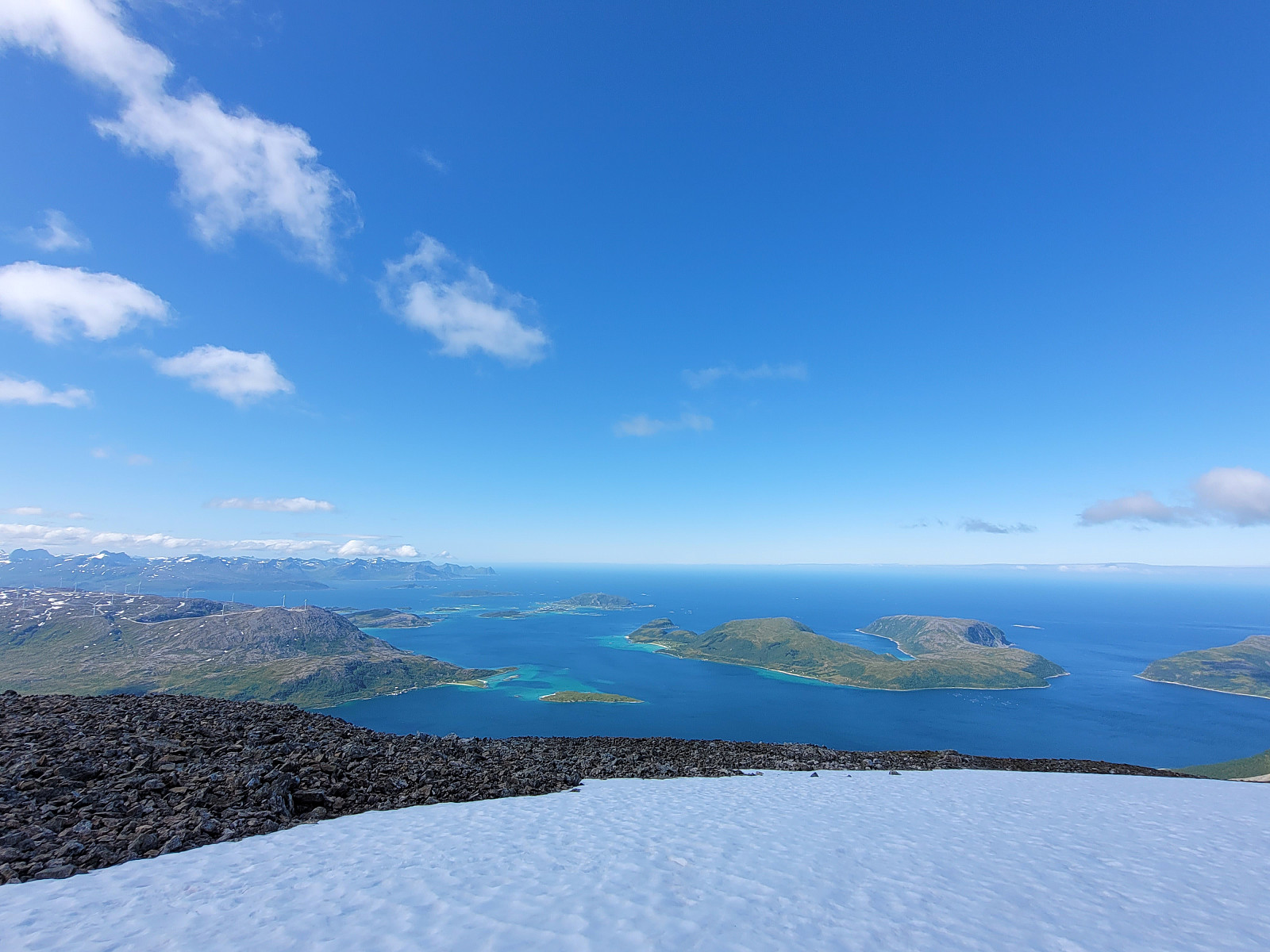 We estimated that there was enough time for another hike (before reaching our flight back from Tromsø). We drove towards Lauklineset on the north of Nordfjorden and parked a bit off from Lauklineset, where some parking place is set off for hikers (you pay a little for parking there, also). From this parking place, there's a marked trail up to Vasstinden. While still close to the road and Lauklineset, this trail is not very good (and one may prefer to walk the first meters along the road, instead). Once directly above Lauklineset, however, the trail is good, leading steeply upwards between the trees. At about 150masl, the trail levels out for a few meters before it gets steep again. At about 440masl, there's a sign that shows the hikers where the marked trail continues (towards the east, >>>
Buren (and an attempt to Rødtinden)
- Dato:
- 01.07.2023
- Turtype:
- Fottur
- Turlengde:
- 4:30t
- Distanse:
- 9,6km
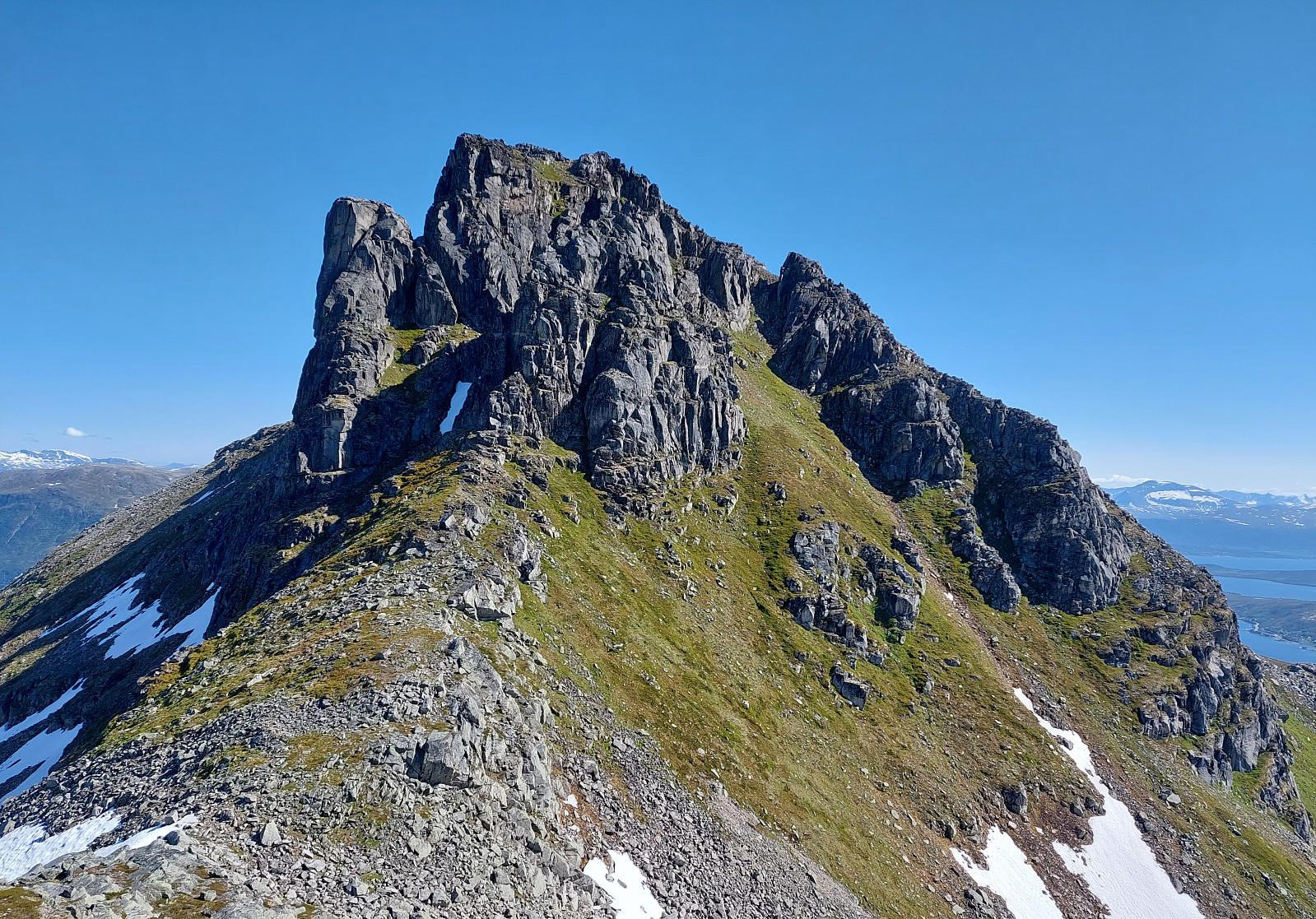 We had relocated ourselves from Senja to Kvaløya (to Ersfjordbotn -- as if there wasn't any Ersfjorden on Senja!). Also this day looked very promising and with wonderful mountains just "around the corner", the plan was to hike up to Buren (without driving). The hidden agenda for this hike was to also try an ascent to Rødtinden, if possible. Starting along Naustbuktvegen, I first walked along the coast into the direction of Gottberget. There, I found a trail that lead me up to a simple ridge which comes down from Skålhammaren (further up in the northeast of Gottberget). Also along this ridge, I could find a simple trail, leading me up to a nice viewpoint at about 200masl (also with a small cairn there). From there, however, I could not find any trail that would lead further >>>
