Arkiv - dato
Arkiv - aktivitet
-
Annen tur (1)
- Kajakkpadling (1)
-
Annen vintertur (3)
- Trugetur (3)
- Fottur (615)
-
Skitur (3)
- Fjellskitur (3)
-
Sykkeltur (94)
- Blandet sykling (22)
- Gatesykling (2)
Arkiv - Etter geografi
"Peakbookvenner"


Lister jeg samler etter
-
Bergen ≥ 50m pf. og ≥ 100 m.o.h.
(81/89)
 91%
91% -
Opptur Bergen
(98/113)
86%
-
De syv fjell rundt Bergen
(6/7)
85%
-
Most dominating tops of the Bergen peninsula
(63/75)
84%
-
Utvalgte topper og turmål i Bergen
(244/306)
79%
-
Sund ≥ 50m pf.
(14/18)
77%
-
Alle topper i Bergen
(272/350)
77%
-
Os ≥ 50m pf.
(23/34)
67%
-
Hytter og objekter i Byfjellene
(66/101)
65%
-
Midthordland PF>= 100m
(73/115)
63%

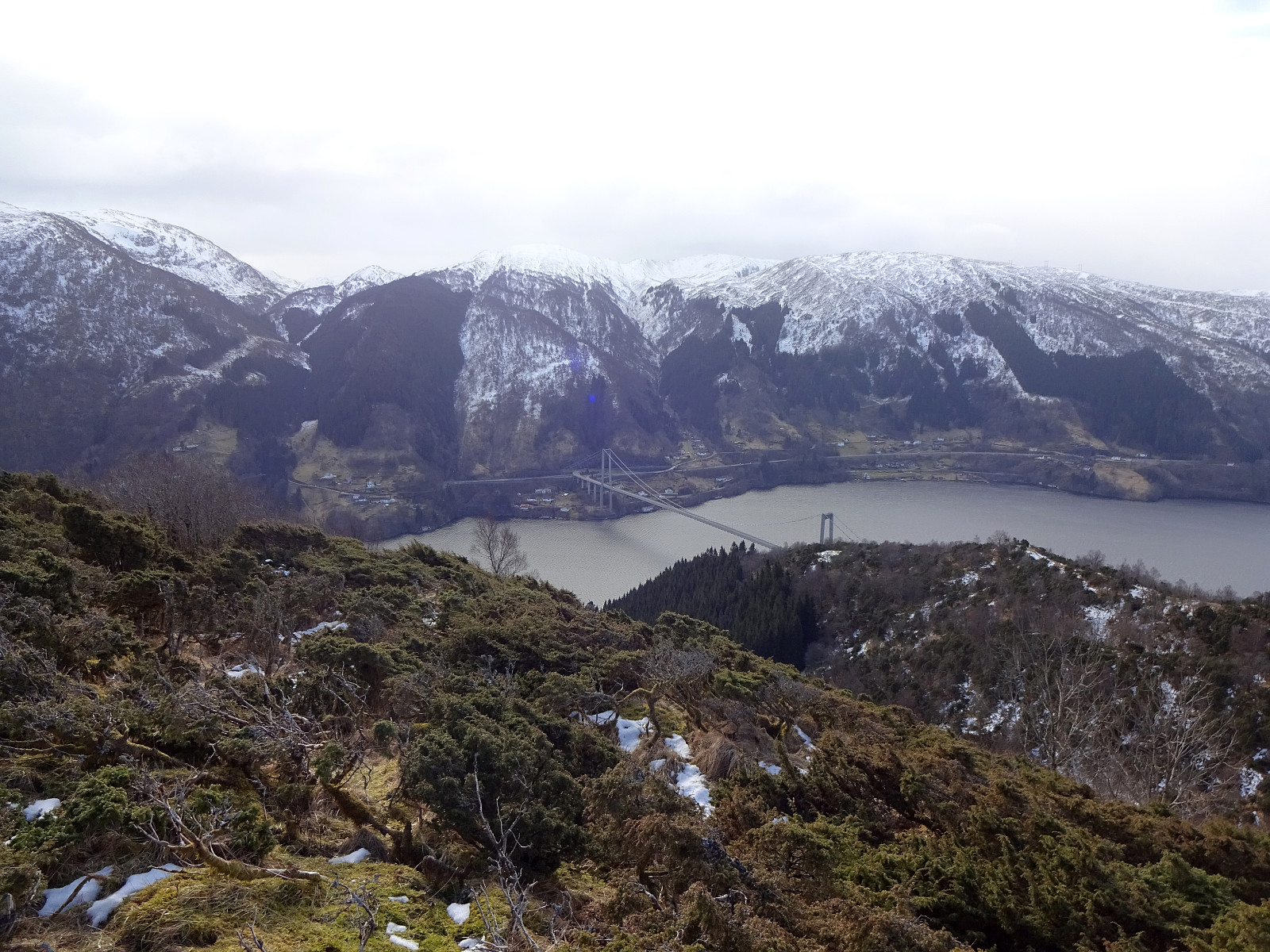
Djupedalseggene and Vindeggene from Ostereidet
- Dato:
- 24.03.2024
- Turtype:
- Fottur
- Turlengde:
- 5:00t
- Distanse:
- 16,4km
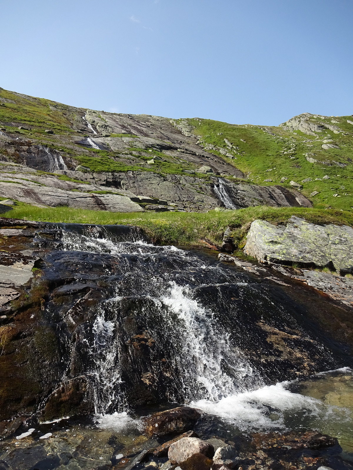
 We took the car from Bergen, first following E39 via Knarvik. From Osterfjordvegen, we then took a small road to Ostereidet, where we parked next to the local school. We started our hike up to Hovåsen, following first some forest roads and then a trail along the southeastern ridge of Hovåsen. From there, we then crossed over to the gravel road that leads up to Storset (via Bruarinden). After then walking up this gravel road to the end of the road at Storset, we then followed a marker that directed us to a small ridge in the south of Storsettjørna (and west of Vardhaugen). Crossing over this ridge (in northwestern direction) and stepping over the small stream that comes down from Storsettjørna (in southwestern direction), we ended up on the trail up to Vindeggene (this trail is not >>>
Eldsfjellet from the north
- Dato:
- 20.08.2023
- Turtype:
- Fottur
- Turlengde:
- 4:00t
- Distanse:
- 8,0km
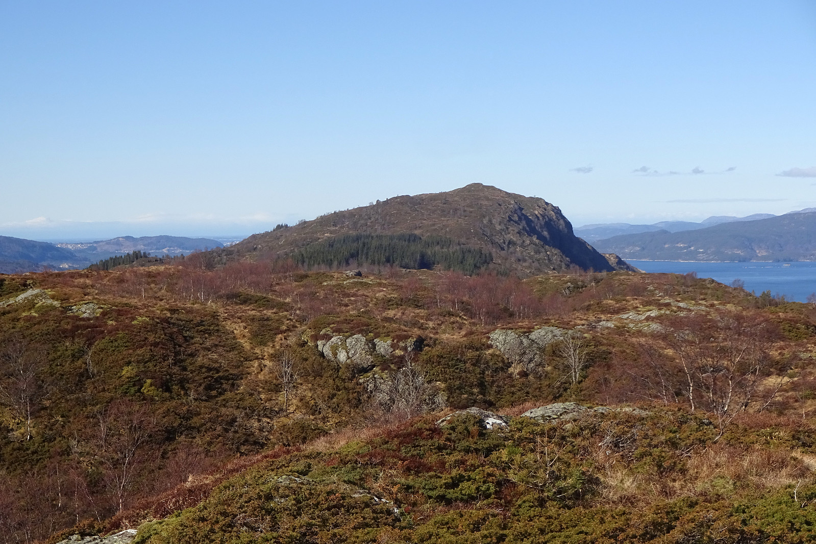
 We had not been on Eldsfjellet for a while -- not the two of us, at least! Eldsfjellet is -- for good reasons -- a relatively popular hiking destination (it's not really high, as a mountain, but since it's standing out of its surrounding quite a bit, one can expect quite nice views from its heights). Here on Peakbook, as well as on other hiking platforms, one can easily get the impression that everyone (or "everyone") hikes up to Eldsfjellet from its south, either from the parking spot near Alvhøyen along Skjelangervegen, or from Skurtveit via Skurtveitvegen. Harald 's approach from the northwest is a notable exception, of course! :-) Even though it looked like off-trail a lot, we made a plan to approach Eldsfjellet from the north, instead. The idea was to follow Skjelangervegen further and around Eldsfjellet, >>>
Brøknipa from Båtaleitet, back via Borgasærtra
- Dato:
- 12.05.2023
- Turtype:
- Fottur
- Turlengde:
- 6:00t
- Distanse:
- 8,9km
 We had the afternoon of this Friday at our disposal and the weather was looking OK. :-) To combine some mountain impressions with such of the fjords, we headed for Brøknipa on Osterøy, starting from Båtaleitet parking at about 350mosl. After driving to Osterøy via the bridge and then continuing further (along Sørfjorden) towards Bruvik, we headed up to the saddle and parked at Båtaleitet parking. Looking up to Brøknipa from there, we recognized that there was still quite a bit of snow left on the northern flank. We agreed to giving it a try, while being ready to turn around whenever anyone of us would feel like it. We followed the main trail that passes by Varmavatnet at about 425mosl. Also the following 100 height meters (in southern direction) were still easy and without much >>>
Stongfjellet and Skolmen
- Dato:
- 15.04.2023
- Turtype:
- Fottur
- Turlengde:
- 4:30t
- Distanse:
- 10,0km
 We first had considered Høgafjellet on Osterøy, but since we expected -- probably for good reasons -- quite a bit of snow on Høgafjellet, we eventually decided against Høgafjellet. Since we already thought about Osterøy, we chose Stongfjellet, instead. To get there, we drove to Osterøy (via the bridge to Osterøy), continuing through the tunnel on Osterøyvegen. At Gongerinden, we left Osterøyvegen, heading towards Gjerstad on Gjerstadvegen. Once through Gjerstad (and crossing over the stream), we continued via Solbjørg and Solbjørgsdalen. We then took Hovdavegen, passing by Låstadvatnet in its south and continuing further upwards in southeastern direction. Very close to the saddle, before reaching Hovdo at the end of the road, we parked right next to the trail-head. From Hovdavegen, >>>
Hæddena, Orrkleivhaugen, and Åsheimfjellet
- Dato:
- 04.03.2023
- Turtype:
- Fottur
- Turlengde:
- 4:00t
- Distanse:
- 8,2km
 We thought that Osterøy would be nice for another hike and so we chose Hæddena right north of the bridge to Osterøy as our goal for the day. This time, however, we wished to get there via the nice-looking ridge, which is directly about the long tunnel of Osterøyvegen (basically the continuation of the bridge). The map had suggested that a simple trail should be leading up there, as well. We parked right after driving through "the other tunnel" (of Hausvegen, "only" some 150m long, or so) and aimed at taking this trail up to the ridge. In order to do so, one should first follow the northbound trail (into the direction of Haus) up to Vikno (or almost all the way there), before then turning around and up a gentle ridge. Instead, we turned right way earlier, ending >>>
Gaustadfjellet, Litlafjellet, Bårafjellet, Øyjordsfjellet
- Dato:
- 04.09.2022
- Turtype:
- Fottur
- Turlengde:
- 6:30t
- Distanse:
- 11,4km
 Looking forward to a nice day, we decided to pay Gaustadfjellet on Holsnøy a visit. To get there, we crossed Krossnessundet right after driving over Nordhordlandsbrua, north of Bergen. Then, we followed road 5310 northwestwards, kind of parallel to Radfjorden on our right side. Since we wished to start our hike from the southeast, traversing all of Gaustadfjellet (and further), we first needed to find a proper parking place along Ådlandsvegen. After a bit of back and forth, we managed to park properly along this rather narrow road. We then followed a not really well visible trail to the southern ridge of Gaustadfjellet (Storhøyden). From there, then, we could use a nice trail that extends over most of this ridge. It's actually a very nice alternative to the otherwise shorter ascent >>>
Hesjadalsnovene from Øyadalen
- Dato:
- 21.07.2022
- Turtype:
- Fottur
- Turlengde:
- 5:00t
- Distanse:
- 14,8km
 With quite some cloud cover predicted, we decided for a medium-high hike on our way back to Bergen. Drvingin out Eksingedalen to Eidslandet and then further along Eidsfjorden, we came to Kalland shortly after. Rounding Stamnesfjellet on the road brought us to the narrow road up from Vik to Vikadalen. Turning right right after the bridge over Vikavatnet, we arrived at the lower end of Øyadalen and parked there at a proper parking place. The map had indicated that one could choose from walking into Øyadalen either on its northwestern side, or on its southeastern one. To see it all, we decided to walk into Øyadalen on its northwestern side, first. Given the substantial amounts of rain on the day before, we quickly learned that this would turn into a very (very!) wet hike soon! :-) Yes, >>>
An attempt to Slettefjellet via Eikemostølen
- Dato:
- 20.07.2022
- Turtype:
- Fottur
- Turlengde:
- 2:00t
- Distanse:
- 4,4km
 The weather forecast was not really promising, but we decided to still give it a chance. Driving down Eksingedalen and passing by the tunnel to Modalen, we soon came to Treshaugen near Eikemo, where we parked the car right next to the road. We had read up front that we should be able to locate a (steep) trail up to Eikemostølen from there and indeed we could find some blue marks on a couple of trees right next to the road near the northern bend of Ekso (in the northeast of Eikemo). Still, finding the "trail" did then require a lot of imagination (yes, a good number of trees were marked on the way up to Eikemostølen, but the "trail" was hard to see, or not, and partially covered fully with vegetation like high grass or farns). Nonetheless, it was then without major >>>
Saudalsnovi from Flatekvål in Eksingedalen
- Dato:
- 19.07.2022
- Turtype:
- Fottur
- Turlengde:
- 6:00t
- Distanse:
- 16,4km
 Expecting a nice day, we aimed at Saudalsnovi in the southwest of Lavik in Eksingedalen. We drove to Flatekvål, a short stretch down Eksingedalen from Lavik, and parked at the parking place for the church, Eksingedalen Kyrkje, right next to Eksingedalsvegen. From there, we walked along Sørdalsvegen, passing by the church and crossing over river Ekso close to where Sørdalen comes down on the other, southern side. After crossing the flat spot at Øyna and entering Sørdalen, we came to a few (commercial?) buildings. There, on the back-side of these buildings, we found a simple pedestrians' bridge that lead us over to the other, western side of the Sørdalselvi. There, we quickly found a marked trail that would lead us (steeply) up to the ridge above Furneslii. Once up there, at about >>>
Det Høga Bungane from Haugen
- Dato:
- 18.07.2022
- Turtype:
- Fottur
- Turlengde:
- 2:00t
- Distanse:
- 6,5km
 After some driving, we ended up in Lavik, Eksingedalen, in the early evening. We decided that it was still enough time for a short walk and followed a recommendation from one we had talked to in Lavik, driving up to Haugen in Fagerdalen, just northeast of Lavik. From there, we started walking, reaching Lavikstølen at the end of the gravel road leading up there from Haugen. At Lavikstølen, we still wished to include a bit more and so we continued along a trail that leads upwards (in western direction) from Lavikstølen. First, we thought that this trail would lead up to Nipa, just to find out rather quickly that the trail tended more and more into southwestern direction, instead. Once above 700mosl, it became clear that this trail would lead around some pronounced cliffs in the south >>>
