Arkiv - dato
Arkiv - aktivitet
-
Annen tur (1)
- Kajakkpadling (1)
-
Annen vintertur (3)
- Trugetur (3)
- Fottur (615)
-
Skitur (3)
- Fjellskitur (3)
-
Sykkeltur (94)
- Blandet sykling (22)
- Gatesykling (2)
Arkiv - Etter geografi
"Peakbookvenner"


Lister jeg samler etter
-
Bergen ≥ 50m pf. og ≥ 100 m.o.h.
(81/89)
 91%
91% -
Opptur Bergen
(98/113)
86%
-
De syv fjell rundt Bergen
(6/7)
85%
-
Most dominating tops of the Bergen peninsula
(63/75)
84%
-
Utvalgte topper og turmål i Bergen
(244/306)
79%
-
Sund ≥ 50m pf.
(14/18)
77%
-
Alle topper i Bergen
(272/350)
77%
-
Os ≥ 50m pf.
(23/34)
67%
-
Hytter og objekter i Byfjellene
(66/101)
65%
-
Midthordland PF>= 100m
(73/115)
63%

Stålet from Ytre Honningsvåg
- Dato:
- 10.07.2023
- Turtype:
- Fottur
- Turlengde:
- 2:00t
- Distanse:
- 4,0km
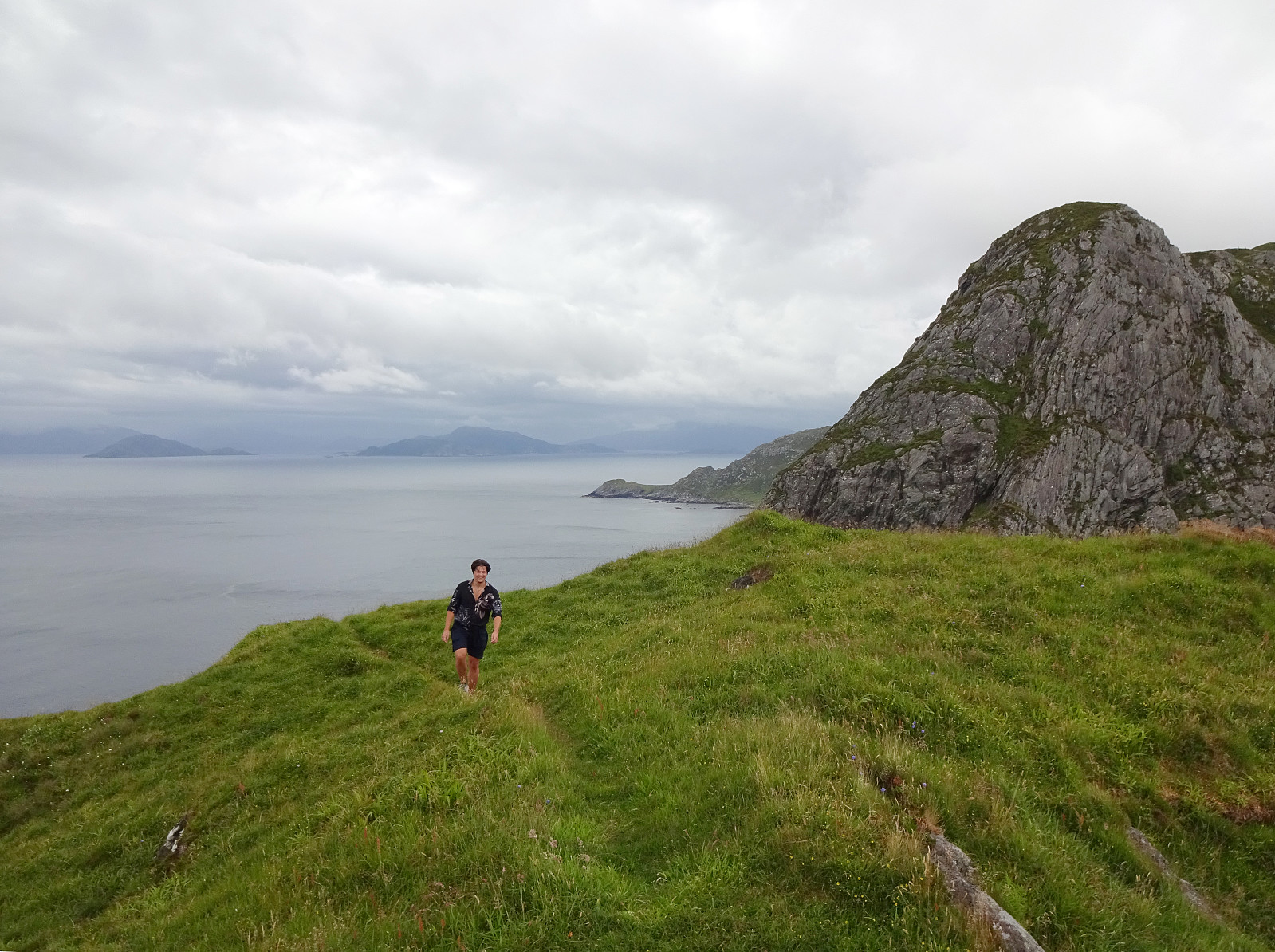 After not seeing much on Vestkapp , we continued to Honningsvågen to make an attempt at Stålet (as far north as you can get on Stadlandet, or so). We found a convenient place to park in Ytre Honningsvåg, right next to the trail head (place for about two cars). From there, we followed a marked trail that extends northwards from Ytre Honningsvåg, traversing the quite steep western slopes of Storebruna, Storeknausen, and Stålsegga at "half height" (or so). While this hike is not long and you also don't have to make many height meters, just the matter of fact that you traverse a relatively steep mountain side (basically all the way out and in), requires a bit of extra care. Also, if the condition should be wet, there may be risks to slip, which could be quite bad in the steepest sections. >>>
Vestkapp on Stadlandet
- Dato:
- 10.07.2023
- Turtype:
- Spasertur
- Turlengde:
- 0:30t
- Distanse:
- 0,6km
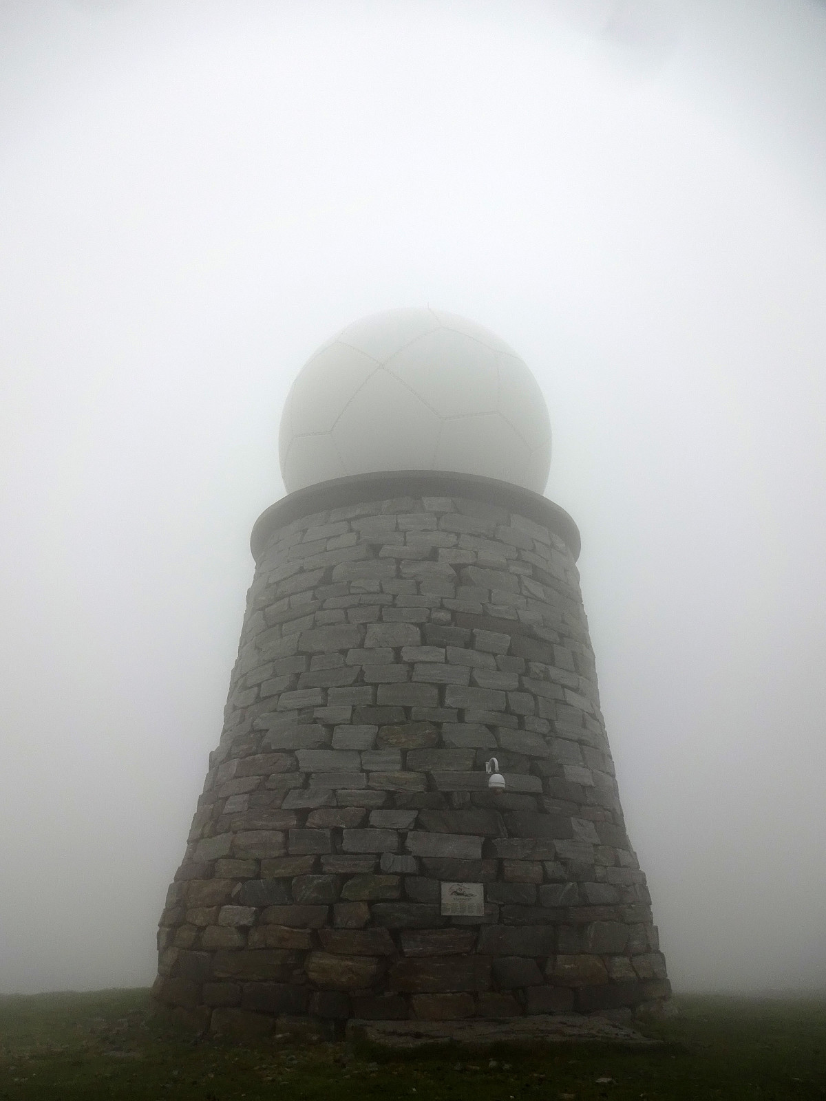 After first paying Vågsøy and Måløy a short visit, we continued to Stadlandet. Our first stop was Vestkapp on Kjerringa in the northwest of Stadlandet. Taking the road up to a parking spot quite close to the actual top, we eventually entered some very thick (and wet) clouds that enshrouded all of the top. Even just a few meters from the massive meteorological radar station on top of Kjerringa we had some difficulties to actually find and see it! :-) Since our views were extremely limited anyway (and it was quite a bit wet, also!), we decided to not stay there for any significant time, but return to our car soon, instead, with our next goal, Stålet , in front of us! :-)
Selected photos are available as Google photo album .
See also the related FB-page Hiking around Bergen, Norway .
After first paying Vågsøy and Måløy a short visit, we continued to Stadlandet. Our first stop was Vestkapp on Kjerringa in the northwest of Stadlandet. Taking the road up to a parking spot quite close to the actual top, we eventually entered some very thick (and wet) clouds that enshrouded all of the top. Even just a few meters from the massive meteorological radar station on top of Kjerringa we had some difficulties to actually find and see it! :-) Since our views were extremely limited anyway (and it was quite a bit wet, also!), we decided to not stay there for any significant time, but return to our car soon, instead, with our next goal, Stålet , in front of us! :-)
Selected photos are available as Google photo album .
See also the related FB-page Hiking around Bergen, Norway .
