Arkiv - dato
Arkiv - aktivitet
-
Annen tur (1)
- Kajakkpadling (1)
-
Annen vintertur (3)
- Trugetur (3)
- Fottur (615)
-
Skitur (3)
- Fjellskitur (3)
-
Sykkeltur (94)
- Blandet sykling (22)
- Gatesykling (2)
Arkiv - Etter geografi
"Peakbookvenner"


Lister jeg samler etter
-
Bergen ≥ 50m pf. og ≥ 100 m.o.h.
(81/89)
 91%
91% -
Opptur Bergen
(98/113)
86%
-
De syv fjell rundt Bergen
(6/7)
85%
-
Most dominating tops of the Bergen peninsula
(63/75)
84%
-
Utvalgte topper og turmål i Bergen
(244/306)
79%
-
Sund ≥ 50m pf.
(14/18)
77%
-
Alle topper i Bergen
(272/350)
77%
-
Os ≥ 50m pf.
(23/34)
67%
-
Hytter og objekter i Byfjellene
(66/101)
65%
-
Midthordland PF>= 100m
(73/115)
63%

Knappen
- Dato:
- 02.06.2024
- Turtype:
- Fjelltur
- Turlengde:
- 0:45t
- Distanse:
- 4,8km
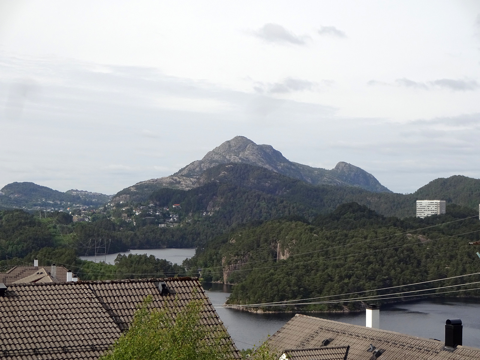 To get some fresh air, we decided to do a quick round over Knappen, approaching it via Sandeidbrotet (up to Eldtona, first). After crossing over to Såta on Knappen, we then descended furthre southwards (via Hesthaugen). Before stepping out on Knappenveien, we saw some (new?) signs near the sports area, suggesting a trail through the forest to Knappentunet. Following this trail, we first made quick progress into the right direction. After a while, however, the trail seemed to cross over some wet area at Hesthaugen, becoming less visible (or not at all, actually). Following our basic sense of orientation, we crossed through the forest into the right direction, connecting to Knappenveien at Knappentunet in the south of Knappatjørna. From there, it was then straight-forward (mostly) to >>>
Bekhilderen at low tide
- Dato:
- 20.04.2024
- Turtype:
- Fjelltur
- Turlengde:
- 3:00t
- Distanse:
- 6,8km
 Planning our timing just right, we decided to visit Bekhilderen at low tide. We parked along Telavågvegen and followed first the road Håvarden. This brought us to the old mill at Selståvågen. From there, we followed the trail first to Grunnevågen and then further, on the other, southern side, to Bekhilderen. After having some good time there, we returned, basically following the same route "backwards". :-)
Selected photos are available as Google photo album .
See also the related FB-page Hiking around Bergen, Norway .
Web page UT.no from the Norwegian Trekking Association recommends a similar hike .
Planning our timing just right, we decided to visit Bekhilderen at low tide. We parked along Telavågvegen and followed first the road Håvarden. This brought us to the old mill at Selståvågen. From there, we followed the trail first to Grunnevågen and then further, on the other, southern side, to Bekhilderen. After having some good time there, we returned, basically following the same route "backwards". :-)
Selected photos are available as Google photo album .
See also the related FB-page Hiking around Bergen, Norway .
Web page UT.no from the Norwegian Trekking Association recommends a similar hike .
Walk around Sælevatent
- Dato:
- 14.04.2024
- Turtype:
- Fjelltur
- Turlengde:
- 2:00t
- Distanse:
- 9,6km
 This time, the plan was to walk around Sælevatnet. I started from Varden and headed towards Bondegården in the north of Sælevatnet, first. I the surrounded Bondegården in its south (around Neset). On the other side, I then followed Sælenveien southwards, before I turned left to enter Stokkedalen via Løtveitveien. Looking east, I wondered whether it is possible to ascent towards Barhaugen via its very steep western flank. North of house #90 in Stokkedalen, I then found an opportunity to get up (not really a trail, but it looked as if others had done this before, still). This brought me up to Rekdalsveien, which I then followed southwards in order to connect to Barhaugen. At house #95, however, there's no way to proceed; I thus had to "go around" via Fjellsdalen. This >>>
Spelhaugen from Varden
- Dato:
- 05.04.2024
- Turtype:
- Fjelltur
- Turlengde:
- 2:00t
- Distanse:
- 6,1km
 I had to get something from Spelhaugen and decided to walk there through Kanadaskogen.
Selected photos are available as Google photo album .
See also the related FB-page Hiking around Bergen, Norway .
I had to get something from Spelhaugen and decided to walk there through Kanadaskogen.
Selected photos are available as Google photo album .
See also the related FB-page Hiking around Bergen, Norway .
Pyttane in windy weather
- Dato:
- 03.02.2024
- Turtype:
- Fjelltur
- Turlengde:
- 1:30t
- Distanse:
- 6,7km
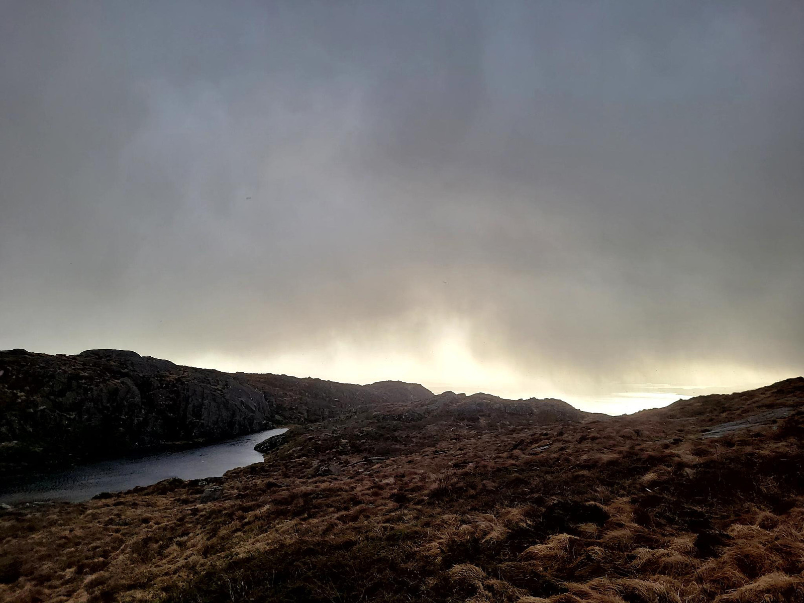 With quite a bit of weather outside, we decided to "just" go up and down Pyttane on Sotra. We took the car to Ekrhovdvegen in the very east of Sotra and parked near Nordre Stølen, where the service road up to Pyttane starts. We then walked up to the radar stations, experiencing significant weather on the top (strong winds, some precipitation). While it was nice to get out into the fresh air, we still did not feel like staying up there "in the elements" for any prolonged time, thus walking back down more or less immediately, again. All in all, this walk up to Pyttane is always nice (and easy), lending itself well to getting some fresh air without an all-too-long trip.
Selected photos are available as Google photo album .
See also the related FB-page Hiking around Bergen, Norway .
Web page WestCoastPeaks.com provides useful information about Liatårnet
and also Petter Bjørstad has a >>>
With quite a bit of weather outside, we decided to "just" go up and down Pyttane on Sotra. We took the car to Ekrhovdvegen in the very east of Sotra and parked near Nordre Stølen, where the service road up to Pyttane starts. We then walked up to the radar stations, experiencing significant weather on the top (strong winds, some precipitation). While it was nice to get out into the fresh air, we still did not feel like staying up there "in the elements" for any prolonged time, thus walking back down more or less immediately, again. All in all, this walk up to Pyttane is always nice (and easy), lending itself well to getting some fresh air without an all-too-long trip.
Selected photos are available as Google photo album .
See also the related FB-page Hiking around Bergen, Norway .
Web page WestCoastPeaks.com provides useful information about Liatårnet
and also Petter Bjørstad has a >>>
Short walk to Donaghys Hill
- Dato:
- 05.11.2023
- Turtype:
- Fjelltur
- Turlengde:
- 1:00t
- Distanse:
- 2,2km
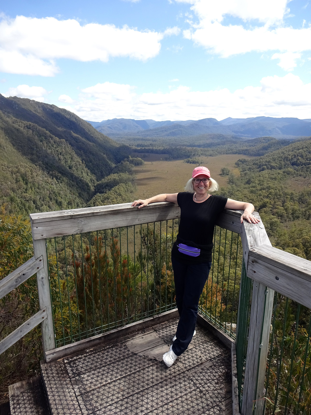 While we thought that we not really had sufficient time for an extended hike, this day, we still wished to see at least something along our drive through the Central Highlands. To do so, we followed a sign that suggested a short walk to Donaghys Hill in order to appreciate some nice views from its top. Parking right next to the highway, we first walked along a forest road, before turning right and into the forest along a regular trail. Not for the first time, and not for the last time in Tasmania, neither, we got very impressed by the very tall trees (and the jungle underneath them). Not far along this trail, we then stepped out of the forest and up onto Donaghys Hill. And indeed, it is true that this little hill offers surprisingly nice views, to the far (for ex., to Frenchmans Cap) as >>>
Visiting Whisky Bay
- Dato:
- 28.10.2023
- Turtype:
- Fjelltur
- Turlengde:
- 1:00t
- Distanse:
- 1,8km
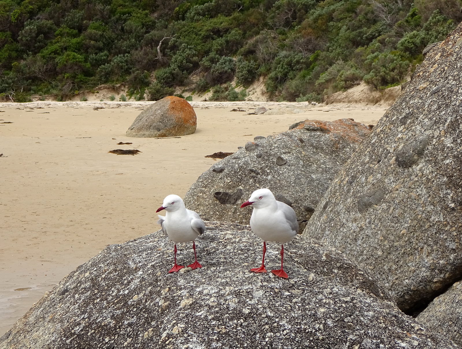 Our third stop in Wilsons Prom (Wilsons Promonotory) was to visit Whisky Bay. We started at the Picnic Bay Carpark, walking down to the Picnic Bay and Whisky Bay Lookout, first. We then continued to Whisky Bay, which impresses with its colored rocks and a nice beach! :-)
Selected photos are available as Google photo album .
See also the related FB-page Hiking around Bergen, Norway .
Our third stop in Wilsons Prom (Wilsons Promonotory) was to visit Whisky Bay. We started at the Picnic Bay Carpark, walking down to the Picnic Bay and Whisky Bay Lookout, first. We then continued to Whisky Bay, which impresses with its colored rocks and a nice beach! :-)
Selected photos are available as Google photo album .
See also the related FB-page Hiking around Bergen, Norway .
Exploring the Dunes of the Big Drift
- Dato:
- 28.10.2023
- Turtype:
- Fjelltur
- Turlengde:
- 2:00t
- Distanse:
- 6,7km
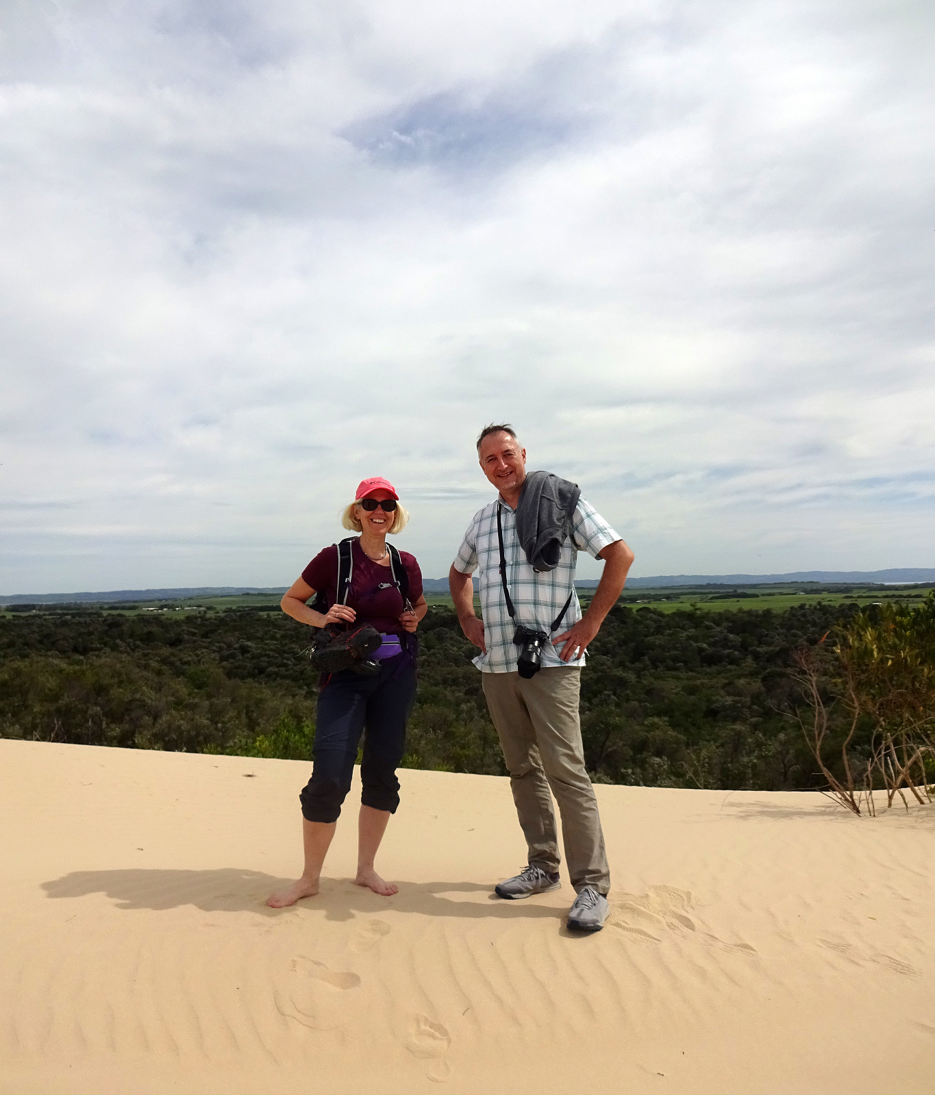 After rounding off the conference in Melbourne, we were ready to explore Victoria a bit. Our first target was Wilsons Prom (Wilsons Promontory) in the southeast of Melbourne. Before driving "all the way" into Wilsons Prom, we started with an exploration of the Dunes of the Big Drift. Following a well-marked trail from the road, we easily connected to the dunes. All this rather large area of sand dunes, surrounded by green nature (and the sea in the west), is a bit surreal and really an interesting spot to visit. Definitely worth the short walk! :-)
Selected photos are available as Google photo album .
See also the related FB-page Hiking around Bergen, Norway .
After rounding off the conference in Melbourne, we were ready to explore Victoria a bit. Our first target was Wilsons Prom (Wilsons Promontory) in the southeast of Melbourne. Before driving "all the way" into Wilsons Prom, we started with an exploration of the Dunes of the Big Drift. Following a well-marked trail from the road, we easily connected to the dunes. All this rather large area of sand dunes, surrounded by green nature (and the sea in the west), is a bit surreal and really an interesting spot to visit. Definitely worth the short walk! :-)
Selected photos are available as Google photo album .
See also the related FB-page Hiking around Bergen, Norway .
Saturday walk to Knappen
- Dato:
- 07.10.2023
- Turtype:
- Fjelltur
- Turlengde:
- 1:00t
- Distanse:
- 4,8km
 One of our afternoon walks to Knappen, enjoying some nice weekend weather. While we stepped up along one of our more usual routes (via Sandeidbrotet, continuing to Knappen via Eldtona), we chose a partially off-trail route down to Knappenveien. Good to get a bit of fresh air! :-)
See also the related FB-page Hiking around Bergen, Norway .
Petter Bjørstad has a useful page about Knappen .
Web page UT.no from the Norwegian Trekking Association recommends another hike to Knappen .
One of our afternoon walks to Knappen, enjoying some nice weekend weather. While we stepped up along one of our more usual routes (via Sandeidbrotet, continuing to Knappen via Eldtona), we chose a partially off-trail route down to Knappenveien. Good to get a bit of fresh air! :-)
See also the related FB-page Hiking around Bergen, Norway .
Petter Bjørstad has a useful page about Knappen .
Web page UT.no from the Norwegian Trekking Association recommends another hike to Knappen .
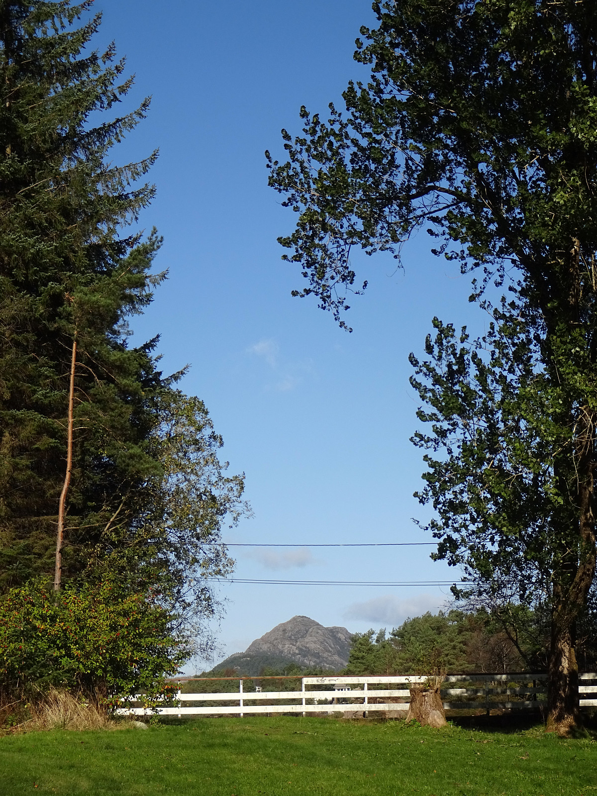
Short excursion to Sælenvatnet
- Dato:
- 23.10.2021
- Turtype:
- Fjelltur
- Turlengde:
- 0:30t
- Distanse:
- 2,1km
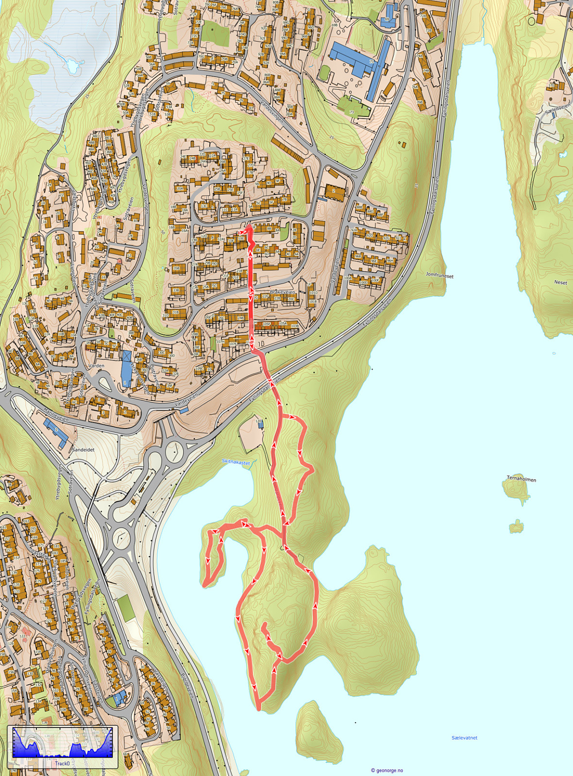 Very shot excursion to the local peninsula in Sælenvatnet to get some fresh air.
See also the related FB-page Hiking around Bergen, Norway .
Very shot excursion to the local peninsula in Sælenvatnet to get some fresh air.
See also the related FB-page Hiking around Bergen, Norway .
