Arkiv - dato
Arkiv - aktivitet
-
Annen tur (1)
- Kajakkpadling (1)
-
Annen vintertur (3)
- Trugetur (3)
- Fottur (615)
-
Skitur (3)
- Fjellskitur (3)
-
Sykkeltur (94)
- Blandet sykling (22)
- Gatesykling (2)
Arkiv - Etter geografi
"Peakbookvenner"


Lister jeg samler etter
-
Bergen ≥ 50m pf. og ≥ 100 m.o.h.
(81/89)
 91%
91% -
Opptur Bergen
(98/113)
86%
-
De syv fjell rundt Bergen
(6/7)
85%
-
Most dominating tops of the Bergen peninsula
(63/75)
84%
-
Utvalgte topper og turmål i Bergen
(244/306)
79%
-
Sund ≥ 50m pf.
(14/18)
77%
-
Alle topper i Bergen
(272/350)
77%
-
Os ≥ 50m pf.
(23/34)
67%
-
Hytter og objekter i Byfjellene
(66/101)
65%
-
Midthordland PF>= 100m
(73/115)
63%

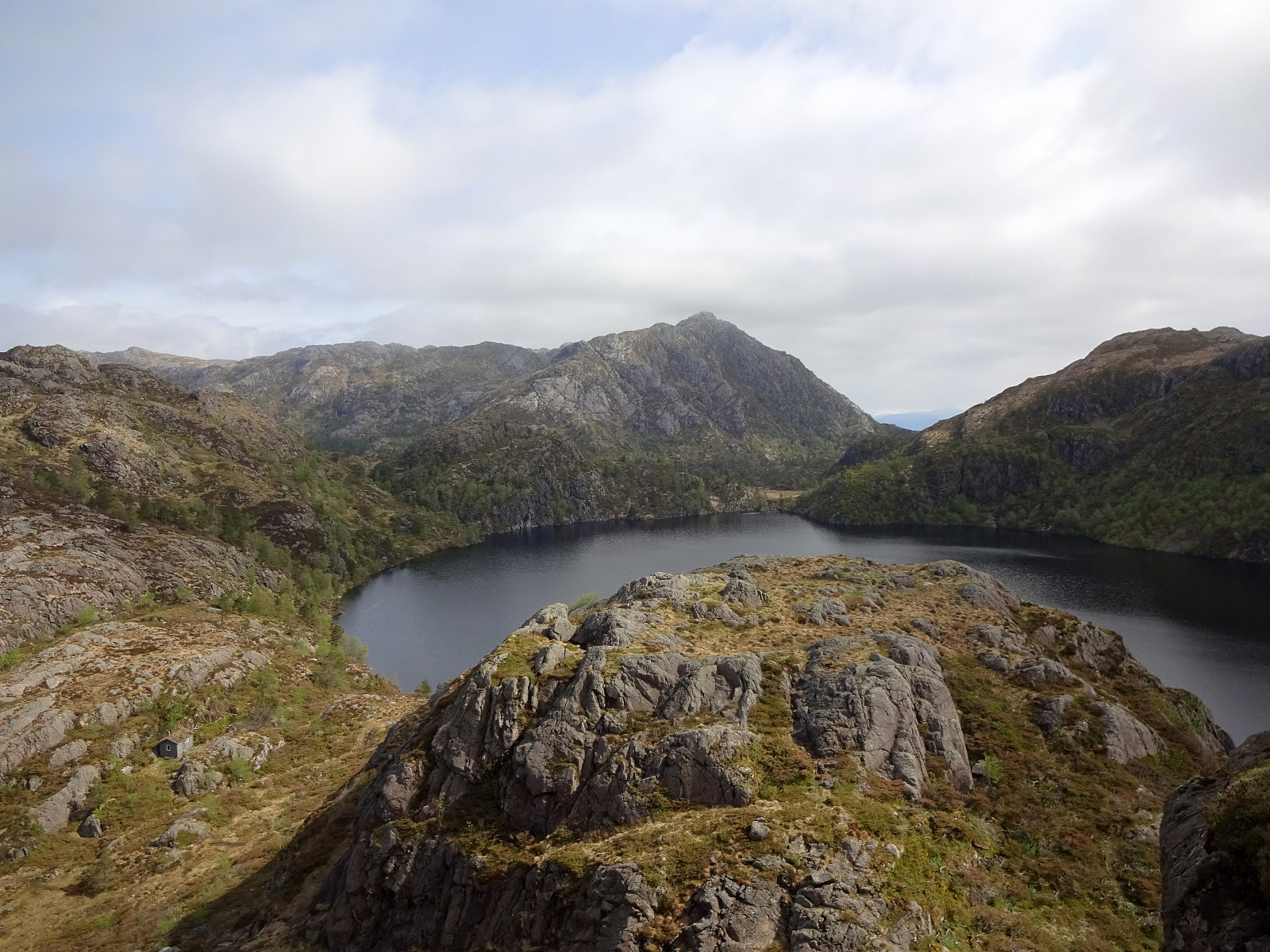
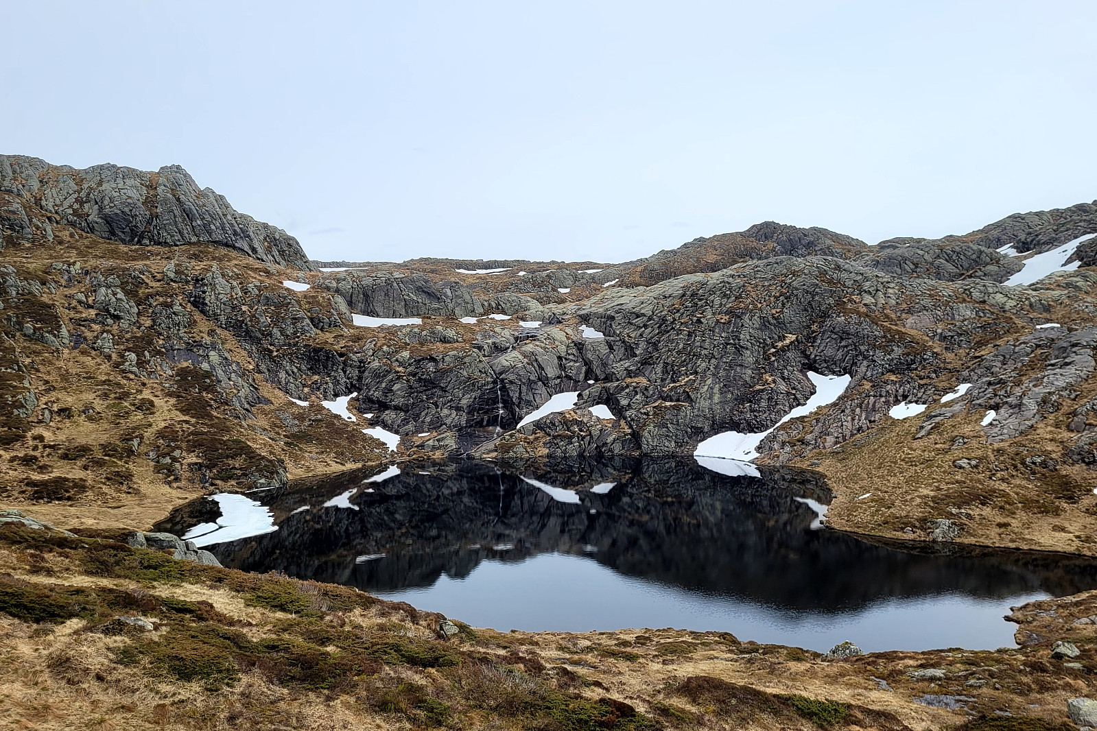
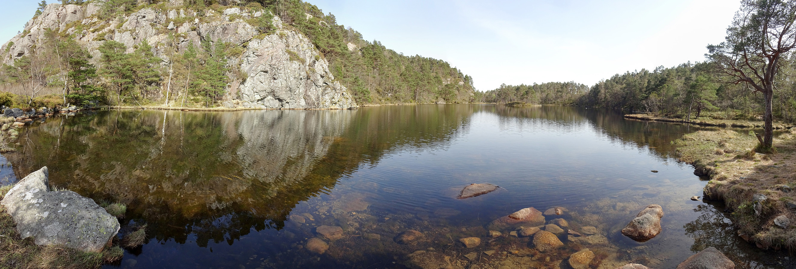
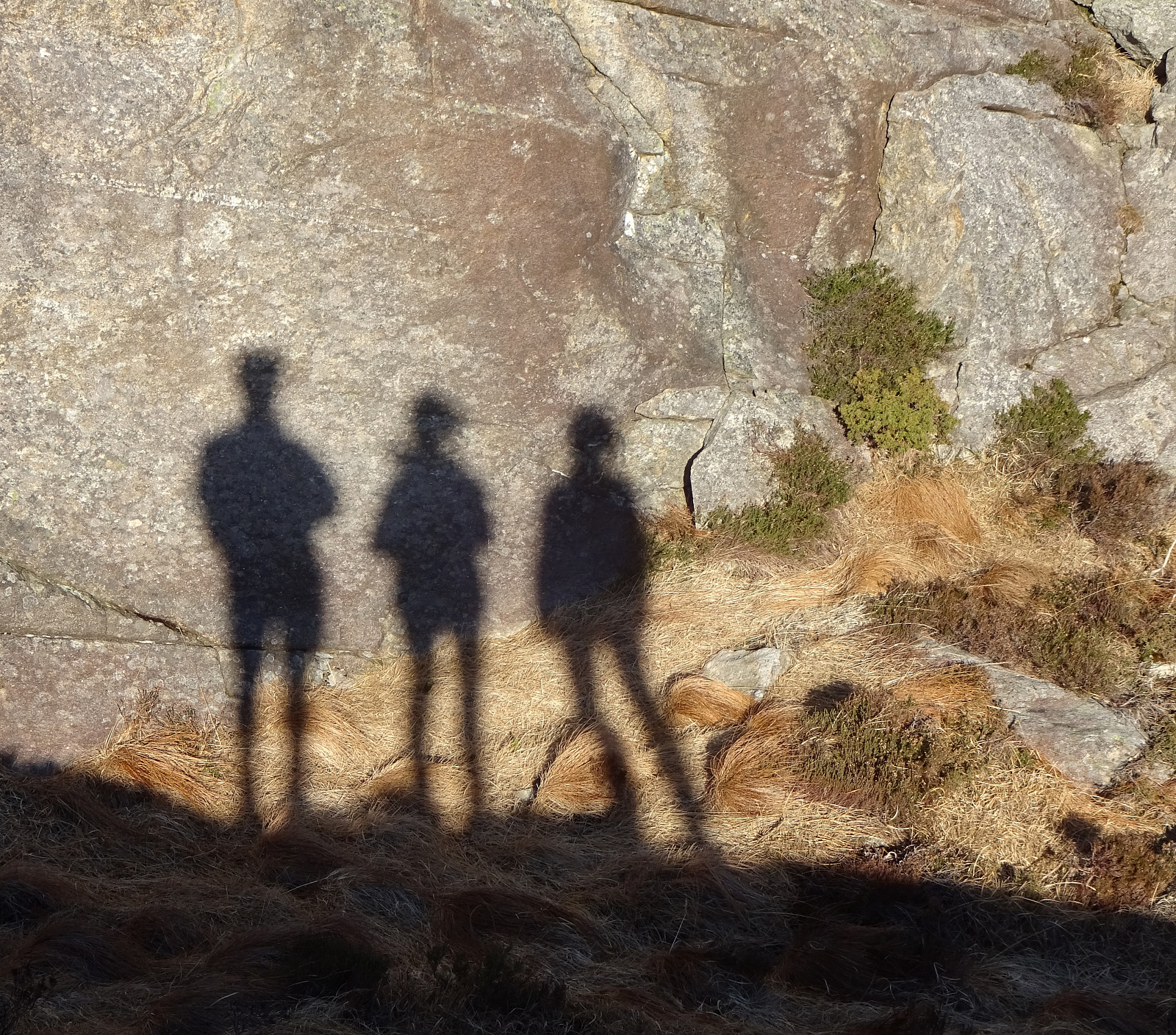
Burlifjellet and Skorafjellet
- Dato:
- 19.05.2024
- Turtype:
- Fottur
- Turlengde:
- 5:00t
- Distanse:
- 11,1km
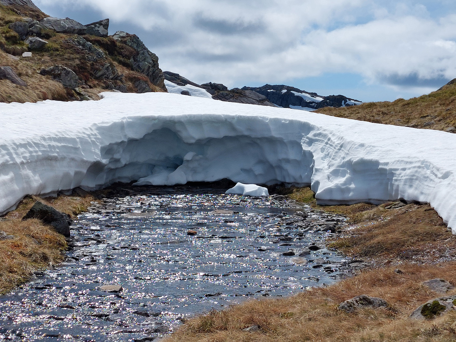 Driving north from Fusa, into the direction of Samnanger, we passed through Eikelandsosen, first, continuing further northwards along road 48. At Sævell, right after passing by Sævellavatnet, we turned right onto Sævellvegen. Near Høgehaugen, we paid a bit of road-toll in order to continue along Sævellvegen. Driving carefully (Sævellvegen is not paved further inwards), we arrived at Kjøpmannavadet shortly after. There, right next to the bridge, we parked at the side of the road. Crossing over the bridge southwards, we started our hike along a forest road that leads to Breivatnet just a little down the road. There, one crosses over Breielva right next to a small cabin right at Breivatnet. A marked trail then leads up to Helane and from there further towards the lower end of Lisetredalen. >>>
Fusafjellet from Strandvik
- Dato:
- 18.05.2024
- Turtype:
- Fottur
- Turlengde:
- 6:00t
- Distanse:
- 16,5km
 Given a very nice (and warm!) day, we aimed at hiking Fusafjellet from the south, starting in Strandvik. We first headed into the valley between Fusafjellet in the northeast and Bogafjellet in the west, where Vikaelva comes down. At about 80 masl, in the northeast of Nyland, the valley opens up a little and we left the main gravel road, stepping "directly north", aiming at the little saddle in the east of the small hill that "sits" there in the middle of the valley. The plan was to continue further upwards (into the direction of Langnuen) from there, but before we did that we first explored this little hills for a few minutes, enjoying some nice views southwards from it. We then followed a forest road that ascends the relatively steep southwestern side of Langnuen. >>>
From Stovegolvet to Sagvåg on Stord
- Dato:
- 11.05.2024
- Turtype:
- Fottur
- Turlengde:
- 5:00t
- Distanse:
- 13,2km
 As part 2 of a two-days hike across Stord, we started from Stovegolvet, where we had stayed over night. We first descended (steeply) towards Tysevatnet, following a nice trail down from Stovegolvet. Instead of walking around Eldhushøgda, as prepared for by the trails, we crossed over this little hill, enjoying some nice views from above. Even though a bit steep on its southwestern side, descending back down to the trail was still no issue. We then followed the trail, which leads (also across the one or other dam) along Tysevatnet in its south, to get to the other side and, eventually, further southwards to Ravatnet, crossing over a little saddle in the west of Ramnaskolten. After walking between Ravasslia (in the northwest) and Ravatnet (in the southeast), we arrived at another small saddle >>>
From Vistvik to Stovegolvet on Stord
- Dato:
- 10.05.2024
- Turtype:
- Fottur
- Turlengde:
- 7:00t
- Distanse:
- 16,5km
 As part 1 of a two-days hike across Stord, we first took an early bus from Bergen southwards. The bus dropped us off near Vistvik (Vestvik?) quite a bit north on Stord. From Grønestølen, we then started our ascent into Hovlandsdalen, where Vistvikelva comes down. At almost 200 masl, we then followed a sign towards Tindane (turning left to get up the northern ridge of Tindane). We then followed the trail further up to Tindane (this trail is not used a lot, as it seems, but still easy to find -- at times, howover, the terrain is quite wet). Near Tindane, we then arrived at Tindaslottet (a small cabin, firmly protected by stones all-around). After a short break (it was not really warm enough for any longer break, and also we could not really enjoy a lot of great views due to low-hanging >>>
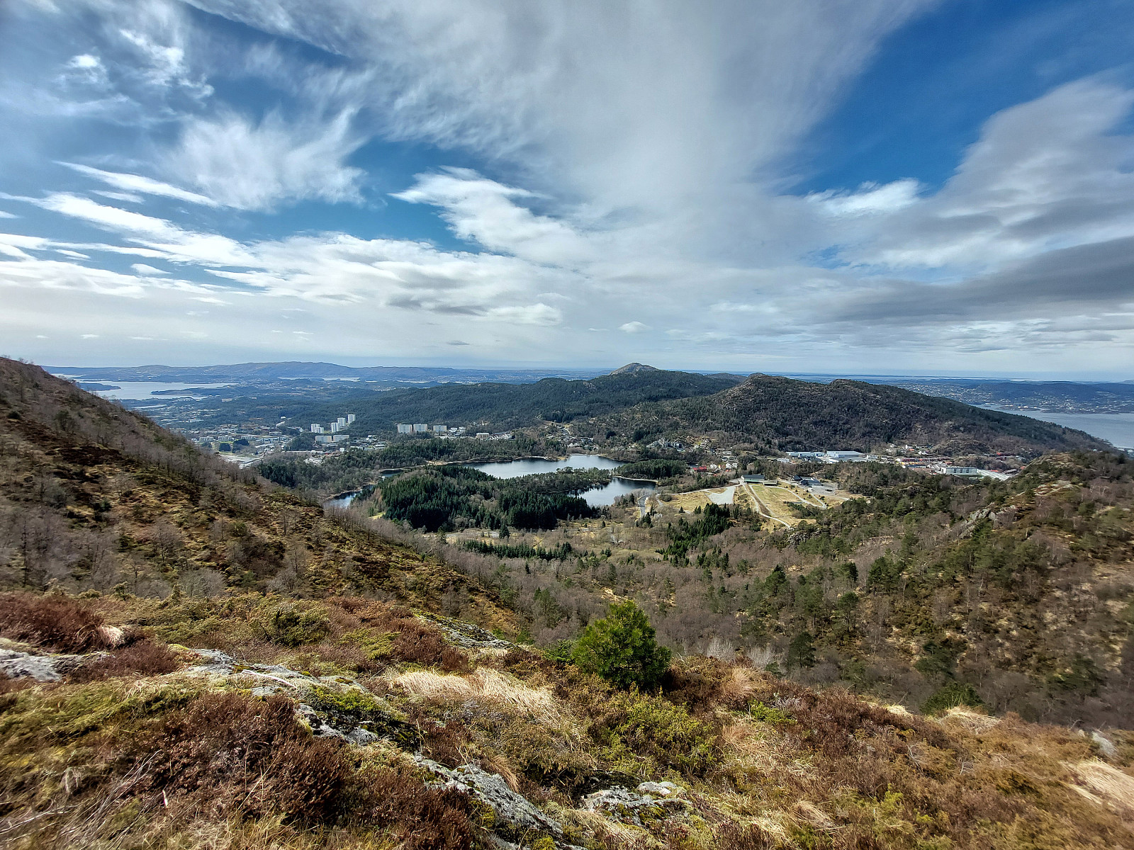
From Varden to Melkeplassen via Gravdalsfjellet
- Dato:
- 01.05.2024
- Turtype:
- Fottur
- Turlengde:
- 3:30t
- Distanse:
- 8,2km
 The initial plan was to hike from Varden to Bergen via Gravdalsfjellet. We started northwards from Varden, reaching Langaheia in the east of Stora Krokatjørna soon after. We then "crossed over" the gravel road from Spelhaugen to Tennebekktjørna to continue to Eikelifjellet. North of Eikelifjellet, we then surrounded Nipetjørna in its northwest in order to take the steep way up to Gravdalsfjellet. We then continued along the main trail (into the direction of Damsgårdsfjellet). However, instead of ascending to Holefjellet "as usually", we took a slightly more southern route eastwards. This brought us to the ascent to Olsokfjellet (via its northwestern ridge). From Olsokfjellet, we then used one of the main trails (in northeastern direction) to get down to Melkeplassen. >>>
From Bergen to Varden via Løvstakken
- Dato:
- 15.04.2024
- Turtype:
- Fottur
- Turlengde:
- 4:00t
- Distanse:
- 11,7km
 After work, I decided to move my body a little and walk home via Løvstakken. I crossed Puddefjorden via Småpudden and then ascended towards Juvdalen via Solheimslien. Right next to Strandafjellet, this brought me up to the heights north of Løvstakken. Following one of the main trails, there, I then continued to the top of Løvstakken. Continuing along the main trail southwards, I then crossed over Gulsteinen to get down to Bønes. Walking through Fjellsdalen and following some more roads I arrived at Nordåsvatnet. From there, it was then only back northwards to Varden along Sælevatnet.
Selected photos are available as Google photo album .
See also the related FB-page Hiking around Bergen, Norway .
Web page WestCoastPeaks.com provides useful information about Løvstakken .
After work, I decided to move my body a little and walk home via Løvstakken. I crossed Puddefjorden via Småpudden and then ascended towards Juvdalen via Solheimslien. Right next to Strandafjellet, this brought me up to the heights north of Løvstakken. Following one of the main trails, there, I then continued to the top of Løvstakken. Continuing along the main trail southwards, I then crossed over Gulsteinen to get down to Bønes. Walking through Fjellsdalen and following some more roads I arrived at Nordåsvatnet. From there, it was then only back northwards to Varden along Sælevatnet.
Selected photos are available as Google photo album .
See also the related FB-page Hiking around Bergen, Norway .
Web page WestCoastPeaks.com provides useful information about Løvstakken .
Sauafjellet and Spjeldsfjellet
- Dato:
- 25.03.2024
- Turtype:
- Fottur
- Turlengde:
- 3:30t
- Distanse:
- 9,9km
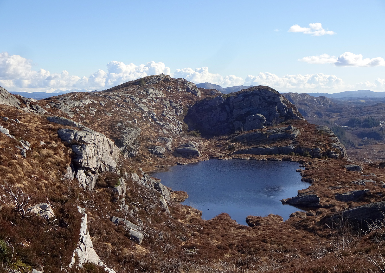 We started at Fjæreide and first went up Sauafjellet. From there, we then reconnected with the trail to Kårtveit north of Sauafjellet (descending Sauafjellet northwards without a trail was just fine; only the last few meters were a bit so that one had to find a way of where to go). We then followed the trail into the direction of Kårtveit, passing by Vardavatnet along the way. At Kårtveit, we wished to continue on another trail (to Spjeldsfjellet, a bit further north). We did not see a more straight-forward way then to first step out and onto road 5242, then follow this road northwards for some 200-300 meters, before then turning right and onto the planned trail, again. To pass by Urafjellet in its north (as planned), we needed to find the right "turn left" where also the >>>
Djupedalseggene and Vindeggene from Ostereidet
- Dato:
- 24.03.2024
- Turtype:
- Fottur
- Turlengde:
- 5:00t
- Distanse:
- 16,4km
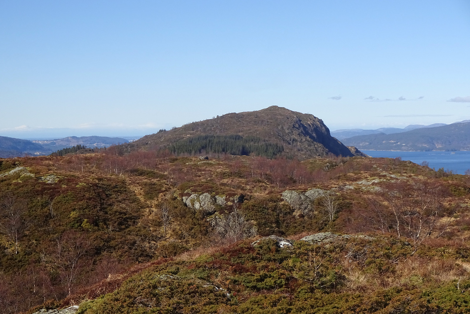 We took the car from Bergen, first following E39 via Knarvik. From Osterfjordvegen, we then took a small road to Ostereidet, where we parked next to the local school. We started our hike up to Hovåsen, following first some forest roads and then a trail along the southeastern ridge of Hovåsen. From there, we then crossed over to the gravel road that leads up to Storset (via Bruarinden). After then walking up this gravel road to the end of the road at Storset, we then followed a marker that directed us to a small ridge in the south of Storsettjørna (and west of Vardhaugen). Crossing over this ridge (in northwestern direction) and stepping over the small stream that comes down from Storsettjørna (in southwestern direction), we ended up on the trail up to Vindeggene (this trail is not >>>
Haganesfjellet from Liaskjeret via Lundaneset
- Dato:
- 16.03.2024
- Turtype:
- Fottur
- Turlengde:
- 2:30t
- Distanse:
- 7,4km
 We took the car to Liaskjeret in the east of Liatårnet on Sotra and started our hike at Jonsokhaugen. From there, we first followed the road southwards until its end at Gulenakken. There, we stepped down towards the coast and passed by Nordra Skagavika to cross over to Skaget and Skaghaugen. From Skaghaugen, we enjoyed some nice views across Røssevikvatnet, before continuing further southwards to Lundaneset. This stretch is without trail, but easy to traverse. From Lundaneset, we then started our ascent to Haganesfjellet, first aiming at Kjempa. Near Kjerringastigen, we then started our ascent to Alteret. At about 150 mosl, there's a slightly steeper section, where hands help out with the ascent. From Alteret, we crossed over Adneviksbakkane, making another slightly steeper ascent >>>
Ørnafjellet and Austre Høghaugen
- Dato:
- 17.02.2024
- Turtype:
- Fottur
- Turlengde:
- 3:30t
- Distanse:
- 7,9km
 We expected some nice sun and decided to enjoy the day with an exploration of a part of Sotra that we had not visited before. We drove the car to Sotra and there to Fjell. South of Fjell, along Søre Fjellavegen and right next to Gardstjørna, we parked next to the road and started our hike, walking down a simple road towards Fjellspollen. Still on this road, we conveniently crossed over the waters, that spring down from Bosvatnet to Litlepollen, using the road-bridge. Studying the map at home had suggested that starting our ascent up to Ørnafjellet would be possible right from the road in the north of Litlepollen. Once there, however, we saw that the hill-side appeared a bit steeper than originally expected. Still, we could make it up to the heights in the north of Litlepollen without >>>
