Arkiv - dato
Arkiv - aktivitet
-
Annen tur (1)
- Kajakkpadling (1)
-
Annen vintertur (3)
- Trugetur (3)
- Fottur (611)
-
Skitur (3)
- Fjellskitur (3)
-
Sykkeltur (93)
- Blandet sykling (21)
- Gatesykling (2)
Arkiv - Etter geografi
"Peakbookvenner"


Lister jeg samler etter
-
Bergen ≥ 50m pf. og ≥ 100 m.o.h.
(81/89)
 91%
91% -
Opptur Bergen
(98/113)
86%
-
De syv fjell rundt Bergen
(6/7)
85%
-
Most dominating tops of the Bergen peninsula
(63/75)
84%
-
Utvalgte topper og turmål i Bergen
(241/306)
78%
-
Sund ≥ 50m pf.
(14/18)
77%
-
Alle topper i Bergen
(268/350)
76%
-
Os ≥ 50m pf.
(23/34)
67%
-
Hytter og objekter i Byfjellene
(66/101)
65%
-
Fjell ≥ 50m pf.
(20/32)
62%

Nordra Såta, Tyssdalsfjellet, and Borgafjellet
- Dato:
- 26.03.2023
- Turtype:
- Fottur
- Turlengde:
- 4:00t
- Distanse:
- 11,4km
 For a longer time, we had considered to visit Nordra Såta in the west of Tyssdalsfjellet (and Møsnuken). To do that, we drove to the parking spot at the lower end of Tyssdalen east of Tyssdalsvatnet (northeast of Ulven). Instead of following the main trail (up through Tyssdalen), we headed north (or even northwest) after crossing Tyssdalselva. We first followed the road (Tøsdalsvegen) for a short stretch until we crossed another minor stream there. There, in the south of Lyhaugen, we left the road and ascended first to a small hill south of Lyhaugen (with a post of a power line up there). It was a bit steep to get up there and one may wonder what it's worth this effort (or any, actually). :-) We then continued to Lyhaugen (also a bit steep, but also without actual problems). From >>>
Førdesveten from Vorland
- Dato:
- 18.03.2023
- Turtype:
- Fottur
- Turlengde:
- 4:00t
- Distanse:
- 11,0km
 We decided to hike Førdesveten in the south of Sotra and planned for an approach from the northwest (from Vorland). After driving south from Fjell, we parked along Sundvegen, where one also finds the head of a trail that leads through Grøndalen into the direction of Vorlandsvatnet. Using this trail, we approached Vorlandsvatnet at Vassvika from the northwest, following a trail that passes by Vorlandsvatnet in its northeast. This is a nice and convenient trail that leads all the way to the southern-most point of Vorlandsvatnet. There, one could "back out", again, following a gravel road towards the west. Instead, we entered the little valley that comes down there from the south (mostly). After only about 100m into this valley, we ascended (kind of steeply) to the southeast, >>>
Lyderhorn in significant snow
- Dato:
- 11.03.2023
- Turtype:
- Fottur
- Turlengde:
- 1:30t
- Distanse:
- 3,0km
 Given all the snow and also the varied weather forecast, we decided to do something not so long. Being not so far away, and always a nice hike, we decided to hike up and down Lyderhorn. We parked on the western side (along Kjøkkelvikveien) and headed towards the trail up to Små-Lyderhorn (first) through Olderdalen. Very quickly it became clear that this hike would be different from what we usually experience (due to all the snow!). At first, some steps of another person could be still recognized in the snow, but this person had decided about half-way up to turn around, apparently. Continuing further upwards was then a nice challenge, breaking quite a bit into the deep snow at every step. Up at the saddle next to Små-Lyderhorn, we then decided to put on brodders ("light form of >>>
Gråfjellet via Solbjørgfjellet from Rolsvåg
- Dato:
- 05.03.2023
- Turtype:
- Fottur
- Turlengde:
- 6:00t
- Distanse:
- 14,2km
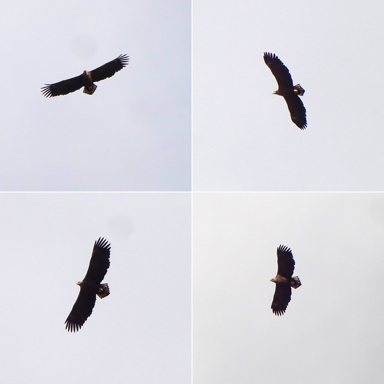
 Expecting a nice day, we made a plan for a hike that would not lead us up into all too much snow. Having seen that Botnahytto (in the southwest of Rolsvåg, north of Os) was registered as war memorial, also, we decided to explore this area, including Gråfjellet in the east of Øvredalsvatnet. We had seen that others had taken the forest road from Rolsvåg (passing Rolsvågvatnet, also called Storavatnet, in its north) to get into the valley with Langavatnet and Botnavatnet. Motivated to make this a round, instead, we decided to start our hike in the south of Rolsvågvatnet, aiming for Solbjørgfjellet first. We parked very near to Rolsvågvatnet (on the east of it) and stepped into the terrain south of Rolsvågvatnet more or less "at once". The ground was still quite a bit frozen, >>>
Hæddena, Orrkleivhaugen, and Åsheimfjellet
- Dato:
- 04.03.2023
- Turtype:
- Fottur
- Turlengde:
- 4:00t
- Distanse:
- 8,2km
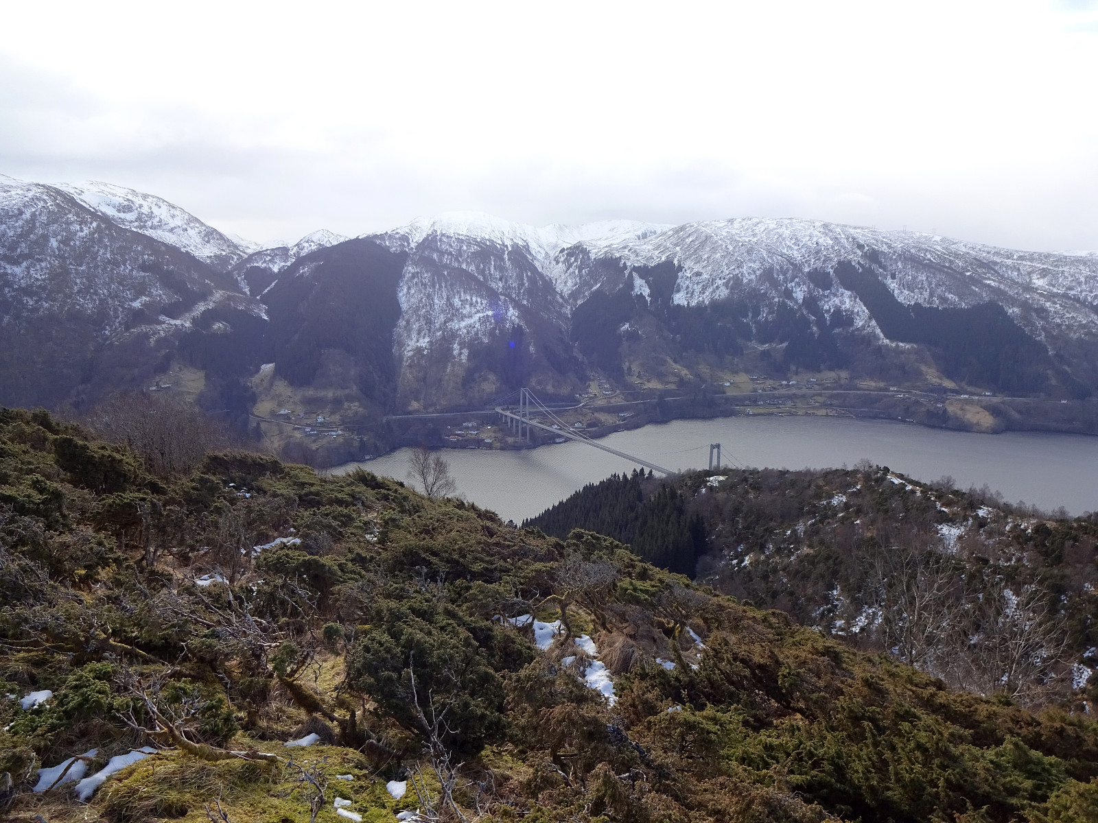 We thought that Osterøy would be nice for another hike and so we chose Hæddena right north of the bridge to Osterøy as our goal for the day. This time, however, we wished to get there via the nice-looking ridge, which is directly about the long tunnel of Osterøyvegen (basically the continuation of the bridge). The map had suggested that a simple trail should be leading up there, as well. We parked right after driving through "the other tunnel" (of Hausvegen, "only" some 150m long, or so) and aimed at taking this trail up to the ridge. In order to do so, one should first follow the northbound trail (into the direction of Haus) up to Vikno (or almost all the way there), before then turning around and up a gentle ridge. Instead, we turned right way earlier, ending >>>
