Arkiv - dato
Arkiv - aktivitet
-
Annen tur (1)
- Kajakkpadling (1)
-
Annen vintertur (3)
- Trugetur (3)
- Fottur (610)
-
Skitur (3)
- Fjellskitur (3)
-
Sykkeltur (93)
- Blandet sykling (21)
- Gatesykling (2)
Arkiv - Etter geografi
"Peakbookvenner"


Lister jeg samler etter
-
Bergen ≥ 50m pf. og ≥ 100 m.o.h.
(81/89)
 91%
91% -
Opptur Bergen
(98/113)
86%
-
De syv fjell rundt Bergen
(6/7)
85%
-
Most dominating tops of the Bergen peninsula
(63/75)
84%
-
Utvalgte topper og turmål i Bergen
(241/306)
78%
-
Sund ≥ 50m pf.
(14/18)
77%
-
Alle topper i Bergen
(268/350)
76%
-
Os ≥ 50m pf.
(23/34)
67%
-
Hytter og objekter i Byfjellene
(66/101)
65%
-
Fjell ≥ 50m pf.
(20/32)
62%

Paddling Liasundet from Hardbakke
- Dato:
- 15.07.2021
- Turtype:
- Kajakkpadling
- Turlengde:
- 4:00t
- Distanse:
- 19,1km
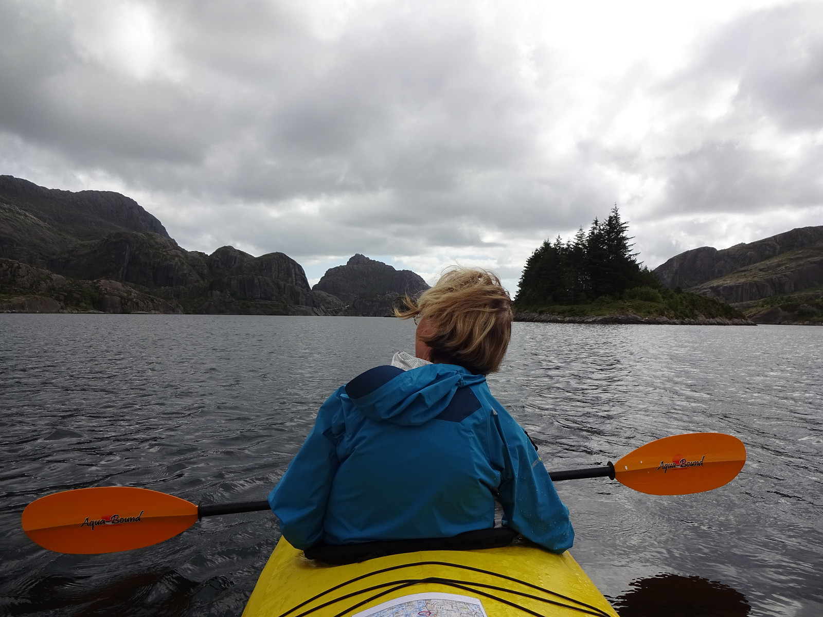 To round off our visit to Solund, we wished to explore this wonder world of islands also from the water. Thus, we had booked a double kayak from a place in Hardbakke that we took out to get around Liasundet for half a day. Leaving Hardbakke, we first paddled northwards on the eastern side of Liasundet, heading towards Råke and Råkeneset in particular, where we had stayed the past few nights. From Råkeneset, we then headed westwards and paddled between Hogneskjela and Hågøyna towards Færøyna, which we then surrounded in its north (in counterclockwise direction). On Litle Færøyna (in the south of Færøyna) we expected to find a place, where we could have a nice little break and indeed, after first also paddling almost all around this island (in its west), we found the indeed nice >>>
Pollatinden from Råkeneset
- Dato:
- 14.07.2021
- Turtype:
- Fottur
- Turlengde:
- 8:30t
- Distanse:
- 15,0km
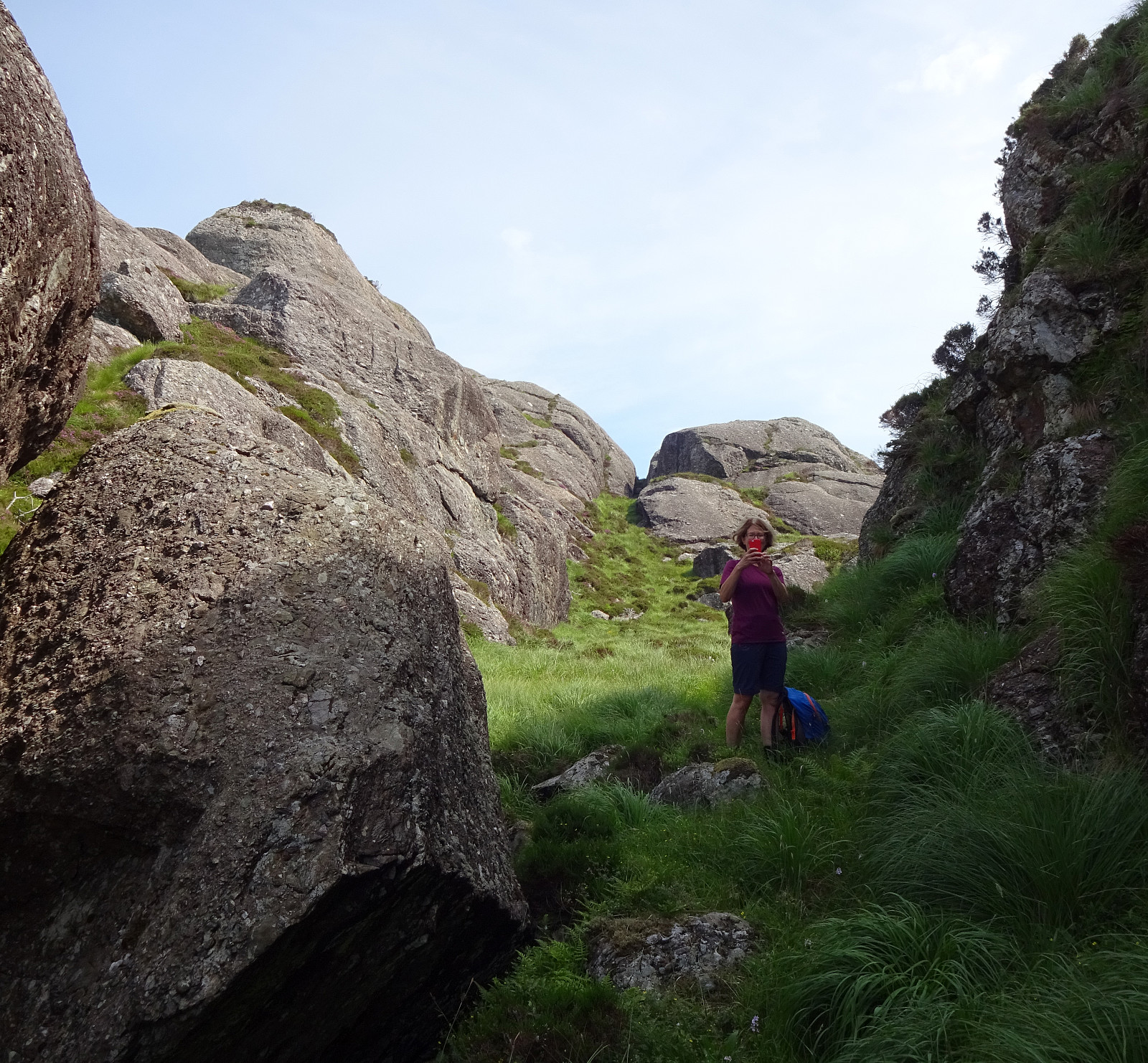
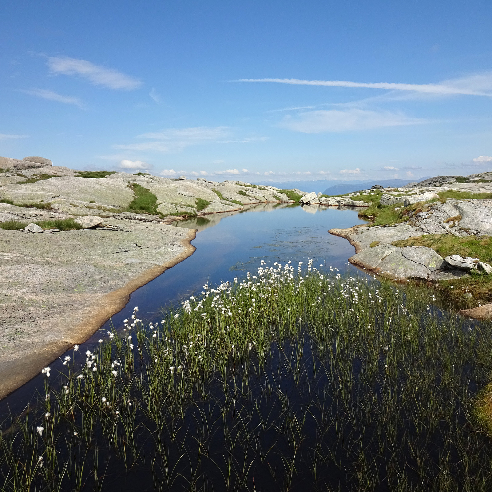
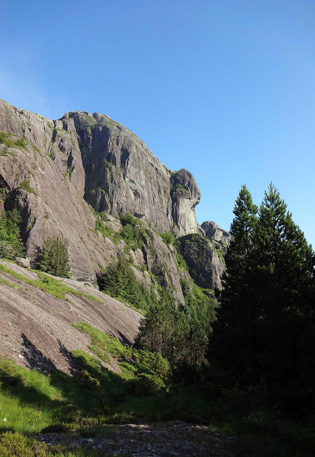 The "big" hiking plan of these few days in Solund was to hike Pollatinden -- but to do this from Råkeneset, where we stayed overnight before and after. The matter of fact that Pollatinden, as well as quite a few of the other landmarks around it, exposes significant cliffs towards the west/northwest (and Råkeneset is exactly in the northwest of Pollatinden), turned this hiking plan into a non-neglegible challenge. When studying the map, it appeared that we could follow one of two routes of "attack": either from the north (via Råkefjellet and then up between Sandvikfjellet and Pollatinden) or from the south (via Storefjellet), while the "standard" approach to Pollatinden (as marked trail) is from the southeast, i.e., exactly from the other side of the mountain, >>>
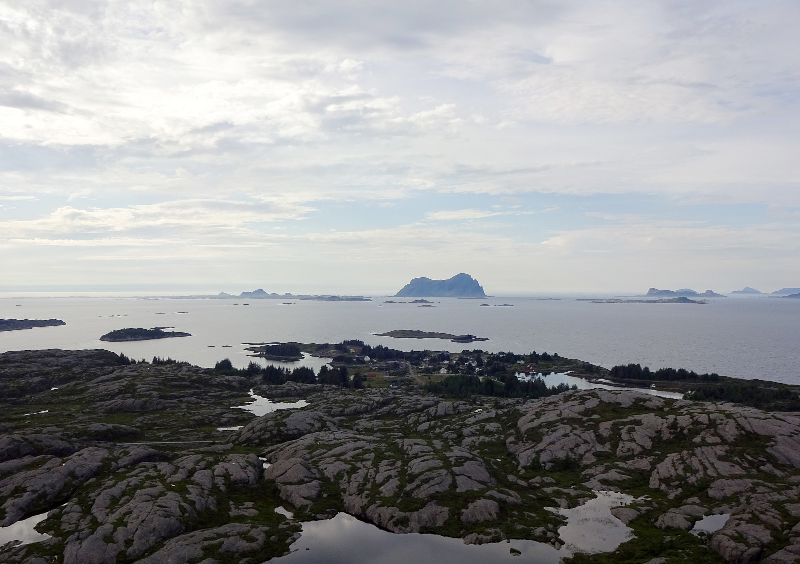
Sperrefjellet and Nordsjøløypen on Ytre Sula
- Dato:
- 13.07.2021
- Turtype:
- Fottur
- Turlengde:
- 4:30t
- Distanse:
- 10,3km
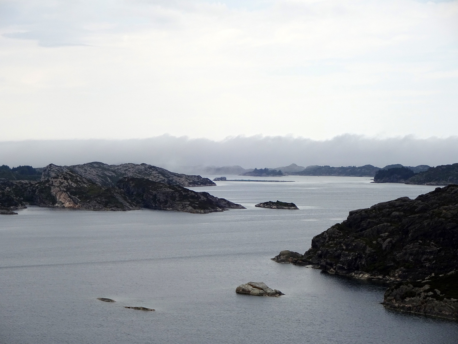
 Staying in Solund for a few days, we also wished to explore Ytre Sula a little. We thus drove westwards from Hardbakke, using road 606. At the very end of this road, at Gjerdneset, we then took the ferry that brought us out to Ytre Sula (to Halldorsneset), crossing Ytre Steinsundet. After weighing several ideas against each other, we ended up with an attempt on Sperrefjellet (not far from Halldorsneset). About half a kilometer from Halldorsneset, we turned left at the T-junction, continuing (for only a short stretch) into the direction of Hjønnevåg. As soon as Sperrevatnet appeared on our left (in the south), we parked on the right, where also a sign marks the trail head for the beginning of this hike. The first section of this hike was then up to Ytre Heia (a little steep, but well-marked >>>
Urdanipa
- Dato:
- 13.07.2021
- Turtype:
- Fjelltur
- Turlengde:
- 0:30t
- Distanse:
- 1,8km
 After our longer hike on Ytre Sula , we still had some appetite and thus decided to pay the north of Sula a short evening visit. Driving eastwards on road 606, passing by Hardbakke along the way, we surrounded Pollatinden and then Hagefjorden (both in their south), before coming close to Ulvegreina. North of that mountain, we then left road 606, turning left (into northern direction, towards Hersvikbygda and Leknessundet). While briefly considering to make a quick hike up to Husefjellet (in the southeast of Hersvikbygda), we then decided to "just" do Urdanipa (south of Leknessundet). The road towards Leknessundet gets actually quite near to Urdanipa, passing over a small saddle in the west of this little top. Finding a suitable place for parking the car, however, is not 100% easy as the road is very >>>
Storeggene, Rabben, Blåfjellet, and Arnipa
- Dato:
- 12.07.2021
- Turtype:
- Fottur
- Turlengde:
- 6:30t
- Distanse:
- 13,9km
 On our way from Bergen to Solund, we wanted to include one hike in Gulen. When checking the map for opportunities, reading also another trip report here on Peakbook , we got tempted to go a nice round in the east of Nordgulen. In order to get to the starting point (at Nordgulen), we drove northwards from Bergen, leaving road E39 at about Knarvik to continue to Mongstad from where we then took a ferry over to Sløvågen. From there, we continued along road 57 (into the direction of Rutledalen), driving first along Eidsfjorden and then further along Nordgulfjorden. Only several hundreds of meters from the northern end of Nordgulvågen, we left road 57 towards the east in order to park somewhere in the area of Tveit. After asking one of the locals, we conveniently parked right next to a playgroud in the northeast of Tveit.
Already >>>
On our way from Bergen to Solund, we wanted to include one hike in Gulen. When checking the map for opportunities, reading also another trip report here on Peakbook , we got tempted to go a nice round in the east of Nordgulen. In order to get to the starting point (at Nordgulen), we drove northwards from Bergen, leaving road E39 at about Knarvik to continue to Mongstad from where we then took a ferry over to Sløvågen. From there, we continued along road 57 (into the direction of Rutledalen), driving first along Eidsfjorden and then further along Nordgulfjorden. Only several hundreds of meters from the northern end of Nordgulvågen, we left road 57 towards the east in order to park somewhere in the area of Tveit. After asking one of the locals, we conveniently parked right next to a playgroud in the northeast of Tveit.
Already >>>
Exploring Knappen near Kallestad
- Dato:
- 04.07.2021
- Turtype:
- Fjelltur
- Turlengde:
- 4:00t
- Distanse:
- 6,7km
 The plan was to use a nice, warm summer day and hike into the north of Kallestad. We parked next to Grendahuset in Kallestad and first walked the street back northwards until we came to Sjoartjørna. Where Kallestadvikvegen turns around this little lake (in its west), a trail heads off in northwestern direction. After only a few meters, already, one has the choice between going directly to Storhaugen, or ascending to Austre Storhaugen, first. We did the latter, heading up to Austre Storhaugen, first, enjoying some nice views, including one back down to Sjoartjørna. From Austre Storhaugen, one can then connect to Storhaugen via a steep descent, first, and then joining the trail that comes around Austre Storhaugen in its south. From Vestre Storhaugen, just a few meters in the west of Storhaugen, >>>
