Arkiv - dato
Arkiv - aktivitet
-
Annen tur (1)
- Kajakkpadling (1)
-
Annen vintertur (3)
- Trugetur (3)
- Fottur (615)
-
Skitur (3)
- Fjellskitur (3)
-
Sykkeltur (94)
- Blandet sykling (22)
- Gatesykling (2)
Arkiv - Etter geografi
"Peakbookvenner"


Lister jeg samler etter
-
Bergen ≥ 50m pf. og ≥ 100 m.o.h.
(81/89)
 91%
91% -
Opptur Bergen
(98/113)
86%
-
De syv fjell rundt Bergen
(6/7)
85%
-
Most dominating tops of the Bergen peninsula
(63/75)
84%
-
Utvalgte topper og turmål i Bergen
(244/306)
79%
-
Sund ≥ 50m pf.
(14/18)
77%
-
Alle topper i Bergen
(272/350)
77%
-
Os ≥ 50m pf.
(23/34)
67%
-
Hytter og objekter i Byfjellene
(66/101)
65%
-
Midthordland PF>= 100m
(73/115)
63%

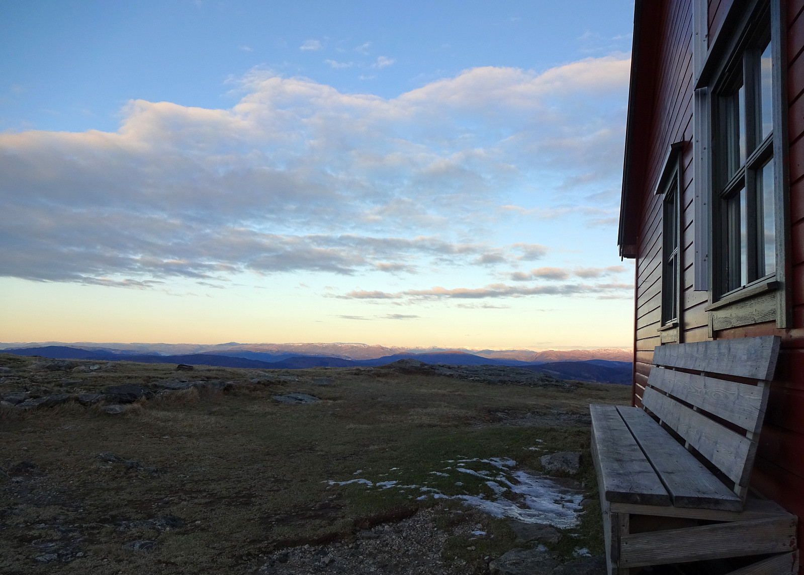
Liatårnet from Fjell Festningen
- Dato:
- 30.12.2020
- Turtype:
- Fottur
- Turlengde:
- 4:00t
- Distanse:
- 10,5km
 Even though it was already a little later on the day (not a great lot of daylight left), we still wished to make a nice hike somewhere in the neighborhood. We then arrived at the following: first, we would ascend to Fjell Festningen (from Søre Fjell), then walk over to Pyttane and Liatårnet, before eventually returning via Fjell Festningen, again. And so we did it. :-) After using road 555 from Bergen towards Sotra (in western direction), we turned left (southwards) on Sotra, arriving in Fjell soon after that. Continuing along road 560 further southwards (from Fjell for about half a kilometer), we soon came to Søre Fjell, where we found a parking place right next to the road. From there, we followed a properly marked trail (in eastern direction), ascending to Fjell Festningen within >>>
Damsgårdsfjellet and Olsokfjellet
- Dato:
- 27.12.2020
- Turtype:
- Fottur
- Turlengde:
- 1:30t
- Distanse:
- 4,6km
 With a prediction of rain, we weren't motivated to more than just a short round. We parked near Betanien along Vestlundveien in Fyllingsdalen and headed northwards through Nordnæsdalen. The original idea was to find the little trail -- is there a trail? -- which should lead up to the southern "top" of Holefjellet in the west of Damsgårdsfjellet. Soon, however, we had walked too far, getting very close to the saddle between Damsgårdsfjellet and Holefjellet. Instead of walking back (in the rain), we decided to drop Holefjellet for this time and instead start our walk back (via Damsgårdsfjellet and Olsokfjellet). The ascent to Damsgårdsfjellet was straight-forward (no ice, this time!) and then crossing over to Olsokfjellet, walking around Tverrdalen, was similarly easy (the >>>
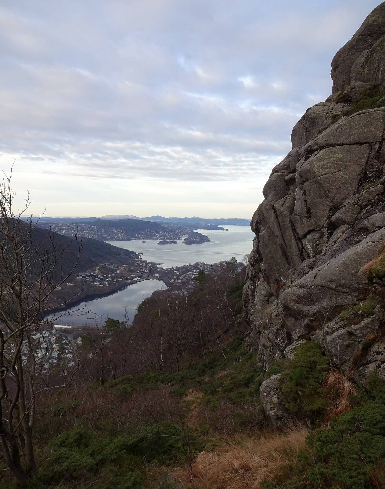
Kanadaskogen with Hesjaholten
- Dato:
- 25.12.2020
- Turtype:
- Fjelltur
- Turlengde:
- 3:00t
- Distanse:
- 8,8km
 With a somewhat average weather forecast on tap, we decided to "just" do a simple walk/hike in Kanadaskogen. Starting from Varden, we first headed for the eastside of Gjeddevatnet, near the fotball fields and Framohallen. After rounding Gjerdsvika, we ascended a little (in northwards direction) in order to get over to (the eastside of) Bjørndalsvatnet, which we then walked along until its northern most end. Continuing in northwards direction, we then walked up to Svartatjørna. On the other, northern side of it, while walking along Storamyra then, we enjoyed to look up to Tobrik, high up over the east of Storamyra. Walking out this little valley, we ended up at the gravel road that leads up to the dam of Tennebekktjørna. About halv way up this road, we then decided to split >>>
Skåldalsfjellet via Hjelterinden
- Dato:
- 24.12.2020
- Turtype:
- Fottur
- Turlengde:
- 3:00t
- Distanse:
- 7,8km
 The weather forecast promised some blue skies over Bergen! :-) So the goal was to welcome the sun somewhere in the (not too deep) snow. After a bit of discussing different options, we landed on a hike up to Skåldalsfjellet (not at the least because of its chances to catch some sun). Since we've developed a taste for stepping up relatively steep mountain sides, recently, we chose an ascent via Hjelterinden, in the (steep) south of Skåldalsfjellet. Leaving the Bergen valley from Nesttun via Helldal and along Grimevatnet, we drove to Haukeland, first, before there leaving road #587 and then following the narrow road to Unneland. From there, we then drove up Gullfjellsvegen until we came to the saddle that leads into the valley with Skåldalselva. We parked (right at the saddle) and continued >>>
Ranen, Midtfjellet, Grønetua, Vardegga, and Ulskebjørnen
- Dato:
- 12.12.2020
- Turtype:
- Fottur
- Turlengde:
- 5:00t
- Distanse:
- 10,8km
 We thought about doing a hike from Jordalen, in the north of Bergen, including Ulskebjørnen (and Vardegga). To give this hike at least something special, we also wished to include Ranen, a somewhat sidelined hill between Rundemanen and Vardegga, right next to Jordalsskaret (in the west of it). While Ranen is no more than just a few gentle steps in northern direction, when coming from the main trail that connects Rundemanen and Vardegga, it really is very steep on its northern side, facing Jordalen. In fact, it gets more and more steep, the furthre north one gets, crossing over Ranshaugane there, and between 200mosl and 400mosl the northern side of Ranen is mostly cliffs that looks impossible (or, at least, very difficult) to cross. After first driving into Jordalen from the north and parking >>>
Nygårdsnipa and Gravdalsfjellet from Laksevåg
- Dato:
- 05.12.2020
- Turtype:
- Fottur
- Turlengde:
- 2:00t
- Distanse:
- 4,0km
 It was time for some new exploration in the city mountains of Bergen! :-) So we chose to ascend to Nygårdsnipa (and Gravdalsfjellet) from Laksevåg. We thus drove around and parked very near to where Damsgårdstunnelen ends on the western side (at Eliasmarken). Within a few steps, we started walking up (the quite steep) Nygårdslien. At the very upper end of Nygårdslien, one can conventiently enter the forest by stepping a little bit to the left at about 70mosl. But instead of following the trail, that extends from there up to the saddle between Holefjellet and Gravdalsfjellet, we crossed over (in southwestern direction) right above the highest houses at Nygårdslien. This first brought us to a little ridge (high above Lyngbøveien). From there, we first followed this ridge upwards >>>
