Arkiv - dato
Arkiv - aktivitet
-
Annen tur (1)
- Kajakkpadling (1)
-
Annen vintertur (3)
- Trugetur (3)
- Fottur (615)
-
Skitur (3)
- Fjellskitur (3)
-
Sykkeltur (94)
- Blandet sykling (22)
- Gatesykling (2)
Arkiv - Etter geografi
"Peakbookvenner"


Lister jeg samler etter
-
Bergen ≥ 50m pf. og ≥ 100 m.o.h.
(81/89)
 91%
91% -
Opptur Bergen
(98/113)
86%
-
De syv fjell rundt Bergen
(6/7)
85%
-
Most dominating tops of the Bergen peninsula
(63/75)
84%
-
Utvalgte topper og turmål i Bergen
(244/306)
79%
-
Sund ≥ 50m pf.
(14/18)
77%
-
Alle topper i Bergen
(272/350)
77%
-
Os ≥ 50m pf.
(23/34)
67%
-
Hytter og objekter i Byfjellene
(66/101)
65%
-
Midthordland PF>= 100m
(73/115)
63%

Haggardsrinden and Kolhusfjellet
- Dato:
- 19.04.2015
- Turtype:
- Fjelltur
- Turlengde:
- 2:30t
- Distanse:
- 7,5km
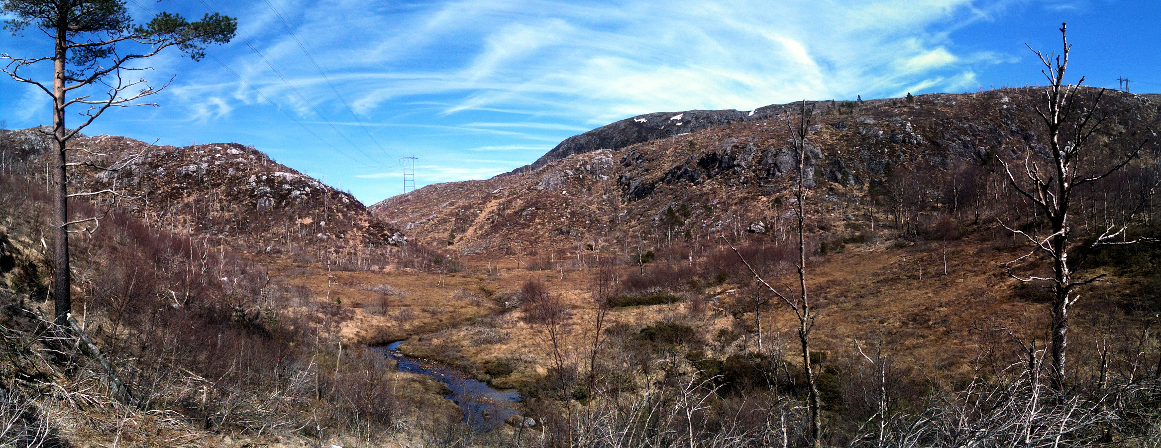 Starting from the parking place near Myrdalsvatnet, we first followed the path around the lake. Soon, we followed the path upwards that also is known as Kubakkane. Shortly before reaching the top, where one would get over to Totland, again, we turned right and fought a short bush war up to Haggardsrinden. From the top, one has a very nice view in all directions! Then, we descended basically towards the same path (Kubakkane), which we only crossed to continued northwards towards Kolhusfjellet. Also up to Kolhusfjellet, we did not really find a good path and so we ascended through the forest. Also from this top, one has very nice views, mostly towards west, via Nordåsvatnet, towards Sotra. We then crossed Kolhusfjellet and descended to Furedalen. Once down in the valley, we turned back >>>
Tennebekksnipa
- Dato:
- 12.04.2015
- Turtype:
- Spasertur
- Turlengde:
- 1:00t
- Distanse:
- 3,3km
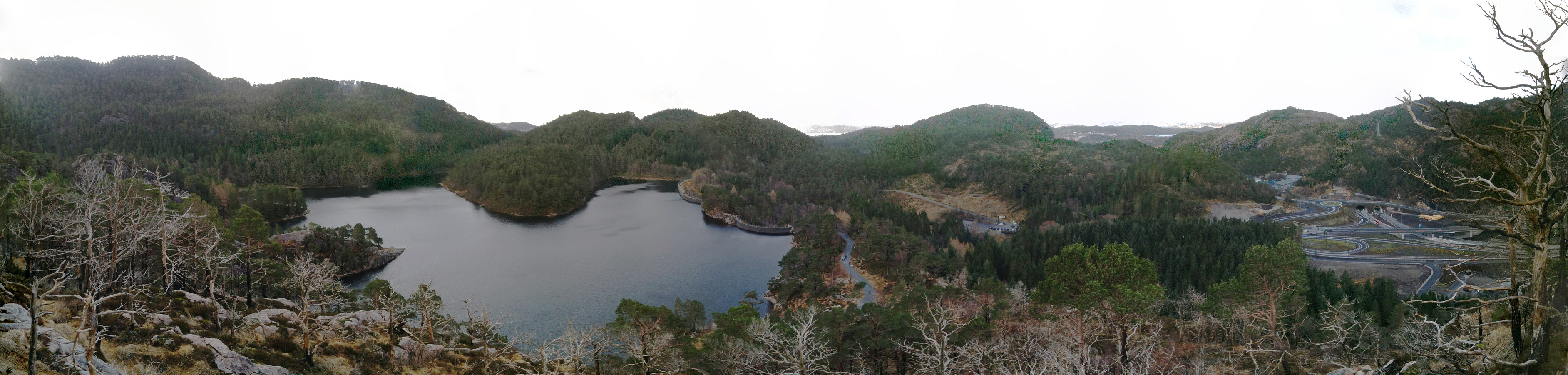 Starting from Lyngbø, we first walked up the street through Lyngbødalen, up to the dam of Skitnetjørna. From there, we followed the ridge, before we crossed over and ascended to Tennebekksnipa from north. We enjoyed nice views of Lyderhorn and Tennebekktjørna. We descended to Tennebekktjørna, before we returned, following the path through Trongedalane. Before going down, again, on this path, we turned right and up the ridge, again, from which we descended to see Skitnetjørna (which we followed on its western side, back to the dam). All in all, a "small is beautiful" tour! :-)
Selected photos are available as Google photo album .
Starting from Lyngbø, we first walked up the street through Lyngbødalen, up to the dam of Skitnetjørna. From there, we followed the ridge, before we crossed over and ascended to Tennebekksnipa from north. We enjoyed nice views of Lyderhorn and Tennebekktjørna. We descended to Tennebekktjørna, before we returned, following the path through Trongedalane. Before going down, again, on this path, we turned right and up the ridge, again, from which we descended to see Skitnetjørna (which we followed on its western side, back to the dam). All in all, a "small is beautiful" tour! :-)
Selected photos are available as Google photo album .
Skjenestølen
- Dato:
- 05.04.2015
- Turtype:
- Spasertur
- Turlengde:
- 1:00t
- Distanse:
- 2,2km
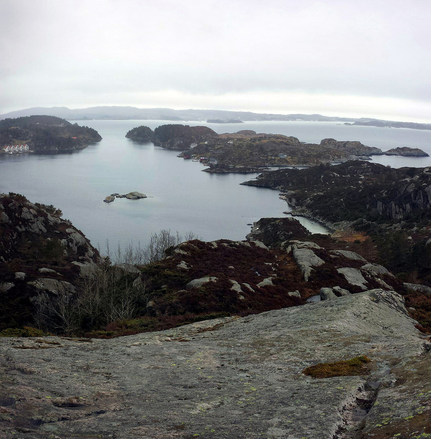 Starting from the last bus stop on Drønen, we walked along the island until we reached Skjenestølen, the highest spot on Drønen -- a short walk, but nice to get out and have some fresh air! :-)
Sendedalen (Vikafjellet)
- Dato:
- 03.04.2015
- Turtype:
- Fjellskitur
- Turlengde:
- 5:00t
- Distanse:
- 14,0km
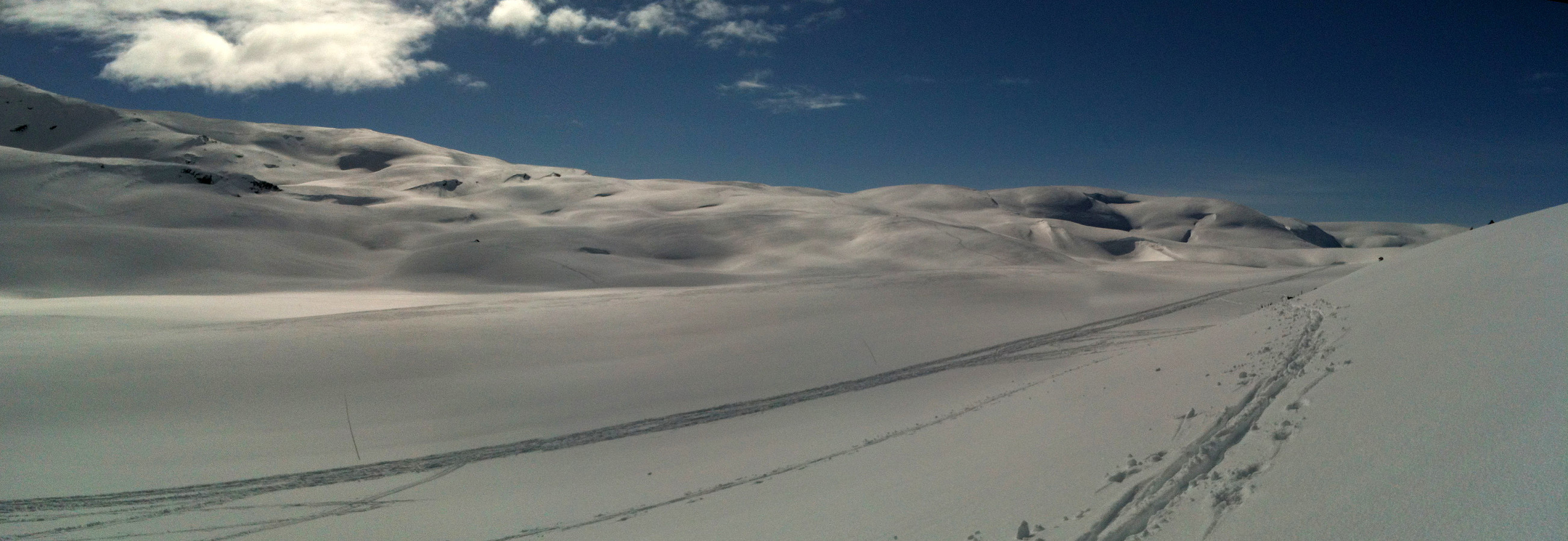 Starting from the road over Vikafjellet (#13), we skied into Sendedalen (and over to Grøndalen) and then back again. What a fantastic winter day?!!! A really great Easter skiing tour! :-)
Selected photos are available as Google photo album .
Starting from the road over Vikafjellet (#13), we skied into Sendedalen (and over to Grøndalen) and then back again. What a fantastic winter day?!!! A really great Easter skiing tour! :-)
Selected photos are available as Google photo album .
