Arkiv - dato
Arkiv - aktivitet
-
Annen tur (1)
- Kajakkpadling (1)
-
Annen vintertur (3)
- Trugetur (3)
- Fottur (615)
-
Skitur (3)
- Fjellskitur (3)
-
Sykkeltur (94)
- Blandet sykling (22)
- Gatesykling (2)
Arkiv - Etter geografi
"Peakbookvenner"


Lister jeg samler etter
-
Bergen ≥ 50m pf. og ≥ 100 m.o.h.
(81/89)
 91%
91% -
Opptur Bergen
(98/113)
86%
-
De syv fjell rundt Bergen
(6/7)
85%
-
Most dominating tops of the Bergen peninsula
(63/75)
84%
-
Utvalgte topper og turmål i Bergen
(244/306)
79%
-
Sund ≥ 50m pf.
(14/18)
77%
-
Alle topper i Bergen
(272/350)
77%
-
Os ≥ 50m pf.
(23/34)
67%
-
Hytter og objekter i Byfjellene
(66/101)
65%
-
Midthordland PF>= 100m
(73/115)
63%

Knappen
- Dato:
- 02.06.2024
- Turtype:
- Fjelltur
- Turlengde:
- 0:45t
- Distanse:
- 4,8km
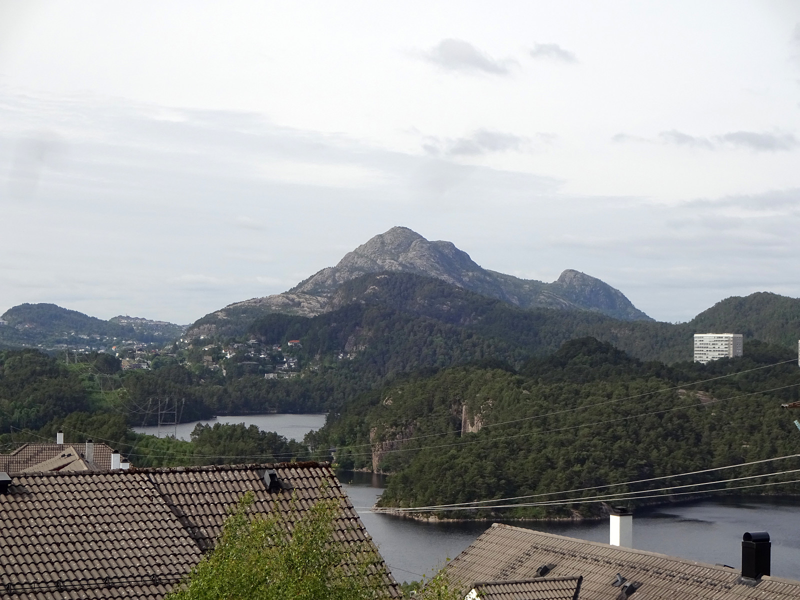 To get some fresh air, we decided to do a quick round over Knappen, approaching it via Sandeidbrotet (up to Eldtona, first). After crossing over to Såta on Knappen, we then descended furthre southwards (via Hesthaugen). Before stepping out on Knappenveien, we saw some (new?) signs near the sports area, suggesting a trail through the forest to Knappentunet. Following this trail, we first made quick progress into the right direction. After a while, however, the trail seemed to cross over some wet area at Hesthaugen, becoming less visible (or not at all, actually). Following our basic sense of orientation, we crossed through the forest into the right direction, connecting to Knappenveien at Knappentunet in the south of Knappatjørna. From there, it was then straight-forward (mostly) to >>>
Exploring some hills near Vadmyra
- Dato:
- 01.06.2024
- Turtype:
- Blandet sykling
- Turlengde:
- 3:00t
- Distanse:
- 30,4km
 After a relatively calm day, there were still a couple of hours to spend outside. The plan was to explore the area around Vadmyra between Storavatnet in the west and Loddefjord in the east. I took the bike along Bjørgeveien and then via Bjørndalsbrotet across Hetlevikstraumen to leave it at Haakonsvernveien, south of Hetlevikåsen. I found a trail that leads up into the direction of Vadmyrahallen (right under the power line). Once up and close to Vadmyrahallen, I turned left in order to make it up to Hetlevikåsen (without finding a trail, though). From Hetlevikåsen, I continued further northwards to find a way up to Høyvikåsen. The western flank of Høyvikåsen is a steep cliff and I first got a bit too far down. A bit of back-tracking, however, brought me back up and further north >>>
Morning walk in Odense
- Dato:
- 30.05.2024
- Turtype:
- Spasertur
- Turlengde:
- 1:30t
- Distanse:
- 9,1km
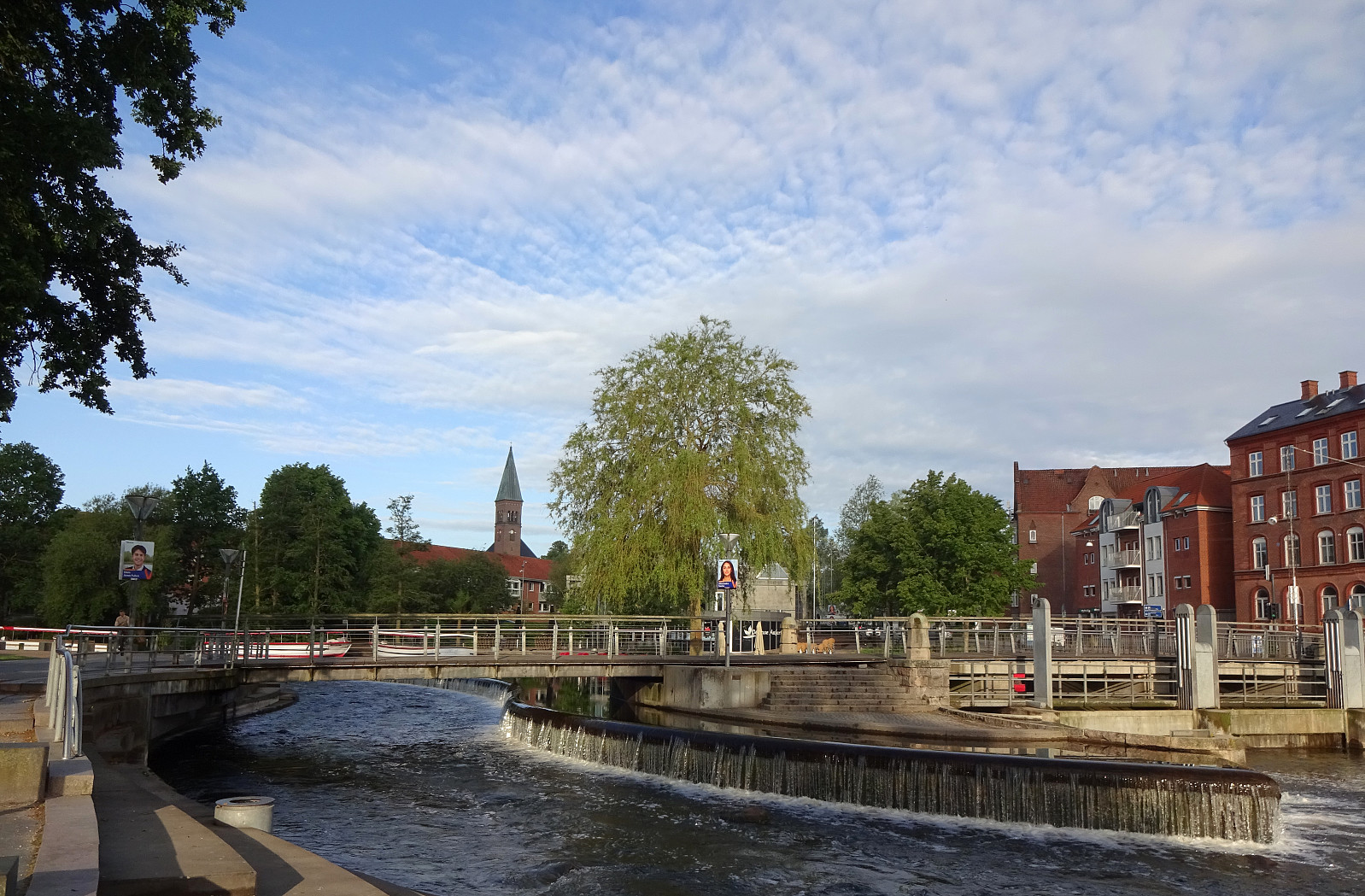 I was up early and had time to walk from downtown Odense to the University ( SDU , i.e., Syddansk Universitet). Starting from the main railway station, I first headed to Kongens Have, where I passed by Odense Slot. I then turned left to pass by H.C. Andersens Hus, before thereafter heading down to Odense Å at Brogade. From there, I basically followed the course of Odense Å upstream, passing through Eventyrhaven and then Munke Mose. Following Odense Å further upstream, I headed towards the Zoo of Odense. When I came to Erik Bøghs Sti, I followed it up to Langelinie. This street then brought me to Læssøgade, which I crossed to continue along Kaalundsvej. Via Skovgyden, I got to Hjallesevej, which I walked southwards only a short stretch to get into Bjørnemosevej. Walking then more or >>>
Burlifjellet and Skorafjellet
- Dato:
- 19.05.2024
- Turtype:
- Fottur
- Turlengde:
- 5:00t
- Distanse:
- 11,1km
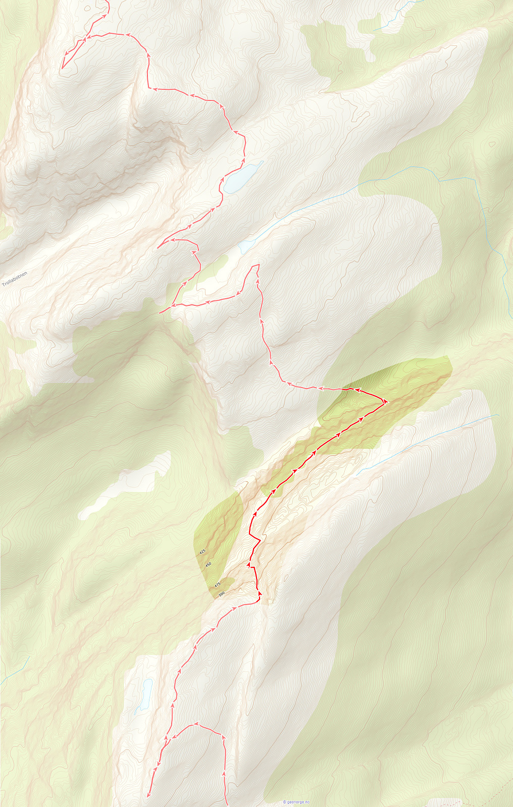
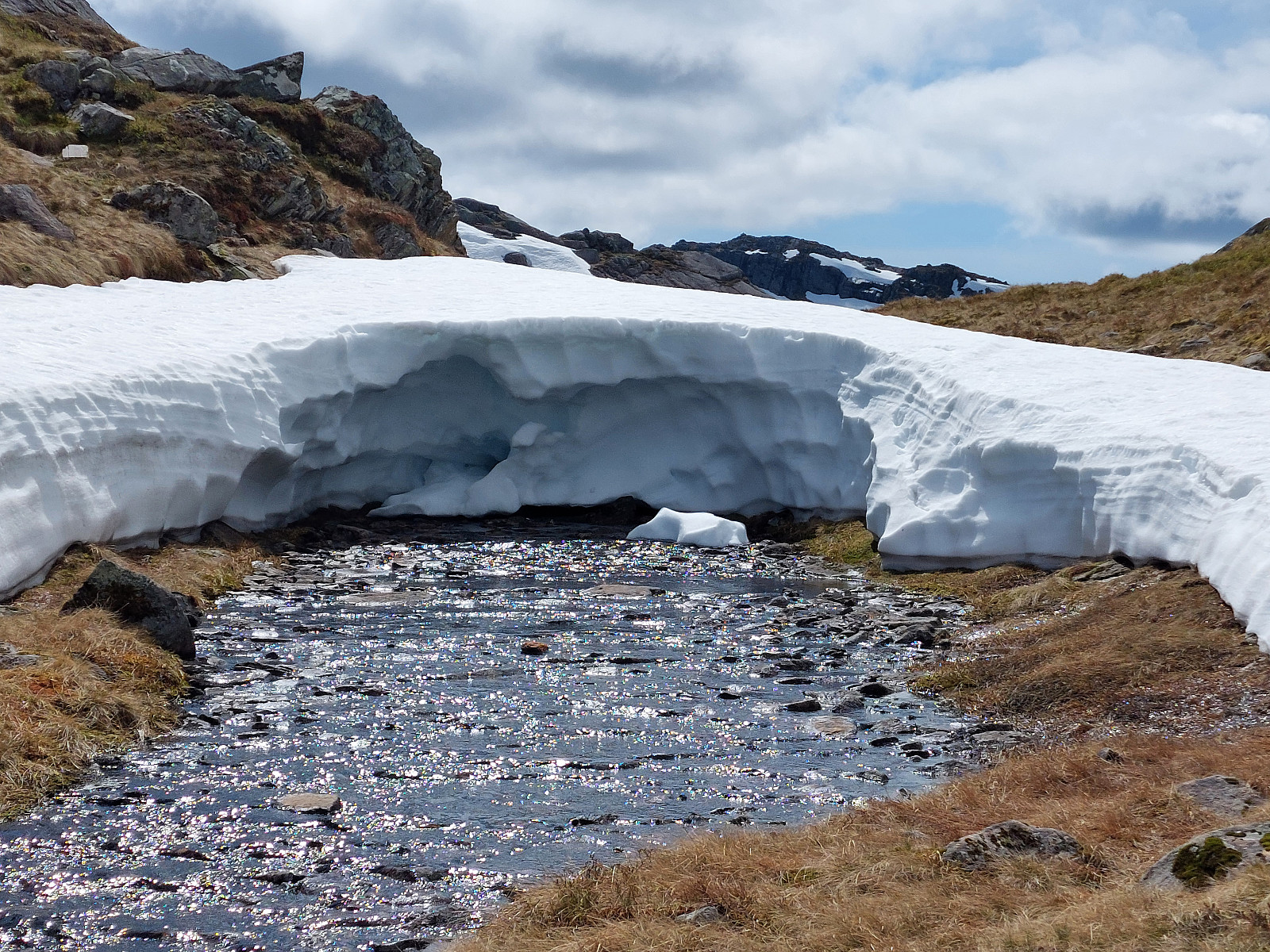 Driving north from Fusa, into the direction of Samnanger, we passed through Eikelandsosen, first, continuing further northwards along road 48. At Sævell, right after passing by Sævellavatnet, we turned right onto Sævellvegen. Near Høgehaugen, we paid a bit of road-toll in order to continue along Sævellvegen. Driving carefully (Sævellvegen is not paved further inwards), we arrived at Kjøpmannavadet shortly after. There, right next to the bridge, we parked at the side of the road. Crossing over the bridge southwards, we started our hike along a forest road that leads to Breivatnet just a little down the road. There, one crosses over Breielva right next to a small cabin right at Breivatnet. A marked trail then leads up to Helane and from there further towards the lower end of Lisetredalen. >>>
Kletten from Strandvik
- Dato:
- 18.05.2024
- Turtype:
- Spasertur
- Turlengde:
- 0:30t
- Distanse:
- 2,2km
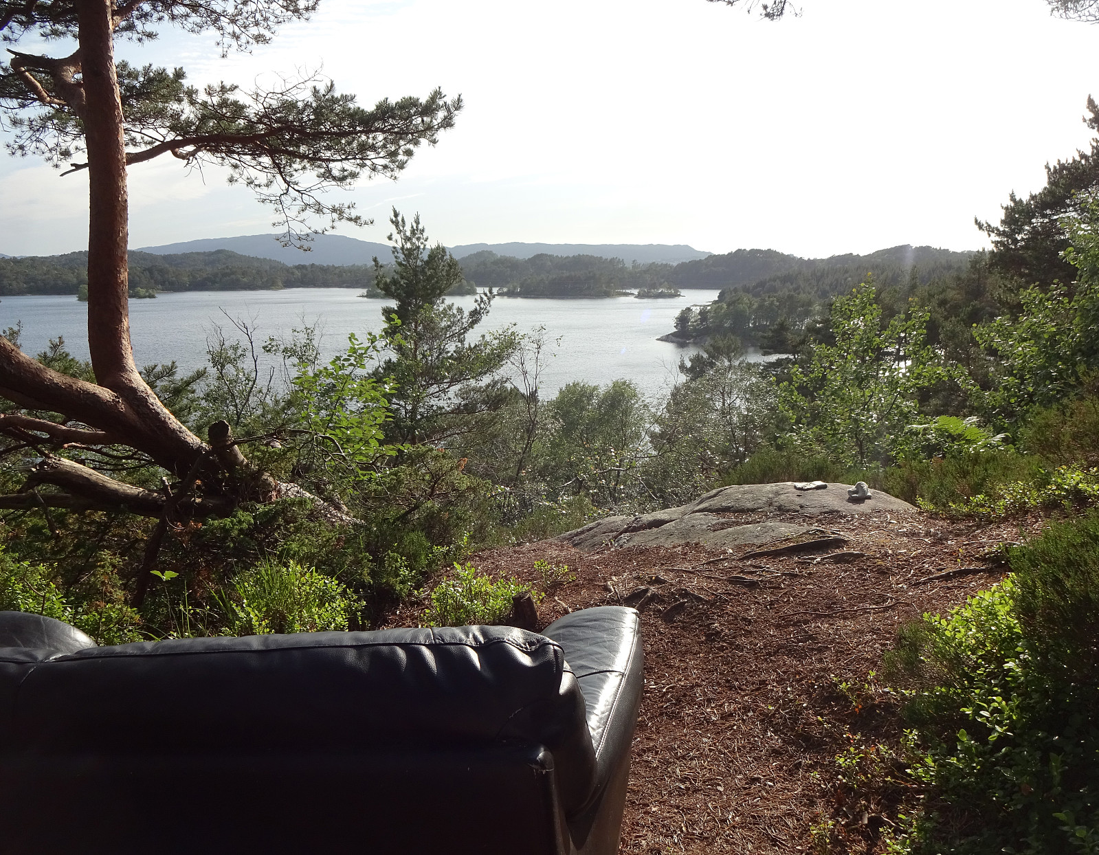
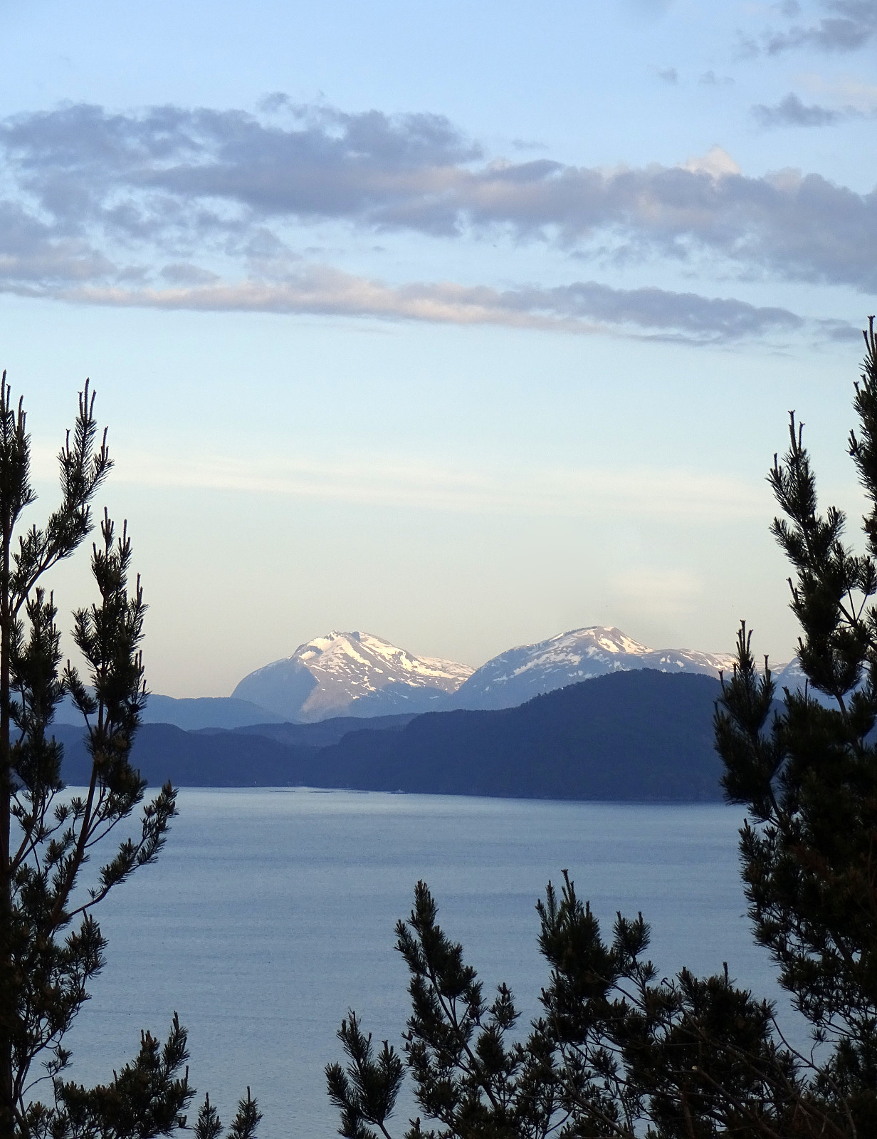 The evening was nice and with plenty of daylight still to use it was just fine with a short round up to Kletten before calling it a day. :-) The plan was to approach Kletten from the east (from Strandvik) and doing so was (almost) straight-forward. Only once, at the very end of Strandvikvegen at house 529, a bit of back-tracking was needed to reconnect with the trail (that is starting a bit further north). Then, instead of going up to Kletten at once, I first surrounded Kletten via Klettaltanen in its south, before eventually ascending to Kletten (then from its west). After crossing over Kletten, I then descended northwards to Strandvikvegen, which I then followed back to Strandvik. Quite nice that one can see Melderskin and Englafjellet from Kletten! :-)
Selected photos are available >>>
The evening was nice and with plenty of daylight still to use it was just fine with a short round up to Kletten before calling it a day. :-) The plan was to approach Kletten from the east (from Strandvik) and doing so was (almost) straight-forward. Only once, at the very end of Strandvikvegen at house 529, a bit of back-tracking was needed to reconnect with the trail (that is starting a bit further north). Then, instead of going up to Kletten at once, I first surrounded Kletten via Klettaltanen in its south, before eventually ascending to Kletten (then from its west). After crossing over Kletten, I then descended northwards to Strandvikvegen, which I then followed back to Strandvik. Quite nice that one can see Melderskin and Englafjellet from Kletten! :-)
Selected photos are available >>>
Fusafjellet from Strandvik
- Dato:
- 18.05.2024
- Turtype:
- Fottur
- Turlengde:
- 6:00t
- Distanse:
- 16,5km
 Given a very nice (and warm!) day, we aimed at hiking Fusafjellet from the south, starting in Strandvik. We first headed into the valley between Fusafjellet in the northeast and Bogafjellet in the west, where Vikaelva comes down. At about 80 masl, in the northeast of Nyland, the valley opens up a little and we left the main gravel road, stepping "directly north", aiming at the little saddle in the east of the small hill that "sits" there in the middle of the valley. The plan was to continue further upwards (into the direction of Langnuen) from there, but before we did that we first explored this little hills for a few minutes, enjoying some nice views southwards from it. We then followed a forest road that ascends the relatively steep southwestern side of Langnuen. >>>
Bergen city walk on May 17
- Dato:
- 17.05.2024
- Turtype:
- Spasertur
- Turlengde:
- 1:00t
- Distanse:
- 4,2km
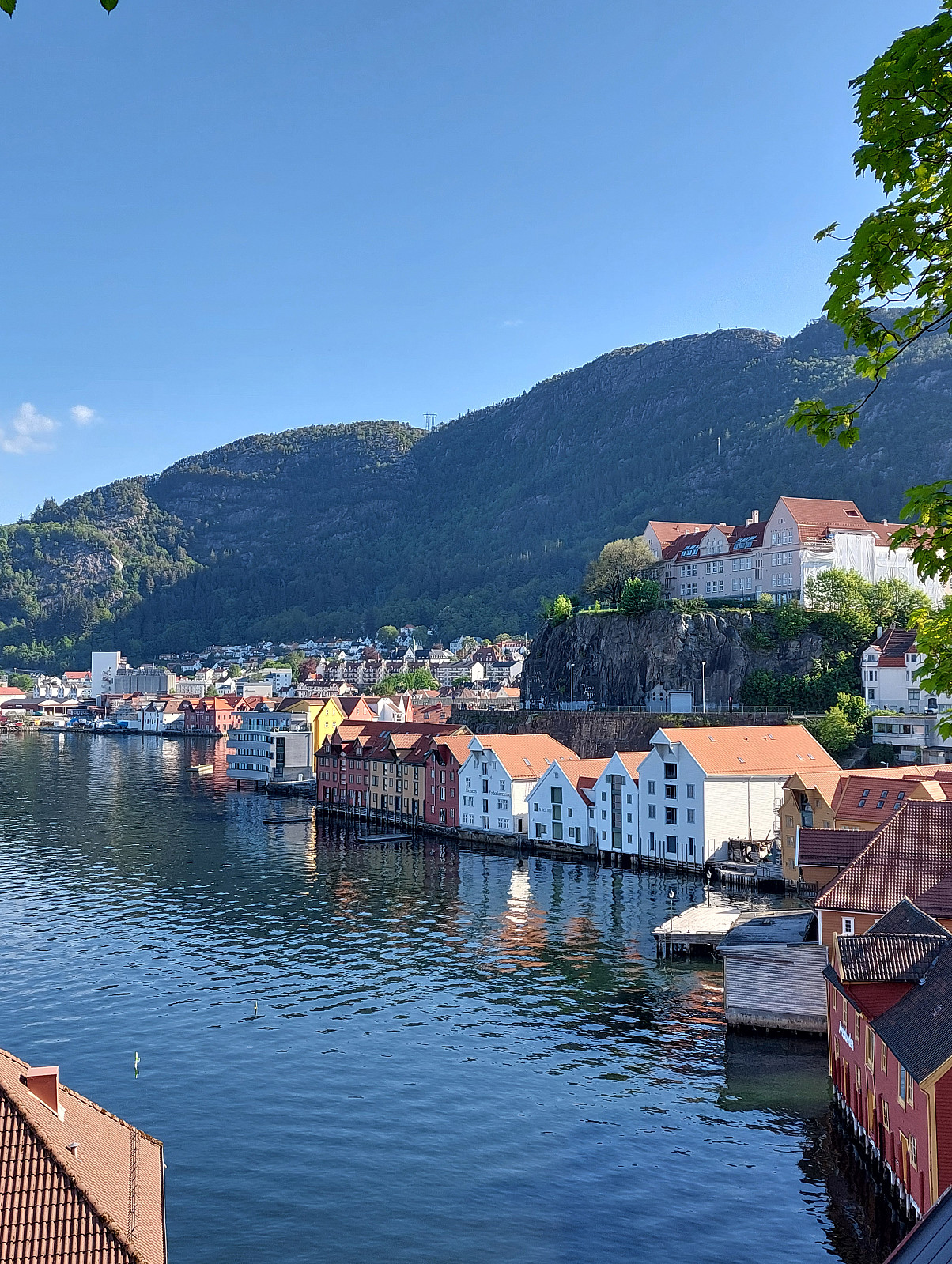 We were out early to see the early parts of the May 17 celebrations in Bergen. After enjoying the atmosphere and a nice coffee break in beautiful spring weather near Smålungeren, we walked towards Sandviken (via Torget, first, then along Bryggen to Bergenhus, before continuing along some streets further northwards).
Selected photos are available as Google photo album .
See also the related FB-page Hiking around Bergen, Norway .
We were out early to see the early parts of the May 17 celebrations in Bergen. After enjoying the atmosphere and a nice coffee break in beautiful spring weather near Smålungeren, we walked towards Sandviken (via Torget, first, then along Bryggen to Bergenhus, before continuing along some streets further northwards).
Selected photos are available as Google photo album .
See also the related FB-page Hiking around Bergen, Norway .
From Stovegolvet to Sagvåg on Stord
- Dato:
- 11.05.2024
- Turtype:
- Fottur
- Turlengde:
- 5:00t
- Distanse:
- 13,2km
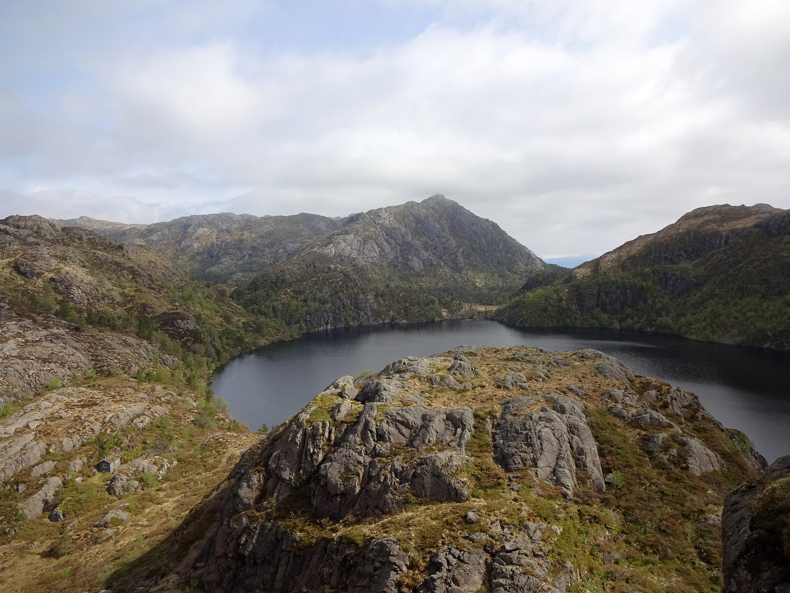 As part 2 of a two-days hike across Stord, we started from Stovegolvet, where we had stayed over night. We first descended (steeply) towards Tysevatnet, following a nice trail down from Stovegolvet. Instead of walking around Eldhushøgda, as prepared for by the trails, we crossed over this little hill, enjoying some nice views from above. Even though a bit steep on its southwestern side, descending back down to the trail was still no issue. We then followed the trail, which leads (also across the one or other dam) along Tysevatnet in its south, to get to the other side and, eventually, further southwards to Ravatnet, crossing over a little saddle in the west of Ramnaskolten. After walking between Ravasslia (in the northwest) and Ravatnet (in the southeast), we arrived at another small saddle >>>
From Vistvik to Stovegolvet on Stord
- Dato:
- 10.05.2024
- Turtype:
- Fottur
- Turlengde:
- 7:00t
- Distanse:
- 16,5km
 As part 1 of a two-days hike across Stord, we first took an early bus from Bergen southwards. The bus dropped us off near Vistvik (Vestvik?) quite a bit north on Stord. From Grønestølen, we then started our ascent into Hovlandsdalen, where Vistvikelva comes down. At almost 200 masl, we then followed a sign towards Tindane (turning left to get up the northern ridge of Tindane). We then followed the trail further up to Tindane (this trail is not used a lot, as it seems, but still easy to find -- at times, howover, the terrain is quite wet). Near Tindane, we then arrived at Tindaslottet (a small cabin, firmly protected by stones all-around). After a short break (it was not really warm enough for any longer break, and also we could not really enjoy a lot of great views due to low-hanging >>>
From Varden to Melkeplassen via Gravdalsfjellet
- Dato:
- 01.05.2024
- Turtype:
- Fottur
- Turlengde:
- 3:30t
- Distanse:
- 8,2km
 The initial plan was to hike from Varden to Bergen via Gravdalsfjellet. We started northwards from Varden, reaching Langaheia in the east of Stora Krokatjørna soon after. We then "crossed over" the gravel road from Spelhaugen to Tennebekktjørna to continue to Eikelifjellet. North of Eikelifjellet, we then surrounded Nipetjørna in its northwest in order to take the steep way up to Gravdalsfjellet. We then continued along the main trail (into the direction of Damsgårdsfjellet). However, instead of ascending to Holefjellet "as usually", we took a slightly more southern route eastwards. This brought us to the ascent to Olsokfjellet (via its northwestern ridge). From Olsokfjellet, we then used one of the main trails (in northeastern direction) to get down to Melkeplassen. >>>
