Djupedalseggene and Vindeggene from Ostereidet (24.03.2024)

| Startsted | Ostereidet (85moh) |
|---|---|
| Sluttsted | Ostereidet (85moh) |
| Turtype | Fottur |
| Turlengde | 5t 00min |
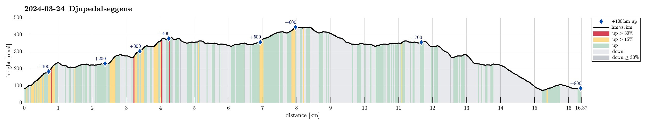
| Distanse | 16,4km |
| Høydemeter | 801m |
| GPS |
|
| Bestigninger | Djupedalseggene (447moh) | 24.03.2024 |
|---|---|---|
| Vindeggene (388moh) | 24.03.2024 | |
| Andre besøkte PBE'er | Høyeste punkt Djupedalseggene (448moh) | 24.03.2024 |
| Storset p-lomme (220moh) | 24.03.2024 |
Trip Summary
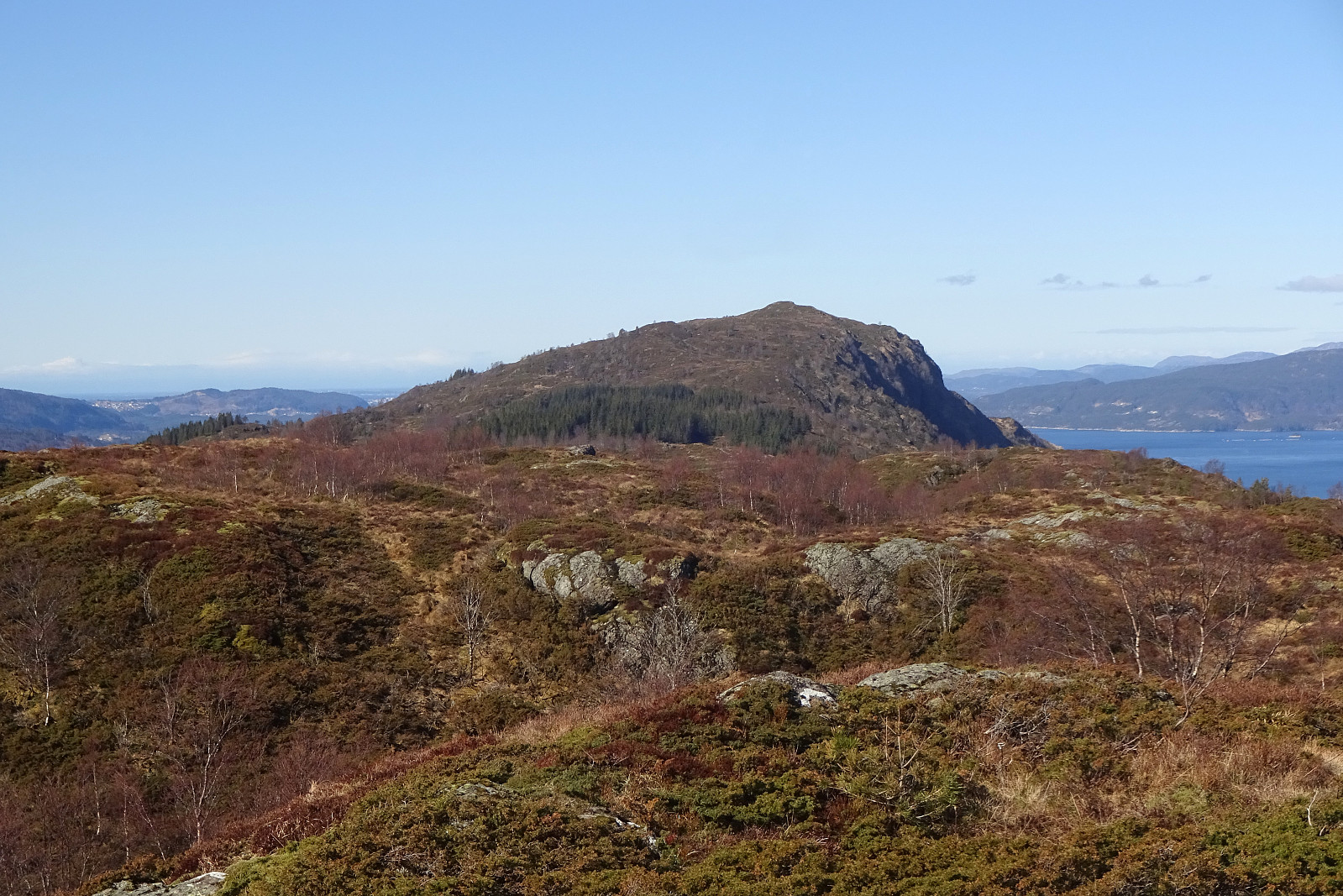
We took the car from Bergen, first following E39 via Knarvik. From Osterfjordvegen, we then took a small road to Ostereidet, where we parked next to the local school. We started our hike up to Hovåsen, following first some forest roads and then a trail along the southeastern ridge of Hovåsen. From there, we then crossed over to the gravel road that leads up to Storset (via Bruarinden). After then walking up this gravel road to the end of the road at Storset, we then followed a marker that directed us to a small ridge in the south of Storsettjørna (and west of Vardhaugen). Crossing over this ridge (in northwestern direction) and stepping over the small stream that comes down from Storsettjørna (in southwestern direction), we ended up on the trail up to Vindeggene (this trail is not always easy to see, but all-in-all it's not problem to find it). This trail leads up via Kallhovdane and towards the west of Vindeggene. To include also Vindeggene, one leaves the "main trail" (which continues further towards Djupedalseggene) and follows a minor trail towards Vindeggene. The one "top" of Vindeggene with the marker on it is a tiny little bit tricky to ascent (we had to get through some vegetation to do so) and its northeastern side is a vertical cliff that one should be aware of. After enjoying the views from Vindeggene, especially also towards the east, we headed back to the "main trail" and along it towards Djupedalseggene. This trail then leads gently (and also quite wet at times) over the ridge in northwestern direction to Djupedalseggene. After enjoying a nice break at Djupedalseggene, we then hiked the main trail back (not including Vindeggene again, of course). From Storset, we then took the gravel road down to Eidavegen, which we then followed to get back to our car. All in all, this hike was (a) a bit longer than what we are used to (but not particularly challenging) and (b) a bit more wet than what we had anticipated. Lots of nice views, however, from the high ridge, made it altogether a very nice experience.
Photos
Selected photos are available as Google photo album.
Useful Resources
See also the related FB-page Hiking around Bergen, Norway.
Petter Bjørstad has a useful page about Djupedalseggene and also web page WestCoastPeaks.com provides useful information about Djupedalseggene and Strandafjellet.
Web page UT.no from the Norwegian Trekking Association recommends a hike up to Djupedalseggene from the northwest.

Kommentarer