Kjerringafjellet from Heggland and Borgafjellet (04.02.2024)

| Startsted | Heggland (65moh) |
|---|---|
| Sluttsted | Hjella (60moh) |
| Turtype | Fottur |
| Turlengde | 4t 00min |
| Distanse | 6,9km |
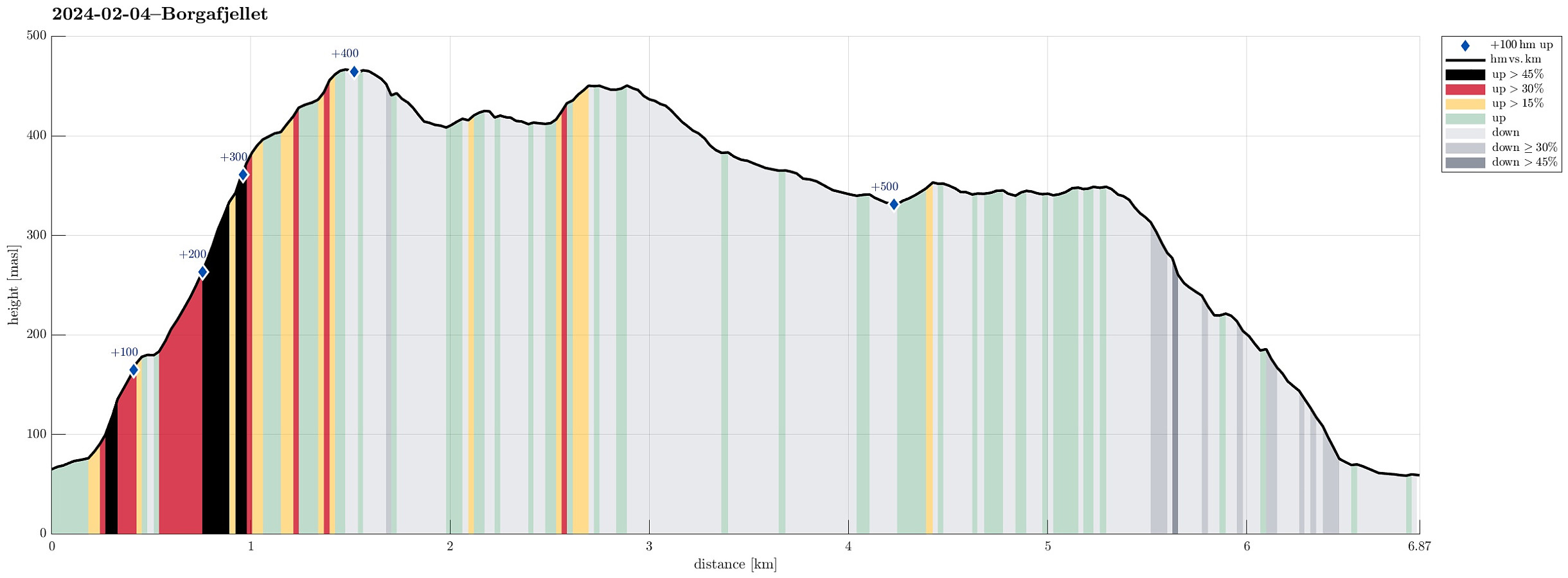
| Høydemeter | 559m |
| GPS |
|
| Bestigninger | Borgafjellet (353moh) | 04.02.2024 |
|---|---|---|
| Andre besøkte PBE'er | Borgafjellet p-lomme (80moh) | 04.02.2024 |
| Borgly (354moh) | 04.02.2024 | |
| Borgabuo (349moh) | 04.02.2024 | |
| Kjerringafjellet (465moh) | 04.02.2024 |
Trip Summary
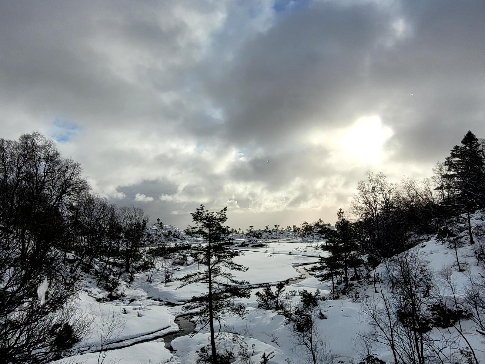
Thinking about snow at higher elevation, we made a plan for a hike that would not lead us so much up, altogether. Still, we aimed at something interesting: Hiking towards (not all the way up to, though) Møsnuken from Heggland. During an earlier hike, a sign was seen that pointed towards Møsnuken at Heggland (near Hegglandsdalsvegen in the northeast of Osøyro). The map shows an approximate trail (leading up to Hegglandstjørna), but no details are to be seen. Exploiting the fact that we came with two cars, we parked one near the planned end of the hike (below Borgafjellet) and then took the other one further along Hegglandsdalsvegen to park near Heggland. Indeed we quickly found the trail-head, again, at Heggland and started the ascent from there. The southeastern side of Møsnuken, there, where also Kvernelva comes down, is very steep (with some cliffs, also). We managed to follow the trail (which isn't much used, as it seems) for quite a stretch. From what the (very approximate) map of the trail looked like, we expected that we would need to turn left at some point to get further up. After all, however, we turned left too early and then ended up in significantly steep terrain. Also, with every step that we took upwards, we encountered more and more snow. While this not really was a big problem, it still contributed to making this ascent a bit more of a challenge than orginally anticipated. Accordingly, it's also advised to make conscious choices regarding a route up this mountain side (and not necessarily following our track "blindly"). After getting over (and above) the most steep terrain, south of Kjerringafjellet, we then reached easier ground (but with quite a bit of snow, at times quite deep snow, also). Still, we managed to make it all the way up to Kjerringafjellet, where we enjoyed some nice views back (south) over Bjørnafjorden! Next, we wished to connect to Borgafjellet, quite a bit further southwest, towards Osøyro. Given the rather deep snow all around us, we thought that maybe connecting towards the main trail, northwest of Midtfellet, which comes up from Tyssdalen in the west, was a promising idea. Stepping down Kjerringafjellet in northwestern direction, however, quickly revealed that this side of this mountain is (also) quite steep in many places. We still made down the little valley, which leads down from Midtfjellet in the northeast to Hegglandstjørna in the southwest. Instead of going back up (to step over the saddle in the west of Midtfjellet), we continued in (mostly) western direction, instead, staying on the slopes in the north of the wet area around Hegglandstjørna. Stepping around "the last hill" before reaching the stream, which flows into Hegglandstjørna, we eventually connected to the main trail (just to find out that it hand't been used, after all the snow had fallen, and thus not really offering any easier progress). We followed the main trail a little into the direction of Tyssdalen, but decided soon that it did not help enough to make a signficiant difference. Instead, we ascended towards the heights of Hegglandsfjellet, hoping the descending over these heights to Gryteskaret would work out well for us. In fact, once we were up on the heights of Hegglandsfjellet, progress became a bit easier (due to winds over the heights not all that much snow had accummulated up there). Once down at Gryteskaret, we connceted to the trail to Borgafjellet. There, a few others had left foot-steps already, helping with making progress towards Borgafjellet. At Borgafjellet, we then made a short break in Borgabuo, before hiking down along the trail to Hjella. While we indeed reached the hiking goal as planned, we still concluded that it was a bit more of a challenge than first thought -- mostly, because of (a) more snow than originally expected and (b) the steep mountain-side in the northwest of Heggland.
Photos
Selected photos are available as Google photo album.
Useful Resources
See also the related FB-page Hiking around Bergen, Norway.
Petter Bjørstad has a useful page about Møsnuken and also web page WestCoastPeaks.com provides useful information about Møsnuken and Tyssdalsfjellet.

Kommentarer