Archive - Date
Archive - Activity
- Bike trip (5)
-
Climbing (13)
- Alpine climbing (7)
- Sport climbing (4)
- Via ferrata (2)
-
Drive (1)
- Car drive (1)
-
Other trip (2)
- Expedition (2)
-
Ski trip (324)
- Backcountry skiing (108)
- Randonnée/Telemark (214)
-
Trip by foot (685)
- Alpine trip (5)
- Glacier travel (1)
- Hike (30)
- Hillwalk (630)
- Walk (1)
Peakbook-Friends


Collected lists
-
Norge fastland ≥ 1000m pf.
(81/84)
 96%
96% -
Møre og Romsdal ≥ 500m pf.
(149/161)
92%
-
Vanylven ≥ 100m pf.
(36/40)
90%
-
Sør-Norge ≥ 500m pf
(363/404)
89%
-
Kommunetopper (fylkestopper) år 2000
(331/410)
80%


Favourite trips
Favourite peaks


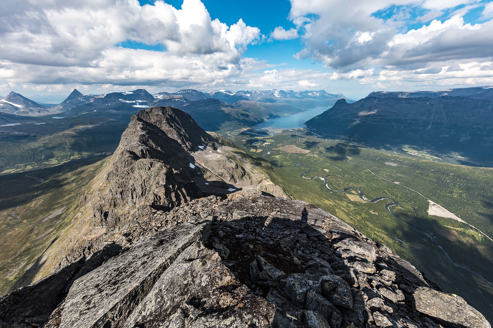
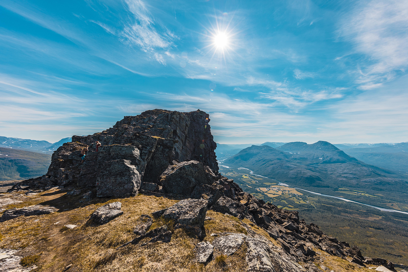
Otertinden - en skikkelig råtass..
- Date:
- 31.07.2018
- Characteristic:
- Hillwalk
- Duration:
- 6:17h
- Distance:
- 15.1km
 Turrapport kan leses hos otto (Otto Lund)
Dronefilm kan ses her:
https://www.youtube.com/watch?v=wDZpWT-FfqI&feature=youtu.be
Turrapport kan leses hos otto (Otto Lund)
Dronefilm kan ses her:
https://www.youtube.com/watch?v=wDZpWT-FfqI&feature=youtu.be
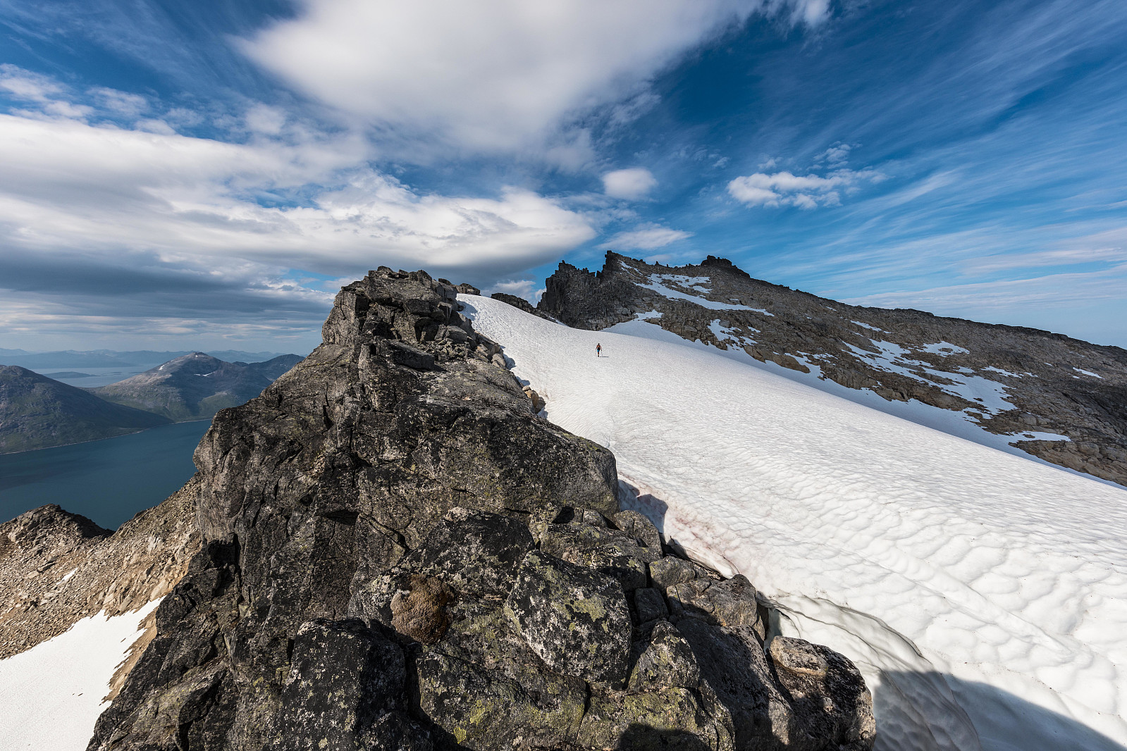
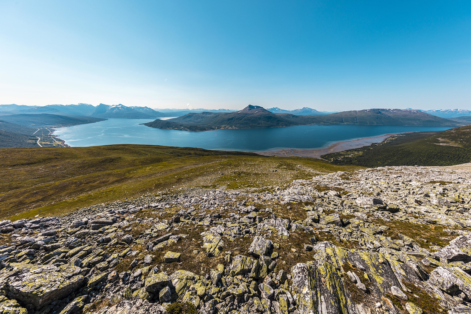
Herlig øytopp - Hollendaren
- Date:
- 30.07.2018
- Characteristic:
- Hillwalk
- Duration:
- 4:17h
- Distance:
- 10.7km
 Turrapport kan leses hos otto (Otto Lund)
Dronefilm kan ses her :
https://www.youtube.com/watch?v=TZrv986AGbE
Turrapport kan leses hos otto (Otto Lund)
Dronefilm kan ses her :
https://www.youtube.com/watch?v=TZrv986AGbE
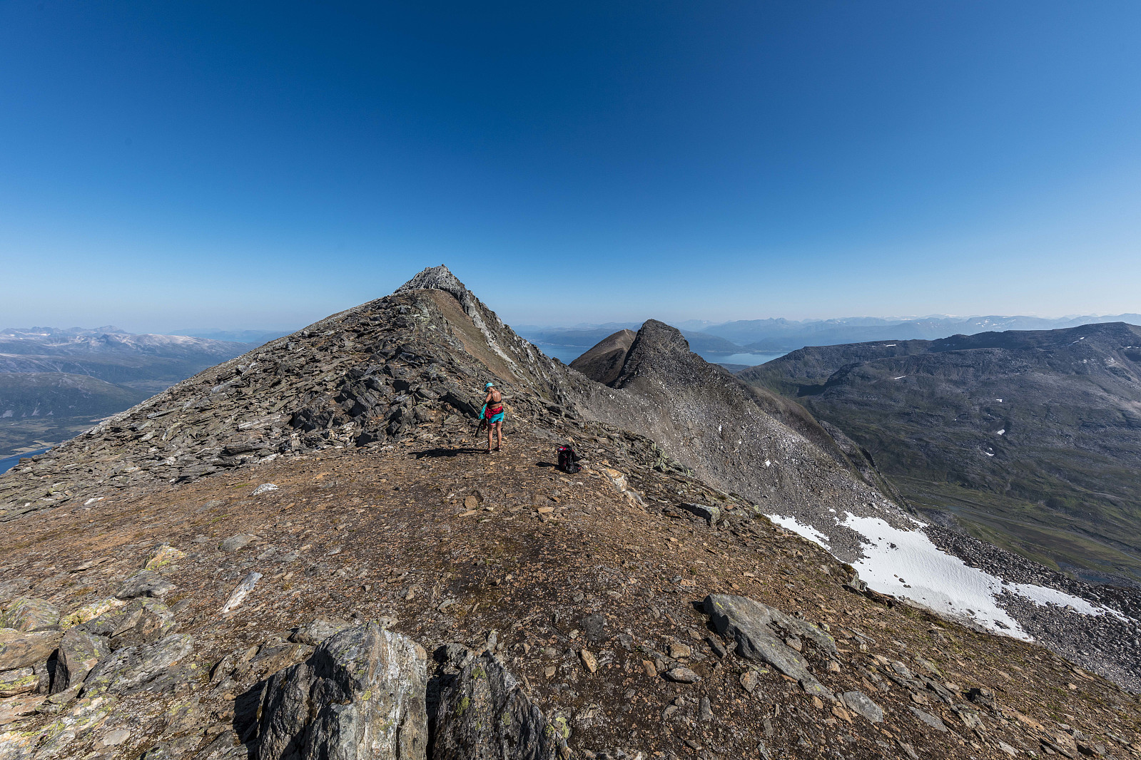
Store Bentsjordtinden
- Date:
- 29.07.2018
- Characteristic:
- Hillwalk
- Duration:
- 4:09h
- Distance:
- 9.2km
 Turrapport kan leses hos otto (Otto Lund)
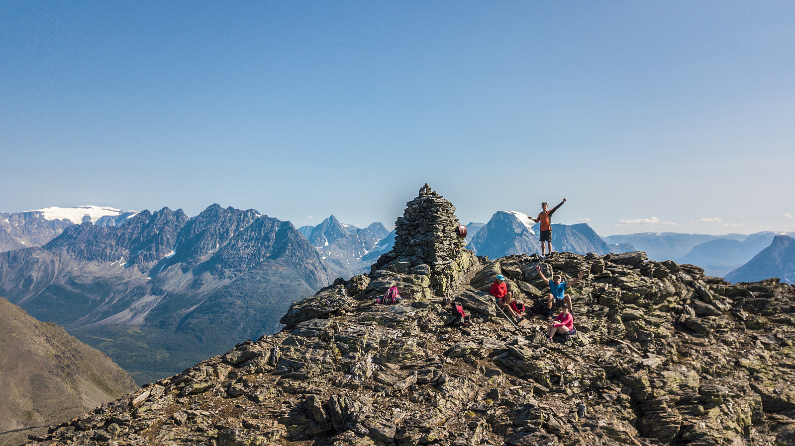
Rasmustinden
- Date:
- 28.07.2018
- Duration:
- 5:00h
- Distance:
- 13.2km
 Turrapport kan leses hos otto (Otto Lund)
Drone film ses her:
https://www.youtube.com/watch?v=zWD1pTqXpBo
Turrapport kan leses hos otto (Otto Lund)
Drone film ses her:
https://www.youtube.com/watch?v=zWD1pTqXpBo
Lavangstinden
- Date:
- 27.07.2018
- Characteristic:
- Hillwalk
- Duration:
- 4:00h
- Distance:
- 10.8km
 Turrapport kan lese hos otto (Otto Lund)
Dronesnutt kan ses her:
https://www.youtube.com/watch?v=BI3SayZ5Zms&feature=youtu.be
Turrapport kan lese hos otto (Otto Lund)
Dronesnutt kan ses her:
https://www.youtube.com/watch?v=BI3SayZ5Zms&feature=youtu.be
Midnattsol tur til Segla
- Date:
- 24.07.2018
- Characteristic:
- Hike
- Duration:
- 3:00h
- Distance:
- 5.1km
 Fantastisk tur og utsikt til Segla. Mamma og Skippy (Innika De Rosa) var med på turen.
Drone snutt:
https://www.youtube.com/watch?v=JP48beKKVYA
Fantastisk tur og utsikt til Segla. Mamma og Skippy (Innika De Rosa) var med på turen.
Drone snutt:
https://www.youtube.com/watch?v=JP48beKKVYA
Perstinden
- Date:
- 19.07.2018
- Duration:
- 3:00h
- Distance:
- 10.6km
 Tur rapport kan leses hos otto (Otto Lund)
Jyppyrä
- Date:
- 18.07.2018
- Duration:
- 3:27h
- Distance:
- 10.3km
 Tur rapport kan leses hos otto (Otto Lund)
Drone film fra turen kan ses her:
https://www.youtube.com/watch?v=EwrT_wFkTQg
Tur rapport kan leses hos otto (Otto Lund)
Drone film fra turen kan ses her:
https://www.youtube.com/watch?v=EwrT_wFkTQg
Blåtinden
- Date:
- 17.07.2018
- Characteristic:
- Hillwalk
- Duration:
- 4:05h
- Distance:
- 10.9km
 Turraport kan leses hos otto (Otto Lund)
Dronefilm av toppen:
http://www.youtube.com/watch?v=2bO9t8aHSUo
STED: Balsfjord kommune i Troms
HØYDE: 1180 moh.
PRIMÆRFAKTOR: 330 m
UTGANGSPUNKT: Ørnesveien 35 moh.
LENGDE: 10 km tur-retur
TID: 5 timer
STIGNING: 1160 høydemeter
VANSKELIGHETSGRAD: Tung
GPS-KOORDINATER: 33w 434160 7700234
KARTBLAD: 172 Balsfjorden
Turraport kan leses hos otto (Otto Lund)
Dronefilm av toppen:
http://www.youtube.com/watch?v=2bO9t8aHSUo
STED: Balsfjord kommune i Troms
HØYDE: 1180 moh.
PRIMÆRFAKTOR: 330 m
UTGANGSPUNKT: Ørnesveien 35 moh.
LENGDE: 10 km tur-retur
TID: 5 timer
STIGNING: 1160 høydemeter
VANSKELIGHETSGRAD: Tung
GPS-KOORDINATER: 33w 434160 7700234
KARTBLAD: 172 Balsfjorden
