
Portjengrat traverse (22.08.2014)


Written by hmsv1 (Hannah Vickers)
| Start point | Almageller hut |
|---|---|
| Endpoint | Furggstalden |
| Characteristic | Alpine climbing |
| Duration | 10h 30min |
| Map |
|
| Ascents | Portjengrat (3,654m) | 22.08.2014 |
|---|
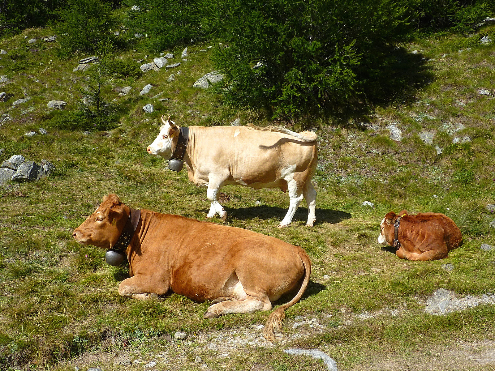
Final day of the climbing week. Objective: Portjengrat. This is a ca. 1km long ridge route at alpine AD/AD+ and according to the guidebook, required in the region of 9 hours to complete from the Almageller hut. Originally Terry had proposed that we have breakfast at 3.30am again to leave by 4am, but since the hut wardens weren’t serving breakfast earlier than 5am, it meant that we would aim to leave by 5.30am. Luxury alpine start?(!). I slept incredibly well, despite sharing a small dormitory with approx. 8 or 9 other guys. This has to be the first time EVER I have stayed in an alpine hut with so many guys who DON’T snore! Unbelievable. In a good way :)
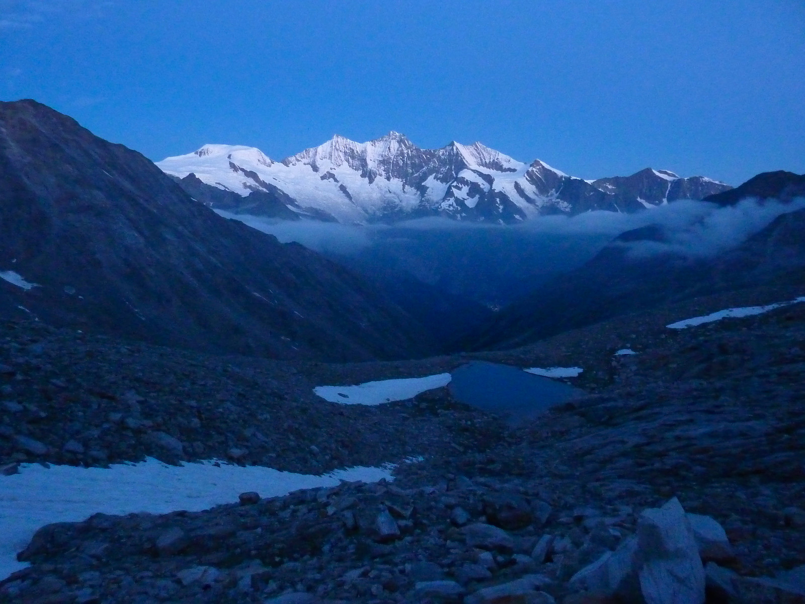
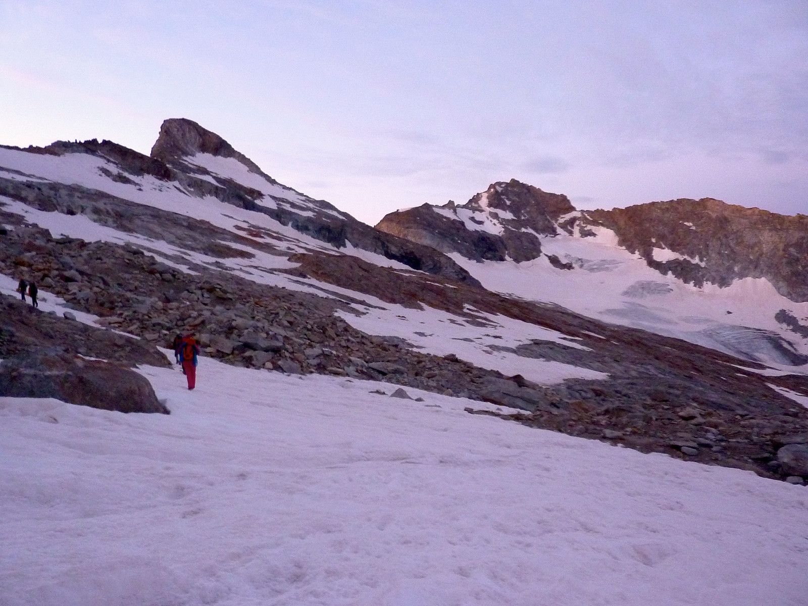
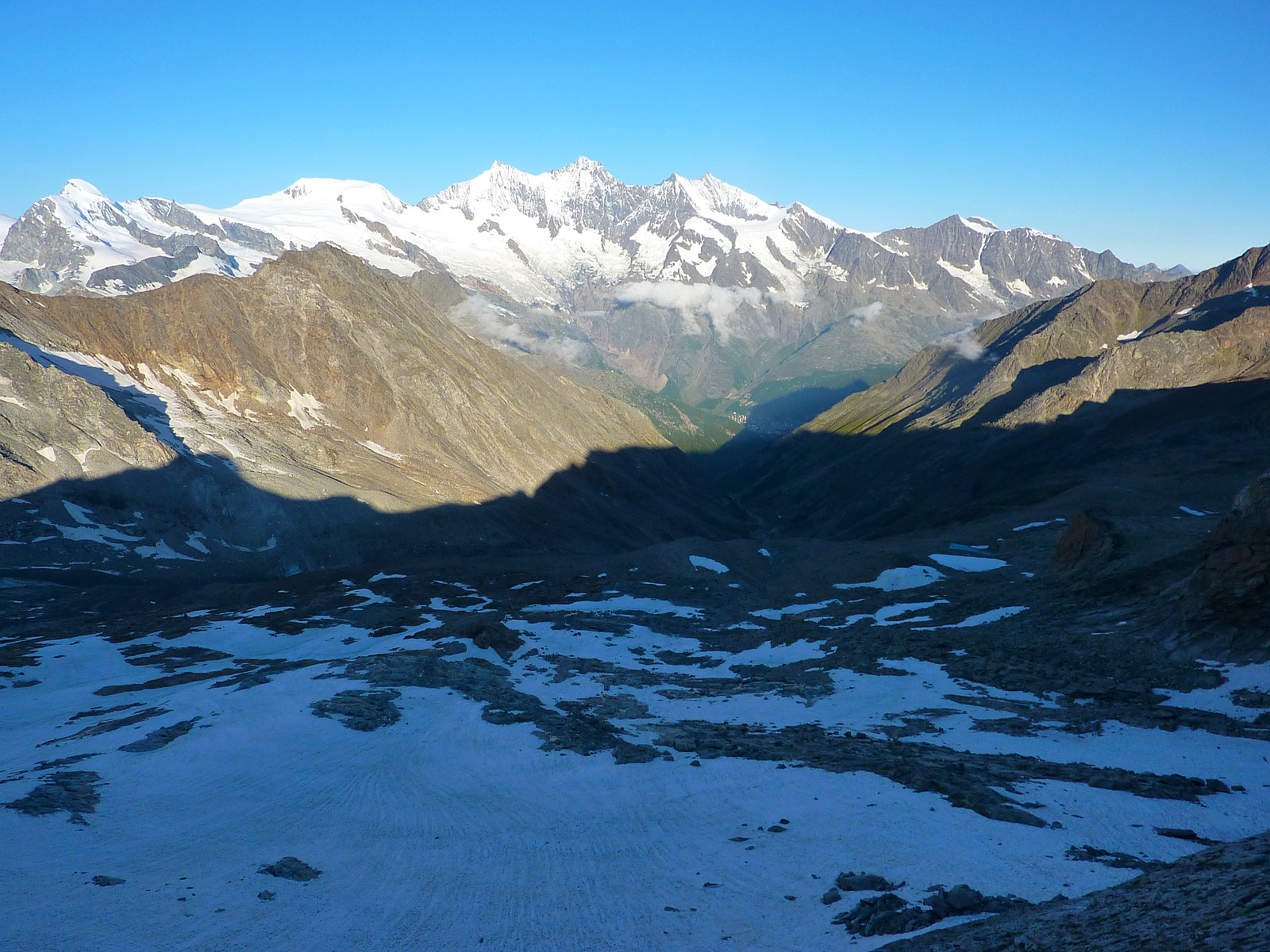
The atmosphere round our table at breakfast was somewhat quiet, in contrast to some of the other groups who seemed un-normally chatty for so early in the morning. We weren’t sitting for so long anyway and it was soon time to get out of the hut. As forecasted, it was a beautiful weather. Clear sky and lots of stars. The approach walk to the start of the route was partly marked, although the trail wasn’t as obvious as when we were on the Gran Paradiso. I took in the region of 1 hour before we came up to the snow field under the ridge. It was a relatively short distance with snow under our feet, but we used crampons anyway since the snow was quite hard.
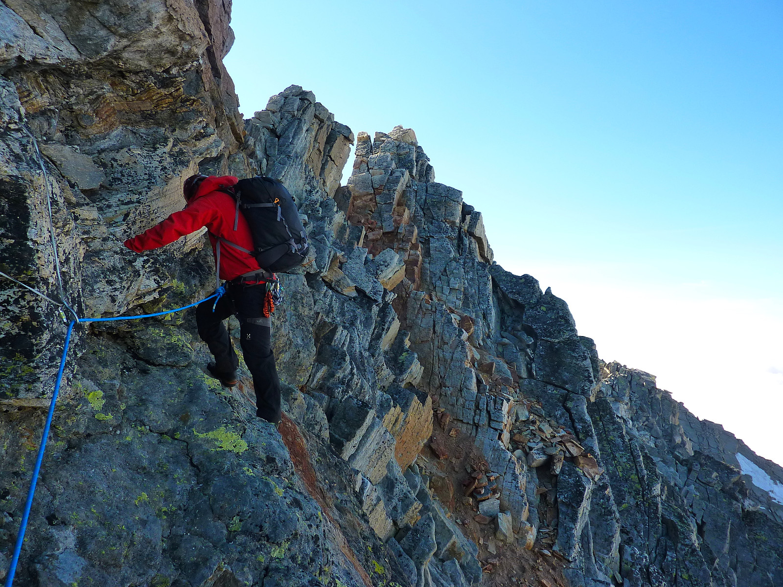
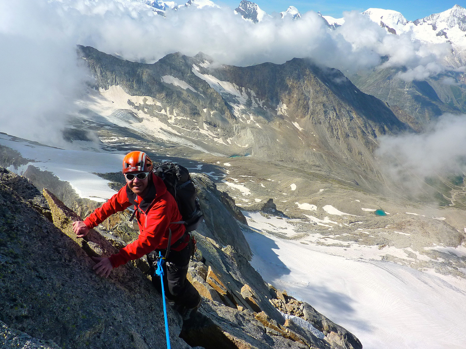
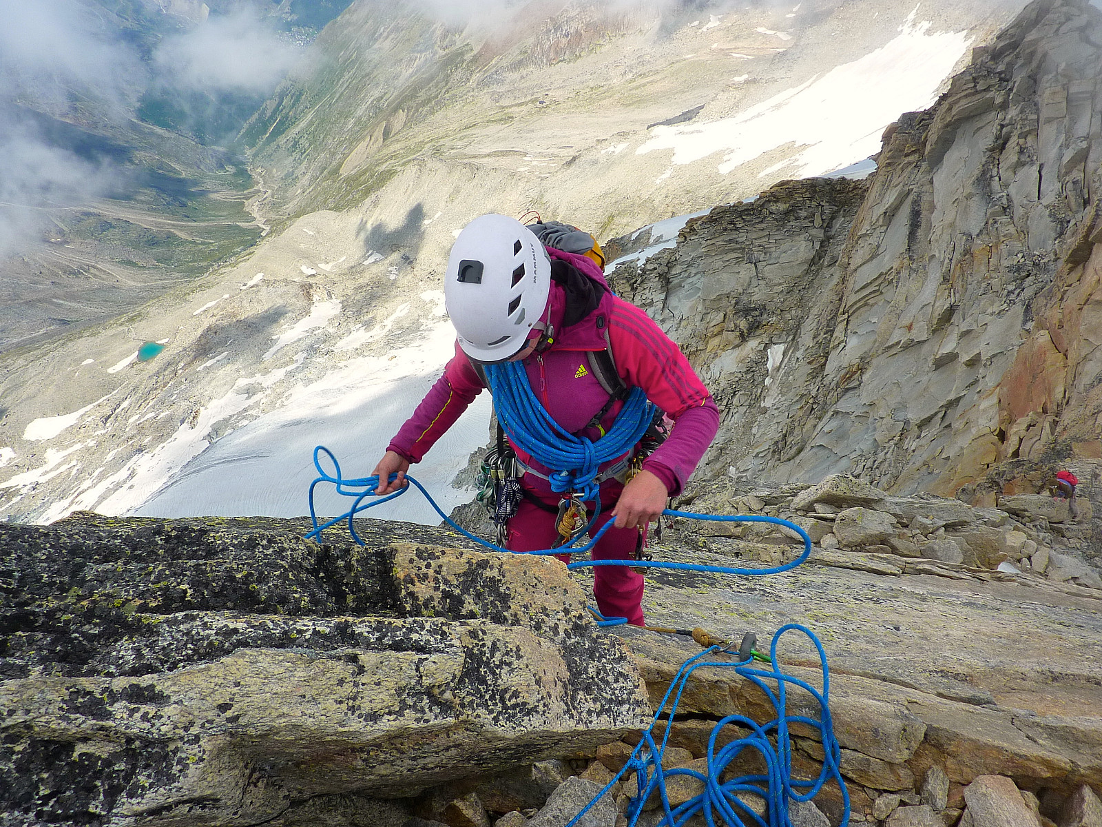
I’d initially thought we would be starting the route from the obvious notch in the ridge or ‘port’, but we in fact took a more direct variation to get onto the crest of the ridge by starting at a sort of rocky ridge to the left of the port. It was mainly straightforward scrambling for the first 10 metres or so, but then it became steeper, looser and the moves were more committing. We climbed one pitch to get up this section to the main ridge. Even though the difficulty was more or less the same as the day before on the Dri Horlini, it felt a bit tougher today especially since we were climbing with gloves on (it was still pretty cold on the rock) and with the extra weight of crampons, clothes, food and more drink than the previous afternoon. Neither Pete or I had packed rock shoes since the Dri Horlini had felt so straightforward in mountain boots, so I was really hoping that I would still manage today’s much longer route with the heavier rucksack as well.
From where we gained the ridge and came into the sunshine it was a matter of following more or less the crest of the ridge all the way to the highest point on the Portjengrat, Pizzo d’Andolla. We climbed further to a bolt where we set up a belay stance. The next section was somewhat more interesting with some tricky moves to get up and over a block directly above the belay stance. It looked a little awkward when Rocio climbed it, so I didn’t hold out any hopes of managing to climb it easily. Once she had got up and climbed further to the next suitable point to belay us, we dismantled our belay and I started climbing. I can’t remember exactly how I got up but it started with a bit of squeezing my way up into a rather wide crack and then somehow I found some suitable handholds above me to pull up onto. There was a bolt on the top of the block to the left of me but it wasn’t necessary tio grab hold of that, there were good handholds around it.
Anyway, I had got a few metres past this initial tricky pull up from the belay when Pete started to climb. I was relatively well balanced but suddenly I heard Pete yelling and the rope between us became tight. When I turned around I saw a massive block of rock flying down to the east side of the ridge and thought Pete had been hit by it and I was in some state of speechless shock for a few seconds. I heard nothing before Rocio shouted down and asked Pete if he was OK. To my relief he shouted back and said yes and that the block he had pulled up on had come loose and totally broken off the ridge. He managed to climb up again and I continued moving to keep the rope tight between us but we didn’t find out the whole story until we’d all gathered at the next belay. None of us could believe that such a huge block could have broken off, both Rocio and I agreed that it seemed pretty solid to climb! Anyway, it turned out Pete was shouting ‘below’ when I heard him yelling, and he hadn’t been yelling because he’d been hit as I first thought. I dread to think what the result would have been if the block had actually hit someone below. Instantly fatal most probably. It was just fortunate that it dropped to the east side of the ridge and not the west side where there was a party of two on their way up. Well, after the initial shock we all had a group hug and tried to recompose ourselves for the rest of the climbing. Terry and Ernie had started climbing before us so I don’t think they realized what had happened. The rockfall apparently was reported by a guide who didn't continue up the route.
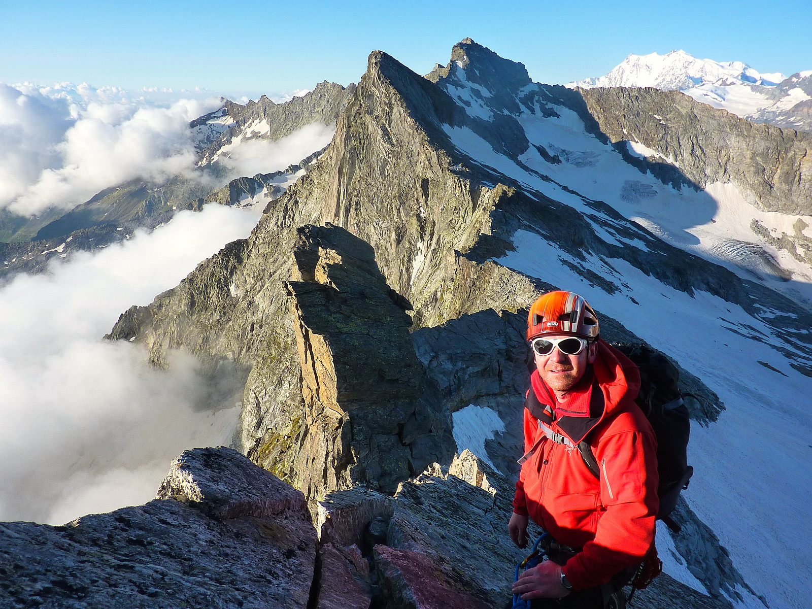
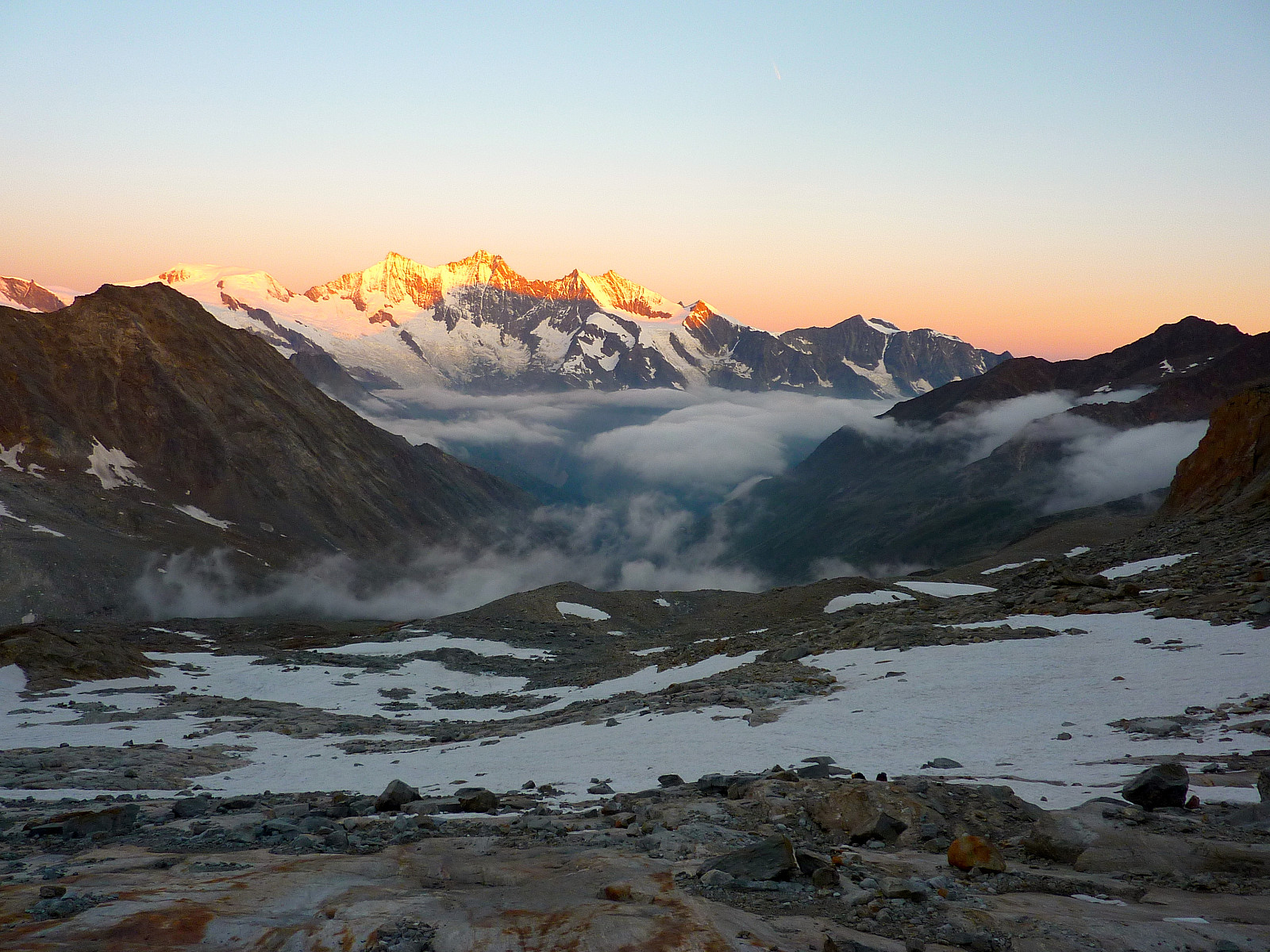
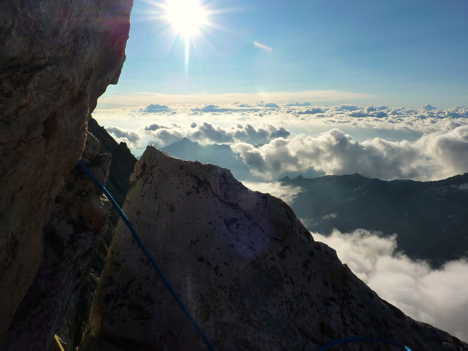
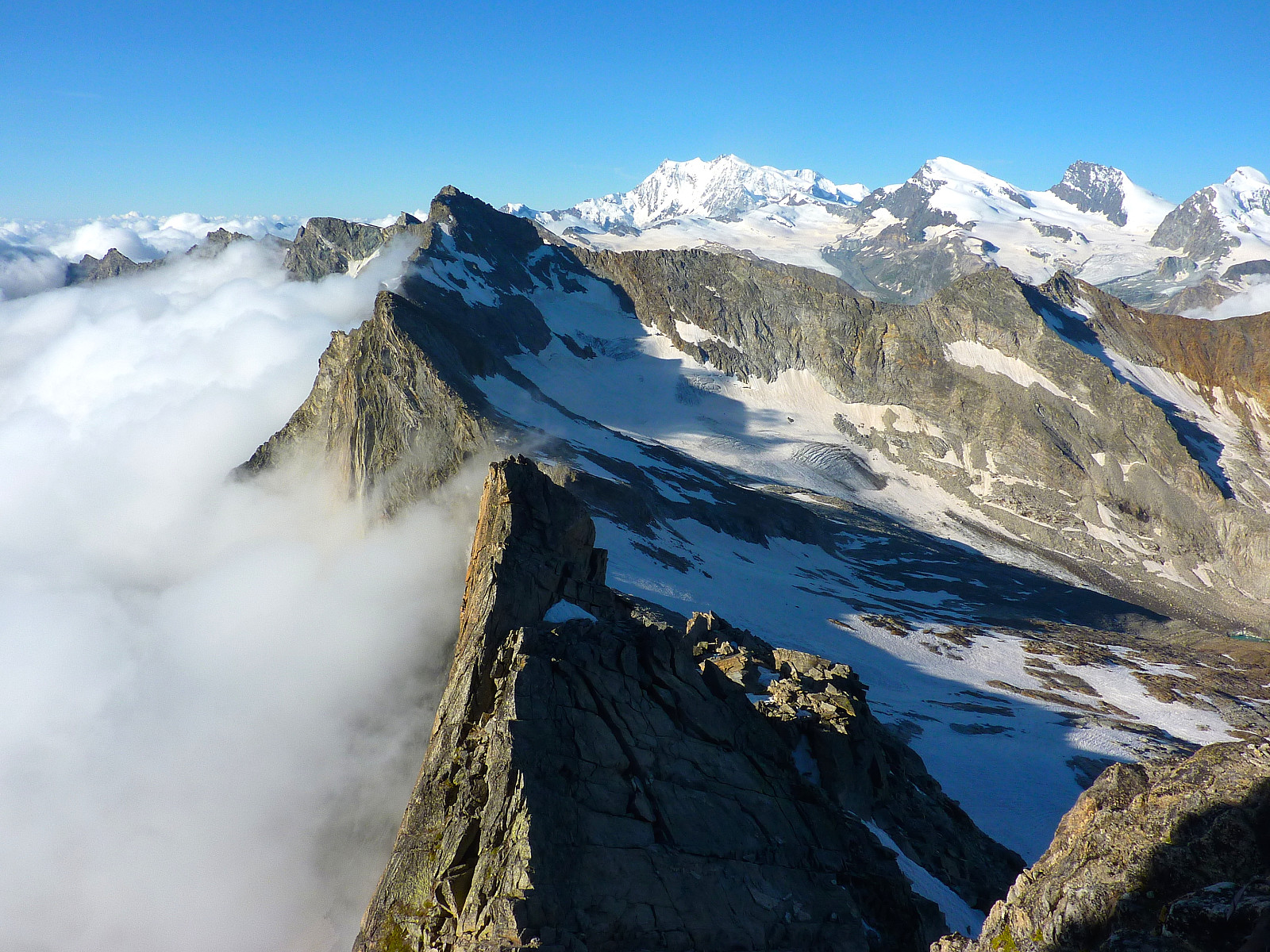
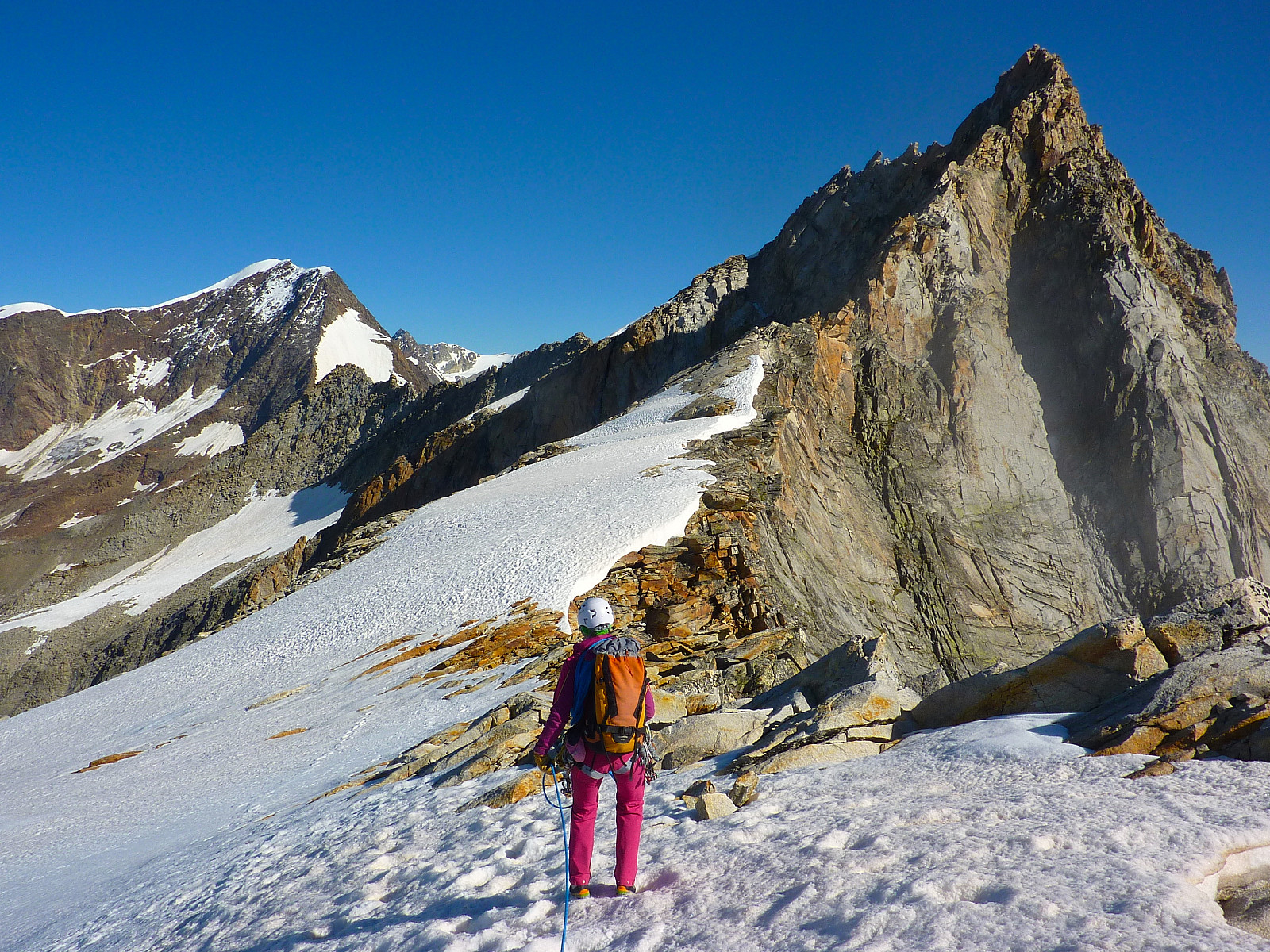
Anyway, fortunately the ground was quite straightforward from the next belay, a bit more climbing but mostly scrambling and moving together on a short rope until we had to descend down to another notch in the ridge. From here the climbing was relatively easy on good rock (at least, we believed it was good). We made OK progress and pitched some of it and moved together on other parts to save time. Once we reached the ‘top’ of this next section, there was a somewhat-exposed traverse across the ridge to where we took a decent break just after a snow field. I thought the traverse was quite easy, but I got the impression that Pete was still feeling a bit unnerved after the falling-block experience and was experiencing some discomfort with the small sections of both downclimbing and the exposure on the ridge. We protected the traverse both naturally and using some slings round blocks. It took some time to complete the traverse. It was a relief to take a decent break and get something to eat, but by this time it was already 9.30am. Had we really been out for 4 hours? It felt like time was flying by! From here we could see the rest of the ridge leading up to Pizzo d’Andolla. It didn’t seem far away at all, but Rocio estimated that it would still take around 2 hours before we got up there. The hardest part of the climbing was still ahead of us.
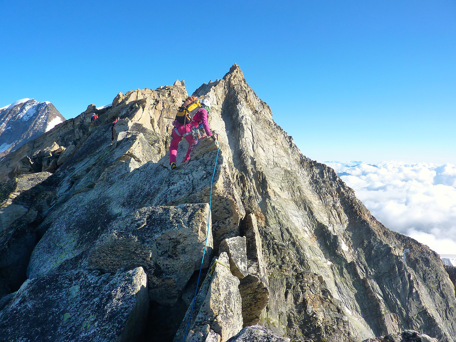
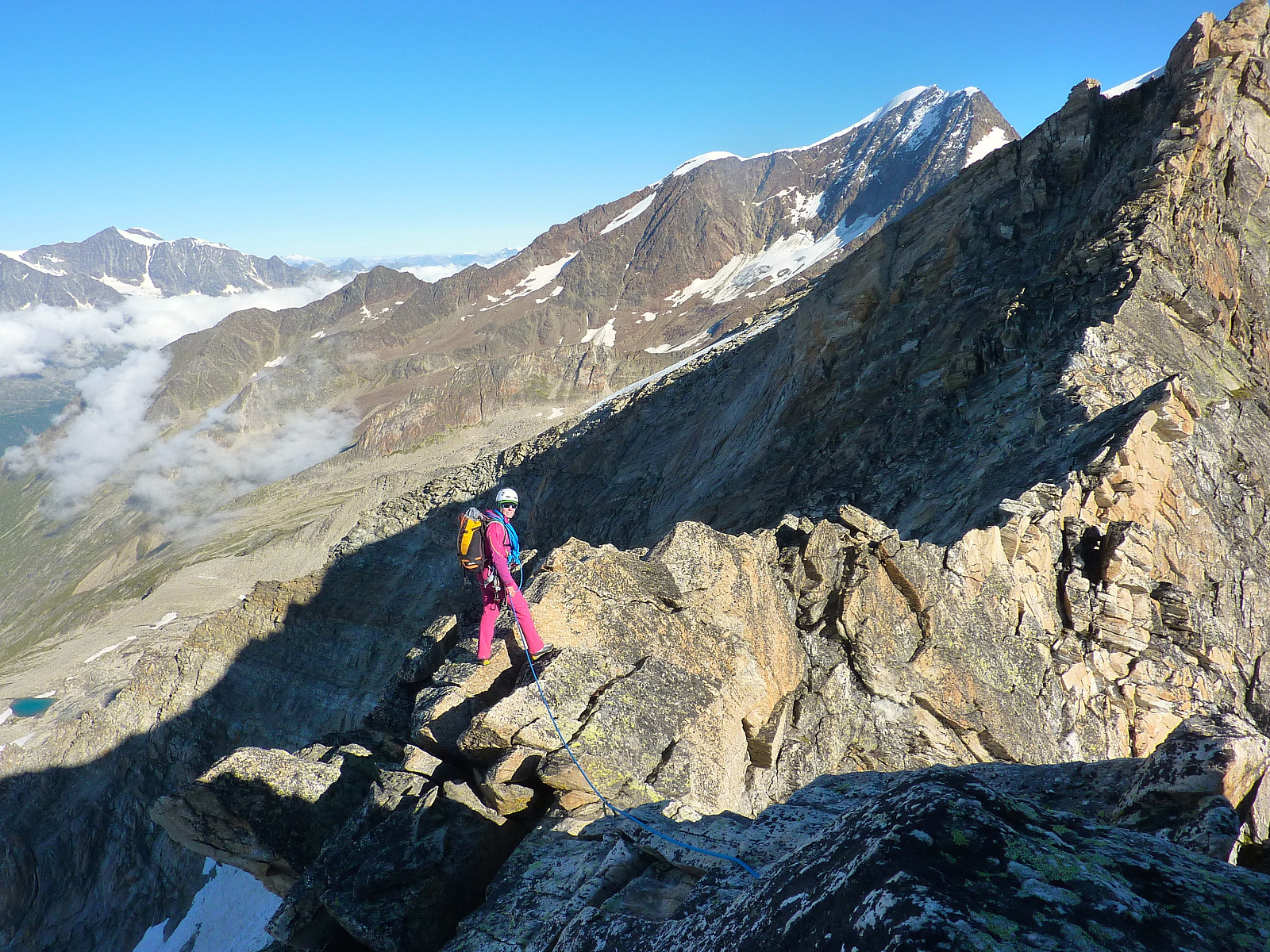
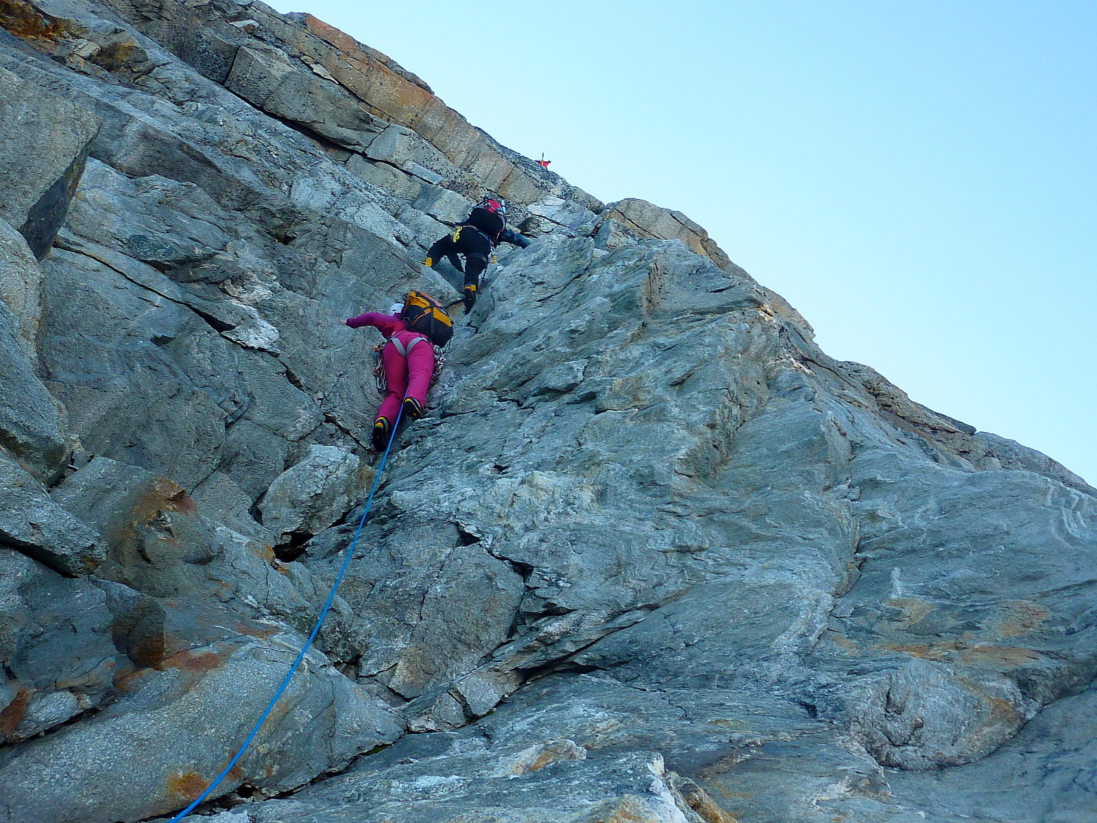
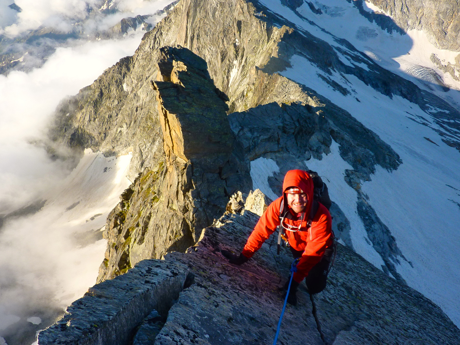
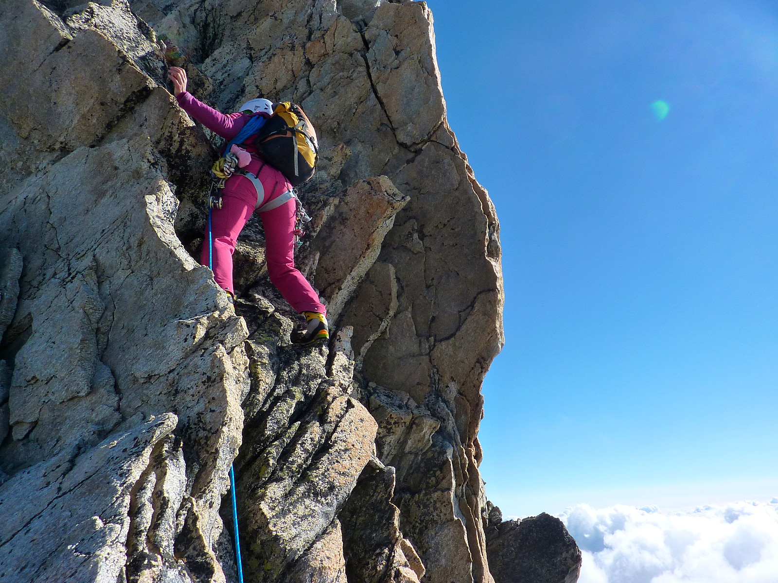
From where we took a break we walked a small distance to a point where we had to downclimb to yet another notch in the ridge. This also took some time, but Rocio protected us from above why both Pete and I downclimbed. Then it was matter of climbing the next section. From here we climbed many, many pitches – not so much moving together on a short rope anymore. But it was actually very fun and pleasant climbing. The rock was so nice, and there were always handholds. My boots were proving to be a dream to use on the rock as they had been the day before, and I don’t regret spending all of the 2800kr I had to part with at Skandinavisk Høyfjellsutstyr!
One of the pitches involved a climbing up a type of chimney feature. Narrow enough but even narrower with a rucksack on your back as well. After a little experimentation I discovered that a rather inelegant combination of shuffling and squeezing worked the best to get myself up this. Maximum use of the bum included.
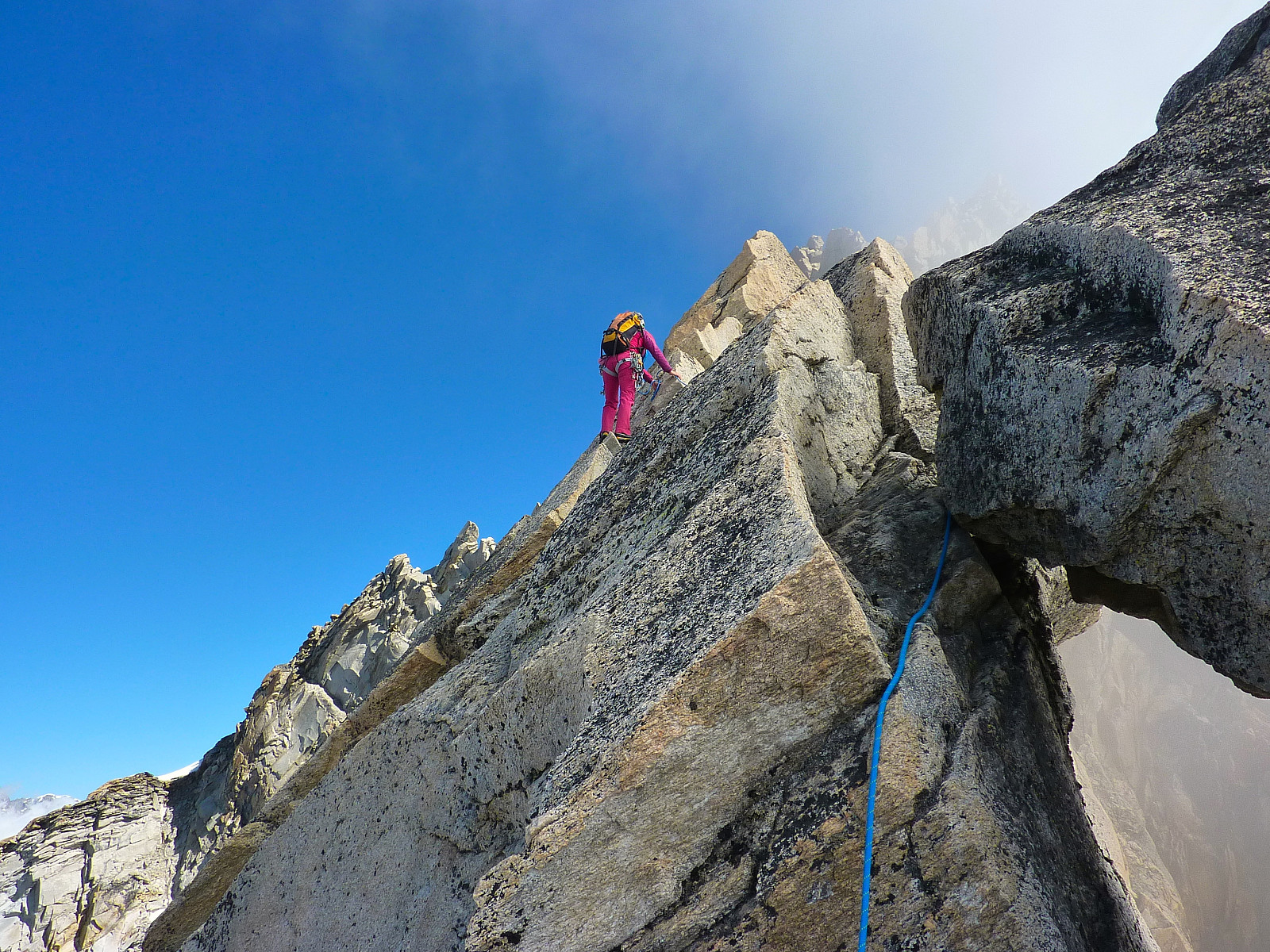
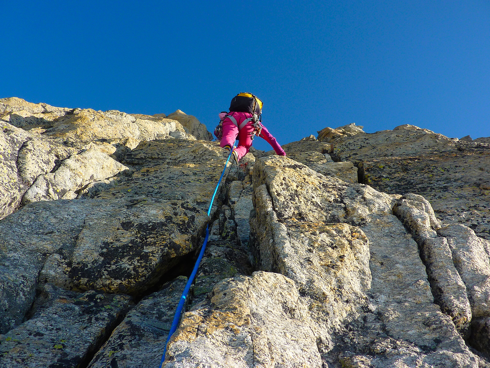
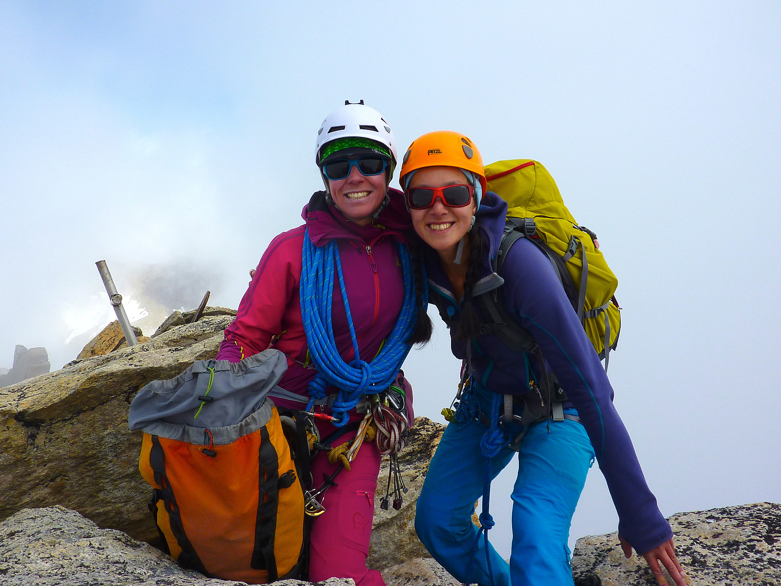
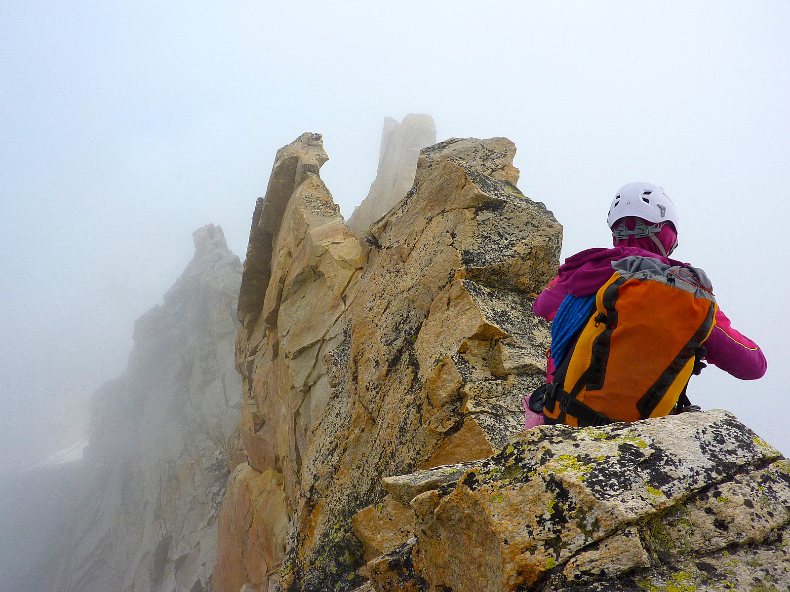
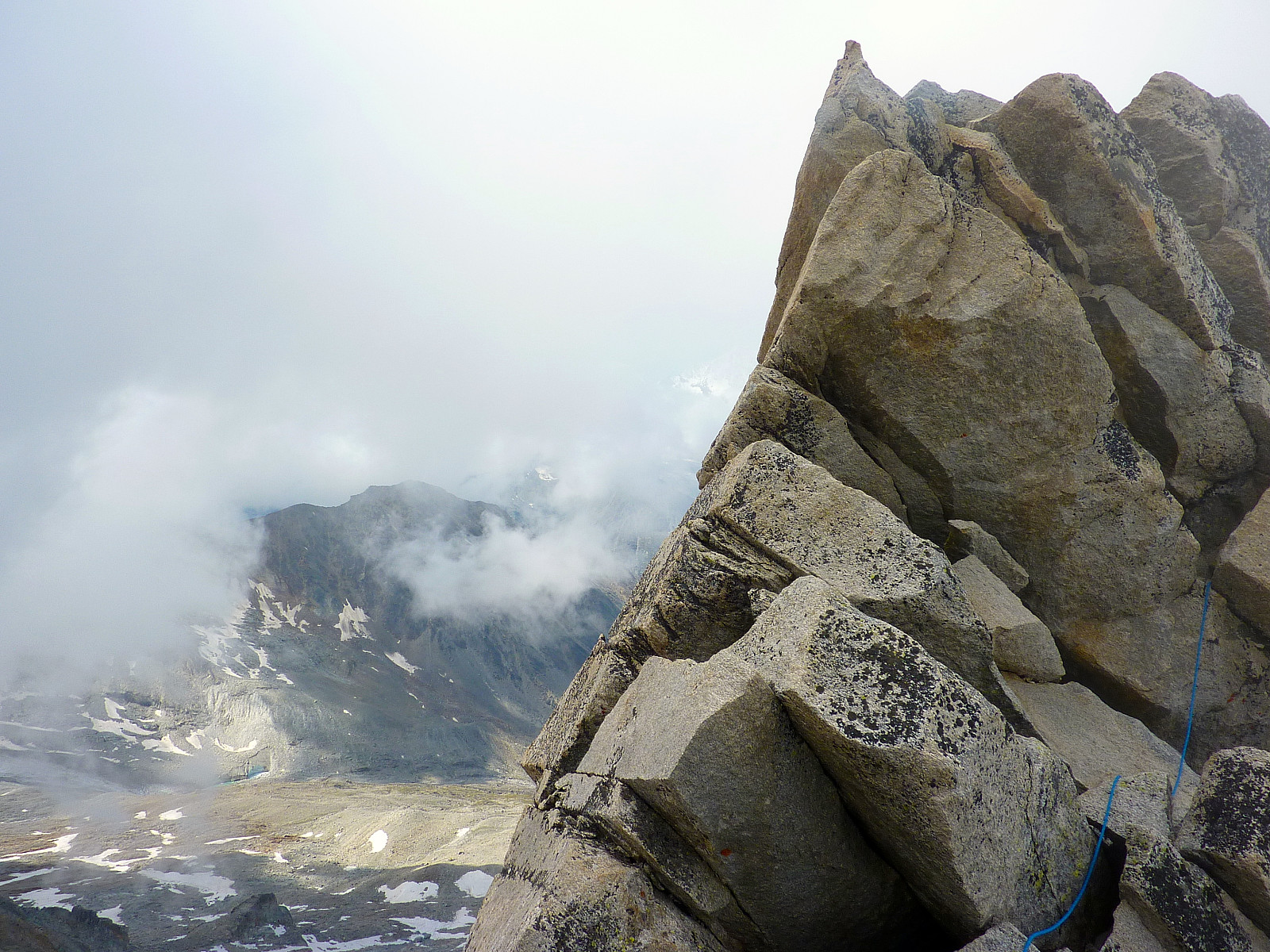
From the top of the chimney the route continued on a proper arête-type feature and it was a matter of contouring upwards on the left side of the arête. Some parts of the arête were proper slab-like and seemed to lack handholds. But there were cracks to jam the fingers in instead. By now there was a fair amount of fog rising up from the east side of the ridge, and it felt pretty atmospheric! There was only one more tricky move to do, just before we finally reached the summit. From what I remember we had to climb right out on the edge of the ridge to find the best hand and footholds. Here it’s best not to spend too much time thinking about the numerous hundred metres below. Just get on with the climbing. Then it was a short traverse around to the left of a large boulder and a walk up to the top, where we were met with zero views and maximum fog. A bit of an anticlimax to a properly excellent route, but nonetheless a relief to know we were finally up.
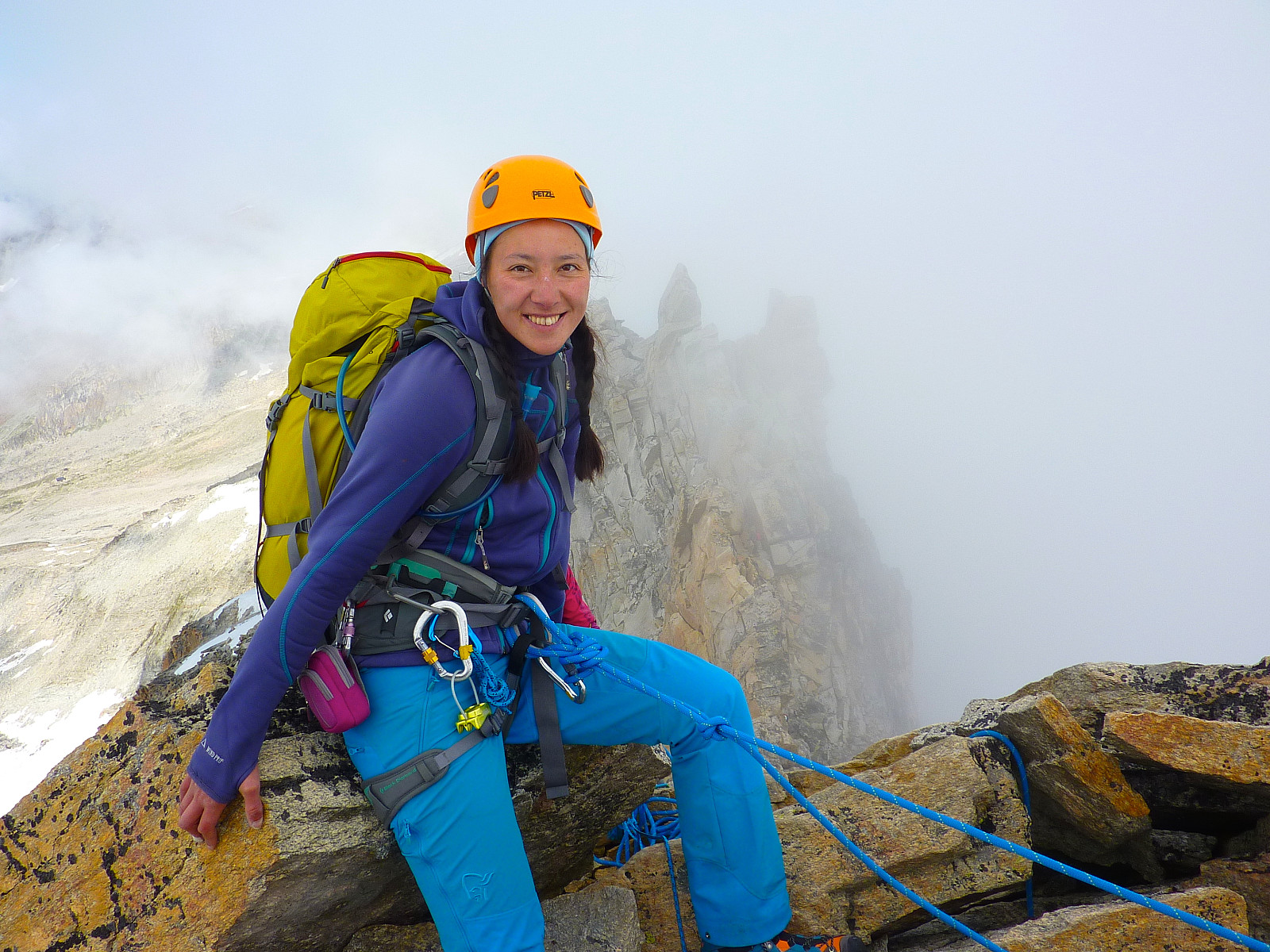
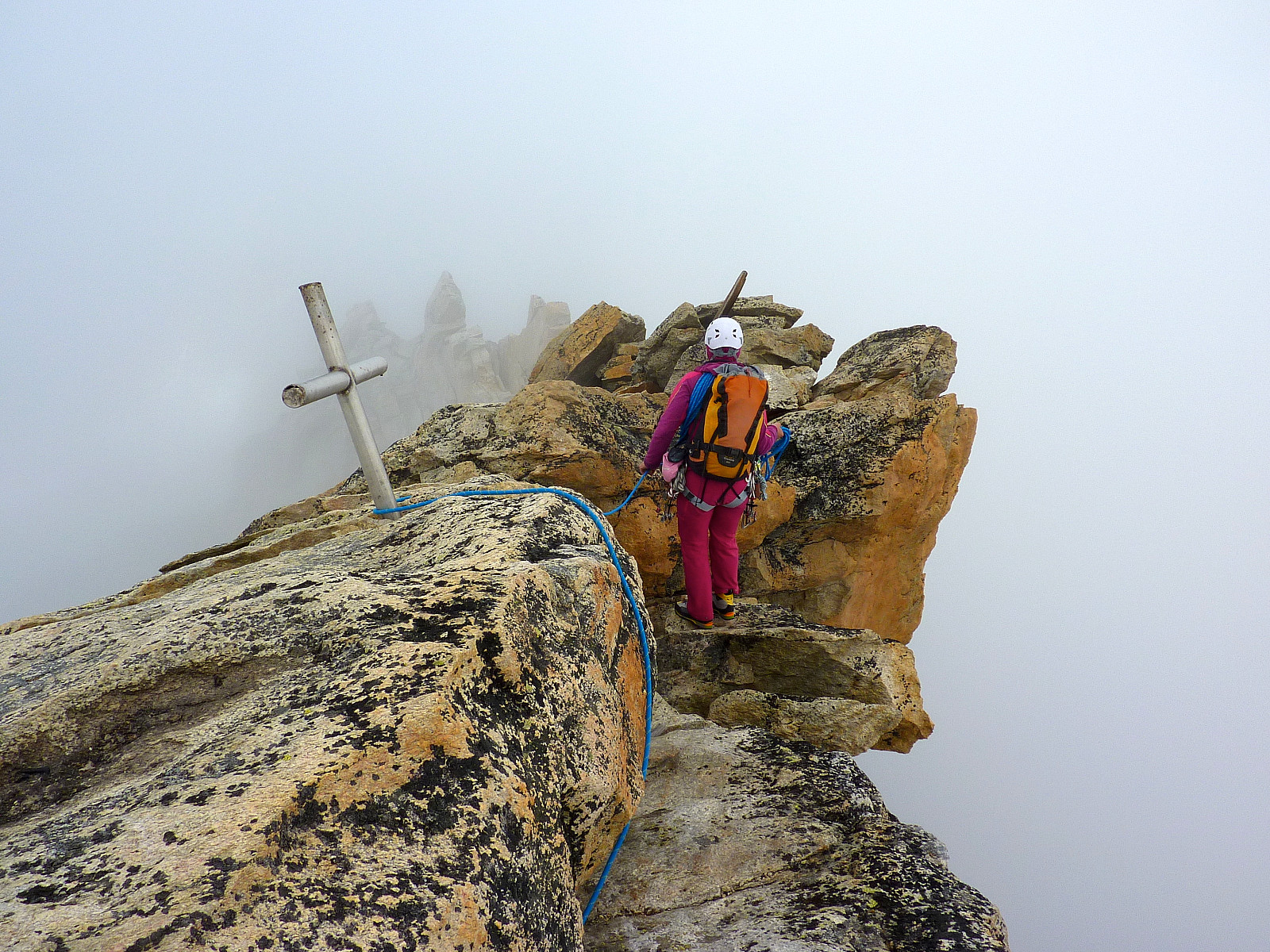
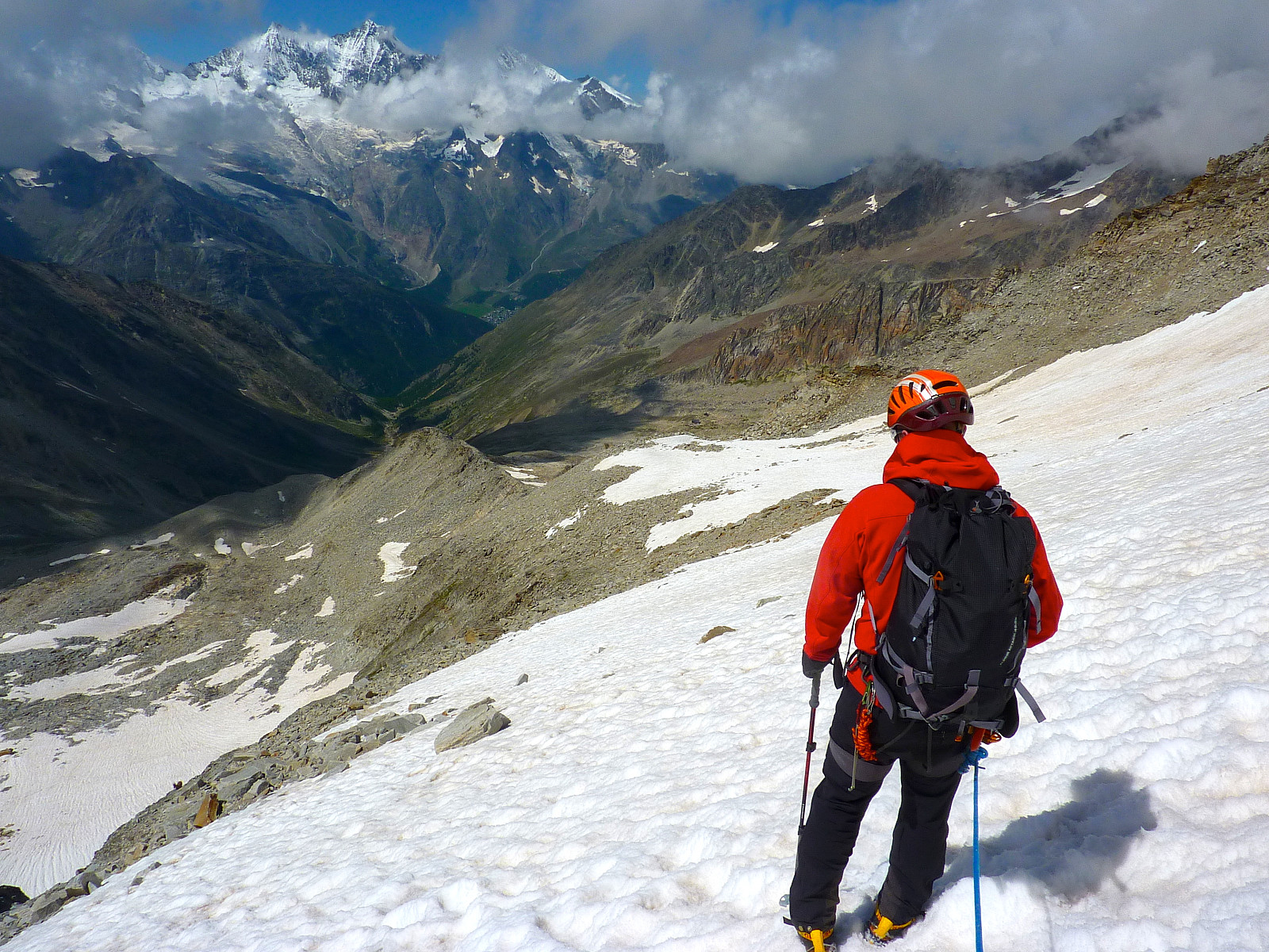
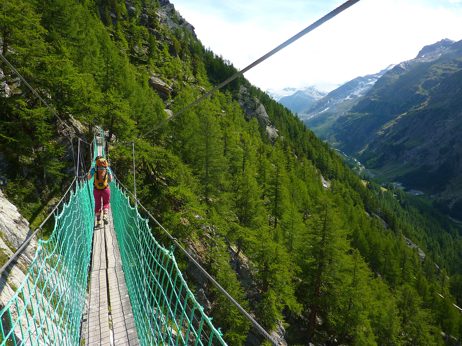
Apart from taking a handful of summit photos we didn’t spend much time there before getting ready to descend. It wasn’t time to start chilling out and switching off yet, there was still some downclimbing, abseiling and traversing around and over some pinnacles first before we reached the nice open snowfield where we would descend for real. I have to admit this probably seemed like the most complicated part of the route. The ‘right’ way across and in-between the pinnacles is not obvious, and I was glad I was with a guide who knew the route, otherwise it would probably have taken an eternity to reach the snow. I was pretty relieved to get there. On with the crampons again. At least we now were out of the fog and had some views across the Saas valley again! It was also a relief to know the descent would be quite straightforward. ‘Just’ walking. Not so much concentration needed, at least not on my part. We made good time going down as much as possible on the snow before taking all our gear off when we met rocks again. From here we continued the rest of the way down to meet the trail we’d used on the approach earlier in the morning and followed this the short way back to the hut.
By the time arrived back it was around 2pm, so we’d used in the region of 8.5 hours altogether, including the extra time taken because of the rockfall episode. We ate a relatively quick lunch here, got our things from the hut which we’d left behind and packed up our rucksacks for the walk back down to Furggstalden. It was admittedly a shame to not have a bit more of a break before leaving, but Terry was quite focused on getting back to Leysin for 6pm. It was a warm – and slightly boring walk back down the same trail. My feet were properly aching by the time we arrived back at the car park! Seems like there is a limit to how long my comfortable and amazing boots can actually remain comfortable and amazing. Good end to a bit of an epic day with plenty of emotions. Lots of humour as well as fear included.


User comments