
Høgstefjellet, Tellevikafjellet, and Nordgardsfjellet (01.05.2023)

Geschrieben von HHauser (Helwig Hauser)

| Startpunkt | Håkonsplass parking (175m) |
|---|---|
| Endpunkt | Håkonsplass parking (175m) |
| Tourcharakter | Wanderung |
| Tourlänge | 2h 30min |
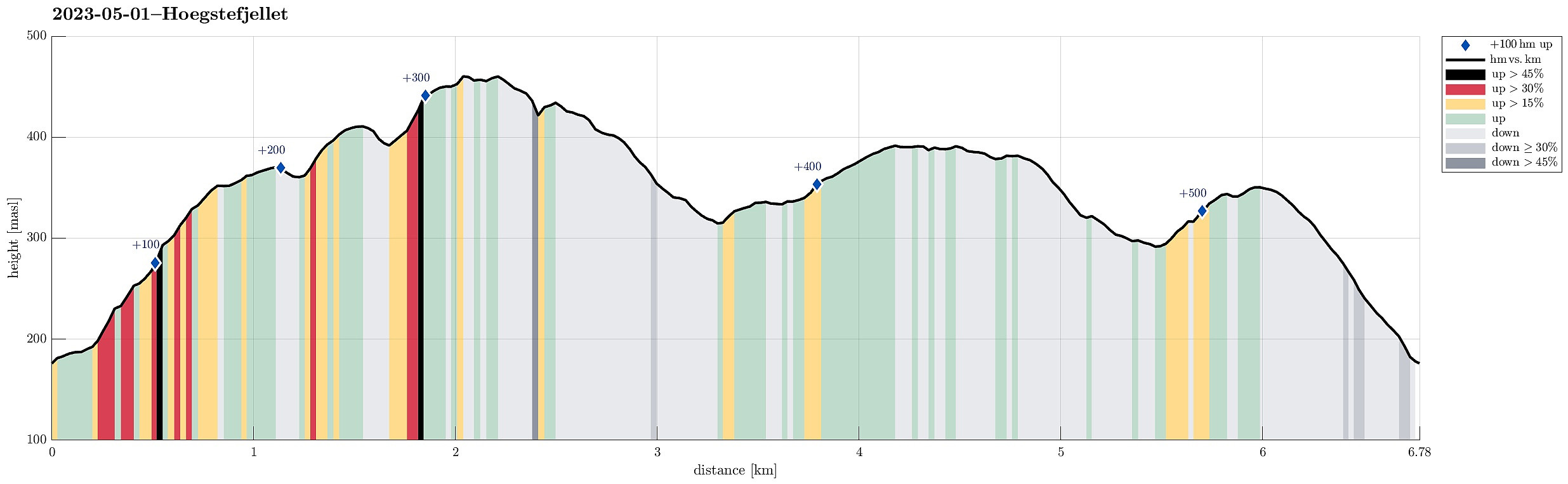
| Entfernung | 6,8km |
| Höhenmeter | 529m |
| GPS |
|
| Besteigungen | Høgstefjellet (464m) | 01.05.2023 |
|---|---|---|
| Nordgardsfjellet (355m) | 01.05.2023 | |
| Tellevikafjellet (395m) | 01.05.2023 | |
| Besuche anderer PBE | Baugtveit p-plass (180m) | 01.05.2023 |
| Tellevikafjellet søyle (390m) | 01.05.2023 |
Trip Summary
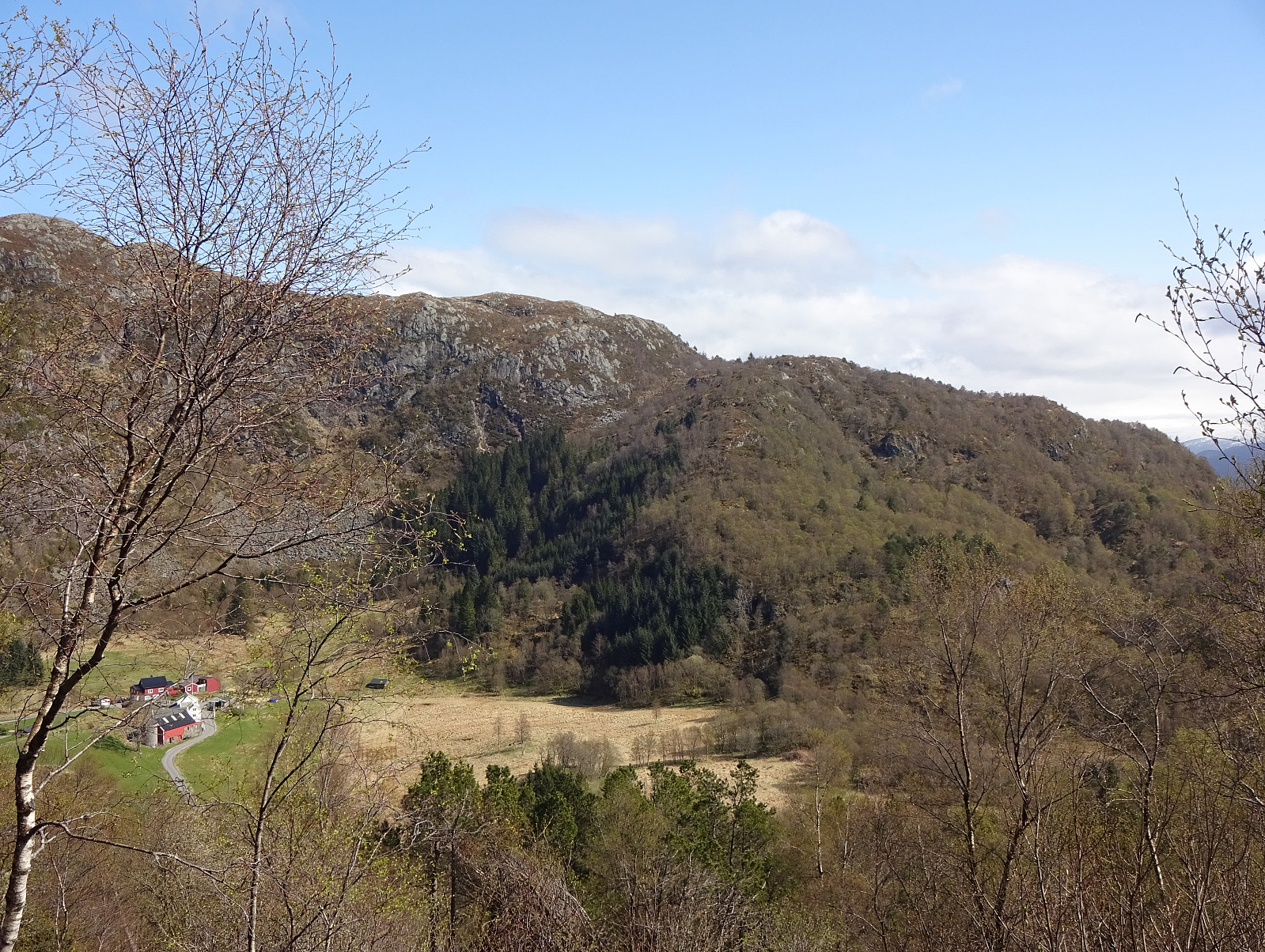
We were up to a medium-long hike and decided to do the round around Baugtveitstemma, including Høgstefjellet, Tellevikafjellet, and Nordgardsfjellet. After driving to Åsane, first, we then continued into the direction of Salhus, turning right at Hitland and entering the narrow road up to Baugtveit. Before actually getting all the way up to Baugtveit, we found a parking place at the parking slot for hikers (Håkonsplass). To get up to Høgstefjellet, we headed into southeastern direction, first. Instead of following the trail in the southwest of Furbudalen, we aimed at the ridge in the northeast of this trail, leading up to Baugtveitgotene. Even though we could not find any trail up this ridge, ascending it was still well doable (there are a few slightly steeper sections -- nothing that causes any difficulties). About half way up this ridge, one gets out of the forest and can enjoy nice views early on! Quickly, we had arrived at the heights of Baugtveitgotene, where we then also connected to the trail (up from Furbudalen). We then followed this trail around Midtfjellet. On the other, eastern side we then got onto the trail that leads straight up to Høgstefjellet (in northern direction). Once on the northern side of Høgstefjellet, we then also enjoyed some nice views down to Baugtveitstemma. To get over to Tellevikafjellet on the other side of Baugtveitstemma, we surrounded the lake in its east, walking down the northeastern ridge of Høgstefjellet on the main trail there. At the saddle above Vassbotn we then started our (short) ascent of Tellevikafjellet. After crossing over Tellevikafjellet, we continued along the trail towards the south in order to get to Nordgardsfjellet. After crossing Salhusskaret, we then ascended to Nordgardsfjellet (in the west of Tellevikafjellet). From Nordgardsfjellet we then descended back to our car via Dyrhovden. All in all, it was good to refresh ourselves a little on this nice round! :-)
Photos
Selected photos are available as Google photo album.
Useful Resources
See also the related FB-page Hiking around Bergen, Norway.
Petter Bjørstad has a useful page about Høgstefjellet and another one about Veten i Åsane, and also web page WestCoastPeaks.com provides useful information about Håstefjellet (Høgstefjellet), Tellevikafjellet, and Nordgardsfjellet as well as about Veten i Åsane.
Web page UT.no from the Norwegian Trekking Association recommends another round around Baugtveitstemma.


Benutzerkommentare