
Climbing the Mountain of God (18.11.2022)

Written by Solan (Atle Solholm)

| Start point | Gregory Rift Valley (1,193m) |
|---|---|
| Endpoint | Gregory Rift Valley (1,190m) |
| Characteristic | Hillwalk |
| Duration | 8h 54min |
| Distance | 12.6km |
| Vertical meters | 2,087m |
| GPS |
|
| Ascents | Ol Doinyo Lengai (2,962m) | 18.11.2022 00:28 |
|---|---|---|
| Visits of other PBEs | Africa Safari Lake Natron (628m) | 18.11.2022 00:28 |
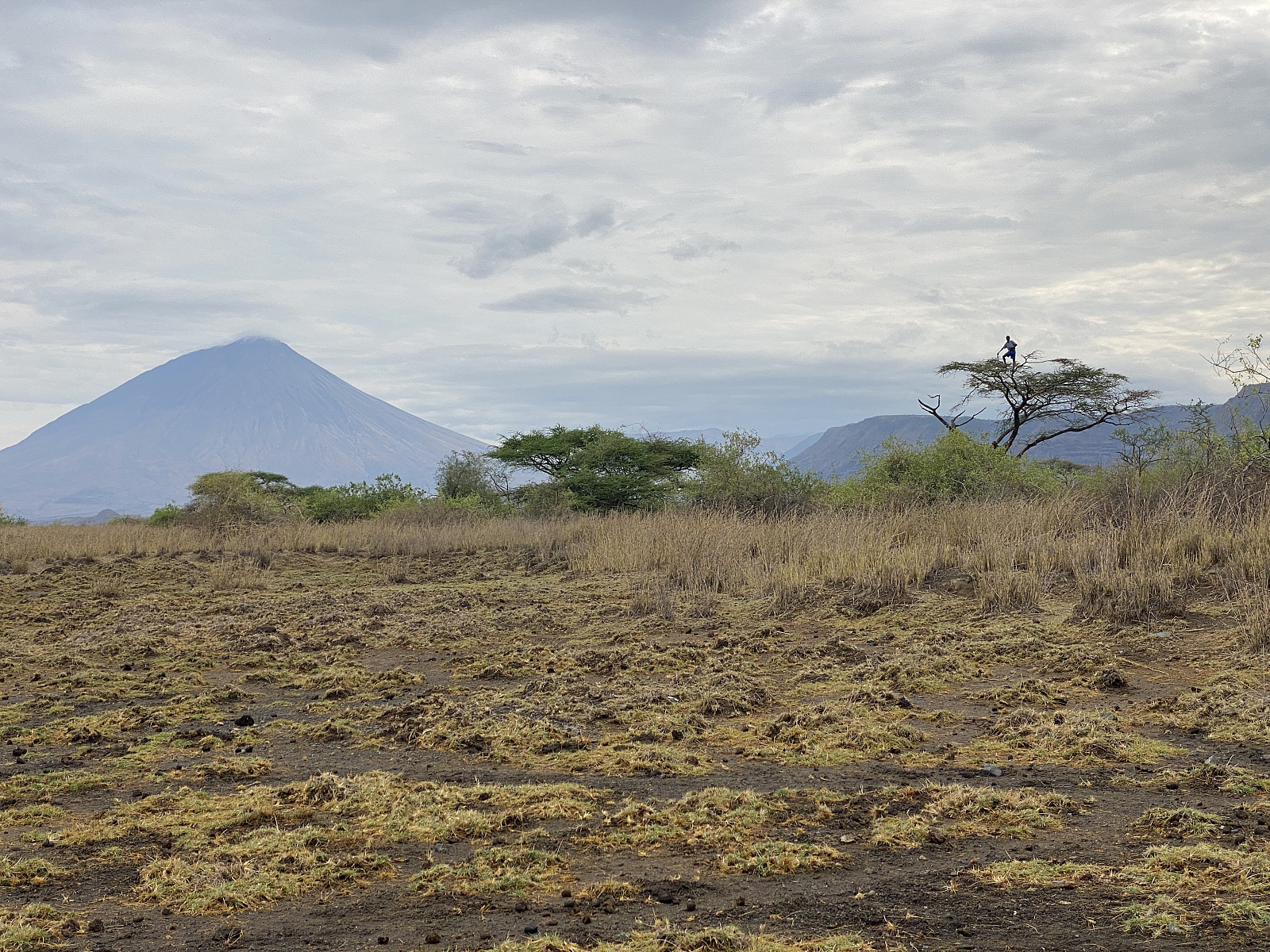
![Image #1: Mount Kerimasi [2602 m.o.h.] as seen from the road towards Lake Natron. This mountain, and the Ol Doinyo Lengai, are of the same volcanic origin.](https://images2.peakbook.org/images/14939/Solan_20230103_63b49ef267b76.jpg?p=xtralarge)
For me, this hike was all about altitude acclimatisation in anticipation of climbing Mount Kilimanjaro. I had planned to summit Kilimanjaro about a week later, and in order not to fail in my attempt at doing so; I had figured out the following plan for gradually getting the necessary habituation:
- Ascend as many >1500 meter summits as possible in Norway before I leave for Africa.
- Stay two weeks at 2400 m.a.m.s.l. in Addis Ababa with running/jogging almost every day.
- Ascend at least one >3000 meter summit while in Ethiopia.
- Ascend Mount Ol Doinyo Lengai [2962 m.a.m.s.l.] immediately after my arrival in Tanzania.
- Ascend Mount Meru [4562 m.a.m.s.l.].
- Ascend Mount Kilimanjaro [5895 m.a.m.s.l.].
I am quite sure a lot of those who fail to reach the summit of Kilimanjaro do so, due to poor planning; and in particular poor planning as for getting used to altitude. Just staying a few days in Arusha or in Moshi prior to the climb won't help much, as the altitudes of these cities are just 1400 and 800 m.a.m.s.l., respectively. I was quite confident that my concept of climbing successively higer mountains prior to Kibo was going to work, however. The alternative would have been to include some acclimatisation days in the camps on my way up towards the summit of Kilimanjaro; which wouldn't have been half as fun.
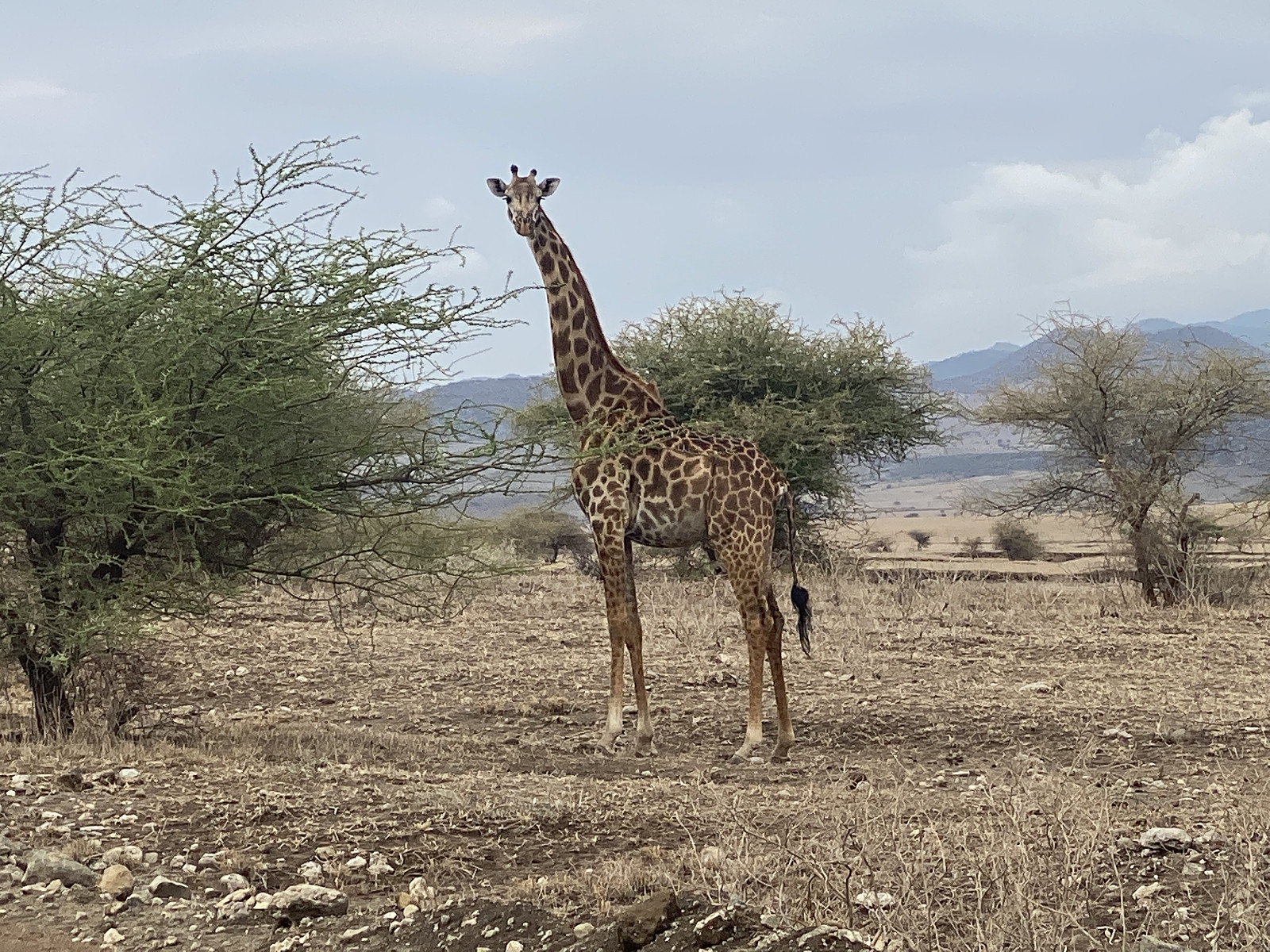
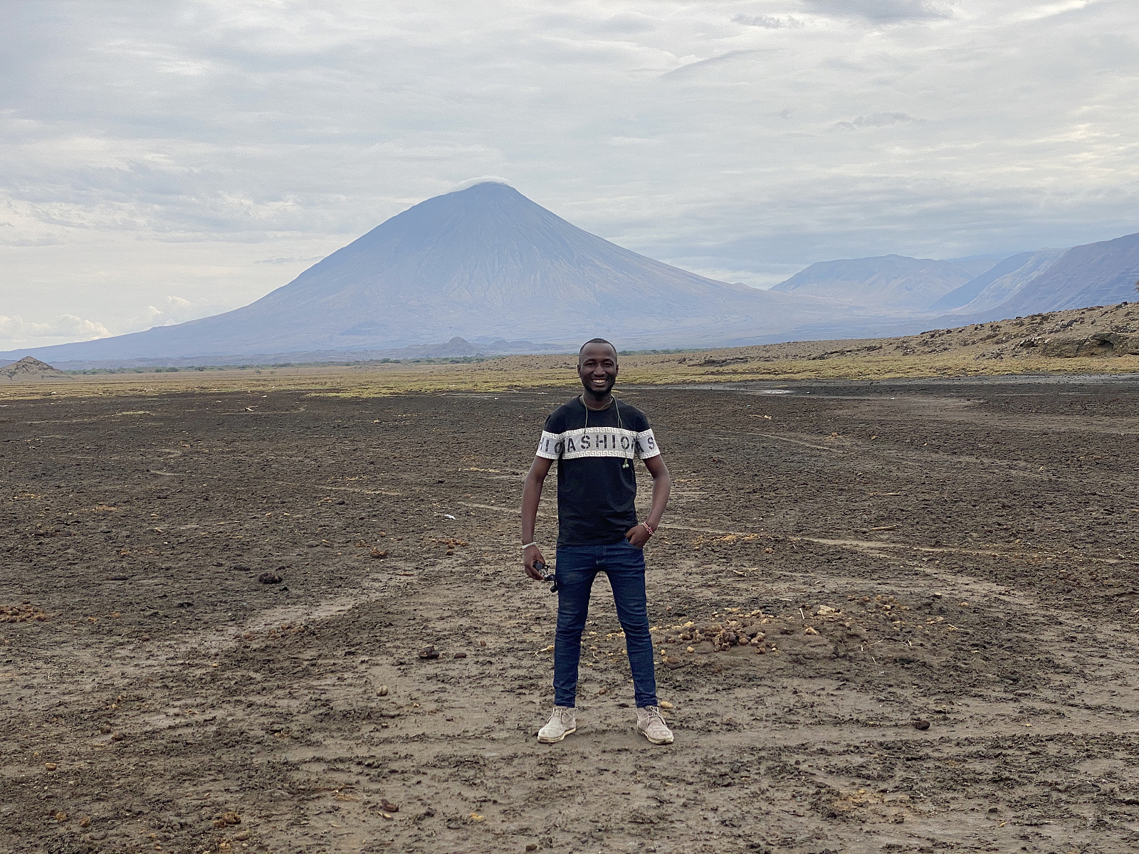
![Image #3: A giraffe in front of Mount Kerimasi [2602 m.a.m.s.l.]. Image ##4&5: Me and Frank, respectively, at the hood of the car, with one of the giraffes in the background. Image #6: The driver shooting a picture of Frank in front of the Safari Land Cruiser.](https://images2.peakbook.org/images/14939/Solan_20230103_63b4a100cacb6.jpg?p=xtralarge)
I had booked the three hikes of Ol Doinyo, Meru and Kilimanjaro with a guy named Frank Fred Lyimo, who works with an Arusha based tour company called Kili Hike Adventures. The cost for the three hikes combined was $ 3500, but this price even included a hike high up in the mountain side of Mawenzi (i.e. up to about 4650 m.a.m.s.l.), to a viewpoint called the Mawenzi Midpoint [see my toor description from our climb on Mount Kilimanjaro: Ascending the Peak of Freedom]. The price did not include such things as airline tickets and hotel nights, nor transport from the airport to the hotel. It did, however, include the transport from the hotels to the mountain gates of Meru and Kilimanjaro; and also the transport from Arusha to Lake Natron and Ol Doinyo Lengay, which we were going to climb first.
![Image #7: The tents of the Africa Safari Lake Natron Lodge. Lake Natron [600 m.a.m.s.l.] is seen in the background.](https://images2.peakbook.org/images/14939/Solan_20230104_63b5eb1e27917.jpg?p=xtralarge)
Frank picked me up at Kilimanjaro Airport on November 16th, and from there we went to Arusha, where I spent the night at the Merves Hotel. In the afternoon we had a long walk in Arusha, Frank and I; and in the evening we had a wonderful meal of ugaly and tilapia, before going to bed. I had first come into contact with Frank through a mountain group on Facebook. Some will point out that it might be risky to use a tour operator that you came in contact with on the internet just like that; as it may be difficult to discern honest and serious operators from fraudulent ones, when you don't know any thing about them. I am a fluent Swahili speaker, however, so I guess it was a bit easier for me to discern a good guy from a bad one (and I always communicated with Frank in Swahili from the very onset of our acquaintance back in 2020). Anyway, Frank proved to be a very honest and decent guy. Had he been a con man or a scrambler, he would've had plenty of opportunities to fool me during my three weeks stay in Tanzania. I payed him the above mentioned $ 3500 the very day after I arrived in Tanzania. A con man would've run away with it, but he didn't.
Frank met me in the hotel the next morning, while I was still enjoying my breakfast; and shortly after breakfast even the driver arrived with a 4WD Toyota Landcruiser (images ## 4, 5 & 6). From the hotel we drove down to Arusha city centre, where Frank went to his bank to deposit the money I had payed him; and shortly thereafter we were on our way towards Lake Natron and Mount Ol Doinyo Lengai in the Gregory branch of the East African Rift Valley (see below). The drive took us a few hours. First you follow the main road from Arusha towards Dodoma, but thereafter you leave the main road close to a town called Mto wa Umbo (literally: "The Mosquito River"); and from there you follow a dirt road northwards to the south shore of Lake Natron.
I had booked a stay at a lodge called Africa Safari Lake Natron, but shortly before we arrived there, we passed through a village called Engaresero, where we picked up the guy that was going to be our guide on our trail to the summit of Mount Ol Doinyo Lengai. The guy, who's name was Isaya, was wearing traditional Masai gear, which was kind of cool, I have to say; though I have to admit I was wondering a little bit whether this clothing would be sufficient for the summit of the mountain... I should probably mention, that wherever you want to climb a mountain in this part of Africa, it is the custom to use a local guide in addition to a guide from the company with which you have booked the trip. The idea is, it seems to me, that even the local societies close to the mountains should benefit from the tourism; and not just the large tour operators in Arusha and Dar Es Salaam. Moreover, Frank, with whom I booked this journey, had never been to Ol Doinyo Lengai before, so we would actually have struggled a bit with finding our way up, had we not had Isaya with us. And it would even have been illegal to climb this mountain without an appropriate and authorised local guide, as there are regulations that require you have such a guide with you on such a trip.
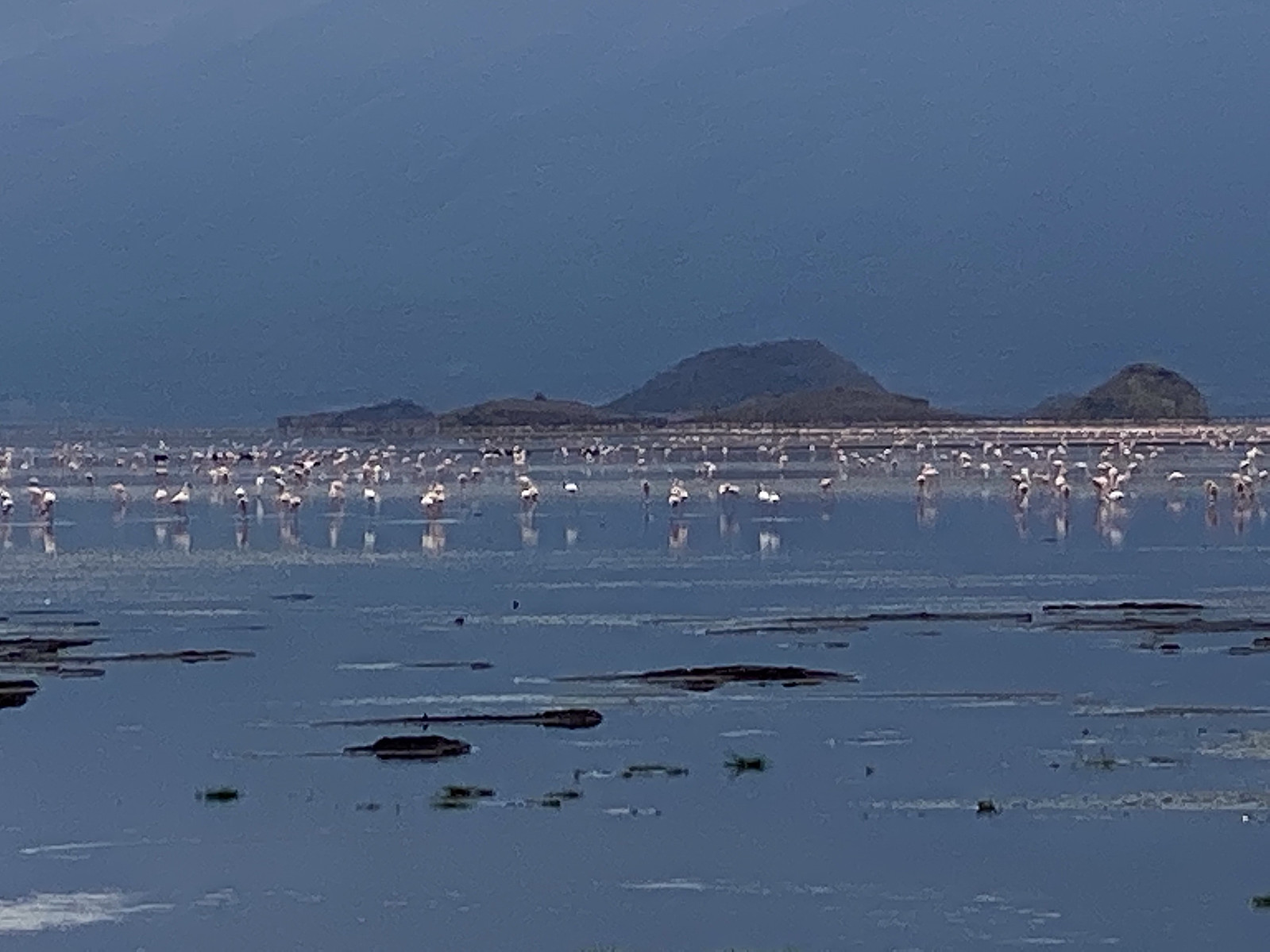
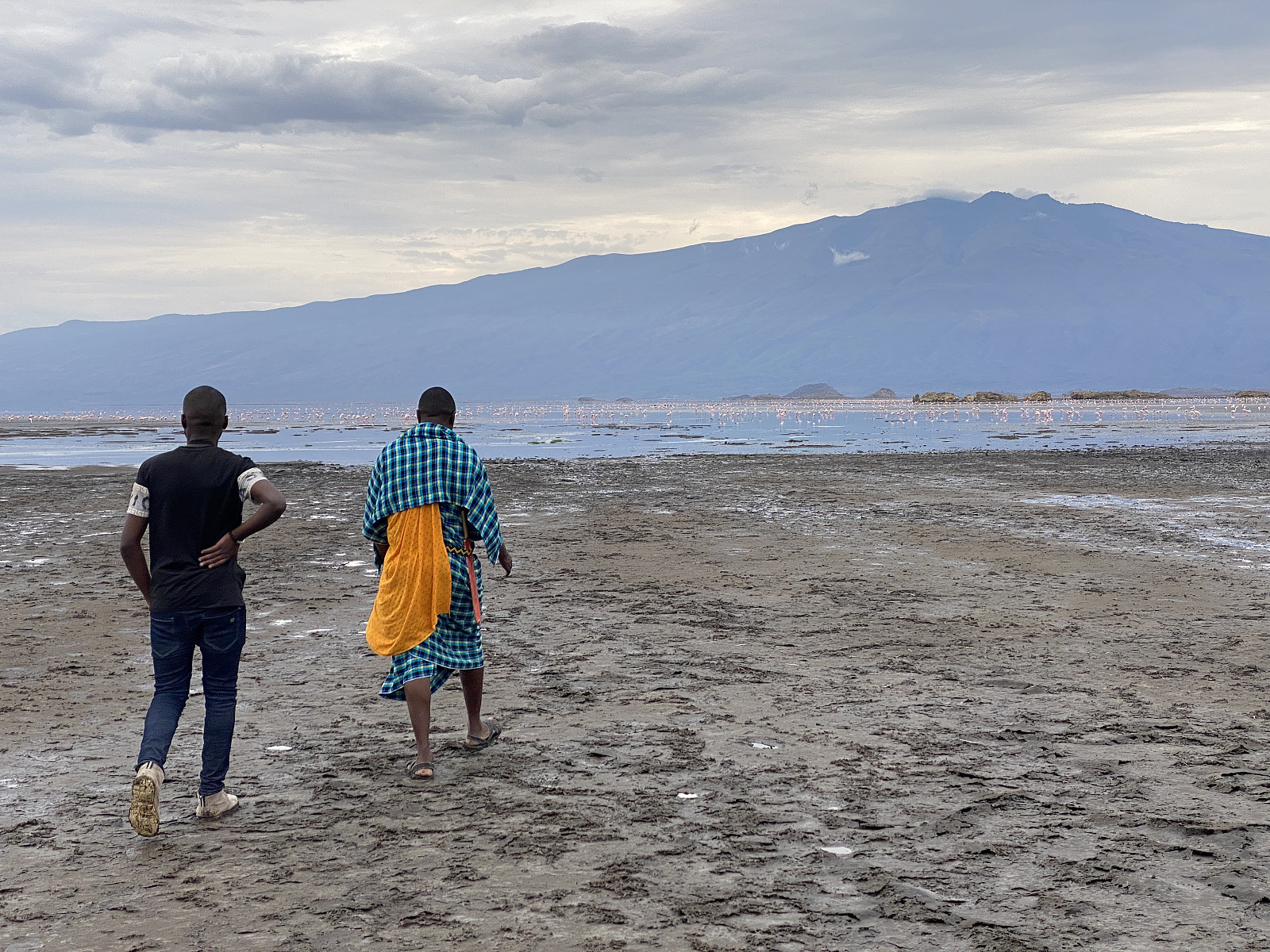
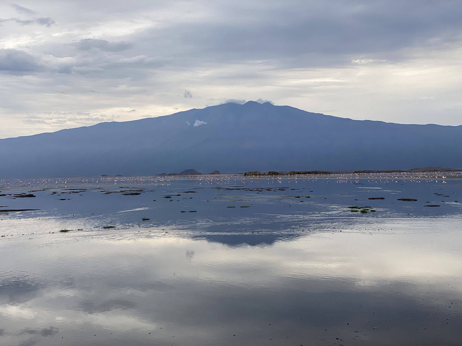
![Image #13: Frank and myself posing in front of Lake Natron and the flamingos. The mountain in the background of these images is Mount Gelai or Kilayi [2946 m.a.m.s.l.].](https://images2.peakbook.org/images/14939/Solan_20230104_63b5f4c36c811.jpg?p=xtralarge)
The lodge was what is generally called a tented lodge, and it was wonderful. It had a large half-open building that was a combined reception and restaurant building; and then there were numerous small hut-like tents for the guests (images ## 7 & 15). It was way to early to go to bed, however, and I was also a bit eager to see the lesser flamingos [by some even called "dwarf flamingos"]; so we made an agreement with Isaya, our Masai guide, to take us down to the south shore of the lake, for us to see the flamingos. We followed Isaya down towards the lake. The walk down to the lake didn't take us more than maybe 20 or 30 minutes. We first walked across sandy land where the predominant vegetation was bushes; and then across a muddy landscape, where the mud was just dry enough to bear our weight. Isaya explained to us that during the rain season, all of this area becomes covered by water, as the level of the lake increases. The pH of the alkaline water in the lake may then fall to below 10; whereas it may climb to above 12 during dry season. Isaya next took us across a little ridge between two mounds; and as we rounded the latter mound, we all of a sudden had the flamingo bay in front of us. Unfortunately, the birds were a little bit distant to us. I had with me a pair of binoculars, however, and through them we admired the beauty of these birds one by one, as we passed the binoculars around among the three of us. I regretted, however, that I hadn't brought with me an SLR camera with a telephoto lens; as I only had the camera on my cellphone with me, and I realised I wouldn't be able to capture a good photo of these pink beauties with it. I tried to use the cellphone camera to take a picture through the binoculars, but it didn't work out; the images tended to be sharp in the centre only, and increasingly blurry towards the edges.
After admiring the flamingos for a while we headed back to the lodge by the same way that we had used to get down to the flamingo bay. At the lodge I had dinner in the Restaurant building, and thereafter I went down to my tent to have some hours rest, before we were scheduled to embark upon our climb of Ol Doinyo Lengai. Frank and the driver went to a cheaper accommodation for guides and drivers; whereas Isaya went back to his village to wait there. Our trek was set to start at about midnight, as the custom is to climb Ol Doinyo Lengai by night; in part because the sunrise is said to be beautiful at the summit, and in part because the heat of the lava may make it look red by night, whereas in daylight it has a black and more boring appearance.
Frank and the driver came and picked me up at the lodge at about 11 p.m. I checked out from the lodge, and then we drove back to Engaresero, and picked up Isaya; who had now changed to mountain gear, including a pair of nice trekking boots. The drive up to the foot of the mountain, where the trek was to start [i.e. at about 1200 m.a.m.s.l.] took us a while, however; and so we didn't start trekking until about half past 12. Isaya was a bit concerned that we might not be able to reach the summit before sunrise, since we started out this late. He had actually been a bit sceptic even from the moment I first met him, as to whether I would be able to do the climb or not. I am of course 55 years old, and maybe I didn't look that sporty to him; but Frank somehow managed to convince him that I was used to mountaineering, and that I would be well able to perform the trek. As for himself, Frank explained to Isaya that he was actually a Kilimanjaro guide. Isaya wasn't that impressed though, and pointed out that there are many Kilimanjaro guides that have failed to climb Ol Doinyo Lengai due to the steepness of the mountain.
Video #1: As we were approaching the rim of the crater of the mountain, there were holes in the ground, or mountain side, were fog-like, sulphurous gases were emerging.

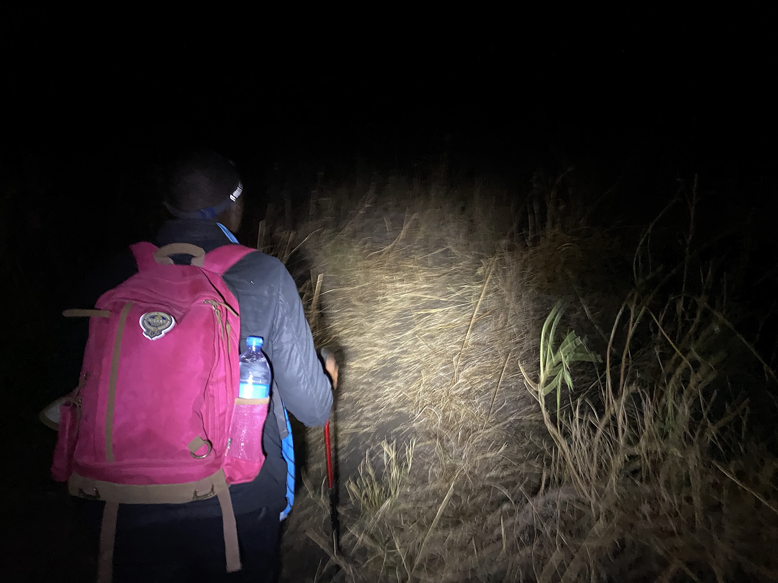
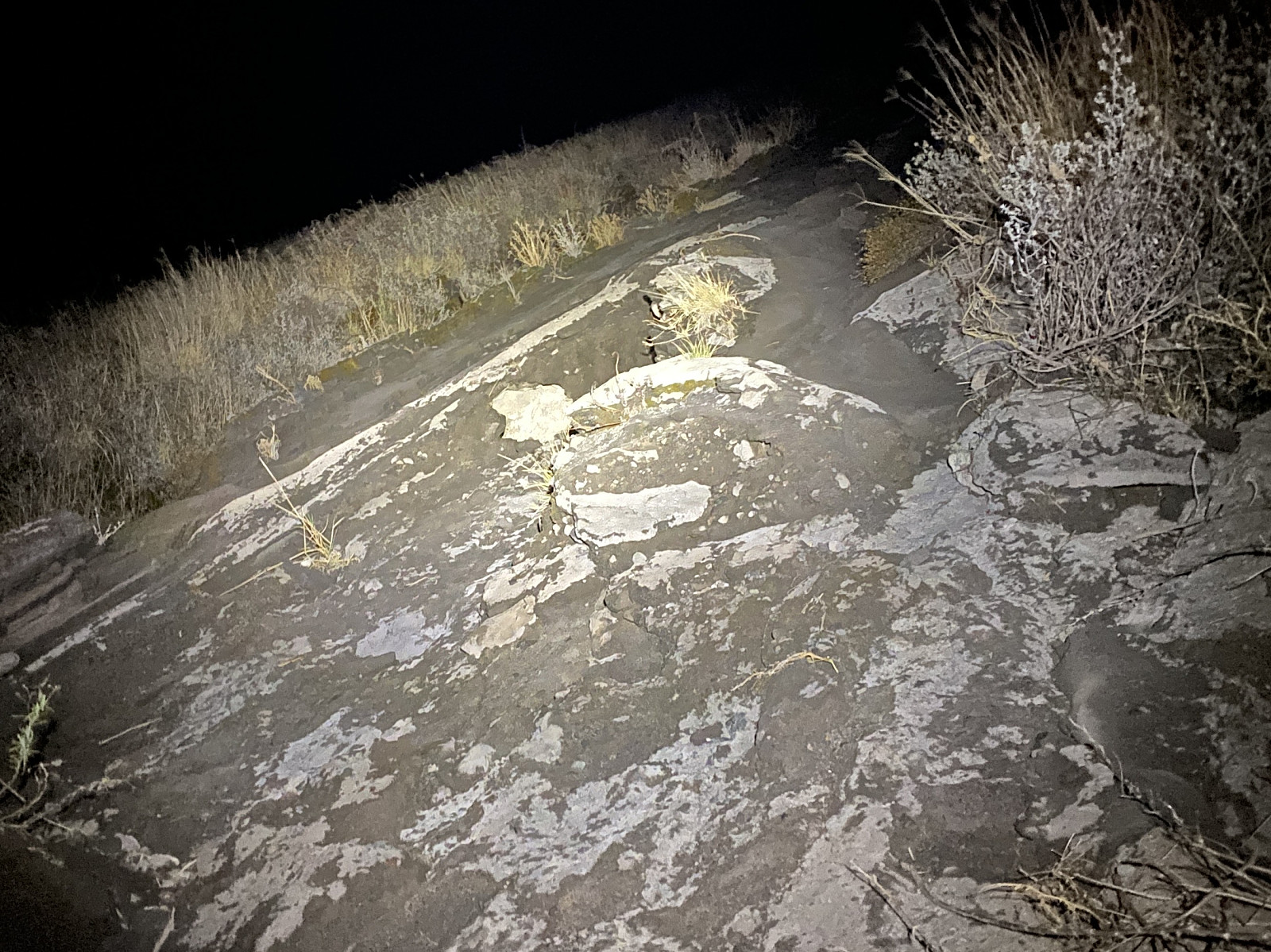
We started tekking at 0:28 a.m. in the night. Isaya, who knew the way, took the lead, followed by myself, and then by Frank. It was all dark around us; there was no moonlight, and no stray light from any nearby city, as there were none. We could see the lights from the Engaresero village, and from the lodges around the south end of Lake Natron, but they were far away, and these lights were in no way illuminating our path; so we were depending solely on the headlight that each one of us had on the forehead. To begin with, the mountain side wasn't that steep, but then it got gradually steeper the higher up we came. At two predetermined spots we stopped to have a short brake; these were spots that Isaya knew about, where a shallow depression in the terrain gave som shelter from the wind. At the first of these spots, we sat down for about nearly 10 minutes, but at the second we spent less than 5 minutes, as Isaya had come to realise by then, that non of us were actually exhausted in any way. As the trail became steeper, Frank started lagging behind a little bit, so we had to stop and wait for him every now and then; not because he was in a bad shape, but because his shoes were quite slippery. On a regular mountain trail his shoes would've been fine, but the surface that we were walking on was made of lava that had been running down the mountain side as it solidified less than 20 years ago; and this surface was just as slippery as Frank's shoes. Luckily, however, Isaya and the other guides that tour this mountain, had carved out stair-like steps at the steepest parts of the trail; and so we finally made it up to the top of the mountain, in spite of Frank's lousy shoes.
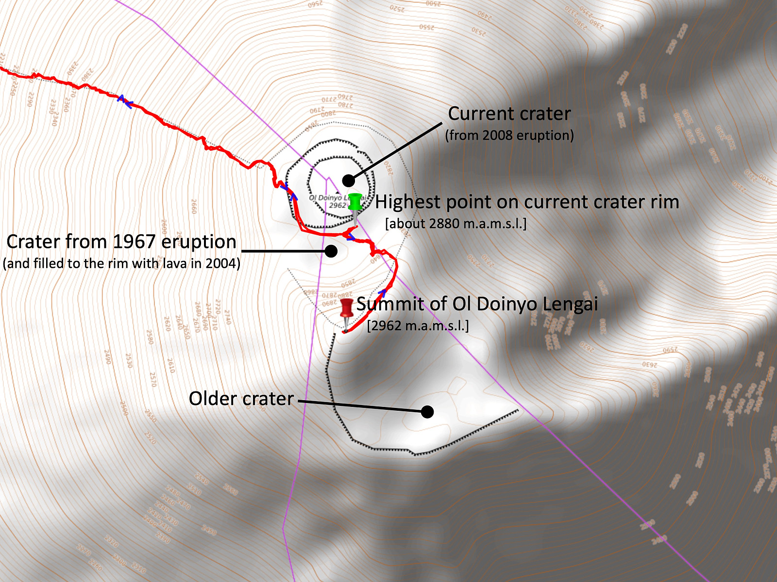
As we were approaching the rim of the crater, Isaya suddenly stopped, and showed us some holes in the ground, from which steam was emerging (video #1 and images ##30 & 31). When looking closer at these holes, one could see a yellowish colour disfiguration on the walls of the holes (towards the end of video #1), indicative of sulphurous gases in the steam, i guess. Shortly after passing these holes, we arrived upon the crater rim. Up there we could hear a roaring sound from within the crater, but we couldn't see anything down in there, as the weather was rather cloudy, and even the crater was full of clouds. You want to go to the summit? Isaya asked us, and took us to the right, along the crater rim, until we arrived at a slightly higer point, at which he pronounced that this is the summit. According to my Garmin Explorer+ GPS this wasn't actually the summit, however; it was merrily the highest point on the crater rim. "No, according to the GPS, the summit is in that direction," I said to Isaya, and pointed towards the south. Yes, there is another mountain over there, Isaya answered, and added: You'll see it when the sun rises.
Video #2: The crater of Mount Ol Doinyo Lengai, as seen from the summit of the Mountain. Lake Natron is seen in the beginning, and thereafter towards the end of the movie. Mount Gelai [2946 m.a.m.s.l.] is seen between 0:08 and 0:12.
![Image #22: View from the summit of Ol Doinyo Lengai towards Mount Gelai [2946 m.a.m.s.l.]. Lake Natron is seen to the left of Gelai.](https://images2.peakbook.org/images/14939/Solan_20230105_63b7360aee644.jpg?p=xtralarge)
We had arrived at the crater rim at 4:52 a.m., and at Isaya's summit at 4:59, so there was still at least an hour to dawn, and there was nothing to se at the crater right now, so Isaya took us down from the crater rim along a different path, and into a little valley, to another resting point, where he made us some tea with hot water that he had brought with him in a thermos; and as we finished drinking it, he said that we should try to get some sleep, while waiting for the sunrise. I fell asleep quite quickly, but then I woke up less than ten minutes later, whether due the tea, or because I was freezing a little, I'm not sure; but anyhow, I was unable to sleep again, and so I got up on my feet, and walked back up to the rim of the crater, to see if there was any sign that the clouds covering the crater were about to break up. Frank and Isaya were both sleeping deeply by now, and I didn't have the heart to wake them up.
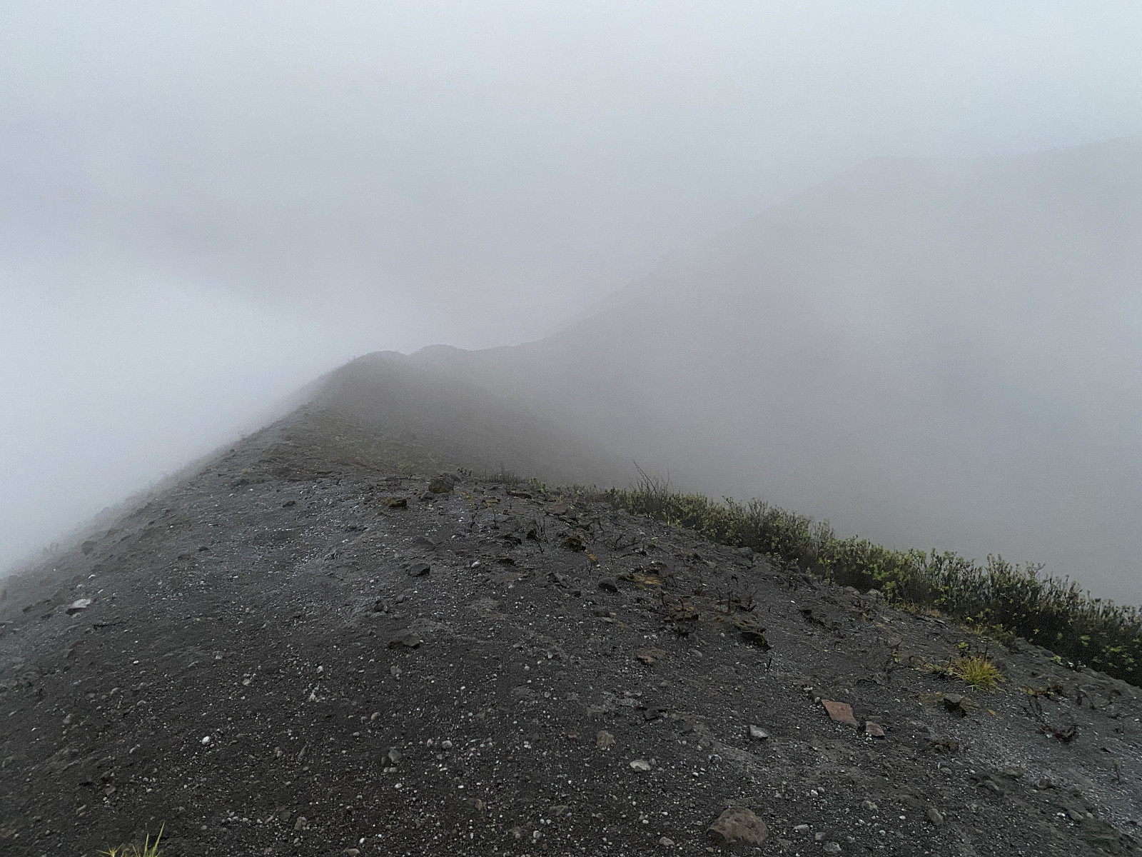
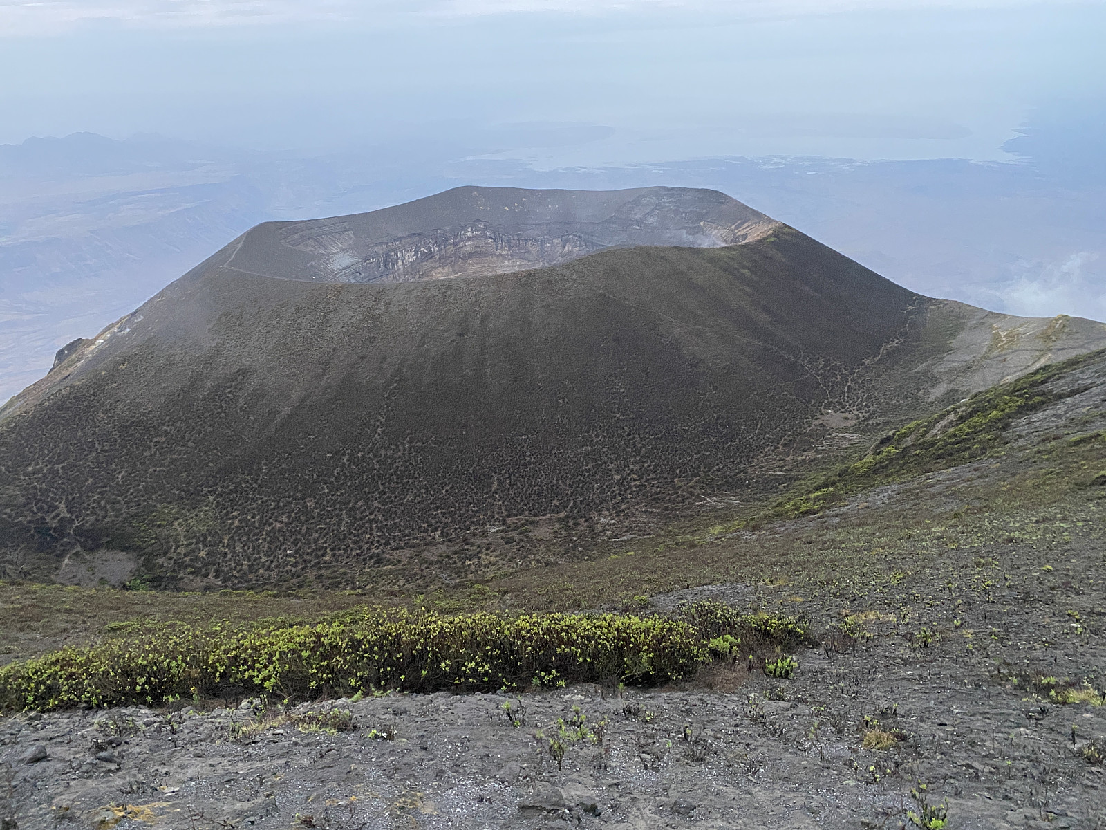
Back up at the crater rim, the weather was foggy as before, but time was about 5:50 by now, and twilight was beginning; and so I could actually see the bottom of the crater through the fog, though it was impossible to get a good photo of it at this time. As I turned around to go back down to Frank and Isaya, however, I could all of a sudden see the true summit of the mountain, right there on the other side of the valley where we had been having tea. My two friends were still deep asleep, and so I decided to summit the mountain all by myself. There was a fairly good trail along a ridge towards the summit, and it was just to follow that one all the way up to the top (images ## 18 & 19). Isaya later told me that the trails up there are all made by mountain goats, as people usually don't go up there. The tourists are generally content once they've looked into the volcano; and no one actually cares to go up to the summit proper.
Video #3: View from the south side of the ridge of the crater, down into the crater, where dark, black greyish lava is seen squirting from the deep. Unfortunately, the sound from the volcano is hard to distinguish from that of the wind, though you couldn't miss it when you were there.
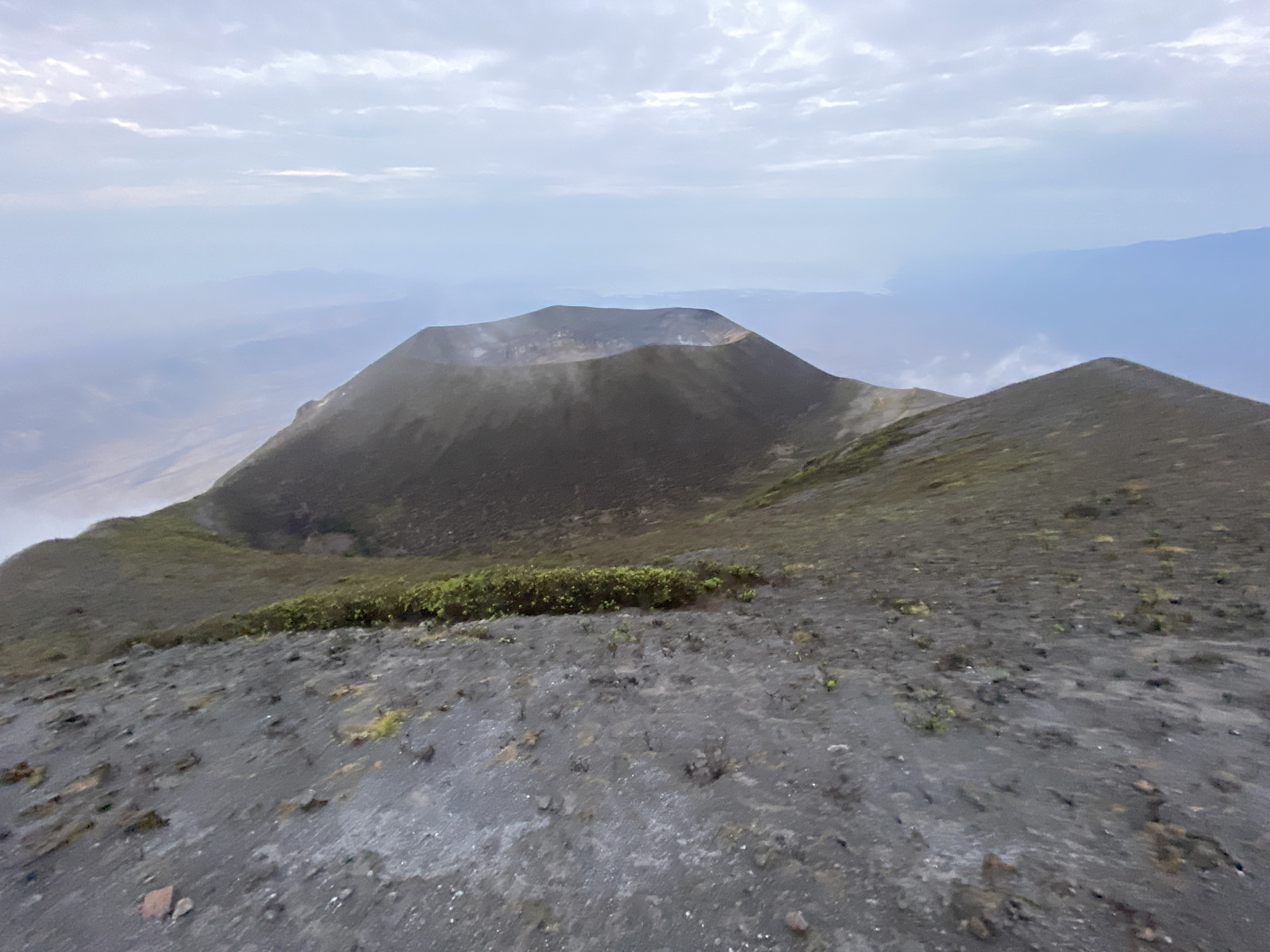
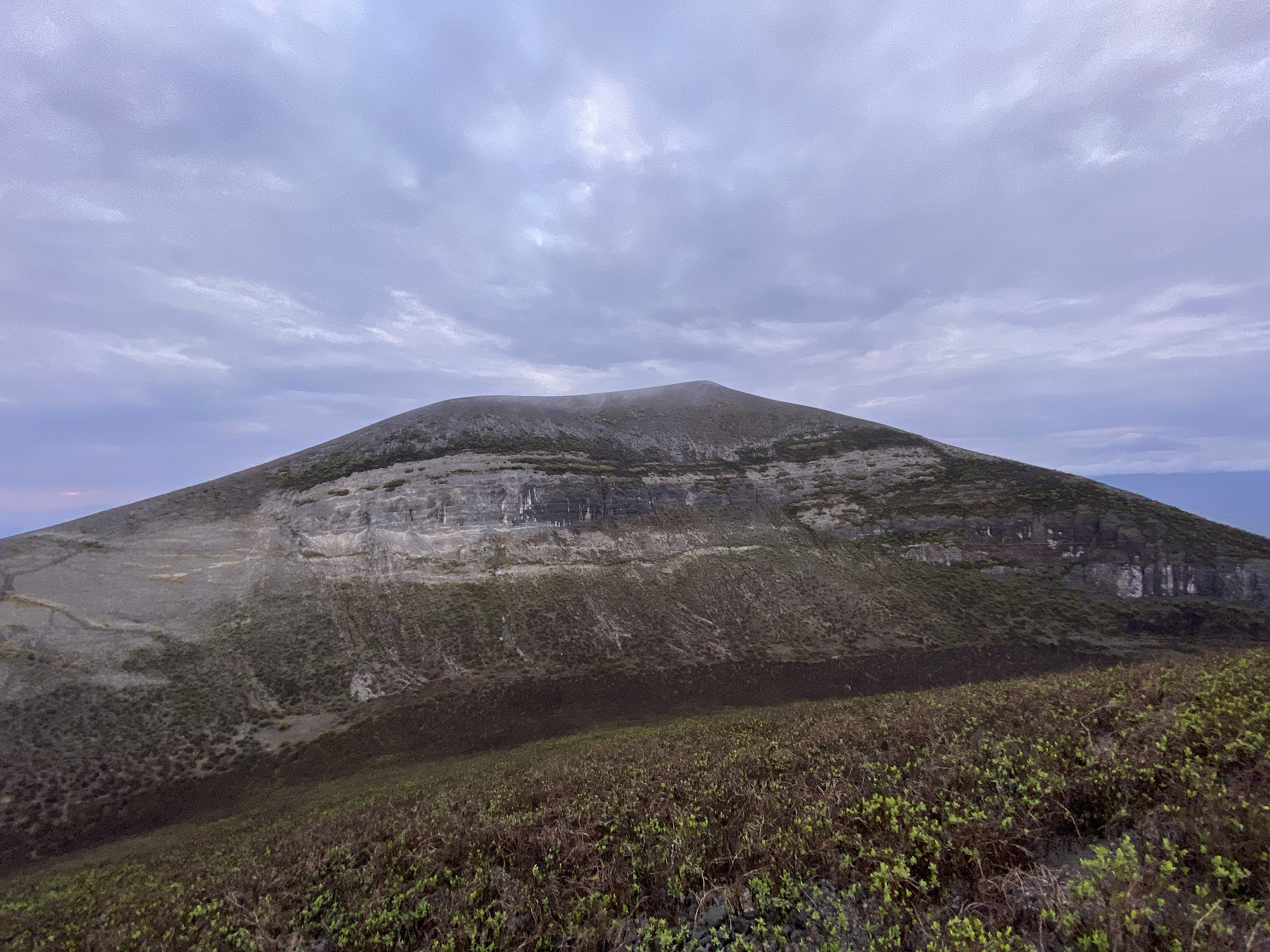
As I reached the summit, I was thrilled to see that the clouds were breaking up, just as we had been hoping. To begin with just a little, but then enough that I could get a nice view and some nice shots of the volcano crater (images ## 20 & 21, and video #2); and I also got a fairly nice view of some of the surrounding mountains, though I never got to see Mount Loolmalasin, just about 30 km south of us; as it was still very cloudy in that direction. As I was looking down into the valley beneath me, the one in which Frank and Isaya were still sleeping; I noticed that it had a rim on absolutely all sides, and that was when I realised this must be an older crater of Ol Doinyo Lengai. There is no tarn, or lake in this valley, however, which means that rainwater probably leaves it through holes in the ground, similar to the ones from which we had seen yellow steam emerging. And as there was a brief opening in the clouds even towards the south, I got a short glimpse of a similar valley, just south of the summit. Even this one looked like an older crater, though on this one much more of the crater rim had been eroded away, and so it had an opening towards the south, through which rainwater may leave. Volcanic mountains are generally known to change quite a bit over time; and they occasionally form new craters when they have new eruptions. Moreover, the summit of Ol Doinyo Lengai is said (on Wikipedia and elsewhere) to be 3188, which might actually have been true at some time. The current elevation of the mountain is, however, slightly less that 3000 metres, which was, I have to admit; a slight disappointment, as I was standing there on top of the mountain, realising by a glance at my GPS there's no way this mountain might be 3188 m.a.m.s.l.
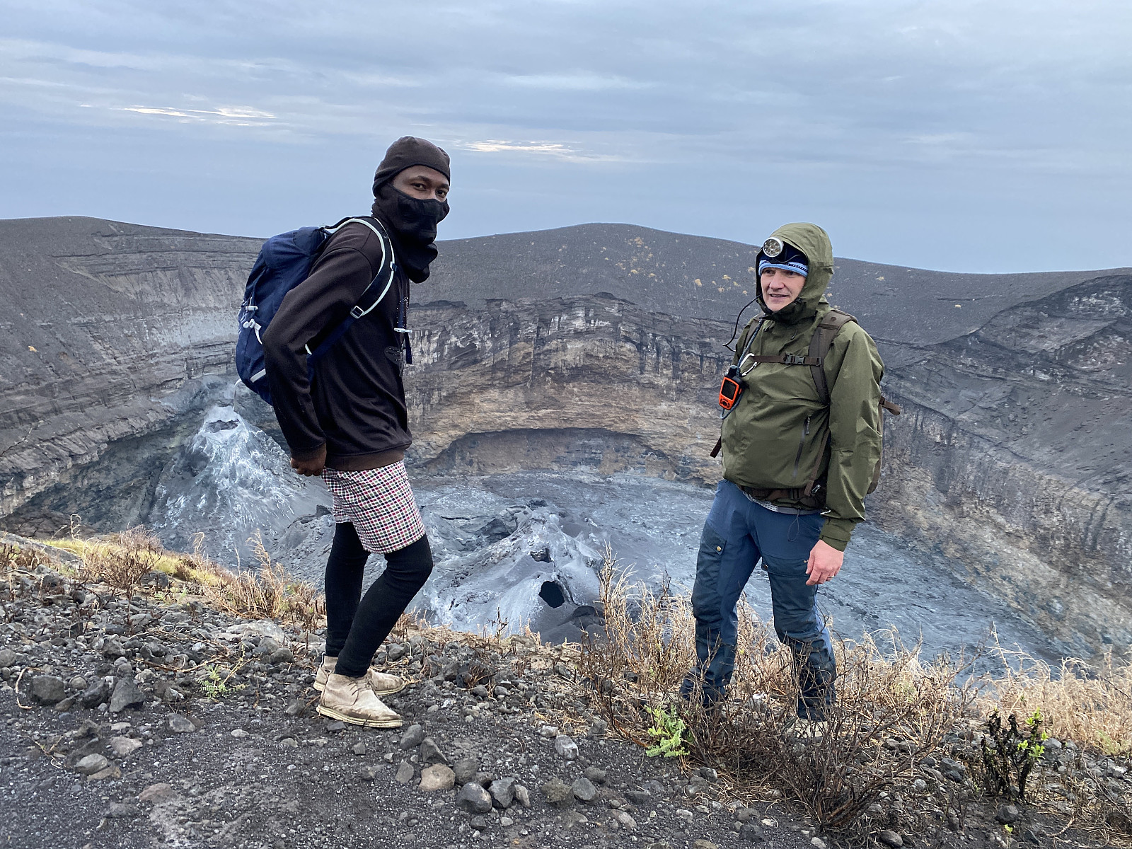
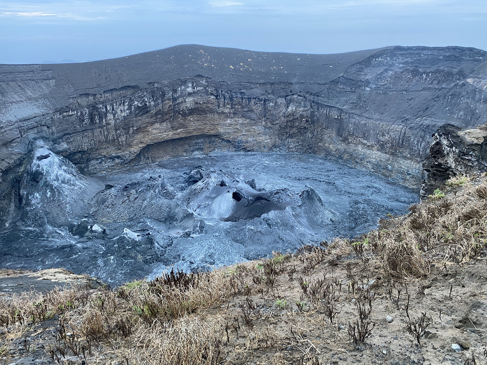
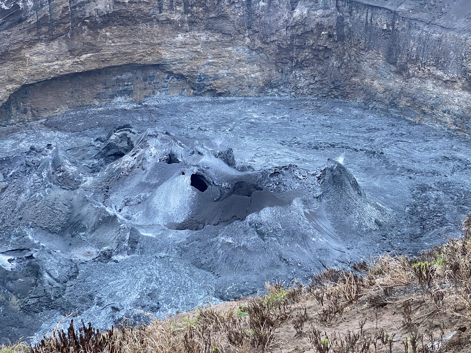
I was suddenly pulled out of my thoughts there on top of the mountain, however, as I heard someone from below shouting my name. That's Frank's voice, I said to myself. I tried to shout back to him, and I even tried to wave my hand hoping they would see me; but I don't think they did, and so I decided to go back down to them, lest they start thinking I've fallen into the crater or something. I met them down in the valley [i.e. the older crater], and then we went together back up to the current crater rim. Time was now about 6:30 as we again reached the highest point of the crater rim; and this time we could actually see the crater activity very well, as there was black, muddy-looking lava being spitted from cones of solidified lava [i.e. hornitos] on the floor of the crater. Isaya said it was a pity we couldn't see anything prior to sunrise (due to the clouds), as the hot lava has a red appearance at night. When visiting a volcano like this in a phase that the activity is more or less confined to the crater, you only get a little glimpse of the immense power it has. But when you think of the power displayed when it has an explosive eruption, throwing ashes thousands of meters into the atmosphere; it is easy to understand that the Masai people have called it Ol Doinyo Lengai, which means The Mountain of God in the Masai language.
Video #4: Another view into the crater from the crater rim of Ol Doinyo Lengai. In addition to the black greyish lava squirting up from an orifice in the crater floor, you may also se yellow, sulphurous steam emerging from the far end of the perimetry of the crater floor.
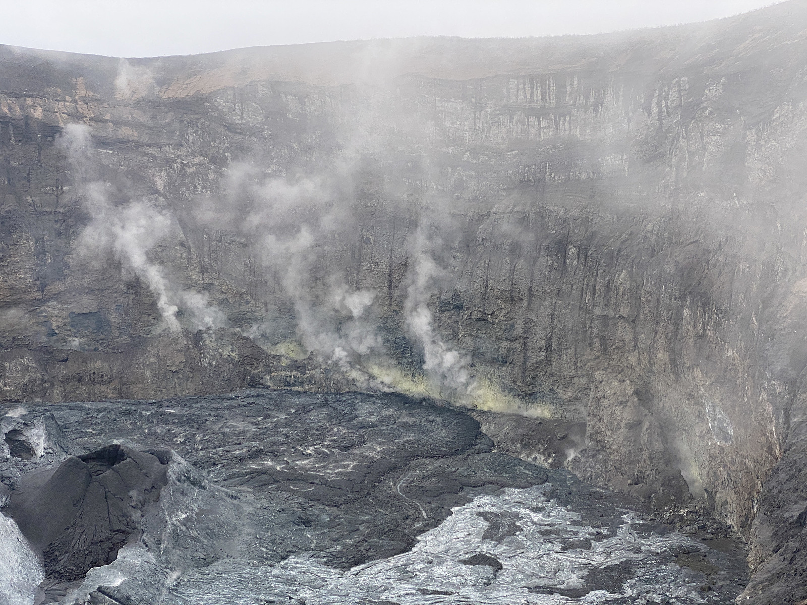
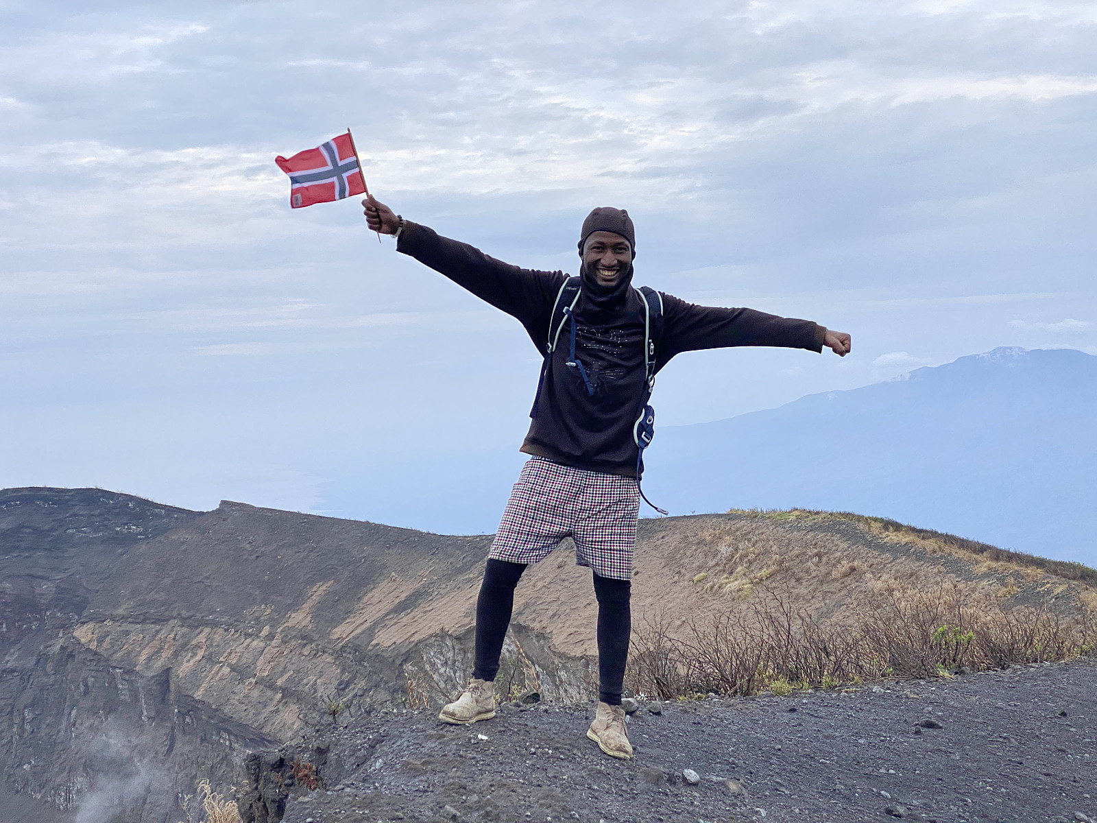
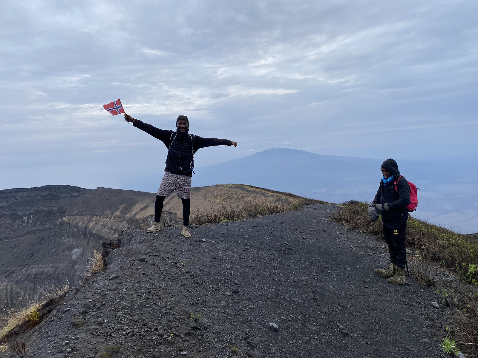
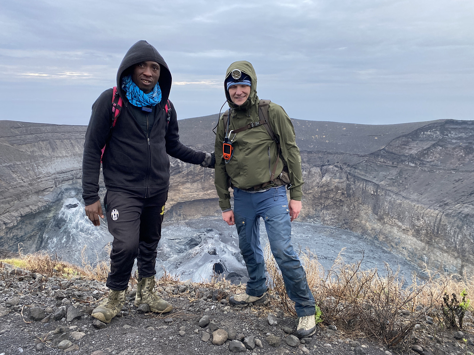
We captured a lot of photos up there, and even made a few video recordings (images ## 24 & 25, and videos ## 3 & 4). We also shot images of each other as we posed in front of the crater, and Frank waved a Norwegian flag that he had talked me into bringing him all the way from Norway. After some minutes on the south rim of the crater, we moved along the rim towards the west, and from there we could se yellow steam columns emerging from between the crater floor and the eastern wall of the crater (image # 30 and video #4). I found this volcano extremely fascinating. This was in no way my first visit of an active volcano, as I visited Mount Nyiragongo along with my wife back in 2017 [Vulkan-trekking på Mount Nyiragongo], but this volcano was different, and it was interesting to be able to see some of the differences with my own eyes, even though I had previously read about them.
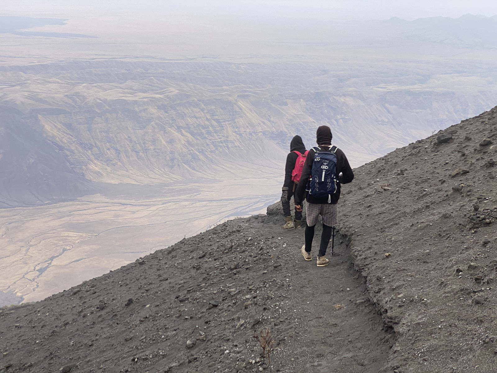
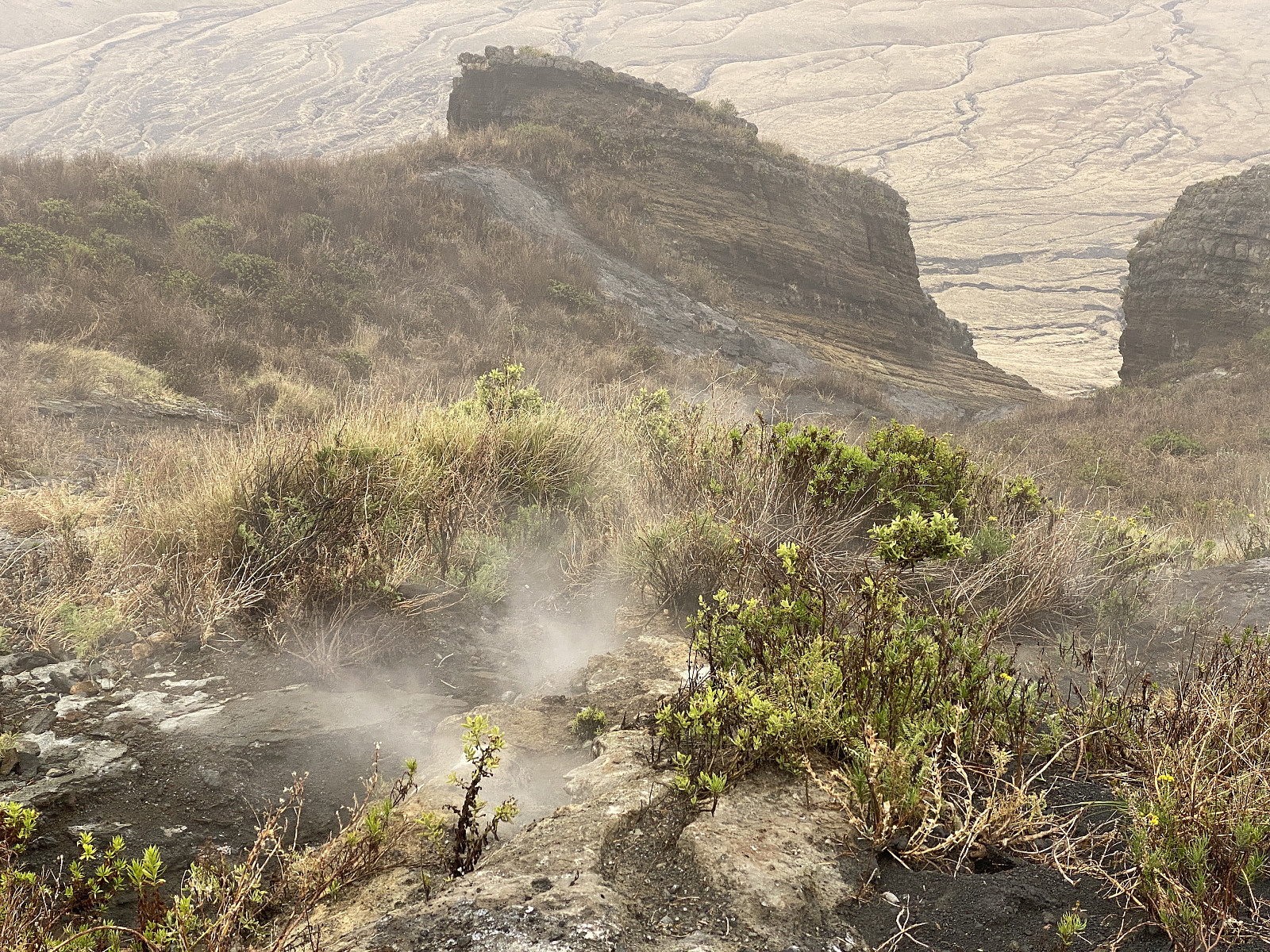
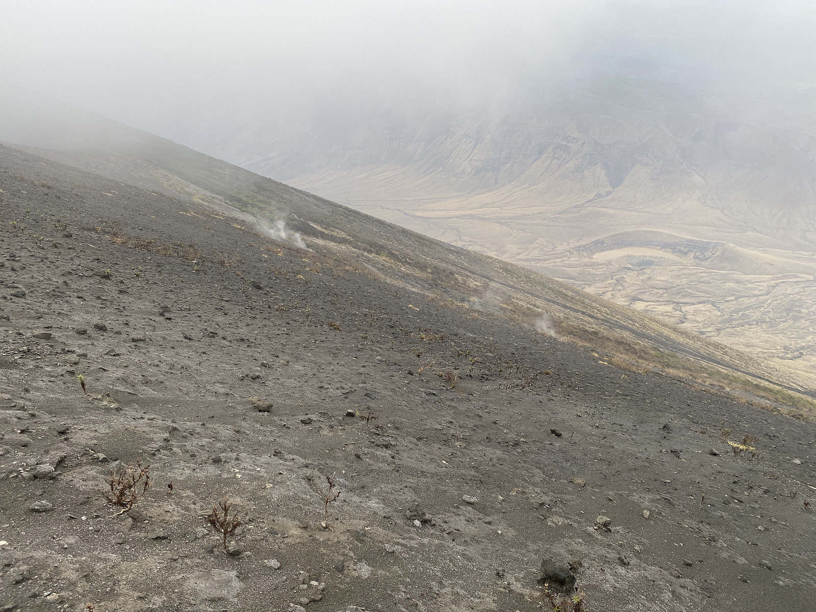
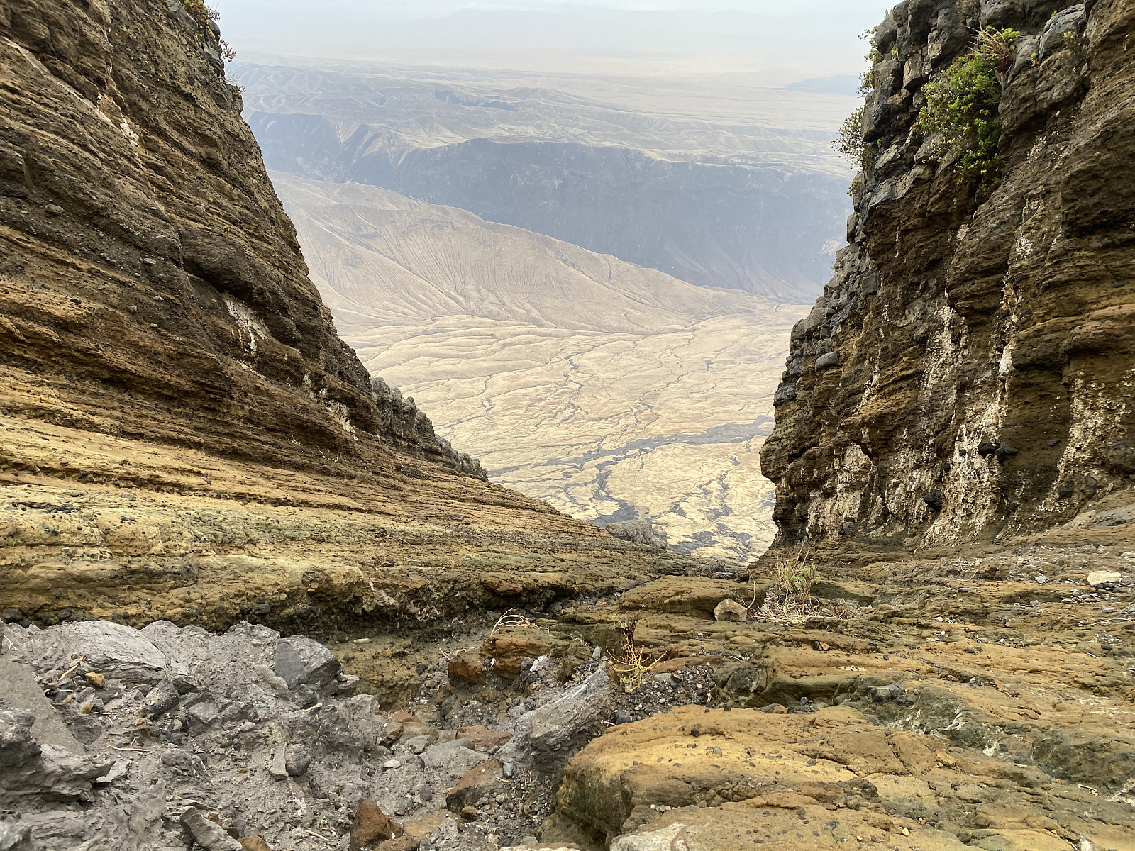
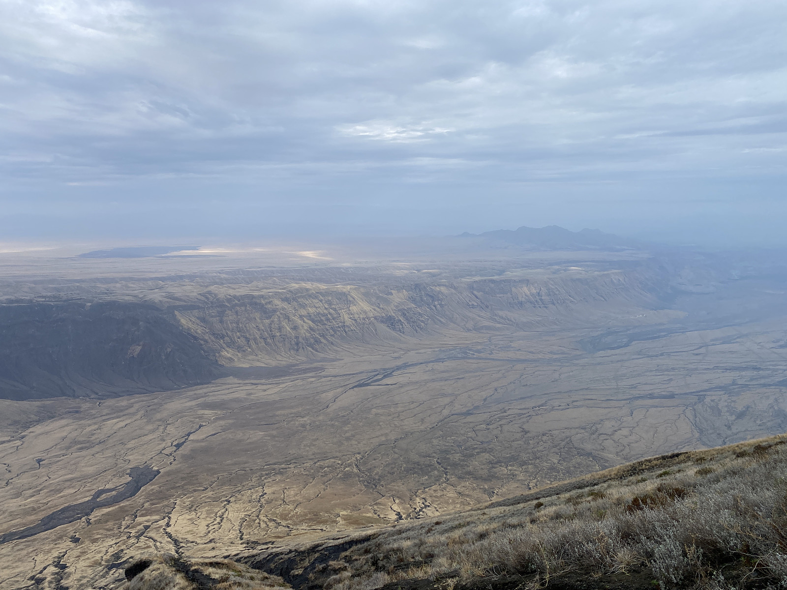
On the west side of the rim of the crater, we found the trail by which we had climbed the mountain by night; and as we had seen what we wanted to see (apart from a non-cloudy sunrise), we immediately embarked upon our descent from the mountain. As we descended on the outside of the crater rim, we could see yellow steam coming out of the ground at multiple places (image #31), and not just through the one hole that we had seen at night. We continued downwards along the trail, and not very far down, it took us through a cleft between two large knolls (images ## 33 - 35 and video #5). As we emerged from the cleft, on the lower end of it, we had a magnificent view of the 400 meters high escarpment lining the west side of the Gregory rift (images ## 36 & 37), and also of the rift floor beneath it. Moreover, to the north we had a pretty nice view of Lake Natron, though it was a bit obscured by distance fog; and to the north west we could see the plains called Angata Salei, just on top of (and west of) the mentioned Gregory rift escarpment.
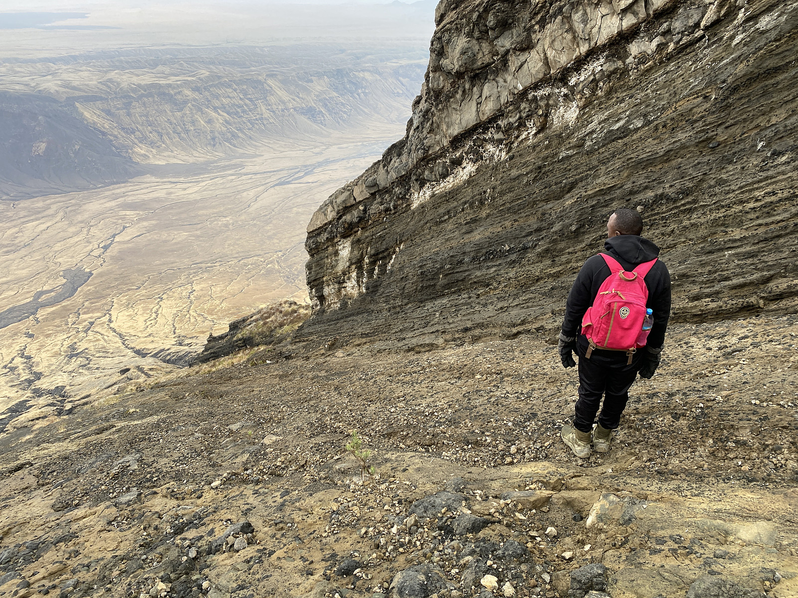
To begin with, we had to descend a bit slowly, as the mountain side was steep, and Frank's shoes were still quite slippery. Isaya offered him to borrow a walking pole that he had with him, however, and that helped him descend a bit more safely. As the slopes of the mountain gradually flattened out a bit, we could increase our speed, however, and from about 1800 metre's elevation I began jogging down towards the car and our driver, who were waiting for us. Frank and Isaya were unable to keep up with my jogging this morning (maybe at least in part due to Frank's slippery shoes), and Frank later told me that Isaya had asked him whether I had wings to fly with. Nevertheless, they arrived at the car only about 10 minutes or so after me, and there by the car we had a little to eat and drink before driving down to Isaya's village, Engaresero.
Vide #5: A video from within the cleft seen on images ## 33-35.

Isaya had arranged for Frank and I to have a shower in Mikuyu Camp before leaving; as we were having a long drive ahead of us before reaching Arusha. Now, this camp is located very close to the village of Ngaresero, so while Frank and I were having a shower, the driver took the car down to the centre of the village to have something welded on it. Having a shower felt really good after the spectacular trek that we had just had. Moreover, as we were waiting for the driver to come back, after we finished showering, we got to relax for some minutes in the beautiful garden of this camp. The driver soon came and picked us up, however, and off we went towards Arusha. Frank and I had hardly slept this night, and so we slept in the car throughout most of our journey back to Arusha; where we had planned to climb Mount Meru [4566 m.a.m.s.l.], as the next step in my altitude acclimatisation for Kilimanjaro.


User comments