
Middagshaugen and Skredfjellet (16.07.2022)

Written by hbar (Harald Barsnes)

| Start point | Berge (186m) |
|---|---|
| Endpoint | Berge (186m) |
| Characteristic | Hillwalk |
| Duration | 4h 36min |
| Distance | 11.6km |
| Vertical meters | 998m |
| GPS |
|
| Ascents | Middagshaugen (1,030m) | 16.07.2022 |
|---|---|---|
| Skredfjellet (944m) | 16.07.2022 | |
| Visits of other PBEs | Berge utsikt (rv.5) (186m) | 16.07.2022 |
| Besshovden (592m) | 16.07.2022 | |
| Heimastølen (350m) | 16.07.2022 | |
| Skredfjellet trigmerke (935m) | 16.07.2022 |
Middagshaugen and Skredfjellet
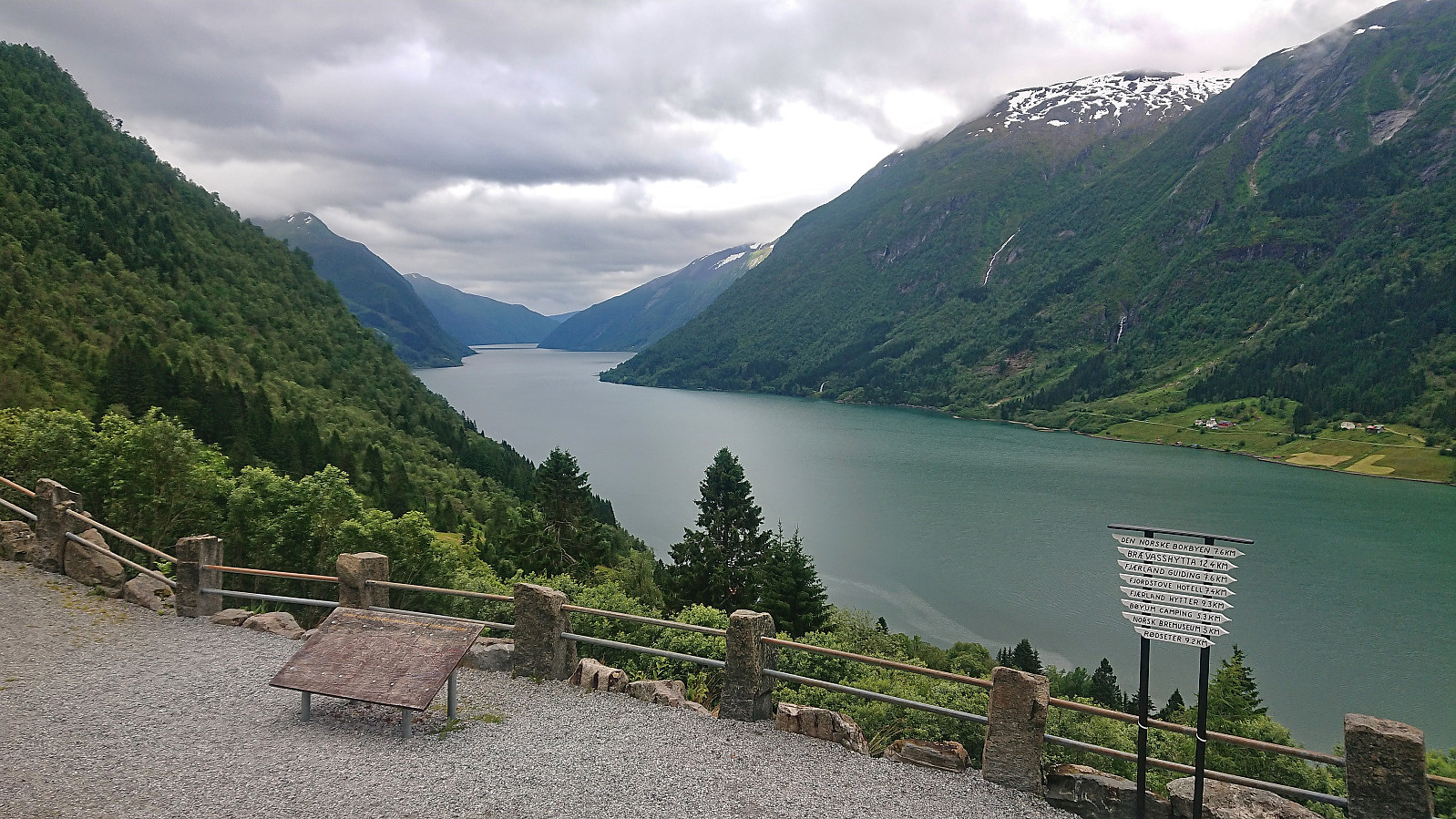
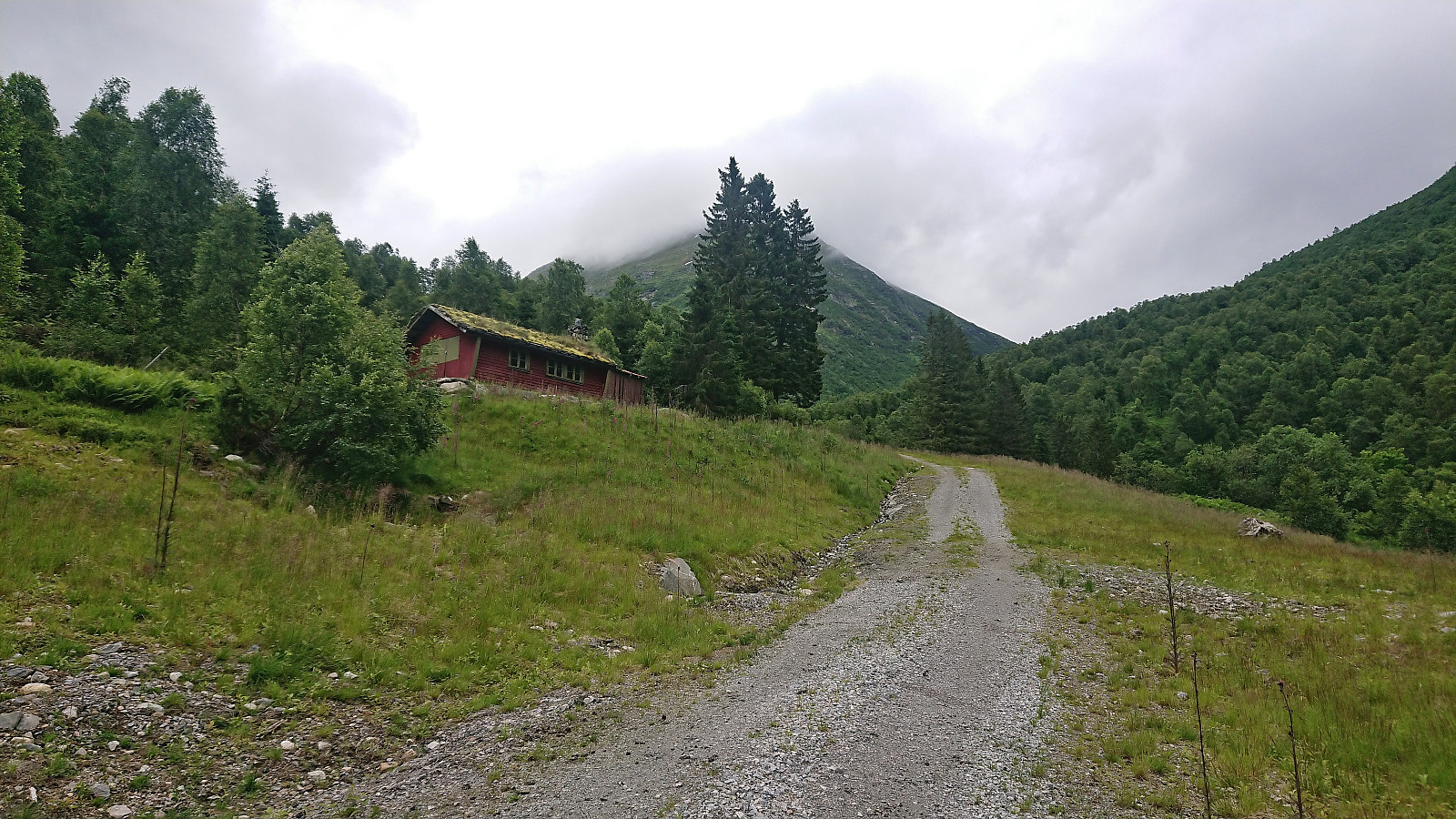
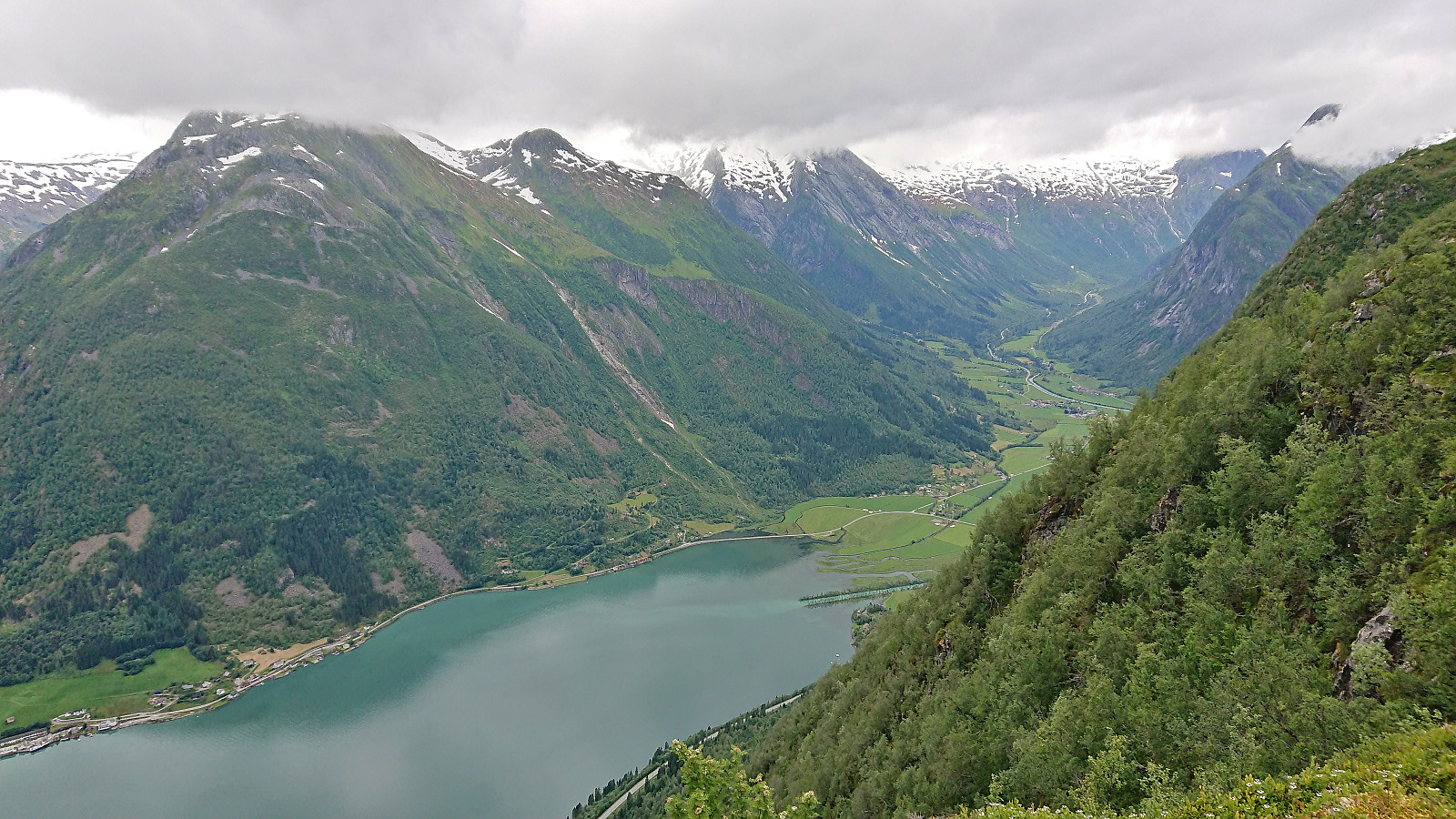
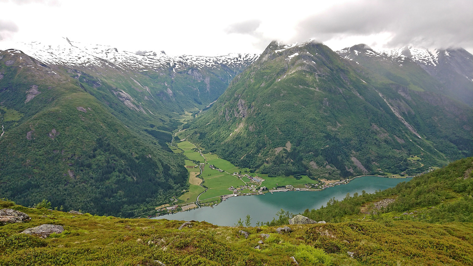
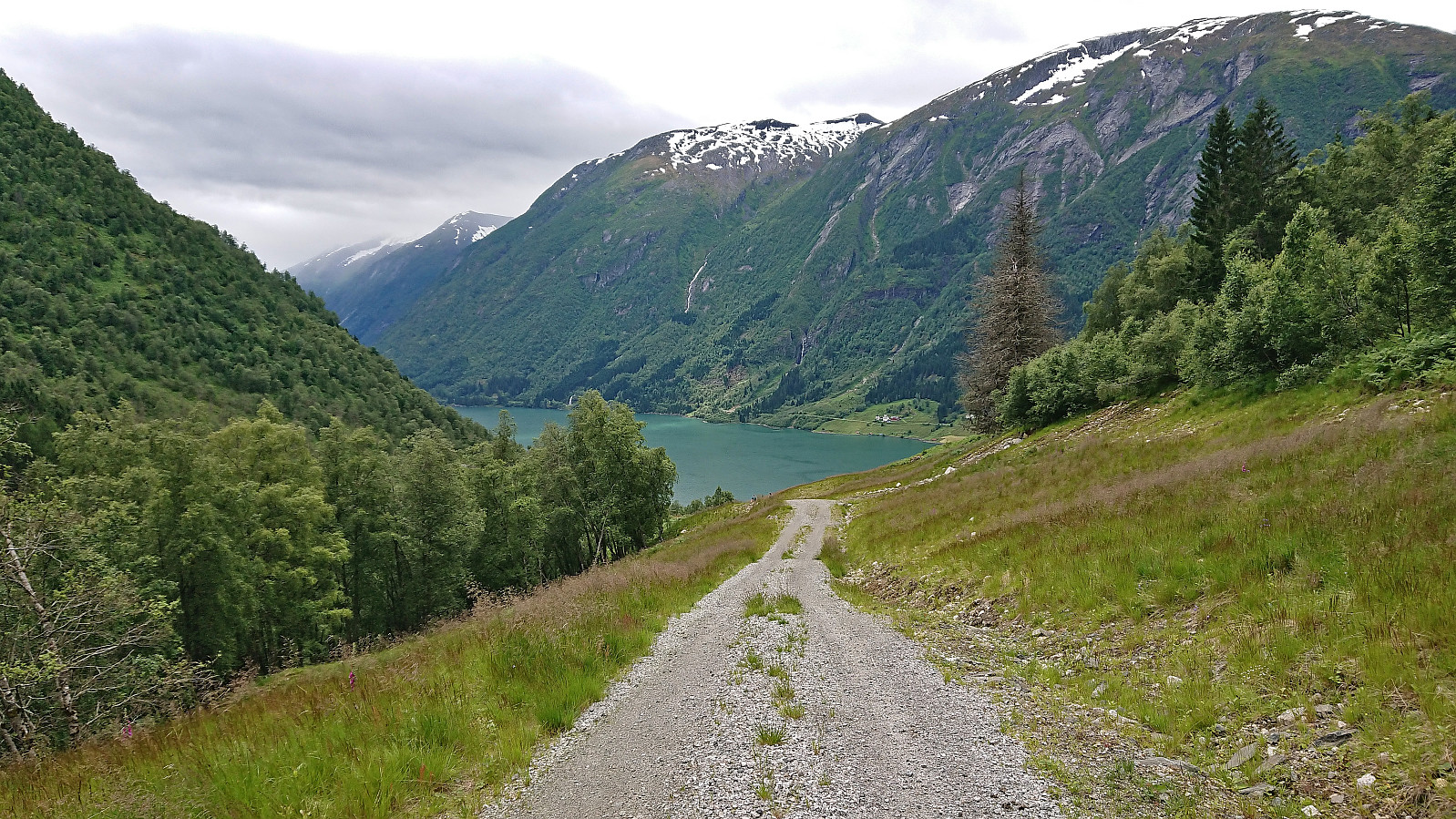
On the last day of my stay in Sogndal this time around, we decided on Middagshaugen and Skredfjellet as our targets and drove to Berge between Frudalstunnelen and Bergstunnelen. Here we parked at the small parking lot next to the viewpoint and started on the gravel road up Bessdalen. Note that after a short initial descent there is a bridge across the motor way enabling hikers to safely get to the other side of the busy road.
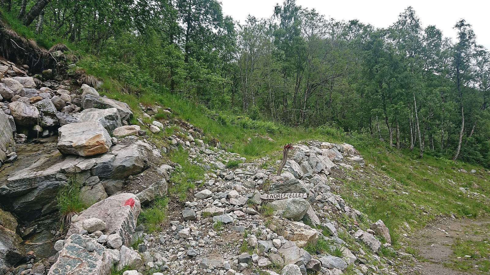
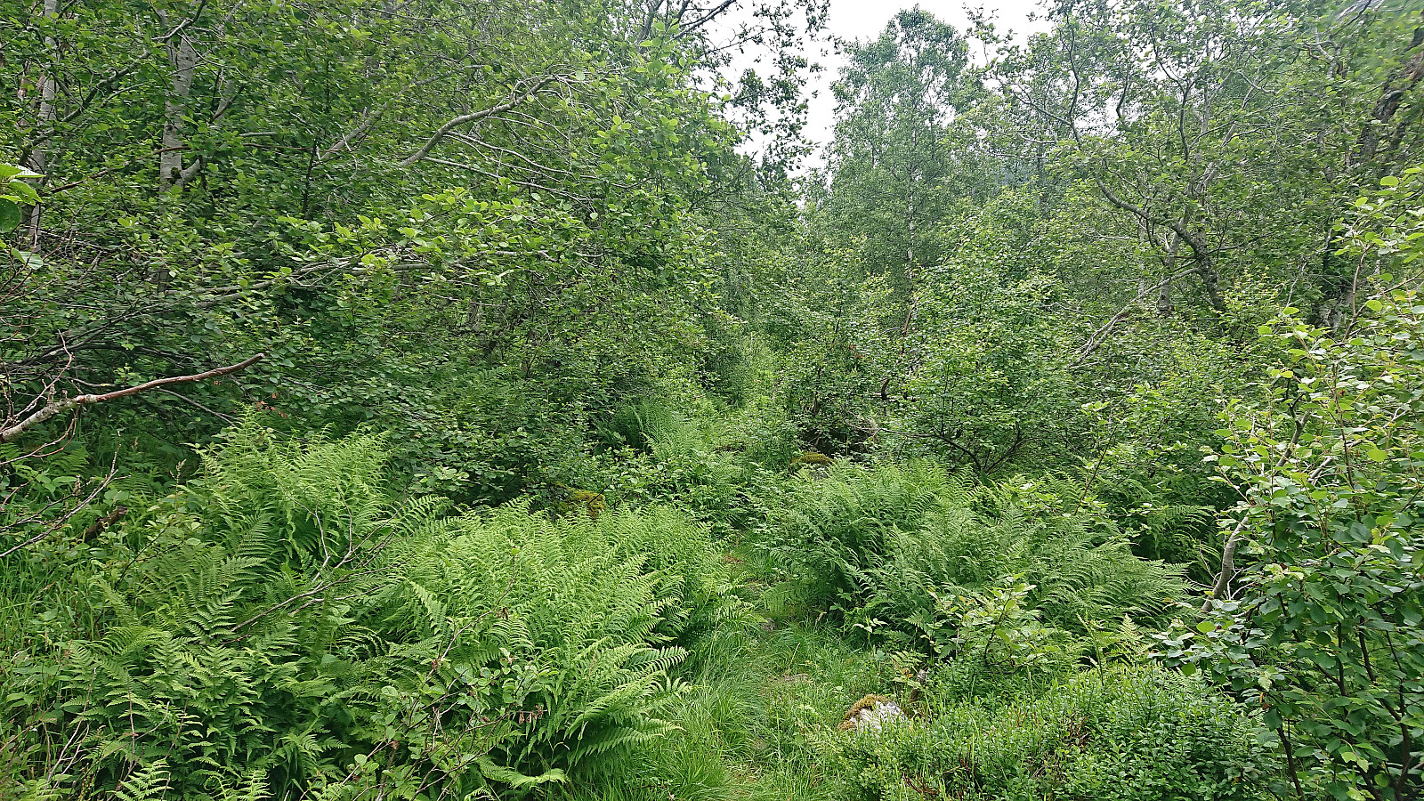
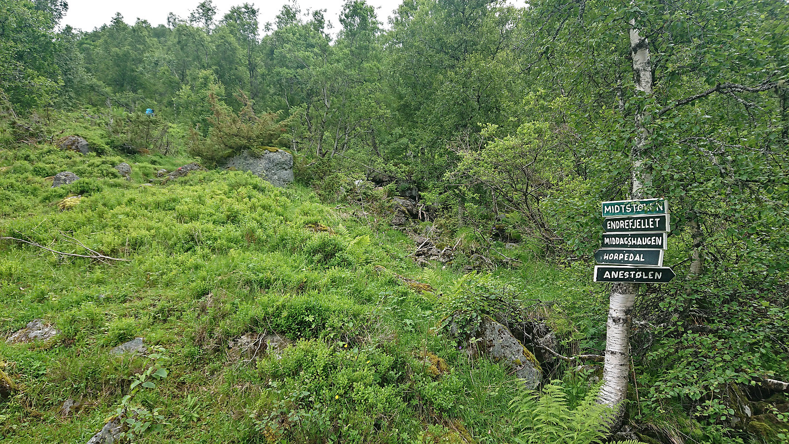
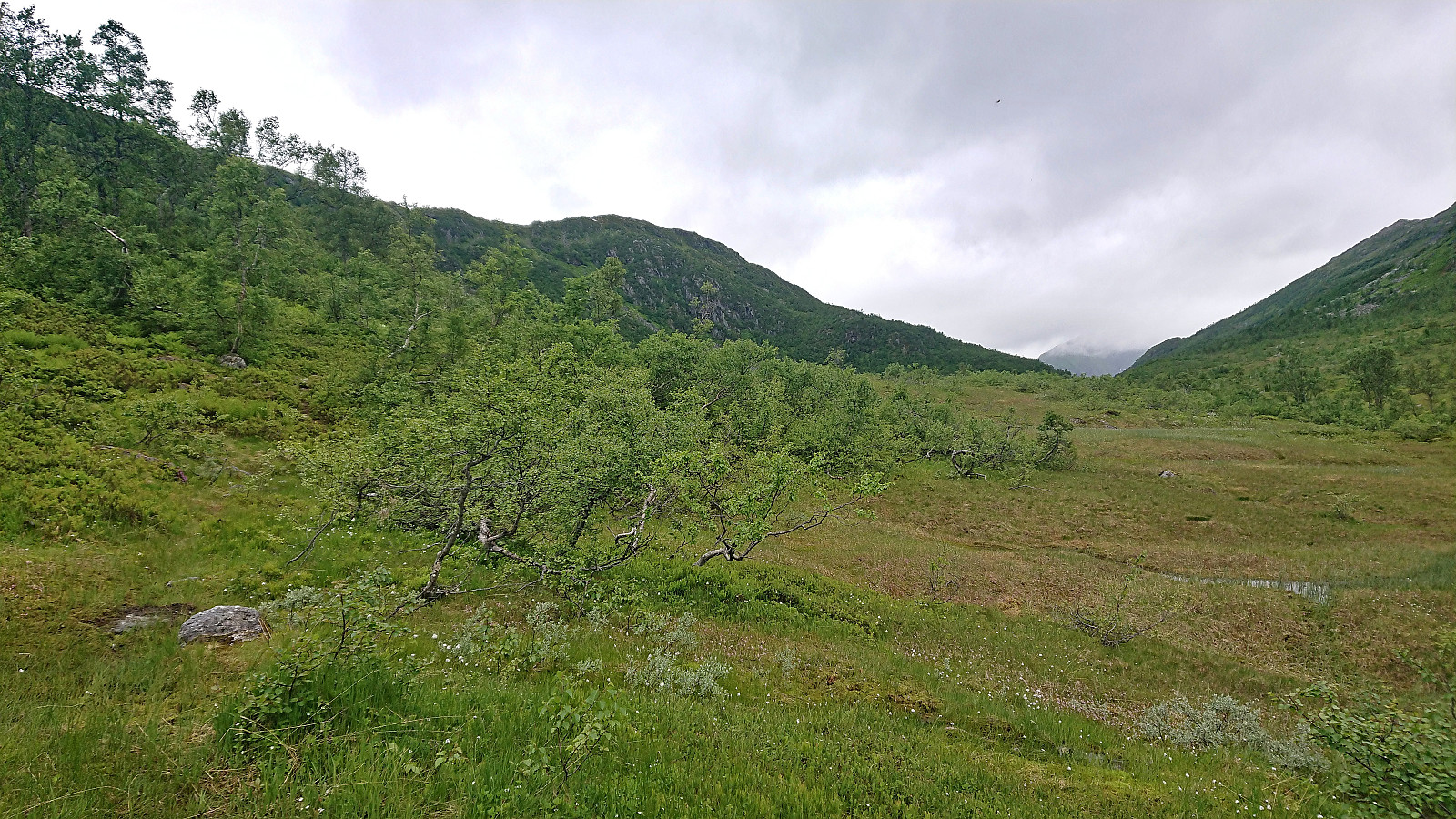
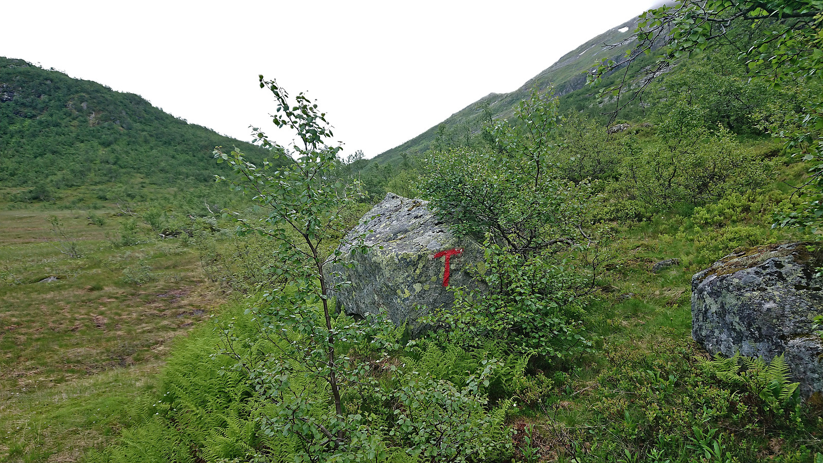
Soon we split from the gravel road at a hiking sign for Endrefjellet and followed a marked trail that would take us up to the large wet area east of the Skredfjellet ridge. Here the trail markers did continue, at least occasionally, but the trail itself was much harder to spot. The direction was however obvious and we simply headed north where we later reconnected with the marked trail.
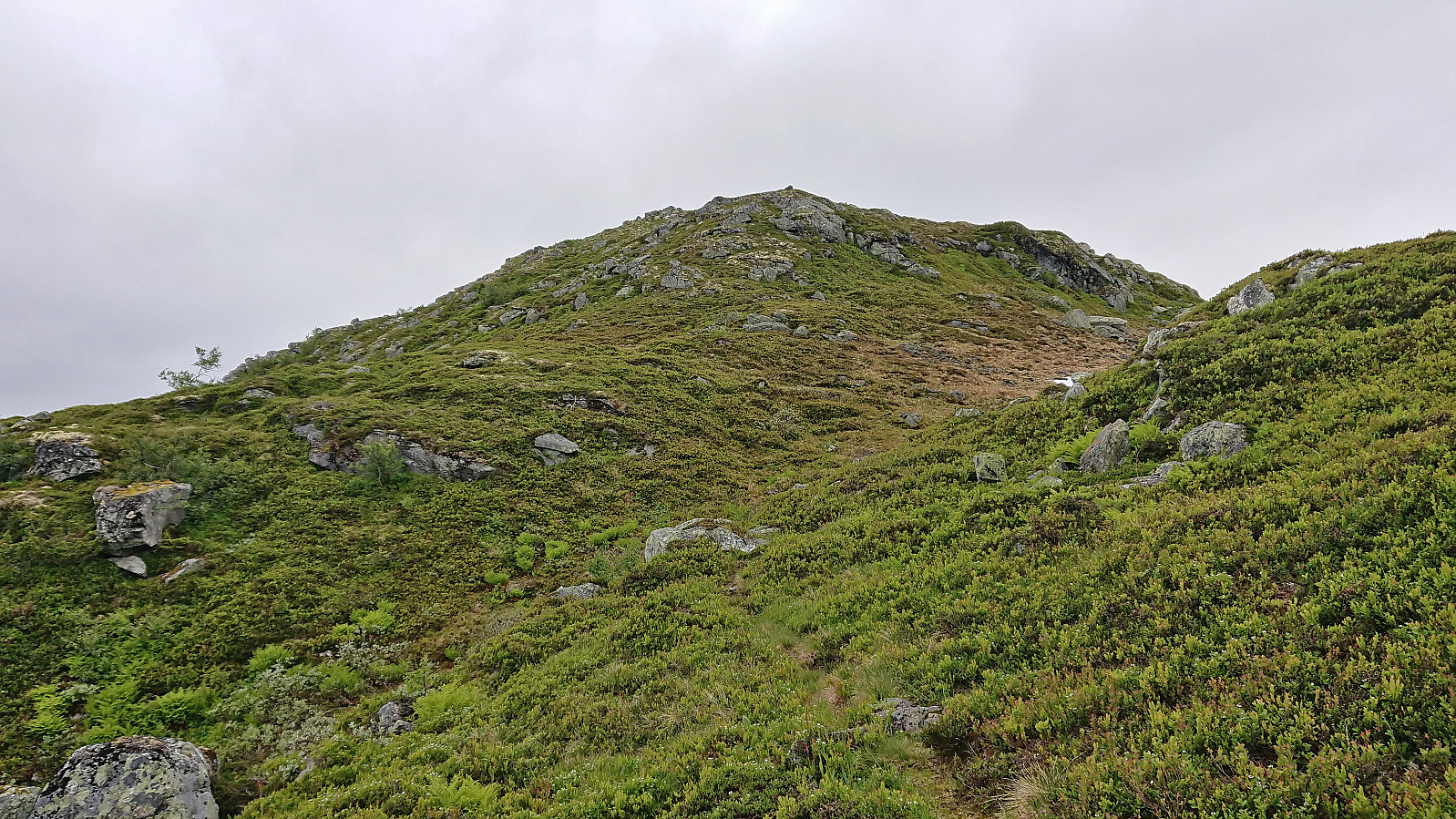
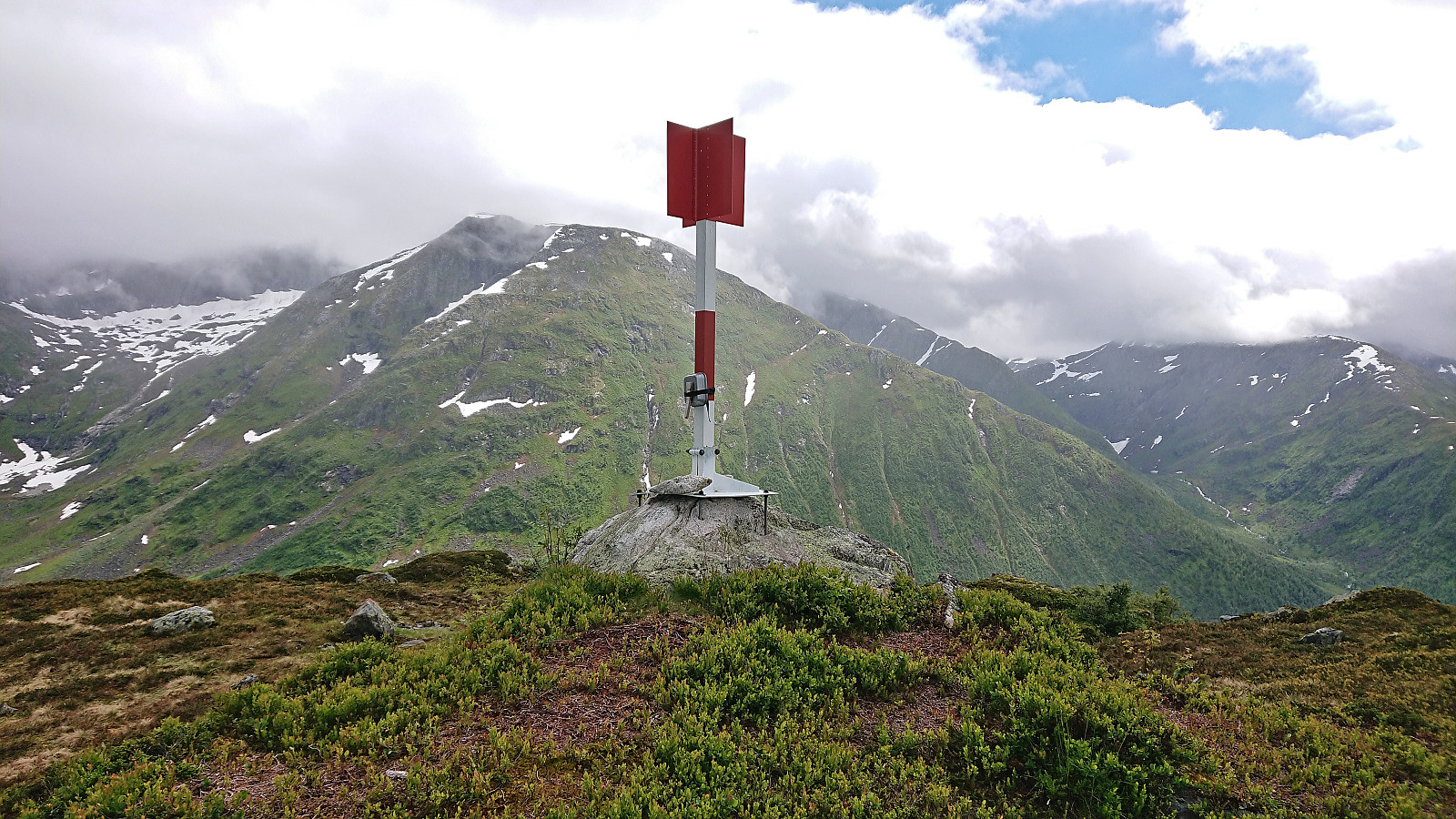
Just before the trail started descending, we came across a broken pole with hiking trail directions. Something that would strangely be a trend for the whole hike, i.e. all hiking signs where either lying on the ground or the poles had been broken. Thankfully the direction was again obvious and we could start our final ascent to Middagshaugen along the marked trail. The trail markers got weaker towards the top but the summit was reached without any issues.
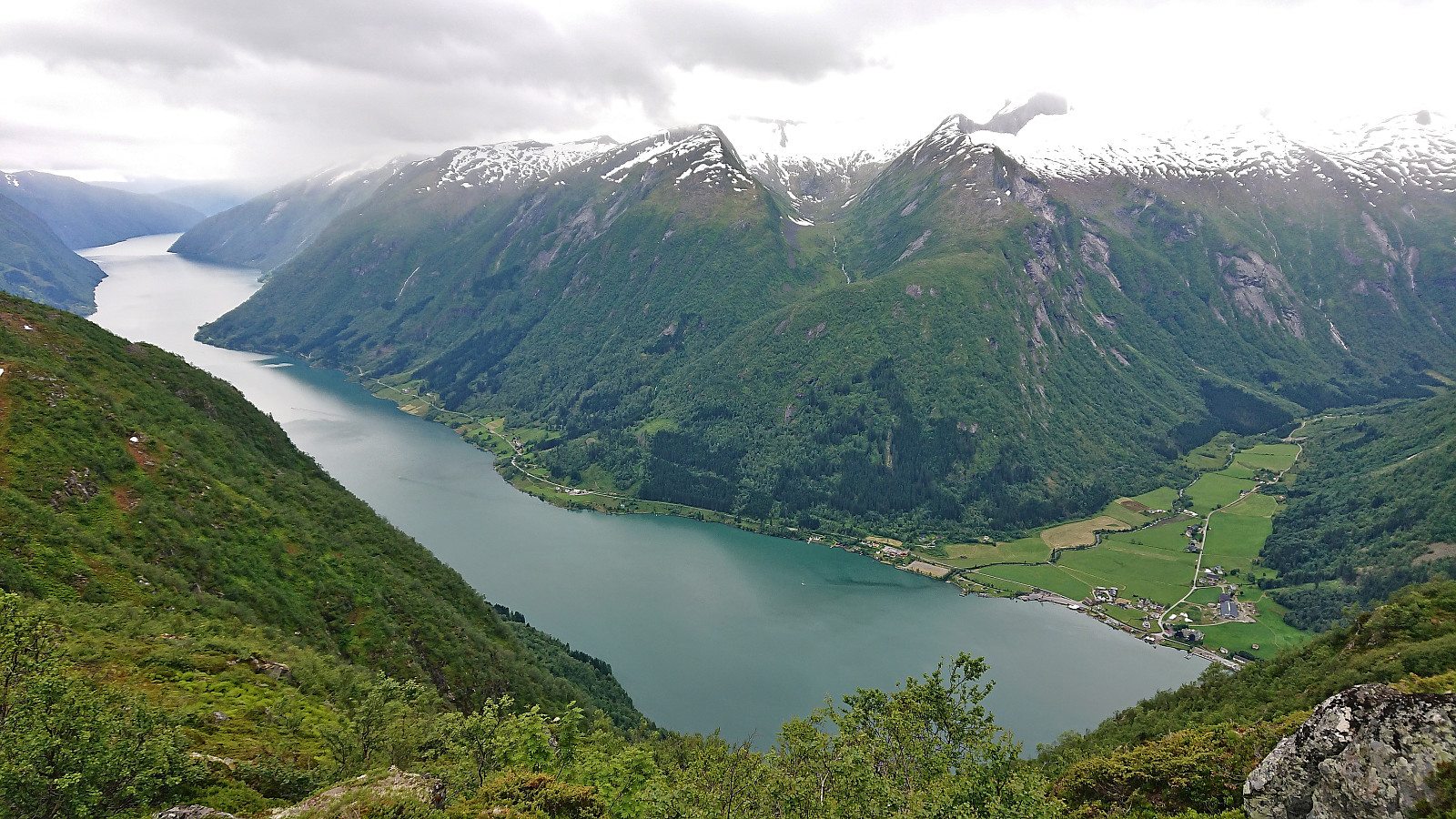
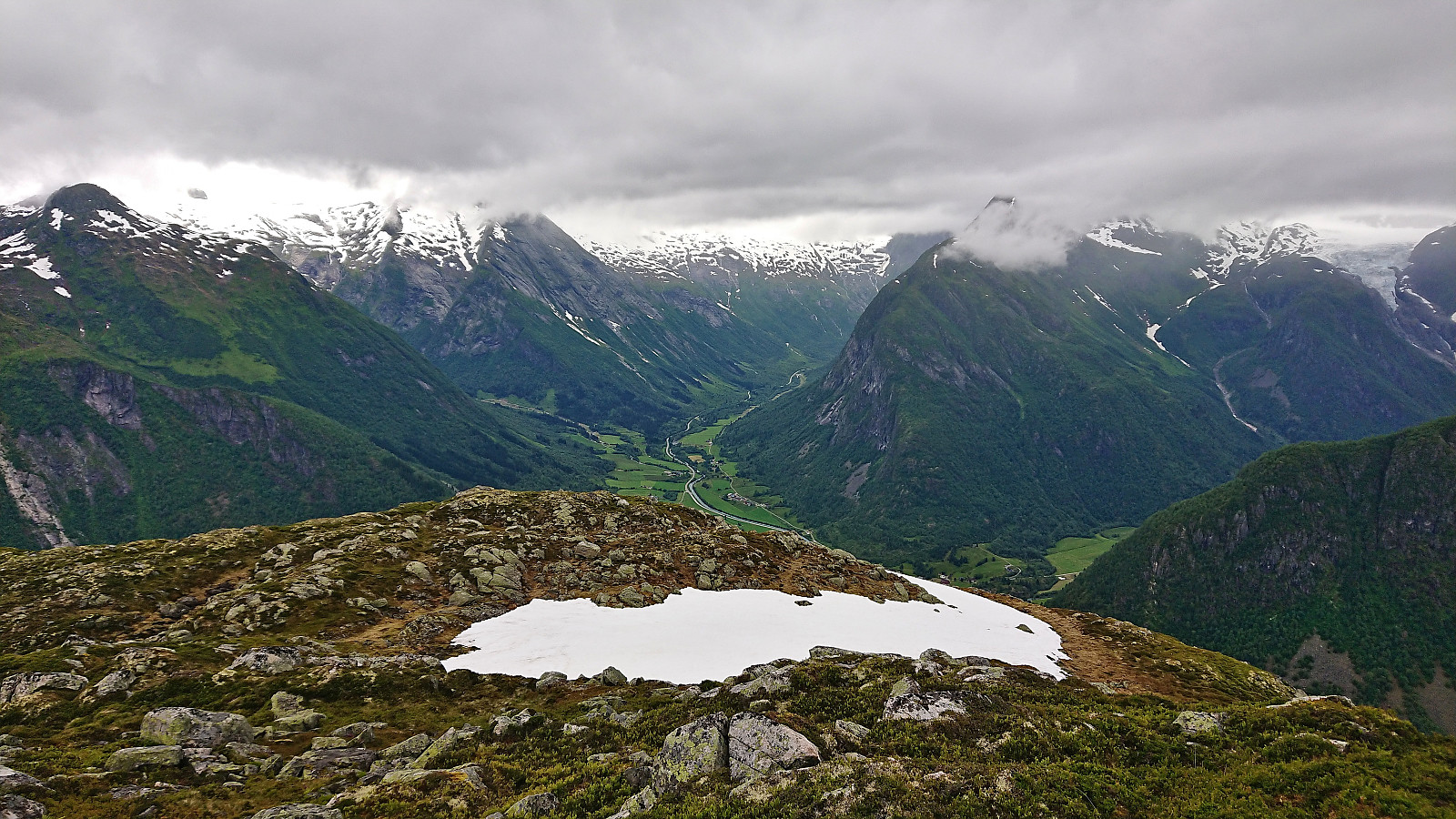
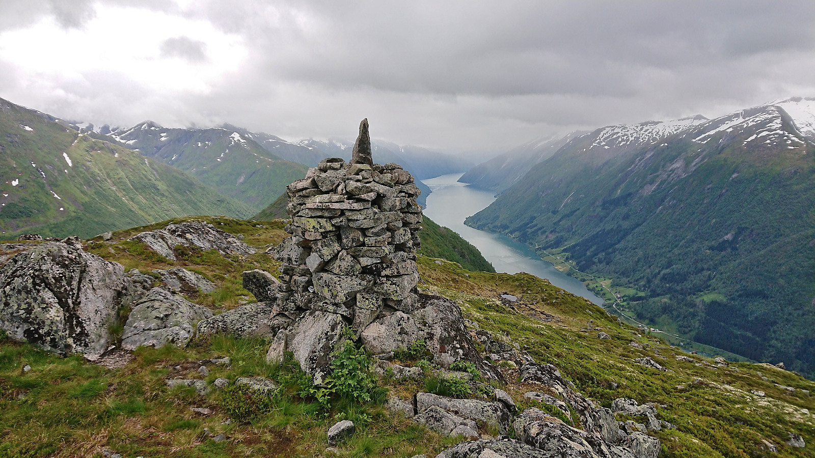
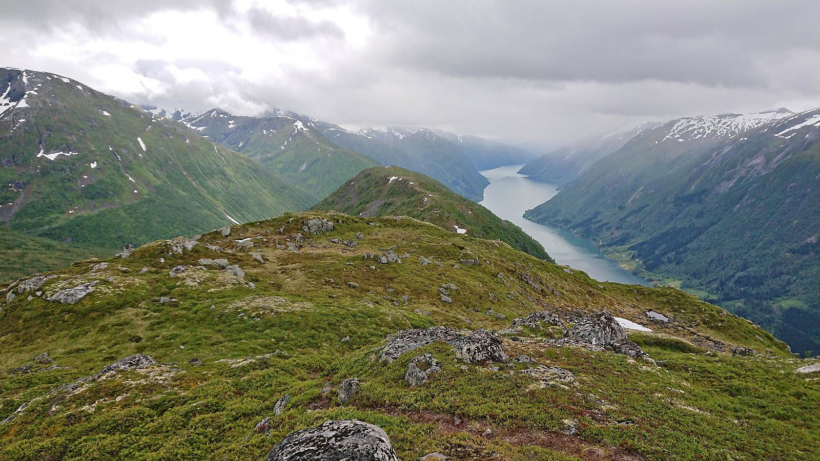
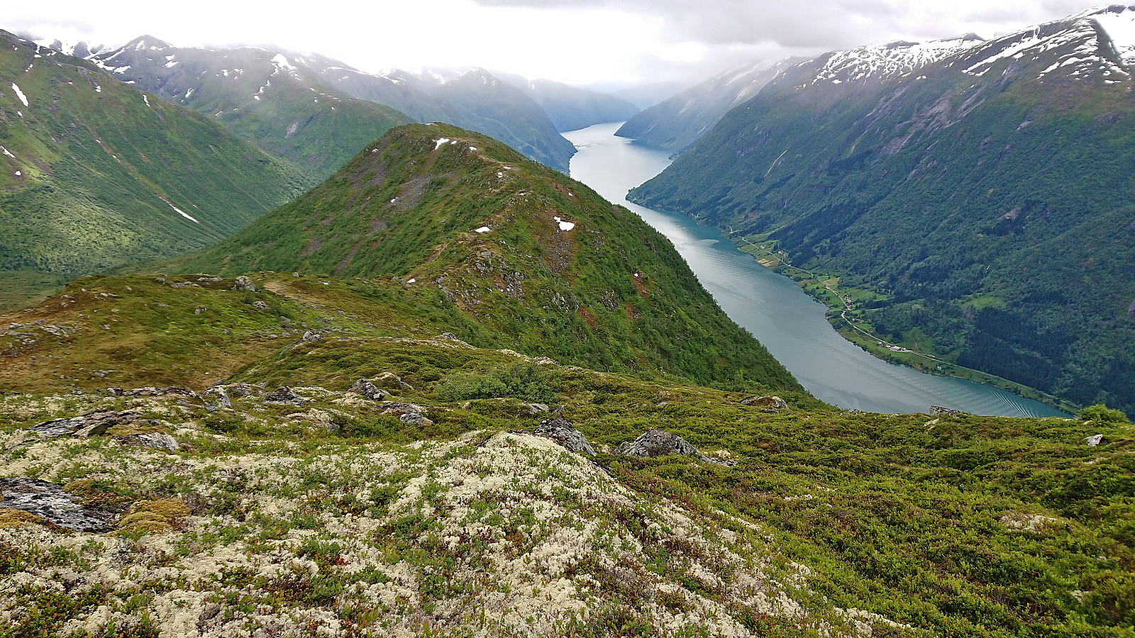
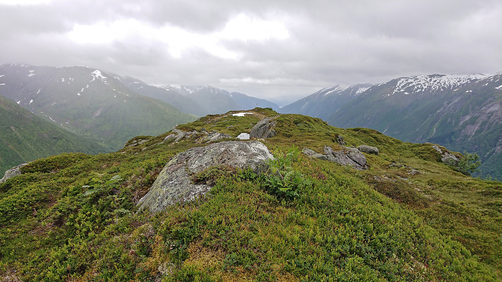
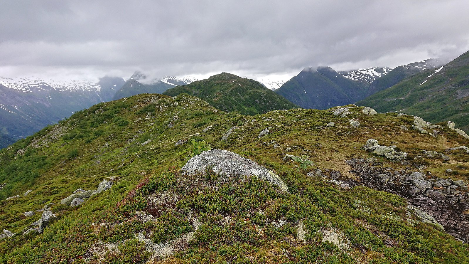
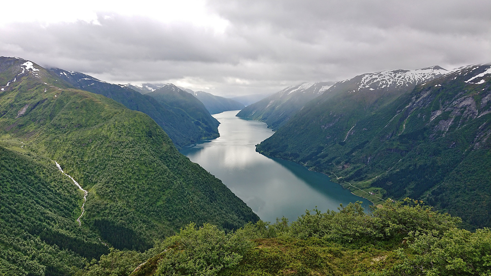
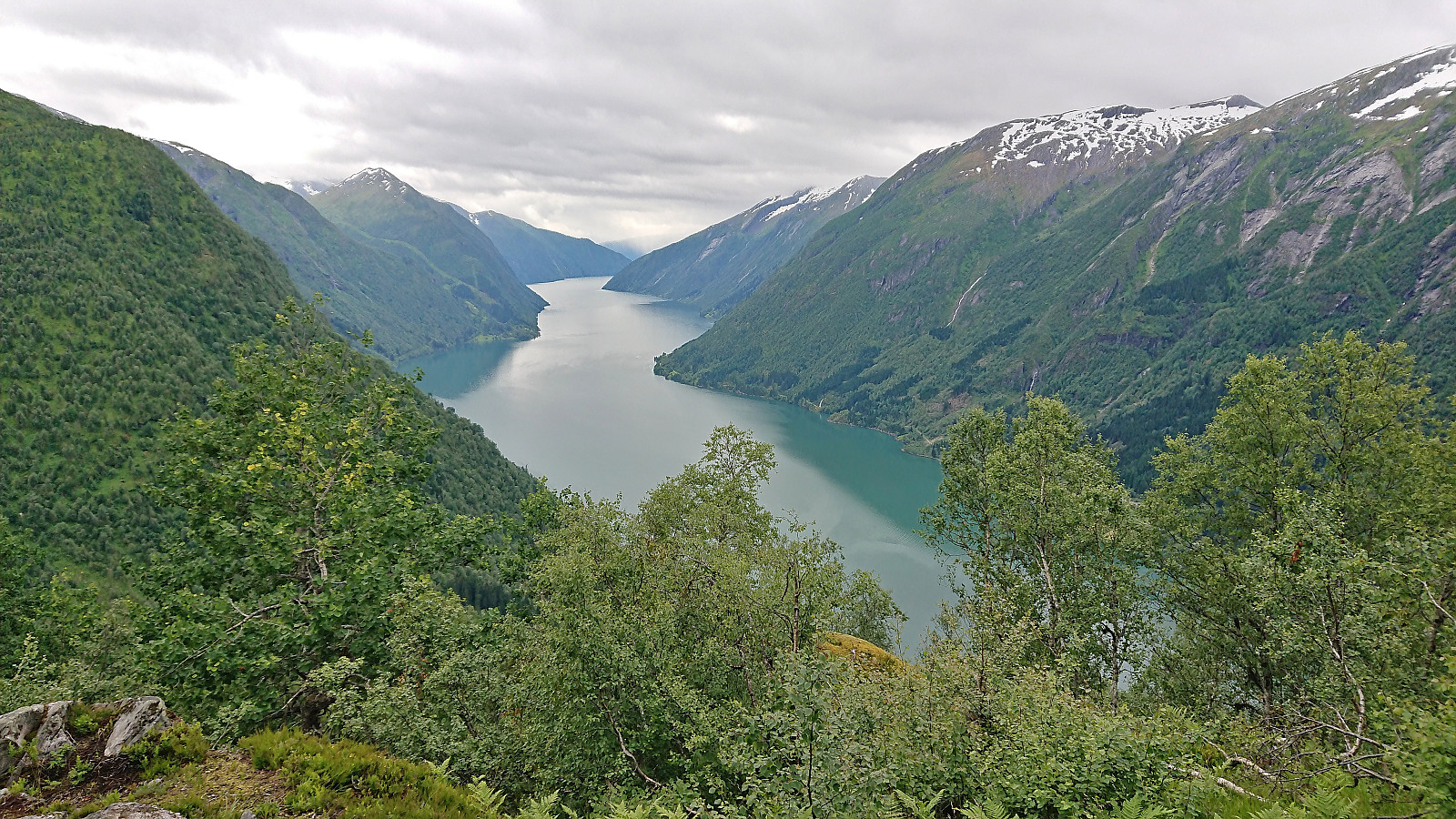
The summit provided excellent views, although somewhat reduced by the low-hanging clouds. Even though it was mid-July, a cold breeze still made us postpone our planned lunch break next to the cairn until we could find more shelter slightly further south. After a short break we continued south along a track following the ridge of Skredfjellet. The wide ridge provided great views and did not contain any exposed areas.
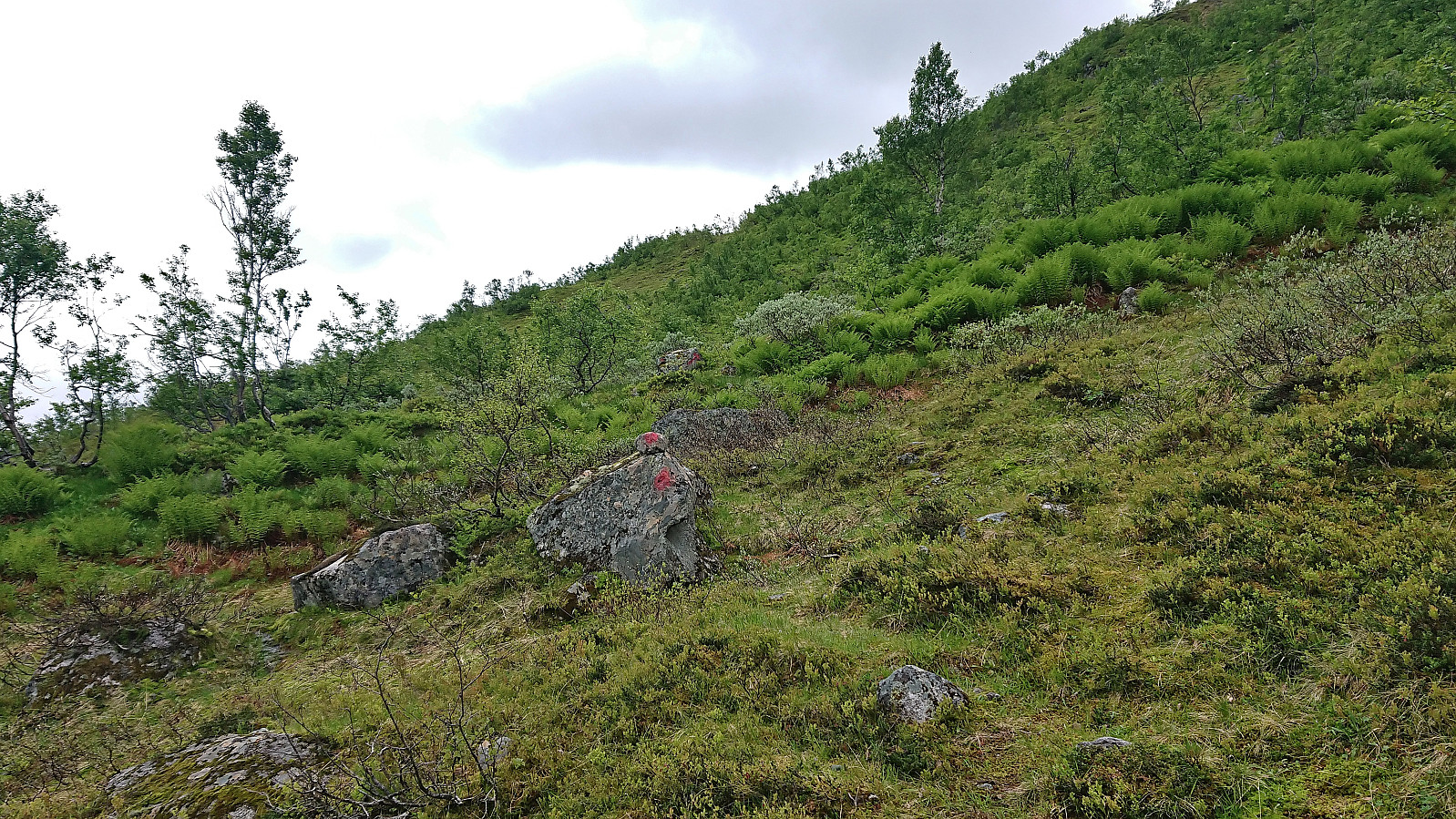
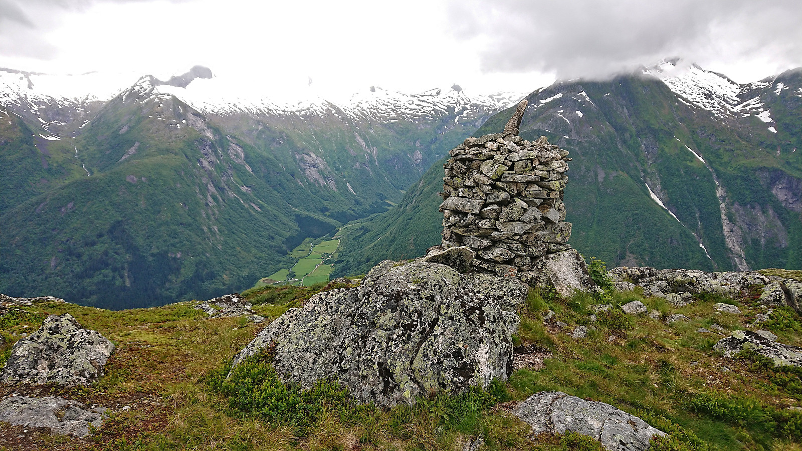
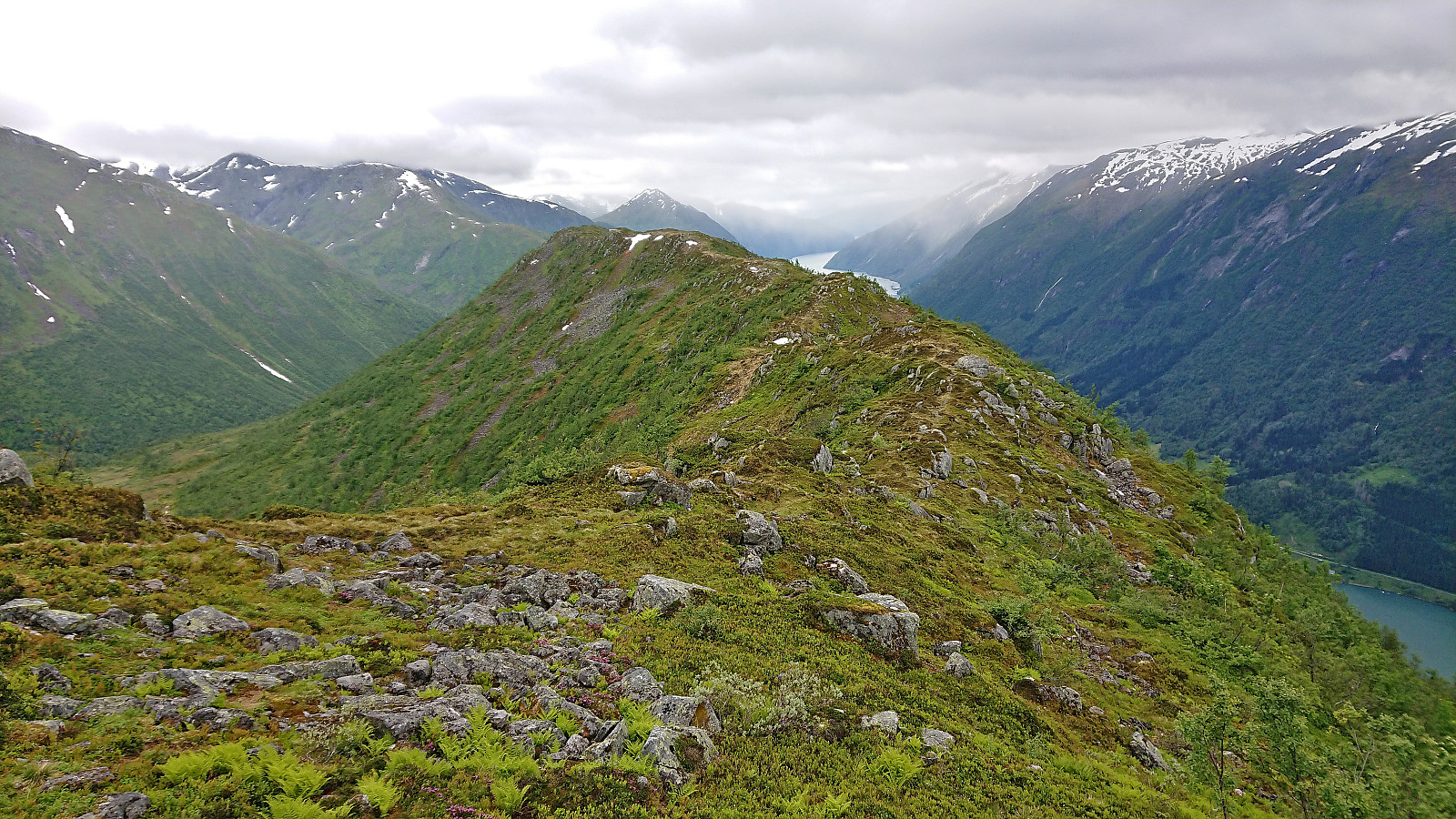
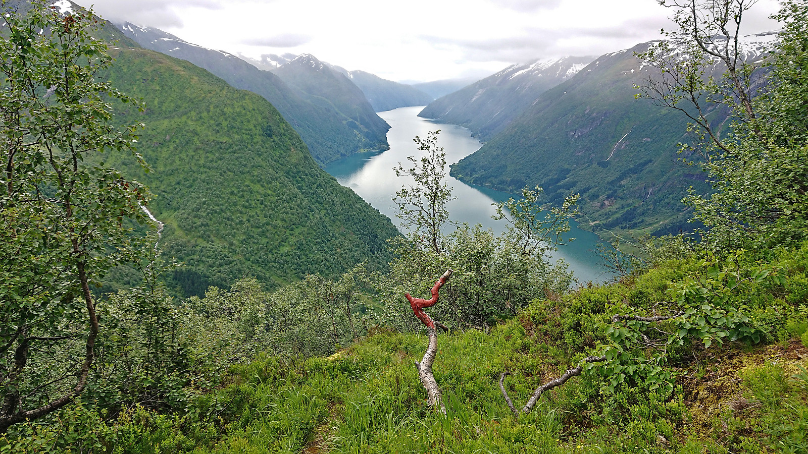
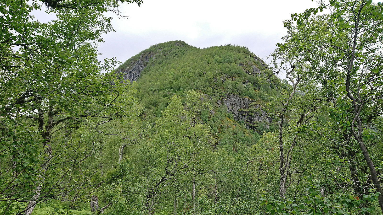
We quickly passed by the highest point at Skredfjellet to get to the even better views at the trig marker further south. Here there was even a small plastic container with a visitor register. Interestingly, while the path from Middagshaugen to Skredfjellet had been unmarked, we now suddenly came across lots of red trail markers, seemingly heading southwest down along the ridge. At first we were thinking that maybe they would take us to an even better viewpoint. But as the markers continued down the ridge, we concluded that we had come across a marked trail that was not indicated on the map.
Without a marked trail we would most likely not have attempted this descent, but with the markers it was actually quite straightforward to descend along the ridge. Granted, it was still steep at times, bordering on scrambling, but it was never exposed and there were always branches to hold on to if a bit of extra safety was desired.
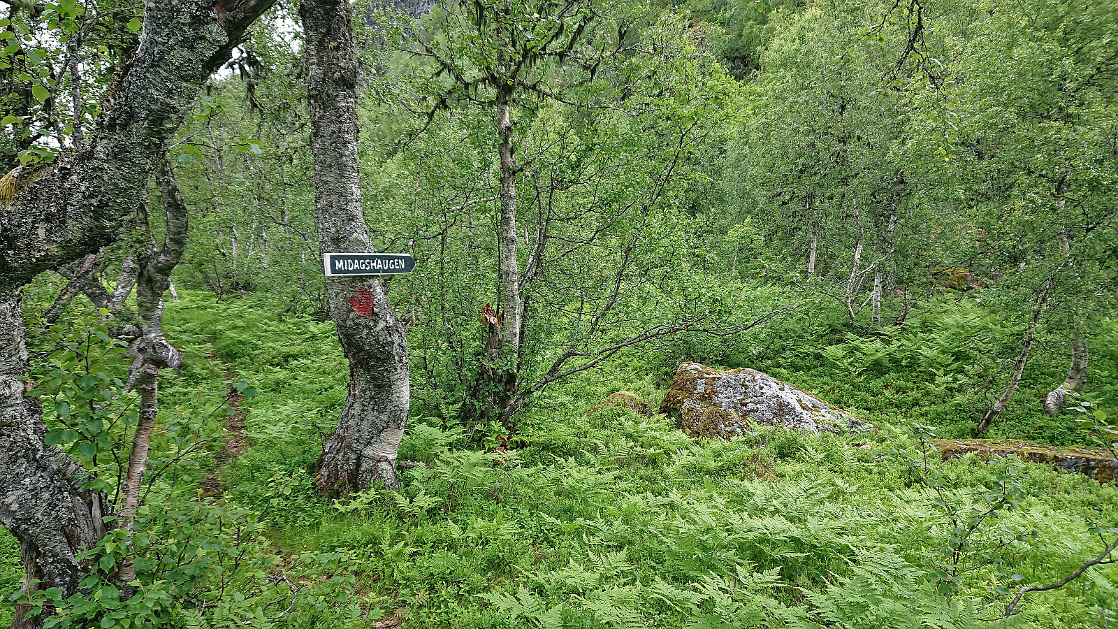
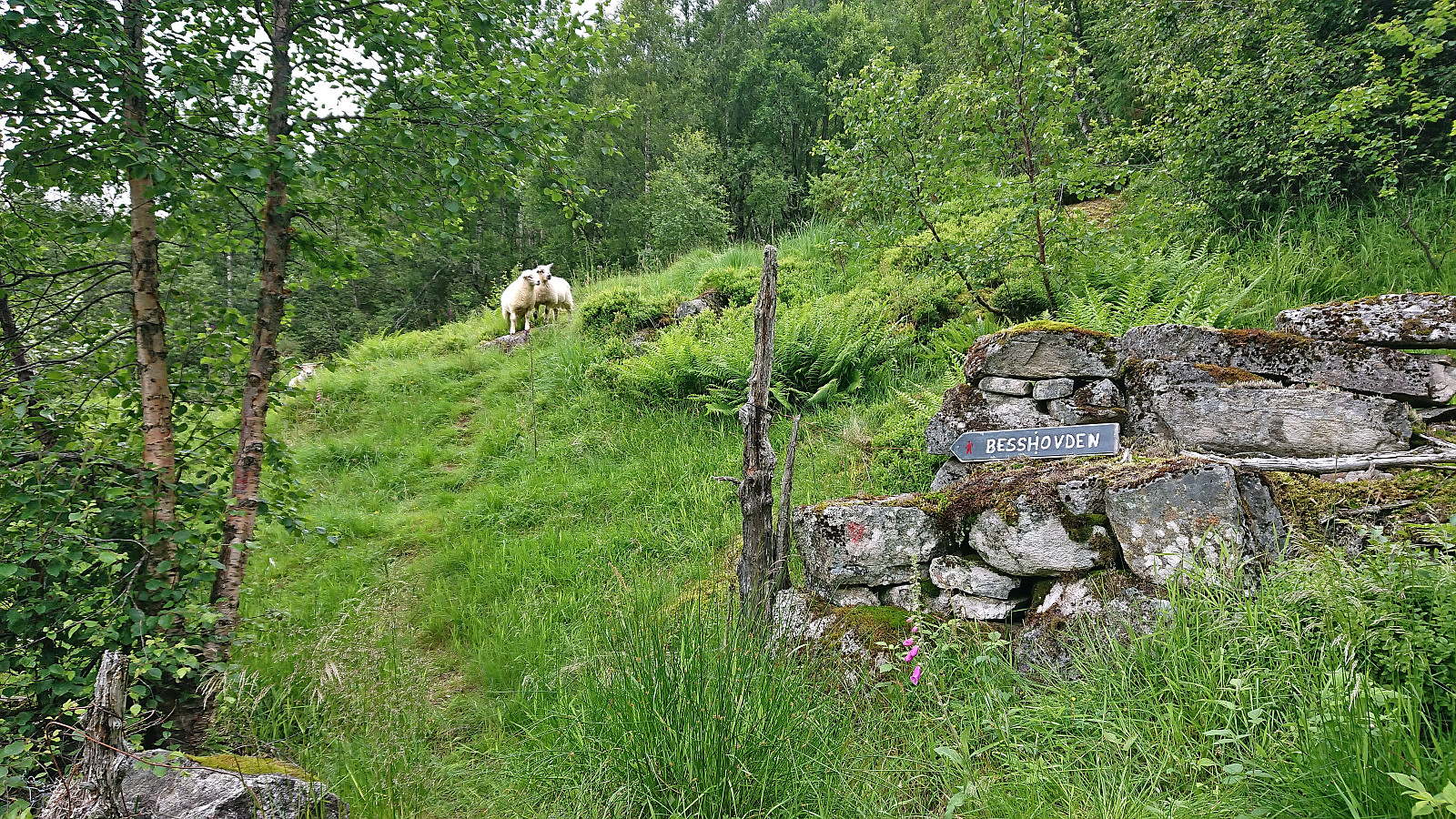
When the trail flattened out we came across a sign for Middagshaugen pointing back up the way we had just descended. A short detour, still along a trail, took us to a viewpoint called Besshovden, which we now remembered having seen on one if the signs pointing towards Skredfjellet shortly after leaving Middagshaugen. I later learned that Fjærland Guiding have organizing trips to Besshovden. (I was not able to find any mentions of the marked trail from Besshovden to Skredfjellet though.)
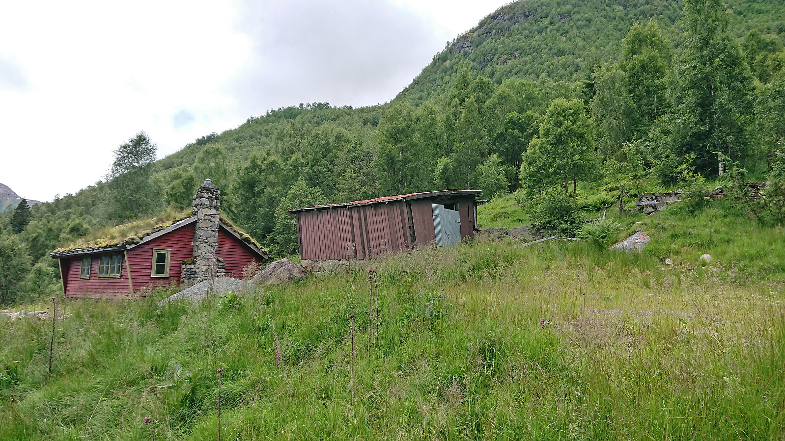
Returning to the main trail, we proceeded to followed it to Heimastølen, where we came across a marked trailhead that we had not noticed when ascending via the gravel road earlier, largely as also this sign was lying down and only visible from directly above. However, as the sign only said Besshovden and not Middagshaugen or Skredfjellet we would most likely have ignored it anyway. All that was left was then the short walk back to the car.
To conclude, this was an excellent hike with spectacular views that can be very highly recommended. The discovered trail along the ridge from Skredfjellet also means that, if ignoring the section across the wet area east of Skredfjellet where it is debatable whether there is a trail or not, it is possible to (more or less) follow a trail for the whole roundtrip. Note that if the steep descent along the ridge is not to your liking, or if you have more than an average fear of heights, it is of course also possible to do the hike in the opposite direction.

| Start date | 16.07.2022 10:53 (UTC+01:00 DST) |
| End date | 16.07.2022 15:30 (UTC+01:00 DST) |
| Total Time | 4h 36min |
| Moving Time | 3h 55min |
| Stopped Time | 0h 41min |
| Overall Average | 2.5km/h |
| Moving Average | 3.0km/h |
| Distance | 11.6km |
| Vertical meters | 998m |


User comments