
Siggjo from Åreiddalen/Finnåsvatnet (21.07.2021)

Skrevet av hbar (Harald Barsnes)

| Startsted | Åreiddalen/Finnåsvatnet (20moh) |
|---|---|
| Sluttsted | Åreiddalen/Finnåsvatnet (20moh) |
| Turtype | Fjelltur |
| Turlengde | 2t 15min |
| Distanse | 5,8km |
| Høydemeter | 484m |
| GPS |
|
| Bestigninger | Siggjo (473moh) | 21.07.2021 |
|---|
Siggjo from Åreiddalen/Finnåsvatnet
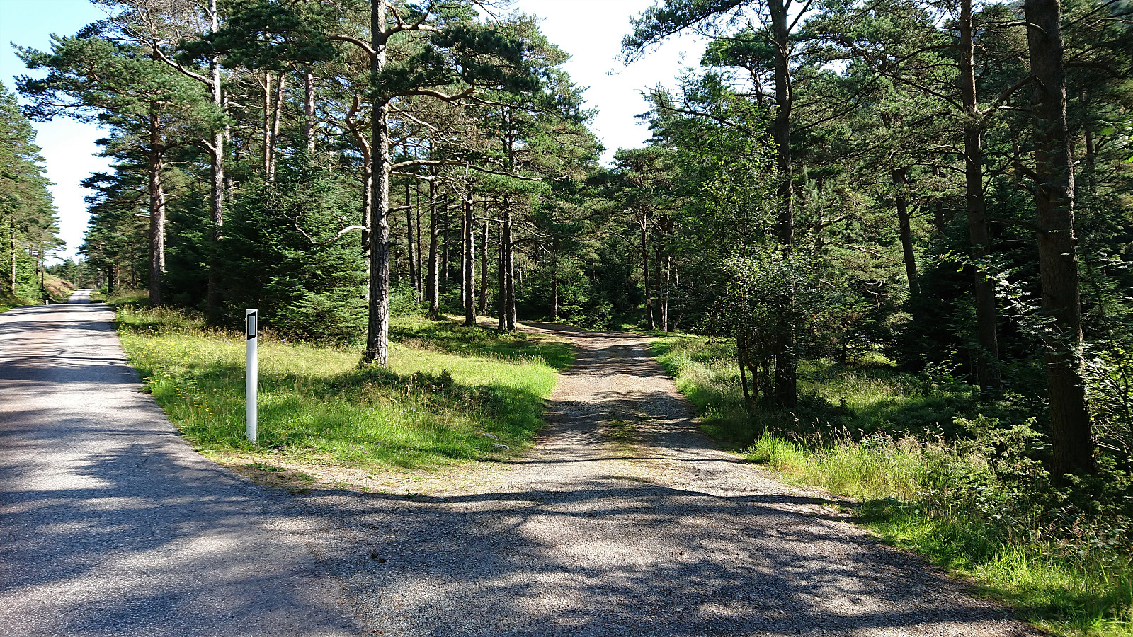
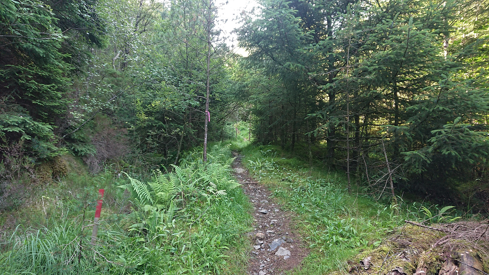
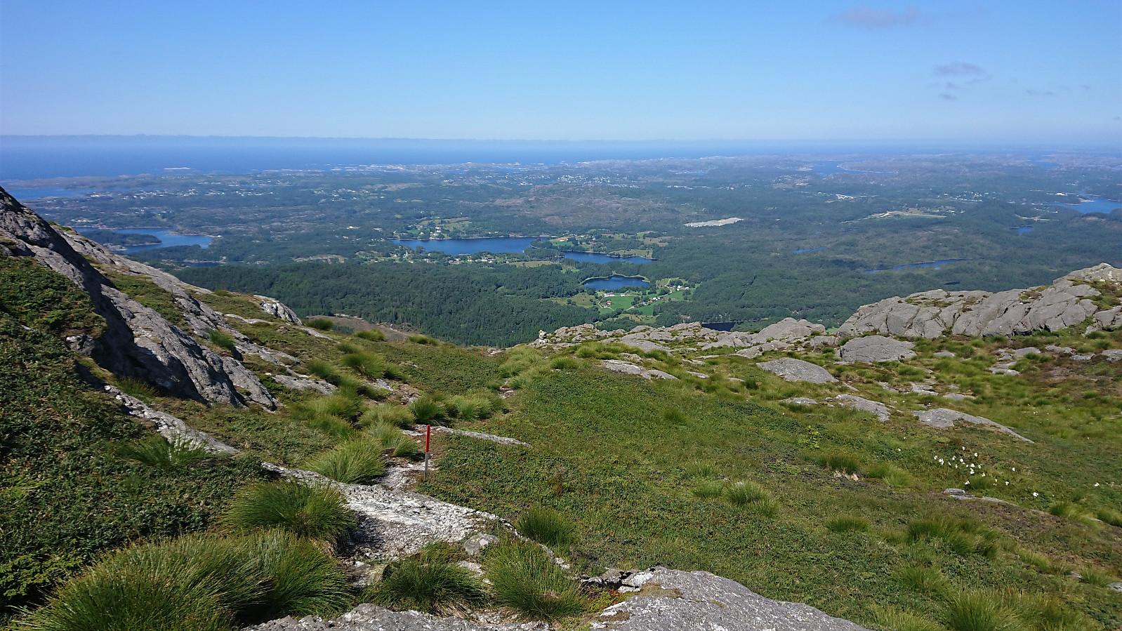
After cycling from Rubbestadneset to the unmarked trailhead for Siggjo in the valley between Siggjo and Furefjellet, I left the bike behind and continued towards the summit on foot following a trail marked with wooden sticks tipped with red paint. (At the start the trail was also marked with pink ribbons, but these soon departed from the main trail, and the one indicated on the map, and I continued following the wooden sticks.)
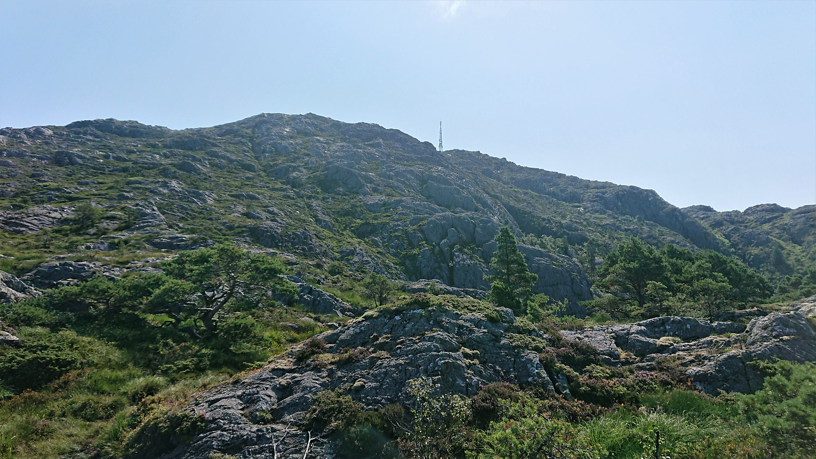
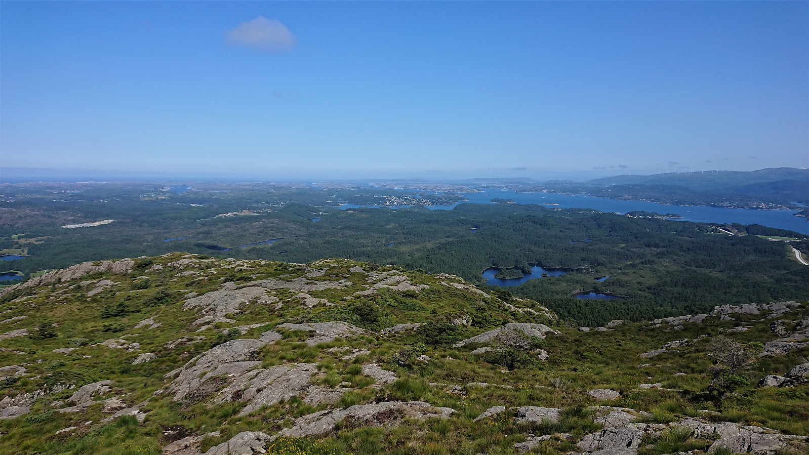
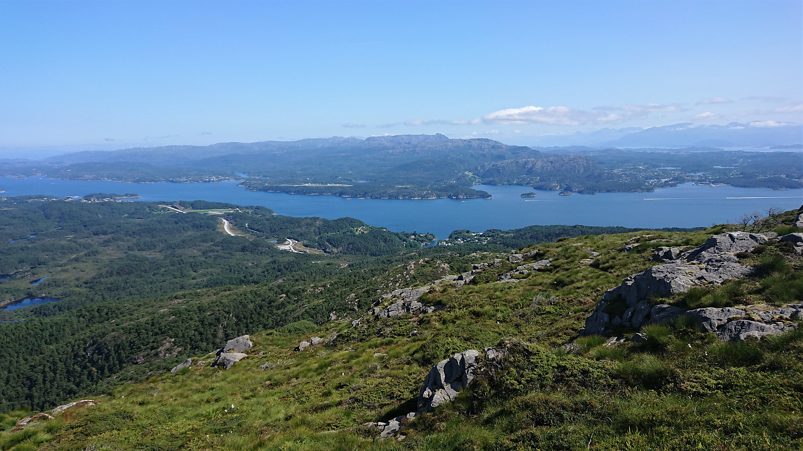
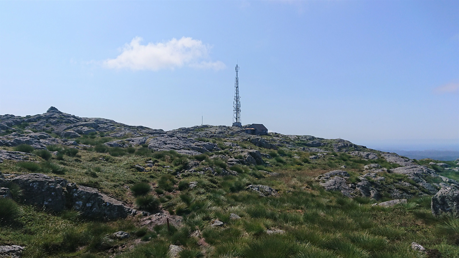
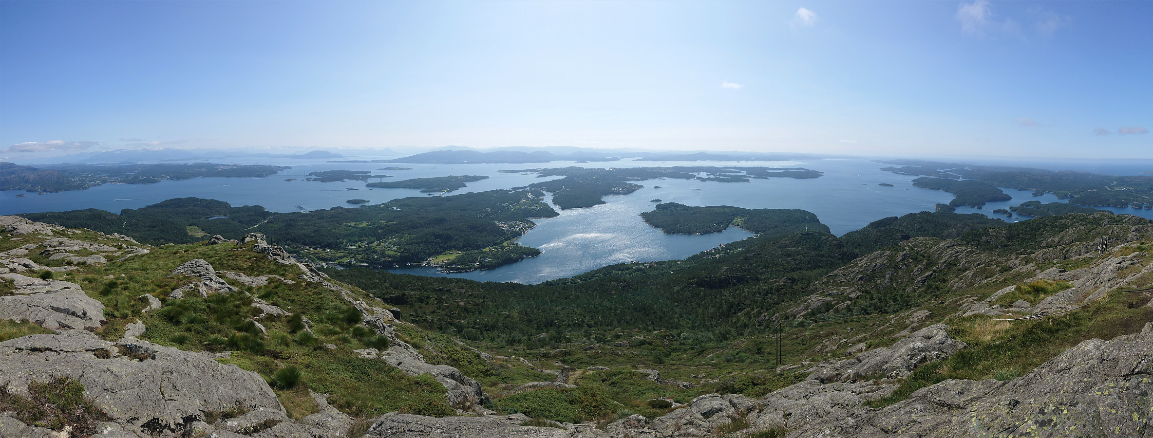
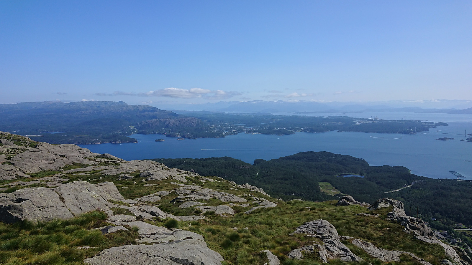
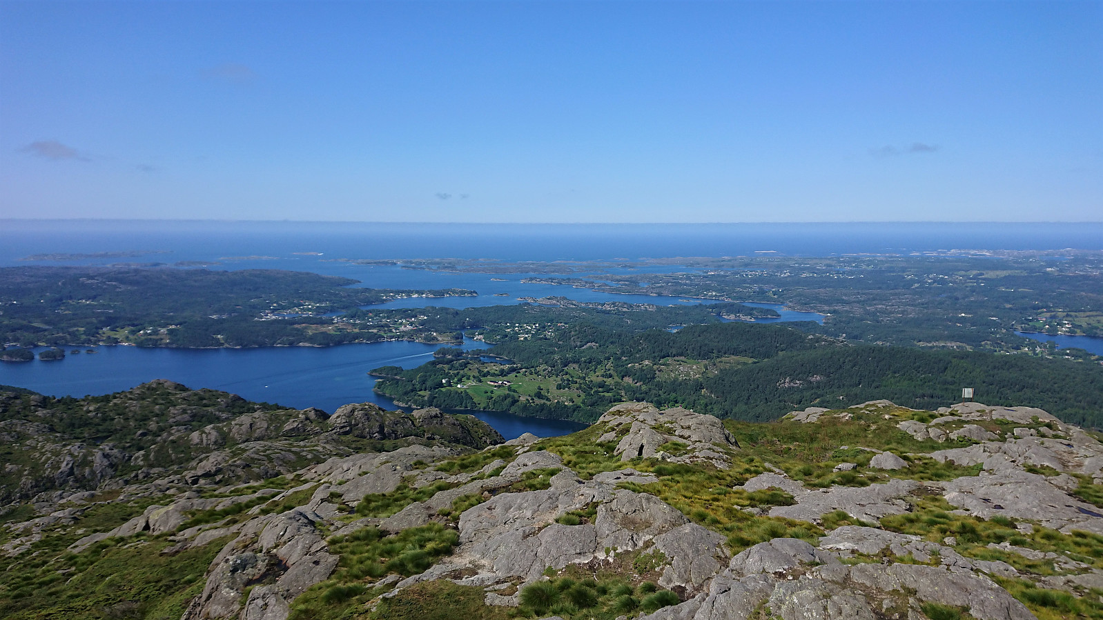
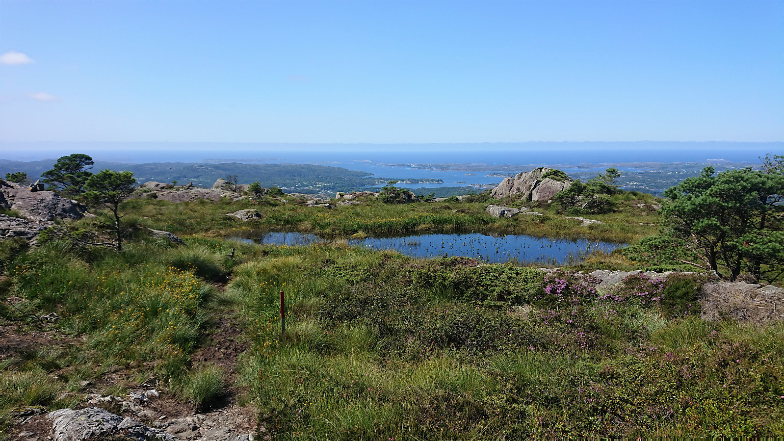
The trail was easy to follow as it winded its way up to the summit, which was therefore reached without any difficulties. Especially the last part was very nice, i.e. when getting above the tree line with the views greatly improving. As expected, the panoramic view from the summit was spectacular with unobstructed views in all directions. After a short break, and lots of pictures, I descended along the same route.
Overall, an excellent hike that can be highly recommended, with the added bonus of seemingly being a less frequently used route to the summit. At least I only met two other hikers in total when both ascending and descending, while there was a constant stream of hikers coming up via the clearly more common route from the northeast.
| Starttidspunkt | 21.07.2021 10:46 (UTC+01:00 ST) |
| Sluttidspunkt | 21.07.2021 13:01 (UTC+01:00 ST) |
| Totaltid | 2t 15min |
| Bevegelsestid | 1t 51min |
| Pausetid | 0t 23min |
| Snittfart totalt | 2,6km/t |
| Snittfart bevegelsestid | 3,1km/t |
| Distanse | 5,8km |
| Høydemeter | 484m |


Kommentarer