
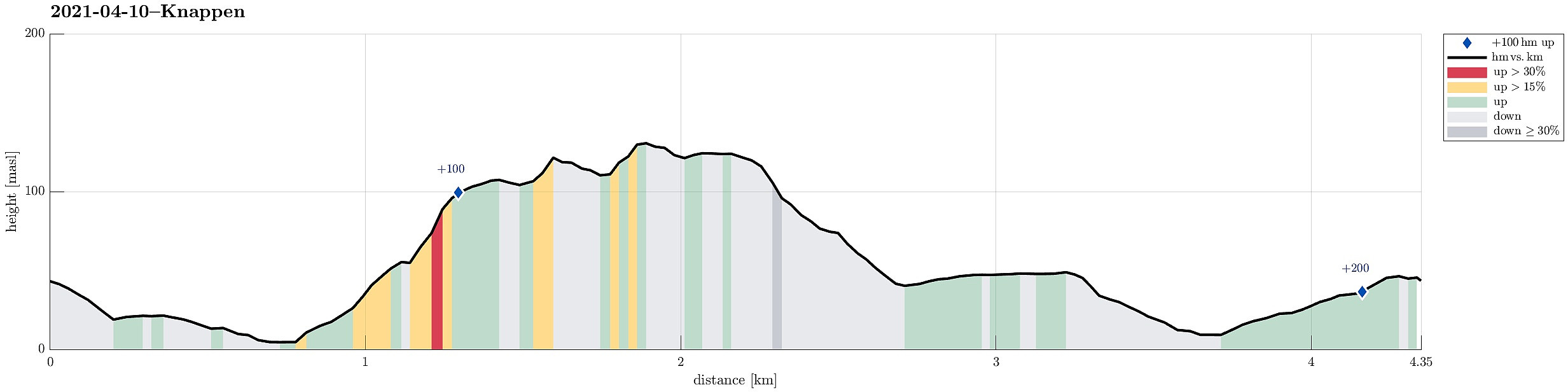
Knappen (10.04.2021)

Written by HHauser (Helwig Hauser)

| Start point | Varden (45m) |
|---|---|
| Endpoint | Varden (45m) |
| Characteristic | Hillwalk |
| Duration | 1h 30min |
| Distance | 4.4km |
| Vertical meters | 211m |
| GPS |
|
| Ascents | Eldtona (128m) | 10.04.2021 |
|---|---|---|
| Knappen (135m) | 10.04.2021 | |
| Visits of other PBEs | Knappen søyle (128m) | 10.04.2021 |
Trip Summary
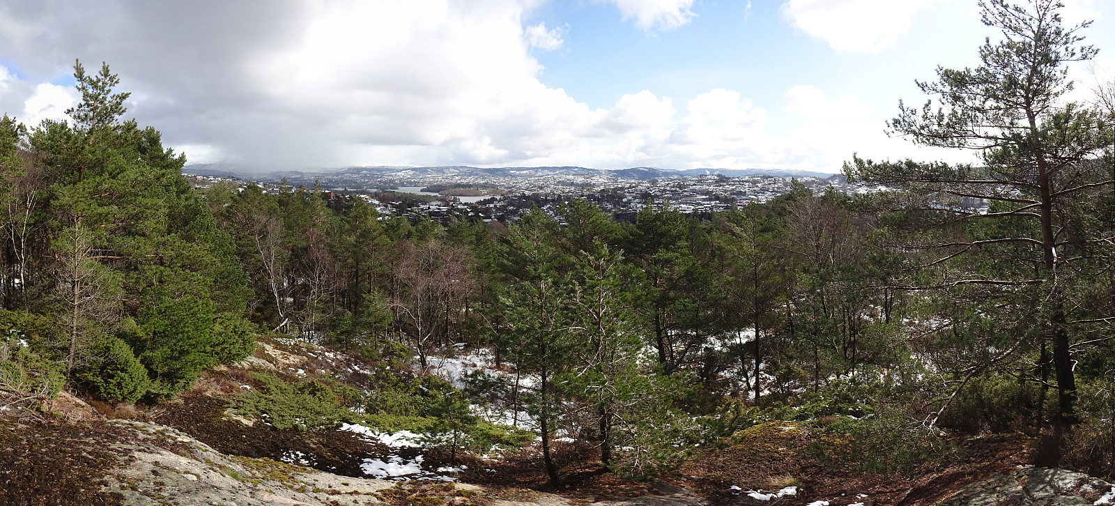
With little time available, we "just" made a quick excursion to Knappen. After walking down from Varden (to Bjørgeveien), we stepped upwards first on Sandeidbrotet (in the south of Gjeddevatnet). Where Sandeidbrotet turns left (eastwards), we continued on the nice trail that extends into the direction of Bjørgelien. Instead of just following this trail (and the one the forks off towards Knappen from it somewhere "half-way" towards Bjørgelien) all the way up, we experimented a little with the (a bit steep) terrain, ascending on something that only with the greatest optimism can be called a trail (it did not matter, though, and all of that was short and quick anyway). Once on the ridge, we just crossed it (in nice winter weather) towards Eldtona and Knappen. After having crossed Knappen, also, we continued first over the ridge until we came to the place, where one still finds many remains for fortifications from WWII. There, we hesitated for a moment (regarding how to descend, this time), which lead to the decision to try something new (at least for us). This way, we made it down "on a diagonal path" towards Knappeveien. In the lower half of this descend, we in fact found a minor trail, again. Once down on Knappeveien, we just rounded Knappatjørna and returned back to Varden. Nice to have opportunities for rewarding short walks "just around the corner"! :-)
Photos
Selected photos are available as Google photo album.
Useful Resources
See also the related FB-page Hiking around Bergen, Norway.
Petter Bjørstad has a useful page about Knappen.


User comments