
Schreckhorn (30.07.2020)

Skrevet av hmsv1 (Hannah Vickers)
| Startsted | Schreckhorn hut (2524moh) |
|---|---|
| Turtype | Alpin klatring |
| Turlengde | 13t 20min |
| Distanse | 13,5km |
| Høydemeter | 2053m |
| GPS |
|
| Bestigninger | Schreckhorn (4078moh) | 30.07.2020 |
|---|
Unlike quite a few of the 4000m peaks I’ve climbed in the Alps in the last few years, the Schreckhorn has not actually stood at the top of my priority list for many years. It was really only after having heard about how awesome (and long) the Schreckhorn-Lauteraarhorn traverse was, from one of Tim’s friends who’d guided it last year, that it began to spark a bit of interest in me. I remember it having caught my eye when I did the Eiger traverse which ascends the Mittellegi ridge and descends the South ridge, but from that angle I thought it looked a bit bold for my climbing abilitiy (or lack of). Turns out the easiest route up the southwest ridge is actually “only” an AD+ with fairly easy climbing, not above III+. And having checked out various route descriptions it did sound like really nice, sustained climbing and on good granite too. At the start of the week it didn’t look too hopeful that the mountain would be in condition before I was supposed to be going home, a lot of new snow had got dumped on the mountain with the cool wet weather on the friday after we’d been on the Nadelgrat and that was one of the reasons why we’d gone for the Grandes Jorasses to start the week. However, having seen absolutely no sign of new snow there – and with warmer weather forecast for the remainder of the week it got me thinking about the Schreckhorn again. No sooner had we crossed into Switzerland from Italy (in the same afternoon we’d descended the Grandes Jorasses) and I was on the phone to the guardian of the Schreckhorn hut to find out if they had any spaces for wednesday and thursday night. Turned out they did.... So without any further hesitation we decided to take the chance and make reservations there! And there was our plan made for the final part of the week and last climb with Tim for this summer. I fell asleep for the rest of the drive back to Evolene! (we had been awake since 12.30am so this was totally legit I think)
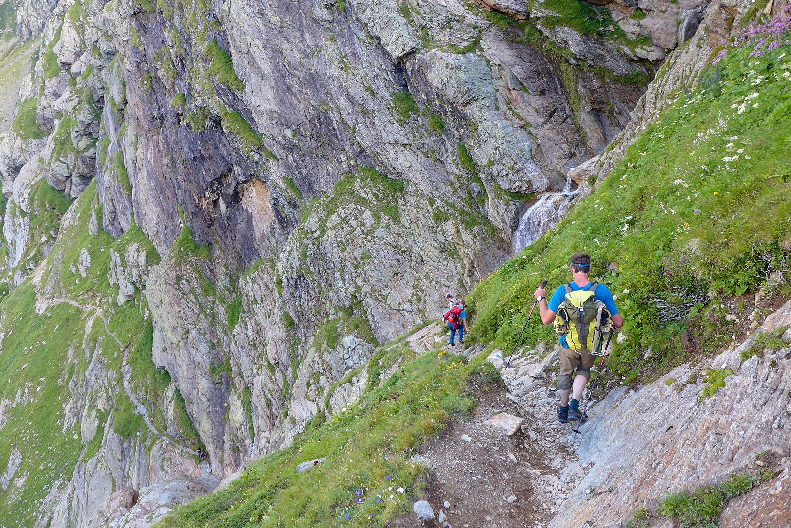
We left Evolene earlyish, around 8am and began the drive across the valley toward Goppenstein and the train which would take us across to Kandersteg and down toward Thunersee. I was expecting it to be a really long journey but actually it didn’t seem to drag on. Nevertheless it was about 11am by the time we had made it up the valley to Grindelwald. After some packing and figuring out how to operate the ticket machine in the car park at the Pfingstegg lift, we were ready to start the journey up to the Schreckhorn hut. Using the Pfingstegg lift only saves about 300m of elevation, but we had enough weight in the rucksacks already and not having to carry the rucksacks for an extra 300m was not necessarily something to object to! I was sort of glad to see a bit of valley fog in the hope that it would make the walk up to the hut fairly cool, but as soon as we arrived at the top of the lift, the fog more or less disintegrated and the sun came out in full force. Fortunately the initial part of the walk up the valley hugs the steep west facing sides of some cliffs, so we were in shade a fair amount of the time. The valley sides were so steep it felt like we were in more of a gorge, but eventually the path emerged into more open mountainside and a nice little café at Baregg appeared after about an hour of walking. Tim’s friend and fellow guide Calum had also decided to join for the Schreckhorn as he was guiding another guy Will for the week. We’d expected to meet them at the café as they had started the walk in earlier than us, but it seemed like they’d already waited enough and kept walking! It was about 25% of the way to the hut; from the café the trail descended a little and traversed around more of the same kind of open mountainside before a path diversion took us down a steep grassy slope since part of the original had been wiped out by a rather massive rockfall.
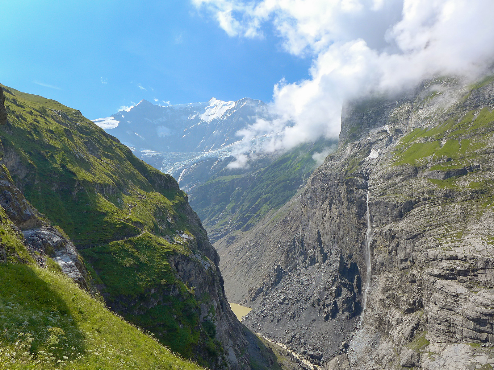
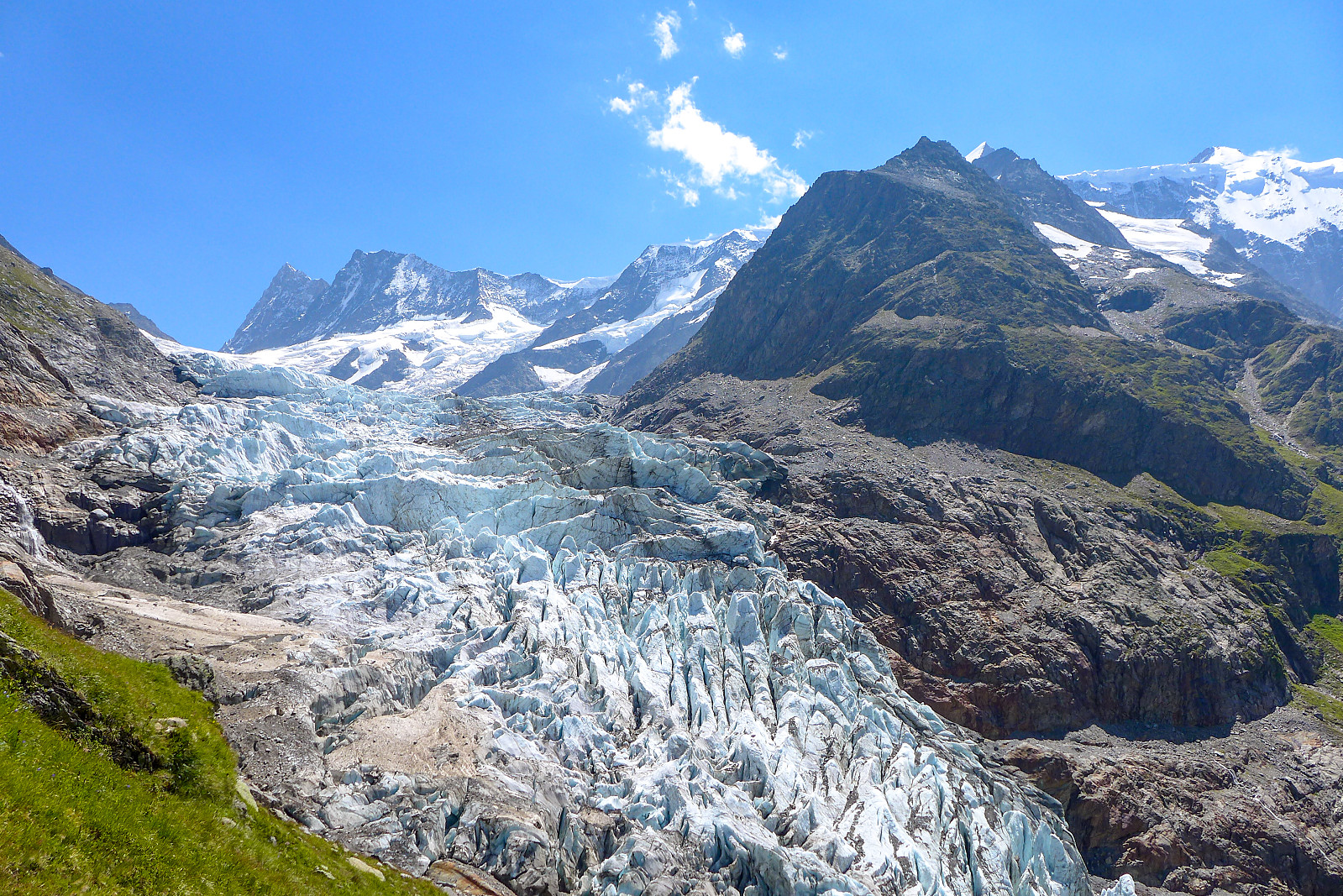
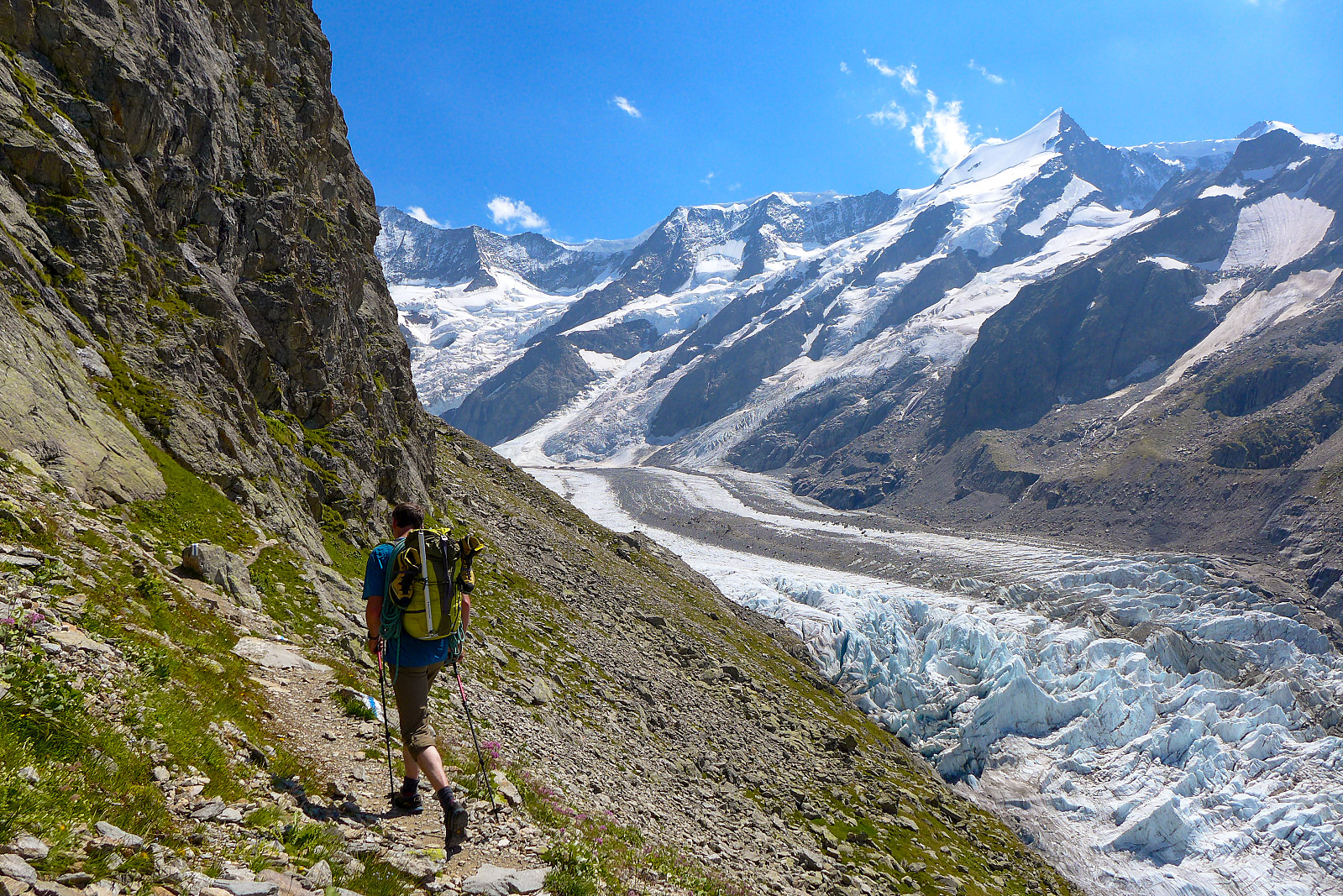
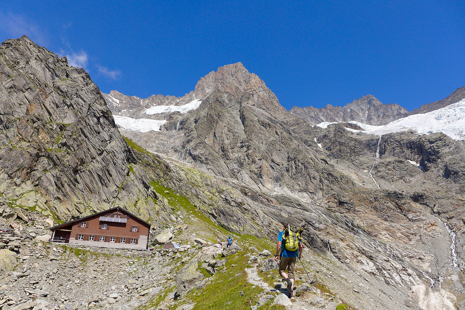
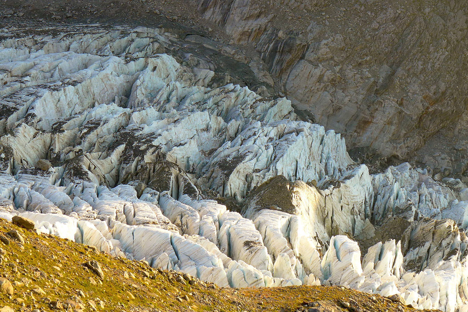
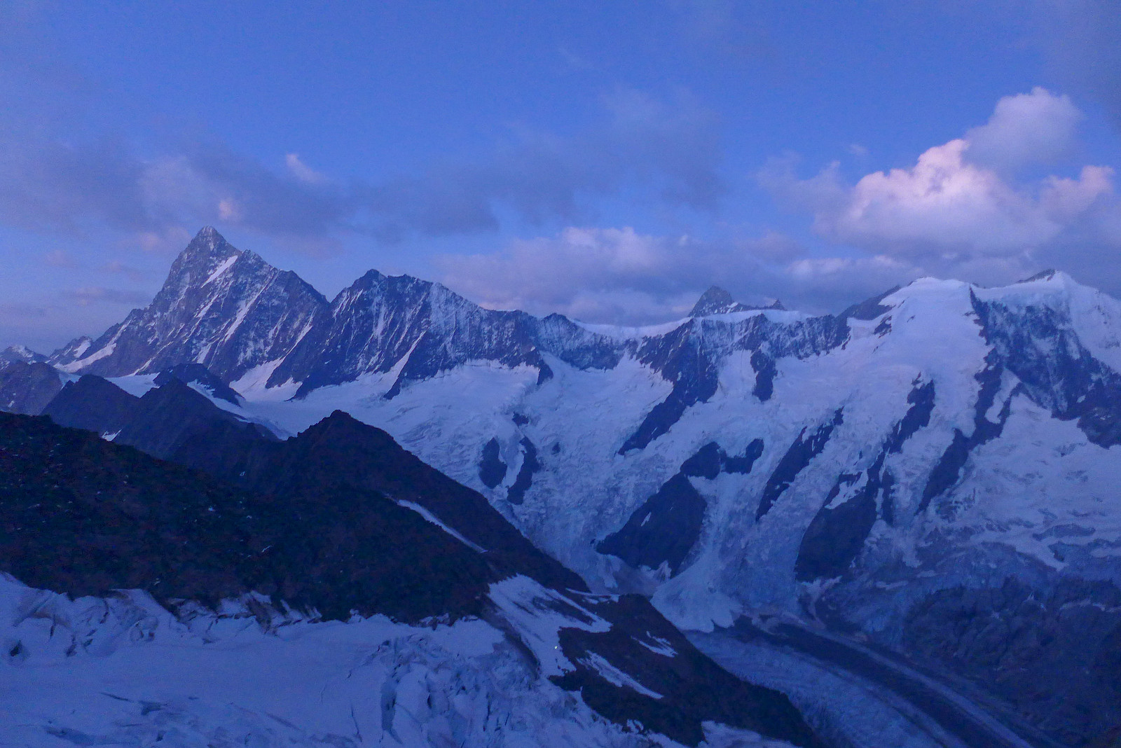
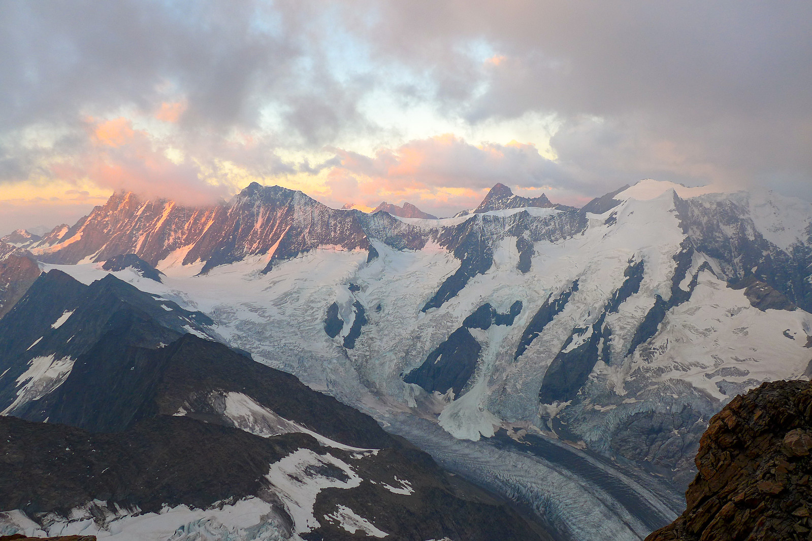
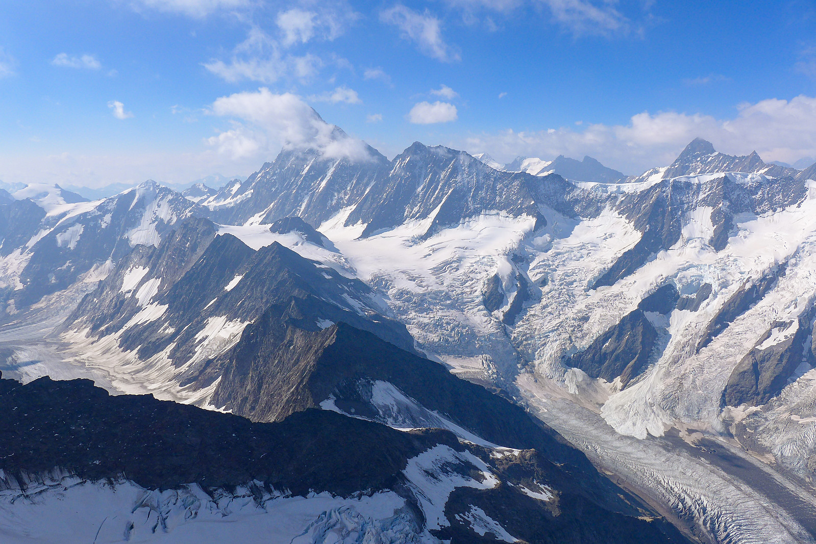
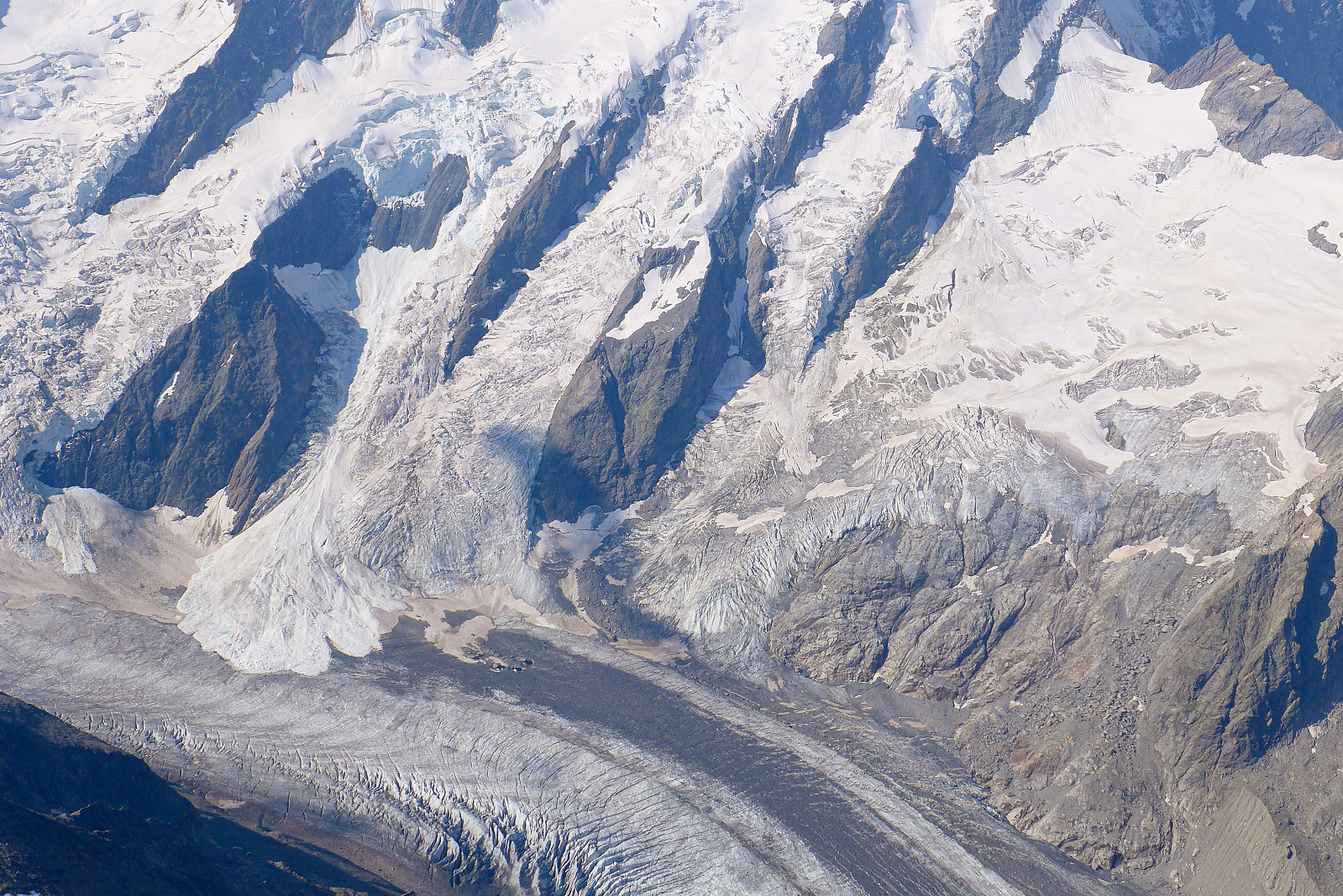
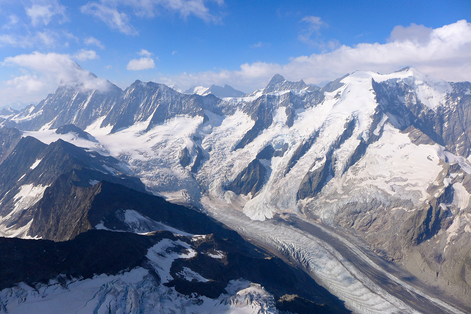
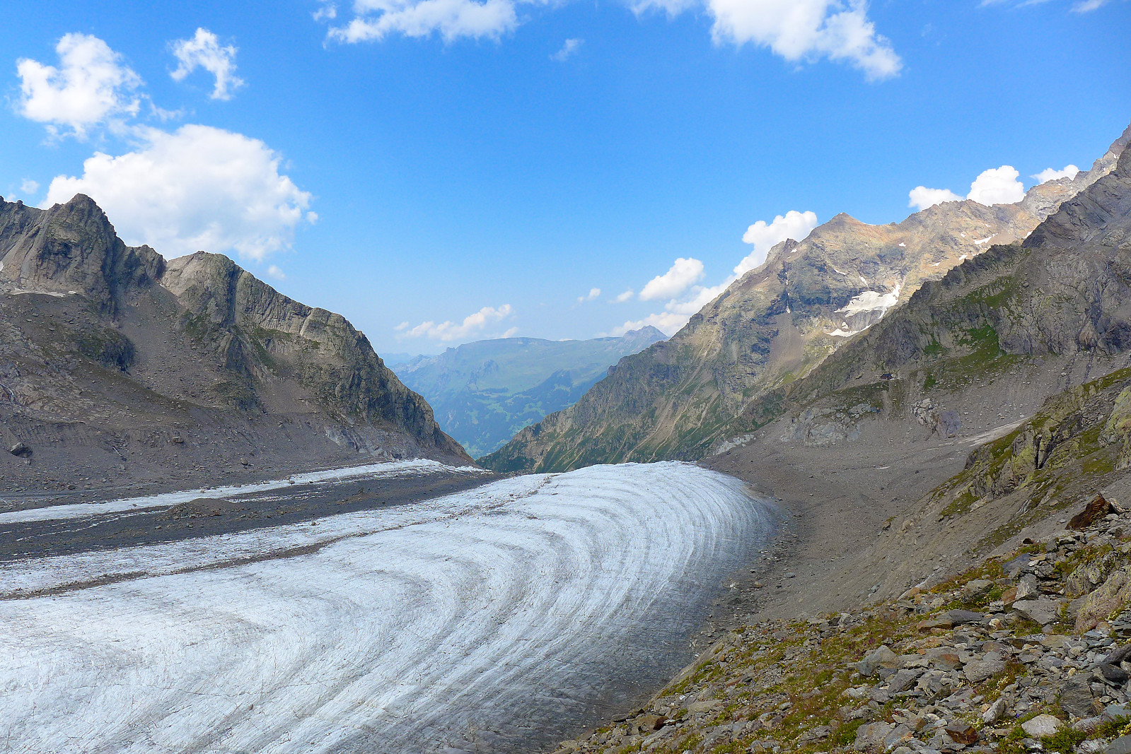
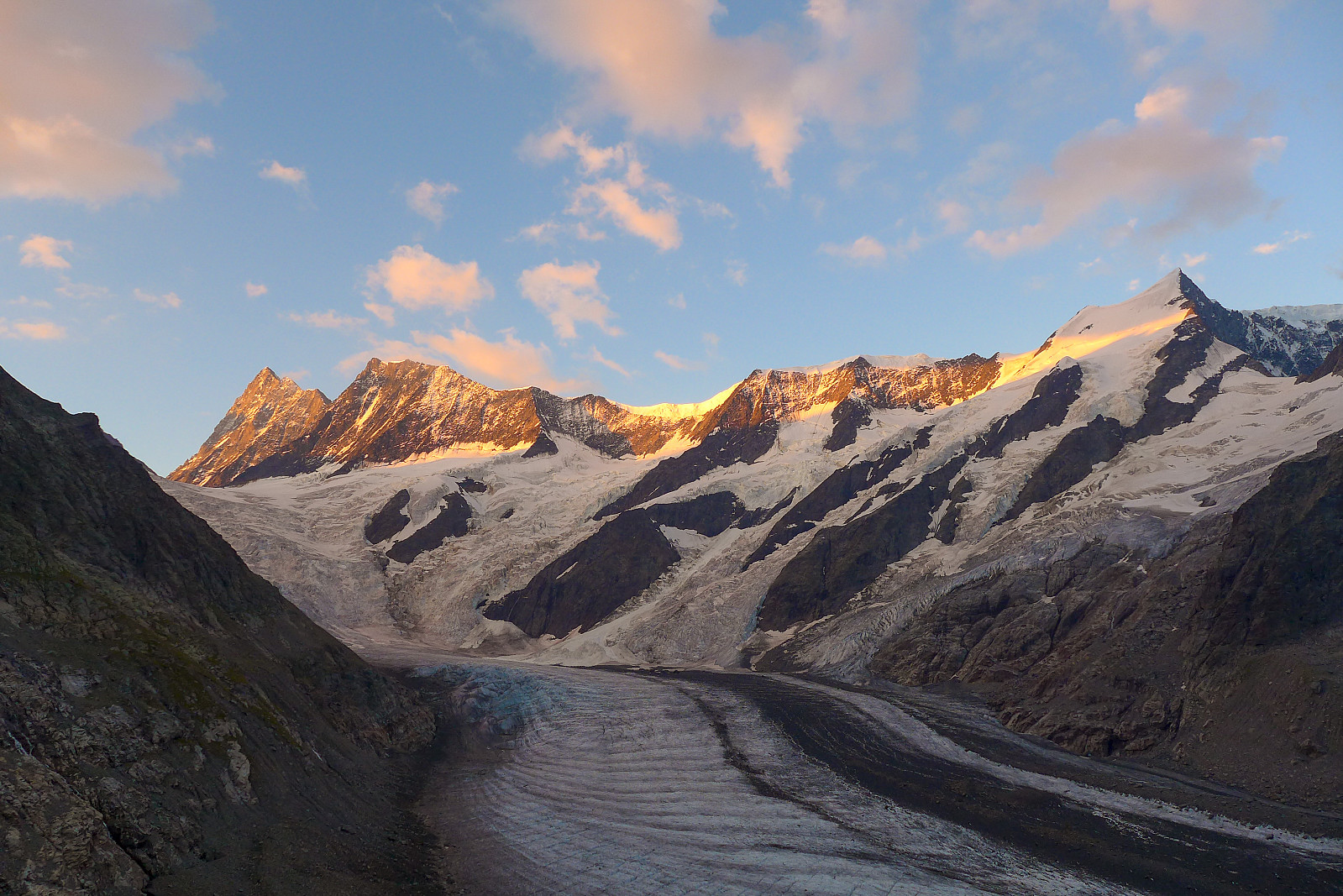
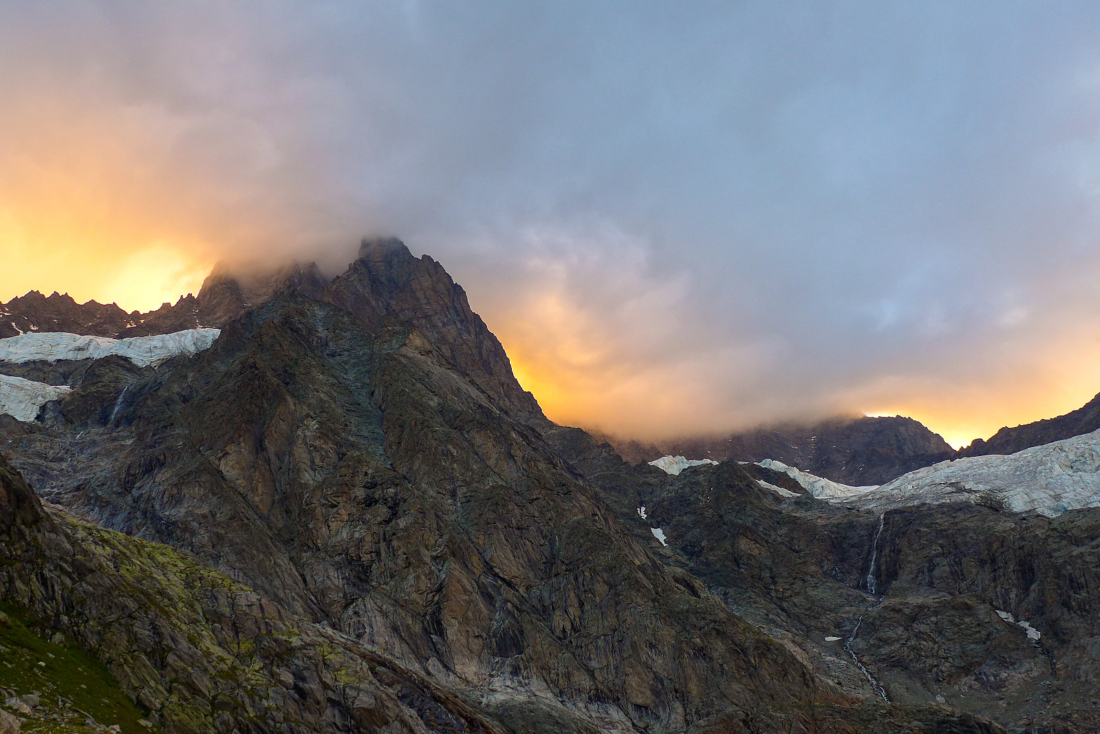
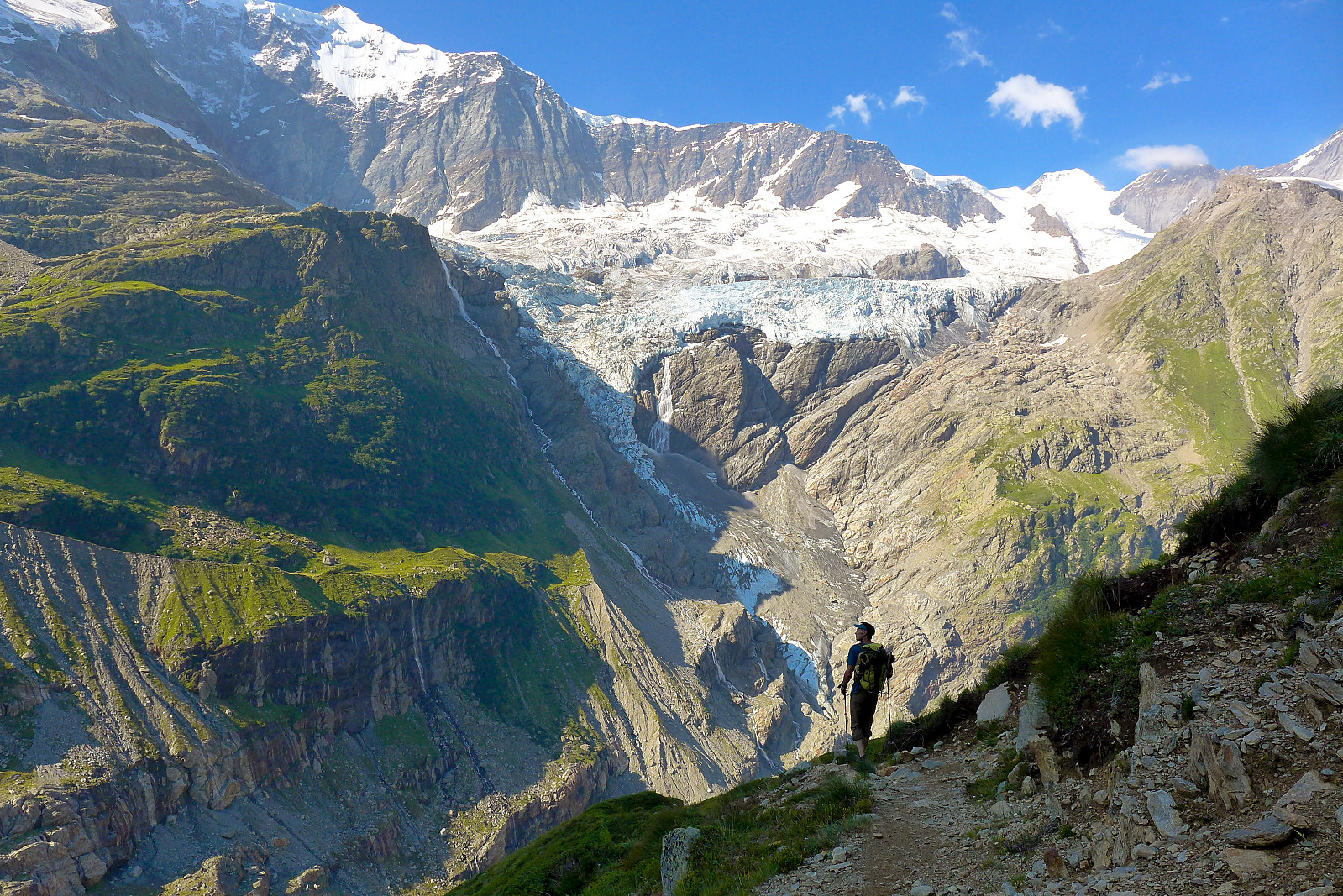
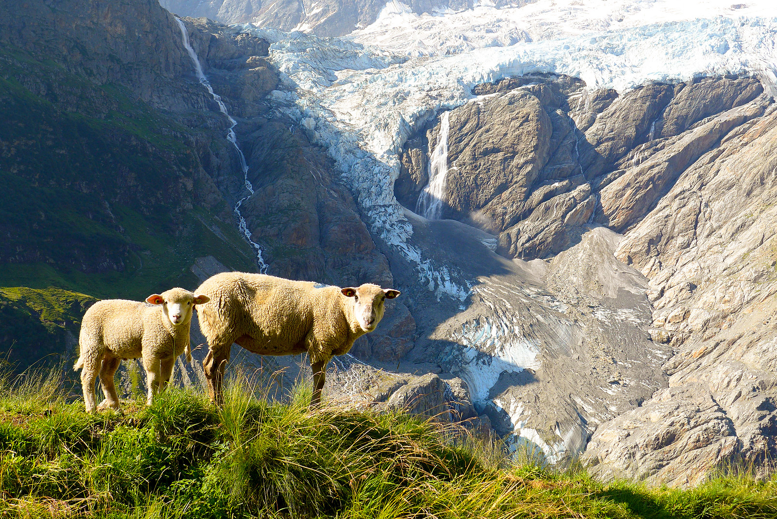
More shady, narrow trails continued from here up to a corner at the foot of a ridge. From here the path took an almost 90 degree turn to follow the course of the Unders Ischmeer glacier, or at least what was left of it. From this corner the Schreckhorn came into view – and it looked a long way up! The rest of the hike up was more of the same, winding around some steep slopes, then eventually ascending some steeper sections of the mountainside assisted by chains etc. The icefall at the foot of the glaciers were really impressive. A bit of a mess too, but something of an aethetic mess, which I thought was the most appropriate description. Far, far up the Obers Ischmeer glacier the Finsteraarhorn eventually popped up and dominated the view for the remainder of the walk up to the Schreckhorn hut. I’d heard about the glaciers in the Bernese Oberland being of Himalayan-proportion. This glacier was only one of the smaller ones so I could totally believe the larger glaciers seeming comparitively gigantic. After 9km, 1280m of elevation and 4.5 hours since getting off the lift at Pfingstegg, we were finally at the Schreckhorn hut. Its location amongst these big peaks and glaciers makes it really worth visiting. Calum and Will had already arrived a while before and it was nice to hang out with them in the afternoon and at dinner. The hut team were also really friendly too, which was apparently a nice change from the previous hut guardian, who had a bit of a reputation for perhaps not being super approachable!
During the course of the afternoon and early evening the hut began to fill up with climbers, both those who’d been returning from routes and those who like us had just arrived to climb the next morning. It was a pretty full dining room at dinner time, and Covid measures here seemed the most relaxed of all the huts we’d stayed at so far.... In a way it was good to have a feeling of normality again and forget about Covid for the time we were up on the mountain. Initially I think we had just intended to go and climb the Schreckhorn, but after hearing that Calum and Will were going to try and do the full traverse to the Lauteraarhorn, I became a bit envious and wondered why on earth we weren’t going to do the same?! So after some convincing we decided to take the earlier breakfast at 1am and have the full traverse as the main plan and if for some reason it wasn’t optimal to continue past the Schreckhorn then at least we could just descend the same route back to the hut. Our dormitory was pleasantly quiet in the evening, so I slept a little but on and off and felt fairy cheerful and excited about the prospects that lay ahead when the alarm rang a few minutes before 1am. Even the instant coffee (not actually sure it was really instant or filtered coffee) tasted amazing. I think I drank at least 4 cups of it at breakfast before deciding to try and eat something too. The bread was unfortunately not as amazing as the coffee, at least not the slice of bread I picked up anyway.
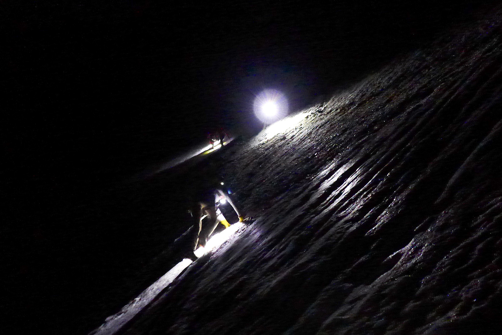
About ½ hour later we were ready to start the climb, which began with about a 100m descent down to the Ober Ischmeer glacier over some loose scree and rock. With the weather being so warm – and starting at only 2500m it was warm enough to walk and shorts and t shirt, which was a nice change compared to the other chilly days we’d had until now. There were 2 (maybe 3?) other pairs of climbers as well as us and Calum and Will, one of those pairs being another guide and his client. I think the guide had already been here before and was more familiar with the route to gain the moraine ridge which we needed to get onto to slog up to the base of the route. This slog was actually quite long and lasted some 800-900m in elevation, but there was a sort of path and the scree was semi-frozen, so it provided a reasonable surface to walk on. I actually don’t mind doing these kind of long walk ins in the dark, as the time seems to pass by quicker than expected when only looking down at the metre or so of path in front of you illuminated by the small circle of light from the headtorch. After some time the wind began to pick up a bit, and it became obvious that this climb would not end up in shorts and t shirt weather on the summit today. I don’t remember how long we spent on that walk in but at some point the scree became more rocky and we arrived at the start of some icy snow slopes. Here it was all change, quite literally – and not only did crampons get put on, but also a pair of trousers, two jackets and a warm headband.
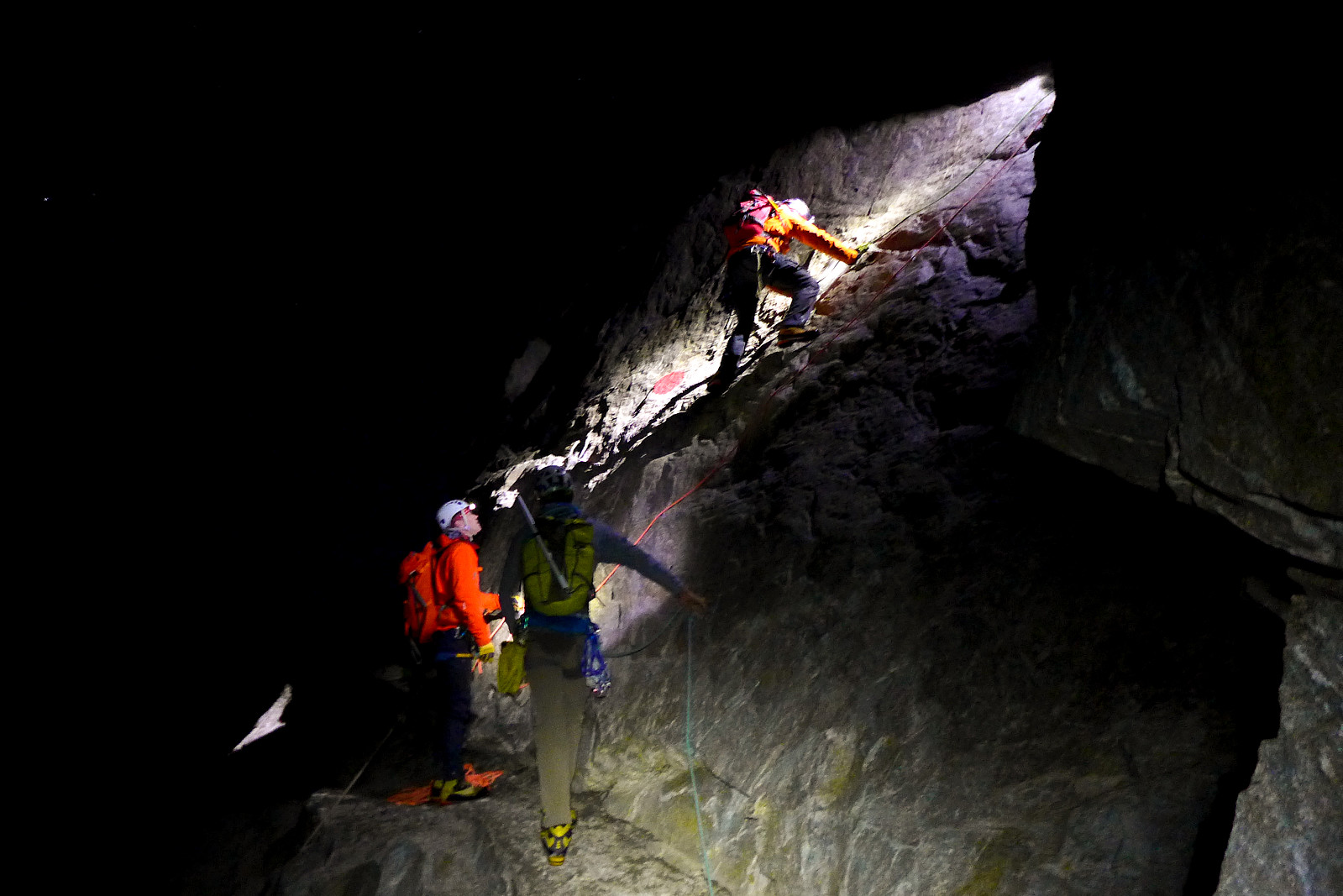
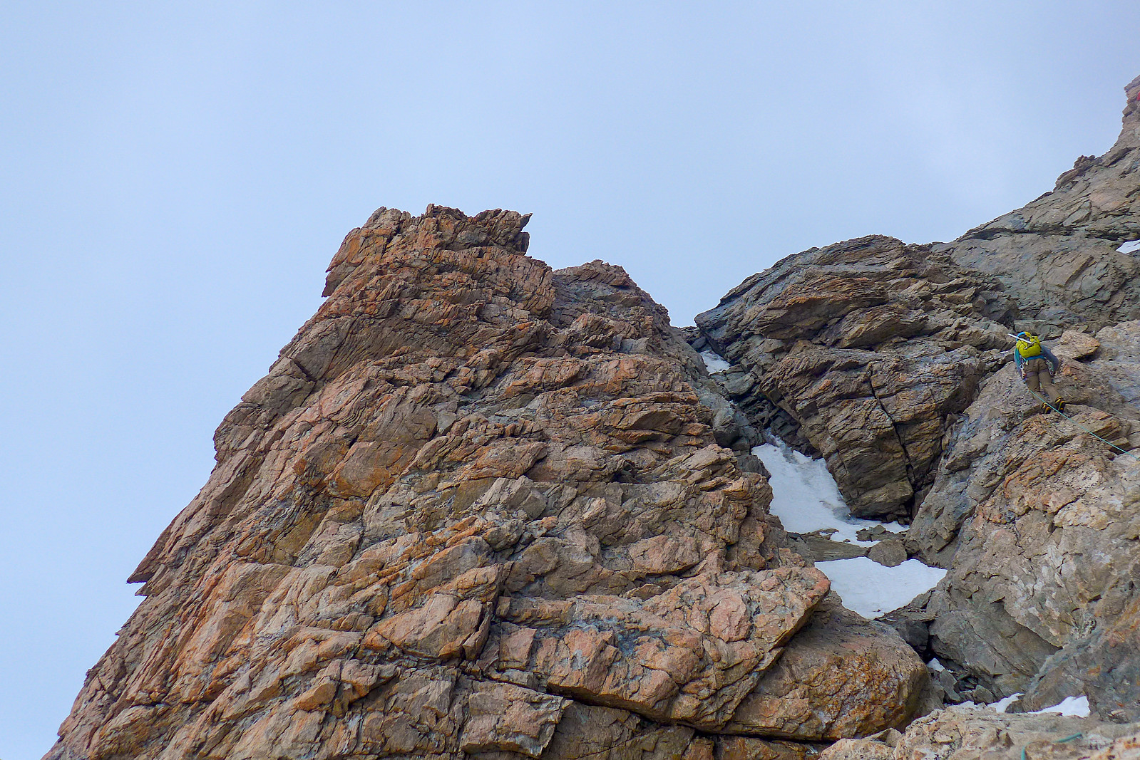
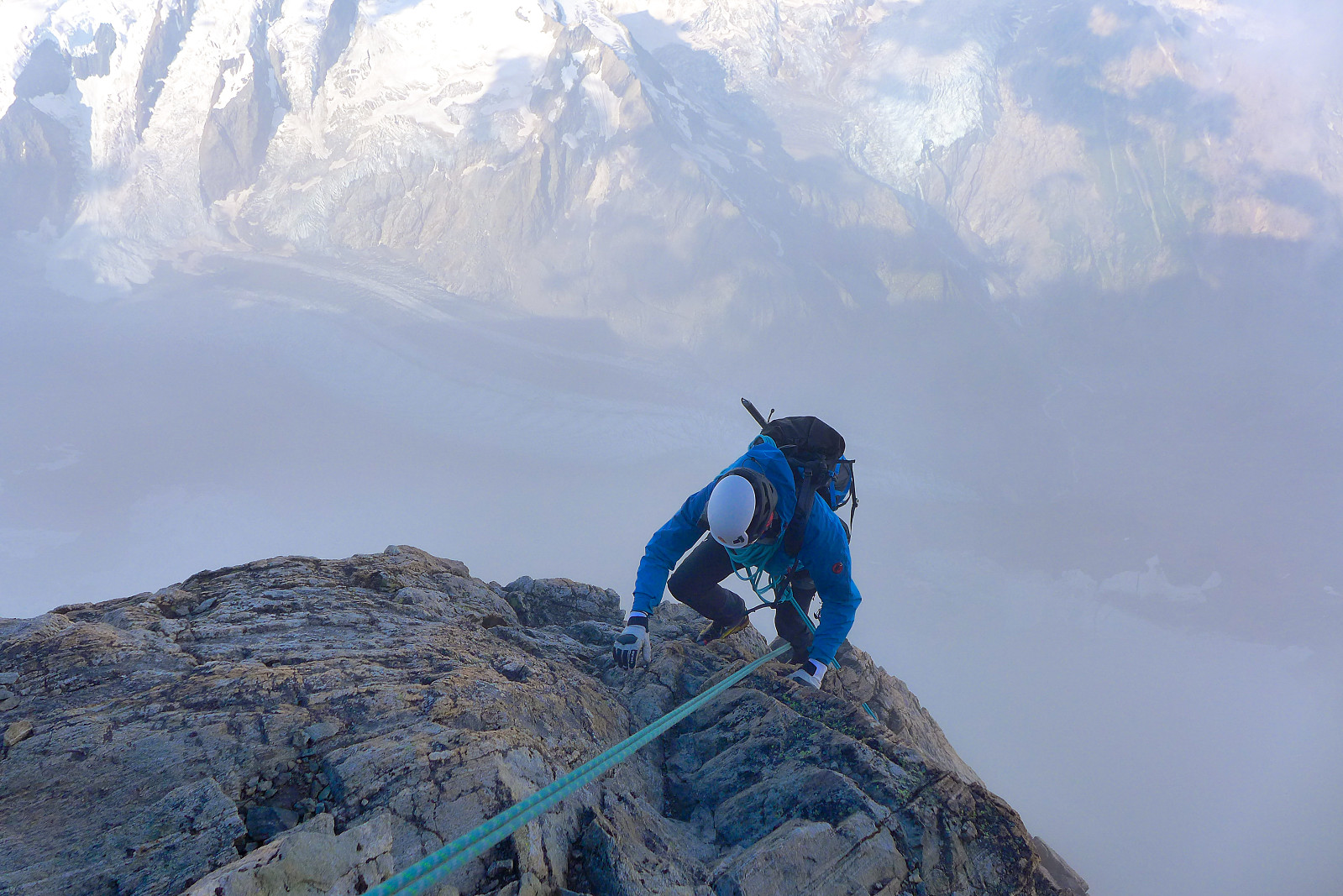
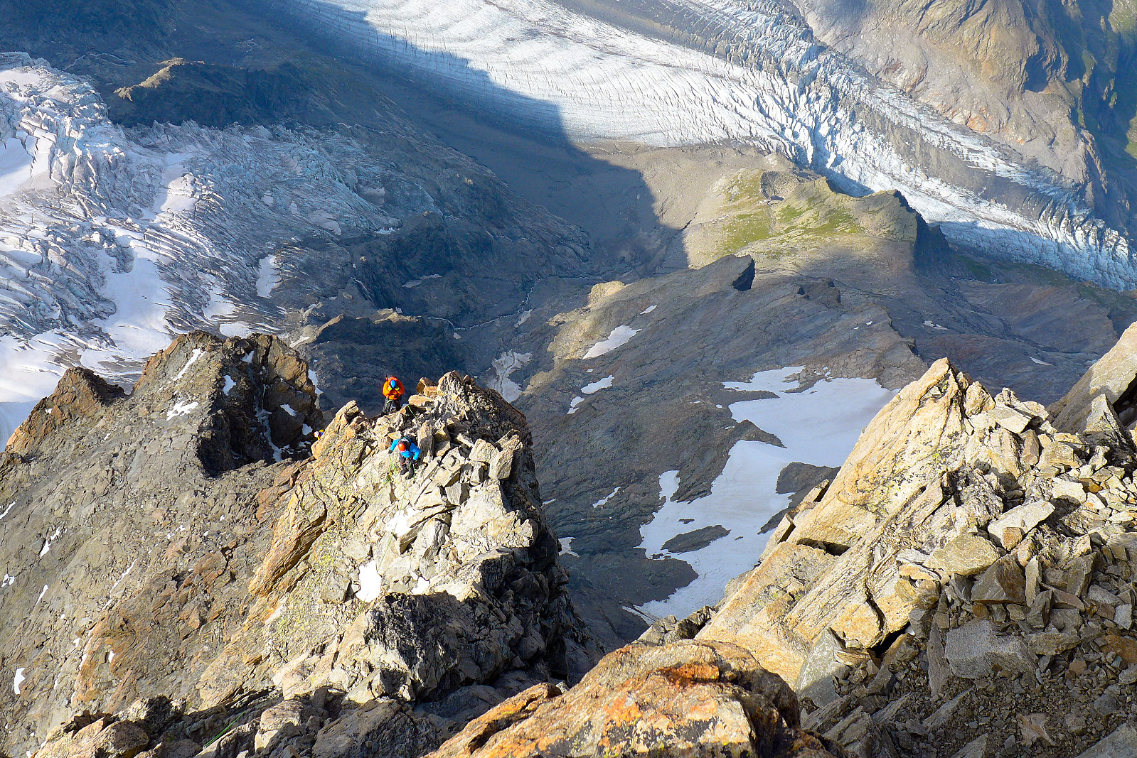
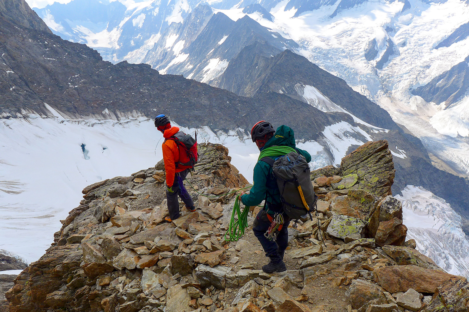
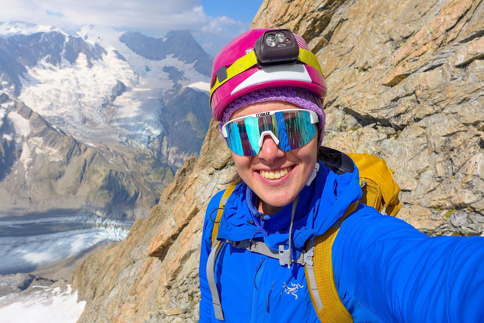
After what seemed like a rather long break here, we made our way across some snow in an OK track, but it was obvious that the snow hadn’t refrozen overnight probably because of a bit of cloud cover and the warm temperature. Anyway, the soft snow soon became an icy traverse, much like on the Grandes Jorasses but slightly longer and after some tip toeing up and across on the front points of our crampons, it was back to trudging in soft snow again which seemed to last for what seemed like an eternity. It wasn’t really that far, but it did seem longer than I was expecting. I was glad when we finally arrived at the foot of the southwest ridge and a transition to some proper climbing and good, solid granite. Calum and Will had already started climbing the first slabby pitch, and since there were two other pairs of climbers (both Swiss I think) waiting in line it turned out to be a bit of a while until we got going. On the plus side, it seemed to be a bit more sheltered from the wind here compared to the moraine ridge, so it wasn’t too cold to stand around and wait. Soon we were climbing pitch after pitch, still in the dark – but at some point the sky began to get lighter and the outline of the Finsteraarhorn could be seen. Down on the glacier, we could see tiny bright spots from the headlamps of everyone who had got up slightly later to climb only the southwest ridge. I was in a way glad we’d started earlier and wouldn’t have to be in a bigger queue behind the rest of the climbers on the ridge today.
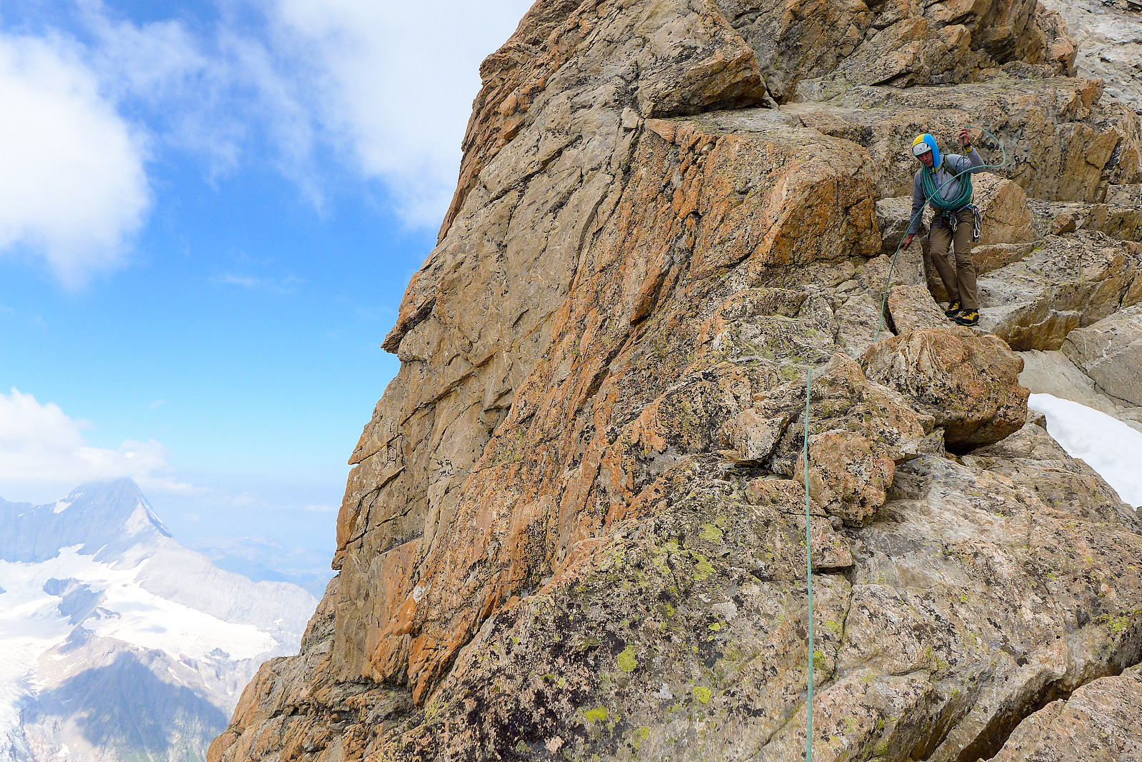
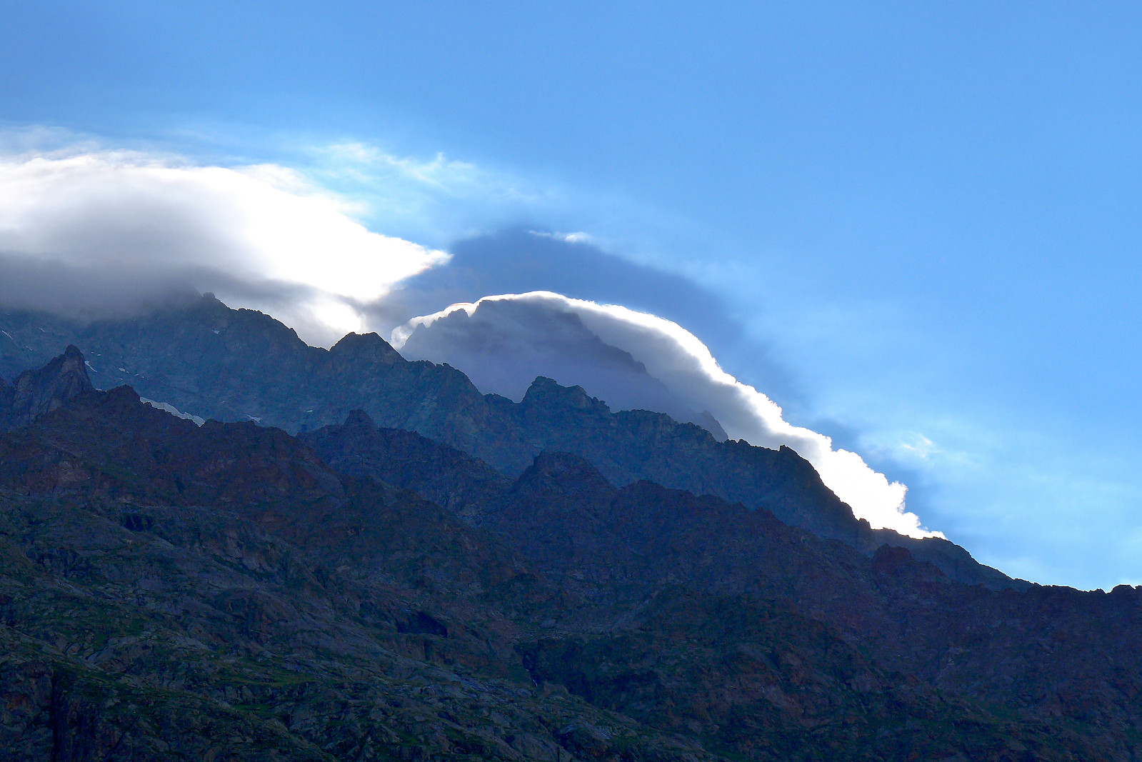
The lower part of the ridge was fairly broad, so it wasn’t obvious where on the ridge we were until we’d got a bit higher up and were on the crest proper. From here not only could we look straight up the ridge, but also a fairly thick lump of fog sitting over the summit of the Schreckhorn and the rest of the traverse across to the Lauteraarhorn. This was more than a bit disappointing, based on the fact that we’d expected clear skies! My enthusiasm for doing the whole traverse dropped a fair bit from then on..... But anyway, we carried on nonetheless. The rock was really top notch and it was a good quality and fun ridge to climb. We were climbing fairly close behind one of the Swiss pairs for much of the time, so there was some waiting from time to time, but they were friendly to chat to so it was actually quite nice with some good company along the way. As we progressed into the fog the winds picked up a fair bit too and parts of the rock were iced over in places; the amount of ice cover generally increased with height and it soon became obvious that the conditions were not exactly ideal for a long traverse to the Lauteraarhorn anyway. I had to fish my mitts out of my rucksack at one point to keep my fingers from freezing, but then it seemed a shame to not be able to appreciate the excellent granite while climbing with mitts on!
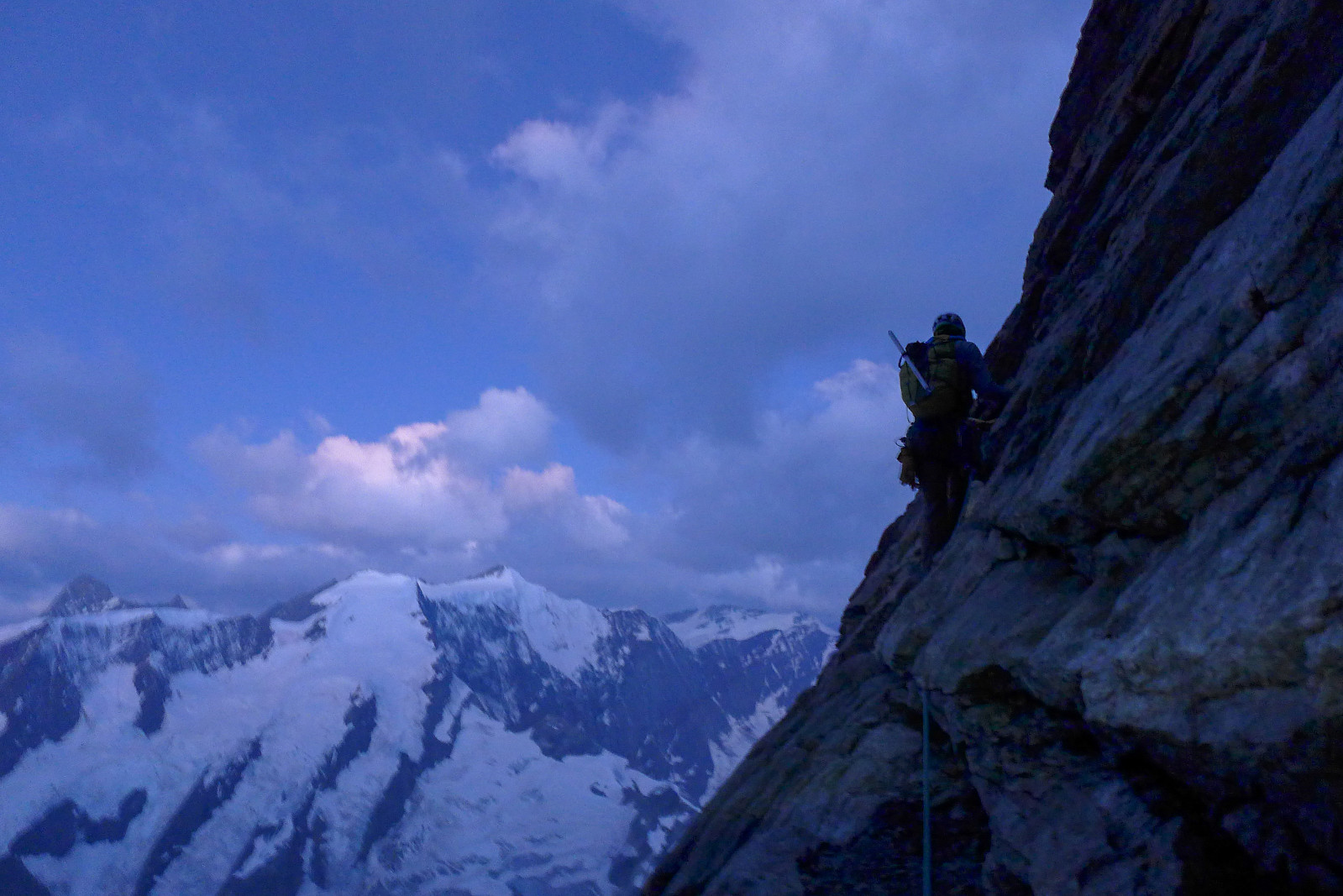
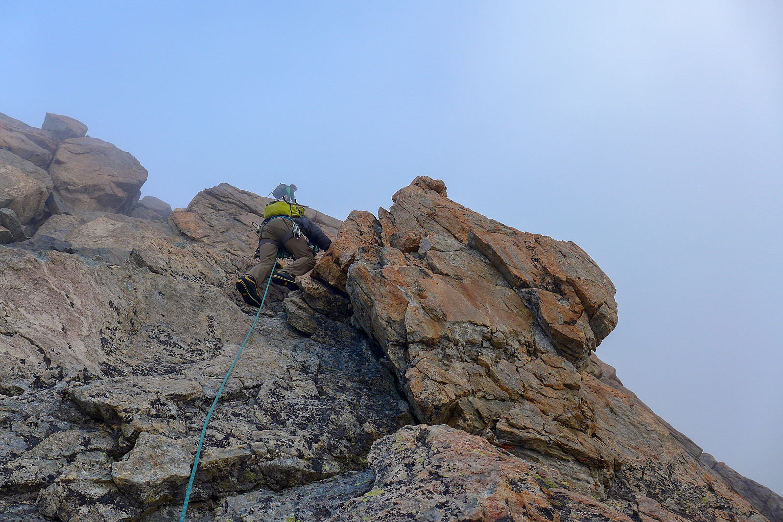
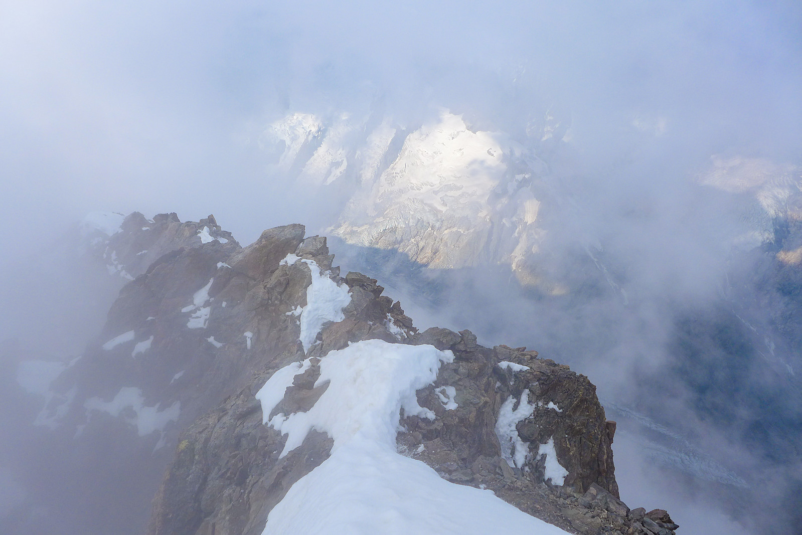
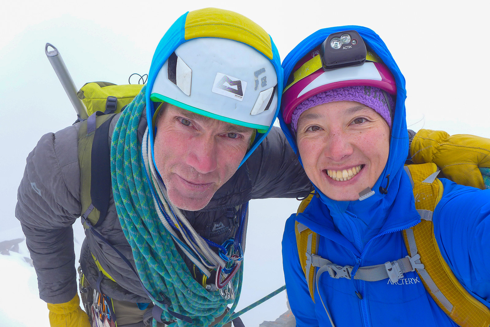
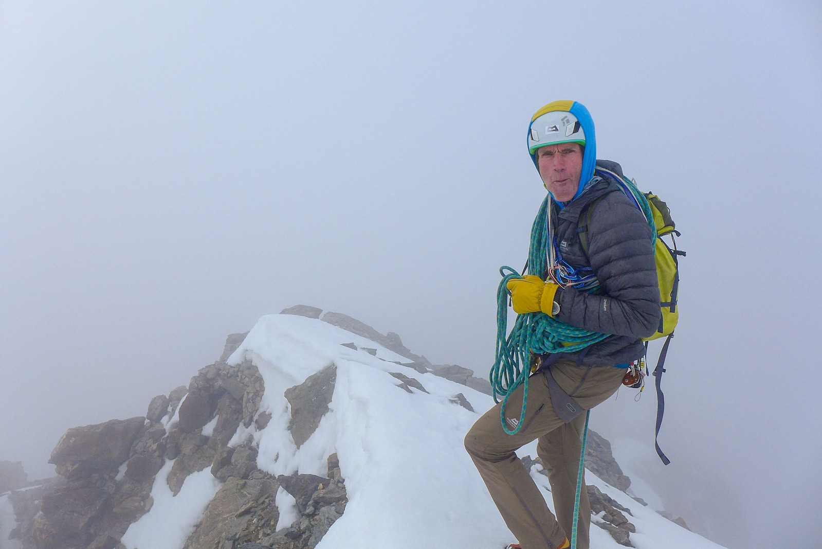
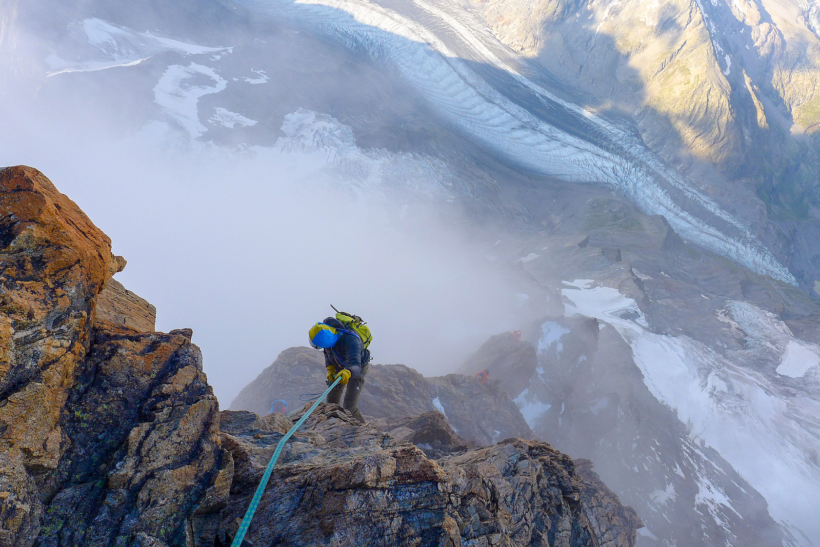
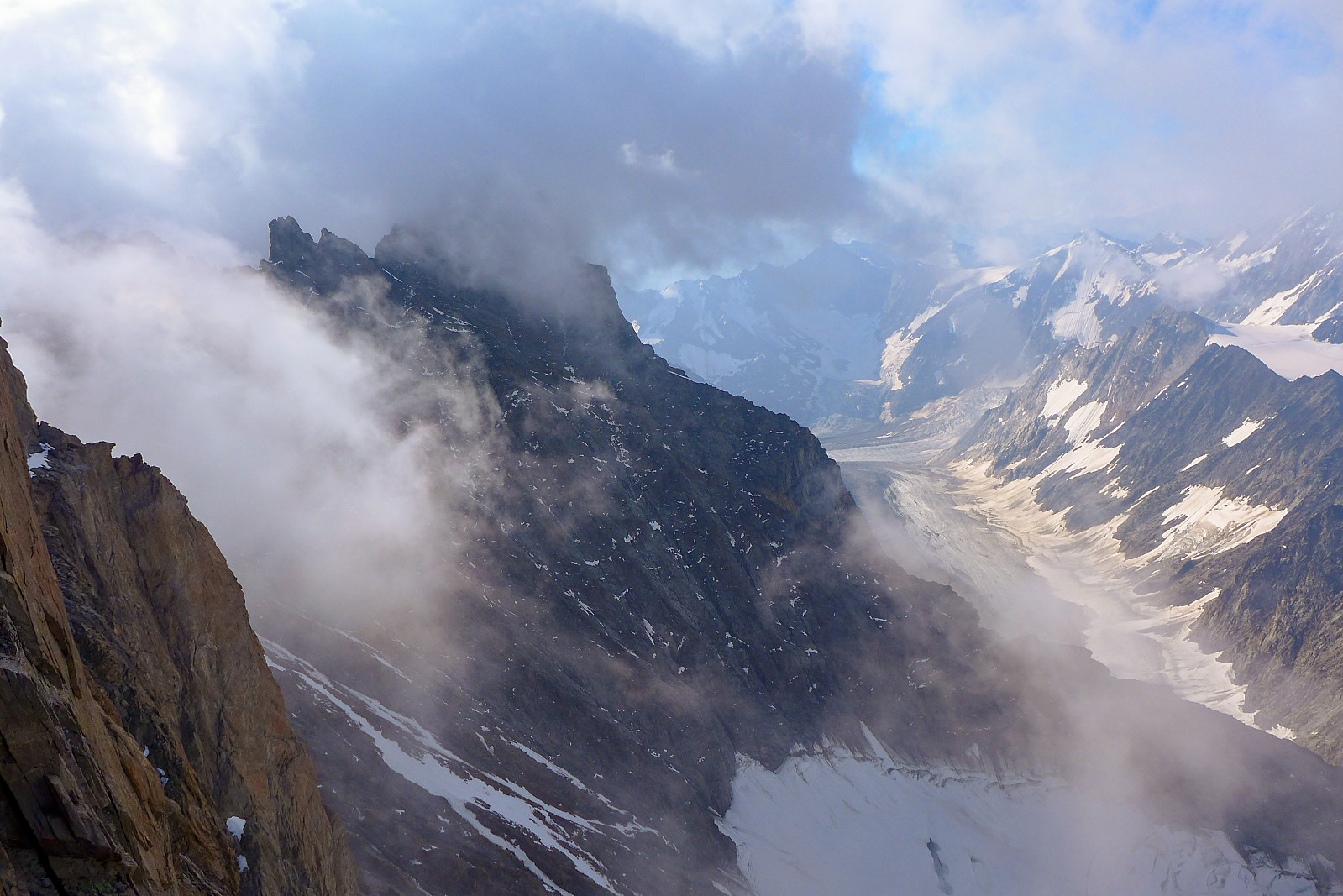
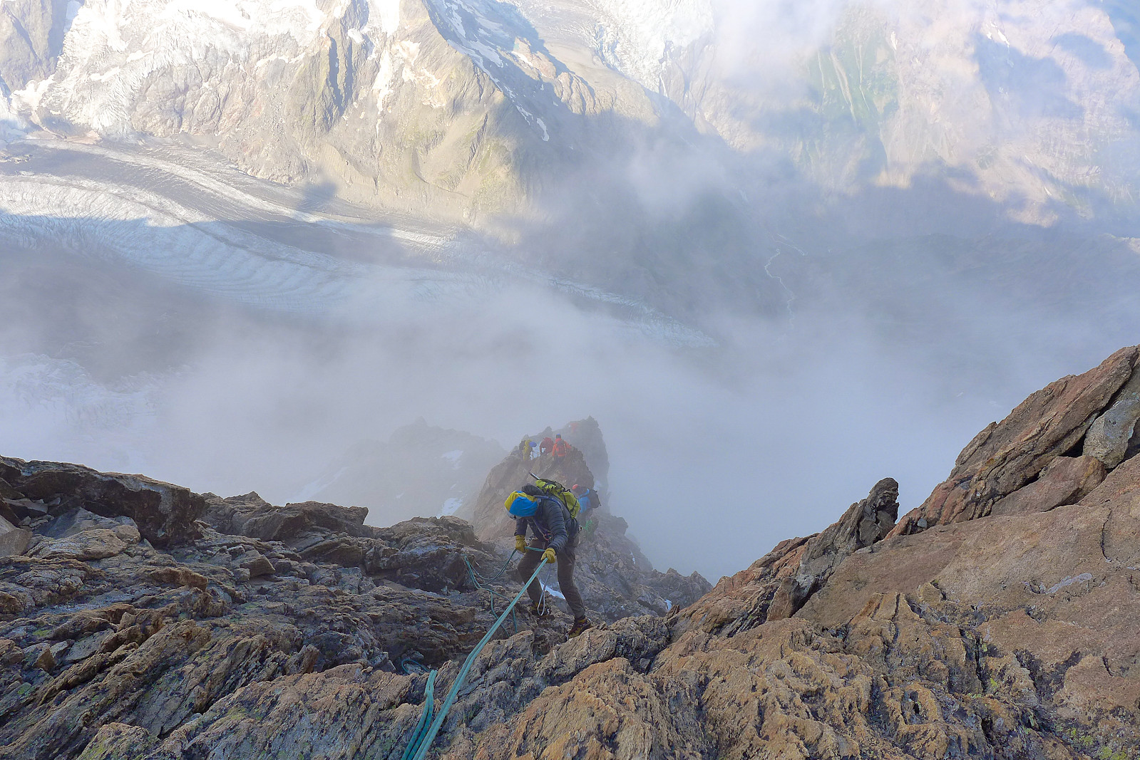
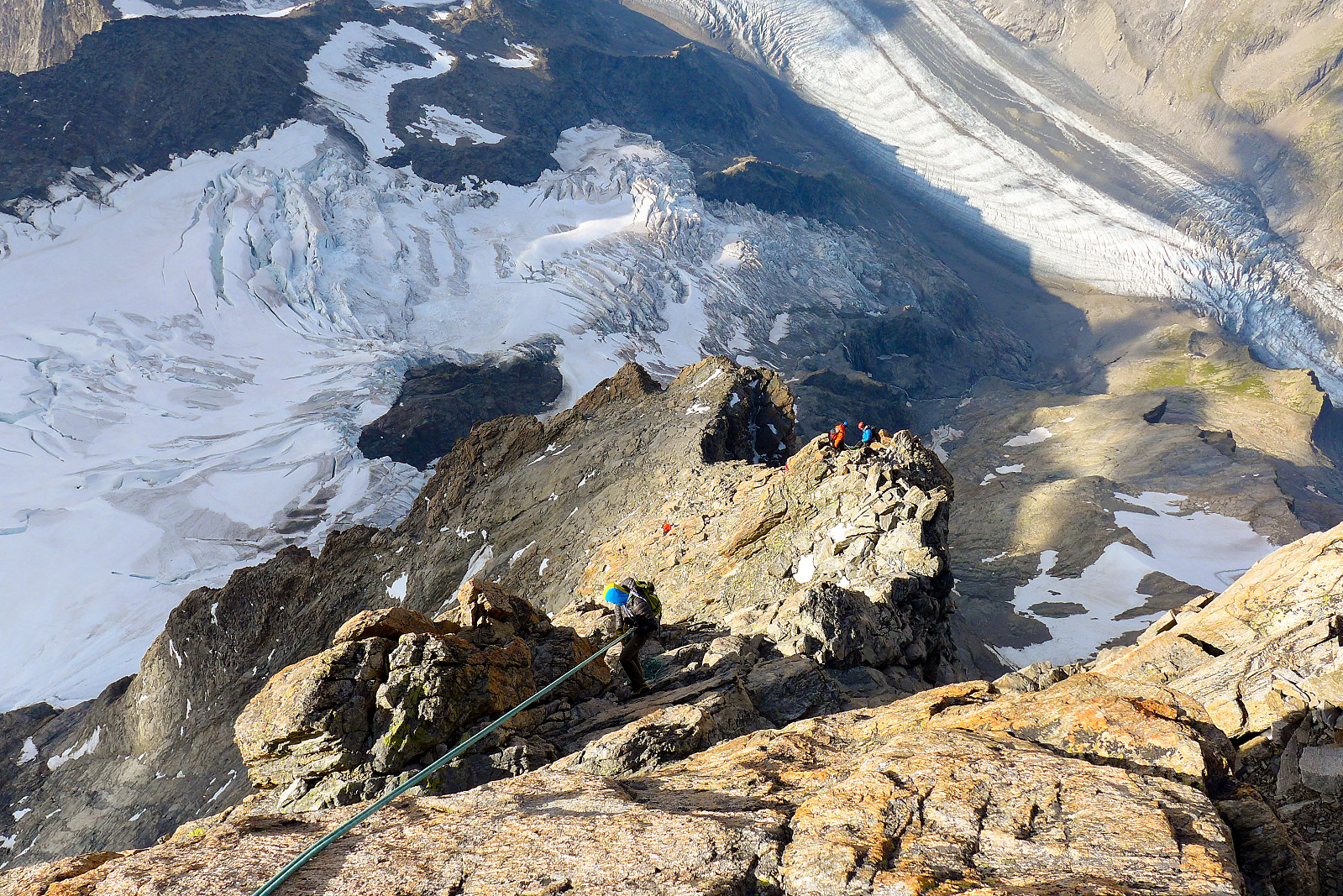
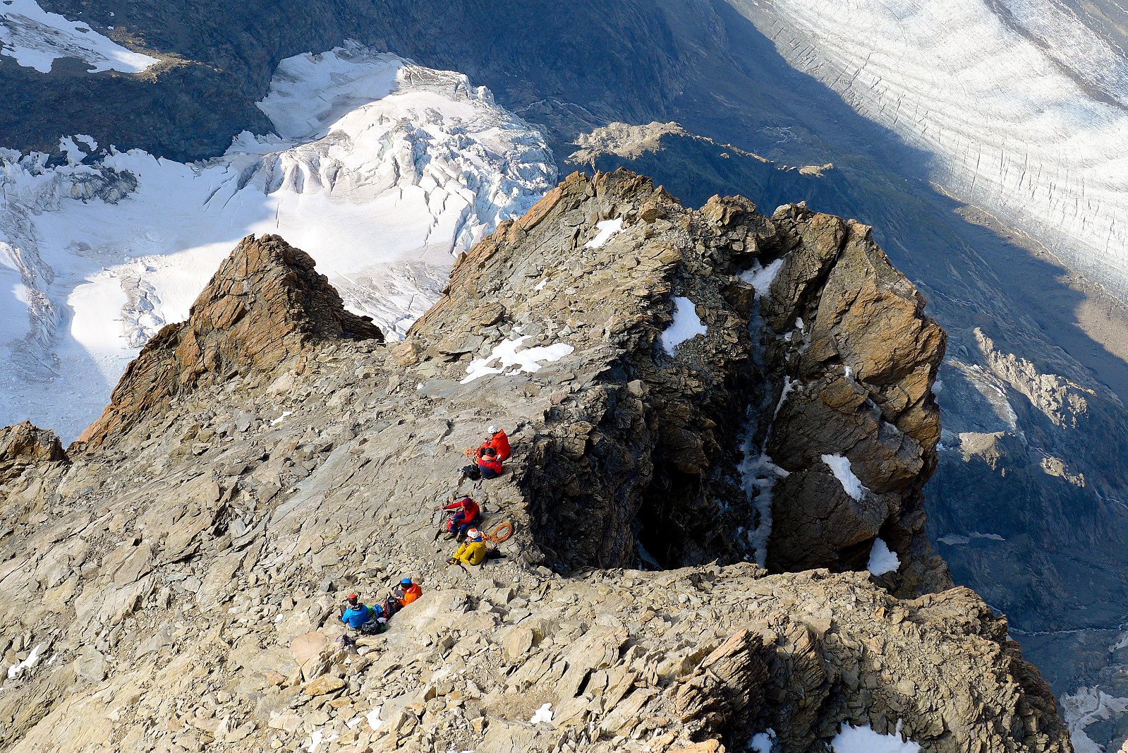
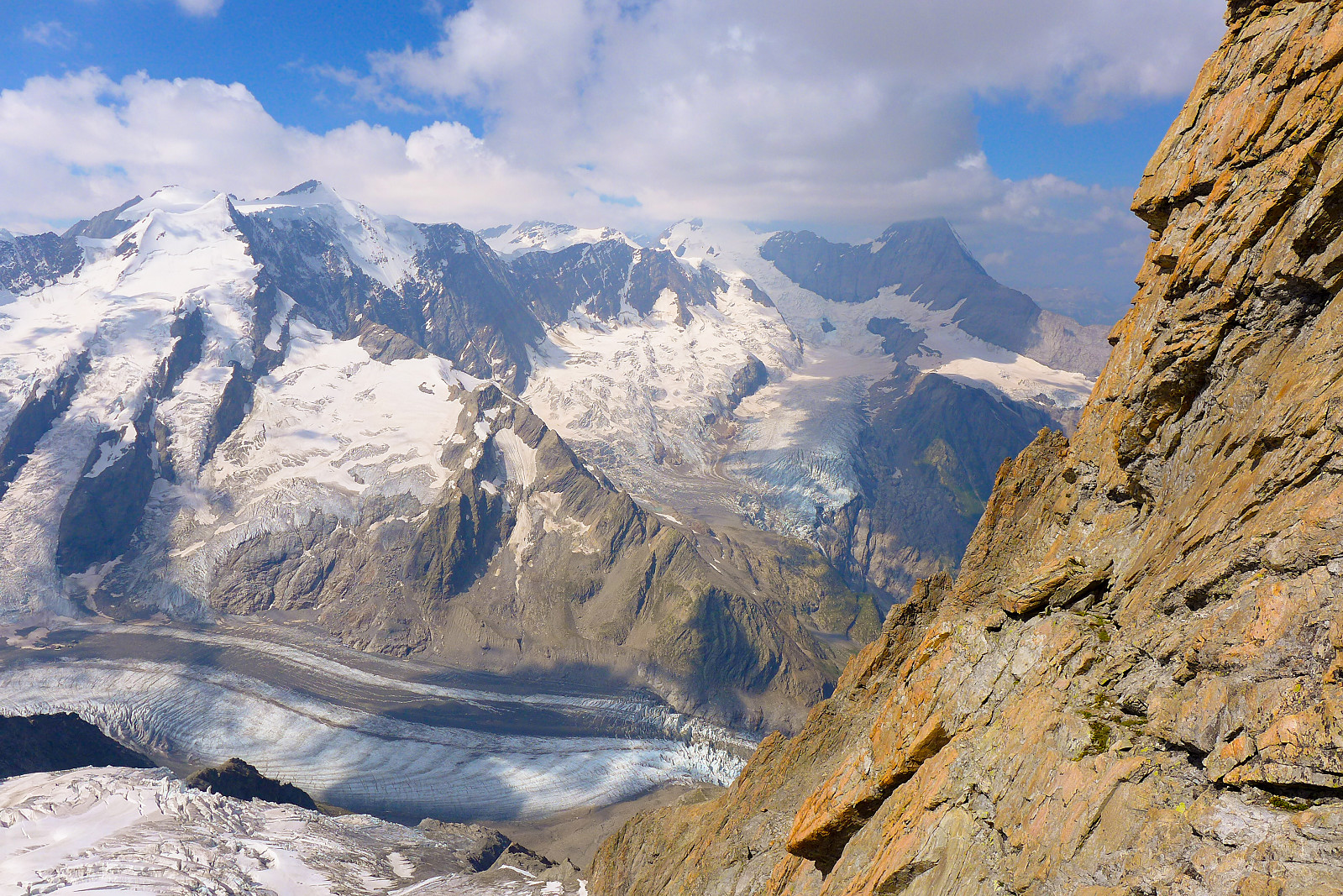
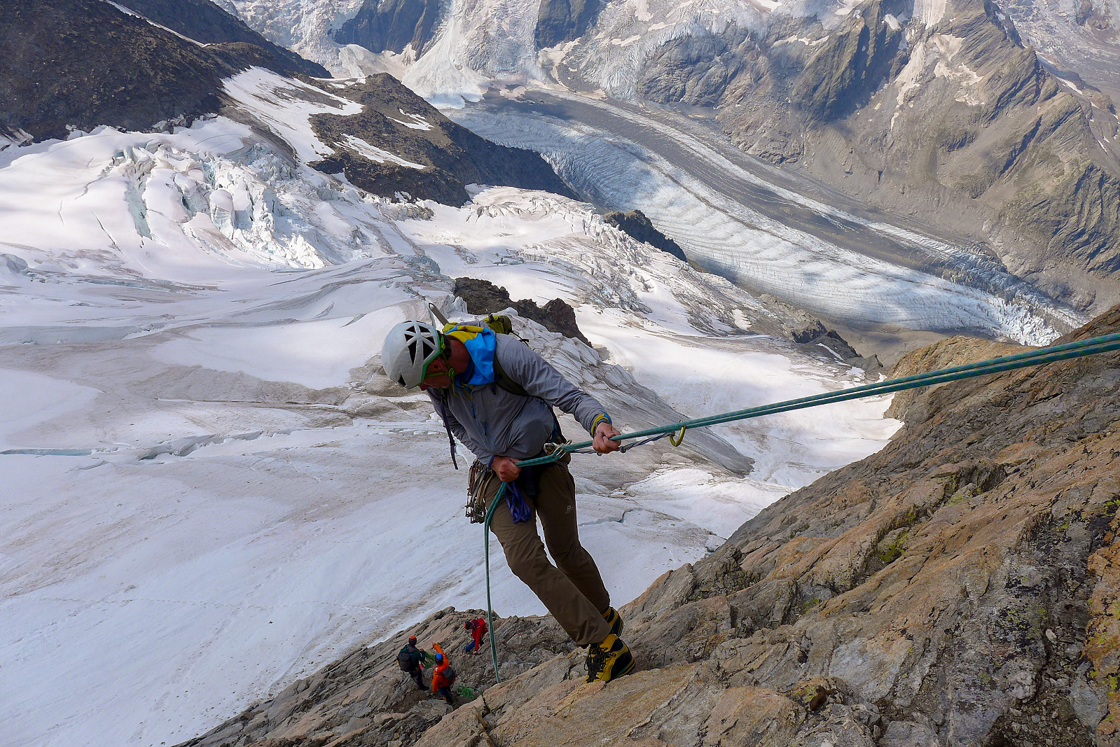
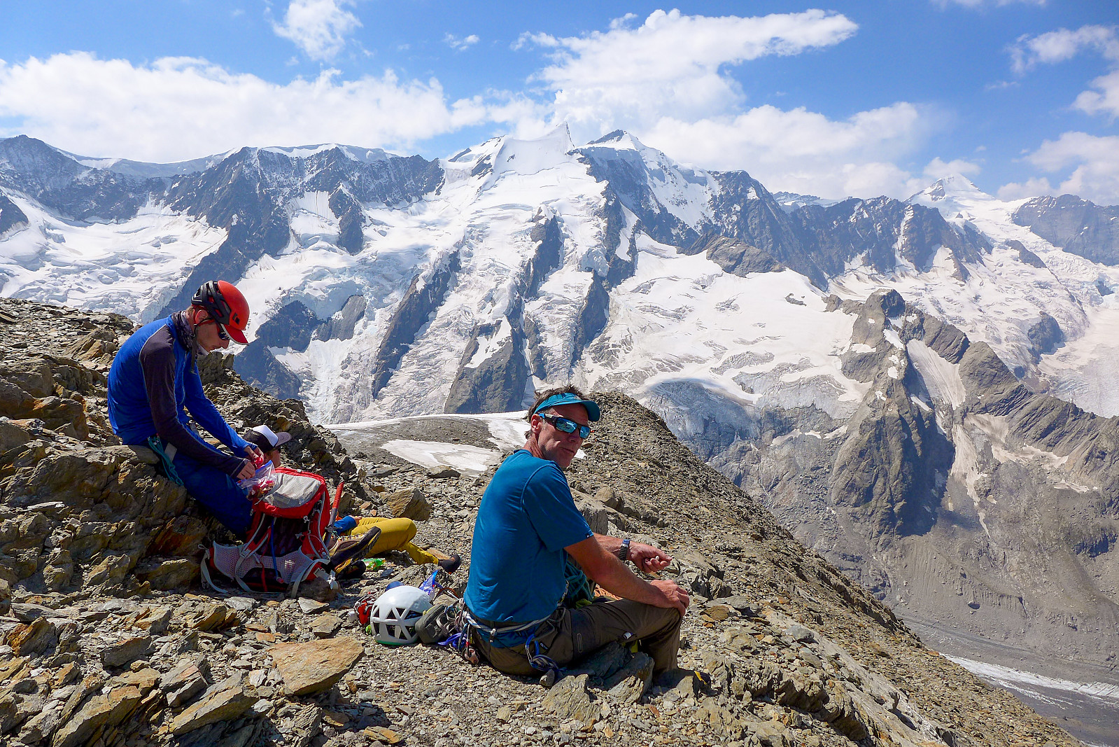
We had by now lost the view, so it was a matter of trying to enjoy the rest of the route to the summit despite the cold. I’d packed a bit less to save weight on this climb, but of all the climbs we’d done it was probably the one I shouldn’t have tried to pack less for... thankfully though, after some 6 hours from leaving the hut, we arrived at the top, greeted by some of the other climbers who were just starting to make their way back down the mountain. It seemed like everyone had decided to drop the traverse because of the weather and verglassed rock. Despite the lack of views and change of plans, the atmosphere was good and it was nice to share the moment with a bunch of cheerful people! It was still pretty chilly up at the summit, though the wind was actually not blowing as much there as it was on the more exposed parts of the ridge, so we sat down for about 10 minutes and had some snacks to refuel before starting the descent. There were momentary glimpses of a view starting to appear – and at one point I thought we might even have struck lucky with timing and the fog would fully disintegrate if we stayed at the top for long enough. It didn’t though, not during the time we were waiting.... after putting back on the crampons we began reversing the route, climbing and scratching carefully over the icy rocks. It reminded me a bit of the conditions we had on the Dent d'Hérens last summer; verglassed summit ridge and only rare glimpses of the sun and the Matterhorn from behind some pretty wild clouds. Anyway, once back to the series of anchors it was going to be a matter of abseiling a large part of the way down the ridge, at least until the terrain was easier and could be just as efficiently downclimbed. There was once again some waiting as climbers who had started later were now approaching the last part of the ridge to the summit, but it didn’t cause too many problems. Some views across to the Kleines Fiescherhorn and the Finsteraarhorn began to slowly appear again as we descended to below the fog level. And at one point I got the impression it was clearing up over the summit too, which was a bit frustrating now we were already on the way down. Maybe we left too early! At least we got a good view of folk further down on the ridge though, it gave a good perspective of what we’d climbed up earlier in the day.
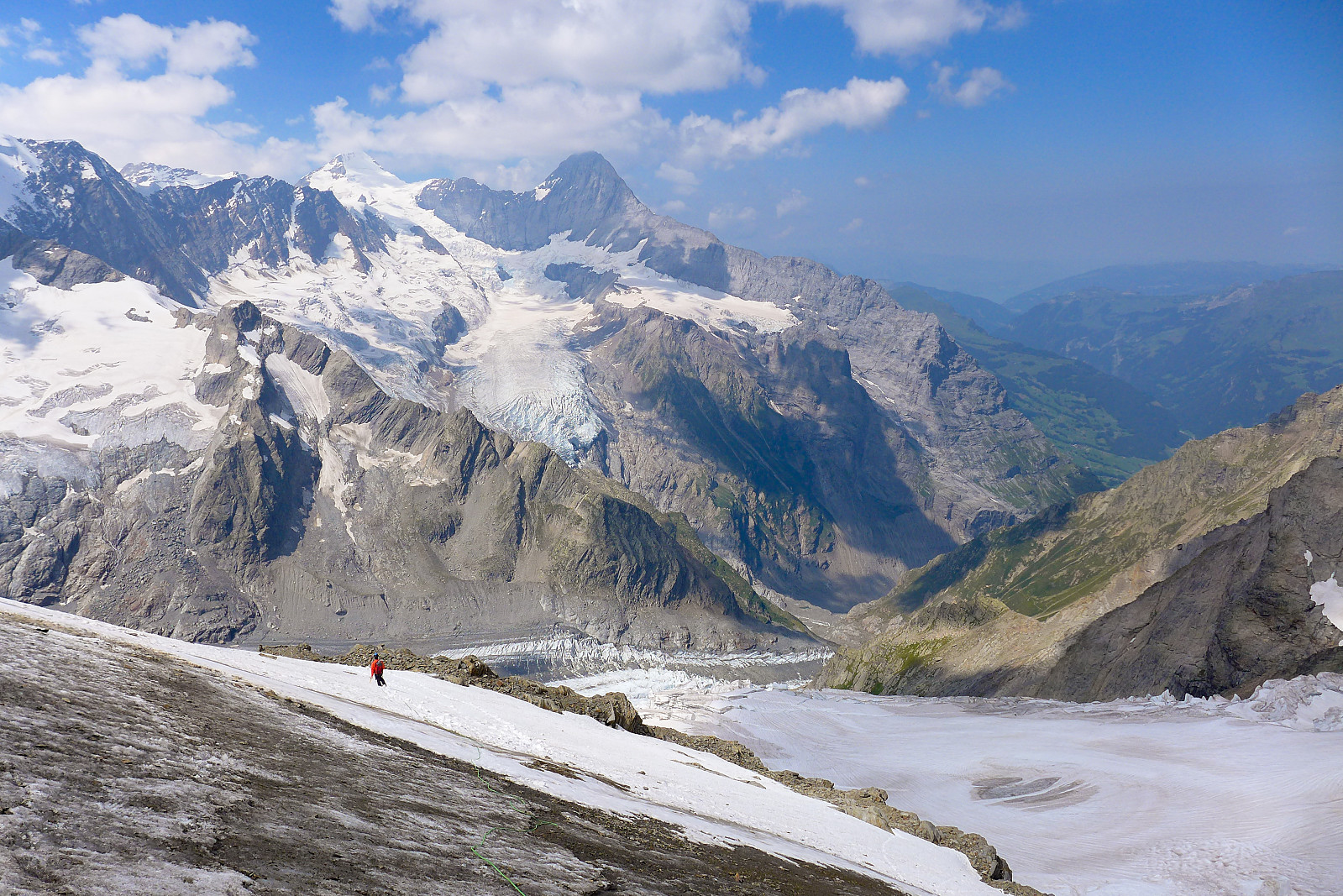
Abseil after abseil followed - it was a nice contrast to the descent from the Dirruhorn exactly a week earlier – until we finally ended up at a flatter part of the ridge where it begins to curve around in a more southerly direction. Here, pretty much everyone we’d started the ascent with had decided it was time for a new breakfast stop, so we thought it would be rude not to join and did the same :-) It was also not windy here and being the sunshine again, it was actually a nice spot to defrost and accumulate a bit more warmth in the body after having spent much of the morning feeling cold! After this point, the terrain was easier and there wasn’t much point in trying to abseil even though there were anchors around, so we downclimbed until we reached the final slabby part of the ridge, maybe some 100-150m above the glacier. It was about 3-4 abseils to reach the bottom of the route. Looking back up it felt like a shame not to have done the route in daylight – and in sunshine. It had been such good quality rock and climbing, and we’d done a good part of it in the dark and in fog... Anyway, the snow had more or less turned to porridge now and the few snow bridges we’d crossed in the dark were now of even more dubious quality, so we were more than keen to be efficient and get off the snow as soon as possible. After a baking hot trudge back down, we reached the early icy traverse, and made our way back across it, with Tim using an ice screw (kindly left behind by Calum and Will) to belay me as I frontpointed my way across and downwards. Then finally we were back at the start of the long and loose moraine ridge. Calum and Will and the two other parties had also decided it was time for yet another break before the walk back down, so another break it was. Haribos and other sugar loaded snacks were shared around and discussions of hut cake and cold drinks were had. It was probably all that was needed to get us on our feet again and back on our way down. This part of the walk-in to the ridge is definitely something to be done in the dark – you definitely don’t want to know how far it goes before you can finally start the climbing! Anyway, some hours later and after a rather awkward descent back over the steep final wet rocks and scree down to the contrastingly dry glacier, it was a matter of plodding all the way along and back up the final slopes to the hut.
My feet were quite sore by this point and so were my knees, so it was a relief to finally get it done and arrive back at the hut, some 13 hours after leaving it at 1.30am. Never have I felt so happy to change into hut slippers! Once rucksacks were unpacked and kit had been strewn over various rocks and benches to dry, we went promptly inside and ordered some really amazing cake and coffee (or in other cases, beer) to end the day properly. A very decent day of climbing with a just as decent finish. Dinner tasted just as good too! Since we’d already booked two nights at the hut we could chill out and relax without having to walk all the way back down to Grindelwald. Fortunately the dormitory turned out to be just as quiet as the previous night so we all got the good night’s sleep we deserved :D Breakfast the following morning was taken at the very respectable time of 7am (although I’d already gotten up at 5.30am and helped myself to some coffee that had been left out for the early-starters) and we packed up and thanked the folk at the hut before starting the walk back down to Grindelwald. The Schreckhorn still had a thick hat of fog covering its summit this morning too, so I felt like it was some sort of consolation and that we’d not have gotten a better view if we’d gone up this day instead of the previous.
I like to finish most things I do properly, and I think an ascent of the Schreckhorn was definitely a proper way to finish off this year’s summer holiday, so thanks to Tim for the super 2 weeks of guiding and excellent company and for not objecting to several outrageously early breakfasts/"late coffees" ;-)

| Starttidspunkt | 30.07.2020 01:28 (UTC+01:00 ST) |
| Sluttidspunkt | 30.07.2020 14:49 (UTC+01:00 ST) |
| Totaltid | 13t 20min |
| Bevegelsestid | 8t 45min |
| Pausetid | 4t 35min |
| Snittfart totalt | 1,0km/t |
| Snittfart bevegelsestid | 1,5km/t |
| Distanse | 13,5km |
| Høydemeter | 2053m |


Kommentarer