
Breithorn half traverse (21.07.2020)

Skrevet av hmsv1 (Hannah Vickers)
| Startsted | Klein Matterhorn (3775moh) |
|---|---|
| Turtype | Alpin klatring |
| Turlengde | 4t 34min |
| Distanse | 7,5km |
| Høydemeter | 582m |
| GPS |
|
| Bestigninger | Breithorn (4164moh) | 21.07.2020 |
|---|---|---|
| Breithorn Zentralgipfel (4159moh) | 21.07.2020 |
After arriving back in Zermatt from the Zinalrothorn, we checked the weather forecasts again to make sure it would still be good weather for the next objectives we had planned to do. Originally the plan had been to head up to the Ayas hut, then traverse both Castor and Lyskamm the following day, spend the night up at the Margherita hut and then do both Nordend and the Dufourspitze on the thursday which was supposed to have the best weather and would have made a nice 3-day outing. Castor and Dufourspitze I had climbed previously, but not Lyskamm or Nordend, so they were still on the "to-do" list. However, since the forecast for the next 2 days were looking less optimal for a big day on exposed snow ridges, we moved onto my backup plan which was to do the Breithorn half traverse, a quick half day outing to make the most of the morning weather, and then cross over to the Saas valley, walk up to the Mischabel hut and do the traverse of the Nadelgrat from there on the thursday. So with the half day weather window the day after the Zinalrothorn, the plan was to get the first (very expensive) lift up to the Klein Matterhorn (6.30am ish) and start the route as early as possible.
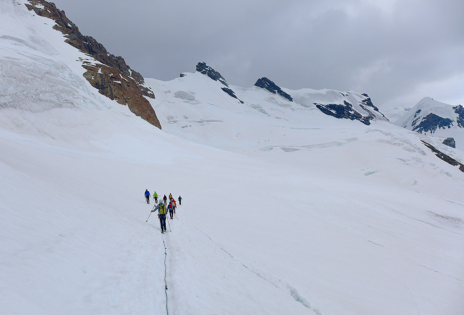
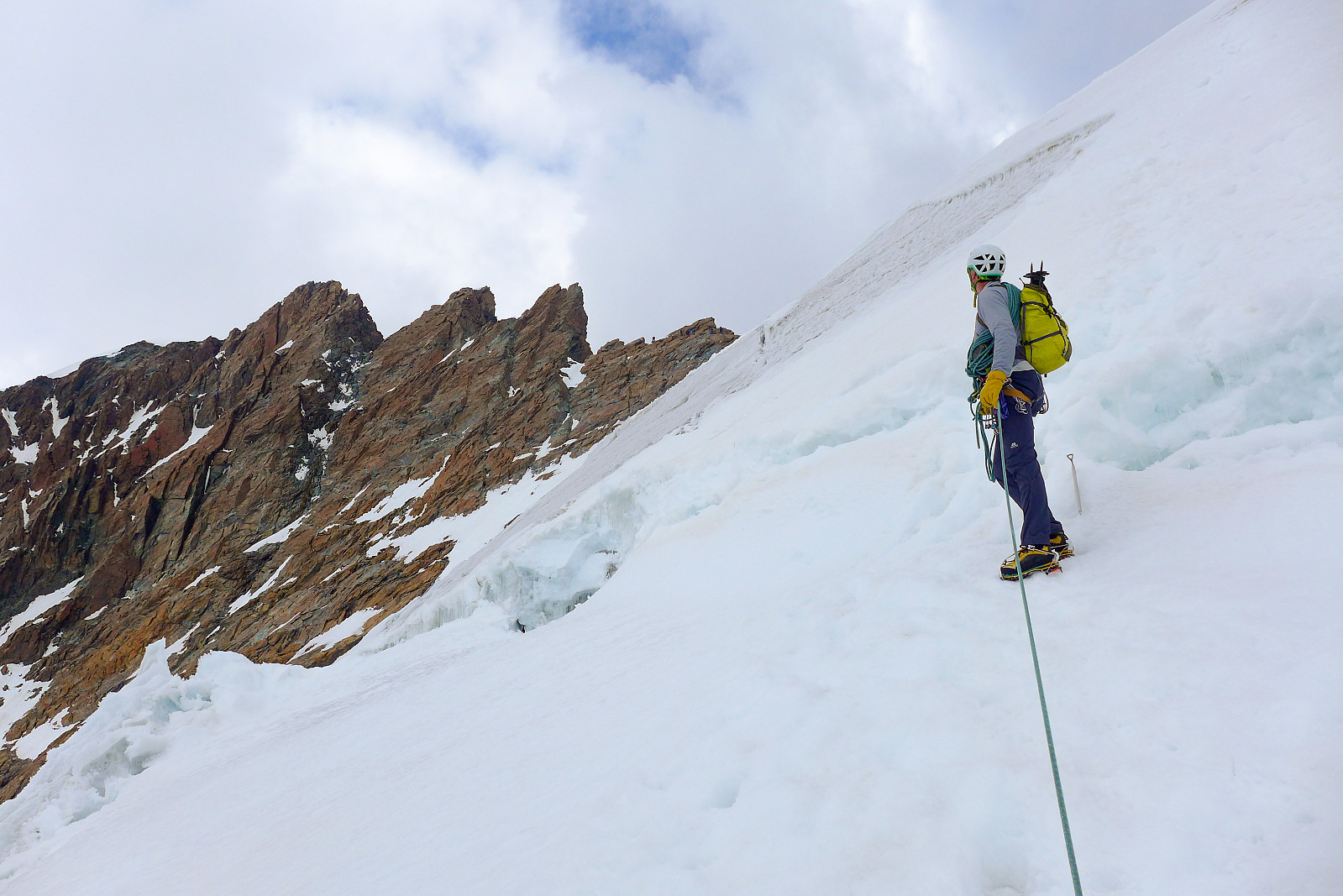
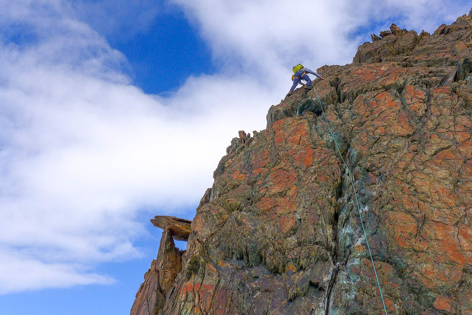
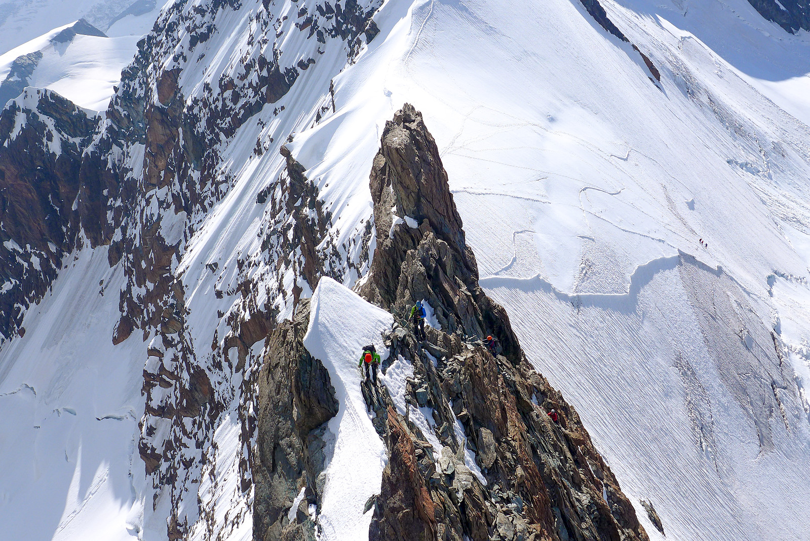
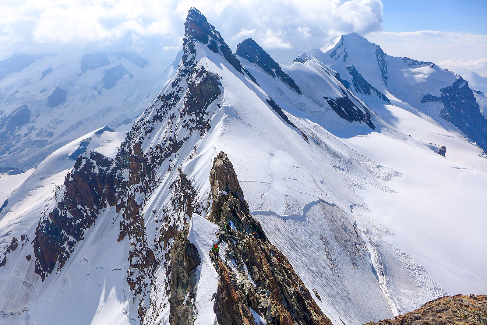
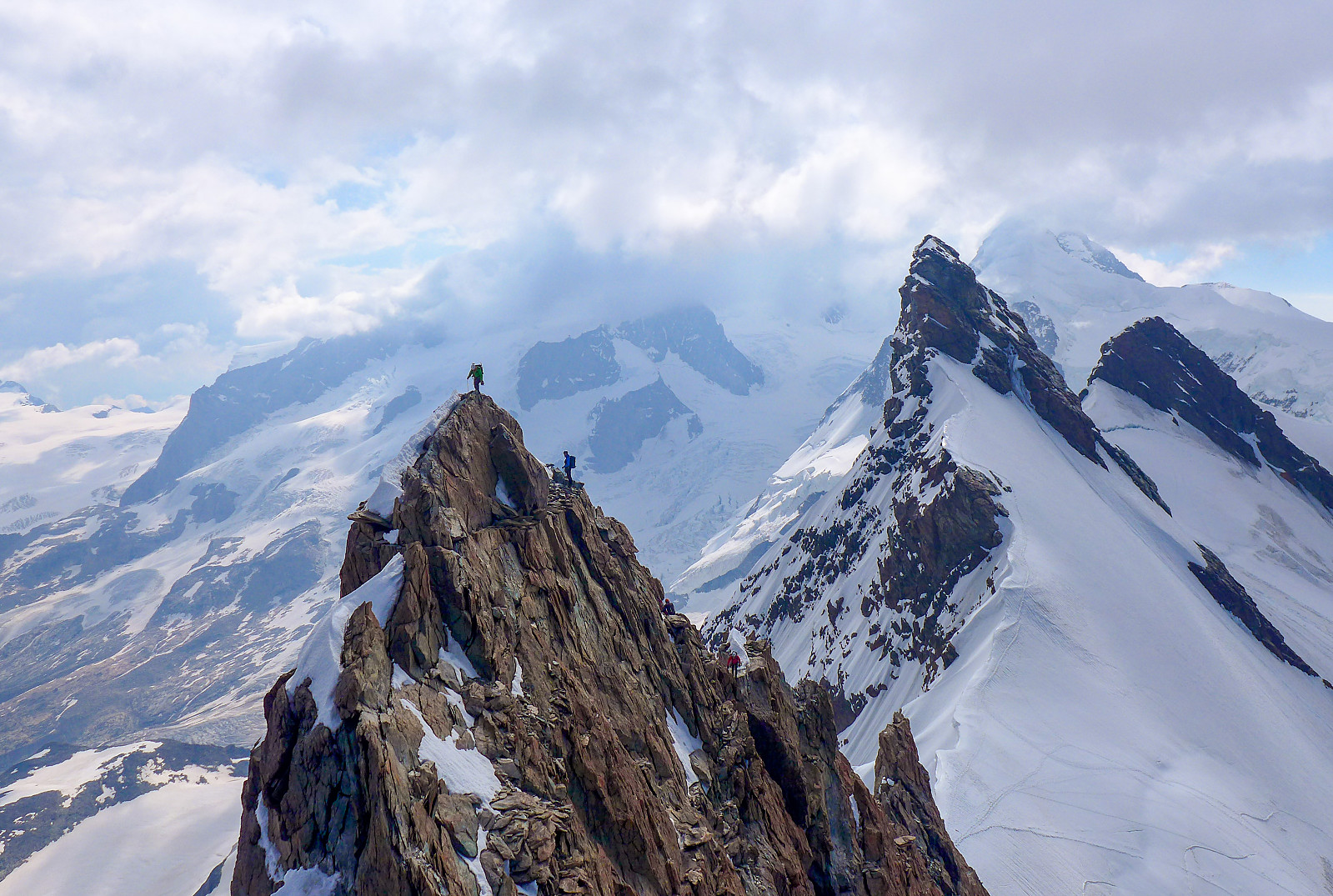
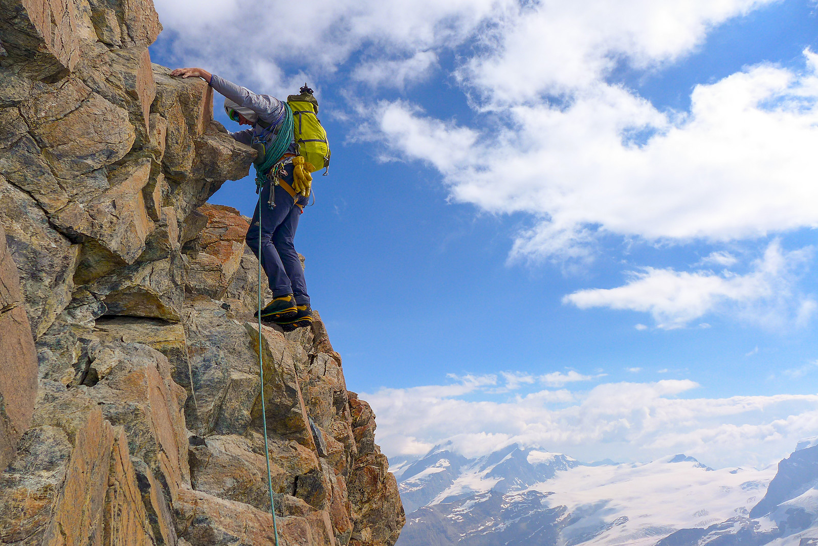
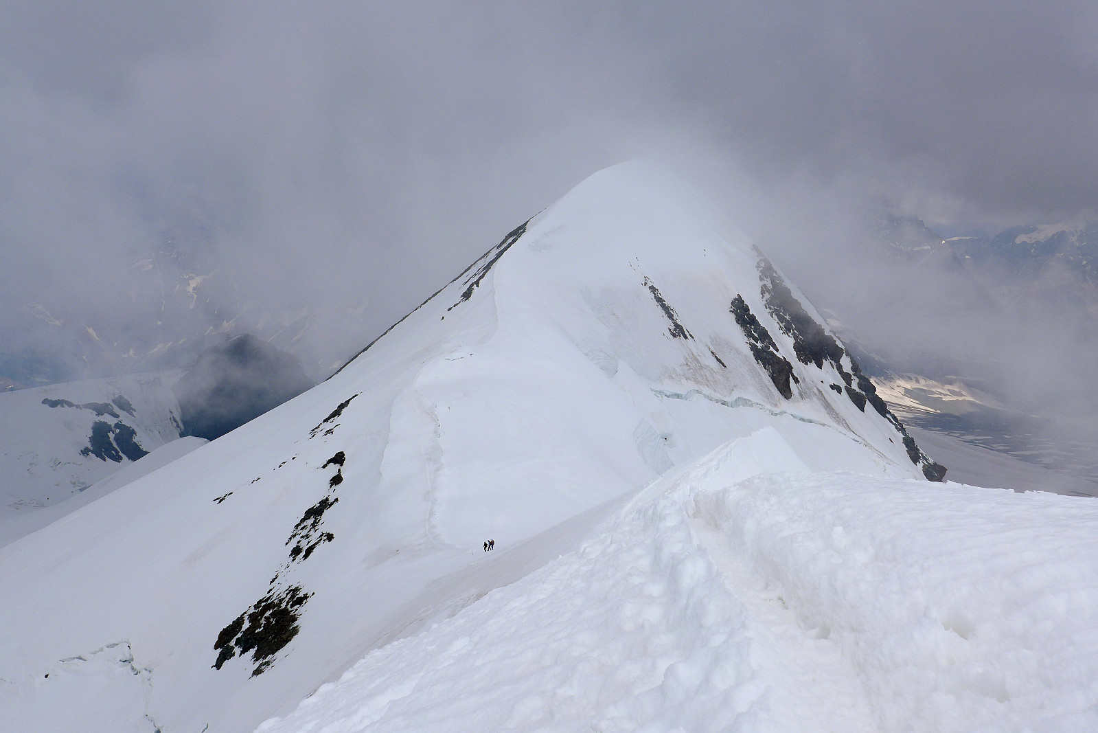
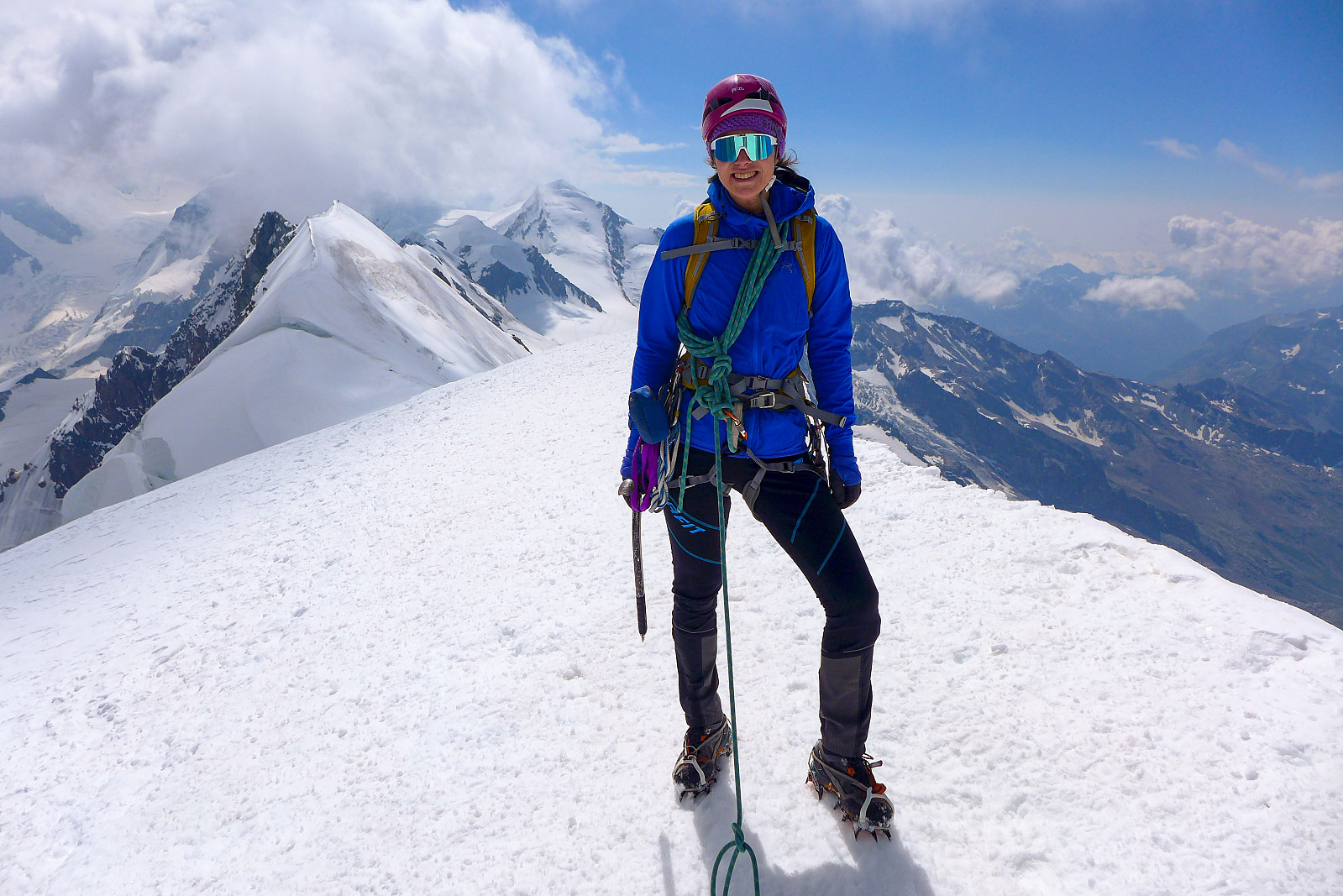
I somehow had the expectation of clear skies when we stepped out into the streets of Zermatt early on the tuesday morning, so it was a big disappointment to observe that it was near-overcast. Not raining, but definitely very grey. Psyche was a bit low (on my part) and for the initial trudge across the glacier I didn’t feel super motivated and my legs responded by feeling heavy. It seemed to take forever to slog our way up to the col between the eastern and western Breithorn summits, but after taking a caffeine-containing energy gel, progress seemed to improve and we eventually reached the saddle in the ridge a short way behind a larger group of climbers. The sky was still a bit grey, but at least the views were better! And it looked like we were getting better visibility than on the Dufourspitze and other summits further to the north and east anyway.... so that was a good consolation. Fortunately, not too long after starting the route, the clouds began to part and slowly the sky became clearer around us, opening up a terrific view of the eastern half of the full Breithorn traverse as well as Castor and Pollux behind. Lyskamm remained obscured for much of the time. The rock itself was great to climb on, a distinctive red color (not granite, but still a good type) and offered big solid holds. There were three (two?) main towers to be climbed, each presenting great photo opportunities of climbers on the ridge behind us. By now all memories of the rather dismal, grey and uninspiring walk-in were forgotten and it felt like we’d not landed such a bad deal after all. By the time we reached the west summit the cloud cover had closed in again and it seemed like there was perhaps some weather on the way. Nevertheless visibility was still OK and there was a solid track in the snow going across to the central summit, so after a short food break we put crampons back on and plodded along to a dip in the ridge, then back up to the main summit. Transient clouds gave us a glimpse of sunshine every now and then, making the view back across the ridge quite atmospheric. More photos were taken on the summit, then we trudged back down in the amazing track to the glacier and across the pistes to the Klein Matterhorn lift. All in all not a bad use of a morning and we realised how good the timing was when we got hit by a wind/rain storm on the lift back down to Zermatt!


| Starttidspunkt | 21.07.2020 07:21 (UTC+01:00 ST) |
| Sluttidspunkt | 21.07.2020 11:55 (UTC+01:00 ST) |
| Totaltid | 4t 34min |
| Bevegelsestid | 3t 36min |
| Pausetid | 0t 58min |
| Snittfart totalt | 1,6km/t |
| Snittfart bevegelsestid | 2,1km/t |
| Distanse | 7,5km |
| Høydemeter | 582m |


Kommentarer