
Skåldalsfjellet from Bjørndalen (04.07.2020)

Skrevet av HHauser (Helwig Hauser)

| Startsted | Gullfjellsvegen (205moh) |
|---|---|
| Sluttsted | Gullfjellsvegen (205moh) |
| Turtype | Fottur |
| Turlengde | 3t 30min |
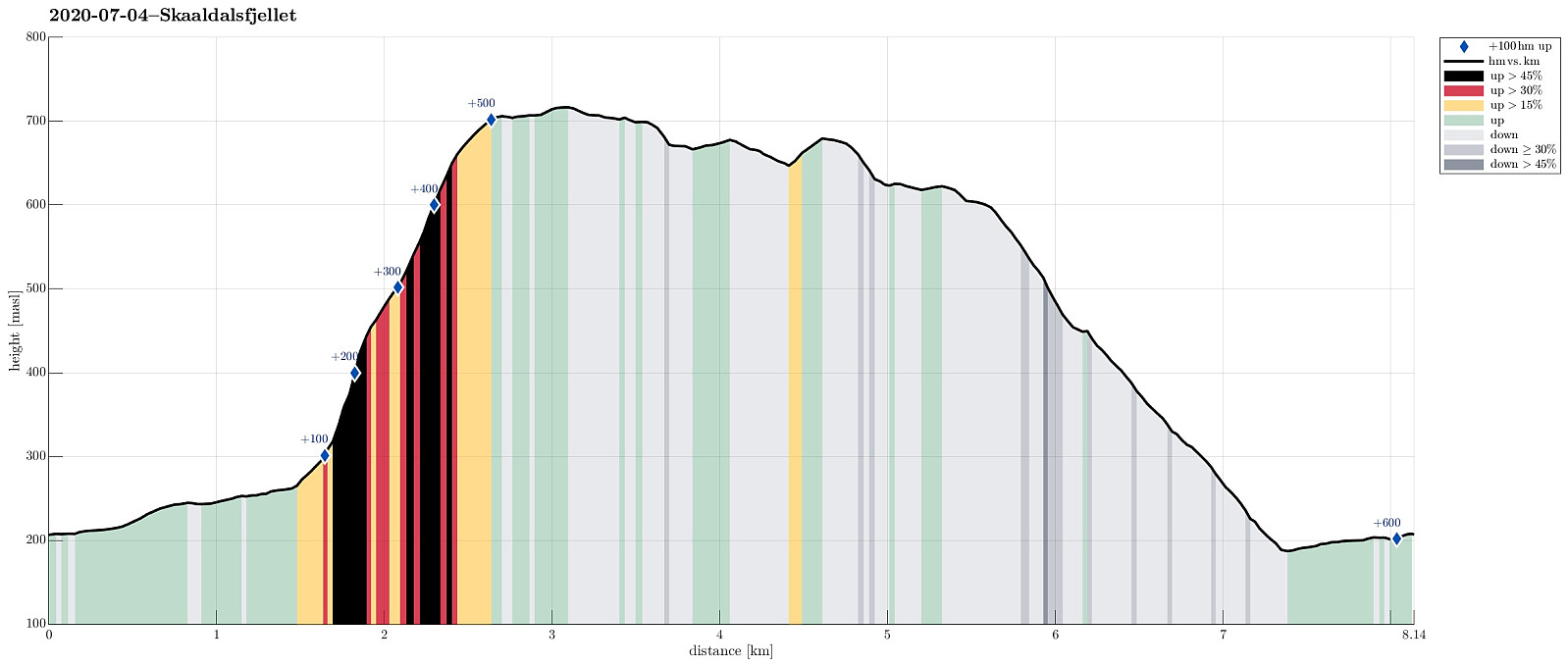
| Distanse | 8,1km |
| Høydemeter | 607m |
| GPS |
|
| Bestigninger | Grøna (680moh) | 04.07.2020 |
|---|---|---|
| Skåldalsfjellet (718moh) | 04.07.2020 | |
| Skåldalsnipa (603moh) | 04.07.2020 | |
| Sælinga (682moh) | 04.07.2020 |
Trip Summary
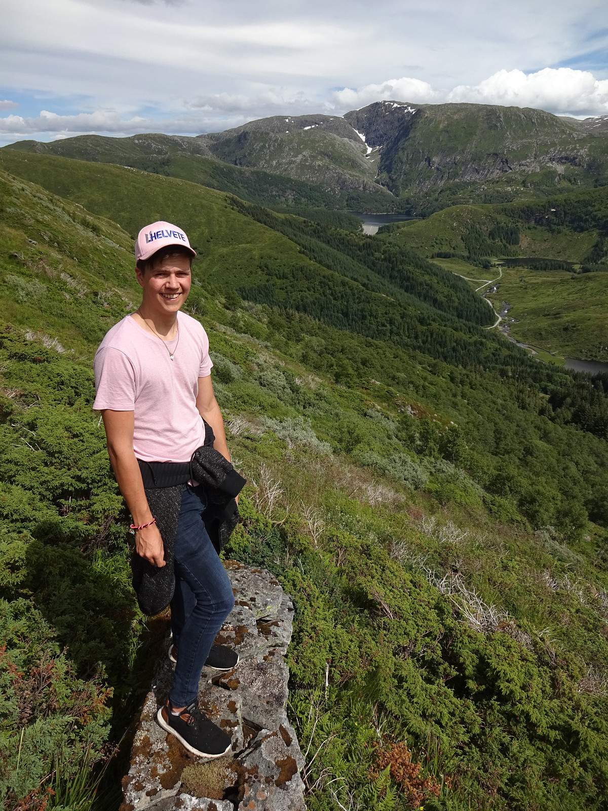
We drove past Grimevatnet and Haukelandsvatnet into the direction of Osavatnet near Gullfjellet, but stopped next to Gullfjellsvegen where the road crosses a small saddle between Ramsdalshovden in the east and Vemånen in the west to continue along Skåldalselva from there. Leaving our car behind, we continued along this road walking, first around Ramsdalshovden on the right (south) and then around Hjelterinden on the left (north). At Søre Bjørndalen, we used a bridge which leads over Skåldalselva to a few houses on the north-side of the valley. Once on this other side, there, we continued first further along a simple road (passing by Nordre Bjørndalen), before starting our actual ascent to Skåldalsfjellet via Høgrusten. On Norgeskart, we had seen that -- while not on a trail -- it should be possible to ascend (steeply) from the valley to Skåldalsfjellet. After first ascending a short stretch over some nice meadow northeast of Nordre Bjørndalen, we then turned more eastwards in order to get up to the ridge of Høgrusten. Once there, we continued (more or less) straight upwards, in northern direction. First, we were still in the forest (which was reasonably easy to traverse), getting out at about 450mosl. The next 250 height meters were steep but donable without any mentionable problems. Once up to about 700mosl, the terrain flattens out (all of Skåldalsfjellet is more or less flat on the top and it's not even crystal-clear, where the highest top of this mountain really is, once one is up there). We still walked a bit further in northeastern direction to reach the highest point, before returning and then heading towards Skåldalsnipa. Coming by Grøna and Sælinga (and crossing some rather swamp-like areas), we soon approached Skåldalsnipa from the northeast. Before actually getting to the cairn on Skåldalsnipa, we made a (very short) detour to another cairn that invited us over (a little north of Skåldalsnipa, offering very nice views (from Arna via Vidden to Livarden and Slettegga). From Skåldalsnipa, then, we descended along its southwestern ridge, making comfortable use of a very nice trail, leading down to Skåldalselva north of Vemånen. Down there, one steps out onto a nice forest road (Moldamyrane), which we then used to walk back to the car. All in all, it was a fun and nice hike, and ascending "diritissima" to Skåldalsfjellet was satisfying! :-)
Photos
Selected photos are available as Google photo album.
Useful Resources
See also the related FB-page Hiking around Bergen, Norway.
Petter Bjørstad has a useful page about Skåldalsfjellet and also web page WestCoastPeaks.com provides useful information about Skåldalsfjellet, Herlandsfjellet, Repparåsen (Tunesfjellet), and Arnanipa (Ådnanipa).
Web page UT.no from the Norwegian Trekking Association recommends a hike up to Skåldalsnipa from Moldamyrane.


Kommentarer