
Laugadalen (and an abandoned attempt at Skjerdingane Øst...) (05.08.2019)

Geschrieben von hbar (Harald Barsnes)

| Startpunkt | Gunvordalen p-plass (427m) |
|---|---|
| Endpunkt | Gunvordalen p-plass (426m) |
| Tourcharakter | Bergtour |
| Tourlänge | 3h 47min |
| Entfernung | 14,1km |
| Höhenmeter | 815m |
| GPS |
|
| Besteigungen | Skjerdingane Øst (1.520m) |
05.08.2019 |
|---|---|---|
| Besuche anderer PBE | Tursti Gunvordalen (430m) | 05.08.2019 |
| Gunvordalen p-plass (430m) | 05.08.2019 | |
| Laugavatnet (728m) | 05.08.2019 | |
| Laugi (550m) | 05.08.2019 |
Laugadalen (and an abandoned attempt at Skjerdingane Øst...)
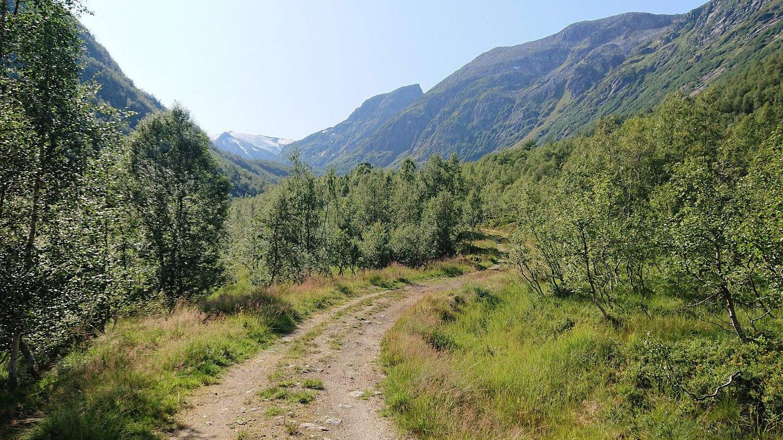
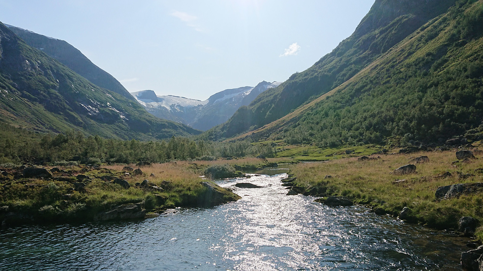
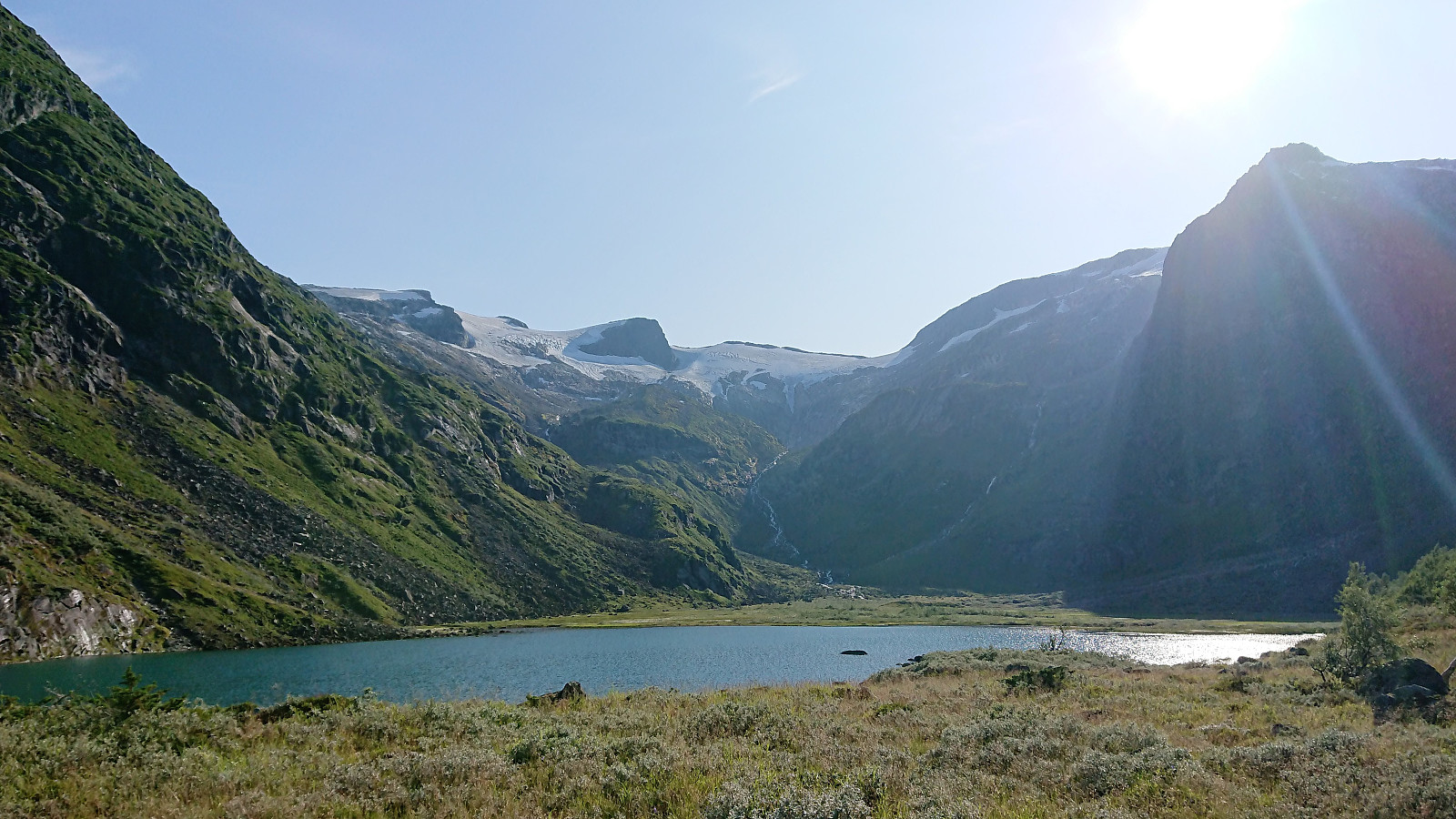
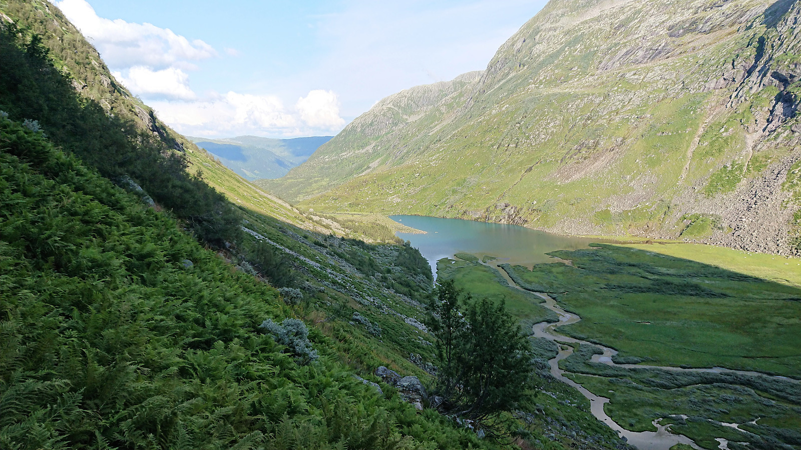
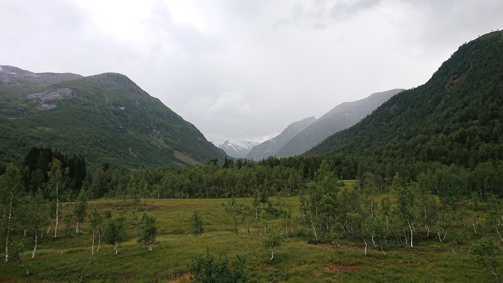
We started out from the parking lot at the bottom of Laugadalen in perfect summer weather and from there followed the forest road, and later marked trail, to Laugavatnet. The trail included several wet areas, but was otherwise easy to follow. Excellent views along the way and also at Laugavatnet itself, where one comes relatively close to Gunvordalsbreen.
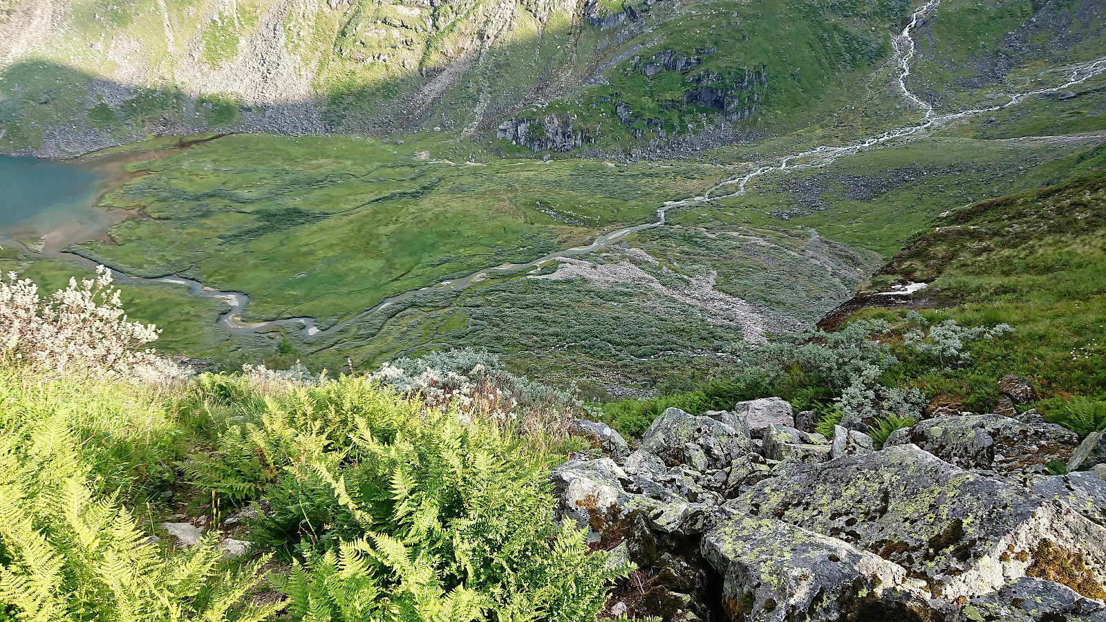
Our plan was now to follow in the footsteps of arntfla (Arnt Flatmo) (see his trip report here) and reach the summit of Skjerdingane Øst. From Laugavatnet we followed a weak trail along the north side of the lake. Clearly not very heavily used, but it could initially be followed without too much difficulty. Within not too long the trail however disappeared completely, and we ended up having to make our own way towards Styggebotngrovi, more or less following along the stream.
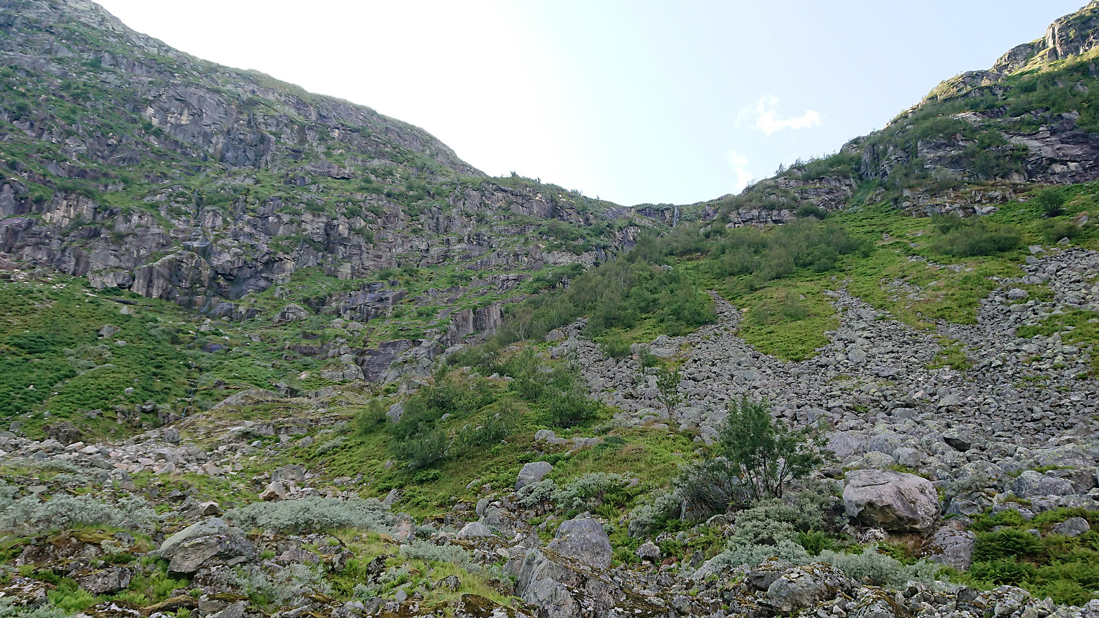
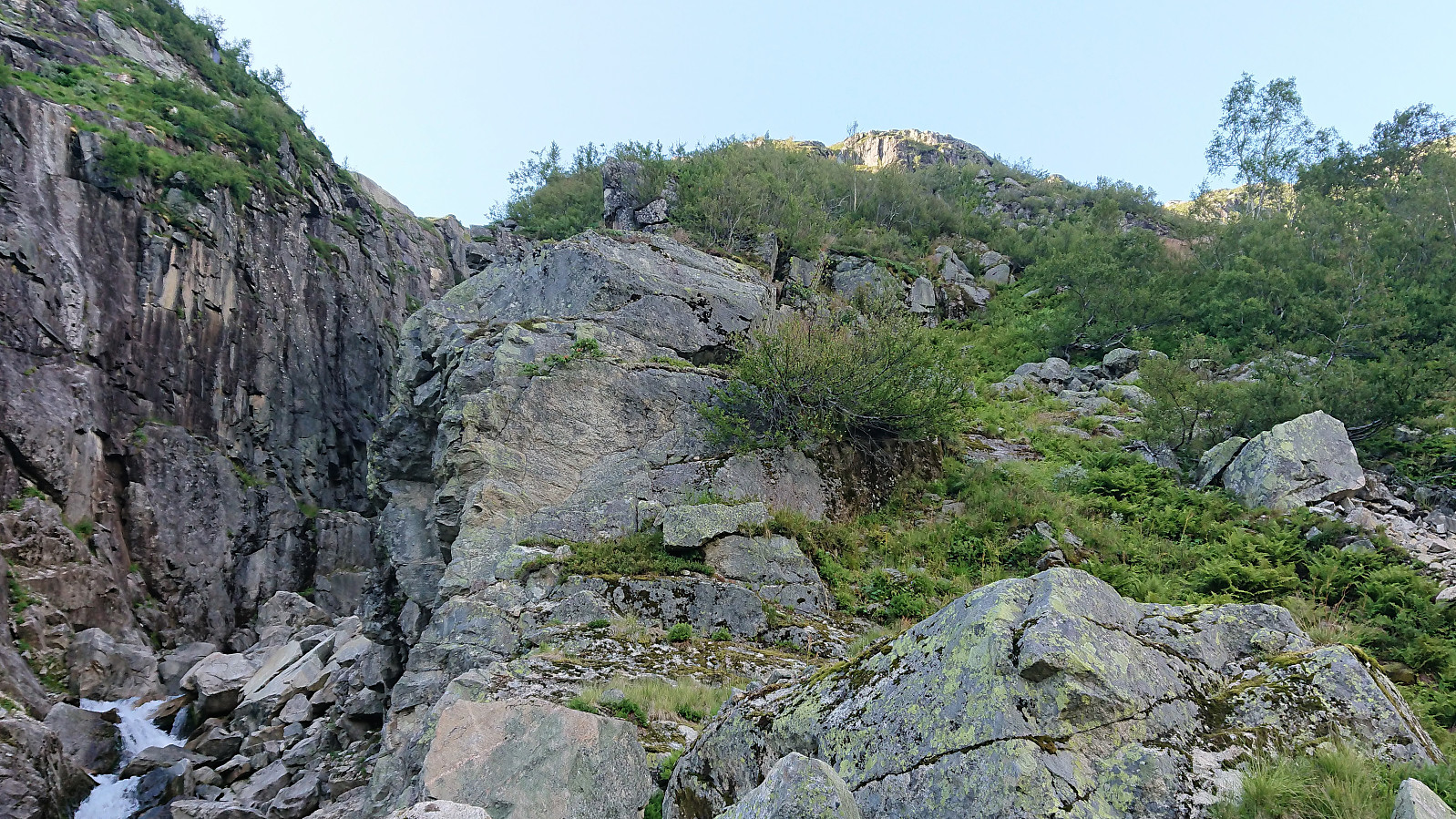
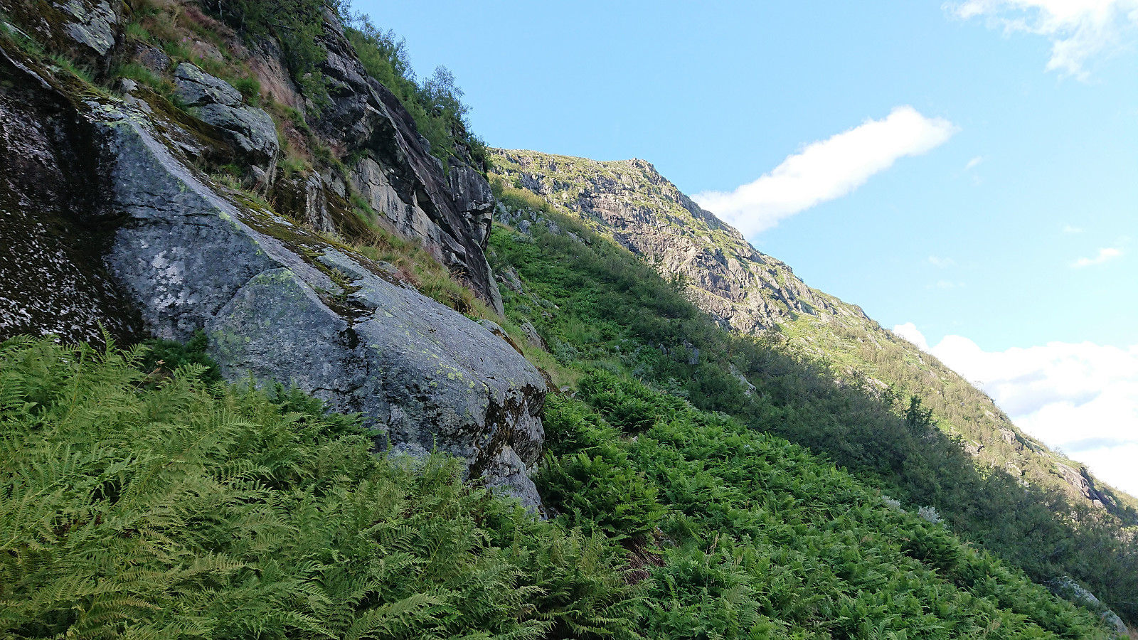
From Arnt's report we knew that the steep trail towards Skjerdingane ought to start somewhere on the eastern side of Styggebotngrovi, but it was still not easy to locate at first. However, a weak but clear trail did appear shortly after starting the ascent. My guess is that this trail is more heavily used by sheep than humans though. At this time of the year it was also partially hidden under the numerous ferns next to the trail, which at times made it difficult to see where the trail continued beyond the next couple of steps.
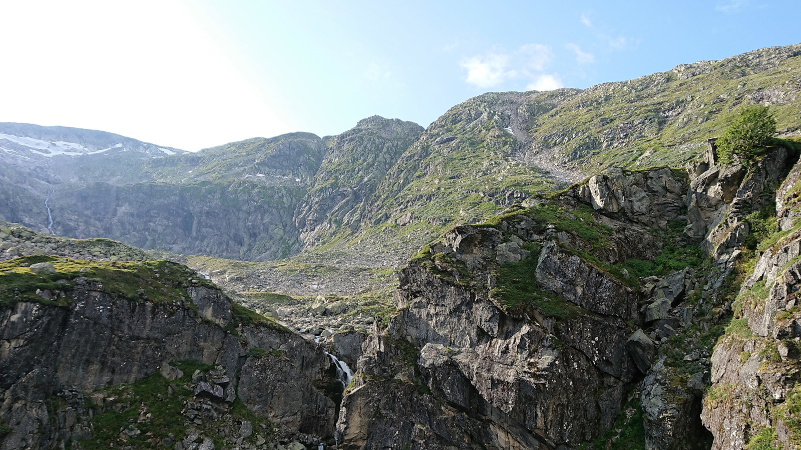
Despite the partially hidden trail we still made good progress upwards when receiving a text message telling us that dark clouds and a potential thunderstorm was heading our way. And while there were no indications of this from our current vantage point, actually there were more or less blue skies in all directions we could see, we decided it was better to be safe than sorry, and abandoned our plan to reach Skjerdingane. We did continue another 100 meters first, just so that we could have a look into Styggebotn and a partial view of the remaining route to the summit.
The dark clouds started appearing just as we were getting back down to Laugavatnet, and minutes later the heavens opened up and heavy rain started pouring down. Next we started hearing the sound of thunder getting ever closer. And while we were very thankfully that we were not at the top of the mountain at this point, being inside the valley was not that much better! Fast walking was therefore replaced by running, in order to reach the parking lot as fast as possible. Luckily, we were heading away from the storm (or it was chasing us, depending on your point of view...) and we thus managed to get to our car without any close encounters with the lightning.
In summary, very much a hike of two halves, of which the second could have been much worse if we had not turned back in time... And while we did not reach Skjerdingane as planned, we did manage to locate the trail for a future attempt in hopefully more favorable weather conditions.
| Startzeitpunkt | 05.08.2019 16:29 (UTC+01:00 SZ) |
| Endzeitpunkt | 05.08.2019 20:17 (UTC+01:00 SZ) |
| Gesamtzeit | 3h 47min |
| Zeit in Bewegung | 3h 40min |
| Pausenzeit | 0h 7min |
| Gesamtschnitt | 3,7km/h |
| Bewegungsschnitt | 3,8km/h |
| Entfernung | 14,1km |
| Höhenmeter | 814m |


Benutzerkommentare