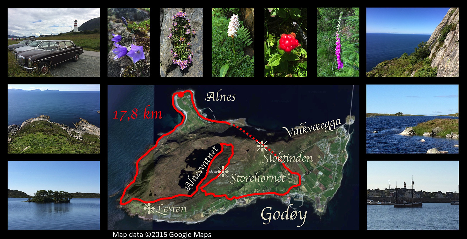
A hike exploring some of the more "inaxessible" parts of Godøy Island. The climb from the westernmost promontory of the Island up to Mount Lesten is rather steep, and the hike along the east coast of Lake Alnesvatnet is rather difficult due to large stones and because there's no real path or track to go on. Left upper image: I parked my car close to the lighthouse on the promontory of Alnes. Upper center images: Some of the flora of the island. Upper right image: Photo giving an idea of how steep the climb from the western aspect of the island up to Mount Lesten actually is. Middle left image: Looking back down the track that I've been climbing. Middle right and lower left images: Lake Alnesvatnet at about 250 m.a.m.s.l., with some of its many tiny islets. Lower right image: The harbor at the promontory of Alnes. Central image: The GPS track of the day's hike.
I went exploring the more inaccessible parts of the island Godøy this day. I've been waiting with this particular trip till I was all on my own, in order not to endanger the lives of my kids or my cousins, or anyone else that would like to join me on hiking. I parked my old car close to Alnes Lighthouse, then walked the shore towards the west-most point of the island. From there I climbed up the mountainside to Lestahalsen or Rantane, and then descended to the lake Alnesvatnet. I next walked (and some places climbed) along the eastern shore of the lake, then, from the north end of the lake started climbing towards the top of Storehornet, the highest peak of the island, with its 495 meters above mean sea level. From Storehornet I descended to Djuv, and from Djuv I finally returned to Alnes (and my car) through the tunnel that runs through the mountain of the island.
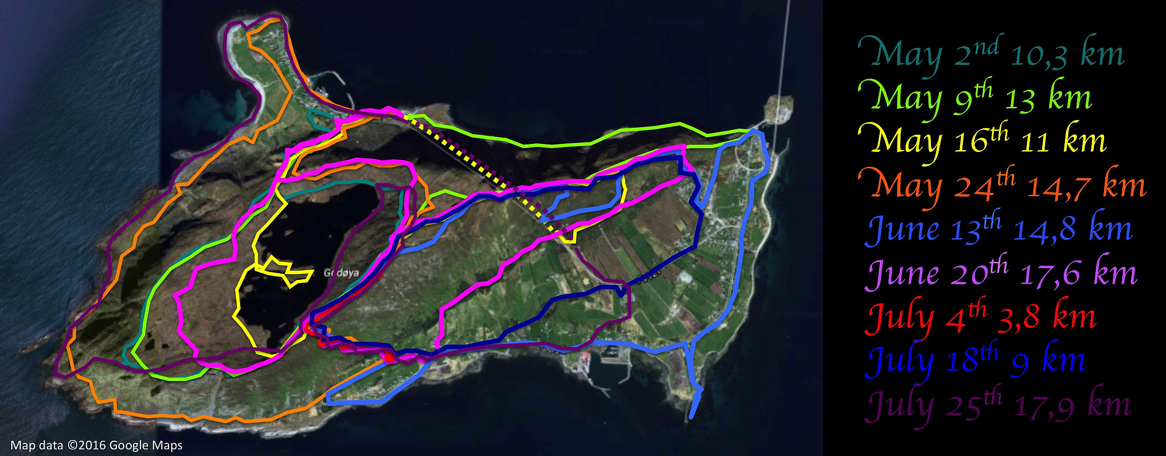
It's a bit cool to lay the GPS-tracks of all my hikes on Godøy Island upon the same satellite image. There doesn't seem to be many places left where I haven't been on this island...
Benutzerkommentare
Kommentartitel:
Zeichen: 1000
Kommentartext:
Du musst angemeldet sein, um Kommentare schreiben zu können.


Benutzerkommentare