
Ørnafjellet and Lyderhorn (25.12.2018)

Written by HHauser (Helwig Hauser)

| Start point | Gravdal (20m) |
|---|---|
| Endpoint | Gravdal (20m) |
| Characteristic | Hillwalk |
| Duration | 2h 00min |
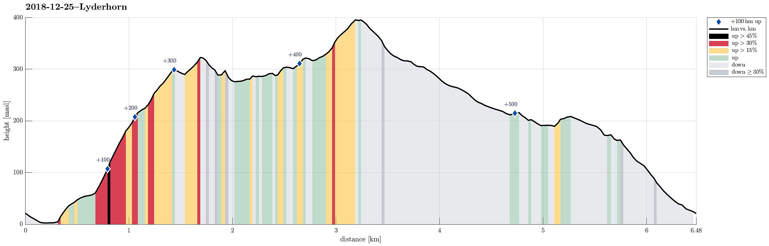
| Distance | 6.5km |
| Vertical meters | 530m |
| GPS |
|
| Ascents | Lyderhorn (396m) | 25.12.2018 |
|---|---|---|
| Ørnafjellet (329m) | 25.12.2018 | |
| Ørnafjellet Nord (304m) | 25.12.2018 |
Trip Summary
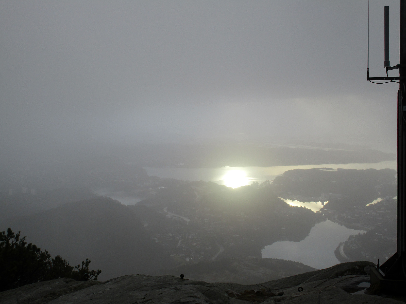
We took the car to Gravdal in order to go up to Ørnafjellet first. Instead of going up via Kvarven and the paved road there, we decided to use a minor path that leads up relatively directly from the east (half way up, one can appreciate a sign calling this ascent "Mördarbacken"). In order to get there, we used the wooden stairs behind the industrial buildings around Nutec in Gravdalsbukten. Once up the stairs, we continued through a little valley in southern direction until we came up to a place with a small soccer field. From there, the actual ascent to Ørnafjellet starts (in western direction and mostly straight upwards). Before actually getting to the top of Ørnafjellet, one reaches a small saddle near to Skåleviksvatnet. From there, it's mostly in southern direction and over a little height before the final ascent to Ørnafjellet. Since Ørnafjellet is substantially steep on its western and southern side, also this time, we first descended along the same path we took up, before then rounding the top of Ørnafjellet on its western side a bit further down. On our way to Lyderhorn, we this time did not go up to Skjenafjellet, but instead followed the path this is a bit more direct towards Lyderhorn (in the southeast of Skjenafjellet). Soon after, we connected to the main path to Lyderhorn. Within short, we found ourselves on the top of Lyderhorn, enjoying a short view towards the sunlit south from there, before then rather quickly turning back. We followed basically one of the main paths (in northern direction and in the west of Skåleviksvatnet) until we connected to the paved road that leads up Kvarven. After walking down this road for a bit, we decided to leave it in favor of a nice hiking path that is cutting short the northern tip of Kvarven, leading (more of less) directly down to the upper parking spot. From there, it was then only a few steps back to our car.
Useful Resources
See also the related FB-page Hiking around Bergen, Norway.
Petter Bjørstad has a useful page about Lyderhorn and also web page WestCoastPeaks.com provides useful information about Lyderhorn and Ørnafjellet.
Web page SpillBy.com describes Ørnafjellet and
web page FotTurer.com describes a tour up Ørnafjellet.


User comments