
Døsjeskiftet to Liaskjeret (08.07.2017)

Written by hbar (Harald Barsnes)

| Start point | Døsjeskiftet (39m) |
|---|---|
| Endpoint | Molltveit (53m) |
| Characteristic | Hillwalk |
| Duration | 4h 46min |
| Distance | 15.2km |
| Vertical meters | 817m |
| GPS |
|
| Ascents | Haganesfjellet (232m) | 08.07.2017 |
|---|---|---|
| Høgafjellet Nord (299m) | 08.07.2017 | |
| Liatårnet (341m) | 08.07.2017 | |
| Pyttane søndre (330m) | 08.07.2017 | |
| Skinntikavarden (238m) | 08.07.2017 | |
| Skitnafenet (239m) | 08.07.2017 | |
| Visits of other PBEs | Høgafjellet Sør (300m) | 08.07.2017 |
Døsjeskiftet to Liaskjeret
Døsjeskiftet to Liatårnet
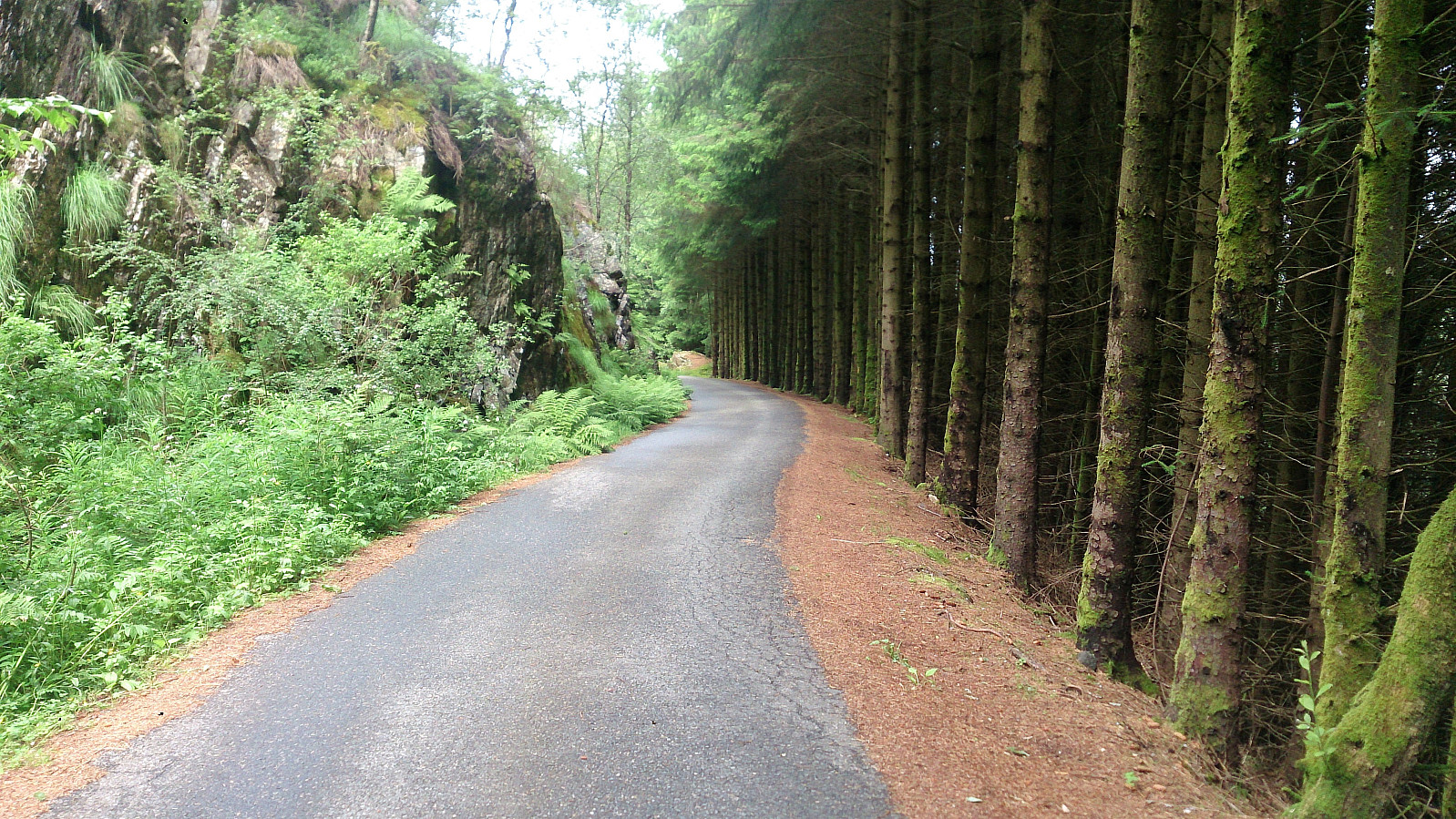
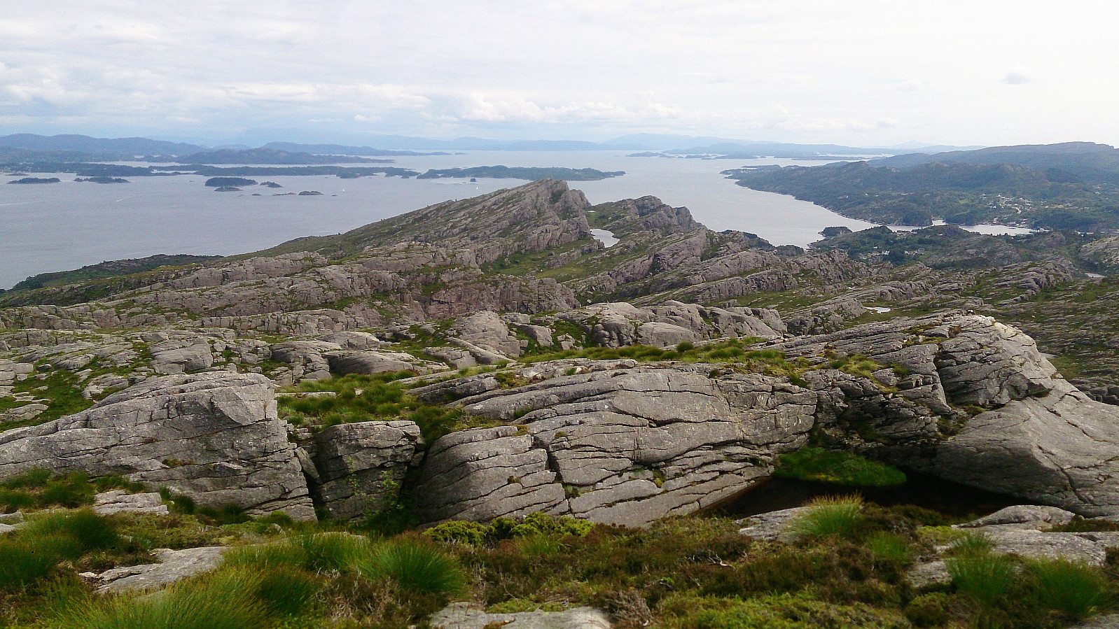
Started by taking the bus to Døsjeskiftet and following the paved road up towards Bildøyvatnet. From there I followed the standard trail south until reaching the road that goes up to Pyttane (with minor detours for quick visits to Skinntikavarden and Skitnafenet), which I then followed to the top of Pyttane before continuing along the trail to Liatårnet. This is where the real hike started, as I was now finally heading into, for me, new territory.
Høgafjellet..?
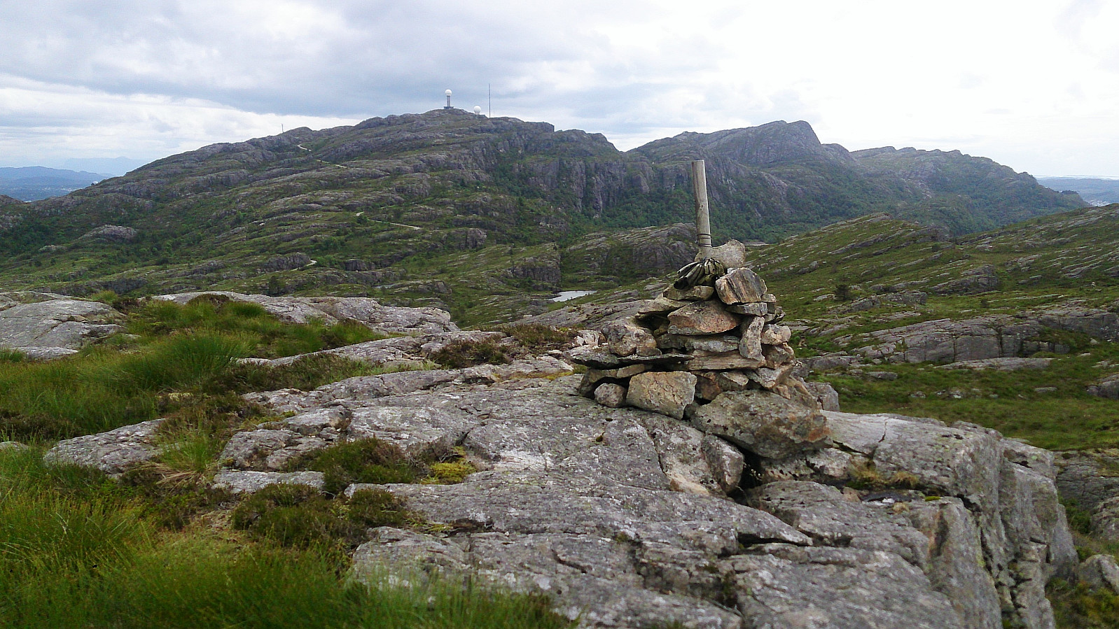
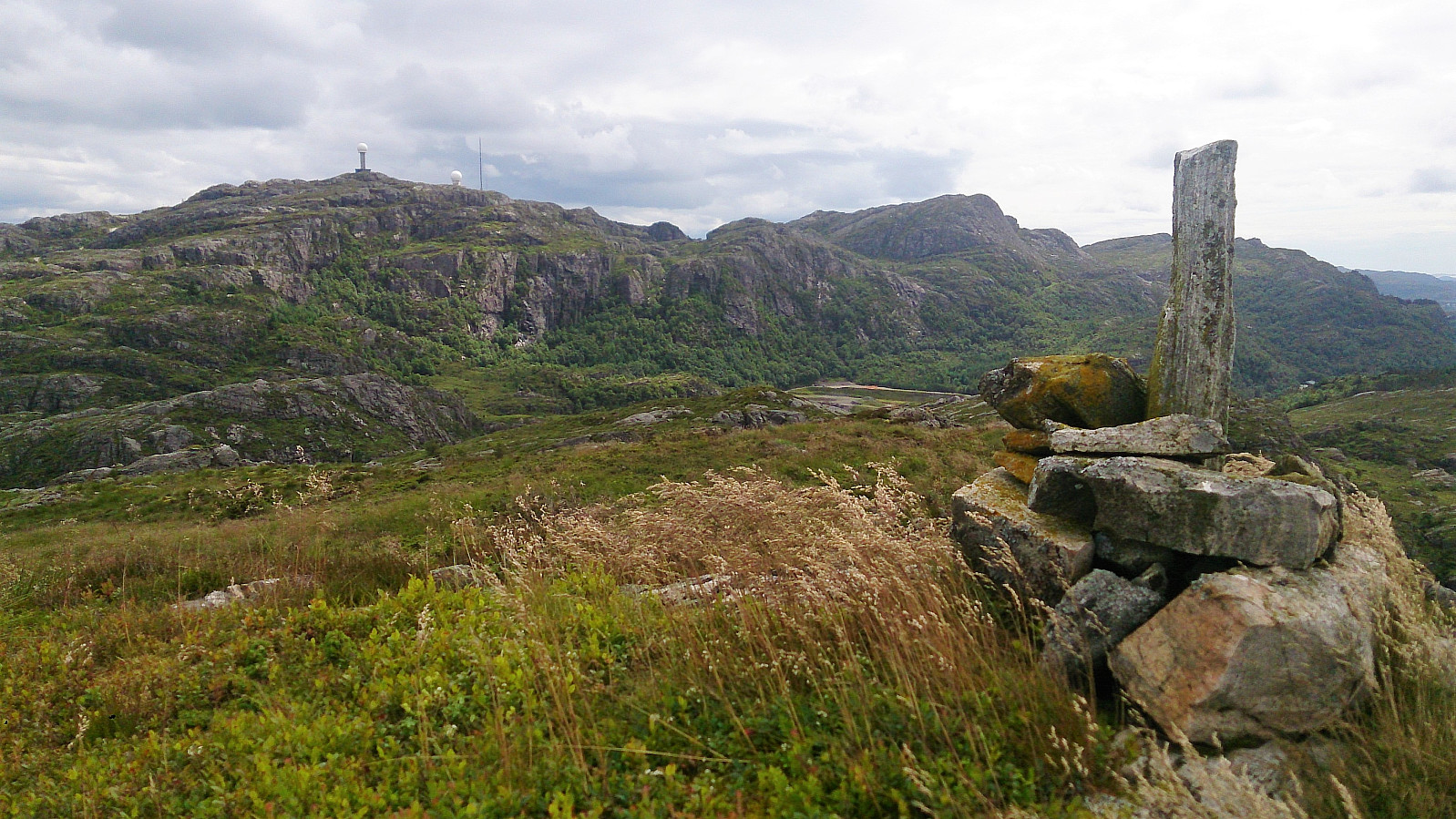
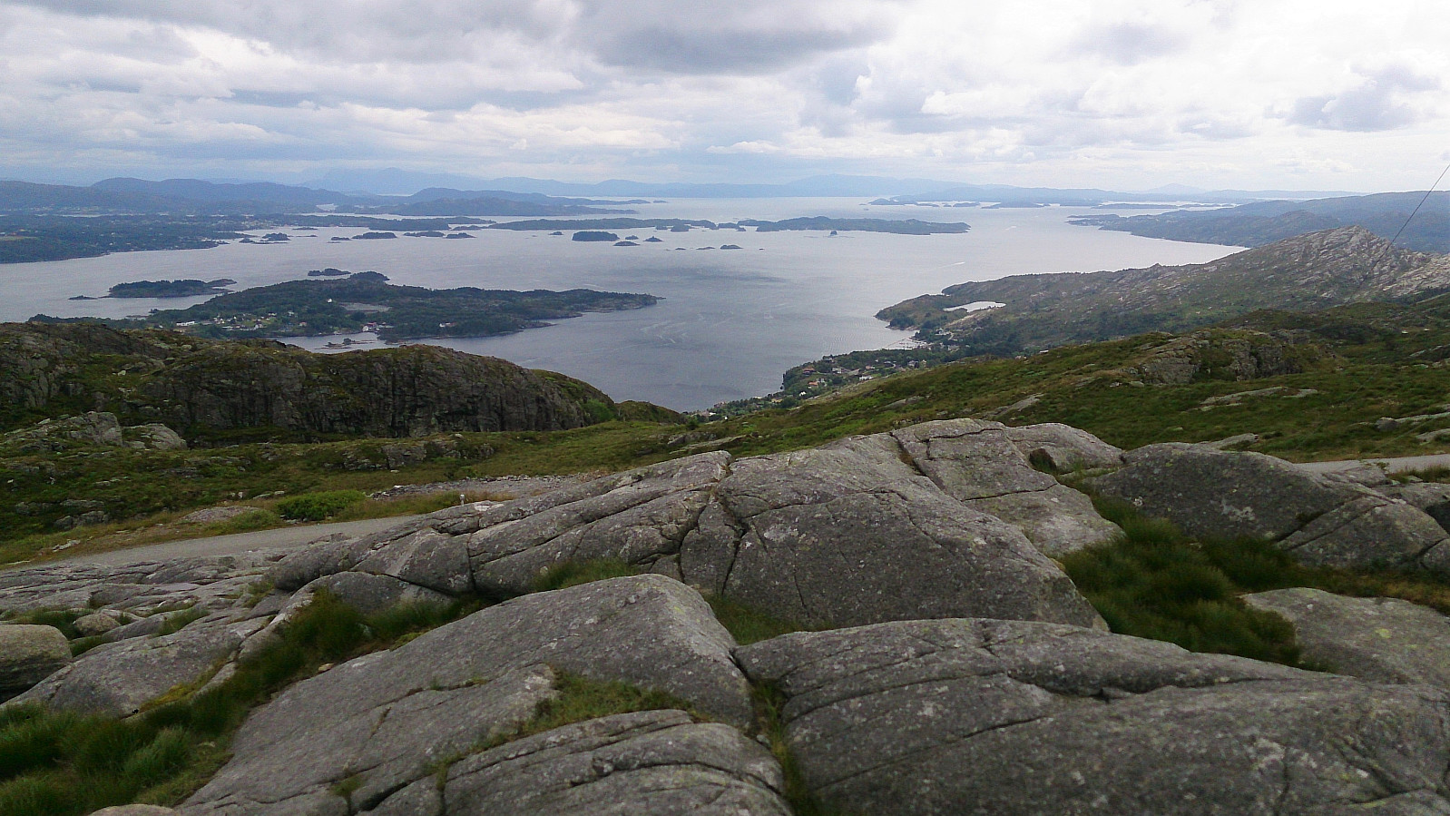
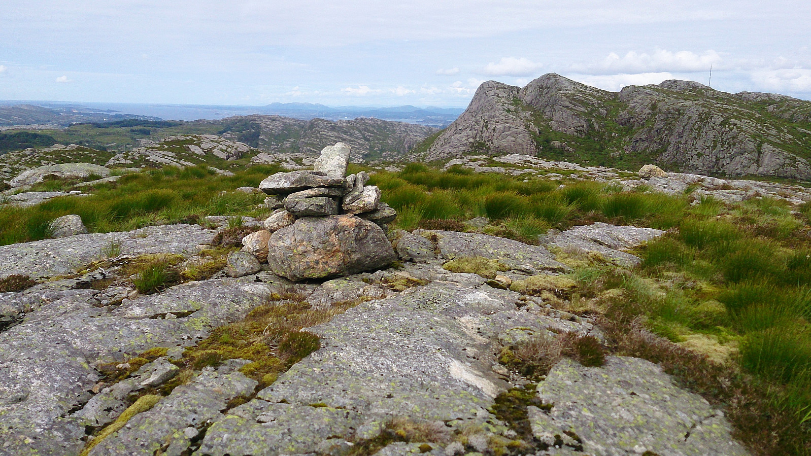
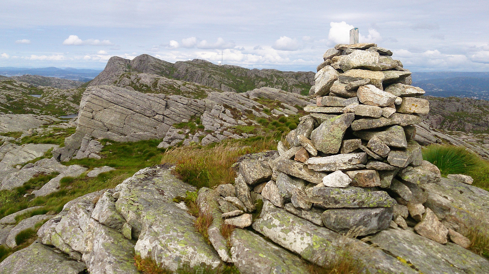
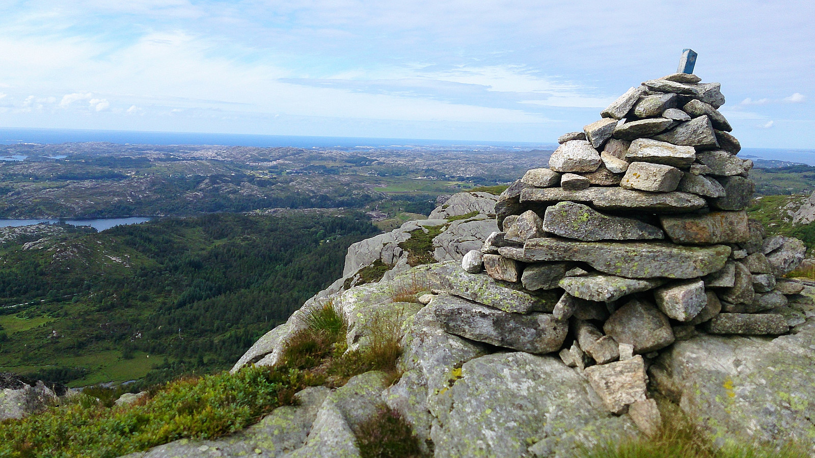
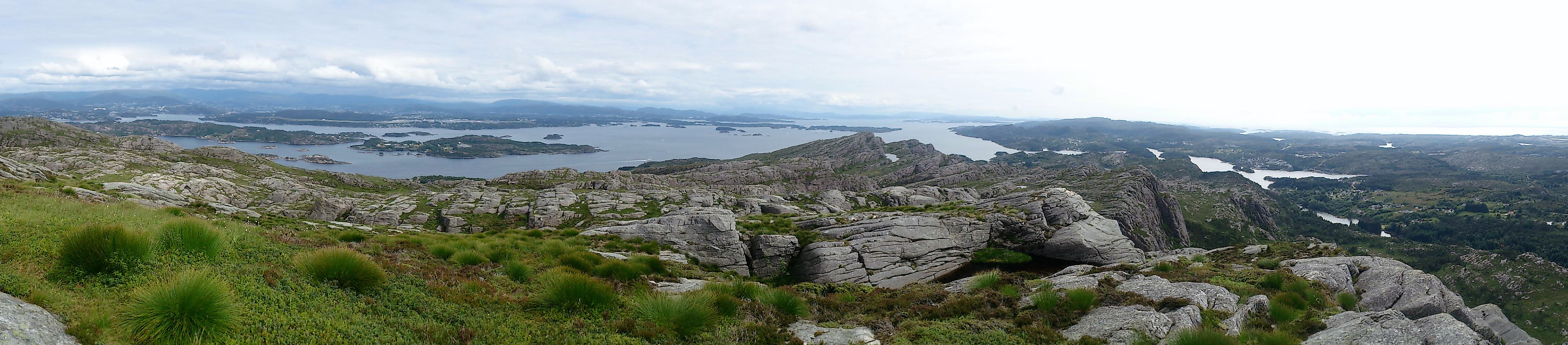
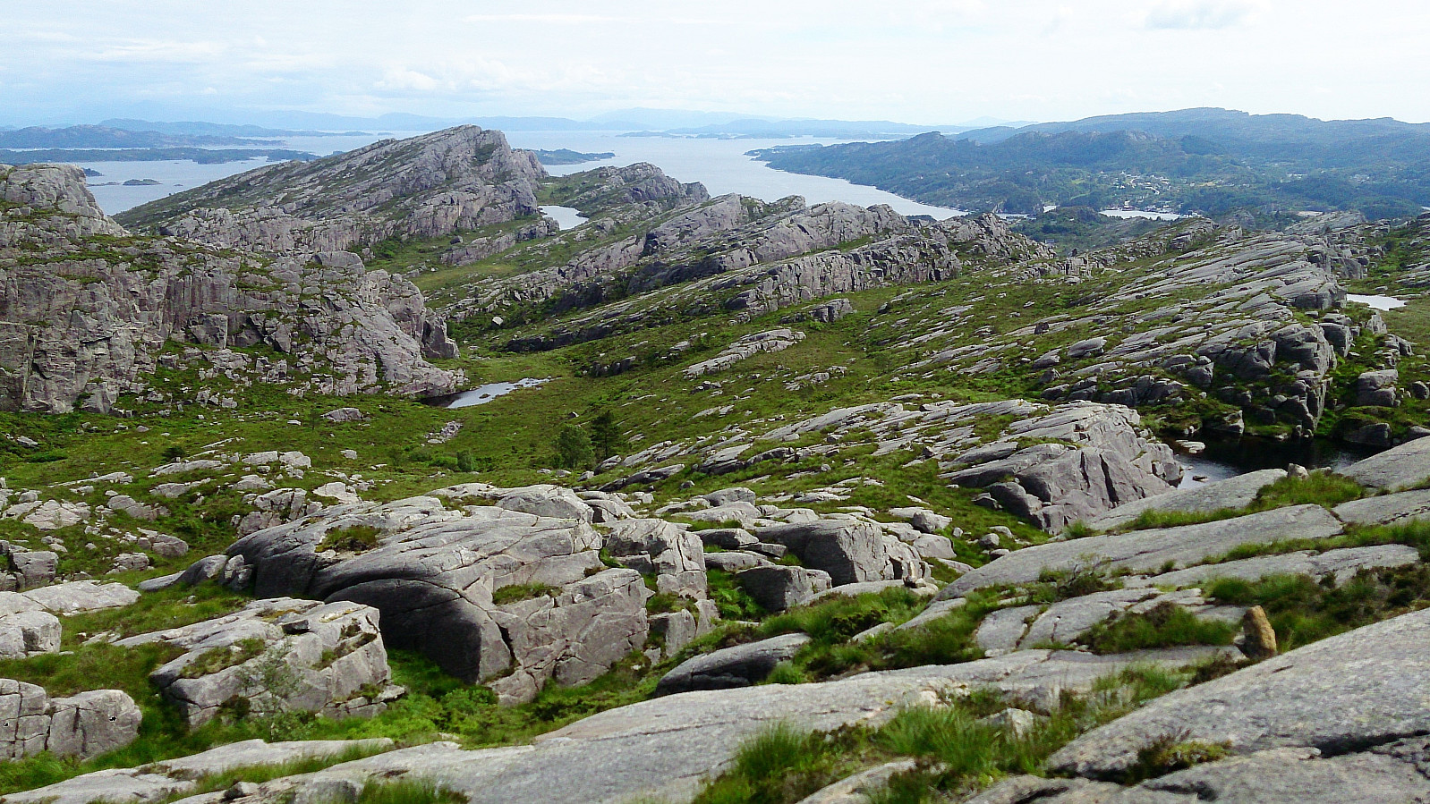
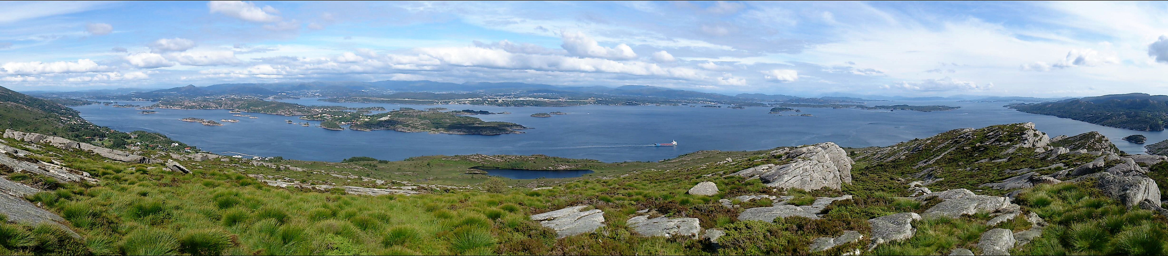
From the top of Liatårnet I followed the trail south, but where the trail started to turn west I instead continued south towards Høgafjellet. To my surprise, I found a trail in this direction as well, which I decided to follow. However, the trail was passing west of Høgafjellet, i.e. not across the summit, but it was straightforward to ascend from the south.
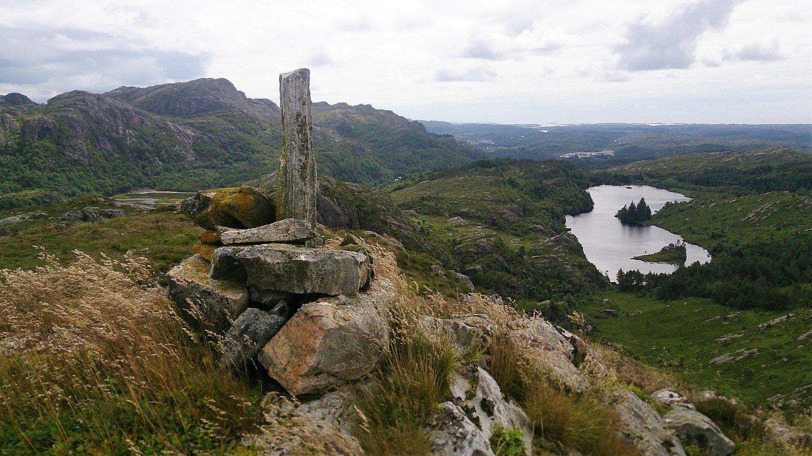
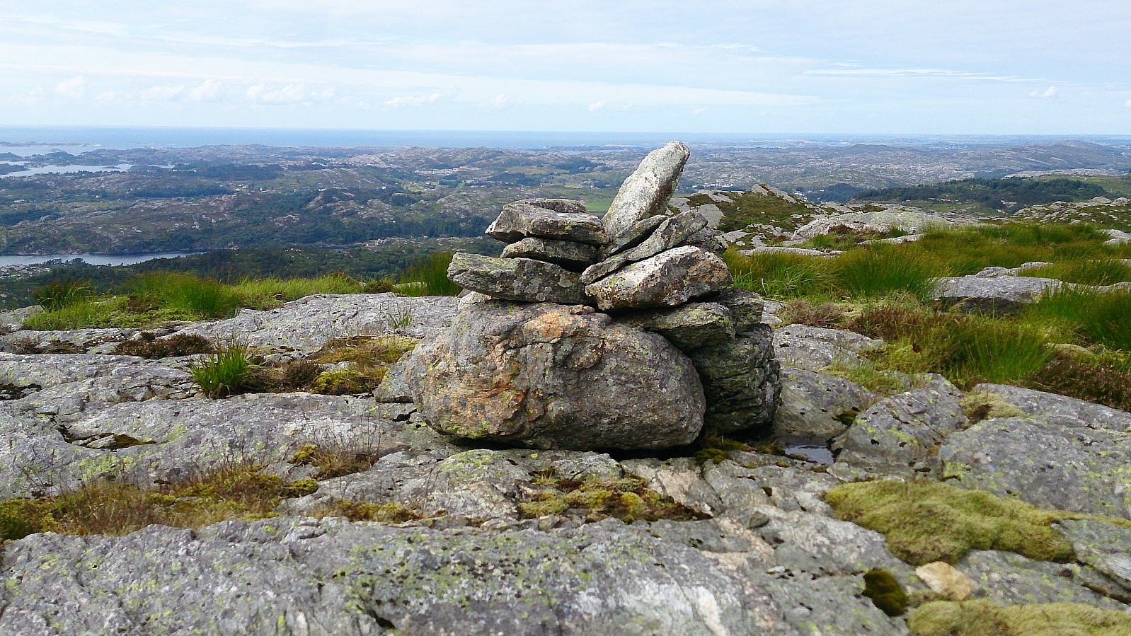
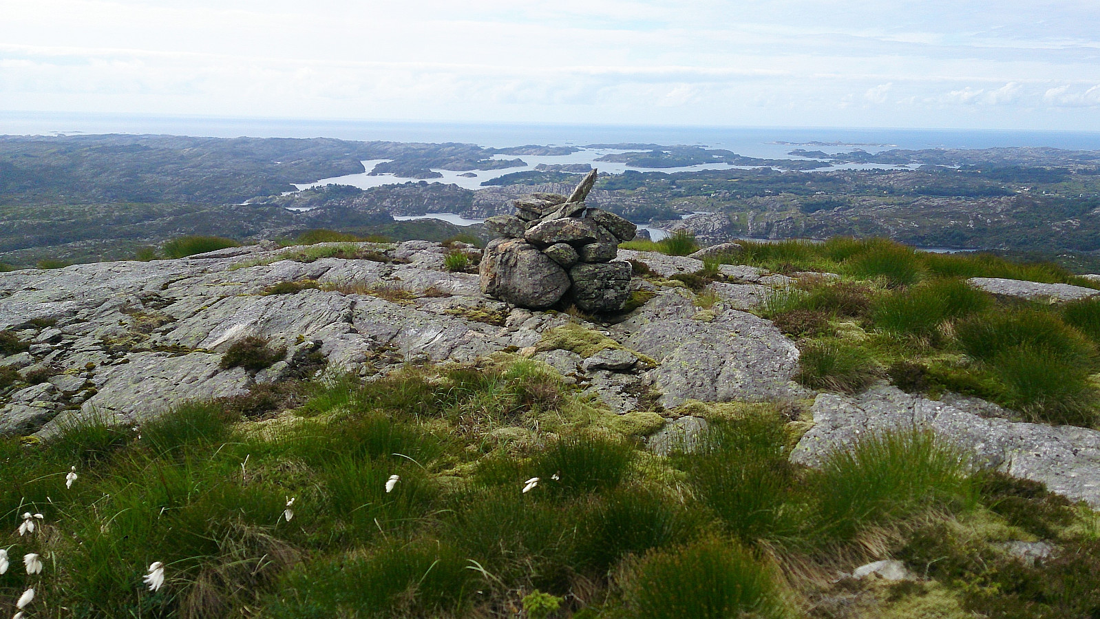
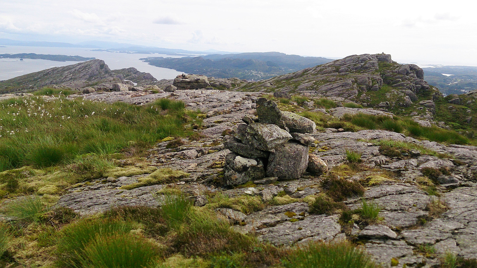
Nice views from the summit, but my interest was drawn to a cairn spotted to the south, which to me seemed to be higher than my current location. I therefore returned to the trail and continued south to inspect the cairn up close. The trail did not pass by the cairn itself, but getting to the cairn only required a short detour. Spectacular views in all directions, better than at the previous peak.
A closer look at the map also indicated that perhaps this location should be used as the true summit of Høgafjellet. I considered moving the location on PB, but instead decided to add the cairn as a panoramic viewpoint, with the hope that people visiting Høgafjellet will then also visit the cairn.
Haganesfjellet
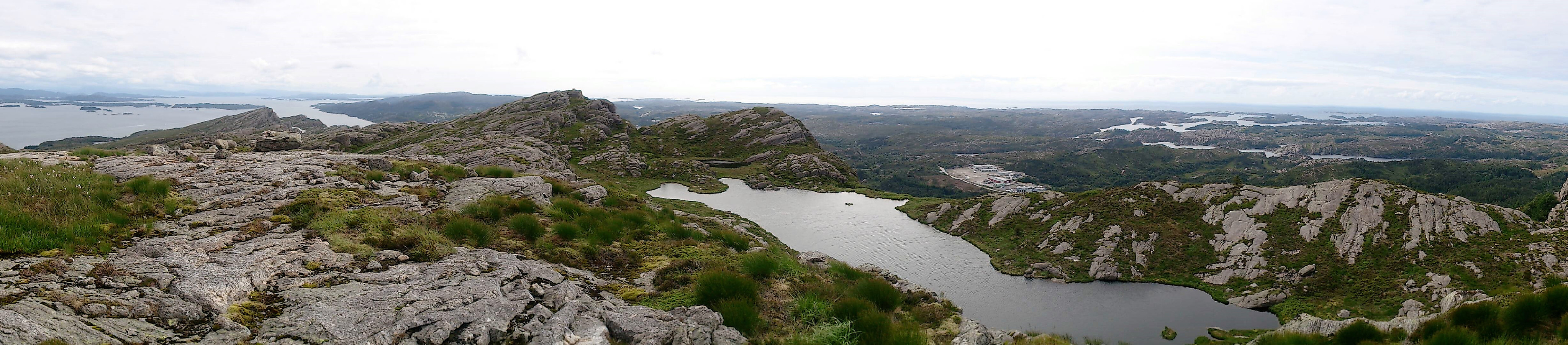
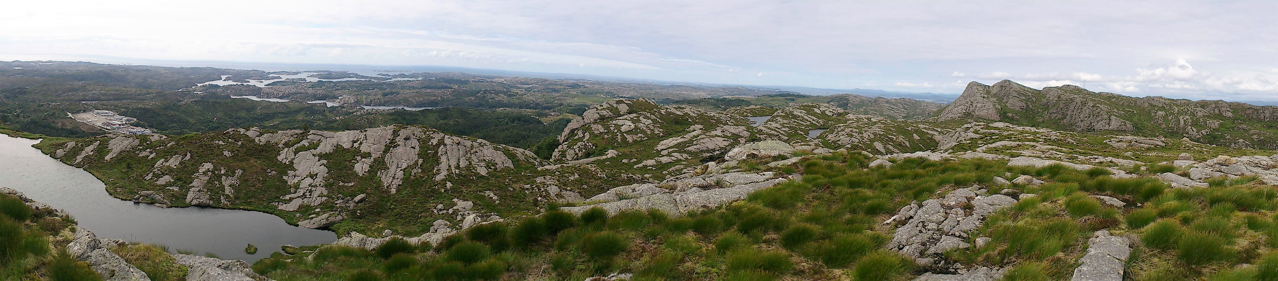
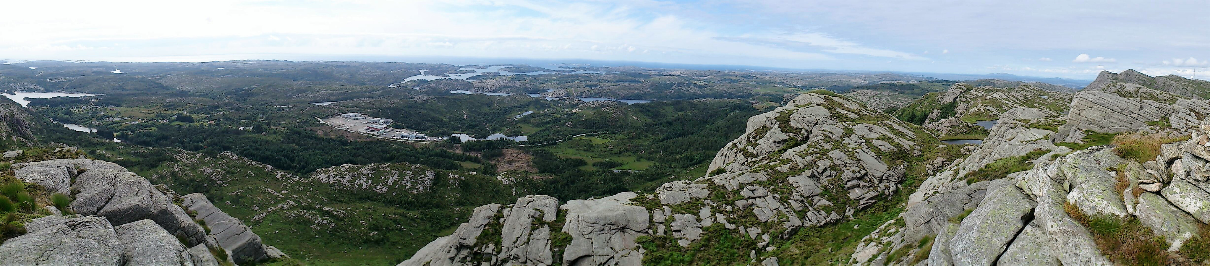
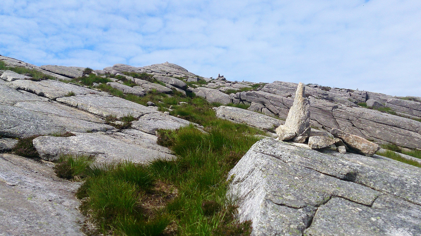
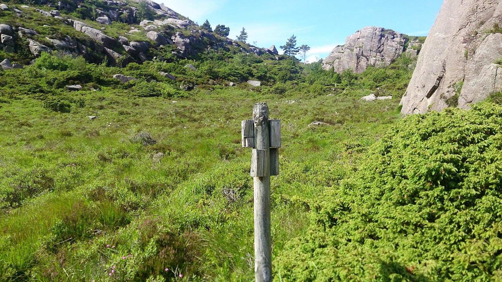
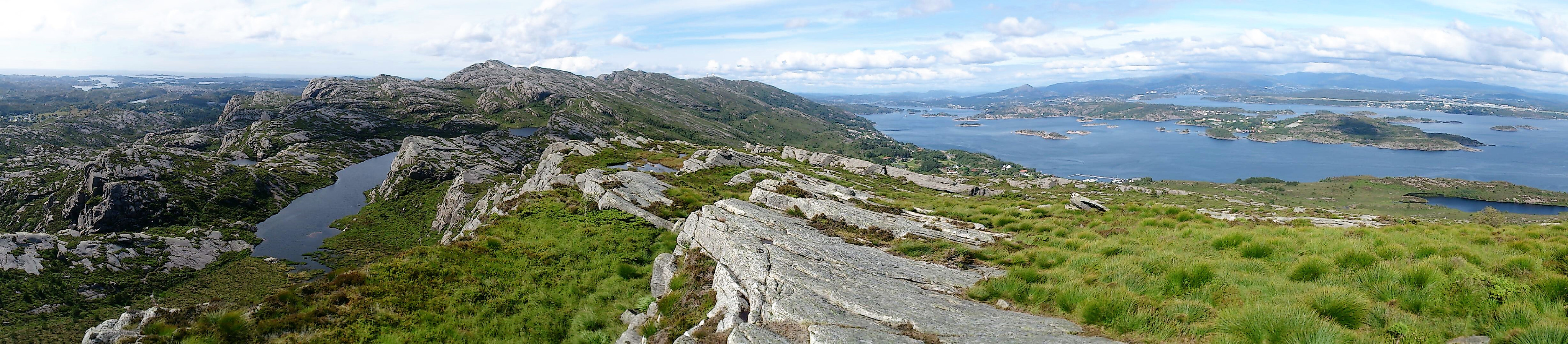
My final goal of the day was Haganesfjellet. I therefore continued south along the trail, hoping that it would lead in the wanted direction. The trail was weak at times, but numerous small cairns showed the way. For example, this was my only indication of where I was supposed to turned east, as here the trail had disappeared. As the trail again turned south, taking me along the west side of Kattatjørna, the trail got weaker, and I was suddenly unsure whether I was following a trail or an animal track.
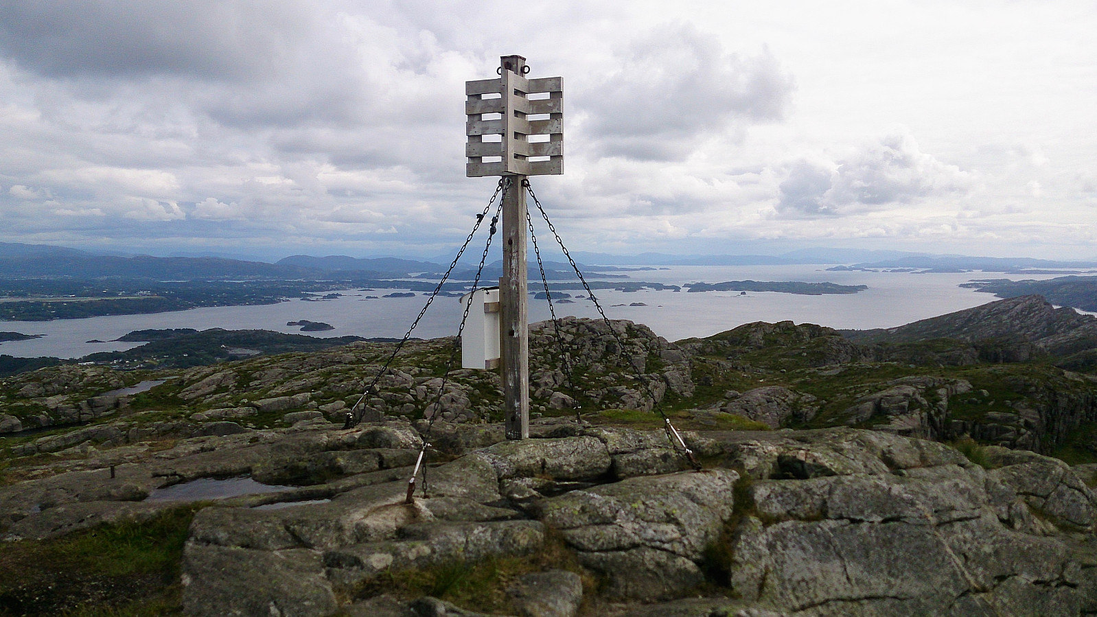
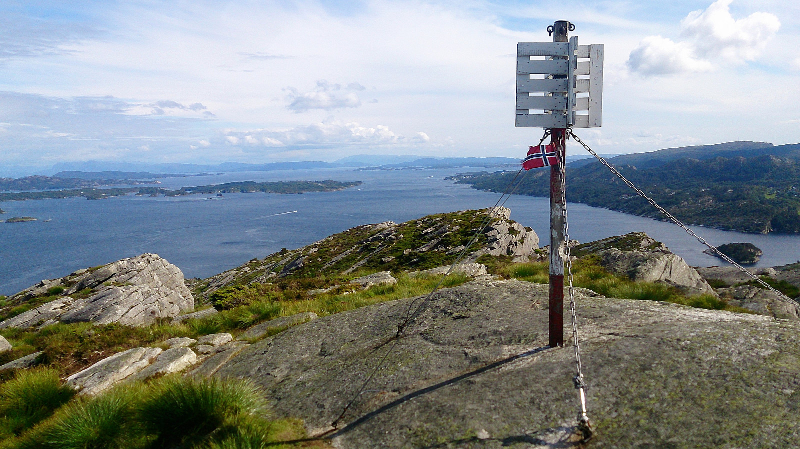
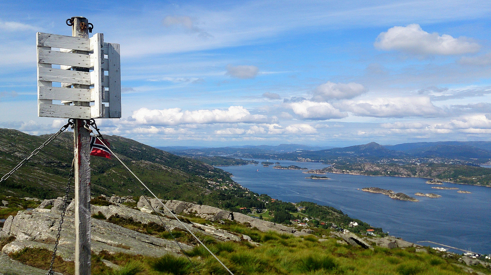
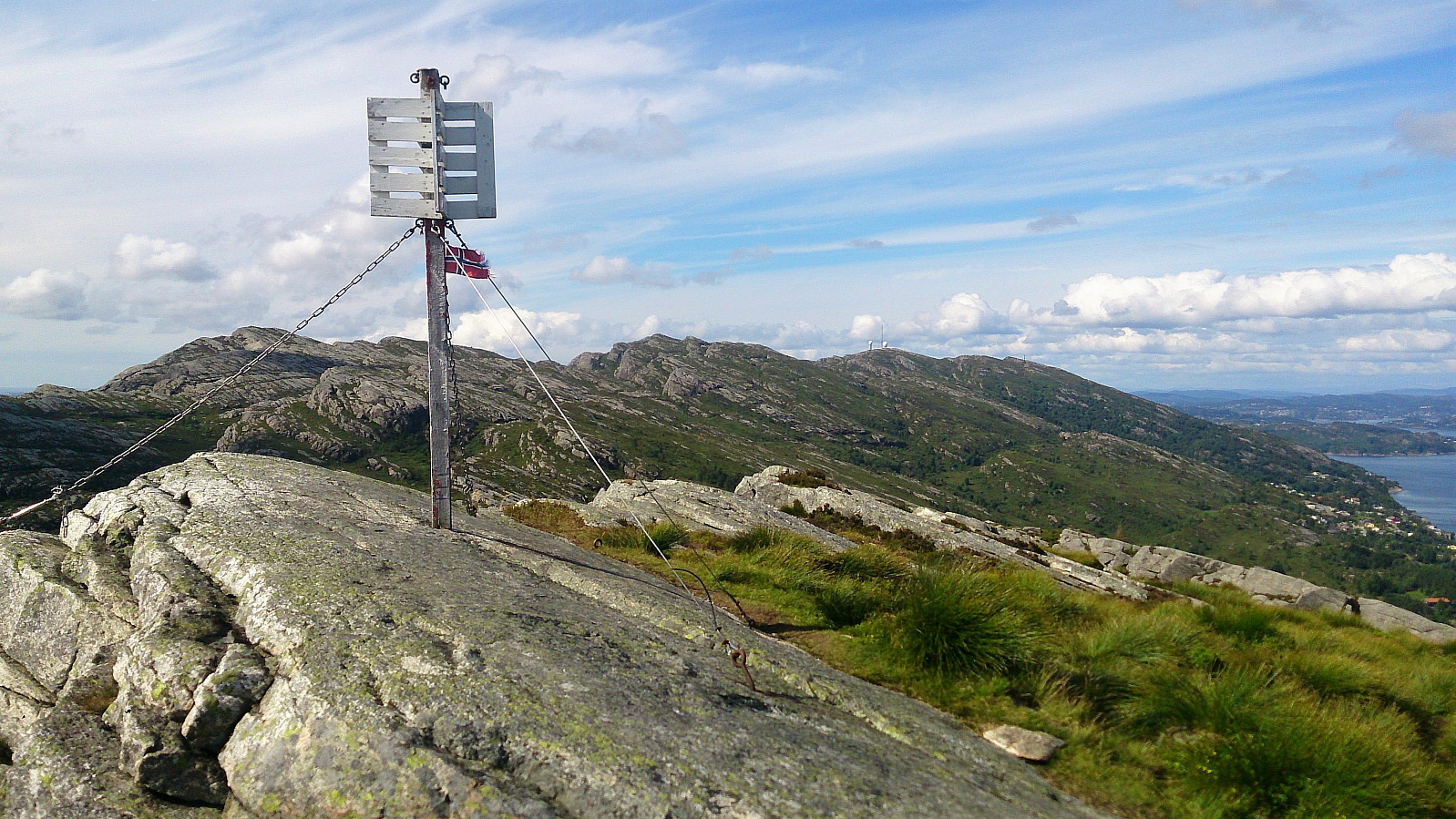
However, as soon as I arrived at the small stream coming down from Kattatjørna, and turning shortly eastward, the trail improved significantly. From here on the trail was overall easy to follow, taking me around Brattstigvatnet, before starting the ascent towards Haganesfjellet (also referred to as Indrafjellet). Ascending Haganesfjellet from the south was straightforward, and the summit provided excellent views in all directions. (Note that the visitor register is located to the south of the summit next to a small bench and not at the summit itself.)
Down to Liaskjeret
The hike was concluded by following the trail north down to Liaskjeret, from where the plan was to take the bus back to Bergen. But I had plenty of time to spare, and therefore ended up walking north along the main road to Molltveit before getting on the bus.
Conclusion
In summary, a very nice hike that can definitely be recommended to those wanting an alternative to the default hikes to Liatårnet. Excellent views all around, and, surprisingly, also decent trails that were, generally, easy to follow.
| Start date | 08.07.2017 13:13 (UTC+01:00 DST) |
| End date | 08.07.2017 18:00 (UTC+01:00 DST) |
| Total Time | 4h 46min |
| Moving Time | 4h 22min |
| Stopped Time | 0h 24min |
| Overall Average | 3.2km/h |
| Moving Average | 3.5km/h |
| Distance | 15.2km |
| Vertical meters | 817m |


User comments