
Bjørnaåsen (04.12.2016)

Written by HHauser (Helwig Hauser)

| Start point | Haljemsmarka (65m) |
|---|---|
| Endpoint | Haljemsmarka (65m) |
| Characteristic | Hillwalk |
| Duration | 0h 30min |
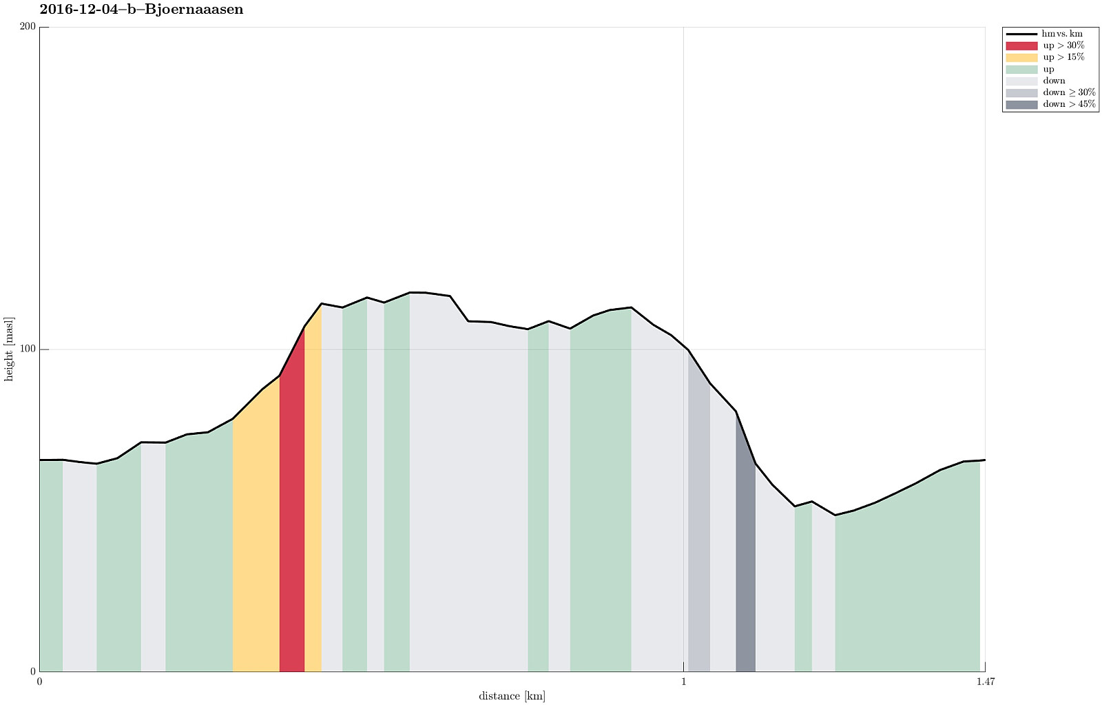
| Distance | 1.5km |
| Vertical meters | 91m |
| GPS |
|
| Ascents | Bjørnaåsen (119m) | 04.12.2016 16:00 |
|---|
Trip Summary
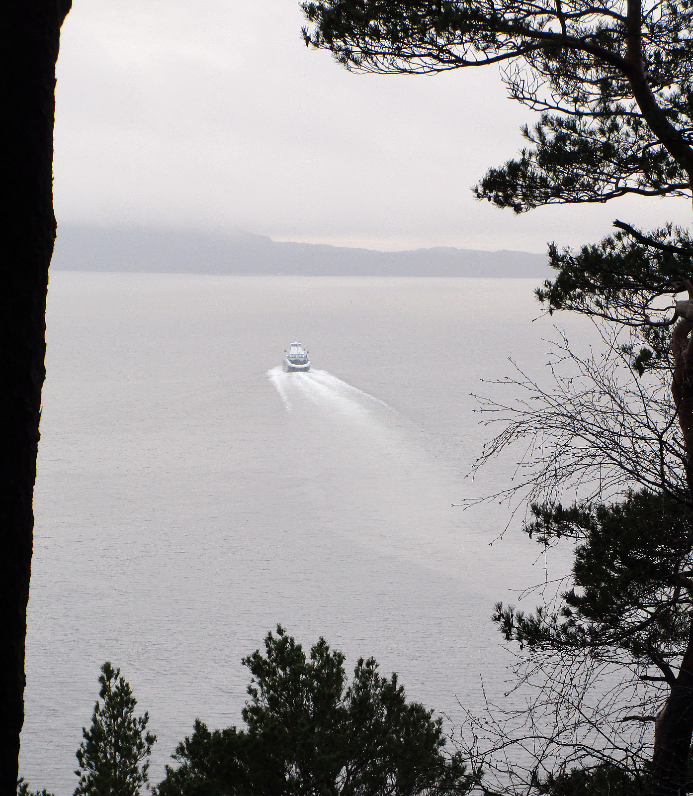
I followed E39 southwards, passing by Os, and heading into the direction of Halhjem, where the ferry leaves towards Vågen on Stord. Right before the ferry port, I turned left (in eastern direction), following Bjørnavegen. I then turned right (in southern direction), continuing on Halhjemsmarka, passing by a little soccer field near Halhjem school. I followed the road until point N60.1402, E5.4393, where I parked. I went a few meters in eastern direction to step out of the houses and into the forrest, which covers all of Sørneset. There, it was basically just following a gradient-search path towards the (small) top of Bjørnaåsen. I crossed over the top until I got at least a limited view towards the south and out onto the sea (through the trees, though), before I returned. I stepped out of the forrest a little further south of where I had entered, returning to my car on the street. All in all, this top could offer some nice views (if it wasn't for all the trees on it). It almost for sure, I'd say as of now, that I will not return to this hill any time soon. :-)
Useful Resources
See also the related FB-page Hiking around Bergen, Norway.
Petter Bjørstad has a useful page about Bjørnaåsen.


User comments