
Erstadfjellet and Stemmeseggi (13.11.2016)

Escrito por HHauser (Helwig Hauser)

| punto de partida | Askeland (210msnm) |
|---|---|
| Punto final | Askeland (210msnm) |
| Tipo de excursión | Senderismo de montaña |
| Duración | 2h 30min |
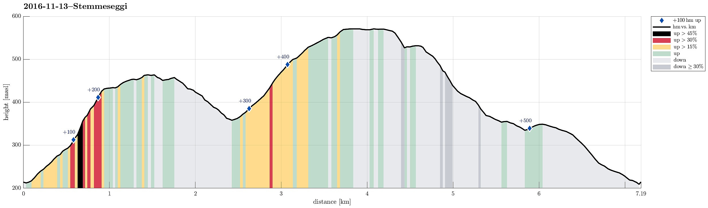
| Distancia | 7.2km |
| Metros verticales | 518m |
| GPS |
|
| Ascensos | Erstadfjellet (465msnm) | 13.11.2016 |
|---|---|---|
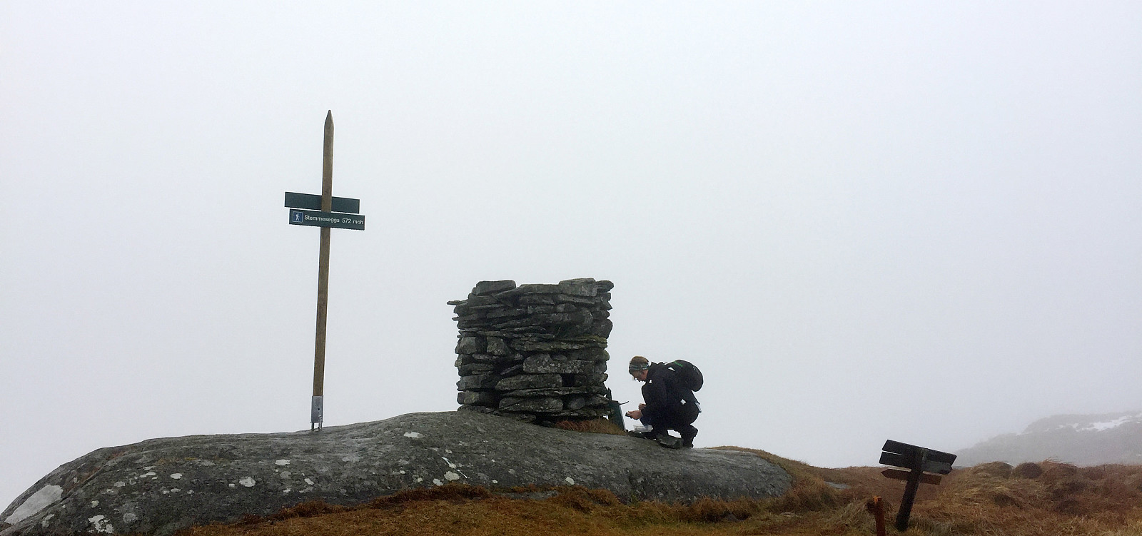
| Stemmesegga (573msnm) | 13.11.2016 | |
| Otros PBEs visitados | Vest for Erstadfjellet (440msnm) | 13.11.2016 |
Trip Summary
We drove from Bergen towards the East and left the E16 to cross Sørfjorden towards Osterøy on the large bridge. We drove then to Haus and further to Votlo, where we continued a few turns upwards (towards Askeland). We parked near the spot, where the street (towards Askeland) crosses the little stream, which comes down Askelandsdalen. From there, we started hiking; first into northwestern direction (further towards Askeland, somehow upwards, also). Only a few steps up this road, we found the path, which departed to the right, now in eastern direction (leading further upwards). This path clearly was a well-made path before, probably serving a little hut not far up the mountain-side. When we reached this hut (more the ruins of it), we turned left and ascended (now more steeply) over some half-open terrain. What first looked a bit like a path, turned out to be more like an animal-path, so we abandoned to look for the path and, instead, ascended more or less straight up the mountain-side. Even though steep, there, this ascent was entertaining and also a bit of an exercise (a bit). A few minutes later, we reached a minor top (with a nice Varde, however), at the western end of Erstadfjellet. From there, we walked over to the actual top of Erstadfjellet---this part was very wet and muddy. From Erstadfjellet, we continued via Merkjedalsstølen to the ridge, which would lead us a little bit down (in southeastern direction), almost to the level of Askelandsvatnet in the east. At Setleitet, we then crossed over to the ridge that would bring us up to Stemmeseggi. In southern direction, we hiked up this ridge, which remains slightly under the main ridge of Stemmeseggi (in the west of the path, which we took). In nicer weather, one can certainly enjoy some nice views over Osterøy from this ridge! Eventually, the path leads over to the main ridge and to the top of Stemmeseggi, which lies a bit further in the south, then. We only made a very short stop a the top (it wasn't exactly warm or inviting) and continued to find the path down into the direction of Haus. In order to get there, one needs to walk back, a little bit, in northwestern direction, before taking a turn to the left and down. Once down on the next ridge (next to the west), one turns back to a southern course (over this ridge), before then taking a turn to the right and down, again. The path there is easy to find. A little further down, after having stepped in western direction for a while, one comes the remains of another little building (right above Årsmyra). Only shortly after, we departed from the main path, taking another, minor path (now in northern direction) that would bring us to the other, northern side of Årsmyra, crossing a small stream, also. On the other side, one finds a nice path which leads over the ridge and to Årsegga, which is nice and easy to walk down (in northern direction). Eventually, one gets back on a simple gravel road, which connects back to the place, where we had parked. All in all, this round was a very nice and relaxing hike---the weather was promised to be better than what it was---still it was good to be out on this hike and get some fresh air! :-)
Photos
Selected photos are available as Google photo album.
Useful Resources
See also the related FB-page Hiking around Bergen, Norway.
Web page WestCoastPeaks.com provides useful information about Stemmeseggi, Erstadfjellet, and Hånipa and also Petter Bjørstad has a useful page about Stemmeseggi and another one about Erstadfjellet.


Comentarios