
Kyajo Ri part 1 - acclimatisation (17.10.2016)

Written by hmsv1 (Hannah Vickers)
| Start point | Lukla |
|---|---|
| Endpoint | Mende |
| Characteristic | Hillwalk |
| Duration | 264h 00min |
| Map |
|
| Ascents | Gokyo Ri (5,357m) | 24.10.2016 07:45 |
|---|
So it had been 5 whole years since my last episode of Himalayan suffering, long enough at least that I had forgotten how incredibly tiresome it is to ascend mountains over 6000m. Thin air was beckoning again :) In the start of 2016 I therefore decided that it was time to go back. Kyajo Ri is a mountain in the Solu Khumbu region of Nepal and one I have wanted to climb since 2012 (not long after I came back from a trip to Mera Peak and Baruntse) when it was first introduced as a commercial trip by the UK-based company Jagged Globe. I was attracted by the fact that it isn’t especially high, one of the less-visited ‘trekking peaks’ and is aesthetically pleasing. Doing a google search revealed masses of pictures of the mountain from various angles – it’s a pointy peak wherever you view it from.
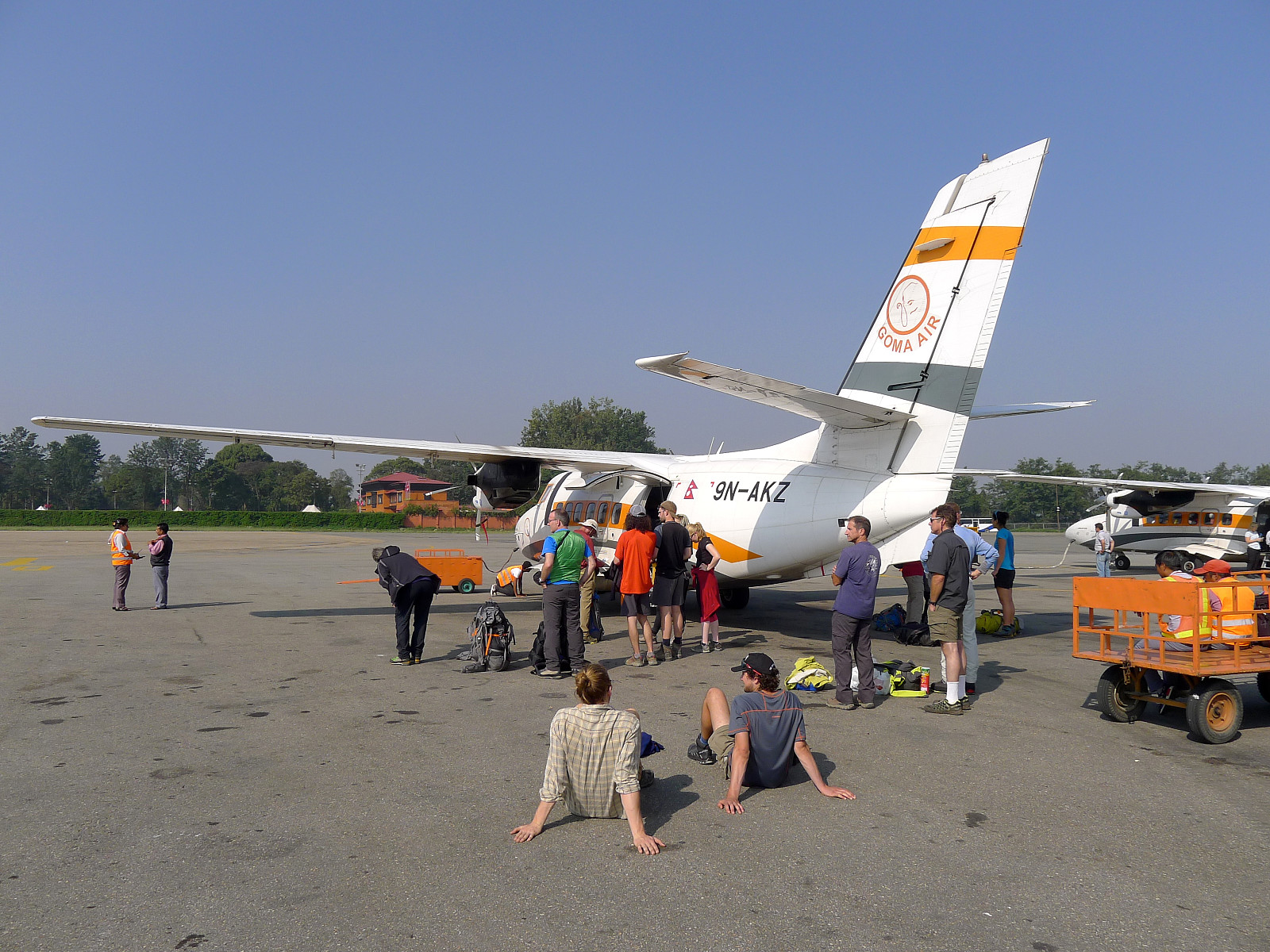
Four of us who had joined the trip organized by Jagged Globe met at Heathrow T4 on 15th October for the flight to Kathmandu via Delhi with Jet Airways; Tony our trip leader, Carl, Mark and myself. We would meet the other three – Deborah, Ankit and Mike at the Summit Hotel in Kathmandu. I didn’t sleep on the overnight flight and I’m not sure many of the others did either, so by the time we were through security at Delhi we were all much less chatty than at Heathrow. It was good to finally arrive at the hotel in Kathmandu and get some sleep, even though it was a somewhat short night since we would be catching an earlyish flight onward to Lukla the next morning.
17th October: Kathmandu-Lukla-Phakding
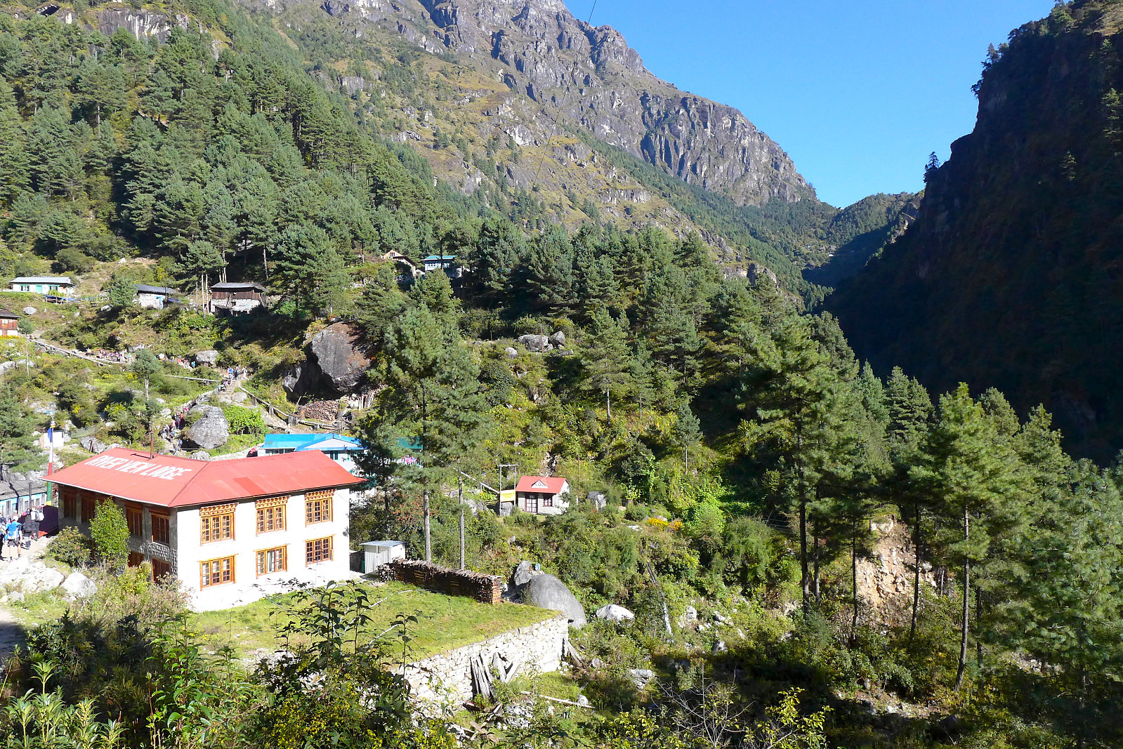
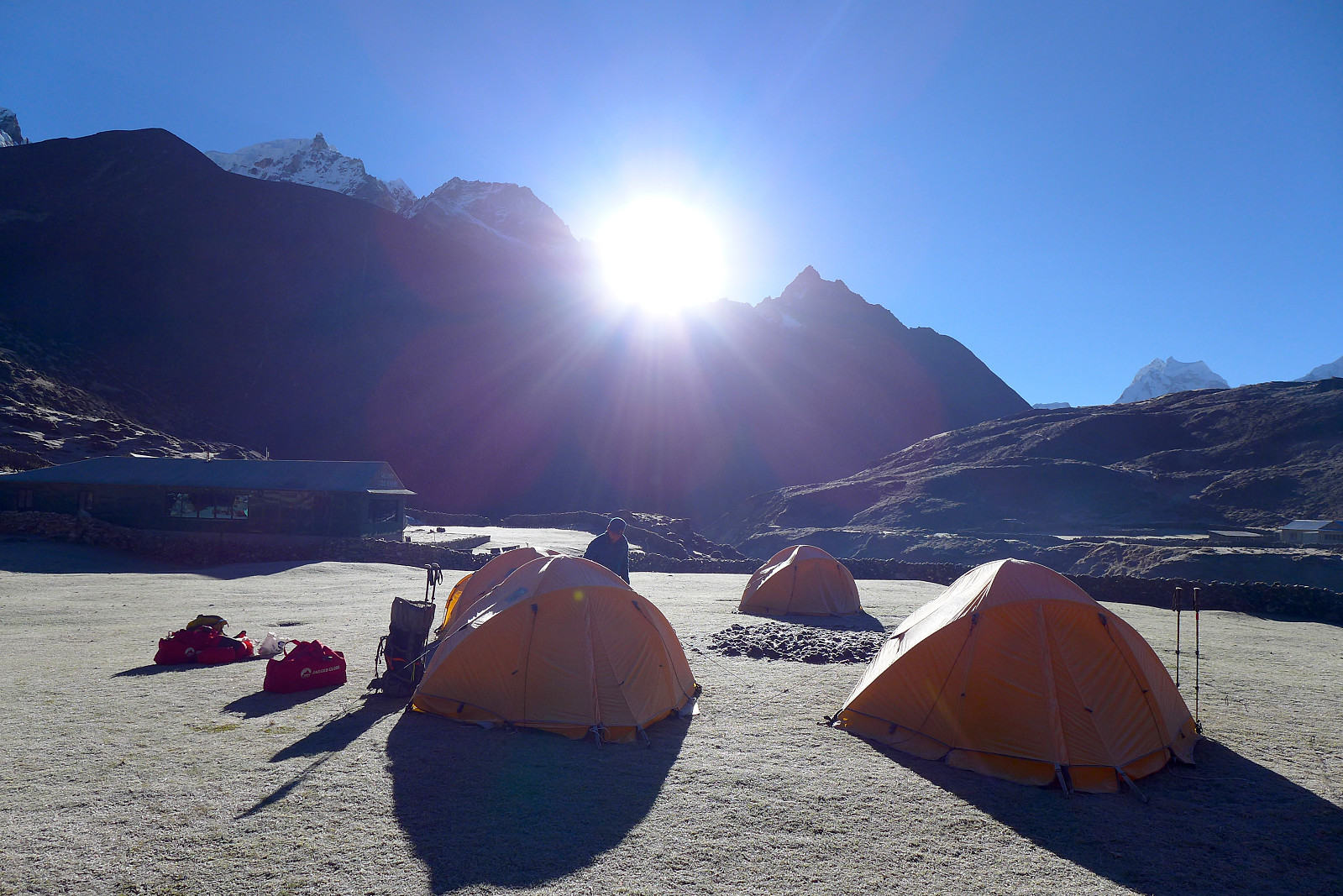
There was a bit of waiting at the domestic terminal before the call for our flight, then more waiting beside the plane before we actually took off. Although still morning time it was very hot in the sunshine and some of us dashed behind the plane to get some respite from the heat! The flight into Lukla itself went fine, though it was a bit bumpy at times and we landed into a somewhat cloudy but comfortably cool Lukla later in the morning. After some tea and doing some repacking at Tara Lodge, we met our sirdar, Pema and one of the two (rather handsome) high-altitude sherpas, Kilu who would be with us on the trip. I later also found out that Kilu works at Juvasshytta as a mountain guide for 3 months every summer, taking groups up and down Galdhøpiggen. Small world. From there we made the short walk down towards Phakding at around 2600m, where we spent our first night camping outside one of the teahouses. We also got our first taste of our cook Mani’s terrific culinary skills!
18th October: Phakding to Namche Bazaar
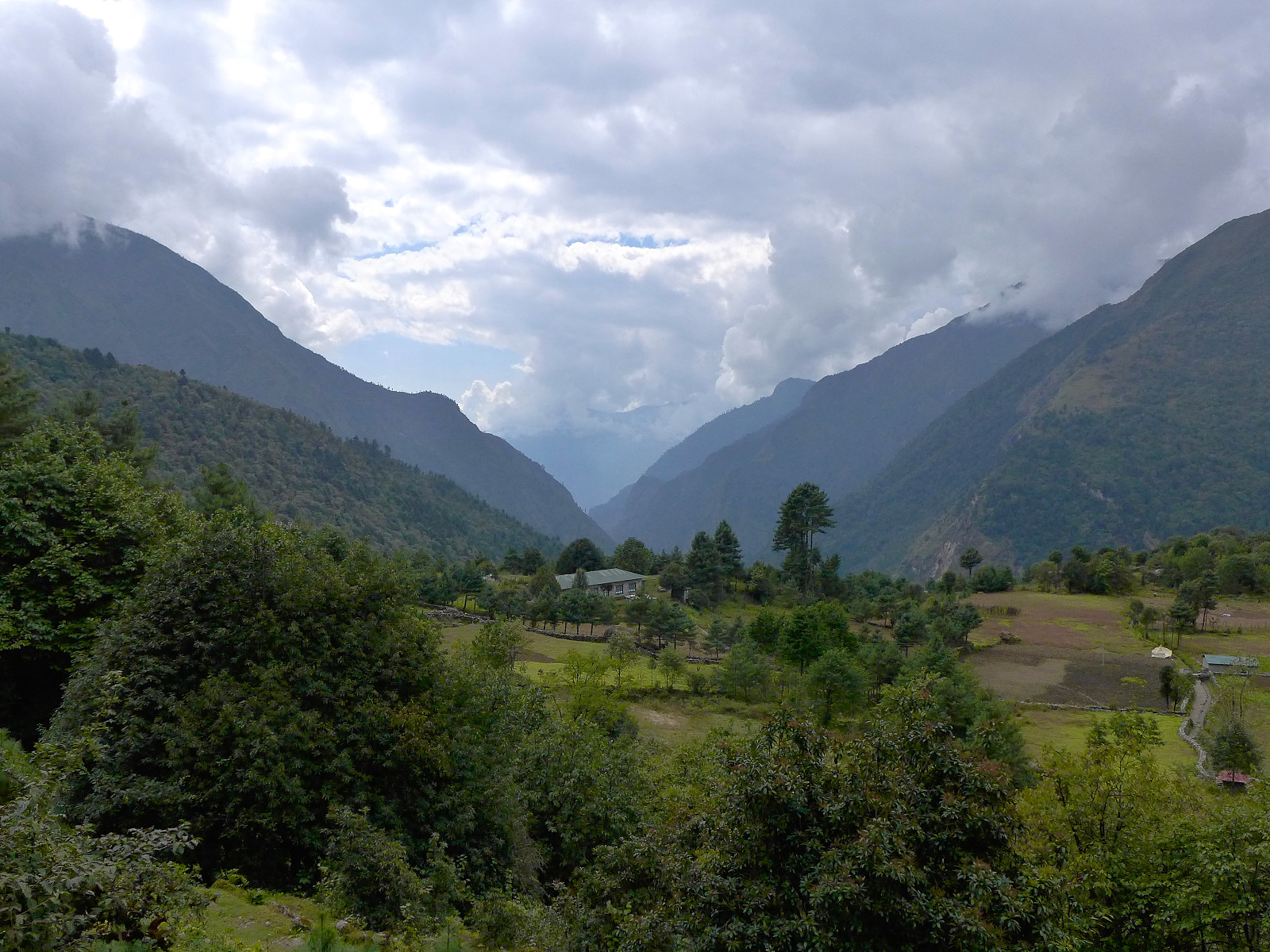
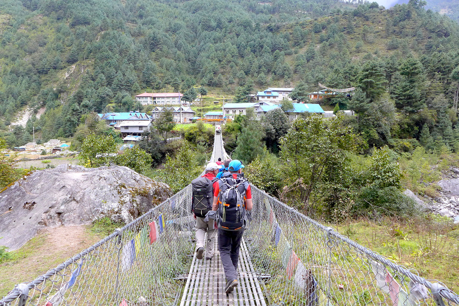
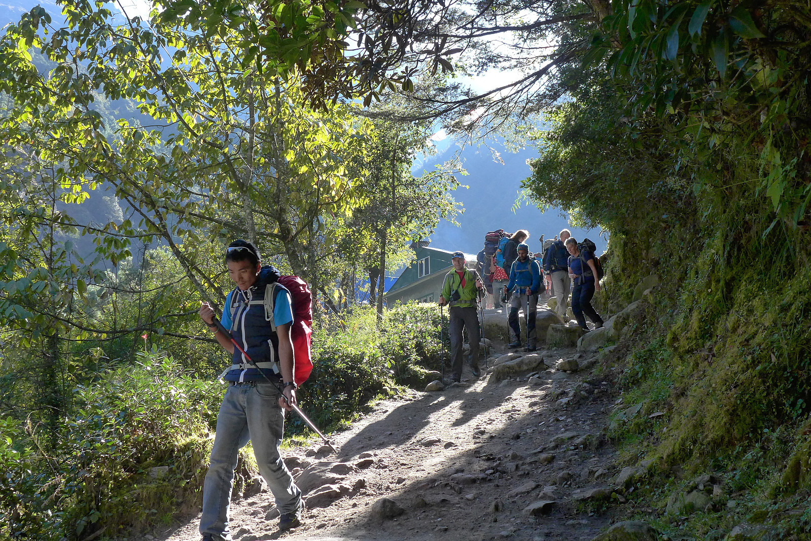
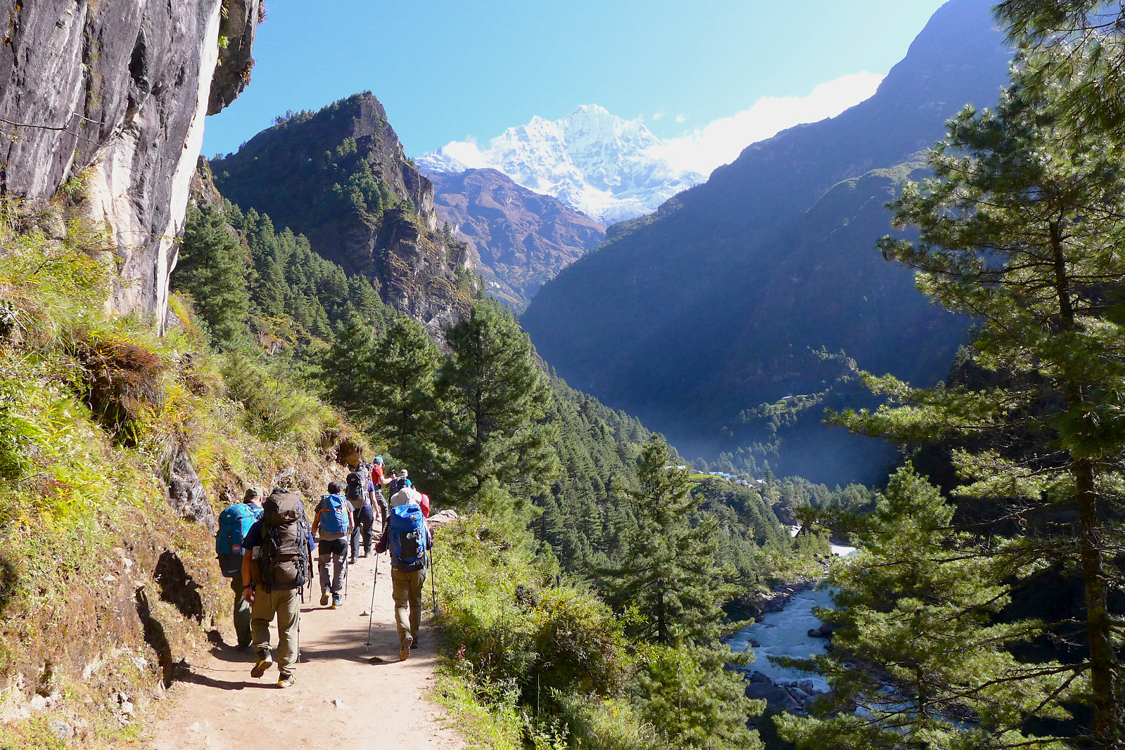
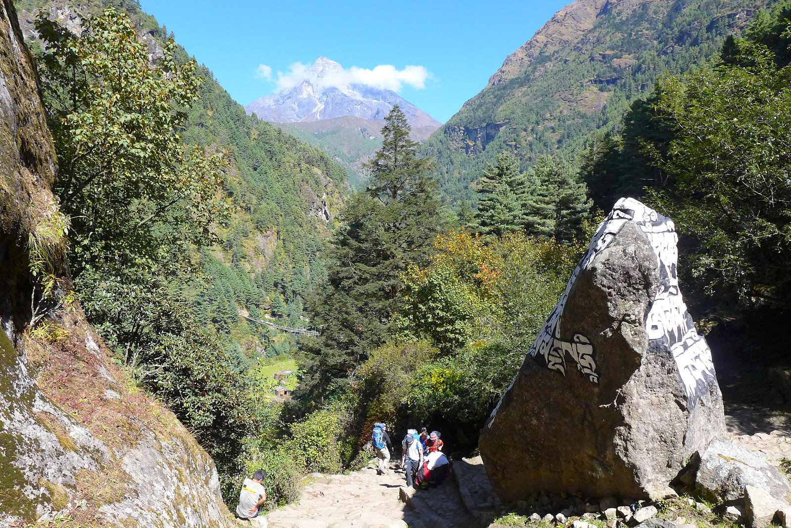
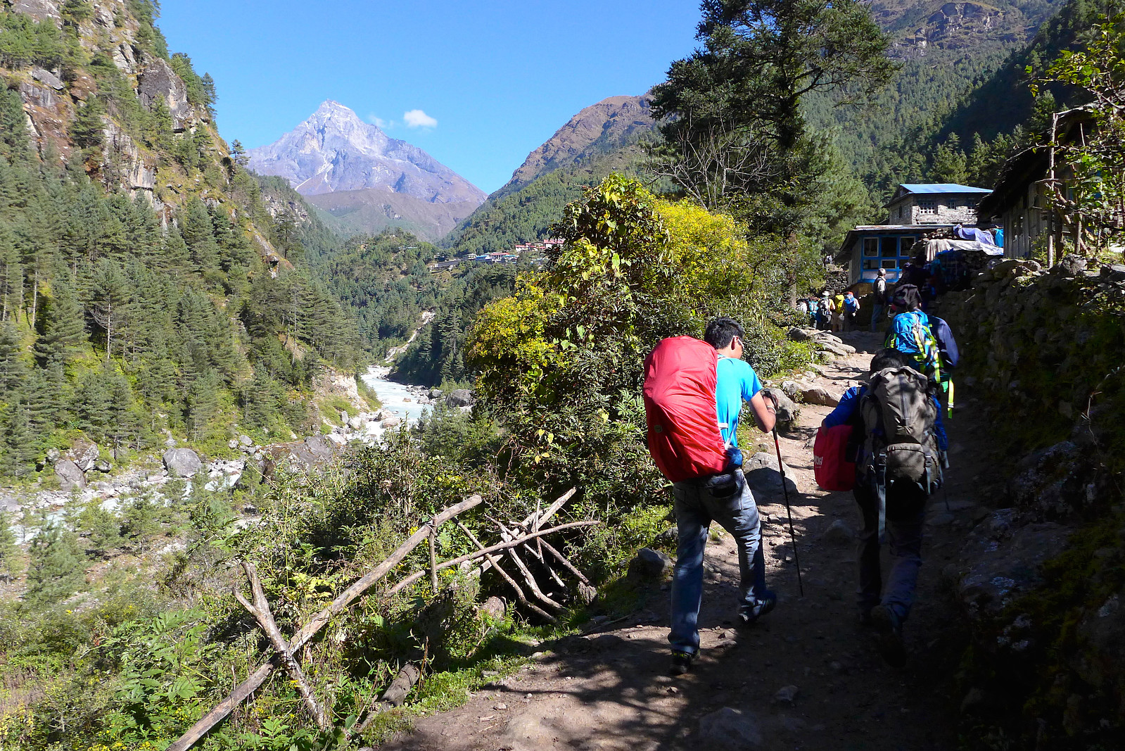
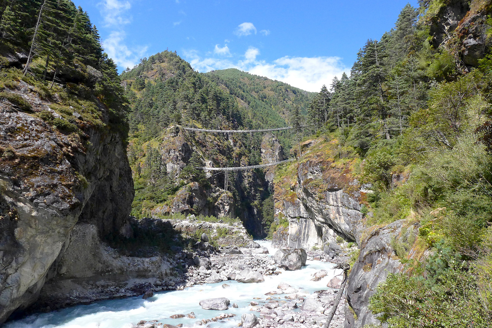
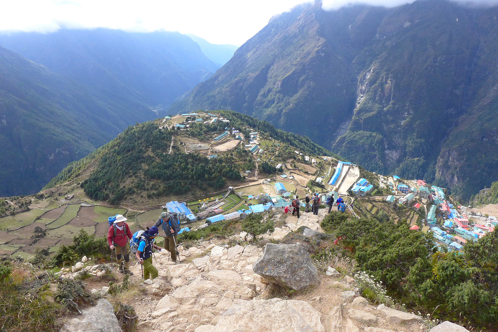
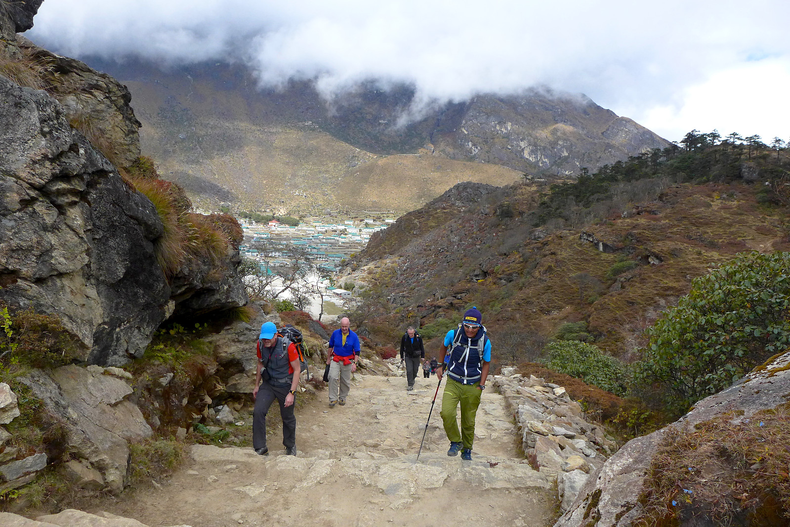
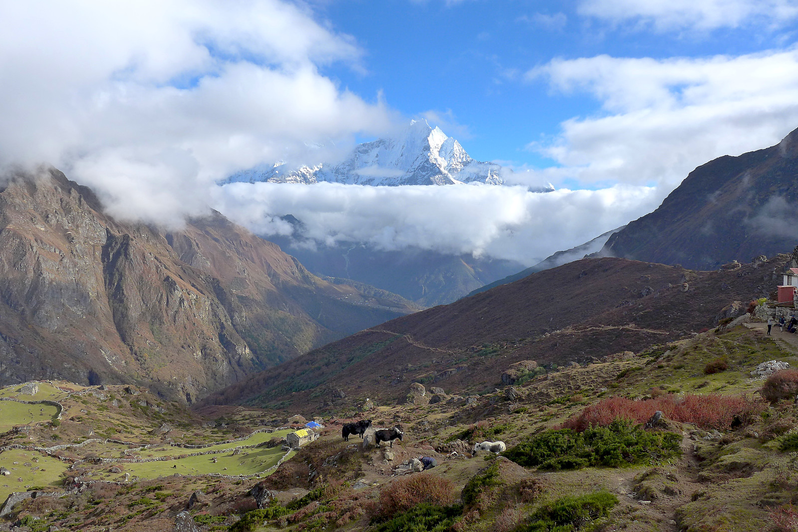
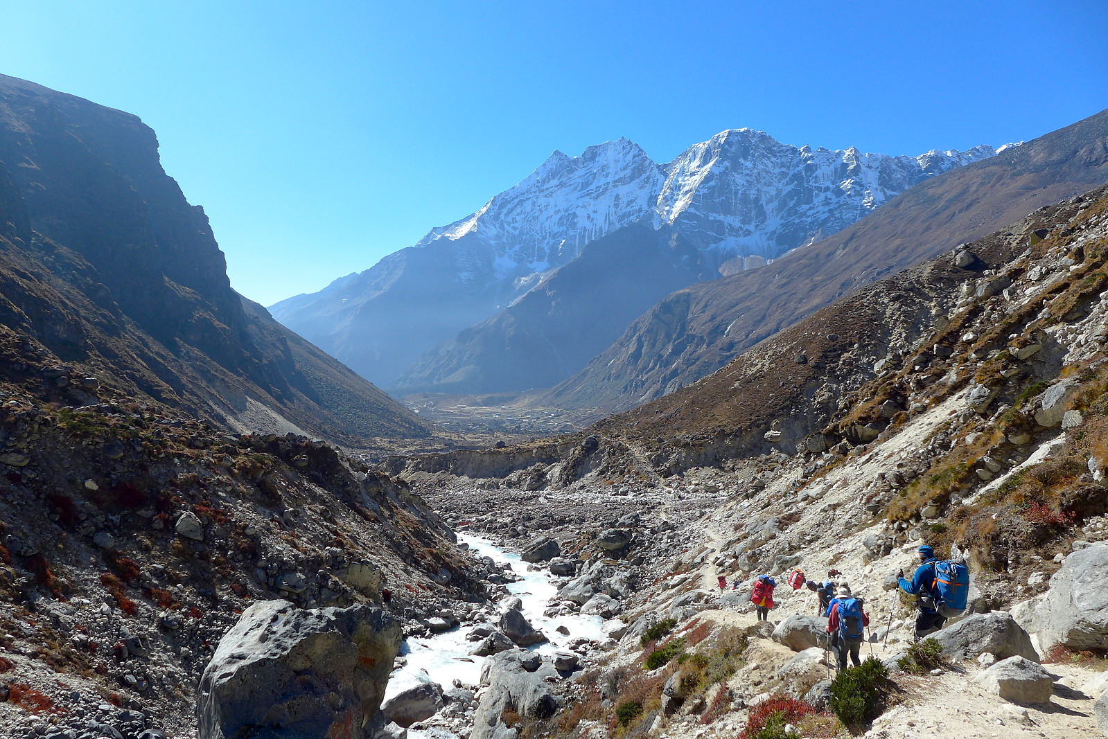
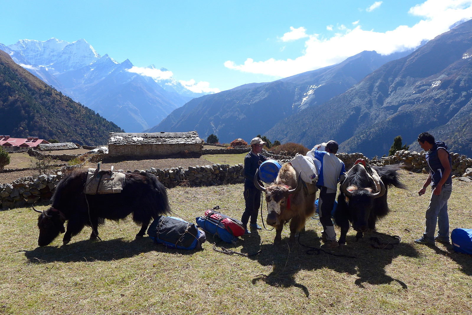
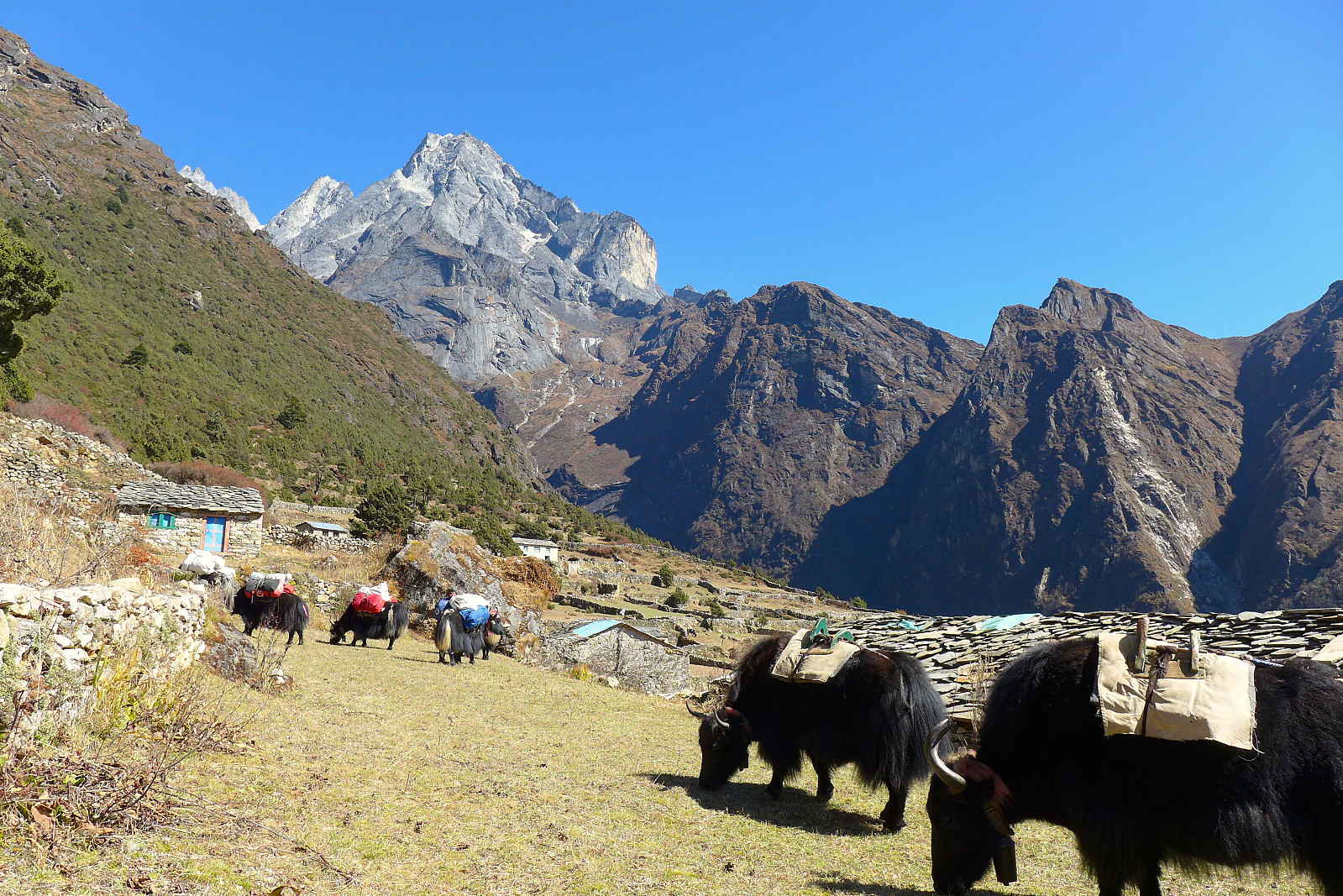
The following morning was sunny, cooler and pleasant for the walk up to Namche Bazaar, some 900m higher in altitude at 3440m. There was a lot of other people trekking along this main trail to Namche, along with hundreds of Zopkio (like a yak, but able to live at lower altitudes) or donkeys transporting baggage and equipment. All in all very crowded. Lots of waiting by the side of the trail for animals to pass or getting held up by slow trekkers along the way, so a bit frustrating at times, but the views were a good consolation. Already we got to see the vey impressive Thamserku, a peak which featured quite a lot in the views during the trip. Despite being steep, snowy and an intimidating objective, it’s one of many ‘trekking peaks’ between 6000-7000m in Nepal. A bit of a misleading label to have! We took a lunch break just before the start of the steep hill which led up to Namche, and it was good to get out of the main stream of trekkers for a while. Unfortunately it was the warmest part of the day by the time we’d eaten lunch and started the ascent up the hill, so it was hot work on full stomachs. Part-way up the hill the group ended up splitting into two since some were walking at much different paces than others. I ended up going ahead in my own pace and waiting for the rest of the group just before entering Namche and Mike followed soon after, a trend which became pretty much the norm for a lot of the trip.

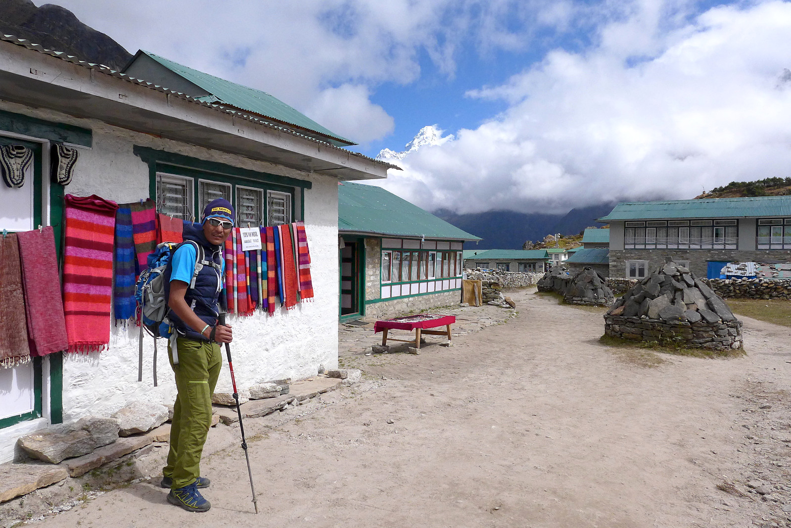
It was around 3pm by the time we arrived at the Sherwi Khangba teahouse/sherpa museum in Namche Bazaar, our next campsite for two nights. Two other groups on Jagged Globe trips were also staying here, though for some reason not camping. I was a bit envious that they were staying in the teahouse and sleeping in proper beds! Nevertheless, it was quiet in the tents which isn’t always guaranteed when staying in busy teahouses, though I slept bad again for some reason and woke up feeling shattered. As part of our acclimatization at Namche we headed up towards the Everest View Hotel the next day. The weather wasn’t amazing and low clouds dominated the skies during most of the morning, so it didn’t look hopeful for actually getting a view of Everest, but it was good to get some exercise anyway. We took a coffee break in Khumjung afterwards where there was slow but free wifi at the bakery. The coffee was very good though! We were back in Namche Bazaar by early afternoon and a few of us went down into the village to buy stuff, I went back earlier as I was really REALLY sleepy but also wanted to take a shower whilst facilities were still there :) But I was mostly looking forward to bedtime in the hope of getting a better night’s sleep. Fortunately I did, but probably only because I was already sleep-deprived after 3 consecutive nights with little or no sleep…...
20th October: Namche Bazaar to Mongla
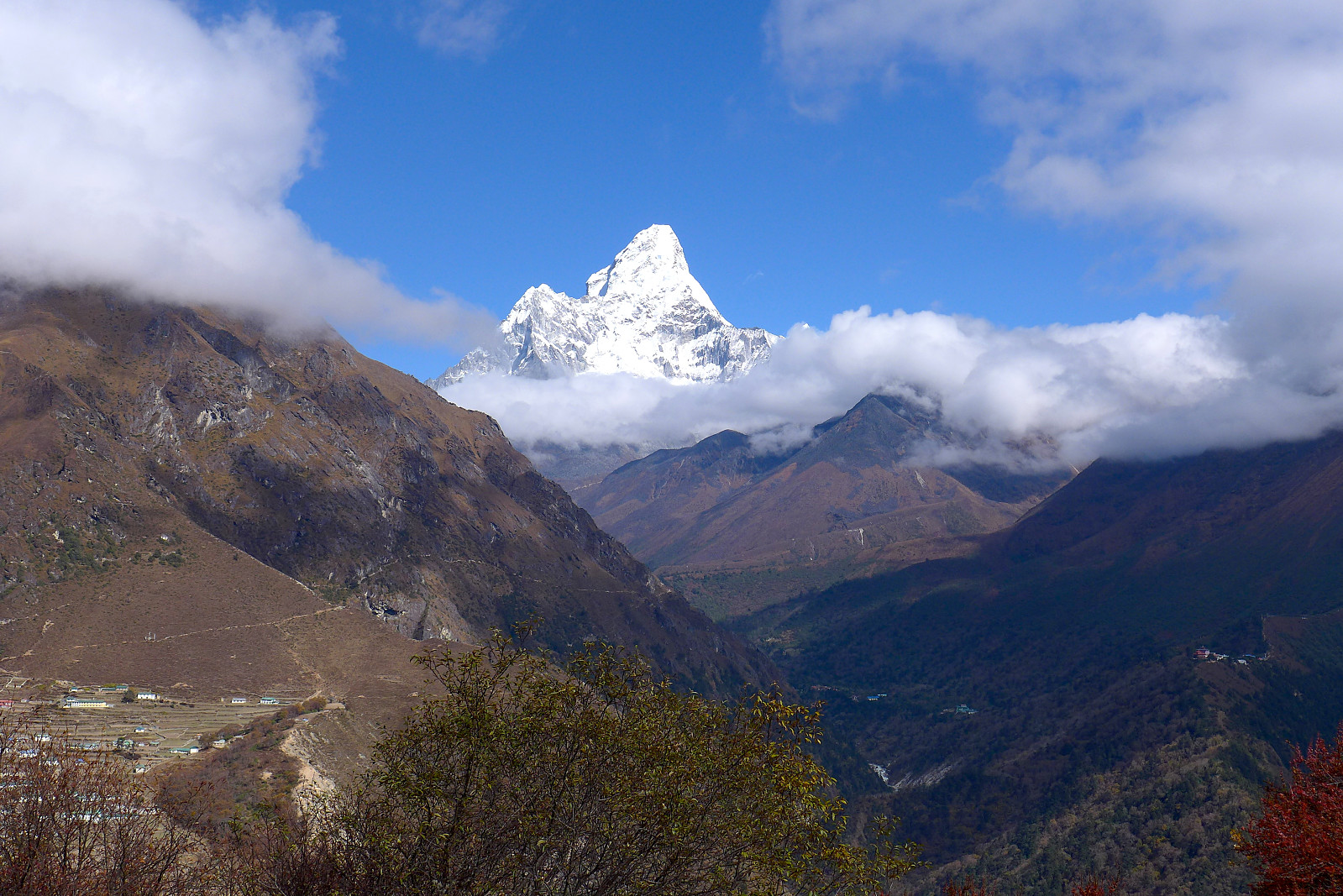
The following morning was the start of our short day up to Mongla at 3975m; the weather was the same (overcast but dry) and lots of people were heading in the same direction. There’s not really much to be said about this day since the views were kind of absent and the route itself was not all that interesting. The main trail out of Namche pretty much contours around a mountainside to start with before rising more gradually up to Mongla. Again we started off altogether but the pace was really quite slow, so I went ahead at what I thought was a more reasonable (but still slow) pace and waited for the rest of the group at the start of the village. I happened to meet Mani and the rest of the cook team there and ended up following them to where we would be camping for the night. We had some brief sunny spells during the early part of the afternoon and even got some glimpses of Ama Dablam. It is a popular mountain and not hard to realize why! It was a fairly long afternoon/evening to find something to do, but the others decided to do a short walk up to some prayer flags nearby to get a bit more acclimatization, although it was by this point completely foggy with nothing to see so I didn’t really see much point in going along. In the end I took the opportunity to chill out and rest in the tent. We were treated to another excellent dinner finished off with apple pie (this only made an appearance once on the trip) after which the entire local team introduced themselves. Our other sherpa, Mingma was also here with us now and we got introduced to the rest of the cook team who were assisting Mani.

21st October: Mongla to Dole
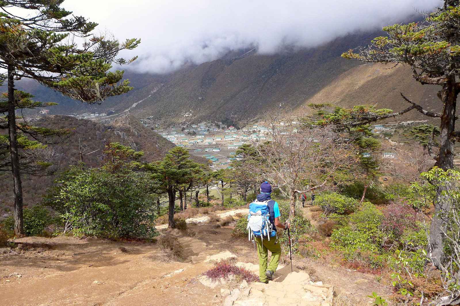
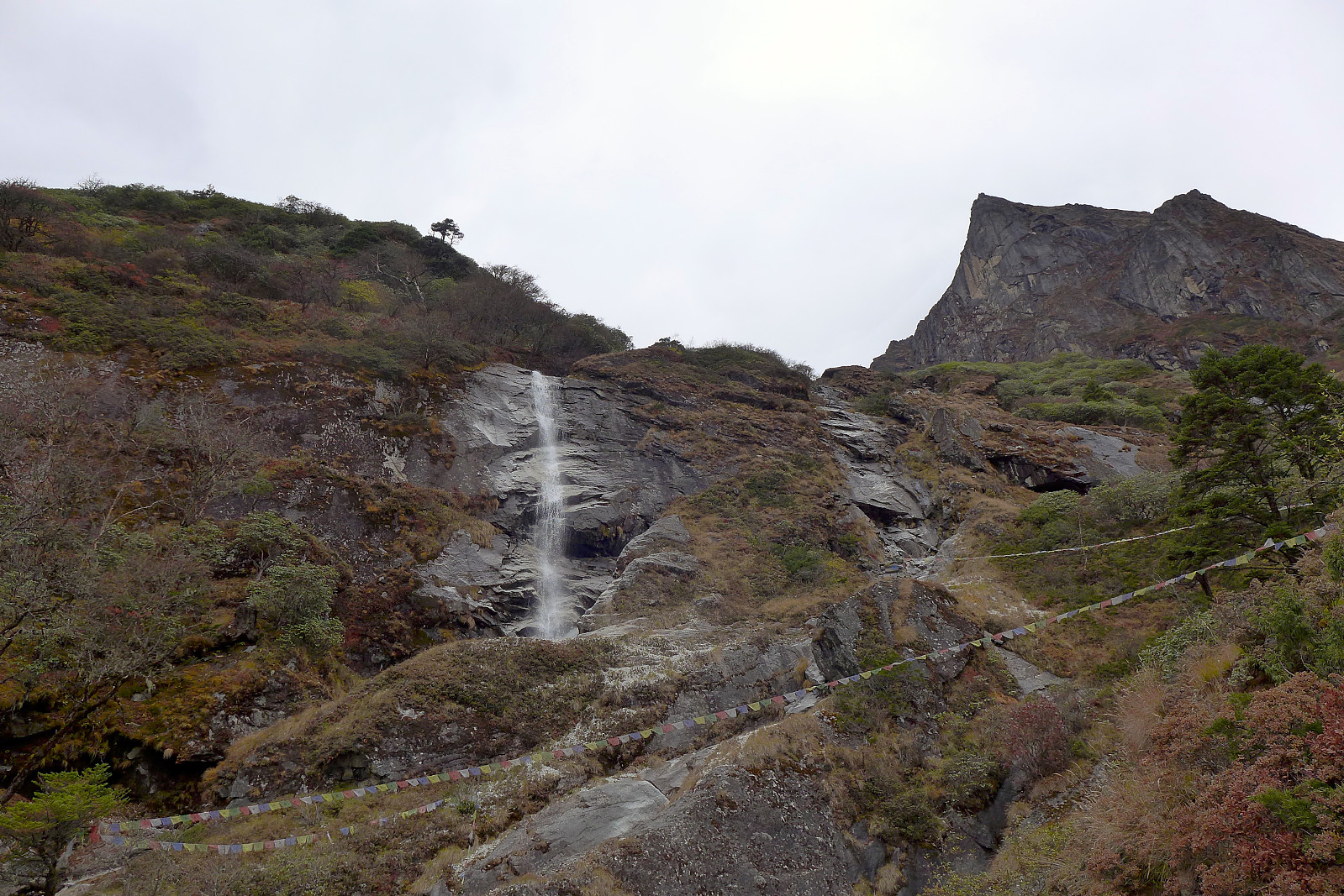
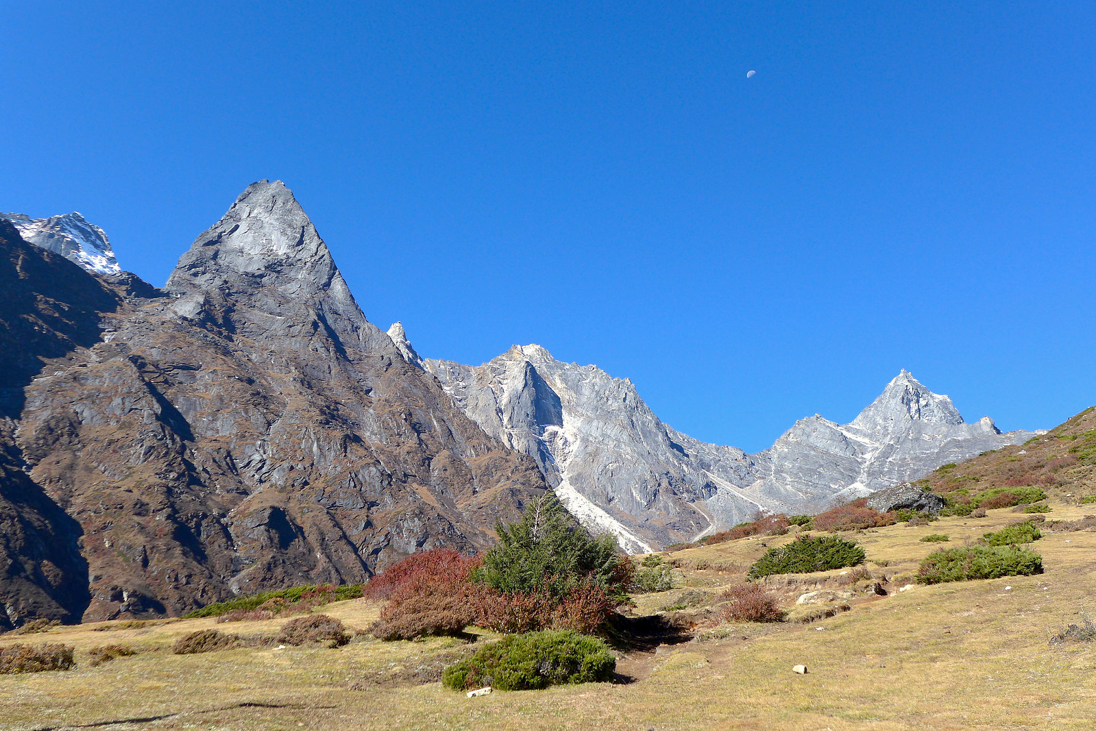
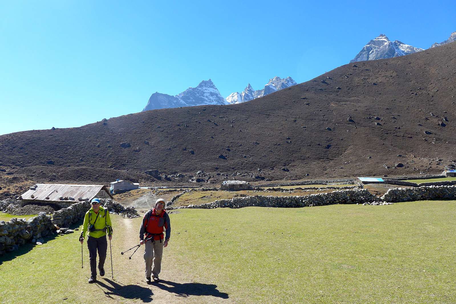
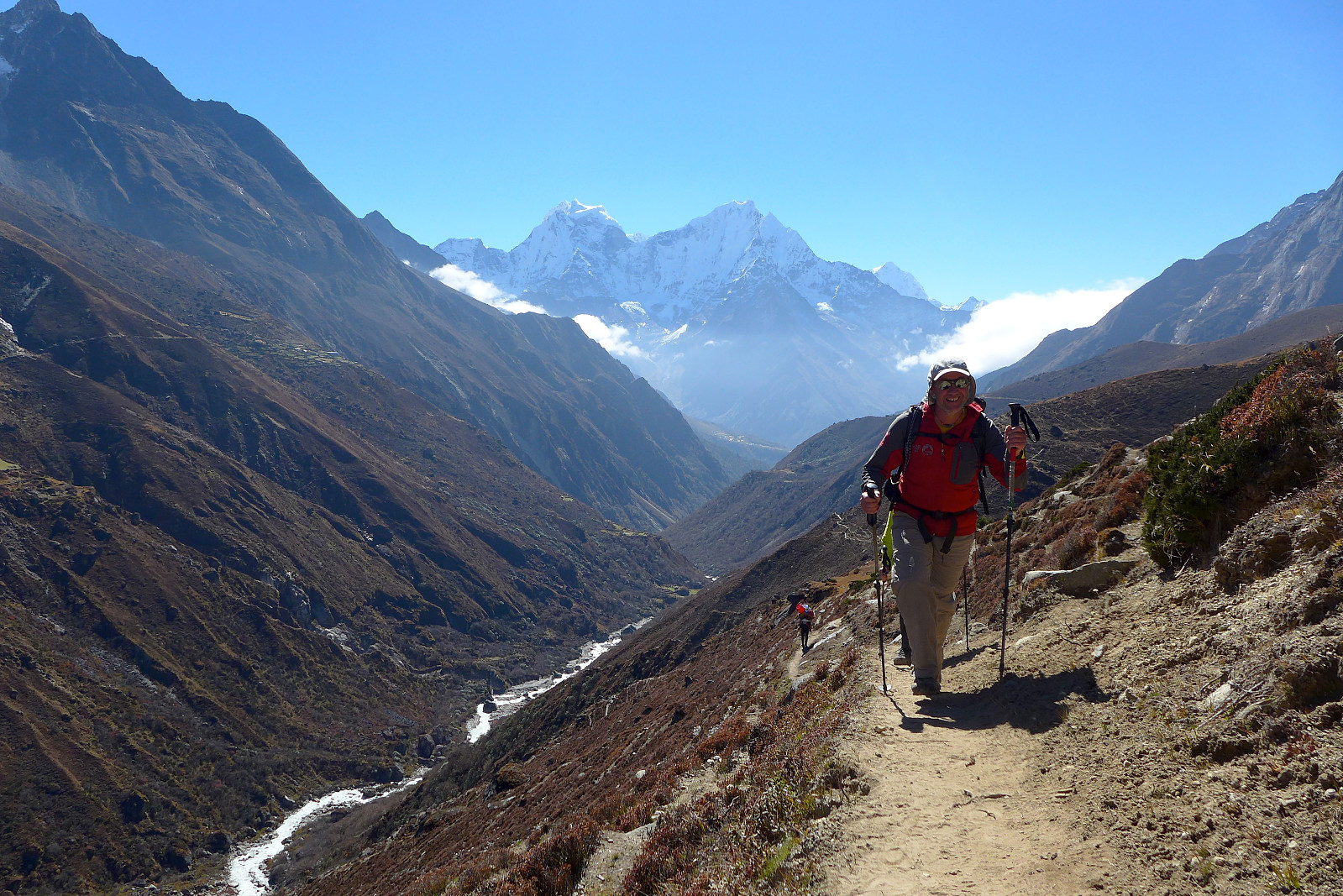
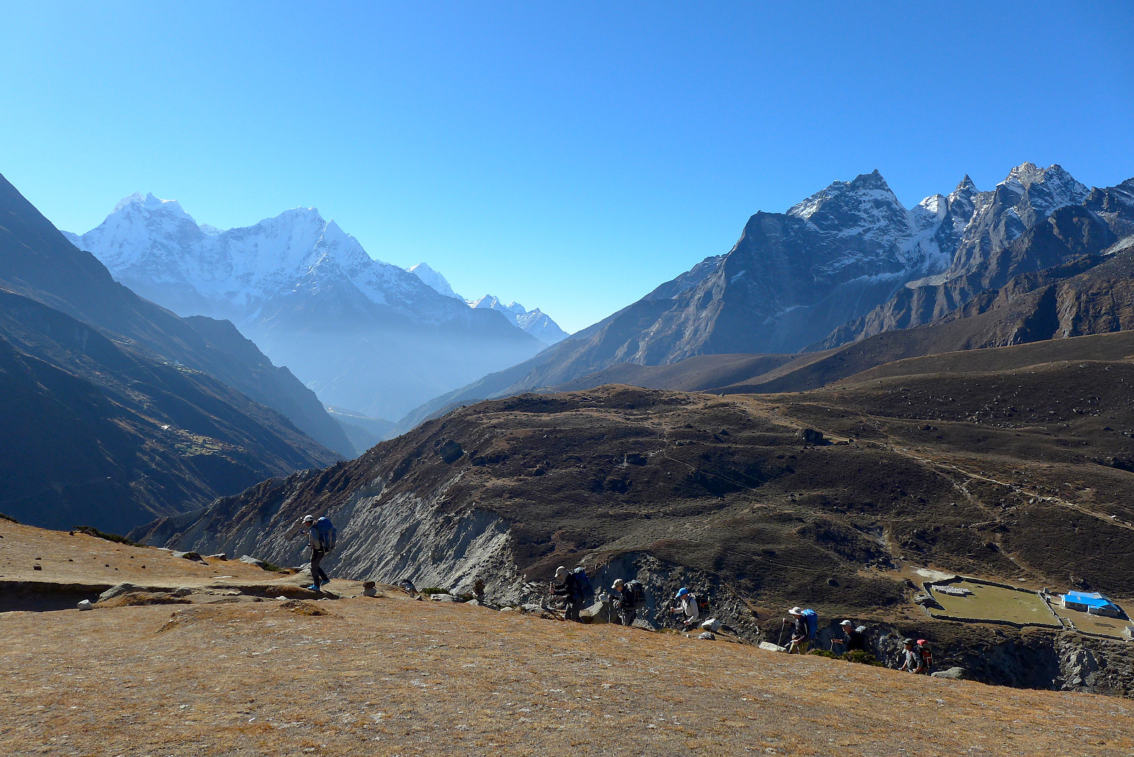
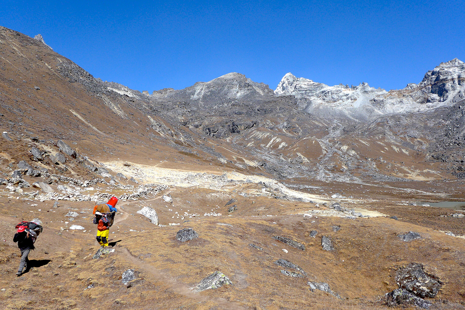
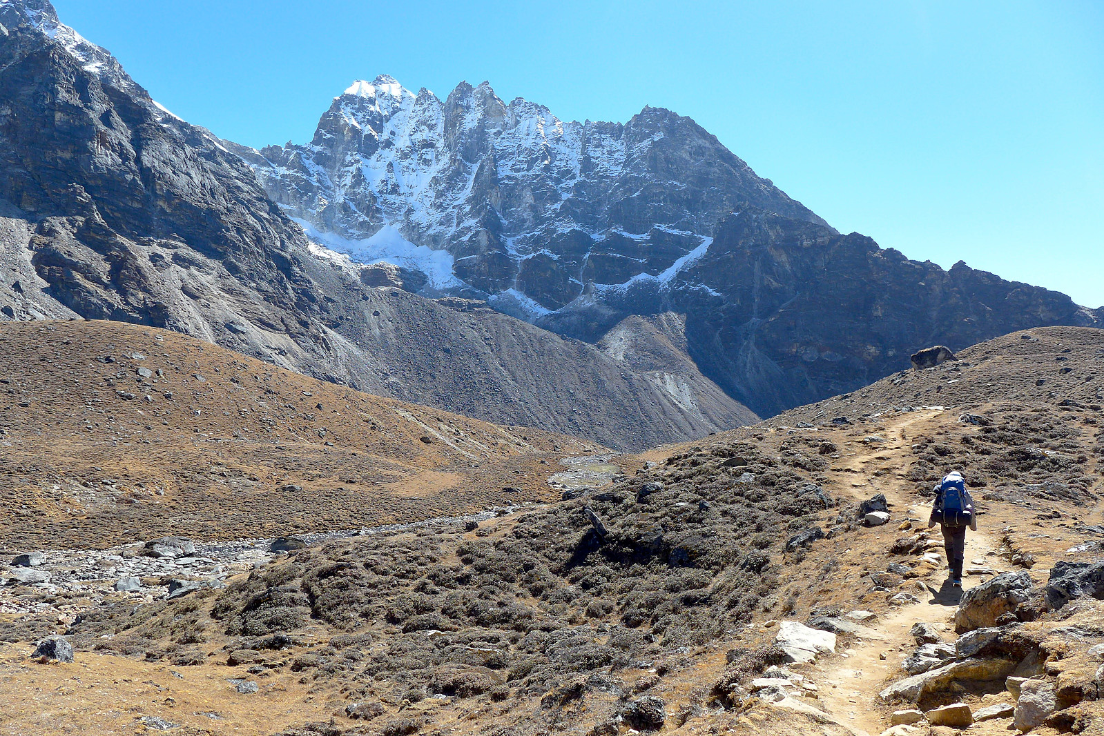
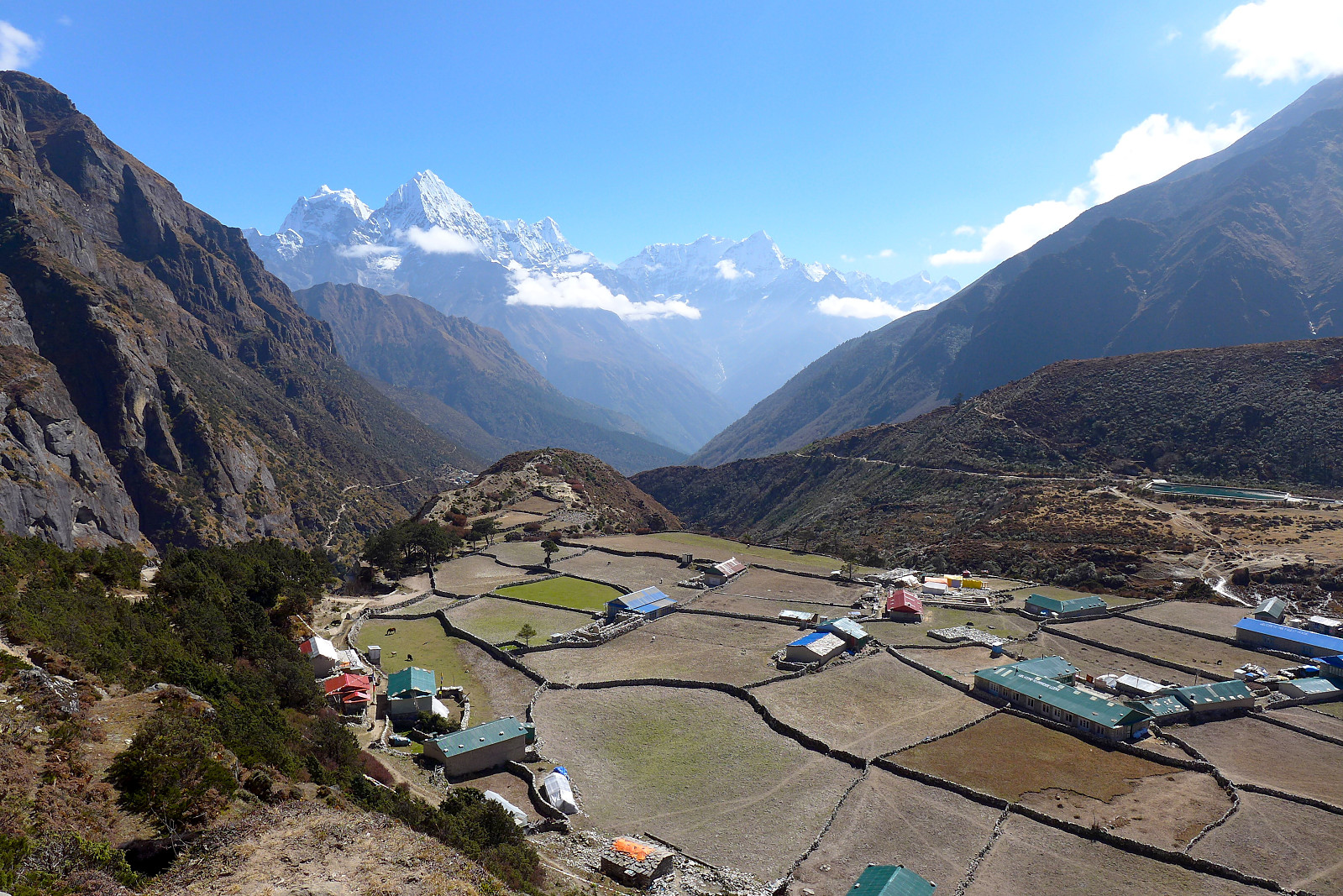
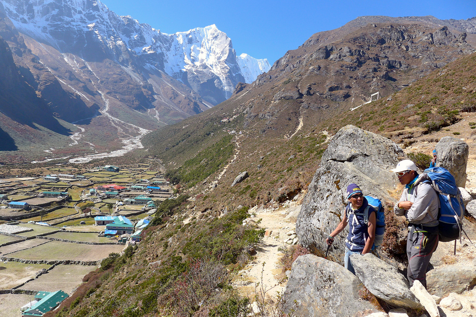
From Mongla at 3975m we walked to Dole, situated at 4040m. The next day started off much the same as the recent days, weather-wise, and the trail involved a reasonably steep descent down to Phortse Tenga first, before gradually ascending again towards Dole. As with most of the trails it was never completely up or down but undulating a lot of the time on an upwards trend. We camped this time at Yeti Lodge, which was something of a luxury with lots of camping space and a nice dining room with the nicest cushions I’ve ever seen in the Khumbu! Since the walking part of the day had been so short we had an early lunch. Some people headed off up the hill to some prayer flags again while I went in the opposite direction up the other hill towards Machermo. We would be heading this way the next day anyway, but I wanted to get a decent afternoon’s walk done despite feeling really sleepy. I didn’t have much of an objective other than to walk as far as I had the energy to do, and got as far as a little hamlet called Luza before turning back. It was around 1.5 hours from Dole and I’d at least got some good views towards Cho Oyu and Pharilapcha, a peak nearby Kyajo Ri. I ate some white chocolate and drank a bit of water before heading back to Dole. Good timing as well, there was some pretty atmospheric light on the clouds lingering over the nearby peaks just as I was descending down towards Dole! I was going a bit slow anyway due to knee pain which I was stressing over, but on the plus side I had more time to observe the views :)
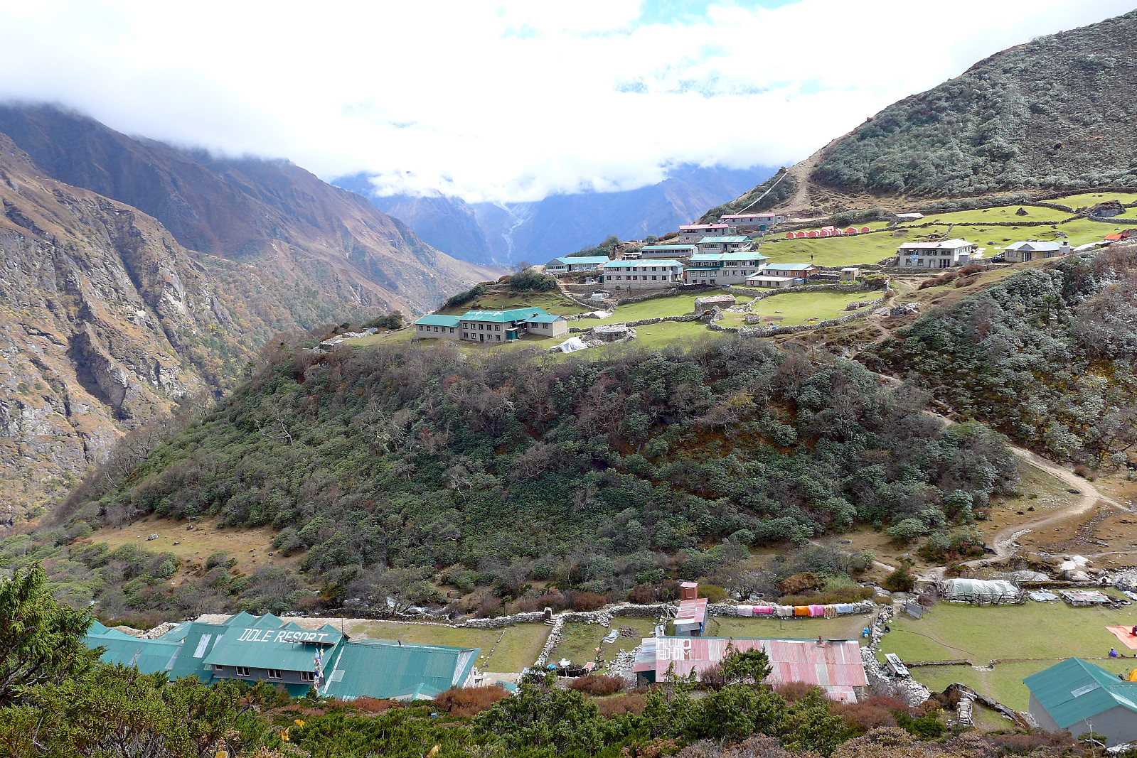

22nd October: Dole to Machermo
The next morning was finally fine and beautifully sunny again with not a single cloud in the sky. I’d slept half-well, the first part of the night pretty awesomely as Pema had asked the teahouse owner if I could borrow a pillow, but the temperature dropped quite a bit during the second half of the night and my head got cold. At least the pillow helped for the first half of the night…… It was another short day with around 2 hours of walking to Machermo, with the group split and going at our own paces for parts of it. We were fortunate enough to arrive at the top of the hill above Machermo in good weather and finally got our first views of the steep east side of Kyajo Ri! In some ways I wished I hadn’t had any idea of what the mountain looked like, but having done extensive googling prior to the trip I expected a good deal of wow factor, which there was. Enough to demand taking plenty of photographs :) Then it was 10 minutes or so more down into Machermo for another early lunch in the sunshine. Some folk headed across to the porter shelter/rescue post for a free lecture on altitude sickness in the afternoon but other than that there was only diary-writing and tea drinking to do once the skies clouded over during early afternoon.
23rd October: Machermo to Gokyo
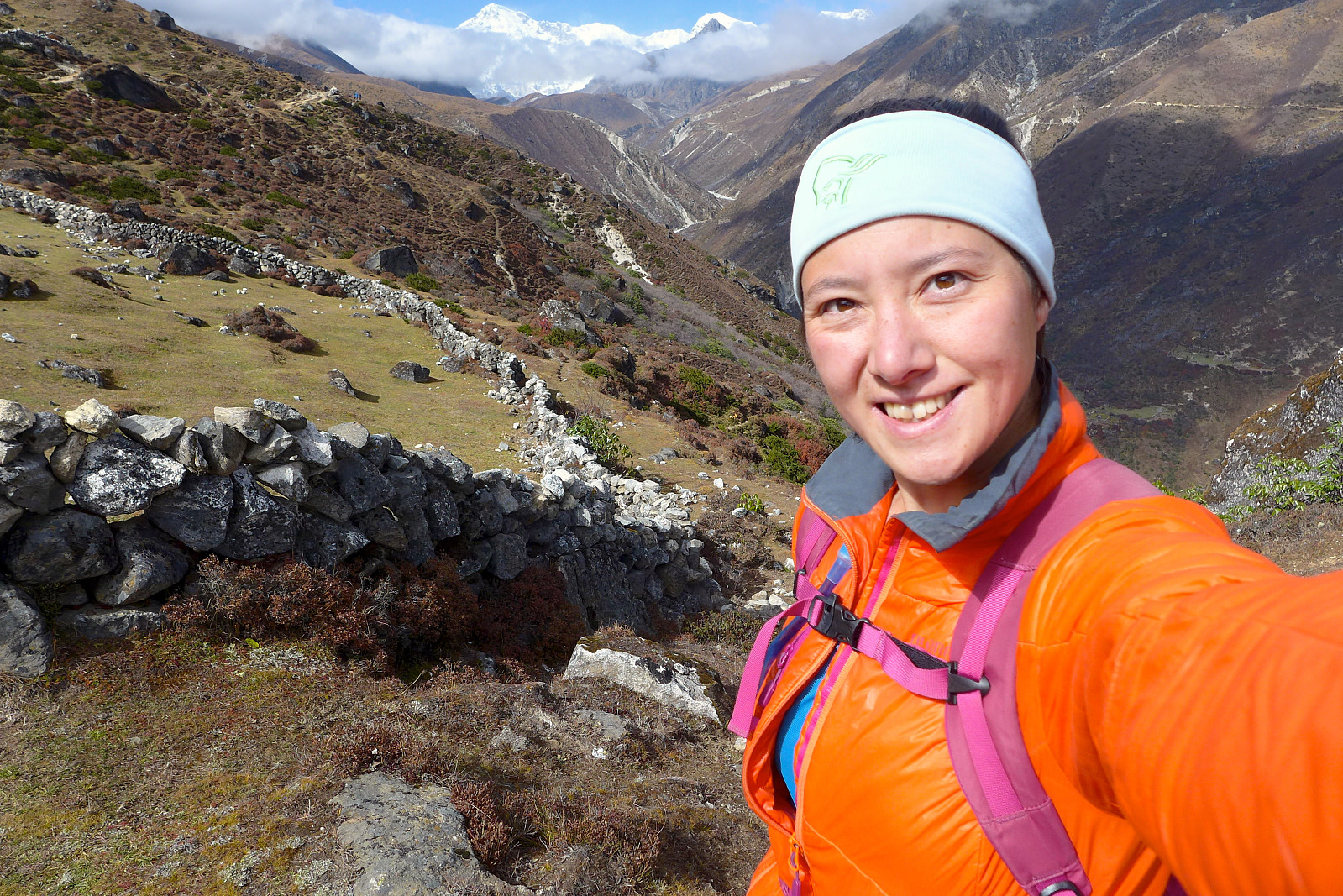
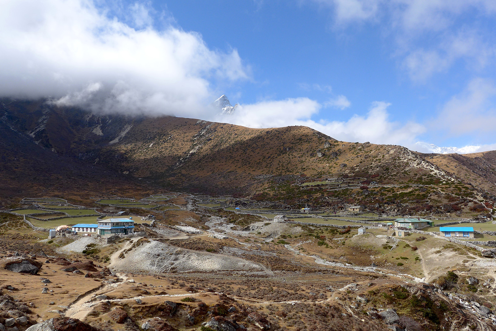
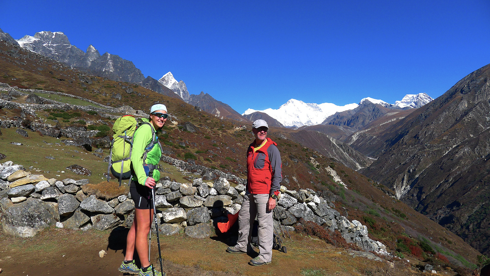
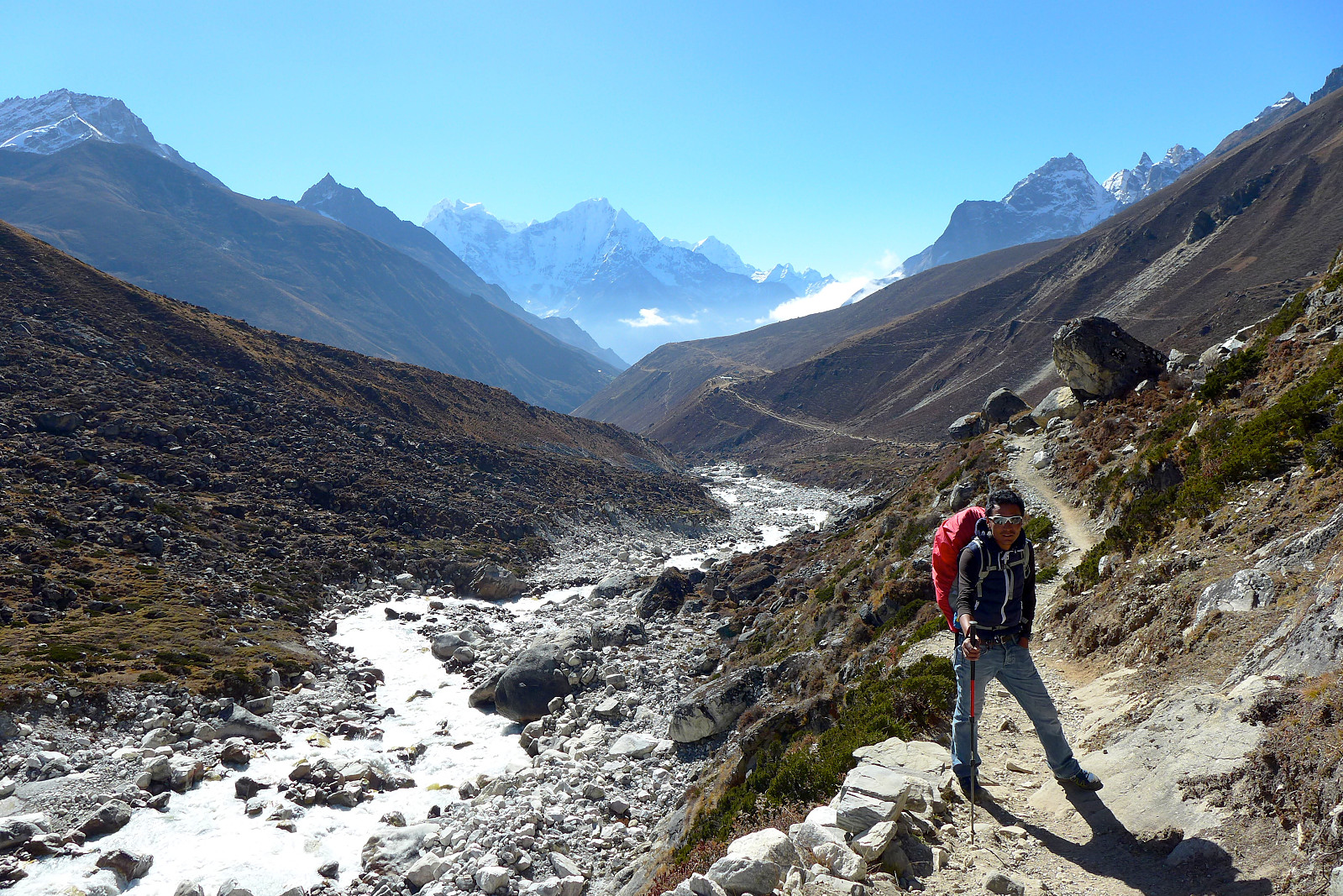
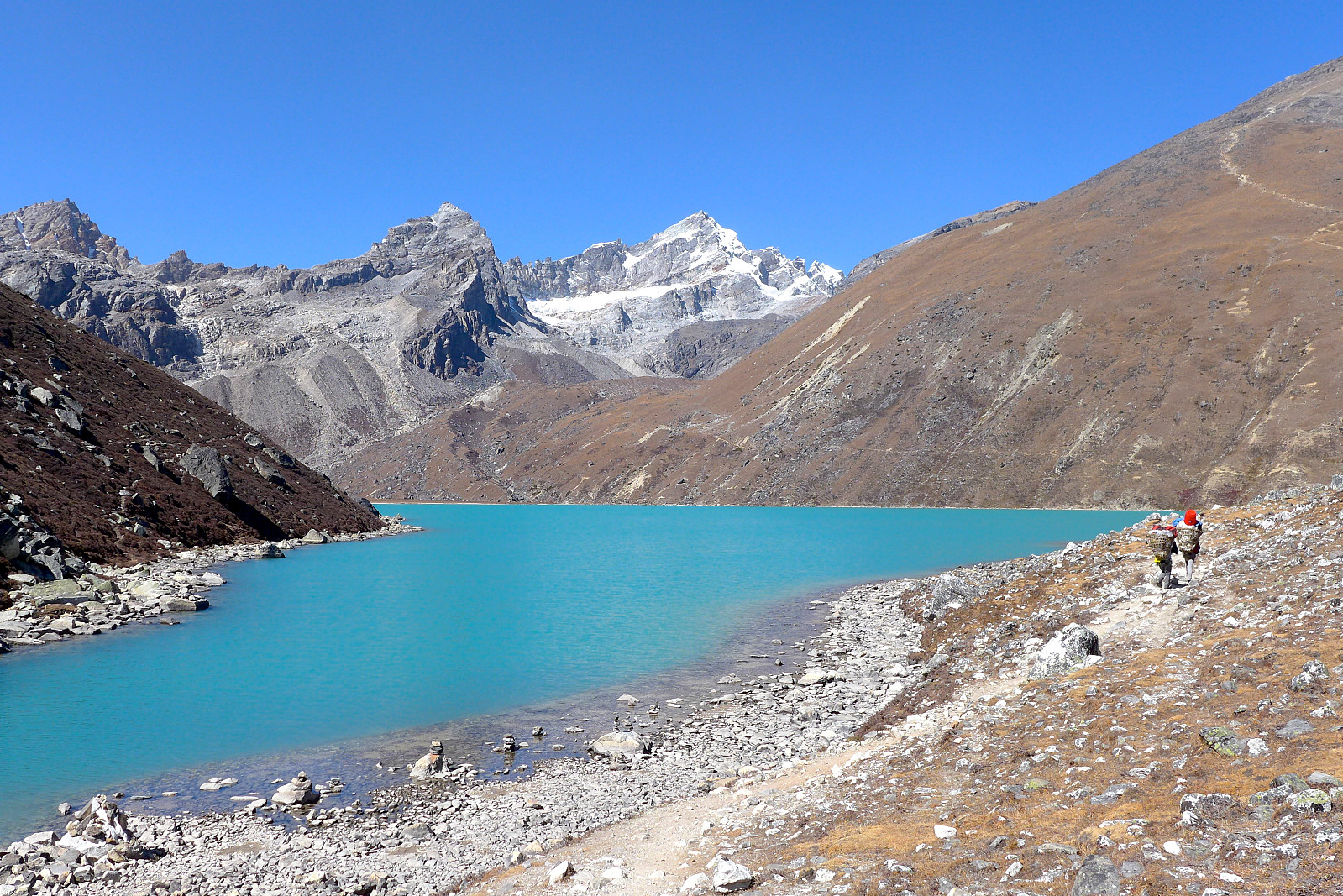
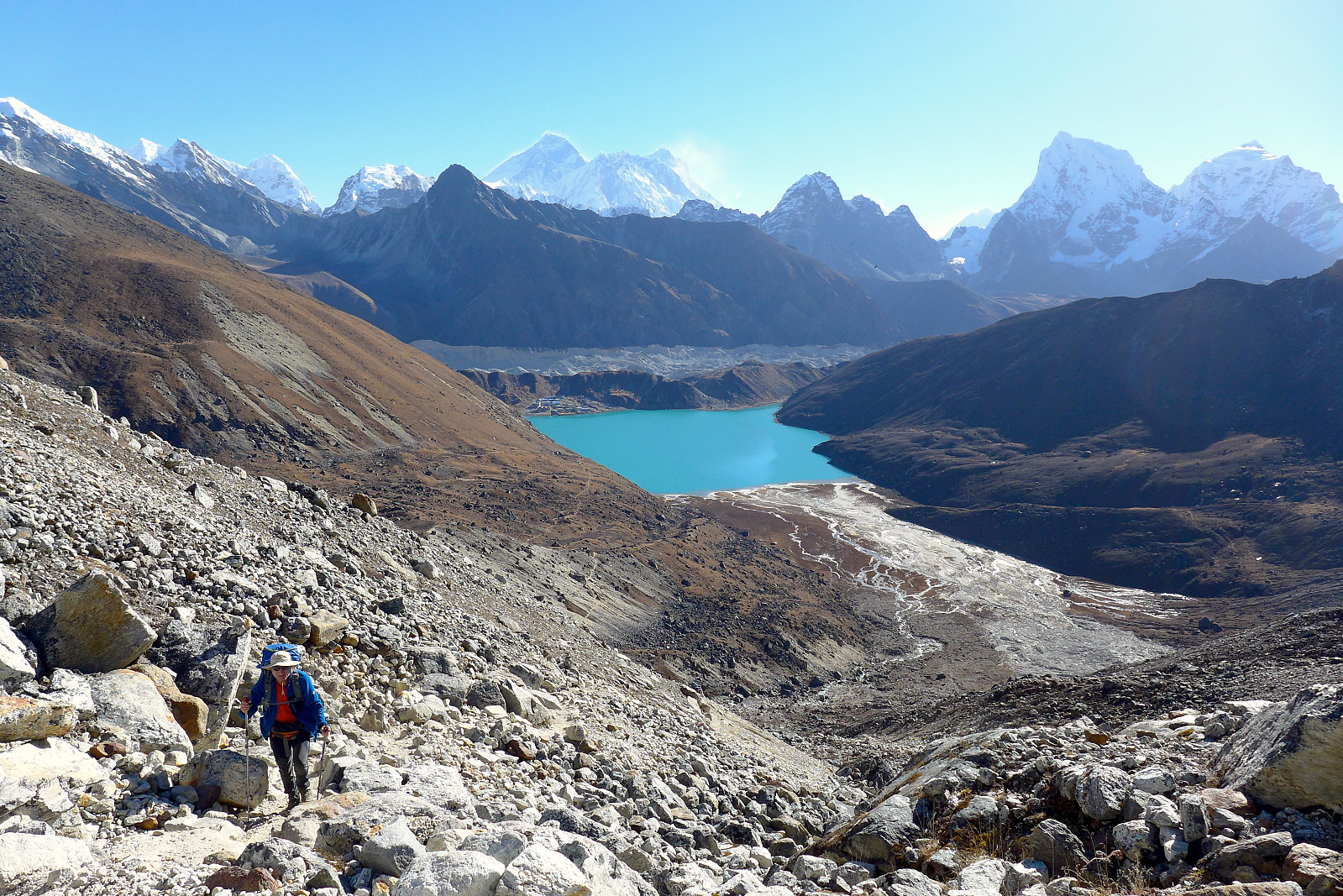
Another night of less-than-perfect sleep followed but it was another relatively short day’s walk from Machermo at 4465m to Gokyo at around 4750m. The height was gained very gradually whilst walking up the Gokyo valley. The views were getting slowly more impressive especially towards Cholatse and with Machermo Peak towering over the Gokyo Lakes, but I have to admit to not fully appreciating it while feeling hugely sleep-deprived. Despite the sleep deprivation I still ended up waiting at Gokyo for almost 2 hours before the whole group had arrived. It turned out that Carl was starting to suffer quite a bit with typical altitude sickness symptoms (banging headaches, lack of appetite). After some lunch Tony got him started on a course of Diamox to help with his acclimatization and he spent most of the afternoon sleeping. I had meanwhile decided that I needed a night or two with proper pillows to try and catch up on sleep myself and fortunately there were some spare rooms at the teahouse. I was more or less prepared to pay whatever was needed for a decent night’s sleep so it wasn’t too bad to find out the cost would be about $18 a night. I spent most of the afternoon taking it easy and enjoying lying in a proper bed in preparation for the early start we would be making to go up Gokyo Ri the next day.


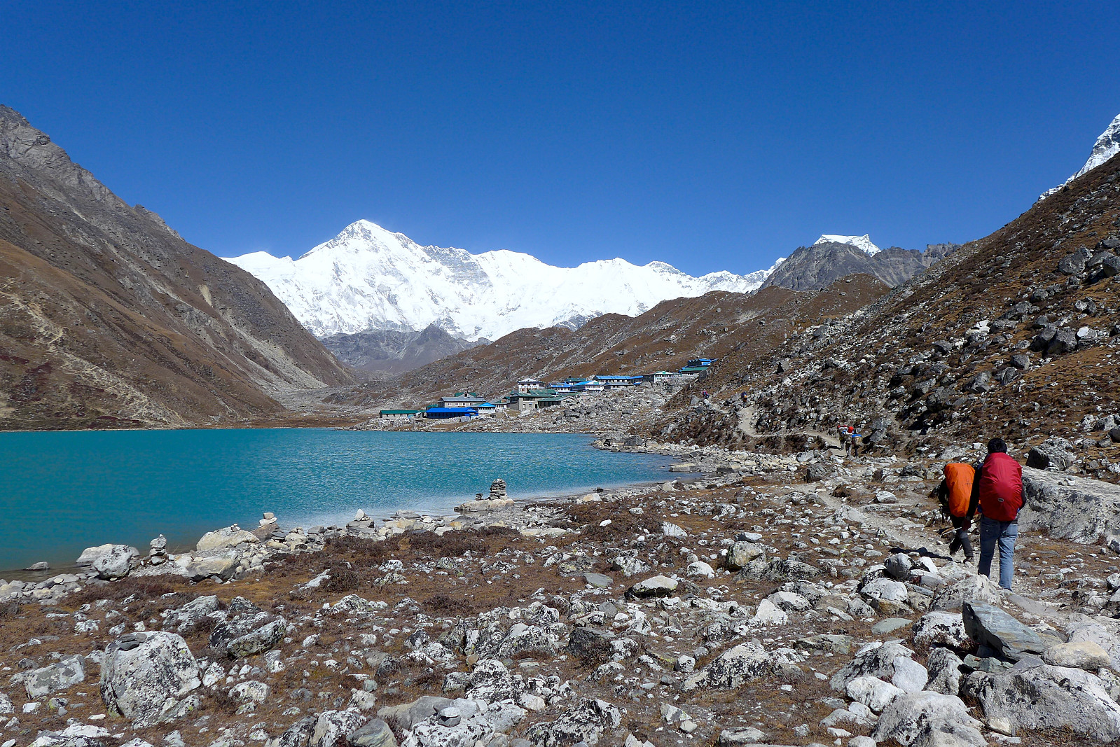
24th October: Gokyo Ri
The plan was to get up and drink some tea and eat biscuits at 5am, and be ready to start the 600m-ascent up Gokyo Ri at around 5.30-5.45ish. I unfortunately didn’t manage to sleep particularly well despite having proper pillows and a proper bed to sleep in, and several times I noticed I got woken up by odd breathing patterns. I suspect we’d probably all experienced Cheyne-Stokes breathing during the night at some or other point so far on the trip, but I can’t ever remember that it has affected my sleep so much before. Anyway, I woke up again feeling lethargic and not entirely enthusiastic about the walk ahead of us. The rest of the group had been somewhat more efficient and left the tents before 5.30am while I was still in the process of drinking coffee, so we agreed that I’d catch them up with Mingma when I was finished. Seemed fairly reasonable since the others had generally been going a lot slower the previous days anyway. I think it was nearly 6am by the time we left the teahouse. At sea level, 600m of height gain would feel like a piece of cake. Starting at nearly 4800m without having been acclimatized to higher altitudes beforehand, the ascent was heavy-going. Actually it didn’t start so bad. It was almost light as we walked to the foot of Gokyo Ri and I think we went fairly efficiently and ended up overtaking a couple of people within the first 100m of height gain. It was still quite cold since the sun hadn’t risen yet but the pace kept me pretty warm and by the time we had reached around halfway, we’d caught up with the rest of the group.


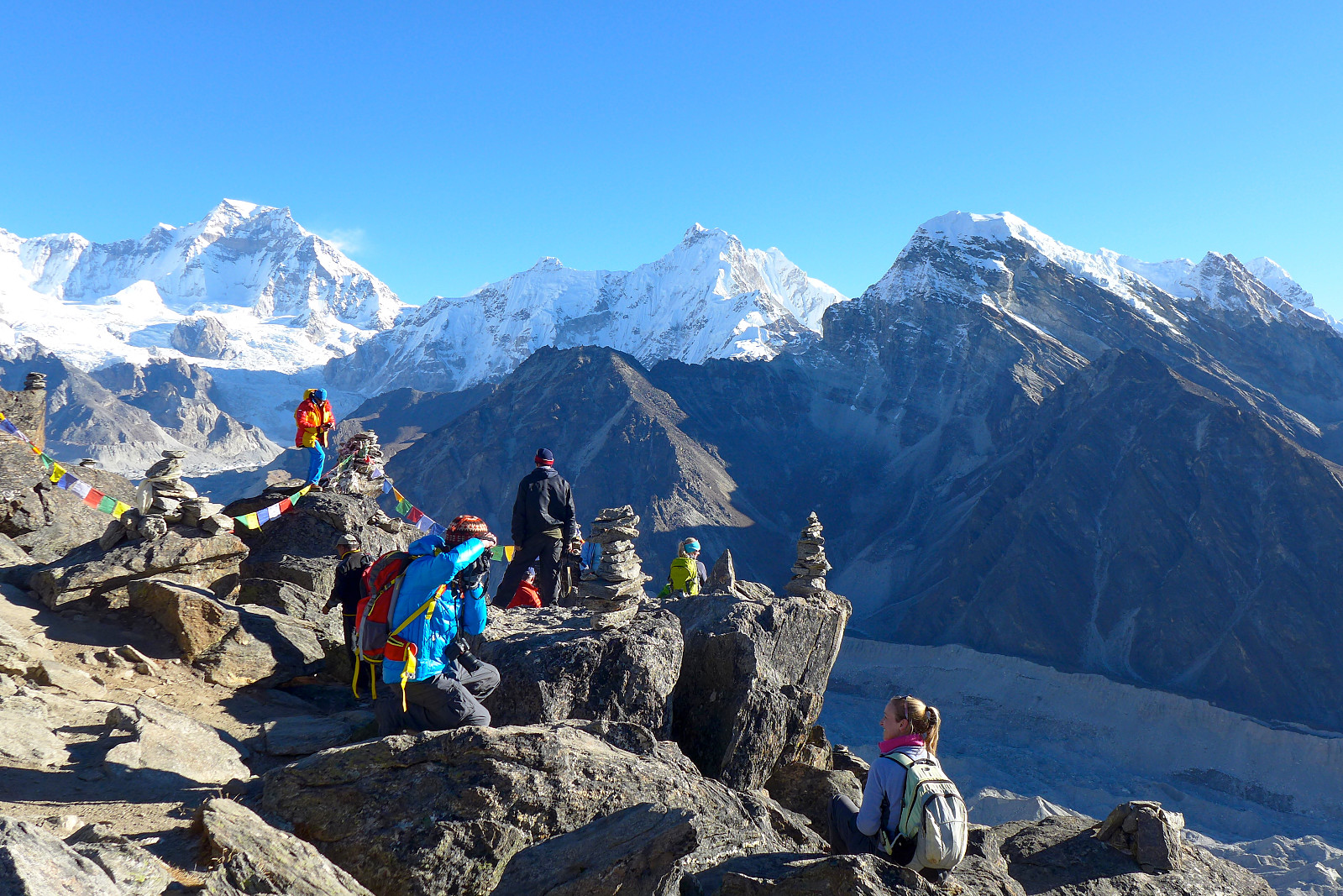
Around the same time it all went a bit downhill and the remainder of the walk up felt like the most exhausting thing I’d experienced in a very long time. Its one thing to feel the altitude, but another thing to suffer from it. This was most definitely suffering. Legs that felt like lead, headache, a bit of dizziness. Not a lot of fun. Just moving one or two steps upward got me breathing as fast as if I’d just sprinted 100m. Ankit apparently felt the same which made me feel slightly better (at least psychologically), but there were several times when I was beginning to have strong doubts over whether I’d actually manage to get up to the top. Tony, Mark and Mike were ahead and must have reached the top of Gokyo Ri a good 10 minutes ahead of us, but to cut a long story short – we all got up (except Carl who had stayed back in Gokyo). Ankit arrived shortly after me, around 7.30amish and Deborah was a while behind so the rest of us had the pleasure of waiting and enjoying the warm sunshine and terrific views of the surrounding peaks. For me the best view is always southwards and across the glacial moraine toward Cholatse and Taboche. Naturally, several team pictures were taken before starting the descent was mentioned. Whilst there I ate some ibuprofen and paracetamol to help get rid of the headache.


Despite having collapsed onto a rock immediately after having arrived at the top, I appeared not to have much of a problem with jogging back down afterwards, so the descent didn’t really take much time. I hadn’t been keen on the early start, but getting a glimpse of the folk who were on their way up under the baking sunshine made me realize that I didn’t at all envy them starting the walk up in daylight! It was around 9am-ish when the majority of us had come down and not too long before we had a proper breakfast, though I wasn’t actually that hungry at the time and concentrated on drinking plenty instead. Now we had a whole day in front of us to recover from the early morning ordeal and get rested for the next longish day which would take us over the Renjo La, a pass at an altitude similar to Gokyo Ri - and down to Langden in the Thame valley on the west side of Kyajo Ri. Its amazing how easy I became adapted to the task of wasting time; despite having literally a whole day to spare I somehow managed to do absolutely nothing without the day feeling incredibly long. On the other hand I’m not entirely sure I actually wanted to do anything else except sleep, and was once again looking forward to bedtime in the hope that this night would be the night I got an amazing night’s sleep. According to Tony, it had been suggested that taking half a tablet of Diamox at bedtime could aid sleeping at altitude, since it helps to even out uneven breathing patterns brought on by the acclimatization process. Since I really didn’t have anything to lose by giving it a go, I willingly accepted a couple of tablets from the group medical box for the next few nights and hoped that it would work its magic.
25th October: Gokyo to Langden
I’d gone to bed the previous evening without too high expectations since I had now almost lost hope of sleeping well, but finally it happened. My dream came true and I’d finally slept for several hours continuously without waking up. And when I did momentarily wake up I also managed to quickly fall back asleep again. Despite having to wake up at 5.30am this morning and start the ascent up to the Renjo La by 6.30am, I was nevertheless feeling human again instead of like a walking zombie. I’ll probably never know if it was the half tablet of Diamox that had done the trick or whether it was a combination of being so completely sleep-deprived and using the Diamox which had more or less made me sleep in the end but whatever, I was in a cheerful mood for the first time in a week.
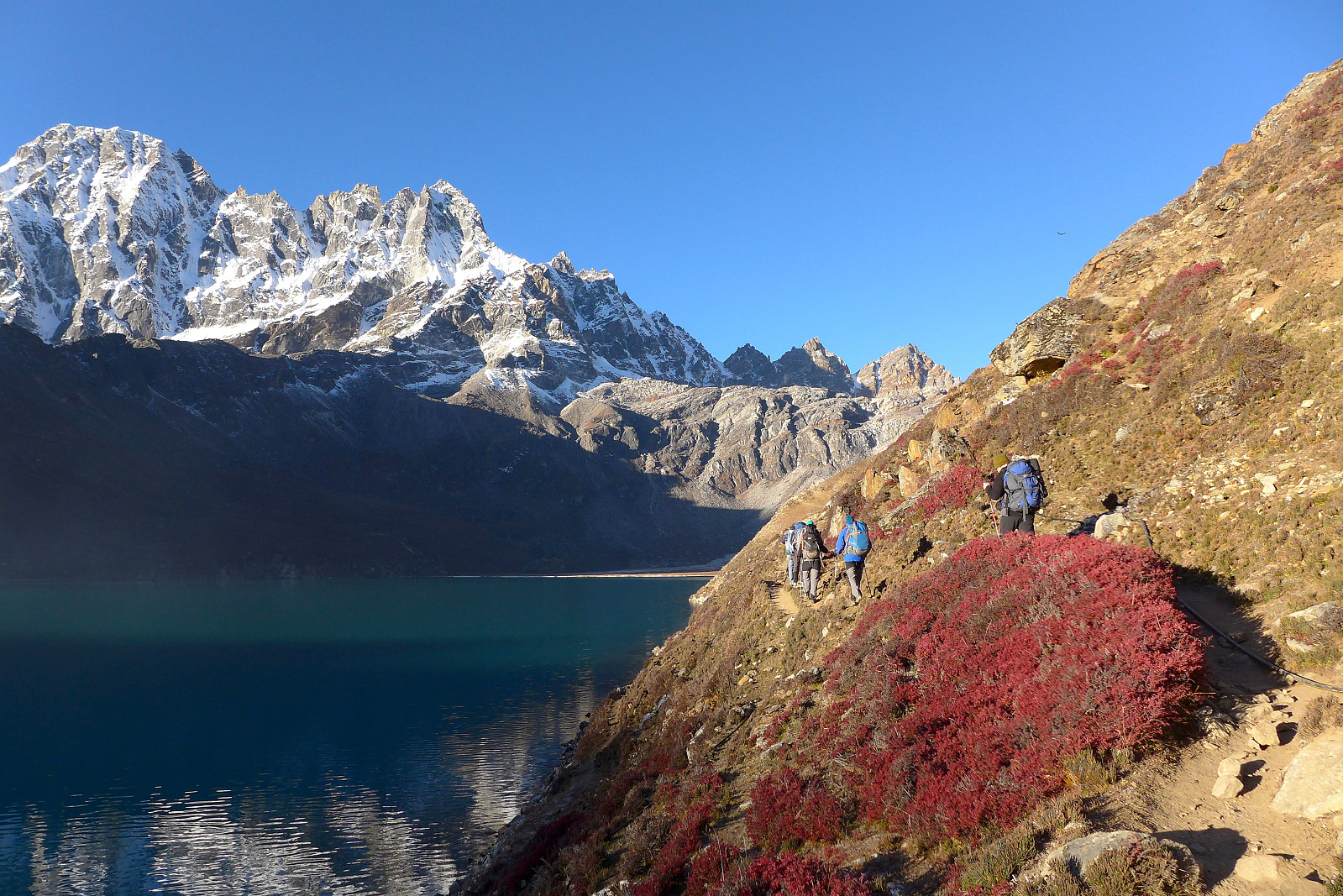


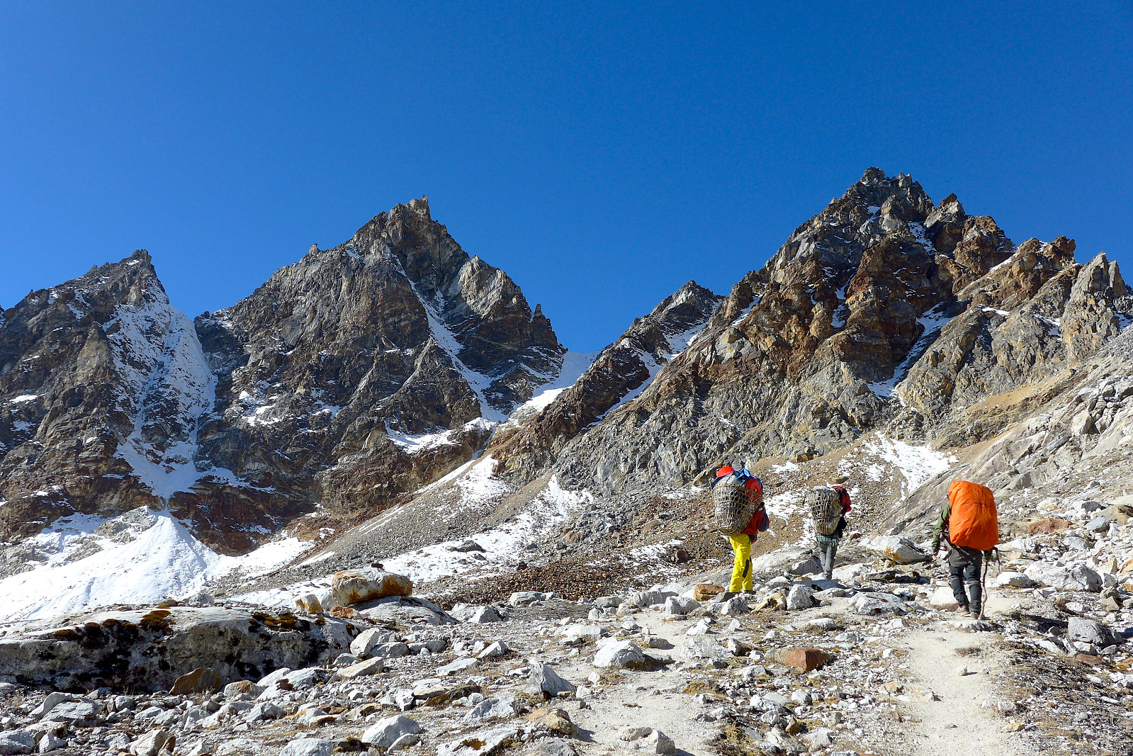
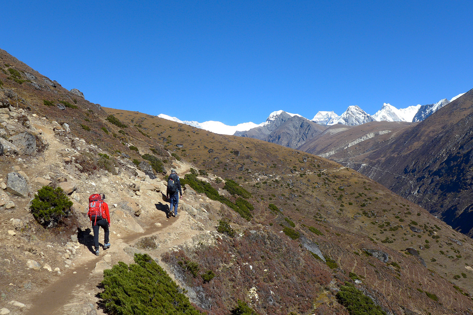
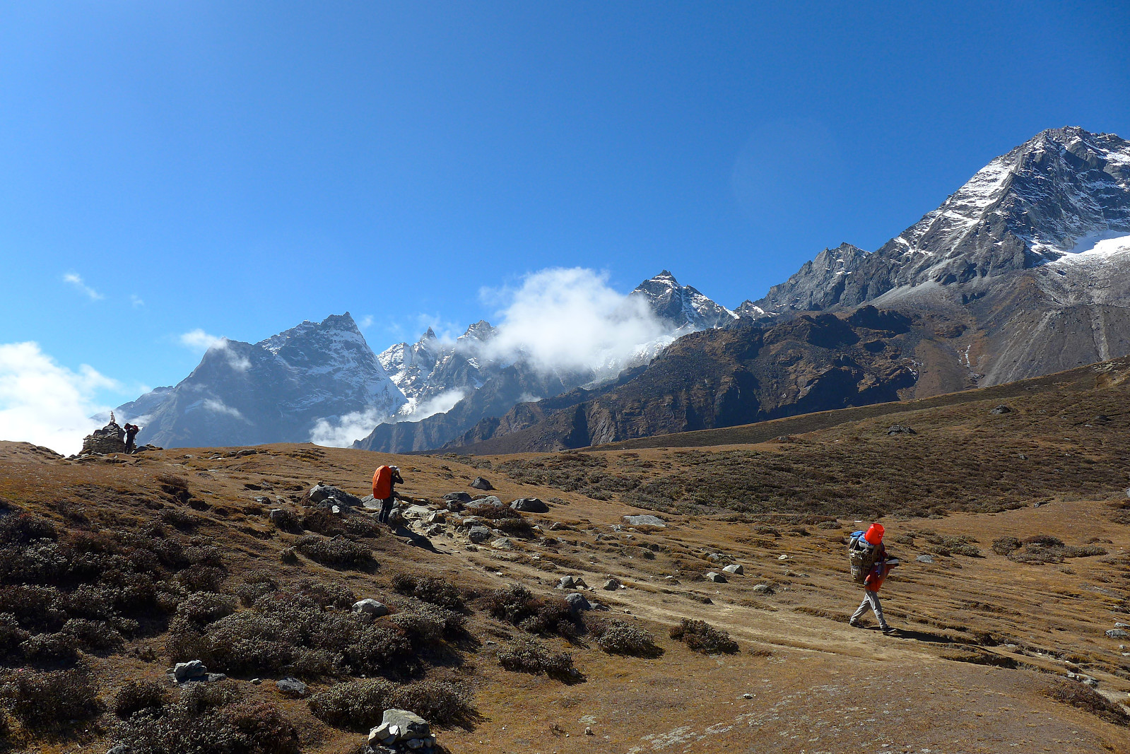
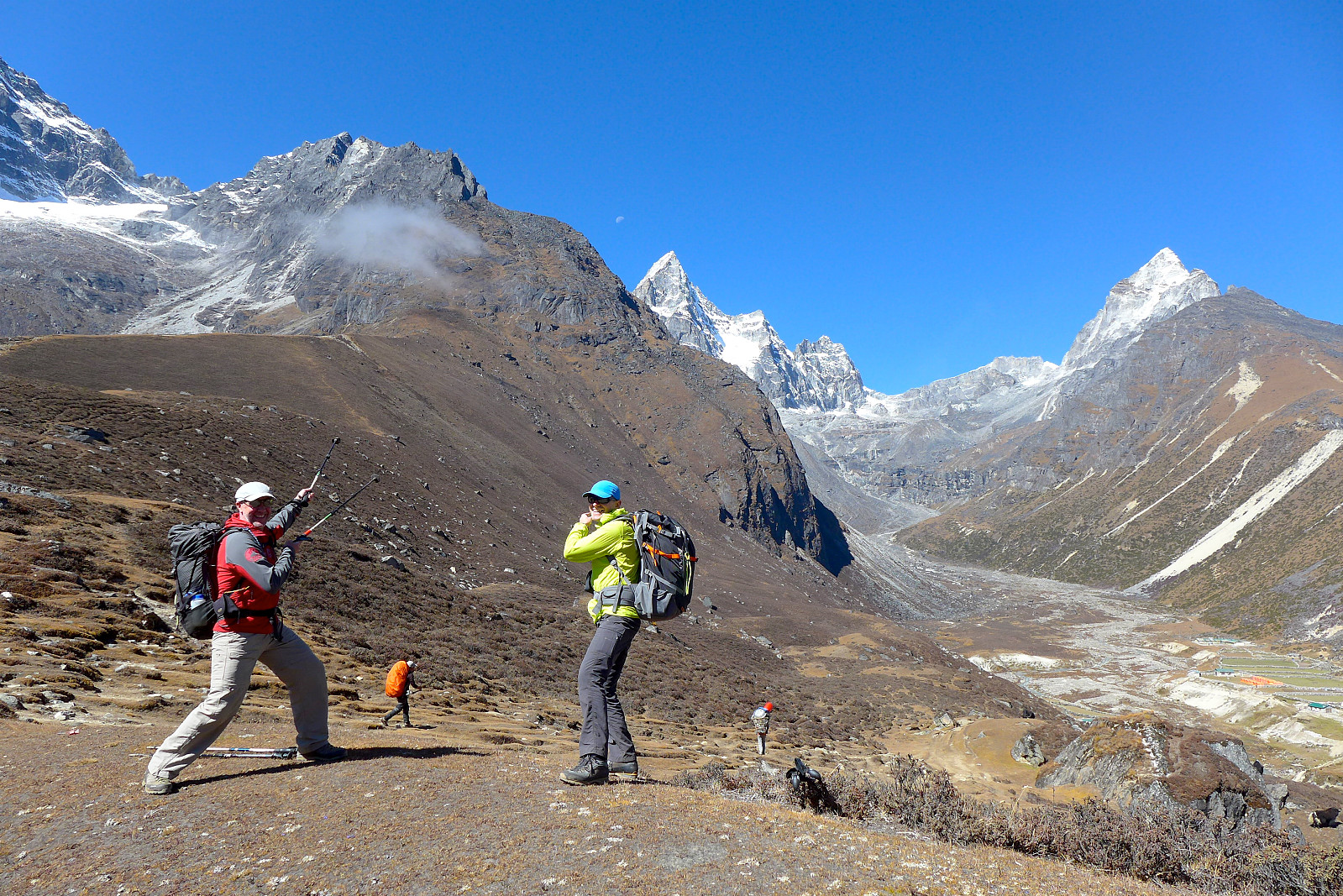
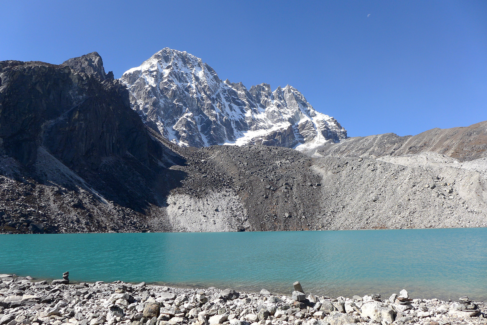
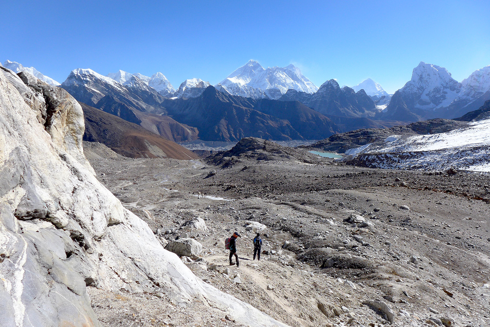
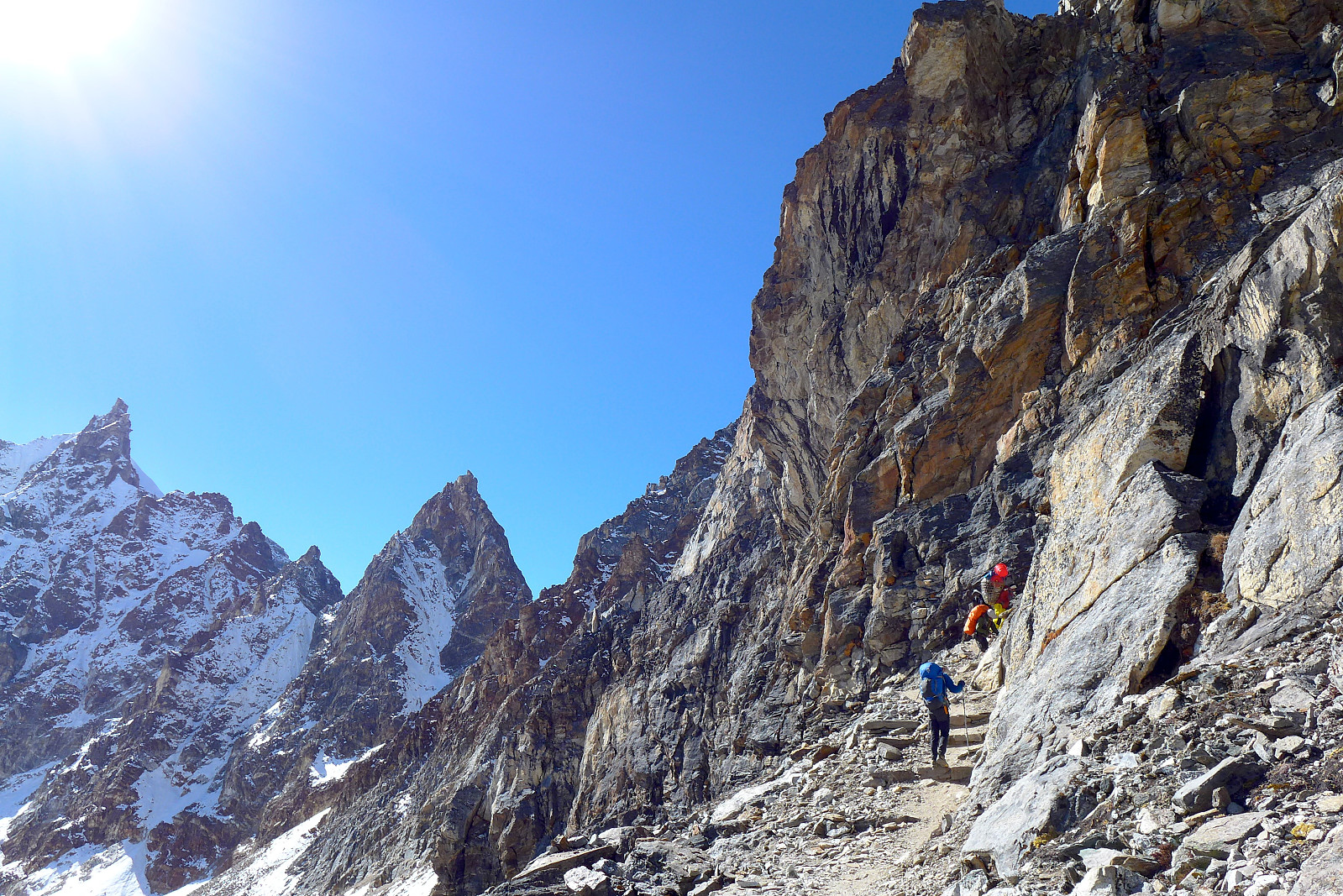
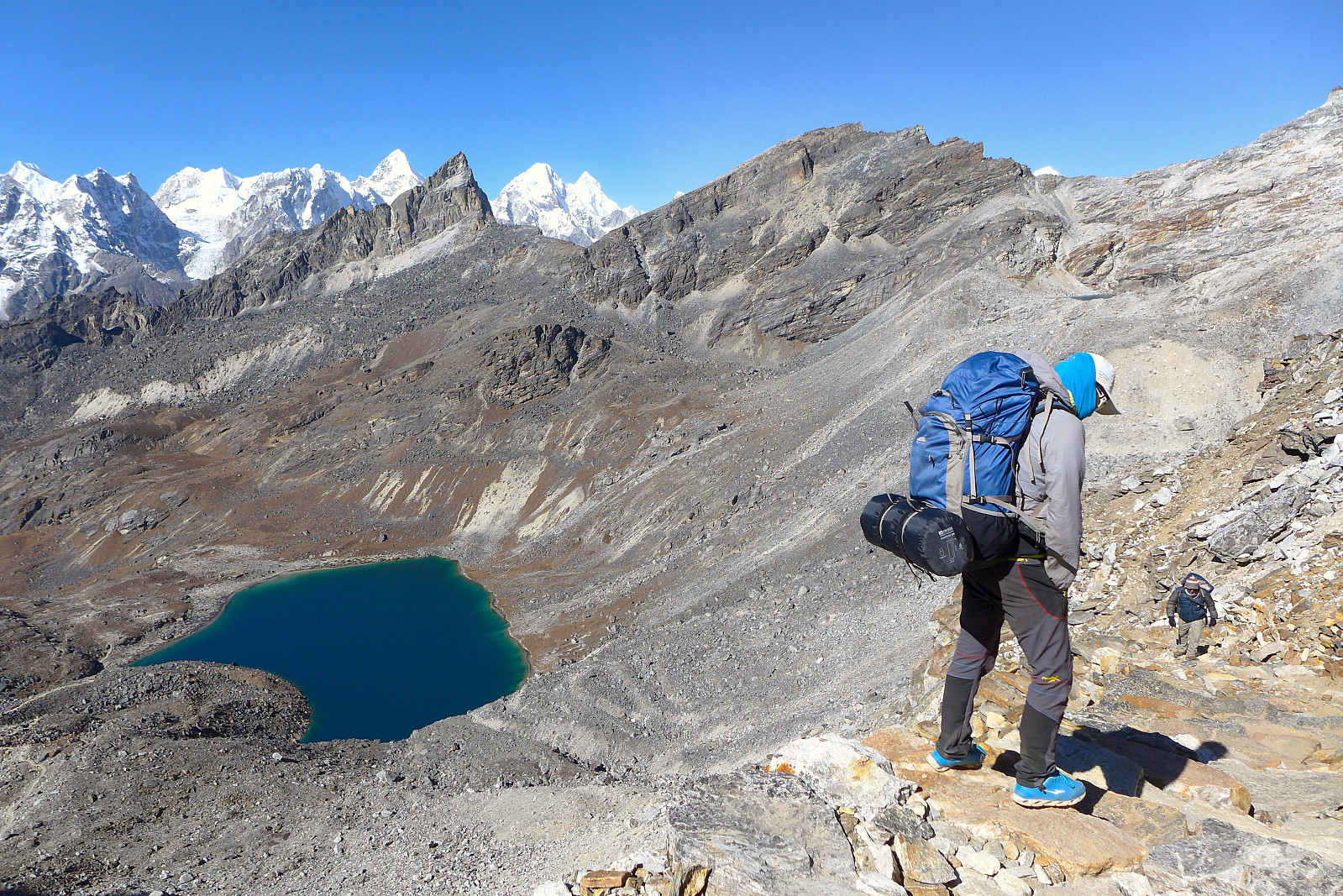
It wasn’t long before we had emerged out of the chilly shade over Gokyo and into the sunshine as we skirted around the bottom of Gokyo Ri by the lakeside. The initial part of the ascent up to the Renjo La was easy and didn’t really rise much for a while. Initially we’d started the day in a group as we’d always done, but after a short 5-minute stop to adjust clothes/drink/put on suncream etc Tony suggested that those who wanted to carry on at their own pace could do so. Relief. It had been a slow and tiring pace to maintain! I ended up walking a short way behind our cook team for the rest of the day who were probably the best company I could have asked for. The ascent up to the Renjo La was scenic and the path was a lot better than I’d expected, but it was still fairly hard work and at times cold. But at least it felt like comfortably hard work today and I didn’t have any doubts over whether I’d reach the pass or not. It was more like a question of when. After the initial pull up the ridge on a somewhat loose and sandy path, the terrain became gradually more filled with boulders, though there was never any scrambling. Behind us we had excellent views towards Everest, which was today exhibiting a fine cloud of spindrift as a result of the high winds. Apart from myself there was only Mike who had caught up and reached the Renjo La with Mani and the rest of the kitchen team and we were eating lunch up at the top of the pass at 9am, some 2-2.5 hours from Gokyo. Mingma came some time after as well but there was no sign of the rest of the group, so after around half an hour of taking pictures and chilling out we decided to start making our way down over the other side of the pass and towards Langden. It was a bit too windy to wait longer. We had Mingma with us anyway so there wasn’t much chance of getting lost. The descent consisted initially of a long series of steep steps. People were coming up to the Renjo La from this side as well and I’m glad we weren’t doing the same. It would have been pretty chilly being on the west side of the pass this early in the day.


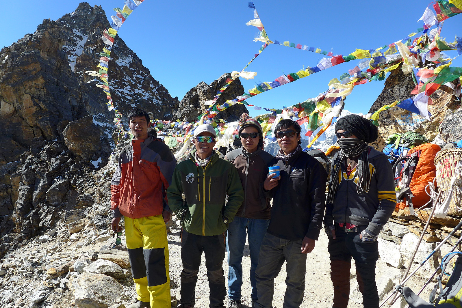
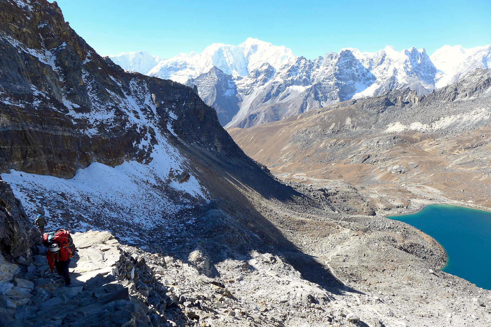
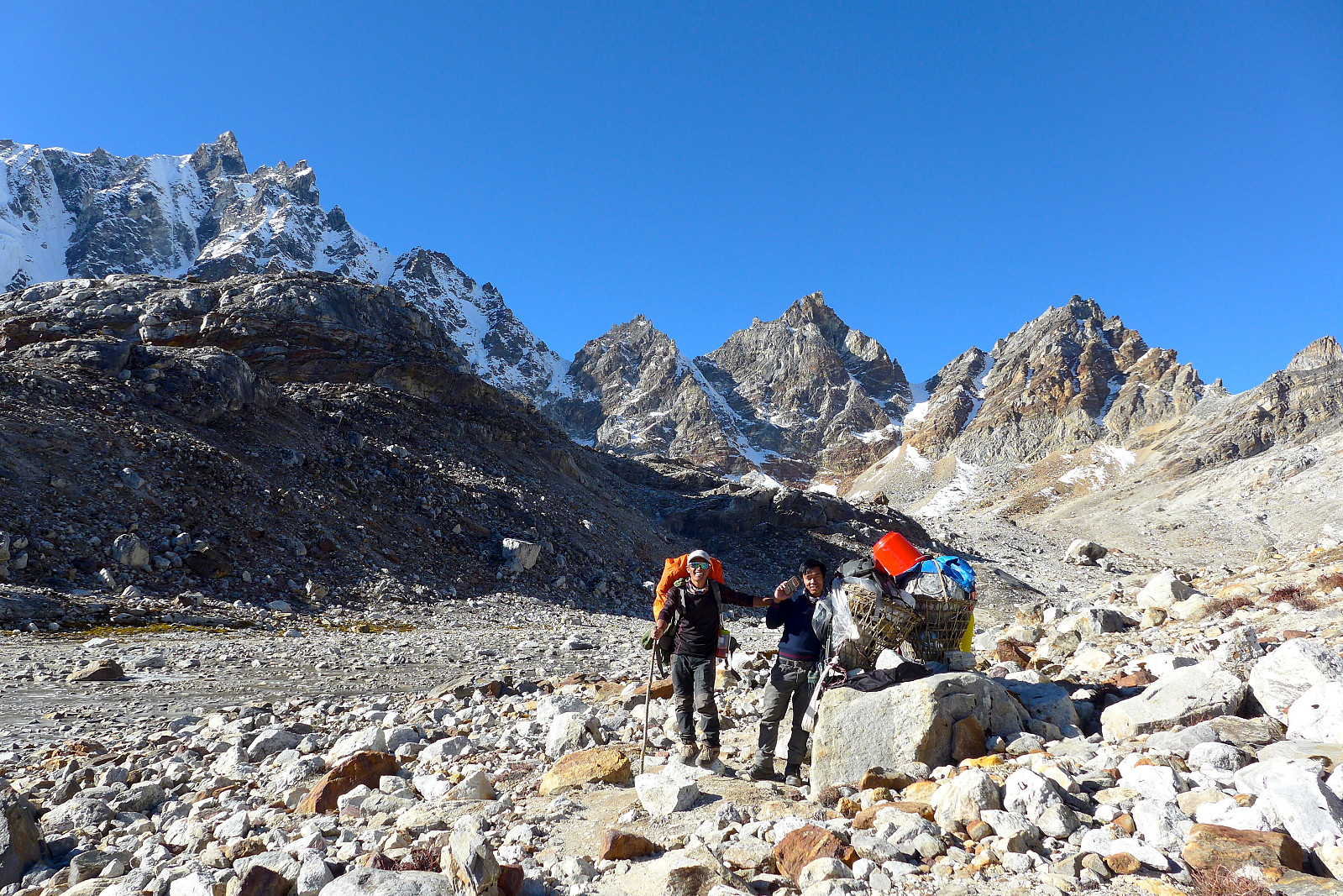
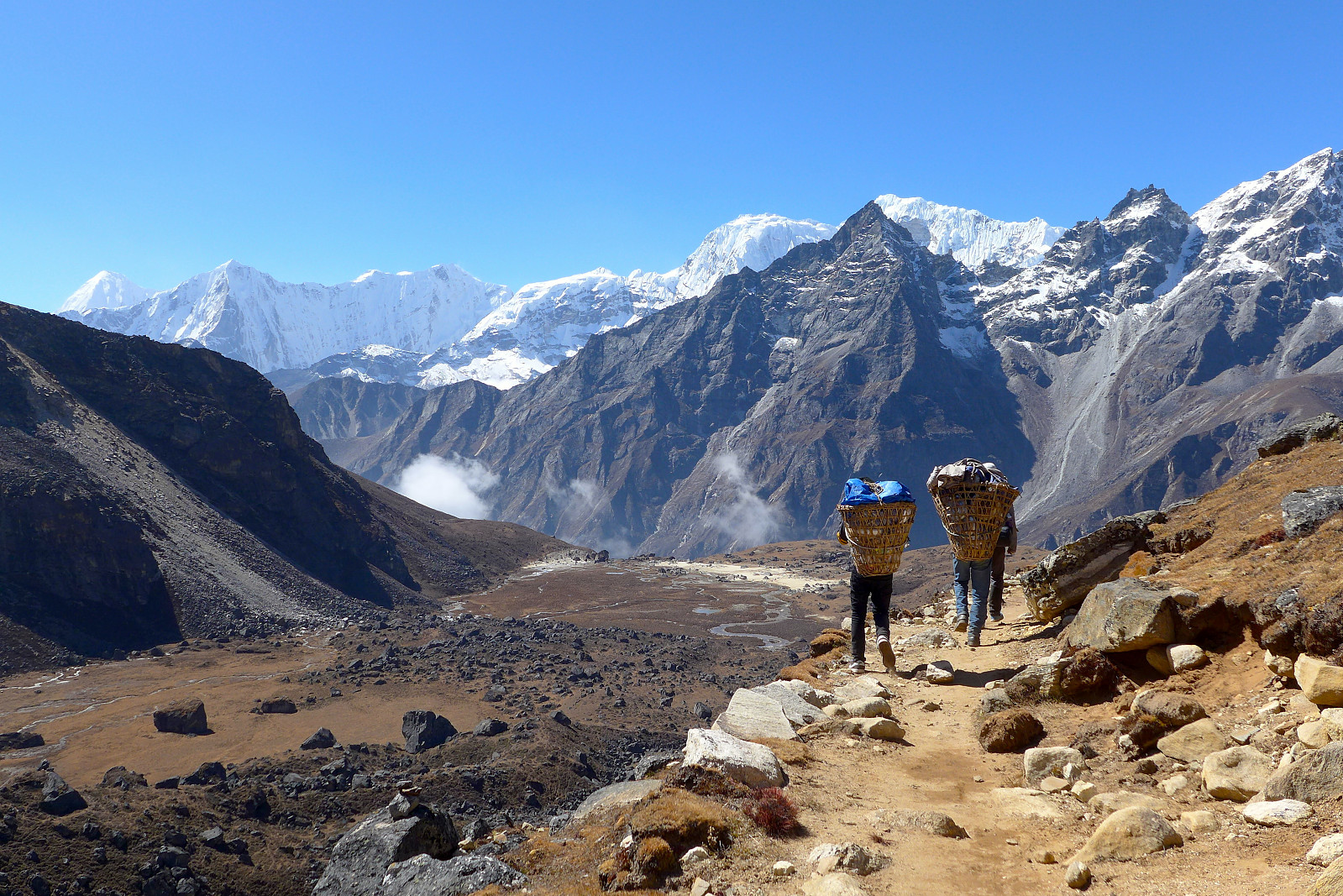
Fortunately it wasn’t long before we’d emerged from the shade and into the sunshine again, and after reaching a lake at the head of the valley, we spent a fair while walking down a fairly easy-angled path, down towards another lake and towards the north side of Kyajo Ri. Eventually there was another steeper descent down into Langden which my knee didn’t appreciate so much, but by that time we were pretty close to the teahouse, which we arrived at before midday. It was quite cool to see Kyajo Ri from this side now – and the snow slopes that we would be ascending from its southern side. It was still impressive to gaze at from Langden, and even though we still had some days ahead of us before the approach to base camp, it felt like we’d made a good deal of progress now since the first few shorts days from Namche Bazaar. Mike and I were at Langden for about 2 hours before the rest of the group arrived, enjoying some awesome noodle soup that Mani had cooked up in the meantime.

It was a slight surprise to be sharing the dining room with so many other people at this teahouse. In contrast to the one we’d used at Gokyo it was almost too full here and a proper squeeze to get everyone around the tables at dinnertime. I was glad to escape as soon as possible, especially with the amount of coughing and nose-blowing which was taking place…..
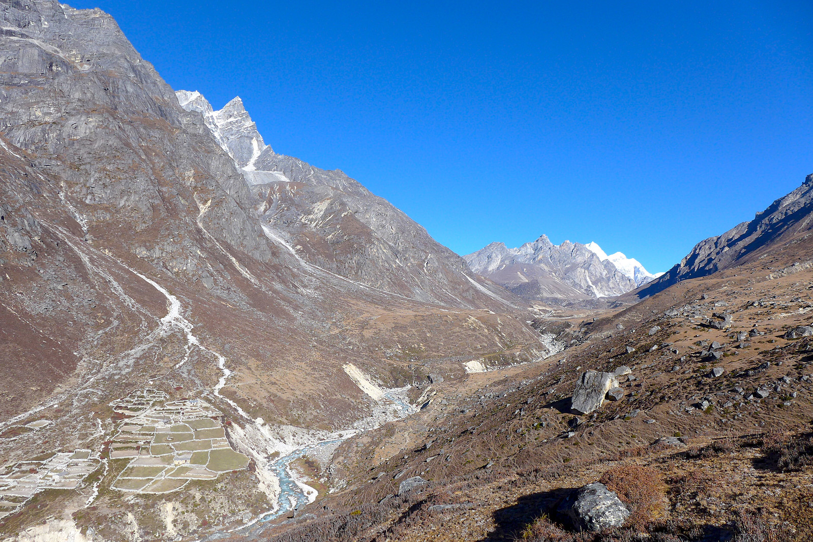
26-28th October: Langden (4360m) -Thame (3800m) –Mende (3730m)
The final two days of trekking around the mountain consisted of us walking down the picturesque Thame valley, first staying in Thame itself, which seemed like a very urban and populated place in comparison to where we’d been for the past week; and then the following day we continued towards Mende, a hamlet which was partly situated on a ridge at the entrance to the Kyajo Drangka, the hanging valley on the south side of Kyajo Ri. Our time at Thame was relatively comfortable and the last chance to have a shower and/or charge up mobile phones at the teahouse. Mende was more or less a collection of buildings and lots of fields. Our mess tent made its first appearance here, so it was just a case of getting used to eating out in the cold now! It had been a bit of a long-winded acclimatization phase to get here, but finally we’d be making our way to Kyajo Ri base camp the next morning and a step nearer to actually making an ascent of the peak.


User comments