
Borga (26.12.2015)

Geschrieben von HHauser (Helwig Hauser)

| Startpunkt | Haugland school (80m) |
|---|---|
| Endpunkt | Haugland school (80m) |
| Tourcharakter | Bergtour |
| Tourlänge | 4h 30min |
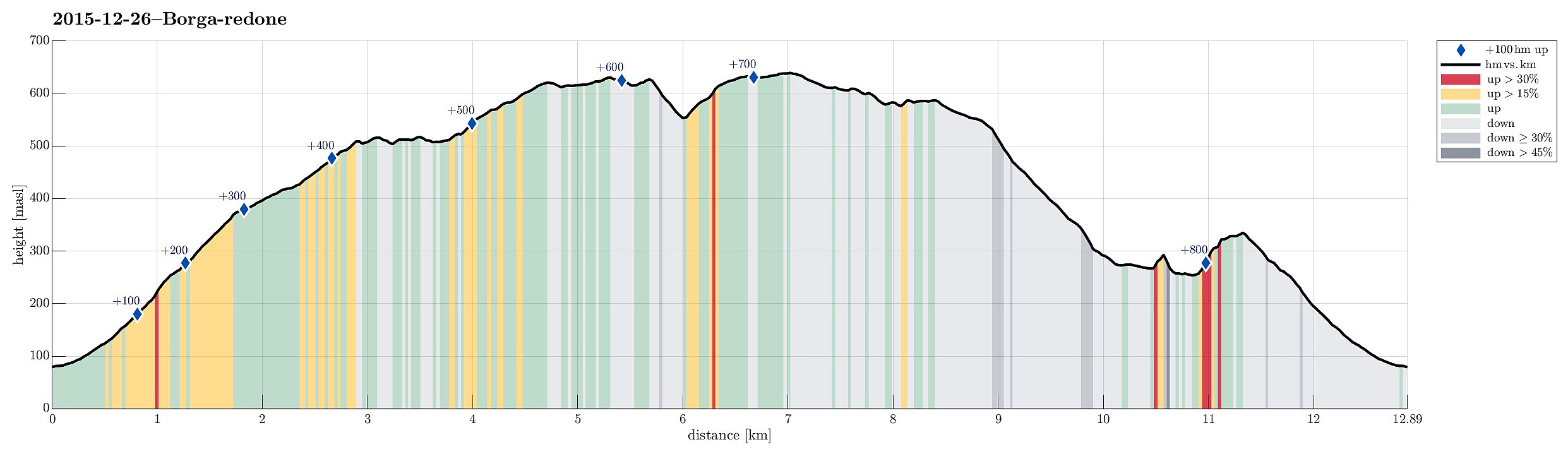
| Entfernung | 12,9km |
| Höhenmeter | 860m |
| GPS |
|
| Besteigungen | Borga (634m) | 26.12.2015 |
|---|---|---|
| Grønetua (642m) | 26.12.2015 | |
| Såtbotshaugen (518m) | 26.12.2015 | |
| Besuche anderer PBE | Henrik Krohns utsikt (590m) | 26.12.2015 |
| Vikinghytten (586m) | 26.12.2015 |
Trip Summary
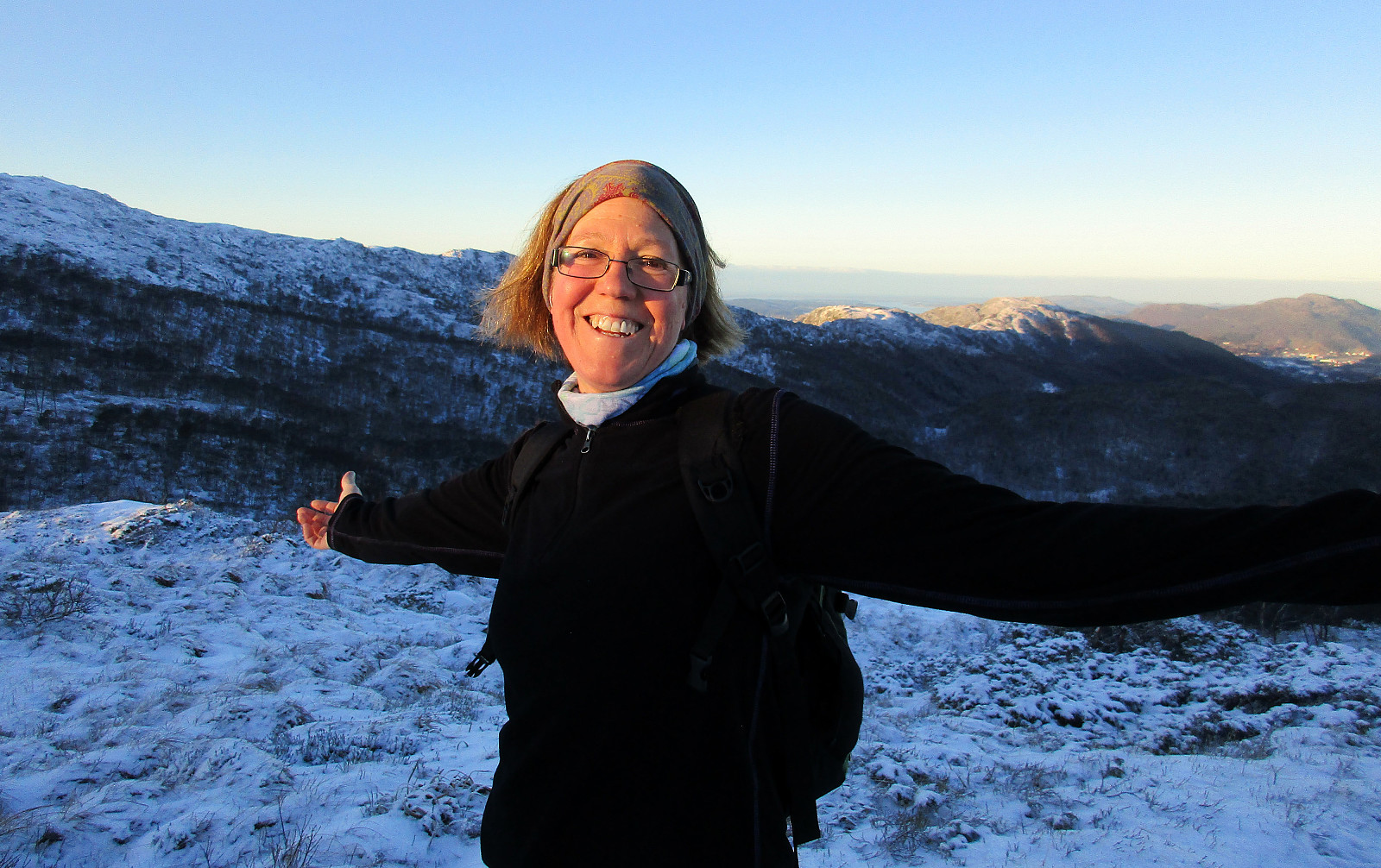
We followed E16 until the exit to Gaupås, continuing first in southeastern direction along Gaupåsvegen, before turning right, following Kvamsvegen for a short part, connecting to Haugland. There, we parked near Haugland school and started walking from there. First, we approached a farm in a place called Botn. Originally, we had planned to find the path that would lead next to Nedste and Øvste Åreina, conneting to a path that should have brought us up Vardegga. For that, however, we should have taken the slightly more northern path up Botn. Instead, we got into Kløvedet and then to Langedalsrustene---the path that we first had thought to take back down. Accepting that we had changed the orientation of our hike, we continued to the ridge that would eventually bring us to Borga, far further south. After a while, we passed the tree line and with that entered a beautiful winter world of snow with the blue sky on top! :-) We passed Såtbotshaugen and continued via Flatafjellet, connecting to the spot, where a path from the east, from Sauhola, comes up. Instead of following this path, we continued in southern direction, towards Borga (passing by Såta on its eastern side). We soon reached the heights of Borga and continued all the way towards the "top" of Borga (most of Borga is very flat on the top and identifying the top is not at all straight forward). From the top of Borga, we walked a little to the southwest---mostly to see, how steep the western side of Borga really is. It seemed possible to get down there and over to Grøntua, so we decided to do just this. We walked back a bit towards the north in order to find a good slope down from Borga and towards Grøntua through Skitnedalen. All this was easy to go, even without a path, and so we ended up on the ridge towards Grøntua after this short passage. We then continued to Grøntua and from there further northwards along Vardegga to Vikinghytten, where we made a short rest. We then followed Vardegga for a bit more, before finding the path down towards Øvste Åreina. While this was easy to find, we then took the wrong path in the valley---instead of taking the path on the left (on the northern side of Øvste Åreina), we walked over two small bridges and ended up on the other side. We still tried to go in the right direction (towards northeast), but we had to understand that (near Fossen) the valley became too narrow and there wasn't really a reasonable opportunity to cross the stream there. To still get back, we started to climb into the forrest (in eastern direction), crossing a small ridge this way and getting down into the next valley (Nautdalen, Nedste Åreina). We crossed Nedste Åreina and thought then that it would not be far to connet back to the path that we had taken up Borga. Accordingly, we continued into the forrest from Nedste Åreina, mostly in eastern direction. Eventually, it was a little longer than expected to get back to the path that we had taken up. Once back there, we returned on this path that we had taken already in the beginning. All in all, this hike was just perfect in order to exploit the one of only marvelous winter day, this Christmas! :-)
Photos
Selected photos are available as Google+ photo album.
Useful Resources
Web page WestCoastPeaks.com provides useful information about Grøntua.


Benutzerkommentare