
Hike around Baugtveit with Høgstefjellet (12.10.2014)

Skrevet av HHauser (Helwig Hauser)

| Startsted | Baugtveit parking (180moh) |
|---|---|
| Sluttsted | Baugtveit parking (180moh) |
| Turtype | Fjelltur |
| Turlengde | 3t 00min |
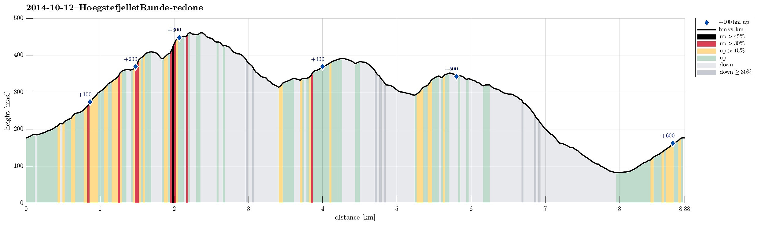
| Distanse | 8,9km |
| Høydemeter | 618m |
| GPS |
|
| Bestigninger | Høgstefjellet (464moh) | 12.10.2014 |
|---|---|---|
| Nordgardsfjellet (355moh) | 12.10.2014 | |
| Tellevikafjellet (395moh) | 12.10.2014 | |
| Andre besøkte PBE'er | Baugtveit p-plass (180moh) | 12.10.2014 |
| Tellevikafjellet søyle (390moh) | 12.10.2014 |
Trip Summary
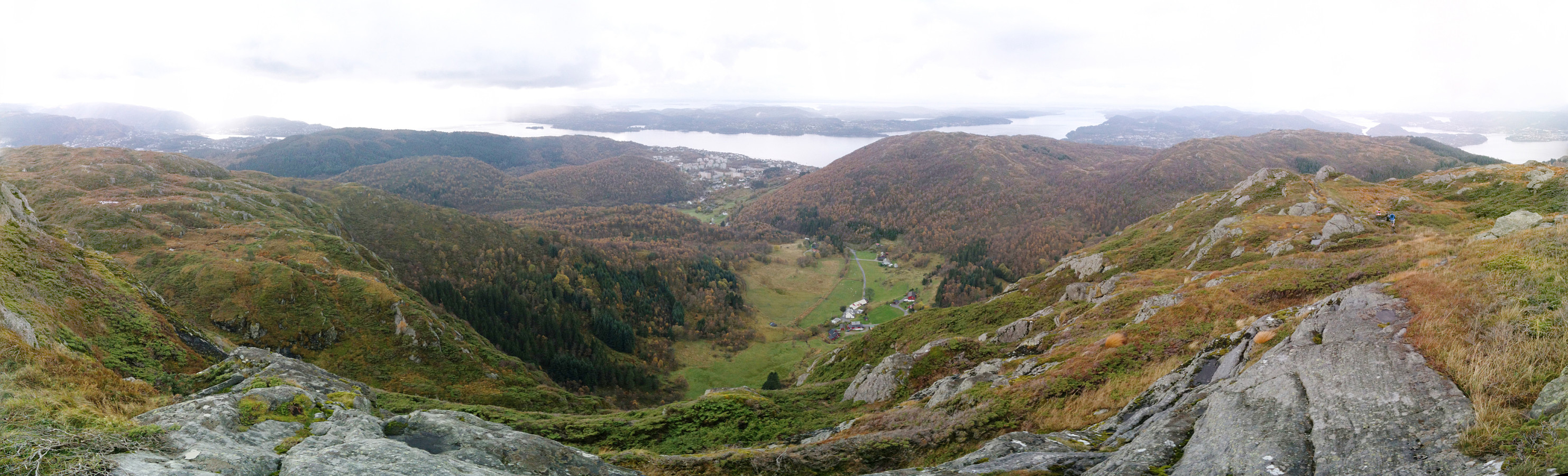
We started from the parking place in Baugtveit (to right, right after driving up the steep road towards Baugtveit) and walked first along Huseberget and up towards Baugtveitgotene, then around Midtfjellet, and up to Høgstefjellet. From the beginning, this was a very wet hike -- and slippery in some places (due to the recent rain). We then continued northwards, via Baugtveitstemma up to Tellevikafjellet. From there, we went down to Salhusskaret and up, again, to Nordgardsfjellet. From there we continued on the path and down to Hitland (lowest point), before we walked to road up, again, to get back to the car. All in all, it was fun to make this hike (several tops and still well doable without being too straining). :-)
Photos
Selected photos are available as Google photo album.
Useful Resources
Web page WestCoastPeaks.com provides useful information about Høgstefjellet, Tellevikafjellet, and Nordgardsfjellet
and also Petter Bjørstad has a useful page about Høgstefjellet.


Kommentarer