Archiv - Nach Datum
Archiv - Nach Aktivität
-
Andere Wintertour (8)
- Schneeschuhtour (8)
-
Fußtour (33)
- Bergtour (12)
- Glacier travel (1)
- Wanderung (20)
Archiv - Nach Geografie


Gesammelte Listen
-
Norges 1000 største fjell målt i primærfaktor
(6/1000)
 0%
0%

Sylan_2020_all_days
- Datum:
- 10.08.2020
- Tourcharakter:
- Wanderung
- Tourlänge:
- 71:02h
- Entfernung:
- 153,0km
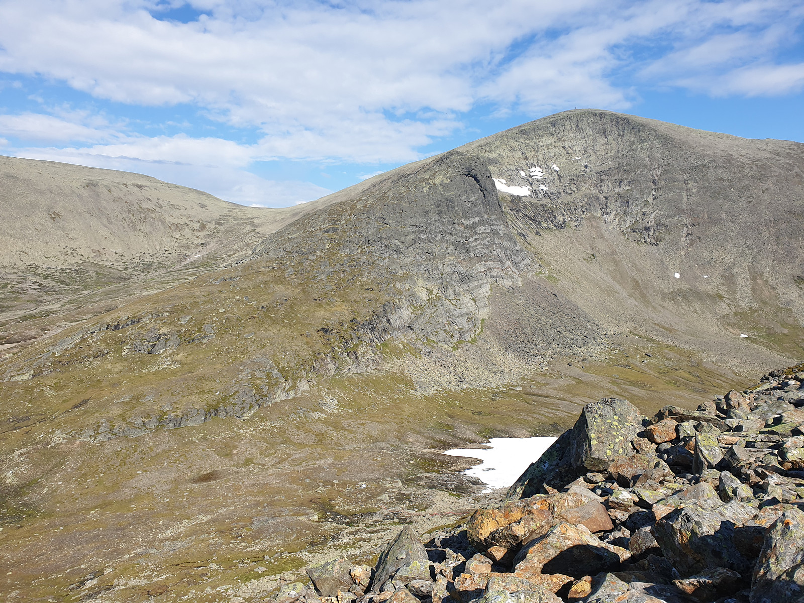
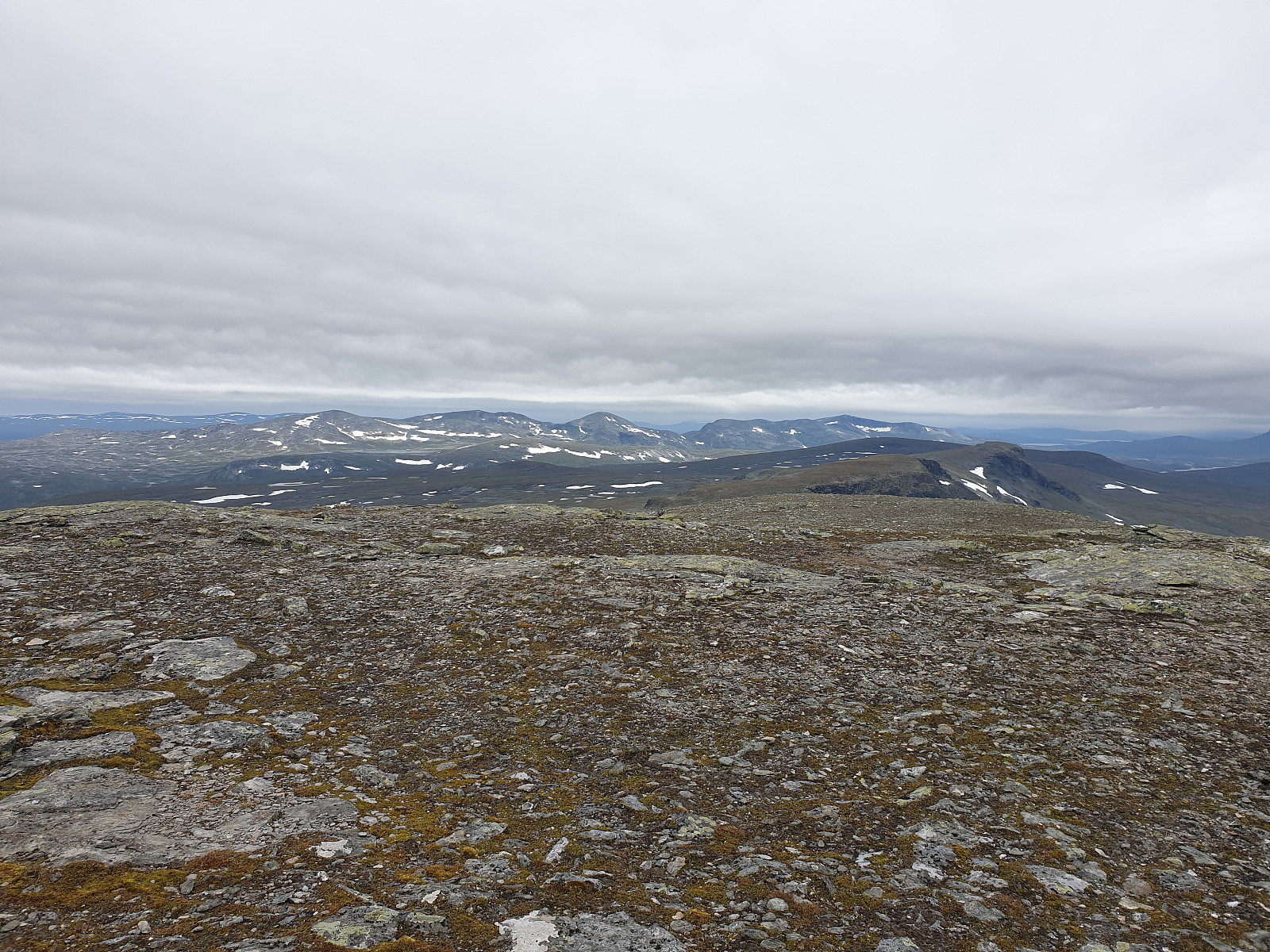
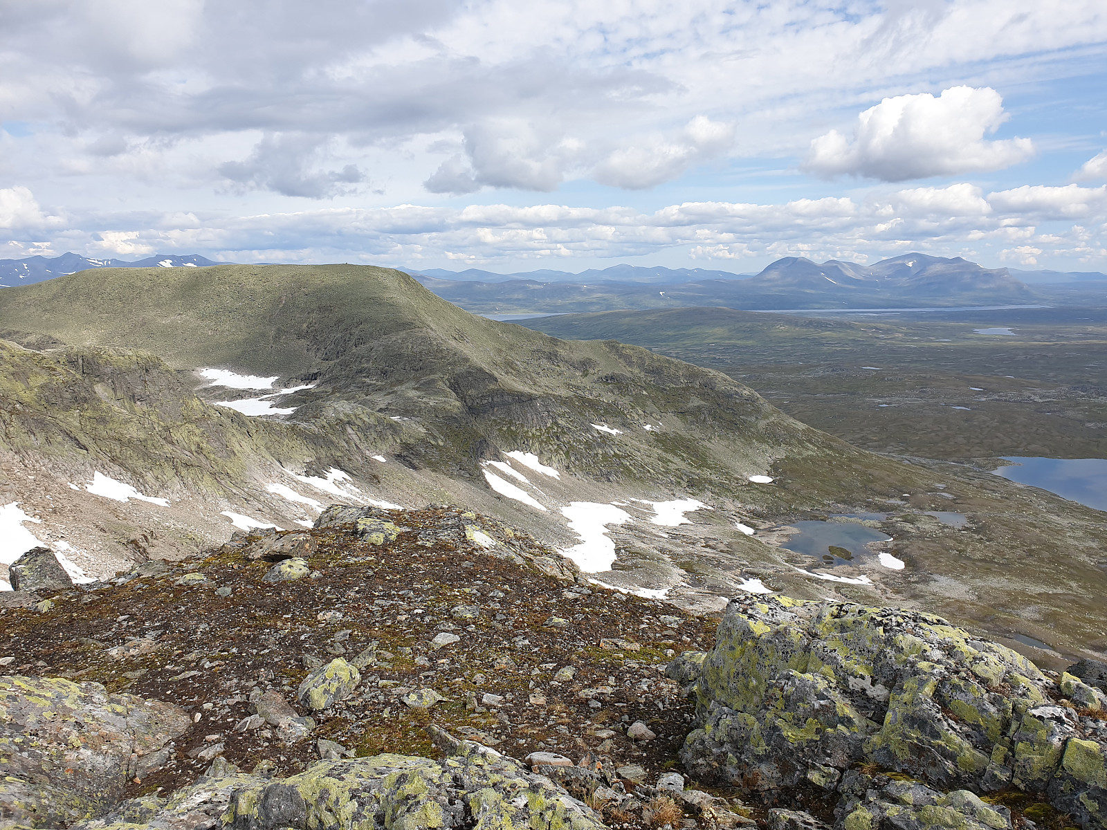
 12 days vacation trip in Syl mountains. Starting weight of my backpack was 35kg and initial plan maximum was to finish tour in Ås or at least Ramsjøhytta with all peaks in Sylan massive together with Fongen on the list. However, my tempo was slower than expected (traveling with finger on the map is simpler), so I decided to finish trip on Nedalshytta. Unfortunately, whether collapsed for the last days and I had to back from my way on Storsylen ridge. Maybe next time ;-)
Some discoveries:
1. 0.3l of bensin is enough for 7-9 days
2. maps are a bit inaccurate (especially about streams)
3. if map is showing small slope based on 10m contour lines it does not always mean easy way (on Predikstolen western face, slope seems to be 10 degree, while it is like 5 meters wall, 20 meters flat, 5 meters wall, >>>
12 days vacation trip in Syl mountains. Starting weight of my backpack was 35kg and initial plan maximum was to finish tour in Ås or at least Ramsjøhytta with all peaks in Sylan massive together with Fongen on the list. However, my tempo was slower than expected (traveling with finger on the map is simpler), so I decided to finish trip on Nedalshytta. Unfortunately, whether collapsed for the last days and I had to back from my way on Storsylen ridge. Maybe next time ;-)
Some discoveries:
1. 0.3l of bensin is enough for 7-9 days
2. maps are a bit inaccurate (especially about streams)
3. if map is showing small slope based on 10m contour lines it does not always mean easy way (on Predikstolen western face, slope seems to be 10 degree, while it is like 5 meters wall, 20 meters flat, 5 meters wall, >>>
Spring ascent on Snota
- Datum:
- 18.05.2019
- Tourcharakter:
- Wanderung
- Tourlänge:
- 15:49h
- Entfernung:
- 29,7km
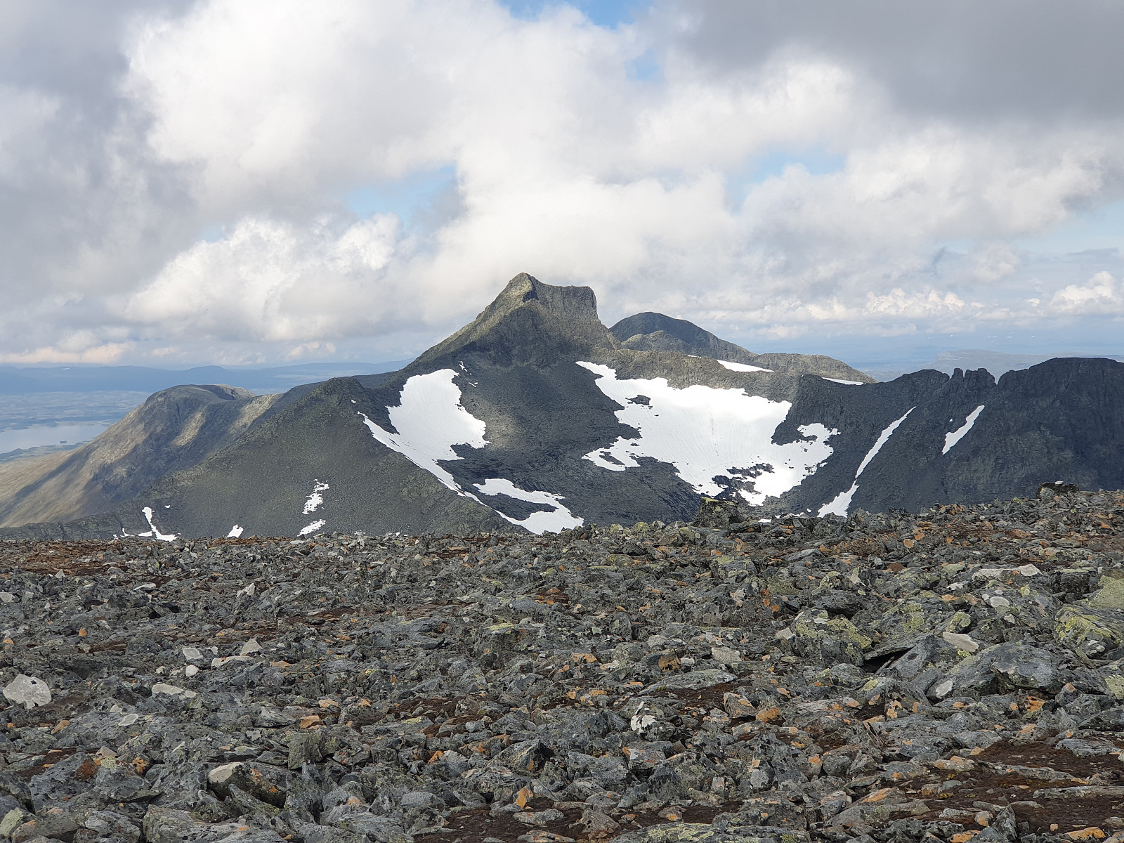
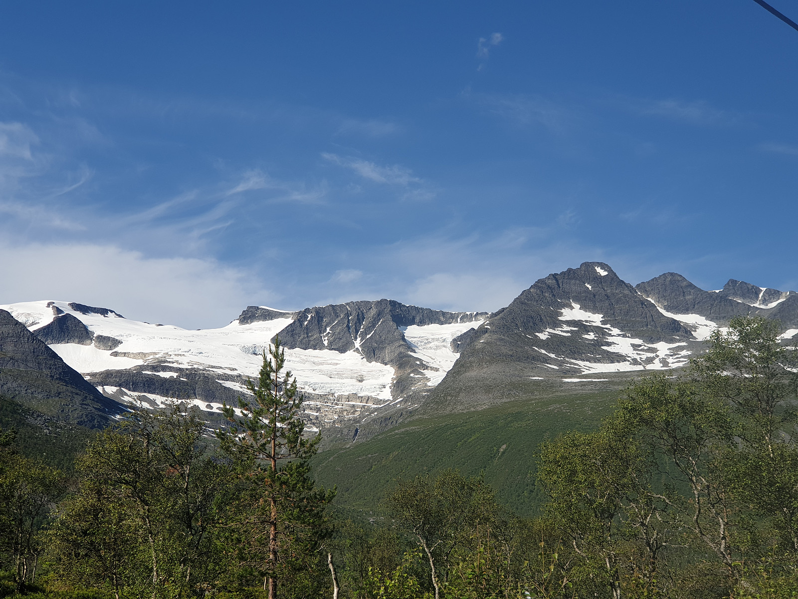
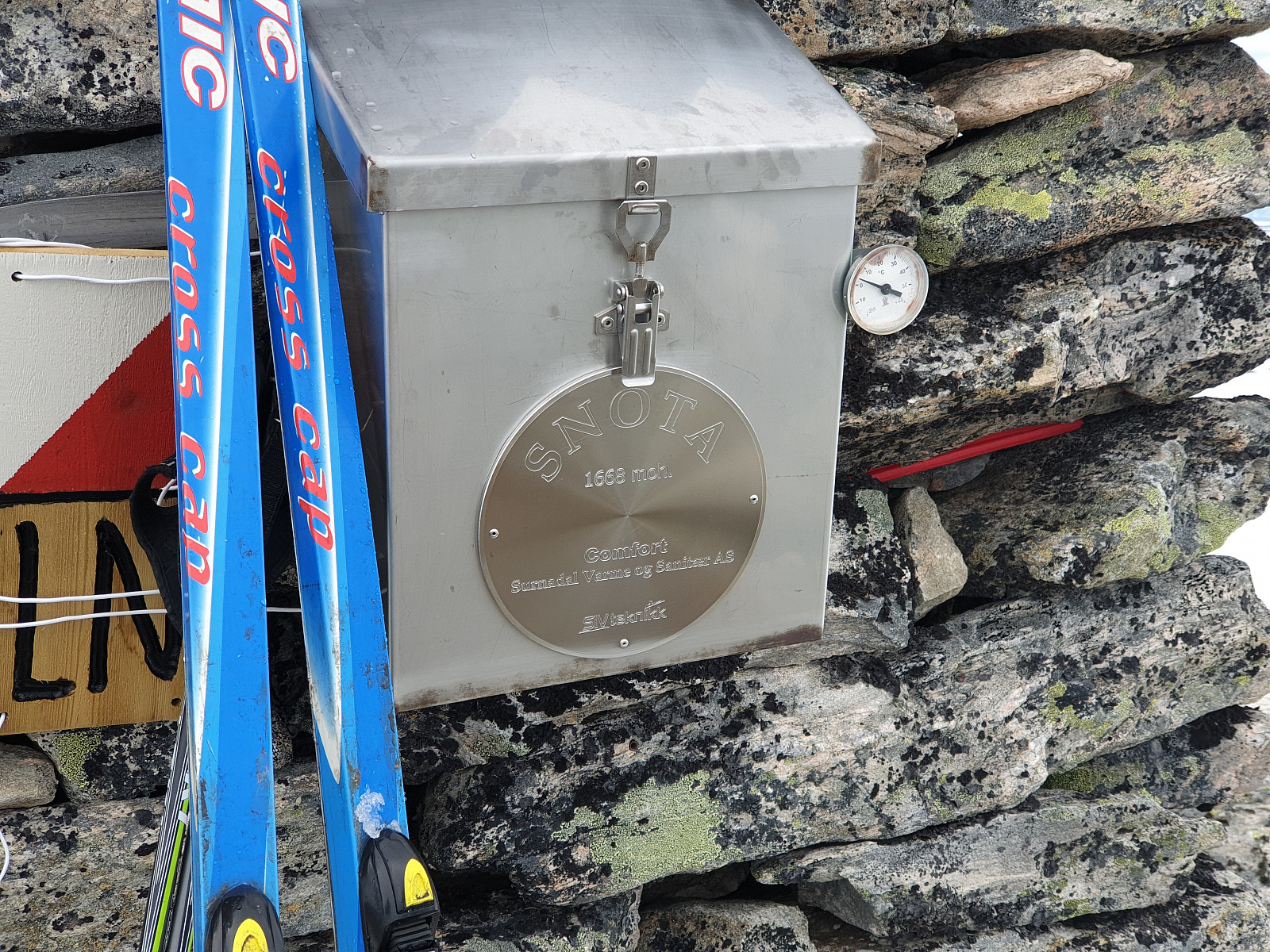 When I have looking for a good trip during long May weekend, my choice fell on the Snota.
The plan was to reach Snota within a single day trip starting from and back to Vindølbu cabin ( a cabin I have reach a day before ).
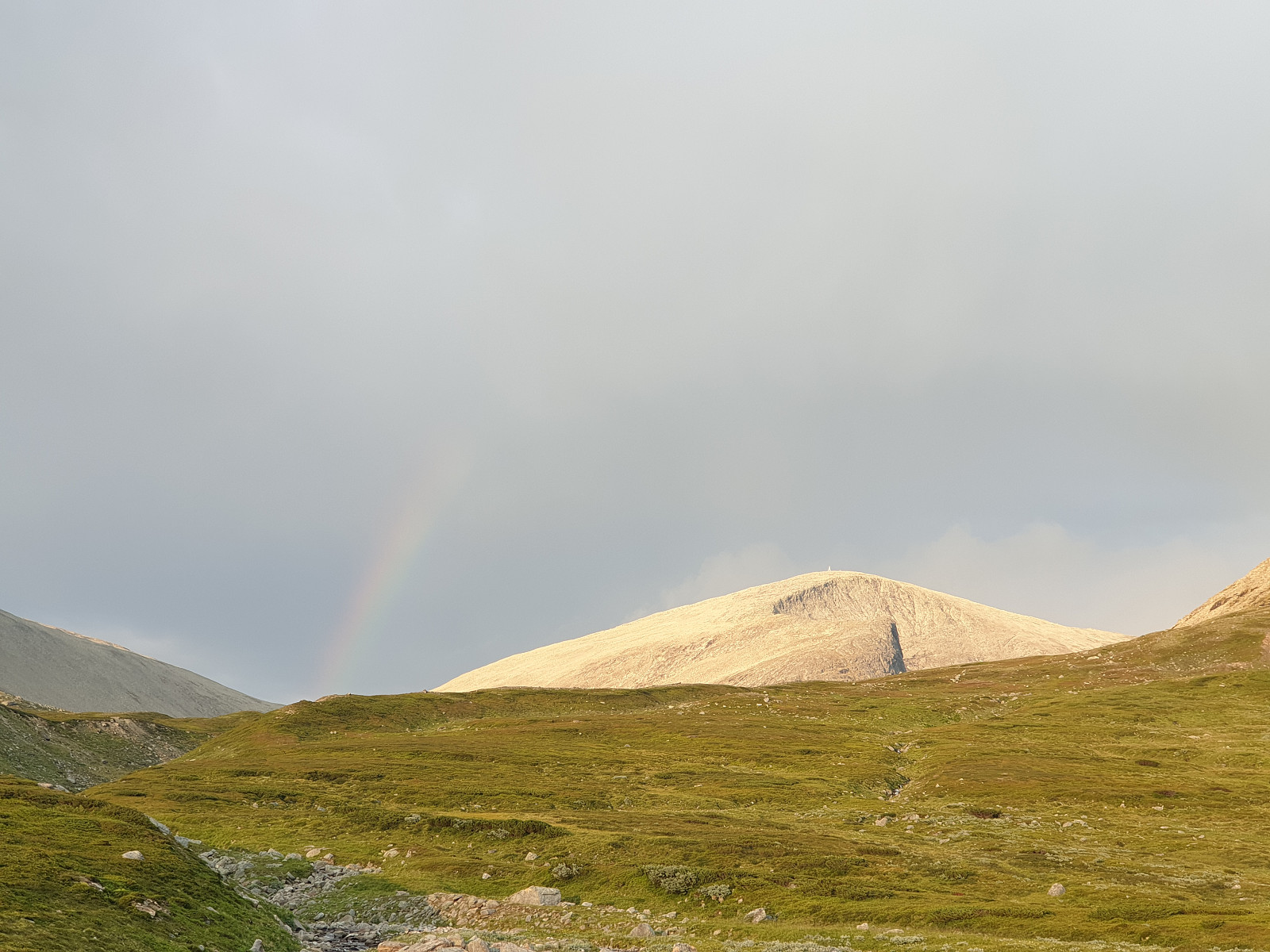
The start from cabin at the 9am, using the road and further path to Vassdalsvatnet lake. Short break, wear the polar and jacket (stronger wind and a bit colder than in the valley), and continue trip by crawling on the rocks of the northern-west tail of Snota massive. The ridge was full of snow, so I wear the snowshoes and continues walk on the top. I have reach the summit at 6pm, took a few photos and finally take a rest after 9 hours of trekking. The panorama was vast, so it was easily to seen Sunndalen, all Trollheimen, fjord of Surnadalen as well as the Fongen massive which from more than 100km distance >>>
When I have looking for a good trip during long May weekend, my choice fell on the Snota.
The plan was to reach Snota within a single day trip starting from and back to Vindølbu cabin ( a cabin I have reach a day before ).
The start from cabin at the 9am, using the road and further path to Vassdalsvatnet lake. Short break, wear the polar and jacket (stronger wind and a bit colder than in the valley), and continue trip by crawling on the rocks of the northern-west tail of Snota massive. The ridge was full of snow, so I wear the snowshoes and continues walk on the top. I have reach the summit at 6pm, took a few photos and finally take a rest after 9 hours of trekking. The panorama was vast, so it was easily to seen Sunndalen, all Trollheimen, fjord of Surnadalen as well as the Fongen massive which from more than 100km distance >>>