Kart
Vær for Uranostinden
Denne tjenesten er i øyeblikket ikke tilgjengelig.
Innledning
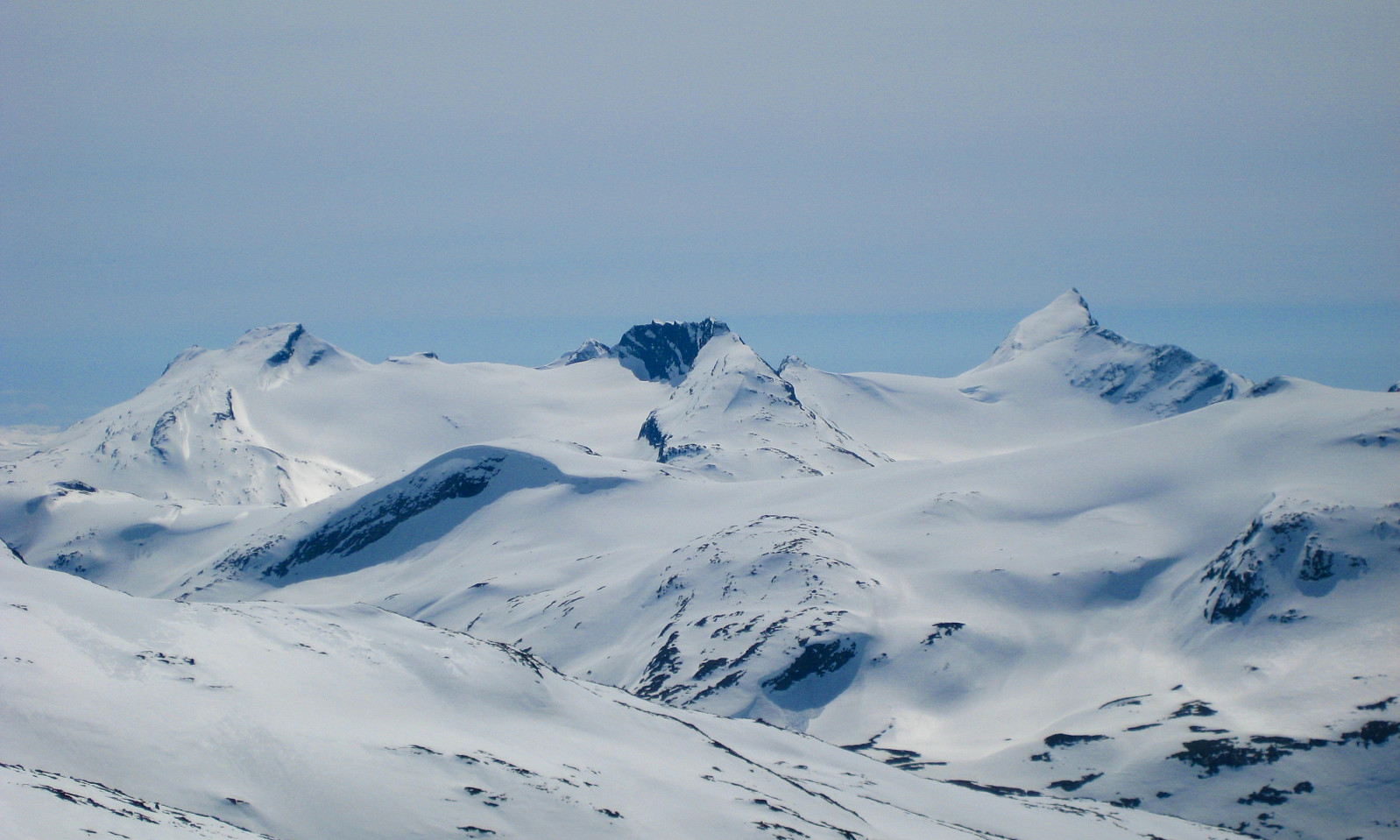
For many mountain hikers, Uranostinden is the most esthetic and beatiful mountain in the Jotunheimen National park. Especially when you drive along the east side of lake Tyin, Uranostinden looks amazing! There are many different routes to choose when you`re going to reach this peak. From east, south, west and north.
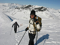
The approach to Uranostinden is quite long, especially in the winter.
In summer the start lies at 1200 metres above sea level and the summit at 2157 metres.
Maps:
- Kartblad 1517 I Tyin 1:50 000
- Turkart "Jotunheimen Vest" 1:50 000
Atkomst
Road E16 to Tyinkrysset. (you can follow E16 from Oslo as well as Bergen – opposite directions).
From Tyinkrysset follow Road 252 (gravel road) from Tyin to Eidsbugarden.
The road is open from mid June to mid October. In the period from middle of February to the end of April there are weasel snow cars driving between Tyin and Eidsbugarden.
From Tyinholmen it is possible to drive on a construction road towards Koldedalen valley. This road has not a good standard, and cars with low profile tyres are not recommended. Park near Raudehaugen (there is a barrier her), but the parking place is not very large.
Route description
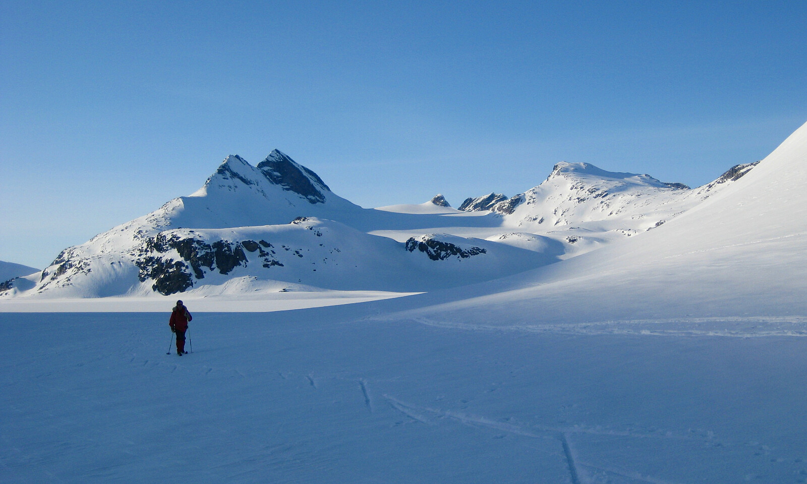
(1) Uranosbreen/Uranos glacier:
From Koldedalen, you follow the "T"-marked trail towards lake Urdadalsvatnet and Skogadalsbøen. When you reach the southern part of lake Urdadalsvatnet, you cross the river to the right. There are stones in the river to avoid the water, but in Juny/July it might be difficult not be wet.
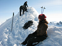
Go to the east side of lake 1518 metres. There are typical glacier landscape here. Now, you follow the Uranosbreen/Uranos glacier up to the north of Uranostinden. While walking on glacier, the rope and glacier-knowledge are necessary! The northridge to Uranostind is easy to follow, but the last few metres to the top is a bit airy. Especially can it be dangerous in the winter because of a huge snowdrift.
(2) West face via the north ridge:
From Koldedalen, you follow the "T"-marked trail towards lake Urdadalsvatnet and Skogadalsbøen. Follow the trail until you reach the pass Urdadalsbandet. Now you go 600-700 metres up westwards before you traverse 600 metres to north. Then you go westwards to the pass north of Uranostinden, and reach the top easily. A little bit airy the last metres to the top. Between the pass and Urdadalsbandet there are some snow areas who are quite steep (an ice axe is useful), and the stones are rolling. It is important that you follow the correct route to avoid some dangerous slabs in the west face. It is more difficult to find the right way down to Urdadalsbandet than from Urdadalsbandet.
(3) The south ridge:
This is the most spectacular and airy route to Uranostinden. If you are scared of hights, a rope might be necessary.
From Koldedalen, you follow the "T"-marked trail towards lake Urdadalsvatnet and Skogadalsbøen. When you reach the southern part of lake Urdadalsvatnet, you cross the river to the right. There are stones in the river to avoid the water, but in Juny/July it might be difficult not be wet.
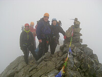
Continue to the summit "1487 metres" and follow the south ridge to the southern top of Uranostinden (2048 metres). The last part to the southern top is quite airy, and you need to use your hands some places. After that, walk easily to the middle top (2020 metres). Now the serious scramble begins. The ridge to Uranostinden is very narrow, and some places there are short, easy and airy climbs (grade UIAA II-III). The ridge is not very long, and suddenly you stand on the top of Uranostinden (2157 metres). The return can follow route 1 or 2.
(4) From Skogadalsbøen:
If you`re hiking from hut to hut and want to arrive Uranostinden from Skogadalsbøen the first step is to reach top "1900 metres" northwest for Uranostinden. (1) Via Skogadalen: Follow the Skogadalen trail until you reach the rivers coming from Uranosi, at the longitude with Skogadalsnosi. Take off the trail and walk up to top "1606 metres" east of Uranosi. Then you go east to the top "1900 metres" and follow the ridge to Uranostinden. You`re passing the northern summit at Uranostinden, called Slingsbytinden. It is some easy scrambling from this to the pass north of Uranostinden. (2) Via Uradalen: Follow the trail from Skogadalsbøen to Koldedalen via Uradalen. Take off the trail when the river from Uranosi crossing the trail. This is northwest of Steinsengene. Then you walk/scramble by the left side of the river to Uranosi. After that, there are an easy walk to top "1900 metres". The last part is described in "(1) Via Skogadalen".
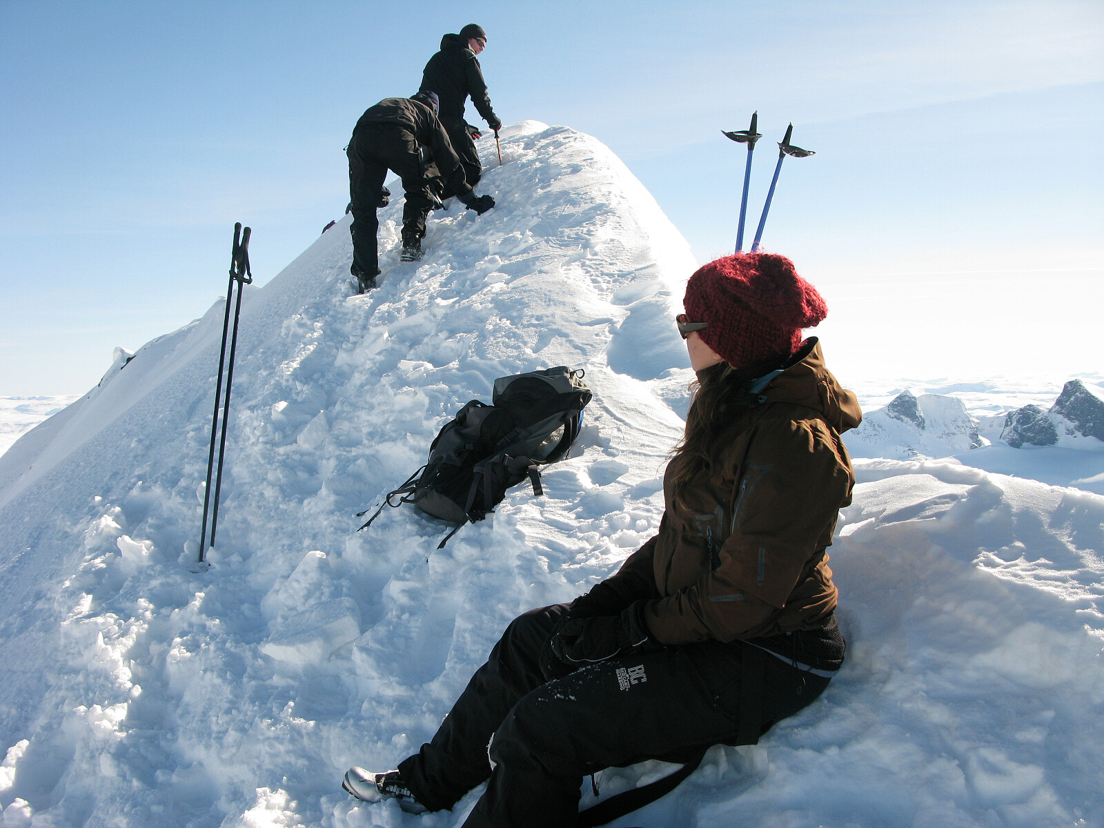
Vinter
In the winter, Uranostinden is one of the most unapproachable mountains in the Jotunheimen area because the road to Eidsbugarden is closed from middle of October to middle of June. In this period the best choice is to start from rv. 53 near Reikesteinodden and cross the lake Tyin (be sure that the ice is safe, check out this web page: www.nve.no/ismelding) to the northern part two km west of Tyinholmen. Here you may camp some place. Next day, you continue north to lake Kvitevatnet and Uranosbreen (Uranos glacier). You can follow the glacier to the saddle between Uranostinden and Slingsbytinden, then it is just a steeper hill to the top. Remember that the summit ridge is narrow, and with lots of winter snow on this you better be careful while walking. Extreme skiers are skiing down the eastern slope when there are advantageous conditions. Between the middle of February to the end of April, the Fondsbu hut is open. At this time there are snow weasels driving between Fondsbu and the southern part of Tyin, here you can see the timetable http://www.jvb.no/beltebiler/index.htm
Tips og diverse
Camping
In Koldedalen there are some places with vegetation you can have your tent. Tyinholmen rents out apartments and huts. Eidsbugarden Hotel and Fondsbu are also places you can spend the night and have a meal.
Red tape
National park
Events featuring Uranostinden?
Events featuring Uranostinden
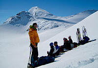
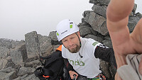
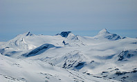
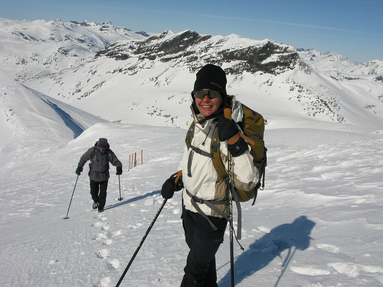
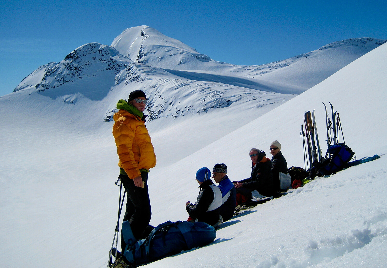
Bilder
Startsteder
Koldedalen near Raudehaugen
Fondsbu
Skogadalsbøen
Eksterne lenker
Litteratur og kilder
Norges Fjelltopper over 2000 meter. ISBN 9788299701358
Flere bilder
 © Knut S. Andersen |
 © Knut S. Andersen |
 © Knut S. Andersen |
 © Knut S. Andersen |
 © Knut S. Andersen |
 © Knut S. Andersen |
 © Sindre Sørhus |
 © Knut S. Andersen |
Turrapporter
- 01.05.2026 - Uranostinden, skrevet av Henriksen
- 26.09.2025 - Uranostind - sørryggen, skrevet av Olavtorgersen
- 13.09.2025 - Peakbook - Uranostinden, skrevet av AnneL
- 07.09.2025 - Uradalsvatnet rundt, skrevet av Henriksen
- 30.08.2025 - Uranostinden FT, skrevet av Henriksen
- 16.08.2025 - Uranostraversen, skrevet av SuperSindre
- 14.08.2025 - Uranostindane, skrevet av Henriksen
- 17.07.2025 - Peakbook - Uranostraversen 2025, skrevet av AnneL
- 16.07.2025 - Uranostind, skrevet av milese
- 15.07.2025 - Uranostinden, skrevet av Nina2412hauge
- 13.09.2024 - 71 nord team - E08 dag 1, skrevet av 500fjell
- 20.07.2024 - Peakbook - Uranostraversen, skrevet av AnneL
- 20.07.2024 - Uranostraversen, skrevet av mortenh
- 27.06.2024 - Uranostraversen, skrevet av svingheim
- 07.03.2024 - Gjensyn med Uranostinden, skrevet av Sindre83
- 09.09.2023 - Uranostind med gruppe, skrevet av mortenh
- 01.09.2023 - Uranostinden, Slingsbytind og Langeskavltind, skrevet av Atomsilda
- 01.09.2023 - Uranostinden Peakbooksamling, skrevet av mortenh
- 18.07.2023 - Uranostind + Slingsby, skrevet av TRefsnes
- 14.07.2023 - Sommerkveldsmagi i Jotunheimen, skrevet av mortenh
- 14.07.2023 - Magiske Uranostraversen - Sagitraversen - Langeskavltind, skrevet av AnneL
- 03.07.2023 - Uranostinden, skrevet av Henriksen
- 25.06.2023 - Uranostrim, skrevet av Naboen
- 31.03.2023 - Tyinfjellas smellvakre påskeegg!, skrevet av Øyvindbr
- 10.09.2022 - Uranostinder og Slingsbytinden fra Koldedalen, skrevet av Gråbein
- 10.09.2022 - FT Uranostraversen, skrevet av mariuskilli
- 10.09.2022 - Uranostraversen, skrevet av ArilT
- 30.07.2022 - Uranostinden fjellsamling, skrevet av mortenh
- 30.07.2022 - Peakbooktreff dag 1 - Uranostind og Slingsbytind, skrevet av JoNy
- 30.07.2022 - Uranostinden - en av Jotunheimens favoritter, skrevet av jensbar
- 29.07.2022 - En detaljert skildring av Uranostraversen + breen rundt FT, skrevet av Henriksen
- 28.07.2022 - Uranos sør T/R, skrevet av Naboen
- 27.07.2022 - Uranostindtraversen FT, skrevet av Henriksen
- 22.07.2022 - Uranos, skrevet av mortenh
- 20.07.2022 - Uranostind FT, skrevet av Henriksen
- 19.07.2022 - Uranostraversen Kursdag, skrevet av Henriksen
- 13.07.2022 - Uranostind FT, skrevet av Henriksen
- 11.07.2022 - Uranostinden 2157 moh & Slingsbytinden 2026 moh, skrevet av Bke63
- 01.09.2021 - Uranostraversen frå Sør. S2 - S1 - Topp, skrevet av 6982
- 21.08.2021 - Uranostinden, skrevet av Ninatopp
- 17.08.2021 - Uranostinder FT, skrevet av Henriksen
- 14.08.2021 - Uranostind FT, skrevet av Henriksen
- 05.08.2021 - Uranostraversen, skrevet av HegeSA
- 31.07.2021 - Uranostindtraversen, skrevet av alexw
- 23.07.2021 - Uranostinden fra vestflanken, skrevet av Mathias
- 12.07.2021 - Trip to Uranostinden from Koldedalsvatnet, skrevet av VegarM
- 22.04.2021 - Kremruta 2021 #2, skrevet av 500fjell
- 17.04.2021 - Kremruta 2021 #1, skrevet av 500fjell
- 11.02.2021 - Uranostinden vintertur fra Tyin, skrevet av mortenh
- 19.09.2020 - Perfekt dag blant flotte tinder, skrevet av Atomsilda
- 30.08.2020 - Ft sørryggen Uranostind, skrevet av kristoffergh88
- 29.08.2020 - Uranostraversen FT, skrevet av Henriksen
- 20.08.2020 - Uranostrim, skrevet av mortenh
- 16.08.2020 - Uranostraversen, skrevet av Skiglad
- 14.08.2020 - Uranostinden og Slingsbytinden, turleder TOT, skrevet av Firing
- 09.08.2020 - Uranosryggen, Sagitraversen, Mjølkedalspiggen&Langeskavltind, skrevet av Romslo86
- 09.08.2020 - Drømmedag over Uranostraversen, skrevet av MathiasMikkelsen
- 25.07.2020 - Toppsamling rundt Koldevatnet med Arne, skrevet av Markusrk
- 24.07.2020 - Uranosryggen med Slingsbytinden, skrevet av raroa
- 24.07.2020 - Uranostinden, skrevet av mariuskilli
- 18.07.2020 - FT sørryggen uranostind, skrevet av kristoffergh88
- 13.07.2020 - Uranostraversen FT, skrevet av Henriksen
- 30.05.2020 - Uranostinden i drømmevær!!, skrevet av Gunski
- 22.07.2019 - Overnattingstur Uranosbreen, skrevet av Henriksen
- 15.04.2019 - Påsketur til Uranostind i nydelig vær, skrevet av Fjellsamleren
- 01.09.2018 - Uranostind og Slingsbytind, skrevet av GreteR
- 05.08.2018 - Uranostinden føringstur DNT Valdres, skrevet av mortenh
- 04.08.2018 - Uranostind Sørryggen føringstur DNT Valdres, skrevet av mortenh
- 04.08.2018 - Uranostraversen med Slingsby- og Langskaveltind, skrevet av Gråbein
- 30.07.2018 - Føringstur på Uranostraversen, skrevet av Henriksen
- 27.07.2018 - Uranostraversen-Sagitraversen-Mjølkedalspiggen-Langskavltind, skrevet av Eirik93
- 21.07.2018 - Uranostind via sørryggen, skrevet av j_snorre
- 21.07.2018 - Føringstur på Uranostraversen, skrevet av Henriksen
- 03.07.2018 - Søreggen til Uranostinden, skrevet av vemundmathiesen
- 03.07.2018 - Uranostinden via søreggen, skrevet av gedded
- 16.09.2017 - Føringstur Sørryggen Uranostind, skrevet av kristoffergh88
- 27.08.2017 - Uranostind(sørryggen)-Sagi traversen + 2-2k til, skrevet av Geir74
- 21.08.2017 - Turen som nesten gikk i dass, skrevet av kristoffergh88
- 21.08.2017 - Uranostindtraversen føringstur, skrevet av mortenh
- 13.08.2017 - En smak av vinter over søreggen på Uranostind, skrevet av Fjellsamleren
- 12.08.2017 - Uranostind, skrevet av Nadine1969
- 21.07.2017 - Føringstur over Uranosryggen, skrevet av 500fjell
- 20.07.2017 - Bare kos på Urdanos - opp søregga, skrevet av Olepetter
- 19.07.2017 - Urdanostraversen (og Slingsbytind), skrevet av andrewol
- 19.07.2017 - Uranostind, skrevet av BjørnF
- 19.07.2017 - Drømmerur over Uranostraversen, skrevet av astridek
- 19.07.2017 - Uranostinden, Slingsbytinden - Luster, Vang, Årdal, skrevet av otto
- 28.07.2016 - Uranostravers & Slingsbytinden, skrevet av knutsdotter
- 20.07.2016 - Vinjerock oppvarming #1, skrevet av ksten
- 13.07.2016 - Føringstur over Uranostraversen, skrevet av 500fjell
- 12.07.2016 - Uranostraversen, skrevet av Daffen84
- 05.09.2015 - Uranostraversen i fagert høstvær, skrevet av 500fjell
- 07.08.2015 - Føringstur over Uranostraversen, skrevet av 500fjell
- 29.07.2015 - Uranos og slingsby via bre, skrevet av dygj
- 17.07.2015 - Hurra, hurra - Uranostinden i utsiktsvær!, skrevet av angjerd
- 17.07.2015 - Uranostind fra Uradalsvannet, skrevet av jesperstokke
- 15.05.2015 - Uranostinden, skrevet av opps
- 14.03.2015 - Uranostinden, skrevet av Klatrenorge
- 13.09.2014 - Uranostraversen - kanontur!, skrevet av haugert
- 06.09.2014 - Vindfull klyve - og bretur; Urdanosegga og Sagi, skrevet av Olepetter
- 05.09.2014 - Uranostind DNT ung Oslo, skrevet av gautedj86
- 28.08.2014 - Uranostraversen og Sagi, skrevet av angjerd
- 28.08.2014 - Tåketur i Koldedalen, skrevet av mortodeg
- 23.08.2014 - DNT Valdres og Gudbrandsdalen tur til Uranostinden, skrevet av Naboen
- 09.08.2014 - Uranosryggen-Sagitraversen-Mjølkedalspiggen, skrevet av SÅH
- 19.07.2014 - Uranosryggen og Langeskavltinden, skrevet av elbow
- 02.07.2014 - Uranostur, skrevet av linntherese
- 23.03.2014 - Fire dager med høytrykksfest i Jotunheimen, skrevet av 500fjell
- 10.10.2013 - Uranostinden med skyfri himmel og krystallklar luft, skrevet av Bragejh
- 28.08.2013 - DNT Valdres Uranostindryggen, skrevet av mortenh
- 23.08.2013 - Uranostraversen, skrevet av espen
- 10.08.2013 - Luftig dag over søreggen på Uranostinden, skrevet av Fjellsamleren
- 07.07.2013 - Uranostinden, skrevet av Frost
- 28.03.2013 - Uranostinden og Slingsbytinden (Toppen ikke nådd), skrevet av elbow
- 23.03.2013 - Flott i Jotunheimen, skrevet av mortenh
- 08.08.2012 - Toppene rundt Uranos- og Mjølkedalsbreen, skrevet av JoSo
- 07.08.2012 - Uranostinden, skrevet av IngunnL
- 13.07.2011 - Høydramatikk på den spenstige Uranosryggen, skrevet av Atomsilda
- 24.08.2009 - Uranostindtraversen og Slingsbytinden, skrevet av knutsverre
- 17.07.2009 - Uranostind via søreggen og Sagi-traversen, skrevet av Bjørneven
- 18.04.2009 - Uranostinden - vinterbestigning, skrevet av knutsverre
- 16.08.2008 - Uranostraversen, skrevet av LarsHemstad
- 25.07.2008 - Uranostiden via Sørryggen, skrevet av JohnTiger
- 28.04.2007 - Vårskitur 2007 - Uranostinden og Slingsbytinden, skrevet av Stigun
- 14.10.2006 - Uranostind og Falketind, skrevet av Øyvindbr
- 25.07.2006 - Klyveklatring opp søreggen, skrevet av Olepetter
- 26.07.2005 - Uranostinden, skrevet av 500fjell
- 23.02.2003 - Uranostinden og Slingsbytinden i Luster/Årdal/Vang, skrevet av ØyvindBergkvam
- 18.08.2002 - Uranostindtraversen, skrevet av mortenh
- 29.09.1997 - Uranostinden, skrevet av mortenh
- 06.08.1997 - Uranostinden via søreggen, skrevet av Nils
- 29.03.1986 - Uranostinden, skrevet av ersystopo


Kommentarer